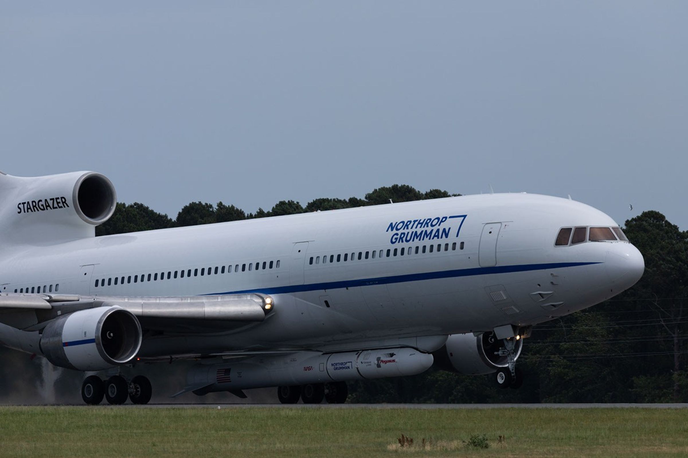
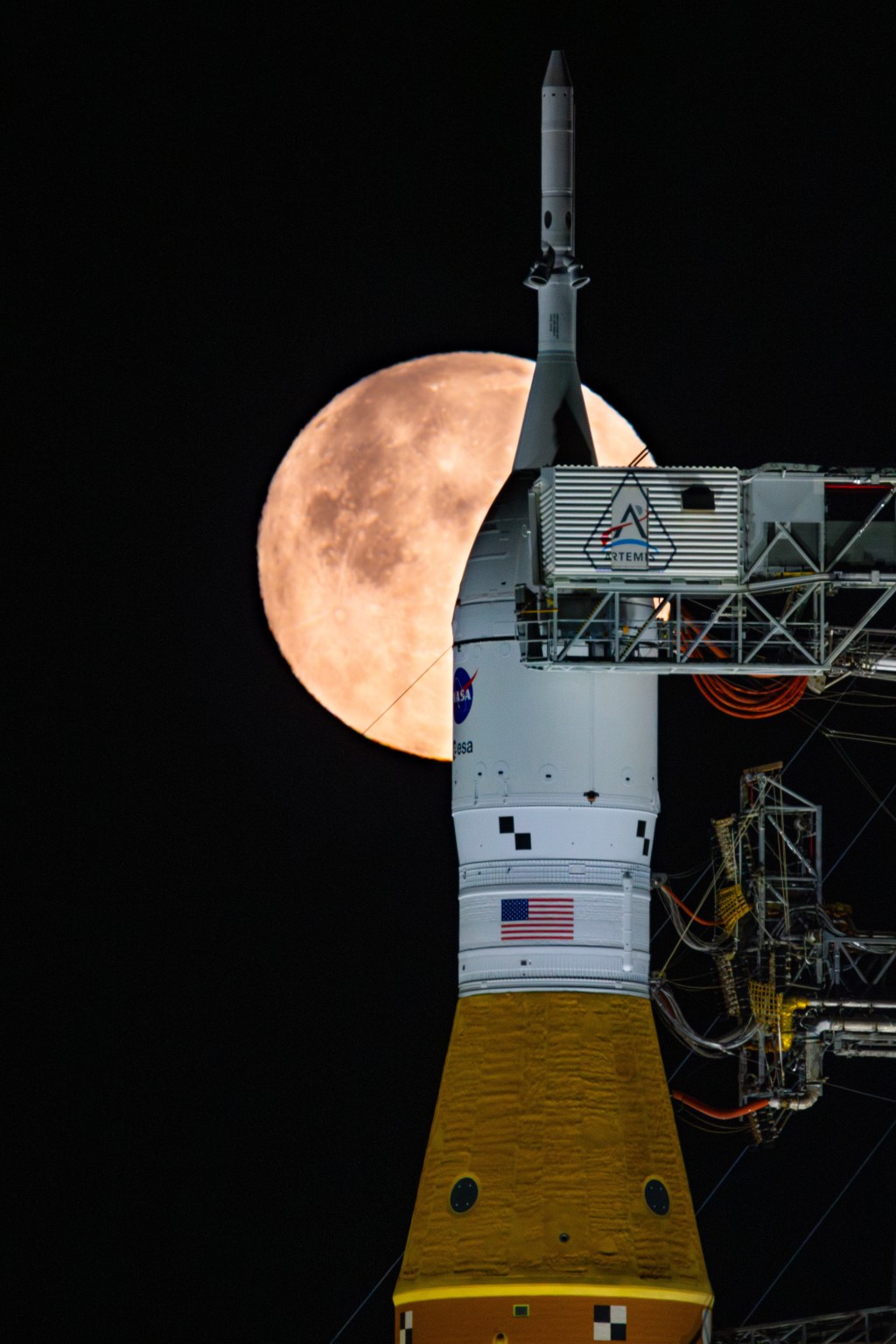
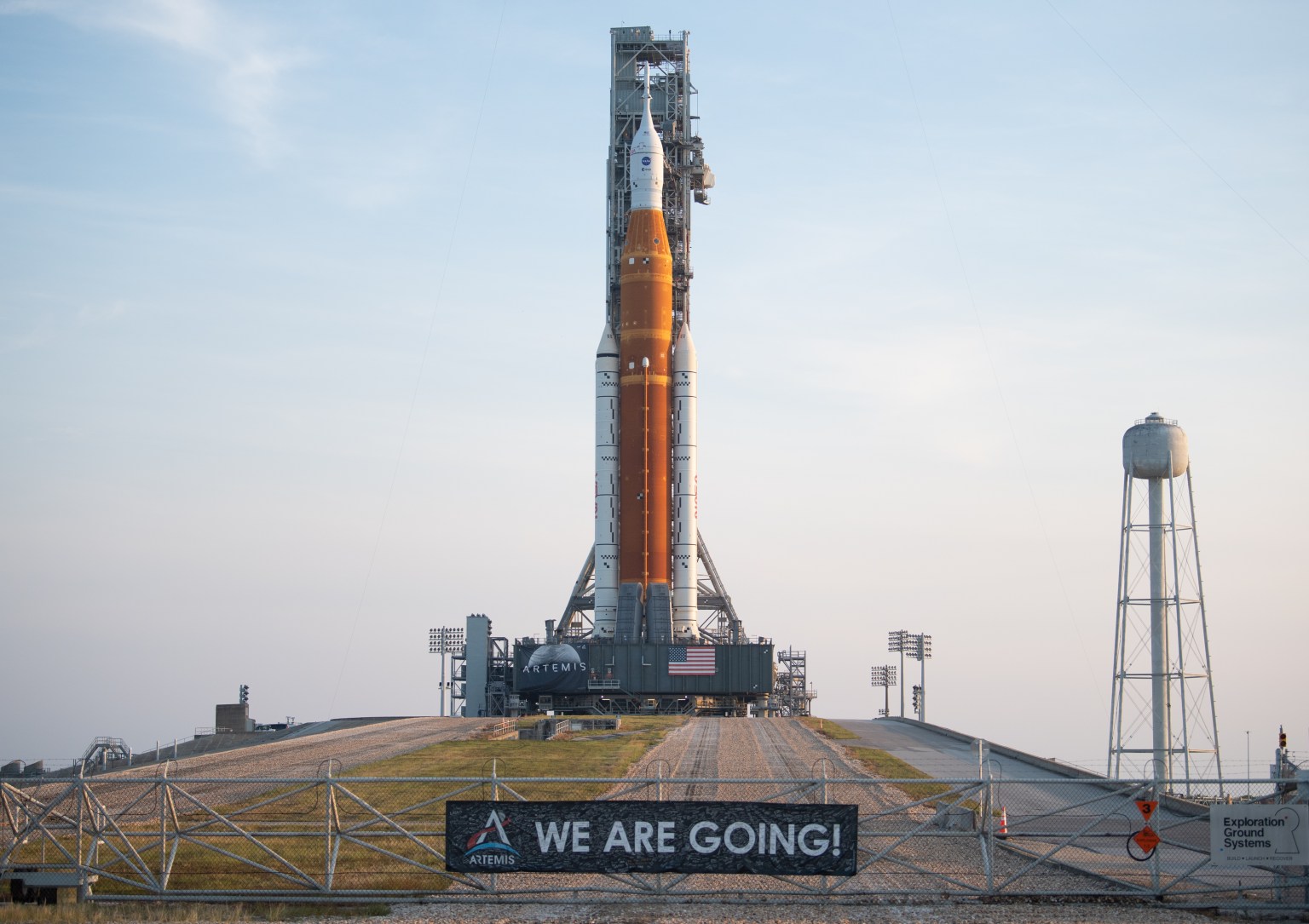
Northrop Grumman’s Stargazer took off Thursday, June 18, 2026, from NASA’s Wallops Flight Facility in Virginia. The modified L-1011 aircraft carried the company’s Pegasus XL rocket hosting LINK, a robotic servicing spacecraft from Katalyst Space. LINK will launch from the air-deployed Pegasus XL later this month on a mission to boost the orbit of NASA’s Neil Gehrels Swift Observatory.
NASA/Jeanette Kazmierczak
An airplane carrying a rocket loaded with a robotic spacecraft designed to raise NASA’s Neil Gehrels Swift Observatory departed the agency’s Wallops Flight Facility in Virginia on Thursday, June 18.
Stargazer, a modified L-1011 operated by Northrop Grumman, took off for Kwajalein Atoll, part of the Republic of the Marshall Islands in the South Pacific Ocean. Attached to the belly of the aircraft was one of the company’s Pegasus XL rockets with LINK inside.
NASA contracted Katalyst Space to design and build LINK to rendezvous and dock with Swift and lift it back to a higher altitude.
Spacecraft in low Earth orbit experience drag caused by our planet’s atmosphere, which gradually reduces their altitude if they do not have propulsion systems to counteract the effect.
Recent solar activity magnified this effect on Swift, which began to sink faster than anticipated.
Katalyst selected Northrop Grumman’s Pegasus XL launch vehicle as the best means of reaching Swift on a short timeline based on orbital and programmatic needs.
Stargazer will carry Pegasus and LINK to Kwajalein Atoll, part of the Republic of the Marshall Islands in the South Pacific Ocean with stopovers in California and Hawai’i.
NASA/Jamie Adkins
Later this month, Stargazer will carry the rocket to an altitude of around 40,000 feet before releasing it.
After several seconds in free-fall, Pegasus XL will fire the first of its three-stage rocket motors, delivering LINK into orbit in about 10 minutes.
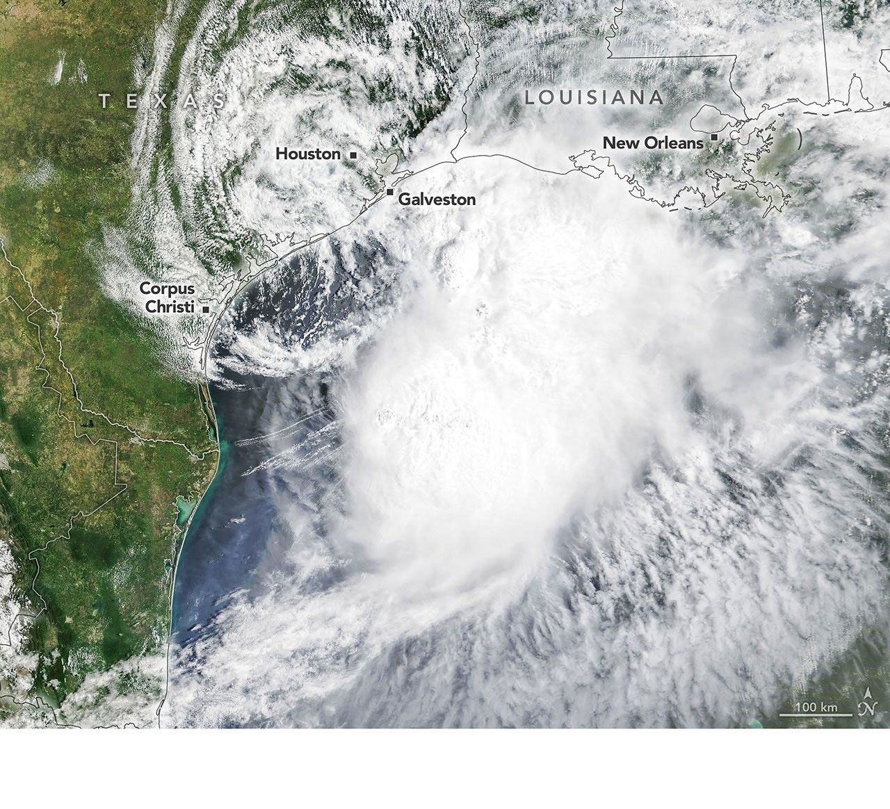
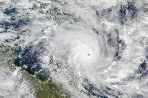
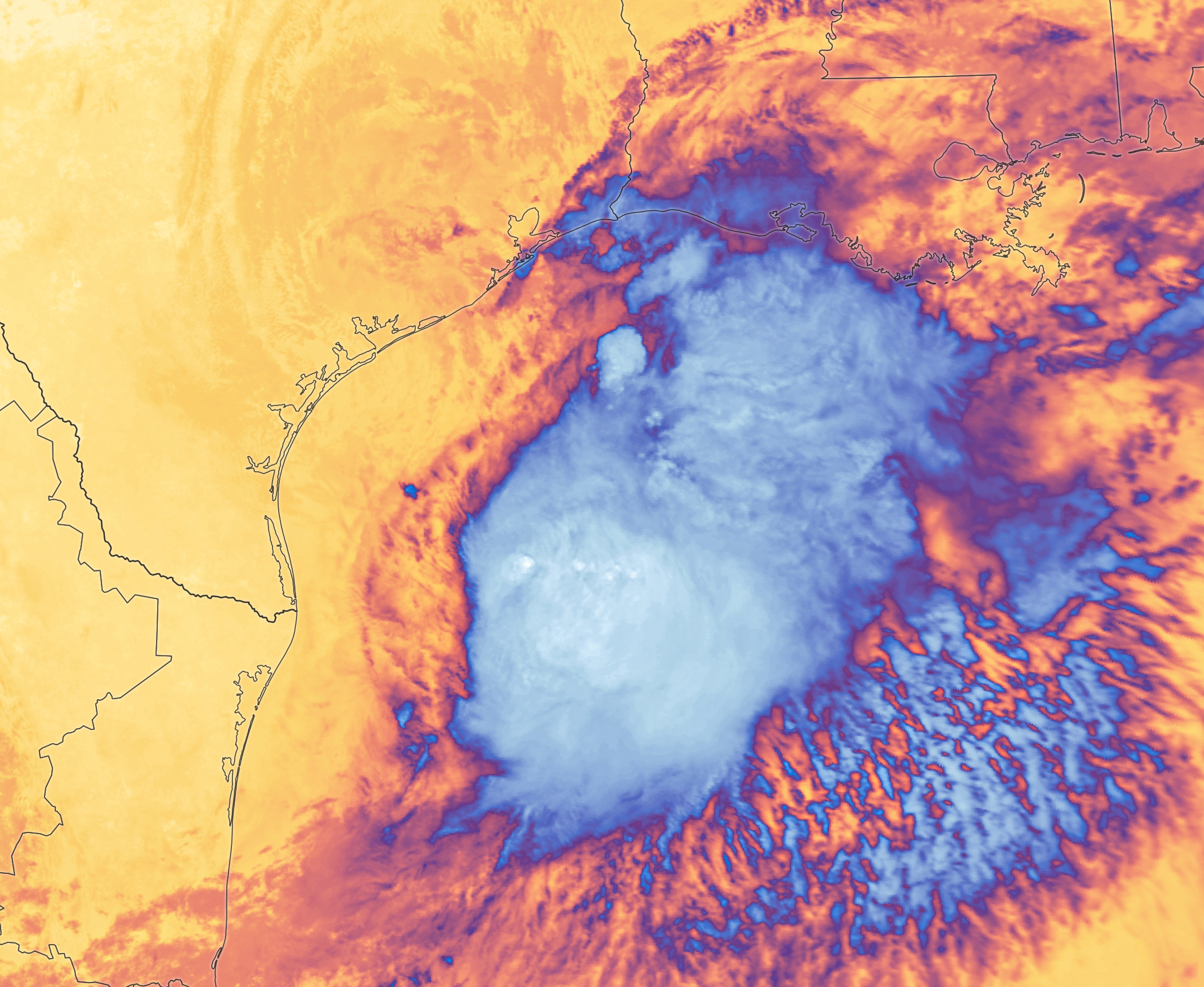
Tropical Storm Arthur’s white storm clouds cover the waters off the U.S. Gulf Coast. Some clouds extend inland over parts of Texas and Louisiana.
NASA Earth Observatory/Michala Garrison
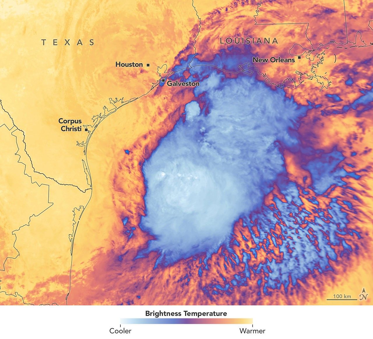
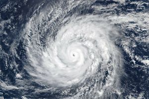
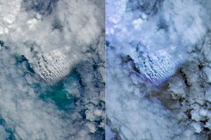
White and purple areas of cloud off the Gulf Coast indicate the cooler areas of cloud tops associated with Tropical Storm Arthur.
NASA Earth Observatory/Michala Garrison
Natural color
brightness temperature
Images from the MODIS (Moderate Resolution Imaging Spectroradiometer) on NASA’s Terra satellite show Tropical Storm Arthur on the morning of June 17, 2026. The left image is natural color; the right shows infrared signals known as brightness temperature. NASA Earth Observatory images by Michala Garrison.
Tropical Storm Arthur, the first named storm of the 2026 Atlantic hurricane season, brought high winds and heavy rain to the U.S. Gulf Coast in mid-June.
NASA’s Terra satellite captured this natural-color image (left) at 10:30 a.m. Central Time (15:30 Universal Time) on June 17. The second image (right) depicts infrared signals known as brightness temperature, which help distinguish cooler cloud tops (white and purple) from the warmer surface below (yellow and orange). Around the time these images were acquired, the system had just recently been designated a tropical storm, according to the National Hurricane Center (NHC).
Though Arthur stayed below hurricane strength, it still delivered strong winds to parts of the Gulf Coast as it tracked northeast. The storm had maximum sustained winds of 40 miles (65 kilometers) per hour around the time these images were captured. Tropical-storm-force winds extended 175 miles (280 kilometers) from the storm’s center, the NHC reported. Measurements at Galveston, Texas, for instance, showed a gust of 48 miles per hour.
The storm also produced heavy rainfall that the National Weather Service warned could lead to life-threatening flash flooding. Estimates from IMERG (the Integrated Multi-Satellite Retrievals for GPM), a product of the GPM (Global Precipitation Measurement) mission, showed high rainfall rates over Gulf waters and extending inland on June 17.
As Arthur weakened and became less organized, it continued to bring abundant moisture to central Gulf Coast states on June 18. The National Weather Service reported rainfall rates of 3 inches (7.6 centimeters) per hour in southeastern Louisiana. Forecasts indicated that storm-total rainfall amounts could exceed 12 inches (30 centimeters) in areas, with some locations seeing totals approaching 20 inches (51 centimeters).
NASA Earth Observatory images by Michala Garrison, using MODIS data from NASA EOSDIS LANCE and GIBS/Worldview. Story by Kathryn Hansen.
Curiosity Blog, Sols 4920-4926: Surveying the Bands
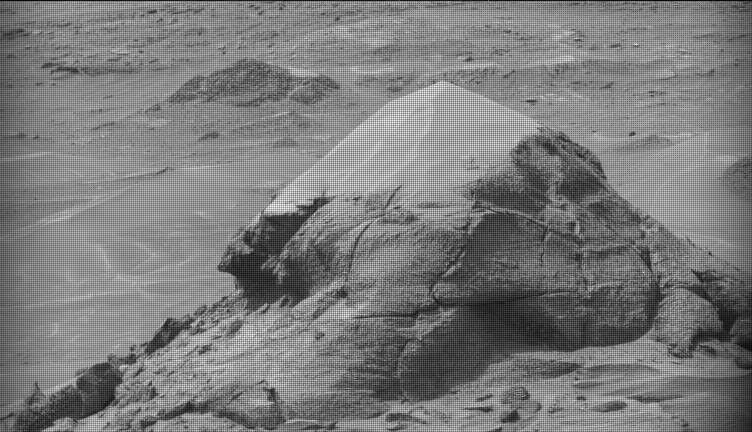
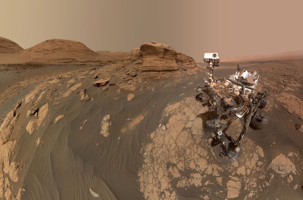
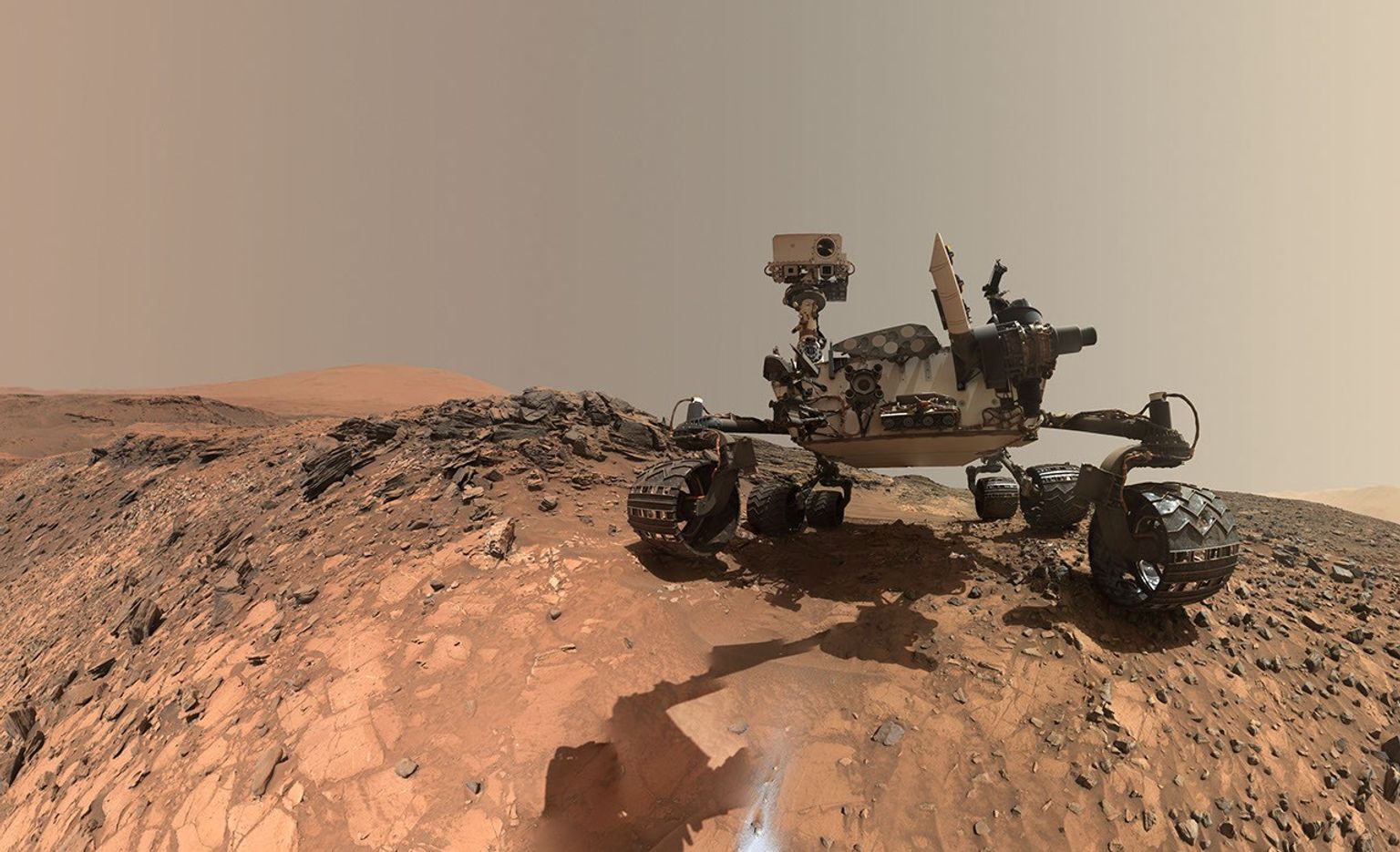
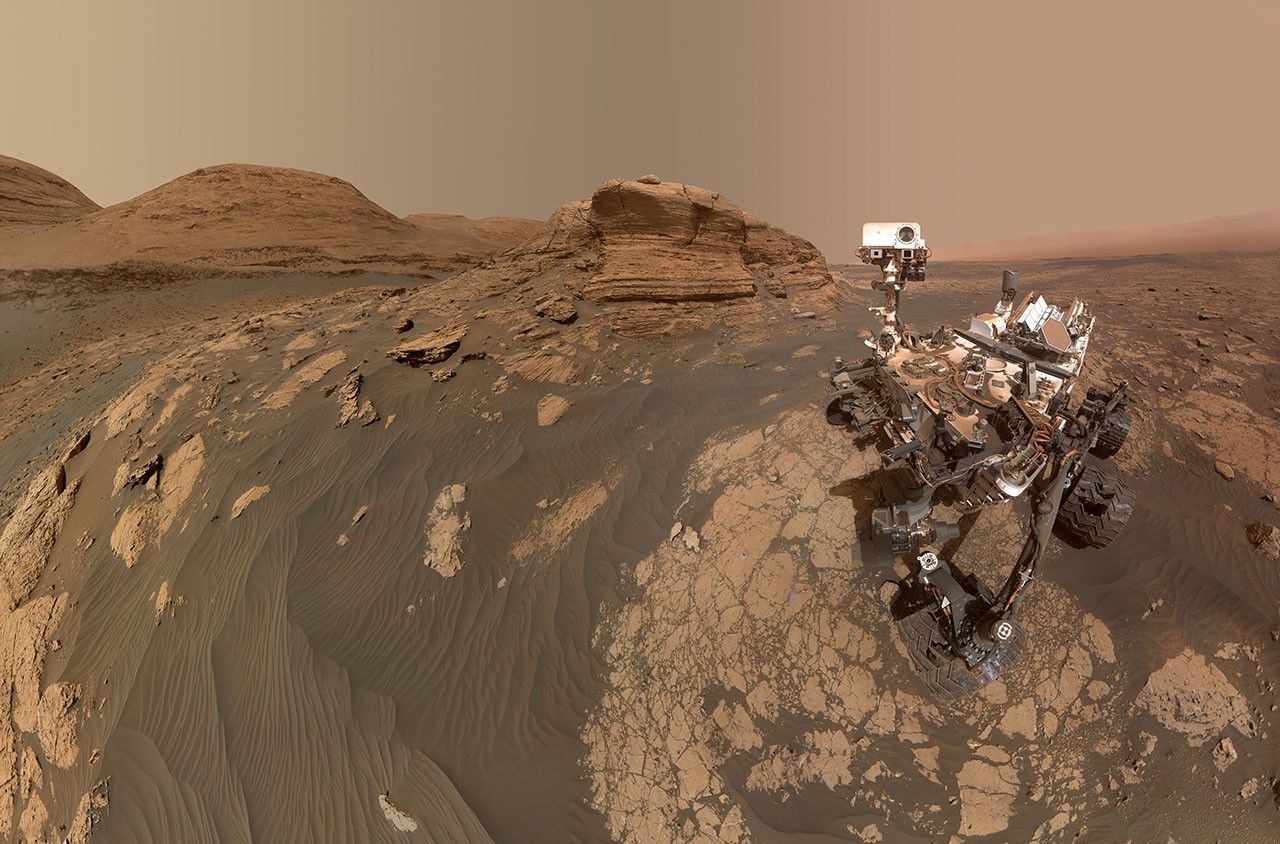
NASA’s Mars rover Curiosity acquired this image of small butte, “Miraflores,” using its Mast Camera (Mastcam) on June 11, 2026 — Sol 4922, or Martian day 4,922 of the Mars Science Laboratory mission — at 09:12:13 UTC.
NASA/JPL-Caltech/MSSS
Written by William Farrand, Senior Research Scientist, Space Science Institute
Earth planning date: Friday, June 12, 2026
Rather than going from stage to stage at a music festival to hear different bands playing different varieties of music, Curiosity has been ascending up Mount Sharp through physical bands of exposed rocks with textural and tonal differences.
Planning for sols 4920 and 4921 were done with the rover in the middle of a unit with a rougher texture and dark-toned bedrock. With the rougher-textured bedrock, brushing wasn’t possible, but APXS chemistry and MAHLI micro-imaging were planned on “as is” bedrock targets “Salto La Cascada” and “Puerto de Rosas.” ChemCam was targeted to perform LIBS spectroscopy on a bedrock target “Kishuara” and a small, layered float rock “La Rosita.” ChemCam’s Remote Micro-Imager (RMI) collected views of the “Mishe Mokwa” butte and another looking at dunes with tonal differences. Mastcam mosaics were collected on the “Valle Grande” channel, “Kimsa Chata” butte, nearby troughs, and the aircraft carrier shaped rock “El Matir.”
Another drive brought Curiosity closer to the upper border of the dark-toned band. Again, brushing of the rocks was not possible, but APXS and MAHLI were collected on dark-toned bedrock targets “Santa Gracia” and “Laguna San Rafael” with ChemCam LIBS also targeting the bedrock. Mastcam mosaics were collected of a layered rock and nearby troughs and a mosaic of the nearby smaller butte, “Miraflores” which displays an interesting layered structure with ragged dark-toned rocks on one side and a stack of dust piled on top (see accompanying image). Other activities included a long-distance RMI mosaic of a bright unit on “Mishe Mokwa”, and Navcam dust-devil surveys in both sols.
Communicating between Earth and Mars has come to seem routine, but at times can still be a challenging endeavor and this was demonstrated to the team on Friday when we did not get a timely downlink of data for the drive planned for Sol 4923. Without these images another drive, in situ examinations, or targeted remote sensing could not be planned. However, there are always interesting things to be done on Mars and the three-sol plan (4924 to 4926) included a 360-degree Mastcam mosaic, the automatic AEGIS targeting of LIBS measurements on each sol, a Navcam dust-devil survey, APXS atmospheric measurements, as well as several other environmental activities.
On Monday, the delayed downlink will be used to plan the first investigation of the next band of surface materials, this one being smooth-textured and light-toned, as well as another drive to continue the surveying of the bands.
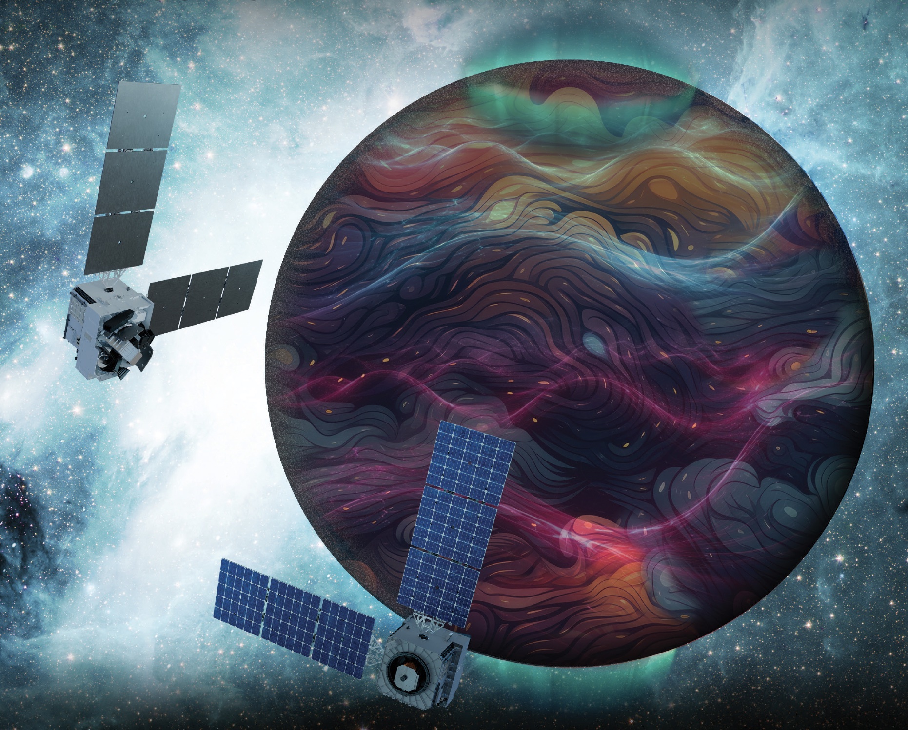
Artist’s rendition of the DAPHNE (Dynamic Atmosphere-Ionosphere Explorer) mission concept. The coloring represents auroras and atmospheric waves in Earth’s atmosphere.
Credit: Laboratory for Atmospheric and Space Physics/Mary Tostanoski
NASA selected a mission concept to research how space weather and dynamics within Earth’s atmosphere influence the space environment and help improve prediction capabilities for impacts on crucial technology, such as GPS and low Earth orbit satellites, as well as astronauts in space.
The DAPHNE (Dynamic Atmosphere-Ionosphere Explorer) mission will enter Phase B of development, which includes planning and design for flight and mission operations. It will use identical twin satellites to study how changes in Earth’s lower atmosphere influence our planet’s upper atmosphere, where space weather is manifested.
“NASA is advancing the United States’ leadership as a space weather-ready nation, and by providing new insights into Earth’s atmosphere we can better predict and prepare for impacts in our daily lives on Earth and in space,” said Nicky Fox, associate administrator, Science Mission Directorate, NASA Headquarters in Washington. “As NASA sends astronauts beyond Earth’s magnetic protection to the Moon, Mars, and beyond, DAPHNE will join the NASA science fleet strategically located across the solar system to provide data that will help mission planners predict and mitigate the effects of space weather for the benefit of all.”
The DAPHNE mission’s low-risk high-return concept will provide coordinated, multi-point measurements of neutral winds, temperature, and composition in the thermosphere. The ionosphere and thermosphere regions are where Earth’s neutral atmosphere transitions into the ionized plasma of space. In this thin shell that surrounds the planet, the atmosphere is in constant motion, shaped by the influence of solar activity and changes in the lower atmosphere and in near-Earth space.
Fundamental observations and physical insights from the DAPHNE mission will incorporate lower-atmospheric energy data to advance space weather predictive capabilities. The mission is led by Aimee Merkel from the Laboratory for Atmospheric and Space Physics at the University of Colorado, Boulder.
The mission will be subject to a confirmation review in 2027, which will assess the progress of the mission and the availability of funds. If confirmed, the total estimated cost of the mission, excluding launch, will not exceed $250 million in fiscal year 2023 dollars, with a mission launch date of no earlier than 2029.
The DAPHNE mission was proposed as a concept study in response to the DYNAMIC (Dynamical Neutral Atmosphere-Ionosphere Coupling) mission announcement of opportunity. Funding and management oversight for this mission is provided by the Solar Terrestrial Probes program at NASA’s Goddard Space Flight Center in Greenbelt, Maryland.
For more information on NASA’s heliophysics missions, visit:
NASA has selected eight new companies and will acquire new data products from six existing Commercial Satellite Data Acquisition contract holders to expand the range of commercial satellite data available to researchers, civil agencies, and decision-makers. Such measurements supplement NASA’s Earth satellites by contributing high-resolution and frequent observations to enhance the agency’s set of data.
Leveraging commercial data demonstrates NASA’s commitment to strong public-private partnerships, allowing the agency to expand scientific insight while reducing costs and accelerating the delivery of data to researchers and decision-makers.
Collectively, NASA and commercial Earth observations provide insight into our home planet – benefitting Americans, providing environmental intelligence, strengthening disaster response, and improving public safety.
The Commercial Satellite Data Acquisition Program On-Ramp 2 Multiple Award contract is a firm-fixed-price, indefinite-delivery/indefinite-quantity multiple-award contract. The original maximum contract value was $476 million, with a performance period that began in 2023 and continues through Nov. 15, 2028.
Contract awardees are:
Airbus DS Geo Inc.
GHGSat Inc.
Hydrosat Inc.
ICEYE US Inc.
ImageSat International
Kuva US Inc.
Muon Space Inc.
Orbital Sidekick Inc.
OroraTech USA Inc.
Planet Labs Federal Inc.
Space Sciences and Engineering LLC, doing business as PlanetiQ
SATLANTIS US
Tomorrow Companies Inc., doing business as Tomorrow.io
Wyvern Inc.
The agency’s Commercial Satellite Data Acquisition mission works to execute a cost-effective way to augment and complement the suite of Earth observations captured by NASA and its partners by identifying, evaluating, and acquiring commercial satellite data.
For more information about NASA’s Commercial Satellite Acquisition program, visit:
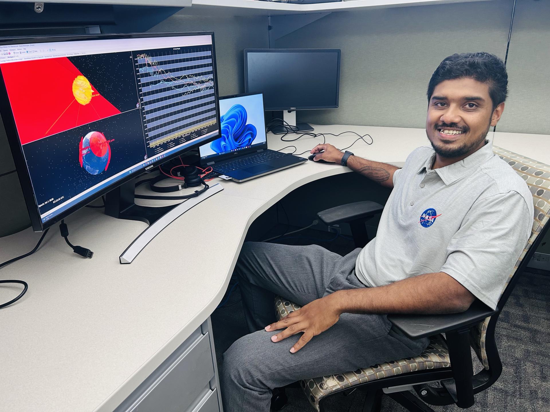
Rohit Goeptar, an electromagnetic/radio frequency analyst with NASA’s Launch Services Program at the agency’s Kennedy Space Center in Florida, reviews a radio frequency link budget analysis for NASA’s Nancy Grace Roman Space Telescope from his office. Goeptar is among the engineers and technicians sworn in as new NASA civil servants as part of NASA Administrator Jared Isaacman’s workforce directive to restore technical core competencies within the civil servants ranks.
NASA/Amanda Griffin
Rohit Goeptar was born into a poor family in Suriname, South America, the kind where both parents work three jobs and they still can only provide food and shelter for their family. At around age six, his family moved to California to start a new life. Only two years later, he moved back to South America with his father while his mother stayed in the United States and remarried. When he was 13, he became a U.S. citizen and he and his brothers returned to live with their mother in California.
At 19, Goeptar joined the U.S. Marine Corps where he spent six years as a technical operator. During one deployment to the Philippines, Goeptar helped set up communication systems for individuals who needed to contact their loved ones after a typhoon ripped through entire towns.
“I was lost, the Marine Corps gave me an opportunity,” Goeptar recalled.
While the Marines taught him useful skills, his life had not been the easiest. He lost not one, but two, fathers to suicide, and a short first marriage ended with him being unhoused on the streets of Kissimmee, Florida, for six months. But Goeptar eventually found his way.
As with most underdog stories, there was another person in the shadows behind his rise to success.
“Your brain works in mysterious ways,” his now wife told him a short while after they met. She then filled out college applications for him, and he eventually applied to NASA’s Kennedy Space Center in Florida.
While raising three kids, going to school full-time pursuing a computer engineering and electrical engineering degree simultaneously, Goeptar got the call that changed his life.
“In spring 2025, I was driving to pick my son up from school when a gentleman from Kennedy calls, telling me he’s seen my resume and do I have time for a quick interview,” Goeptar recounted.
He pulled on the side of the road and took part in an impromptu job interview.
Two weeks later, he had an in-person interview with others from Kennedy and two weeks after that, he had a contractor badge at America’s premier spaceport.
After starting as an intern under the Expendable Launch Vehicle Integrated Support, or ELVIS, contract, then moving to part-time until he graduated from the University of Central Florida (UCF) in Orlando, then full-time at the beginning of 2026, Goeptar was one of the ELVIS contractors who applied and were picked up to become civil servants recently.
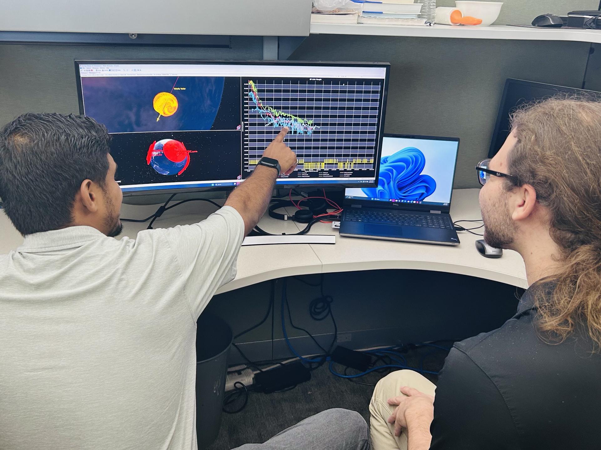
Rohit Goeptar, an electromagnetic/radio frequency analyst with NASA’s Launch Services Program at the agency’s Kennedy Space Center in Florida, reviews a radio frequency link budget analysis for NASA’s Nancy Grace Roman Space Telescope with a colleague.
NASA/Amanda Griffin
Now an employee of NASA’s Launch Services Program, Goeptar works with electromagnetic interference, electromagnetic compatibility, and radio frequency. It is his job throughout the entirety of the mission to analyze and ensure avionic boxes or anything electrically powered doesn’t interfere with any other systems. He also ensures independent systems are compatible when brought together. And finally, he conducts model radio frequency link analysis for different rockets and science demonstrations payloads. These may belong to NASA or commercial partners, and he is responsible for ensuring uninterrupted communication with the ground. In his short time at Kennedy, Goeptar has worked on Sentinel-6B, JPSS-4 (Joint Polar Satellite System), and IMAP (Interstellar Mapping and Acceleration Probe) missions.
And as far as his wife’s assessment that his brain works differently, he proved that within a year at Kennedy when he noticed an analytical issue his team wasn’t tracking. Once a rocket launches, it does a pitch, yaw, and roll. The analysis the team had been conducting didn’t account for this movement, which meant it wasn’t as accurate as it could be. He presented his solution to the team lead, and it now enables NASA data and partner data to be much more in sync.
“There is no greater feeling, being able to serve. It’s more than serving the public, it’s serving our country. It’s serving the future of our country,” Goeptar said with tears brimming in his eyes. “Being able to give back to that same government that gave me an opportunity to be where I’m at today. There’s no greater feeling than that.”
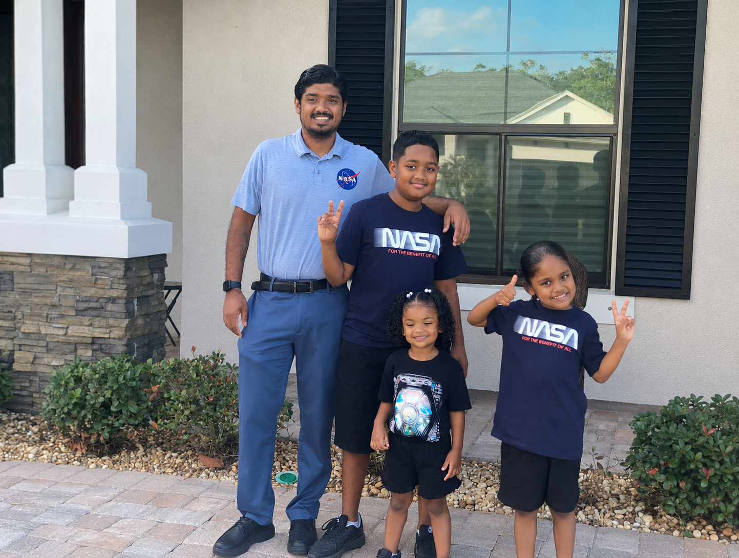
Meanwhile, Goeptar’s 11-year-old takes most of the credit for his landing at the space center, a NASA enthusiast, his son believes he spoke it into existence.
Rohit Goeptar, an electromagnetic/radio frequency analyst with NASA’s Launch Services Program at the agency’s Kennedy Space Center in Florida, poses for a photograph with his children.
NASA/Rohit Goeptar
“One day he wants to become an astronaut,” Goeptar said with joy on his face. “And I told him I will guide him until the day that I die. Maybe my last mission could be the one my son flies on. I’m not going to stop until that day happens.”
Rohit’s positive streak continues as he recently was accepted into electrical engineering master’s programs at both Johns Hopkins University, and UCF.
Desert Field Test With NASA Advanced Rover Prototype
PIA26701
Credits: NASA/JPL-Caltech
Downloads
Desert Field Test With NASA Advanced Rover Prototype
PNG (27.94 MB)
PIA26701 Figure A
JPEG (26.03 MB)
PIA26701 Figure B
JPEG (951.75 KB)
PIA26701 Figure C
JPEG (16.03 MB)
PIA26701 Figure D
JPEG (16.46 MB)
Description
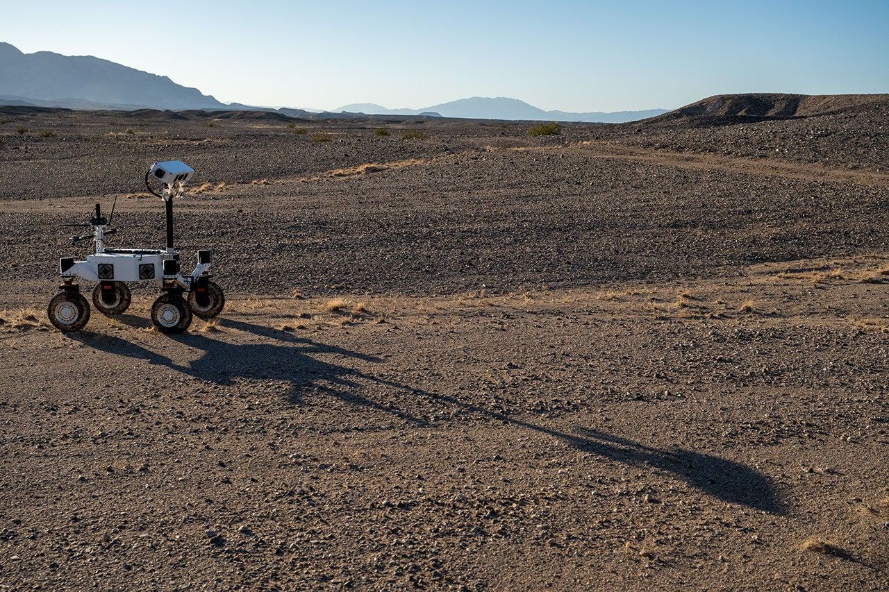
A prototype four-wheel rover developed at NASA’s Jet Propulsion Laboratory with advanced mobility and robotic autonomy capabilities trundled across the Colorado Desert near Plaster City, California, during a field test in March 2026. Called ERNEST (Exploration Rover for Navigating Extreme Sloped Terrain), the rover served here as a testbed for autonomy software developed for a potential lunar mission requiring higher speeds and much greater mileage than can be achieved with current planetary rovers.
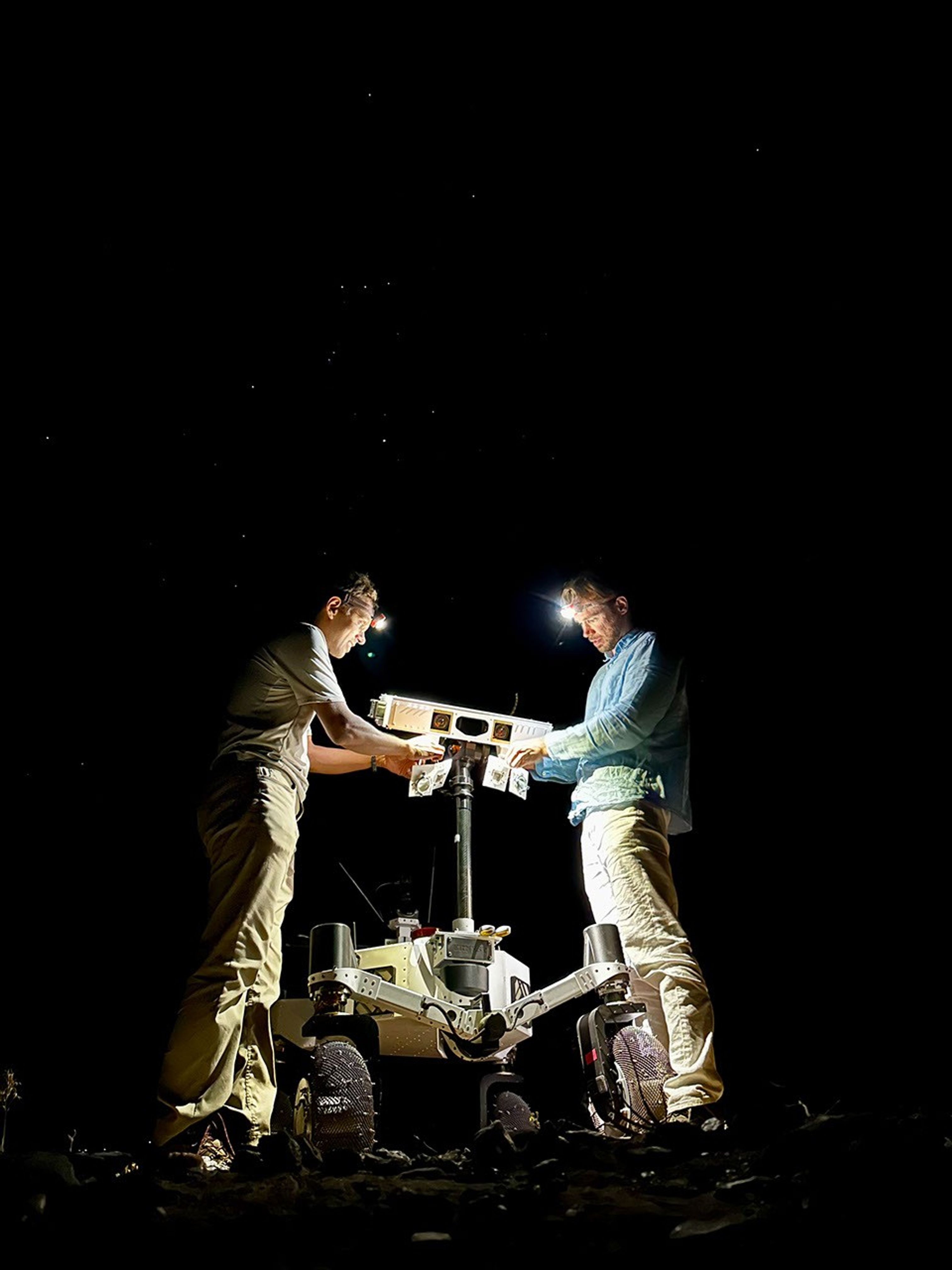
ERNEST was trailed by engineers as it traveled about 16 miles over the course of 37 hours of drive time. That’s more than 10 times the speed at which NASA’s Perseverance rover can navigate on Mars. The team also tested how well the rover traveled at dusk, dawn, and nighttime to simulate the experience of large terrain shadows in polar regions on the Moon.
Figure A
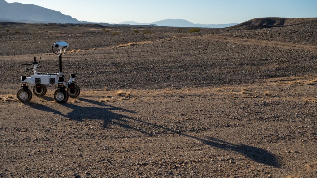
Figure A shows the rover traveling toward its shadow.
Figure B
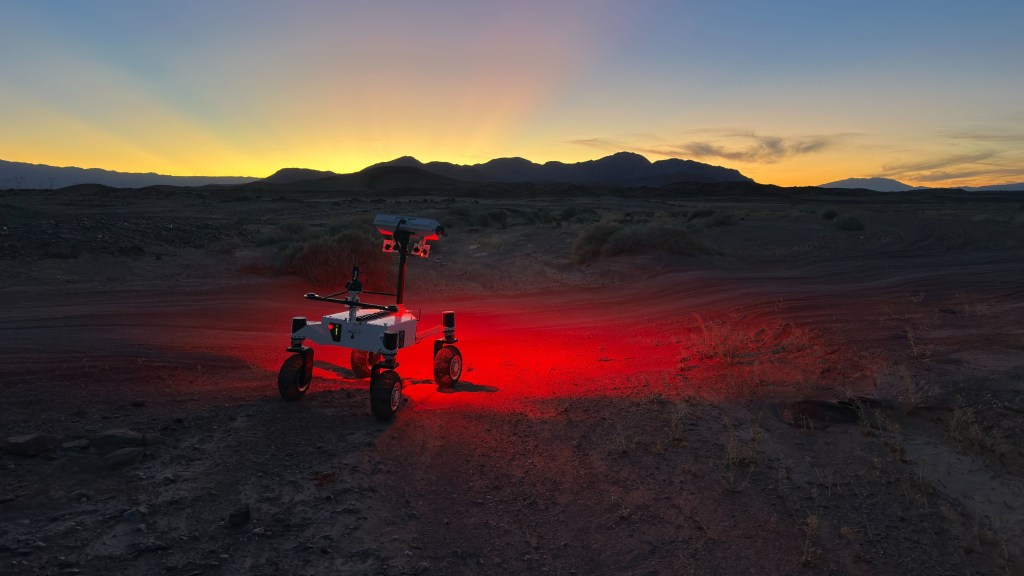
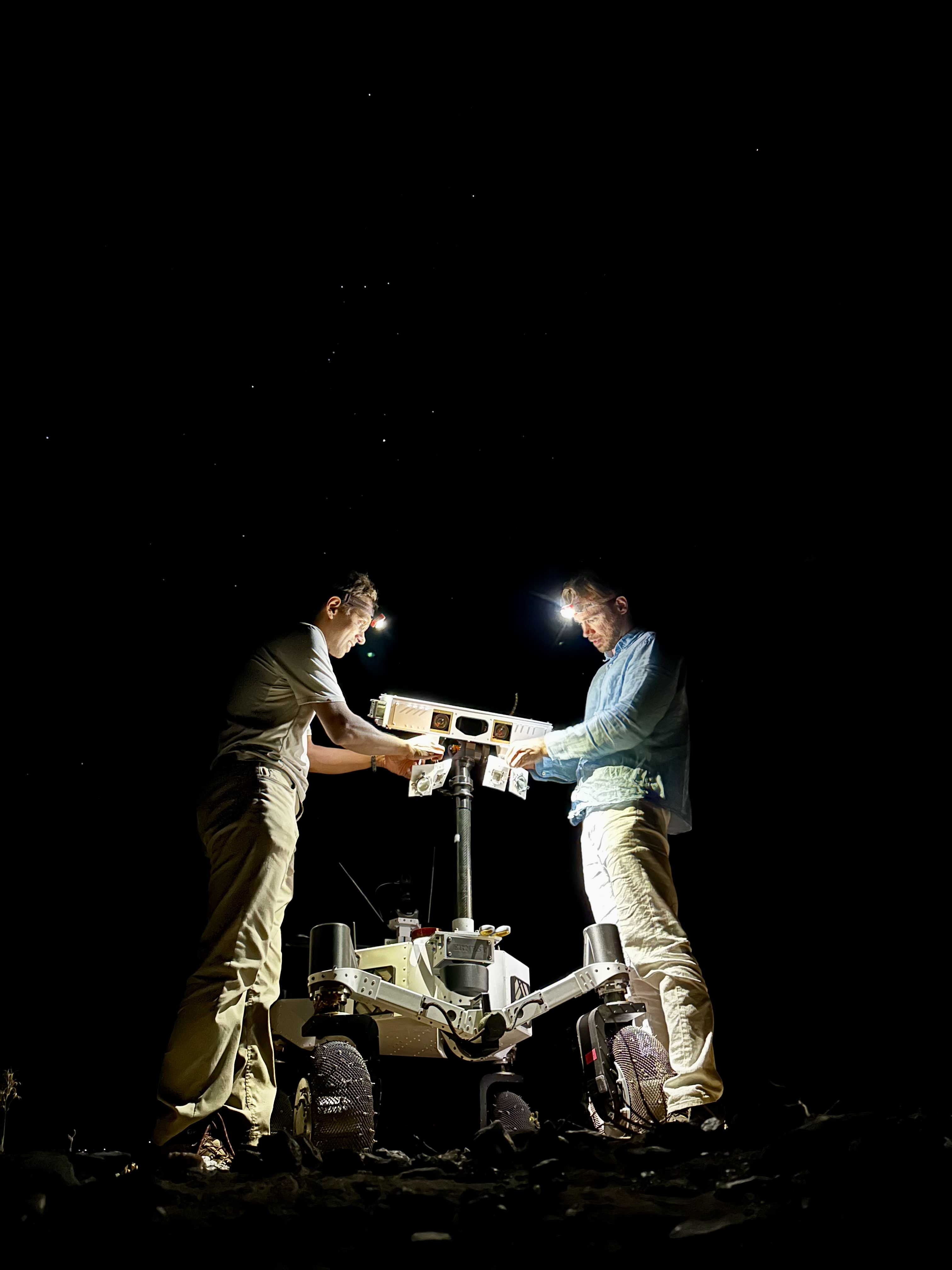
Figure B shows two team members setting up illuminators on the rover at night.
Figure C
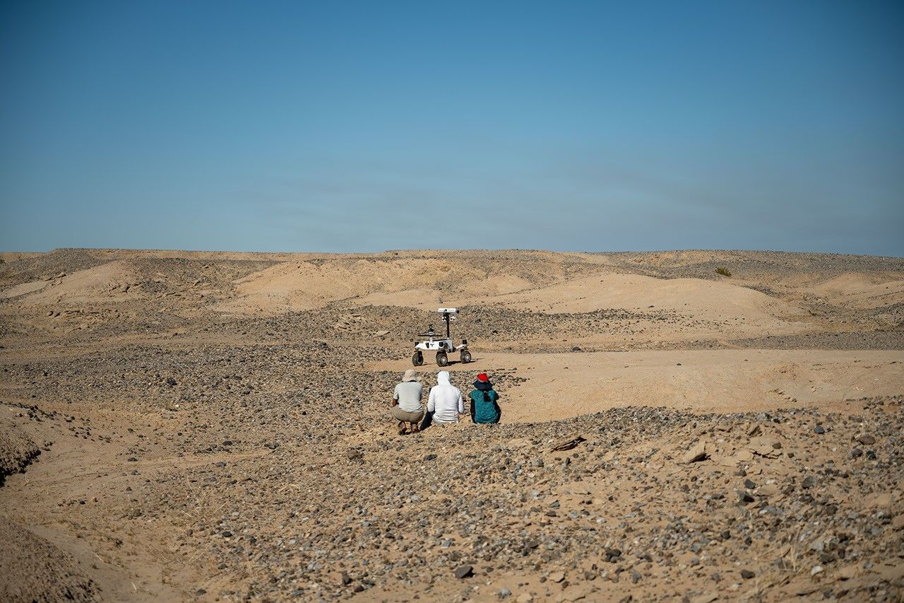
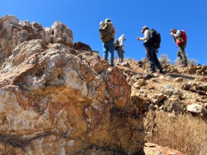
Figure C shows three team members observing the rover during its long-range traverse.
Figure D
Figure D shows the rover with one wheel up on a rock.
Work on ERNEST began in 2022 and was initially supported by JPL internal research and development funds. It is currently funded by NASA’s Mars Exploration Program and the agency’s Exploration Science Strategy Integration Office under its Science Mission Directorate in Washington. Caltech in Pasadena, California, manages JPL for NASA.
Developed at NASA’s Jet Propulsion Laboratory, ERNEST (Exploration Rover for Navigating Extreme Sloped Terrain) is used in a desert field test to help refine mobility hardware and autonomy software that could be used for a potential future long-range lunar rover mission.
During the field test, which took place in March 2026 in the Colorado Desert of Southern California, the JPL team deployed ERNEST at all times of the day — including dusk, dawn, and nighttime, when lighting conditions create long shadows like those seen on the Moon’s polar regions.
On a bleak stretch of the Colorado Desert in Southern California, a compact four-wheeled rover recently trundled about 16 miles (26 kilometers) with minimal intervention from the team of engineers trailing it. Called ERNEST (Exploration Rover for Navigating Extreme Sloped Terrain), this prototype is being used by NASA to advance both robotic autonomy and the ability to traverse challenging landscapes.
Developed at NASA’s Jet Propulsion Laboratory in Southern California, ERNEST is 4 feet (1.2 meters) long. Not only can it lift each of its mesh wheels to get past obstacles that would stymie Curiosity and Perseverance, NASA’s six-wheeled Mars rovers, but the prototype also has enhanced independent decision-making capabilities. These mobility and autonomy advances could be infused into future missions that will venture to previously inaccessible areas of the Red Planet or the Moon.
ERNEST serves as a testbed for a potential future lunar rover mission requiring high speeds and extreme distances. In a recent field test, the prototype traveled 16 miles over the course of 37 hours, going an order of magnitude above the top speed at which NASA’s current Mars rovers can navigate. Credit: NASA/JPL-Caltech
In the field, ERNEST served as a testbed for a potential future lunar mission requiring higher speeds and much greater mileage than can be accomplished by current rovers. This technology could be used to inform future designs for exploration efforts on the Moon and beyond.
“This testing is helping us refine the mobility hardware and autonomy software to navigate extreme distances across a wide range of terrain and lighting conditions anticipated on the Moon,” said Issa Nesnas, a principal technologist at JPL who led the recent testing as head of autonomy for a NASA mission concept for a potential future long-range lunar rover.
Engineers from JPL set up illuminators after transporting ERNEST for a pre-sunrise test during a seven-day desert field campaign.
NASA/JPL-Caltech
Nesnas’ team is using ERNEST to demonstrate it is possible to build a rover that’s twice as big as the prototype and capable of a long-distance Moon mission. During the recent campaign, ERNEST traveled at speeds up to 0.6 mph (1 kph) over 37 hours of driving, across seven days of intermittent testing. That’s an order of magnitude above the top speed Perseverance and Curiosity can navigate.
“You could do a science road trip across the Moon — or Mars — with this vehicle,” said James Keane, a JPL planetary scientist working on lunar missions.
The initial goal of the team that developed ERNEST was mechanical: to design a relatively simple, low-cost rover that advances the trusted rocker-bogie suspension system featured on every Mars rover since NASA’s Sojourner. This passive system keeps relatively constant weight on all six wheels, thanks to pivot points and struts that enable each one to adapt to the changing surface.
The mobility and autonomy advances developed at JPL for the ERNEST prototype rover could be infused into future NASA missions to previously inaccessible areas of the Red Planet or the Moon. Credit: NASA/JPL-Caltech
On ERNEST, the active suspension lets the rover manage weight distribution among its wheels. Two powered joints in front articulate a gimbal that allows the rover to drive using different gaits like squirming, wheel-walking, and obstacle-climbing. With a clutch mechanism, it can switch between active and passive suspension, which is less terrain capable but more energy efficient. With four steerable wheels, it can drive in any direction, including sideways.
“We started by postulating that we could do better in designing a planetary surface robotic mobility system,” said Hari Nayar, a JPL principal technologist leading the ERNEST team. “While the rocker-bogie system has been very successful over the past 30 years, there’s been a lot of research in that time on mobility and understanding terrain interaction.”
Before arriving at today’s version of ERNEST, the team built two earlier prototypes, each about 2 feet (0.6 meters) long, to test 11 active suspension configurations. In a trailer filled with lunar regolith simulant, they ran experiments at different slope angles over several months before landing on a final design.
Then the team scaled up, including adding a rectangular head mounted on a 4.5-foot-tall (1.4-meter-tall) mast. The hardware was completed in September 2024, but the rover still needed a human operator to joystick it, sending commands to instruct the rover on how to move over obstacles.
In order to train the rover to think on its own, the ERNEST team turned to reinforcement learning, a type of artificial intelligence where the robot learns by interacting with its environment. The Dynamics and Real-Time Simulation Laboratory at JPL developed a high-fidelity virtual testing environment that replicates the rover’s behavior. The team fed the simulator data collected by engineers who documented the response of the actual rover hardware to a variety of terrain types. On a high-performance computing cluster, the team ran many simulations at once, sometimes completing thousands of hours of tests over a single weekend.
After months of virtual training, the ERNEST team was ready to see if the rover could use its new autonomous algorithms to figure out how to drive over terrain features that would halt a passive-suspension rover. They set up an obstacle course with sand ripples, rubble piles, steps, and steep slopes in JPL’s Mars Yard, an outdoor terrain proving ground. Then they watched as the rover maneuvered the terrain on its own. Since then, ERNEST has completed many such courses.
Nayar’s team is starting a new autonomy project which involves integrating the rover’s ability to determine when and how to use its active suspension with longer-range intelligent navigation. The goal is to enable ERNEST to plan an efficient path so that it can tackle surmountable obstacles and circumnavigate hazardous ones. These capabilities could contribute to potential future rover missions encountering formidable landscapes on Mars or more rugged areas of the Moon.
Work on ERNEST began in 2022 was initially supported by JPL internal research and development funds. It is currently funded by NASA’s Mars Exploration Program and the agency’s Exploration Science Strategy and Integration Office in its Science Mission Directorate at NASA Headquarters in Washington. Caltech in Pasadena, California, manages JPL for NASA.
Even small asteroids lead complex lives. During its flyby of the asteroid Donaldjohanson last year, NASA’s Lucy spacecraft revealed the asteroid to be a wobbly, peanut-shaped body that has undergone a lot of activity in its relatively short history. Formed as fragments coalesced after a violent collision 155 million years ago, the asteroid was transformed by the small but inexorable force of the Sun’s radiation, all while retaining signs of the brief presence of liquid water in its distant past.
Zooming through the main asteroid belt toward one of the Jupiter Trojan asteroid groups, the Lucy spacecraft collected the first close-up images and other data at Donaldjohanson on April 20, 2025, as it passed 650 miles away from the asteroid. The data revealed that, instead of spinning simply around one axis like most other asteroids and planets, Donaldjohanson has a more complicated two-axis rotation. Scientists also saw Donaldjohanson’s peanut shape and the craters and ridges on its surface.
A timelapse video made from images taken by NASA’s Lucy spacecraft as it approached the asteroid Donaldjohanson on April 20, 2025. The L’LORRI (Lucy Long Range Reconnaissance Imager) instrument, the spacecraft’s high-resolution black-and-white imager, collected these images over two hours as the spacecraft rapidly closed in on the asteroid from an initial separation of more than 58,000 miles (93,000 km), until the spacecraft passed a mere 650 miles (1000 km) from the 5-mile- (8 km-) wide asteroid.
NASA/Goddard/SwRI/JHU-APL
Lucy’s encounter with the asteroid was planned as a dress rehearsal for the spacecraft and mission team before its primary asteroid encounters, which begin with Lucy’s flyby of the Trojan asteroid Eurybates on Aug. 12, 2027. The instruments performed as expected, and, as a bonus, scientists got a rare opportunity to study a previously unexplored asteroid up close and to compare it to two asteroids with similar compositions but different histories: Bennu, the target of NASA’s OSIRIS-REx sample-return mission, and Ryugu, the site of JAXA’s (Japan Aerospace Exploration Agency) Hayabusa2 sample-return mission.
With Earth-based telescopes, observers saw fluctuations in the light Donaldjohanson reflects, regular patterns of peaks and valleys, typical of an elongated object rotating once every 10.5 Earth days. But Lucy’s data revealed another pattern: Donaldjohanson appears to be rotating like a wobbly top. Paper authors reported that the asteroid rotates end-over-end once every 10.5 Earth days, and wobbles back and forth around its long axis once every 26.5 days.
The asteroid Donaldjohanson is shown slowly rotating in a tumbling, non-principal axis motion, with its angular momentum vector and rotation axes indicated. The surface is colored by gravity slope, which measures the angle between the local surface and the direction of gravity. Higher values (warmer colors) indicate steeper terrain relative to the local gravitational pull. Regions with limited stereo image coverage have been masked out where the shape model is less well constrained.
Kel Elkins/NASA’s Science Visualization Studio/DLR
Peanut shape
While the Earth-based observations hinted at Donaldjohanson’s elongated shape, the Lucy flyby revealed a “bilobate” structure: two lobes connected by a neck, like a peanut. These lobes are likely two fragments from an asteroid collision that gently came together afterward by their mutual gravity.
Donaldjohanson likely rotated at least 10 times faster when it formed, having slowed to its current rate in the last 20 to 60 million years, the team estimates. As it slowed, the balance between the centrifugal force pushing things apart and gravity pulling things together changed and loose rocky material slid down slopes creating the worn-down appearance of many craters, as the flyby images showed.
The paper’s authors say that the asteroid’s slowing rotation is likely caused by a subtle consequence of solar heating known as the YORP effect. Each part of the asteroid’s Sun-warmed surface radiates heat away as infrared light, and that radiation imparts a tiny recoil force to the surface. Because the asteroid’s shape isn’t symmetric, this results in a net torque, or twist, that can change the asteroid’s rotation. Thus, YORP can slow asteroid spins down or speed them up, as in the case of Bennu (once every four hours) and Ryugu (once about every seven hours), which both likely used to rotate much slower than they do today.
Fleeting water
As it passed by Donaldjohanson at 30,000 mph, Lucy recorded the signatures of iron-rich clay minerals on the surface. These clays must have formed in the distant past with the help of liquid water. However, the exposure must have been brief, Lucy scientists concluded, because iron in clays tends to be replaced with other elements, such as magnesium, as water lingers.
Indeed, scientists saw magnesium-rich clays at Bennu and Ryugu, which suggested prolonged water exposure, perhaps lasting millions of years, when they were still part of larger asteroids.
This difference in water exposure history, and other characteristics, may mean that the parent bodies of these asteroids formed at different times or in different regions of the solar system before relocating to the main belt.
Compare, contrast
Donaldjohanson is thought to be made from rocky remnants of a larger, carbon- and water-rich asteroid that collided with another object in the main asteroid belt. Bennu and Ryugu are thought to have formed in the same way and in the same region.
But Donaldjohanson is different. At 155 million years old, it is much younger than Bennu and Ryugu, which formed 1 to 2 billion years ago. Donaldjohanson also has remained in the asteroid belt since birth, while its wandering cousins migrated into orbits around the Sun that bring them close to Earth’s orbit about once a year (which made them perfect close targets for sample return missions).
During its April 20, 2025, encounter with the main-belt asteroid Donaldjohanson, NASA’s Lucy spacecraft discovered evidence for iron-rich clays on the surface using its infrared spectrometer. These clays, which are similar to those found in carbon-rich meteorites such as QUE 97990, indicate that water was briefly present in the asteroid during the distant past.
NASA/Goddard/SwRI/Dan Gallagher
“It’s helpful for scientists to compare Donaldjohanson with asteroids like Bennu and Ryugu, which are seemingly similar asteroids, because every subtle difference is another clue to our origin story,” said Simone Marchi, Lucy deputy principal investigator and lead author of the study at the Boulder, Colorado, office of the Southwest Research Institute.
“Once we start learning more about the Trojans, a completely different population of space rocks with very different histories, our understanding of solar system formation is destined to be challenged,” said Marchi.
Named after a fossilized skeleton of a human ancestor discovered in Ethiopia in 1974, NASA’s Lucy will be the first mission to explore Jupiter’s Trojan asteroids, a population of well-preserved space rocks that formed early in our solar system’s history and could help scientists understand how the planets formed and moved around before settling in their current configuration.
Lucy’s principal investigator is based out of the Boulder, Colorado, branch of Southwest Research Institute, headquartered in San Antonio. NASA’s Goddard Space Flight Center in Greenbelt, Maryland, provides overall mission management, systems engineering, and safety and mission assurance. Lockheed Martin Space in Littleton, Colorado, built the spacecraft. Lucy is the 13th mission in NASA’s Discovery Program. NASA’s Marshall Space Flight Center in Huntsville, Alabama, manages the Discovery Program for the agency’s Science Mission Directorate in Washington.
For more information on NASA’s Lucy mission, visit:
Zooming through the main asteroid belt toward one of the Jupiter Trojan asteroid groups, the Lucy spacecraft collected the first close-up images and other data at Donaldjohanson on April 20, 2025, as it passed 650 miles away from the asteroid. The data revealed that, instead of spinning simply around one axis like most other asteroids and planets, Donaldjohanson has a more complicated two-axis rotation. Scientists also saw Donaldjohanson’s peanut shape and the craters and ridges on its surface.
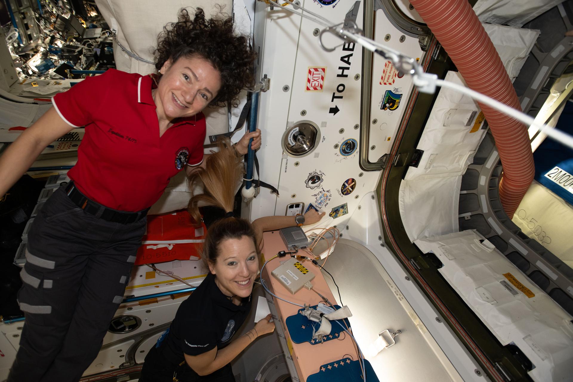
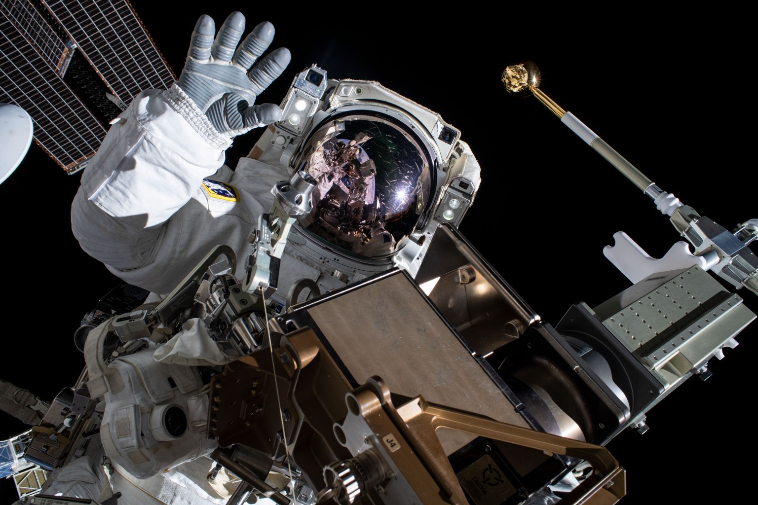
Astronauts, from left, Jessica Meir and Sophie Adenot show off a Cygnus mission sticker for Northrop Grumman’s 24th cargo mission to the International Space Station.
NASA/Chris Williams
The Expedition 74 crew explored how weightlessness affects cartilage growth and the digestive system on Thursday to protect crew health and improve patient care on Earth. The orbital residents are also gearing up for a robotics maintenance spacewalk at the end of the month on the International Space Station.
Conducting research in the microgravity environment of the orbiting laboratory provides unique insights unobtainable in Earth’s gravity. This helps scientists, doctors, and engineers develop space-influenced therapies, medicines, and products leading to advances in human health, industrial processes, spacecraft designs, and more.
Cartilage cells are growing aboard the orbital outpost that may inform new ways to treat disabilities and repair injuries. NASA flight engineers Jessica Meir and Chris Williams worked together on the biotechnology investigation using the Kibo laboratory module’s Life Science Glovebox. Williams retrieved the cartilage cell samples preserved in a science freezer then thawed them to begin scientific operations. Next, Meir nourished the cell samples inside the glovebox and stowed them inside a research incubator so they could begin growing. Manufacturing cartilage tissues in space could lead to self-repairing implants on Earth and advanced fitness techniques for astronauts on a long-term spaceflight.
Roscosmos cosmonauts Sergey Kud-Sverchkov and Sergei Mikaev joined each other after breakfast and scanned their abdominal region using an ultrasound device for a digestion study. The real-time biomedical data will give doctors insight into how microgravity affects the blood flow and shape of a crew member’s digestive organs after a meal. Results may help advance methods to monitor and improve digestive health both on Earth and in space.
Meir and flight engineer Sophie Adenot of ESA (European Space Agency) also conducted ultrasound scans using ESA’s EchoFinder-2 device to image the major blood vessels and key organs in their abdomen. The human research experiment uses augmented reality to assist with the scans and artificial intelligence to recognize organs. The lightweight, easy-to-use gear may enable independent crew health monitoring on spacecraft travelling to the Moon, Mars, and beyond.
Adenot then joined NASA flight engineer Jack Hathaway and studied procedures necessary to prepare astronauts for a spacewalk. The duo reviewed spacesuit handling techniques, Quest airlock pressurization and depressurization steps, and emergency responses. Adenot also partnered with Meir and Williams and serviced the lithium-ion batteries that power the spacesuits. NASA will soon announce the two astronauts who will exit the space station on June 30 to repair a wrist joint on the Canadarm2 robotic arm.
Roscosmos flight engineer Andrey Fedyaev had a busy day of science and maintenance beginning his shift downloading and reading data collected from a station radiation detector. Afterward, Fedyaev transferred water from the Progress 94 resupply ship into tanks inside the orbital outpost’s Roscosmos segment. Finally, the two-time cosmonaut wrapped up his shift testing artificial intelligence tools to boost crew efficiency and communications in space.
Nominate yourself or a colleague to join the leadership council of the NASA AI/ML Science and Technology Interest Group (STIG). We welcome early-career researchers (graduate students, postdocs, and early-career scientists) broadly interested in AI and astronomy. Duties are light: suggesting speakers and helping run remote seminars by sending reminders and introducing the speaker.
We are especially looking for early-career researchers, including graduate students, postdocs, and early-career scientists, who are broadly interested in the intersection of AI and astronomy. You do not need to be an expert across the whole field; curiosity and a willingness to help the community learn matter most.
The organizational duties are light. Council members help suggest speakers and run the remote seminars, which mainly means sending email reminders and introducing the speaker. It is a great way to meet people across the field and to help shape a series that reaches the NASA community and beyond.
Two themes will anchor next year’s series:
Agentic AI for Astrophysics. How LLM agents and multi-agent systems can accelerate astronomical research, from literature and data analysis to simulation and discovery workflows.
AI and Astronomy in the US: Initiatives, Funding, and Broader Impacts. The wider landscape of AI in astronomy, including national initiatives, funding opportunities, AI pedagogy, the ethics and philosophy of AI in science, and ways AI can support NASA priorities such as ASTRA.
Please use this Google form to nominate yourself or someone else by the end of next week (extended to 27 June 2026).
Alicia Mendoza-Hill is a program executive within the Science Mission Directorate (SMD) Heliophysics Division. In her role, she manages the Carruthers Geocorona Observatory and Joint EUV coronal Diagnostic Investigation (JEDI) missions. Additionally, Mendoza-Hill manages the Sounding Rockets Program and Wallops Flight Facility Range. She is also the Science Mission Directorate rideshare lead, serving as the central point of contact for all rideshare and access-to-space activities. She leads the coordination of rideshare launch opportunities for SMD missions within the agency and with external government and international partners.
Mendoza-Hill completed a detail with SMD at NASA Headquarters from April 2019 through April 2020, assisting the development the SMD-level rideshare implementation processes, policy, and plans. During this assignment she co-led the implementation of rideshare on the IMAP mission.
Prior to joining SMD, Mendoza-Hill was a mission manager in the Flight Projects Office of the Launch Services Program at NASA’s John F. Kennedy Space Center in Florida (KSC). As the mission manager, she was the primary spacecraft customer interface and was responsible for the management of the launch services, integration, and launch vehicle engineering aspects for the OCO-2, CYGNSS, InSight, DART, and GeoCarb missions. She also led the Mission Integration Team (MIT) which ensures that the mission will be launched successfully into its required orbit, on time and within budget.
Prior to transferring to LSP in 2011, Mendoza-Hill was the NASA vehicle manager for the external tank (ET) and solid rocket boosters (SRB) within the Operations Integration Branch of the Launch Vehicle Processing Directorate for the Space Shuttle Program. She was responsible for managing all NASA activities associated with the processing of the ET, SRBs, and Mobile Launch Platform at Kennedy for every space shuttle mission. This included coordination of prelaunch operations, launch and recovery activities with the KSC management, Marshall Space Flight Center shuttle program elements, and NASA contractors. She was also responsible for evaluating, planning and integrating all element deliveries, operational requirements and resource availability for all ET and SRB operations for both near-term and long-range manifest schedules.
From 2003 to 2007, she served as a NASA vehicle processing engineer for the ET and SRBs, as well as for the orbiters Discovery and Endeavour.
Mendoza-Hill joined NASA in 2000 as an industrial engineer (IE) in space shuttle processing. She was the study manager for the Space Shuttle Program Industrial Engineering for Safety Program and the IE representative for the OV-103 Orbiter Major Modification Team. She also managed contractor IE and human factors engineering projects.
Throughout her career at NASA, Mendoza-Hill has received numerous group achievement and performance awards, as well as multiple Space Flight Awareness Team Awards, a Kennedy Launch Vehicle Processing Superior Achievement Award, Kennedy Certificate of Commendation, Outstanding Leadership Medal, Kennedy and Headquarters Exceptional Achievement Medals, and a Space Flight Awareness Silver Snoopy.
Mendoza-Hill earned a Bachelor of Science in industrial and systems engineering from Florida International University, followed by a Master of Science in space systems from the Florida Institute of Technology.
Dear Astrophysics Strategic Technology & Research Accelerator (ASTRA) community members this serves as a reminder for those attending AAS248. This session is in-person only.
NASA’s astrophysics fleet of observatories push the limits of human vision and understanding, exploring the most profound questions of our existence while driving innovations that transform the extraordinary into the everyday and reinforce U.S. leadership in space. This special session, organized by the NASA Astrophysics Division, will provide insight into the ASTRA Initiative, share initial findings from the May 2026 Innovation for Astrophysics Missions Workshop, and will discuss plans for the September 2026 Astrophysics community science (Ad ASTRA) workshop. Talks will be followed by a panel to address questions from the community.
Sprouted from seeds that journeyed around the Moon aboard Apollo 14 in February 1971, “Moon Trees” planted across the United States endure as living reminders of Apollo-era lunar exploration.
In 2022, a new generation of tree seeds flew around the Moon on NASA’s Artemis I mission as part of a national STEM Engagement and conservation education initiative.
The “Moon Tree” in front of the Visitor Center at NASA’s Goddard Space Flight Center in Greenbelt, Md. This sycamore was planted at the visitor center on June 9, 1977, and grew from a seed carried to the Moon aboard Apollo 14.
NASA/Pat Izzo
Apollo 14 Moon Trees
Apollo 14 launched in the late afternoon of January 31, 1971 on what was to be our third trip to the lunar surface. Five days later Alan Shepard and Edgar Mitchell walked on the Moon while Stuart Roosa, a former U.S. Forest Service (USFS) smoke jumper, orbited above in the command module. Packed in small containers in Roosa’s personal kit were hundreds of tree seeds, part of a joint NASA/USFS project. Upon return to Earth, the seeds were germinated by the Forest Service. Known as the Apollo “Moon Trees”, the resulting seedlings were planted throughout the United States (often as part of the nation’s bicentennial in 1976) and the world. They stand as a tribute to astronaut Roosa and the Apollo program.
Astronaut Stuart A. Roosa was the command module pilot of the Apollo 14 lunar landing mission. In 1971 hundreds of tree seeds were packed in his personal kit as part of a joint NASA/USFS project.
NASA
The project began after Roosa was chosen for the Apollo 14 mission. Ed Cliff, Chief of the Forest Service, knew of Stuart Roosa from his days as a smokejumper and contacted him about bringing seeds into space. Stan Krugman of the Forest Service was put in charge of the project and selected the seeds for the experiment. Seeds were chosen from five different types of trees: loblolly pine, sycamore, sweetgum, redwood, and Douglas fir. The seeds were classified and sorted, and sealed in small plastic bags that were stored in a metal canister. Control seeds were kept on Earth for later comparison. Roosa carried possibly 2,000 or more seeds in the canister in his personal kit, a small canvas pouch that stayed with him as he orbited the Moon in the command module “Kitty Hawk” in February, 1971. Unfortunately, the seed bags burst open during the decontamination procedures after their return to Earth, and the seeds were scattered about the chamber and exposed to vacuum, and it was thought they might not be viable.
Stan Krugman collected the seeds and an attempt at germinating some of the seeds was made in Houston. Somewhat surprisingly, it proved successful and the seeds started growing, but they did not survive long because the facilities there were inadequate. A year later the remaining seeds were sent to the southern Forest Service station in Gulfport, Mississippi (sycamore, loblolly pine, and sweetgum) and to the western station in Placerville, California (redwood and Douglas fir) to attempt germination. Many of the seeds, and later cuttings, were successful and grew into viable seedlings. Some of these were planted with their Earth-bound counterparts as controls, (as might be expected, after over forty years there is no discernable difference) but most were given away in 1975 and 1976 to many state forestry organizations to be planted as part of the nation’s bicentennial celebration. These trees were southern and western species, so not all states received trees. A loblolly pine was planted at the White House, and trees were planted in Brazil, Switzerland, and presented to the Emperor of Japan, among others. Trees have also been planted in Washington Square in Philadelphia, at Valley Forge, in the International Forest of Friendship, and at various universities and NASA centers, reportedly in 40 different states.
Clipping from the September 1977 edition of Goddard Space Flight Center’s newsletter Goddard News.
NASA
Stuart Roosa was born on August 16, 1933, in Durango, Colorado. He worked for the Forest Service in the early 1950’s as a smoke jumper fighting fires and later joined the Air Force and became a test pilot. He was one of 19 people selected for the astronaut class of 1966 and was part of the astronaut support crew for Apollo 9. Following Apollo 14, Roosa was backup command module pilot for Apollo 16 and 17. He then worked on the Space Shuttle program until his retirement as a Colonel in the Air Force in 1976, the time when many of his trees were being planted. Roosa passed away in December 1994.
The Moon Trees continue to flourish, a living monument to our first visits to the Moon and a fitting memorial to Stuart Roosa. Believed locations of some of the original Moon Trees are listed below, but no list was ever kept nor any systematic tracking made of the disposition of all the trees. This list of Moon Trees was initiated by Dr. David R. Williams, retired curator at NASA’s National Space Science Data Center, after receiving a request for more information from Joan Goble, a third grade teacher in Indiana in 1996. Since then, dozens of people have contributed with information about other Moon Trees.
If you know of a Moon Tree not listed here or have a update to the status of one of those listed, please send a message to marie.j.henderson@nasa.gov.
Apollo Moon Tree Locations
City and State
Location
Type of Tree
Planting Date
Birmingham, Alabama
Birmingham Botanical Gardens
Sycamore
25 February 1976
Montgomery, Alabama
State Capitol
Loblolly Pine
19 April 1976
Troy, Alabama
Pioneer Museum of Alabama
Loblolly Pine
5 August 1976
Tuscumbia, Alabama
Ivy Green
Loblolly Pine
19 October 1976
Tuskegee, Alabama
VA Medical Center
Loblolly Pine
1976
Tucson Arizona
University of Arizona
Sycamore
30 April 1976
Ft. Smith, Arkansas
Sebastian County Courthouse
Loblolly Pine
15 March 1976
Washington, Arkansas
Old Washington Historic State Park
Loblolly Pine
15 March 1976
Arcata, California
Humboldt State University
3 Redwoods
1976
Berkeley, California
Tilden Nature Area
2 Redwoods
26 July 1976
Lockeford, California
Lockeford Plant Materials Center
Redwood
1979
Monterey, California
Friendly Plaza
Redwood
27 July 1976
Sacramento, California
Capitol Park
Redwood
April 1976
San Luis Obispo, California
Mission Plaza
Redwood
30 July 1976
Gainesville, Florida
University of Florida
Sycamore
c. 1977
Keystone Heights, Florida
Keystone Heights Library
Sycamore
1984
Perry, Florida
Forest Capital State Park
Loblolly Pine
29 April 1978
Tallahassee, Florida
Cascades Park
Sycamore
Tallahassee, Florida
Doyle Conner Building
Loblolly Pine
1976
Athens, Georgia
Clarke County Planning Dept.
Loblolly Pine
May 1976
Macon, Georgia
Georgia Forestry Center
Loblolly Pine
22 March 1976
Waycross, Georgia
Okefenokee RESA
Loblolly Pine
Boise, Idaho
Lowell Elementary School
Loblolly Pine
1977
Cannelton, Indiana
Camp Koch Girl Scout Camp
Sycamore
1976
Indianapolis, Indiana
Indiana Statehouse
Sycamore
9 April 1976
Lincoln City, Indiana
Lincoln State Park
Sycamore
1 May 1976
Atchison, Kansas
International Forest of Friendship
Sycamore
24 July 1976
Elmer, Louisiana
Palustris Experimental Forest
Loblolly Pine
April 1976
Bethesda, Maryland
Society of American Foresters
Loblolly Pine
30 September 1975
Greenbelt, Maryland
Goddard Space Flight Center
Sycamore
9 June 1977
Holliston, Massachusetts
Holliston Police Station
Sycamore
1982
Niles, Michigan
Fernwood Botanical Gardens
Sycamore
23 April 1976
Biloxi, Mississippi
Private Residence
Sycamore
1974-75
Starkville, Mississippi
Mississippi State University
Sycamore
1975
Wiggins, Mississippi
Camp Iti Kana
Sycamore
April/May 1974
DeSoto, Missouri
Walther Park
Sycamore
Santa Fe, New Mexico
State Capitol Building
Douglas Fir
22 July 1976
Silver City, New Mexico
Gough Park
Sycamore
15 August 1976
Asheville, North Carolina
Botanical Gardens at Asheville
Sycamore
19 March 1976
Clyde, North Carolina
Haywood Community College
Sycamore
1976
Pisgah National Forest, North Carolina
Cradle of Forestry
Sycamore
18 October 1976
Jefferson County, Ohio
Friendship Park
Sycamore
29 July 1976
Corvallis Oregon
Oregon State University
Douglas Fir
Spring, 1976
Eugene Oregon
University of Oregon
Douglas Fir
1976
Roseburg, Oregon
U.S. Veteran’s Hospital
Douglas Fir
3 May 1976
Salem, Oregon
State Capitol Building
Douglas Fir
30 April 1976
Salem, Oregon
Private Residence
2 Douglas Firs
1973
Coudersport, Pennsylvania
Coudersport Area Recreational Park
Sycamore
Late 1970’s
Dillsburg, Pennsylvania
Dillsburg Elementary School
Sycamore
29 April 1983
Ebensburg, Pennsylvania
Cambria County Courthouse
Sycamore
29 June 1976
Hollidaysburg, Pennsylvania
Highland Hall
Sycamore
5 May 1976
King of Prussia, Pennsylvania
Lockheed Martin
Sycamore
30 June 1976
Newtown/Langhorne, Pennsylvania
Core Creek Park
Sycamore
30 April 1976
Topton, Pennsylvania
Topton Mini Museum
Sycamore
20 June 1976
Knoxville, Tennessee
University of Tennessee
Loblolly Pine
April 1976
Sewanee, Tennessee
University of the South
Sycamore
April 1976
Westlake, Texas
Private Residence
Sycamore
1978
Draper, Utah
Lone Peak Conservation Center
Sycamore
1976
Bracey, Virginia
River Ridge Campground
Sycamore
Unknown
Doswell, Virginia
Kings Dominion Amusement Park
Sycamore
1976?
Hampton, Virginia
Patrick Elementary School
Sycamore
30 April 1976
Loudoun County, Virginia
Scott Jenkins Memorial Park
Sweetgum
September 1978
Olympia, Washington
State Capitol Building
Douglas Fir
April 1976
City and Country
Location
Type of Tree
Planting Date
Brasilia, Brazil
IBAMA Institute
Sweetgum
14 January 1980
Cambara do Sul, Brazil
Praça Central São José
Redwood
26 September 1982
Rio Grande do Sul, Brazil
Santa Rosa
Redwood
18 August 1981
Chavaniac, France
Chateau Lafayette
Sycamore status unknown
1976
City and State
Location
Type of Tree
Planting Date
San Francisco, California
Strybing Arboretum
Coast Redwood status unknown
22 July 1976
Savannah, Georgia
Unknown
Sycamore status unknown
Unknown
Pocatello, Idaho
Idaho State University
Douglas Fir status unknown
18 May 1976
Springfield, Illinois
State Capitol
Sycamore status unknown
29 April 1976
Des Moines, Iowa
State Capitol
Sycamore ? status unknown
30 April 1976
Baton Rouge, Louisiana
Governor’s Mansion
2 Loblolly Pines status unknown
16 January 1976
Annapolis, Maryland
Tawes Garden
Sycamore status unknown
Unknown
Cleveland, Mississippi
Delta State University
Status Unknown
1976
Hattiesburg, Mississippi
University of Southern Mississippi?
Status Unknown
1976
Missoula, Montana
University of Montana
Douglas Fir Status Unknown
17 July 1976
Nebraska City, Nebraska
National Arbor Day Center
Status Unknown
24 April 1976?
Monmouth County, New Jersey
Monmouth County Courthouse
Sycamore Status Unknown
Albany, New York
Empire State Plaza
Sycamore status unknown
1977?
Brooklyn, New York
Fulton Ferry
Sycamore status unknown
June 1976?
Buffalo, New York
Delaware Park Lake
Sycamore status unknown
25 May 1977?
Rome, New York
Fort Stanwix
Sycamore status unknown
1976?
Elkton, Oregon
D.L. Phipps State Forest Nursery
Douglas Fir status unknown
Portland, Oregon
Western Forestry Center
Douglas Fir Status Unknown
25 May 1976
Emporium, Pennsylvania
Cameron County Courthouse
Sycamore Status Unknown
15 May 1976
Portersville, Pennsylvania
Moraine State Park
Sycamore status unknown
4 August 1977
City and State
Location
Type of Tree
Planting Date
Auburn University, Alabama
G.W. Andrews Forestry Sciences Lab
Loblolly Pine†, Sycamore†
22 October 1976
Huntsville, Alabama
U.S. Space and Rocket Center
5 Sycamores†, 2 Pines†
29 October 1976
Flagstaff, Arizona
Flagstaff Jr. High School
Douglas Fir†
30 April 1976
Little Rock, Arkansas
Forestry Commission Headquarters
Loblolly Pine†
15 March 1976
Monticello, Arkansas
University of Arkansas at Monticello
Loblolly Pine†
15 March 1976
El Dorado Hills, California
St. Stephen’s Lutheran Church
Redwood†
1976
San Dimas, California
Technology & Development Center
Giant Sequoia?†
29 March 1977
Cape Canaveral, Florida
Kennedy Space Center
Sycamore†
25 June 1976
Gainesville, Florida
University of Florida
2 Loblolly Pines†
c. 1977
Boise, Idaho
State Capitol
Douglas fir†
7 May 1976
Moscow, Idaho
University of Idaho
Sycamore†
Tell City, Indiana
Forest Service Office
2 Sweetgums†
1976
New Orleans, Louisiana
New Orleans River Walk
Loblolly Pine†
June 1983
New Orleans, Louisiana
NASA Michoud Assembly Facility
Loblolly Pine (2?)†
July 1976
North Pembroke, Massachusetts
Historical Society
Sycamore†
April 1976
Jackson, Michigan
Dahlem Environmental Education Center
Sycamore†
22 April 1976
Lansing, Michigan
State Capitol
Sycamore†
22 April 1976
Wyoming, Michigan
Wyoming Police Station
Sycamore†
23 April 1976
Waynesboro, Mississippi
Forestry Commission Nursery
Sycamore†
Alamogordo, New Mexico
International Space Hall of Fame
Sycamore†
5 October 1976
Albuquerque, New Mexico
Civic Plaza
Douglas Fir†
7 April 1976
Capitan, New Mexico
Smokey Bear State Park
Sycamore†
15 May 1976
Athens, Ohio
District 4 Headquarters
Sycamore†
20 July 1976
Columbus, Ohio
City Nursery
Sycamore†
1976
Illinois Valley, Oregon
Siskiyou Smoke Jumpers Base
Douglas Fir†
Portland, Oregon
World Forestry Center
Douglas Fir†
Philadelphia, Pennsylvania
Washington Square
Sycamore†
6 May 1975
Elizabethton, Tennessee
Sycamore Shoals State Park
Sycamore†
April 1976
Tullahoma, Tennessee
Arnold Air Force Base
Loblolly Pine†
April 1976
College Station, Texas
Brazos County Arboretum
Sycamore†
21 March 1976
Salt Lake City, Utah
State Capitol Building
Douglas Fir†
Doswell, Virginia
Kings Dominion Amusement Park
Sycamore†
1976?
Washington, D.C.
White House
Loblolly Pine†
19 January 1977
Princeton, West Virginia
Forestry Sciences Lab
Sycamore†
18 October 1975
† Trees no longer alive
Featured Story
Moon Trees Stand as Living Testaments to First Voyages to Moon
The craters, mountains, and plains of the Moon stretched beneath the Apollo 14 Command and Service Module Kitty Hawk in…
Second-generation trees, either grown from seeds of mature Moon Trees or from cuttings, are also growing around the world and continue to be planted today. In memory of her father, Stuart Roosa’s daughter, Rosemary Roosa, has continued the legacy of the original Apollo 14 Moon Trees through promoting planting second-generation Moon Trees around the world.
City and State
Location
Type of Tree
Planting Date
Enterprise, Alabama
Private Residence
Sycamore
15 February 2002
Enterprise, Alabama
Private Residence
Sycamore
15 March 2003
Huntsville, Alabama
Marshall Space Flight Center
Sycamore
22 April 1996
Lancaster, California
Lancaster Performing Arts Center
Sycamore
23 September 2009
Blue Lake, California
Ultra Powers Co.
Redwood
Lake Arrowhead, California
MSAS Astronomy Village
Sycamore
May 1999
Mountain View, California
Private Residence
Redwood
January, 1998
Tampa, Florida
Museum of Science and Industry
Sycamore
16 November 1996
Hartwell, Georgia
Madora Garden Club
4 Sycamores
Spring, 2006
Boise, Idaho
National Interagency Fire Center
Sycamore
Spring, 2002
Libertyville, Illinois
Adler Park School
Sycamore
1 October 1997
Indianapolis, Indiana
Greenbriar Elementary School
Sycamore
22 April 1999
Storm Lake, Iowa
Living Heritage Tree Museum
Sycamore
Louisville, Kentucky
Louisville Zoo
Sycamore
Stevensville, Maryland
Private Residence
Sycamore
Circa 1997
Battle Creek, Michigan
Private Residence
Sycamore
May, 1998
Buchanan, Michigan
Private Residence
Sycamore
1996
Wyoming, Michigan
Wyoming Police Station
Sycamore†
23 April 1976
Unionville, Missouri
Historic Tree Museum
Sycamore
November, 1988
Wayne, New Jersey
Cyanamid Company
Sycamore
Somers, New York
Lasdon Park and Arboretum
Sycamore
Greensboro, North Carolina
Guilford College
Sycamore
Spring, 1995
Rowan County, North Carolina
Sloan Park
Sycamore
Canal Winchester, Ohio
Private Residence
Sycamore
August, 1996
Fairfield, Ohio
Paper Products Company
Sycamore
13 July 2016
Cave Junction, Oregon
Siskiyou Smoke Jumpers Base
Douglas Fir
6 October 2012
Hockley, Texas
Private Residence
Sycamore
15 April 2002
Arlington, Virginia
Arlington National Cemetery
Sycamore
9 February 2005
Flamstead, England
Private Residence?
Sycamore
Summer, 2008
Tradate, Italy
Tradate Astronomical Observatory
Loblolly Pine
12 October 2011
Lucern, Switzerland
Swiss Museum of Transport
Sycamore
8 October 2011
† Trees no longer alive
If you are seeking detailed information about the Moon trees listed here, contact marie.j.henderson@nasa.gov.
Artemis Moon Trees
A new generation of Moon Tree seeds traveled into lunar orbit aboard the Artemis I spacecraft in 2022. These Artemis Moon Tree seedlings have found homes with schools, museums, libraries, universities, and community organizations across the contiguous United States.
In a nod to the legacy of Apollo 14, and a celebration of the future of space exploration with NASA’s Artemis Program, a “New generation” of Moon Tree seeds traveled into lunar orbit aboard the Orion spacecraft. The seeds travelled thousands of miles beyond the Moon spending about 4 weeks in space before returning to Earth.
Through NASA’s Office of STEM Engagement (OSTEM) and NASA’s Artifact Module, museums, universities, federal agencies, including NASA Field Centers, and K–12 serving organizations were invited to apply for ownership of a Moon Tree seedling. Recipient distribution schedule aligned to four planting cycles: Spring 2024, Fall 2024, Spring 2025, and Fall 2025.
Artemis I Moon Tree Stewards
Artemis I Moon Tree seedlings found new homes with schools, museums, libraries, universities, and community organizations across the United States. An open call to NASA’s Artifacts Module in Fall, 2023 welcomed over 1000 organization submissions, which were reviewed and ranked by a joint USDA Forest Service and NASA panel.
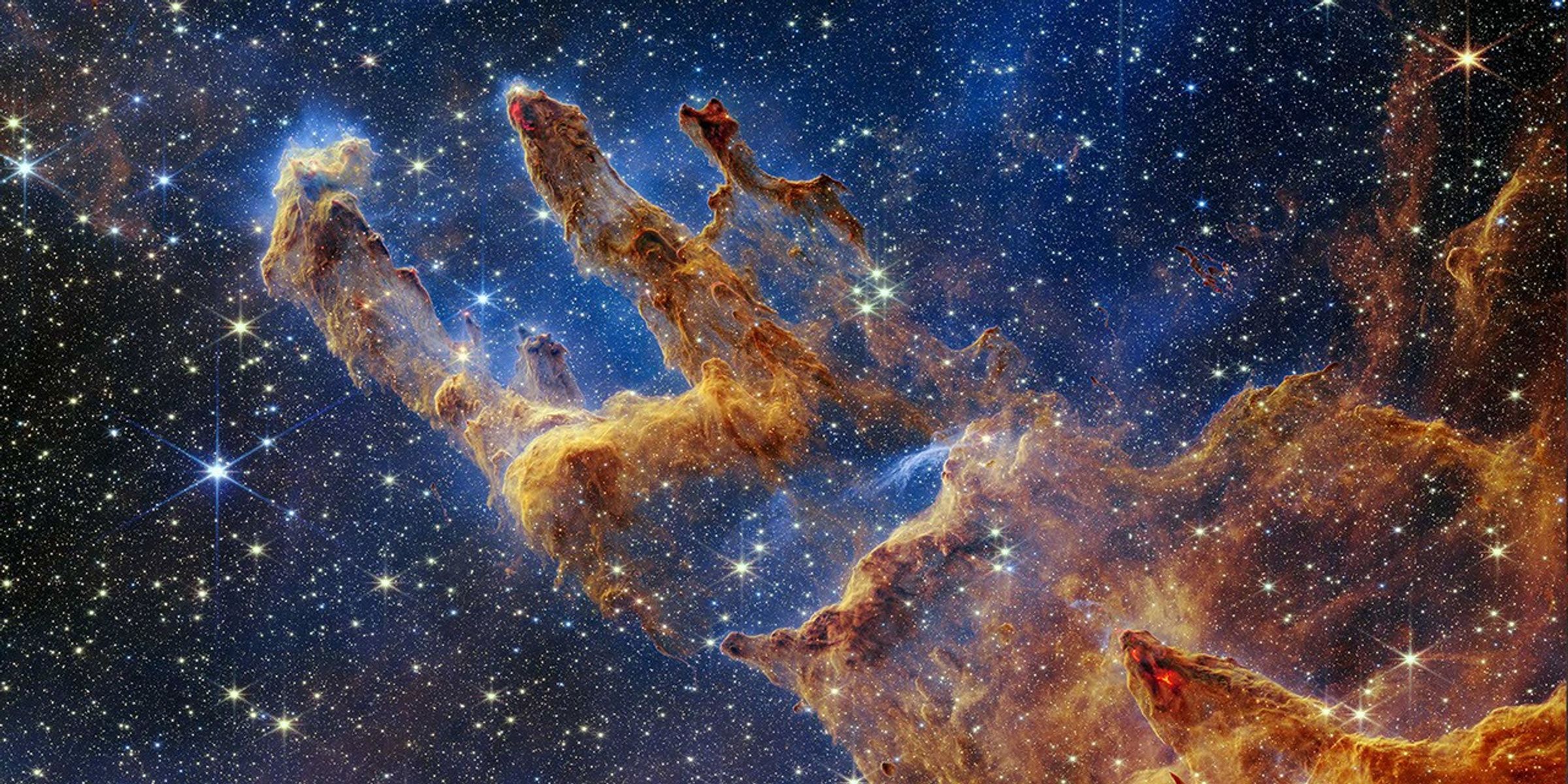
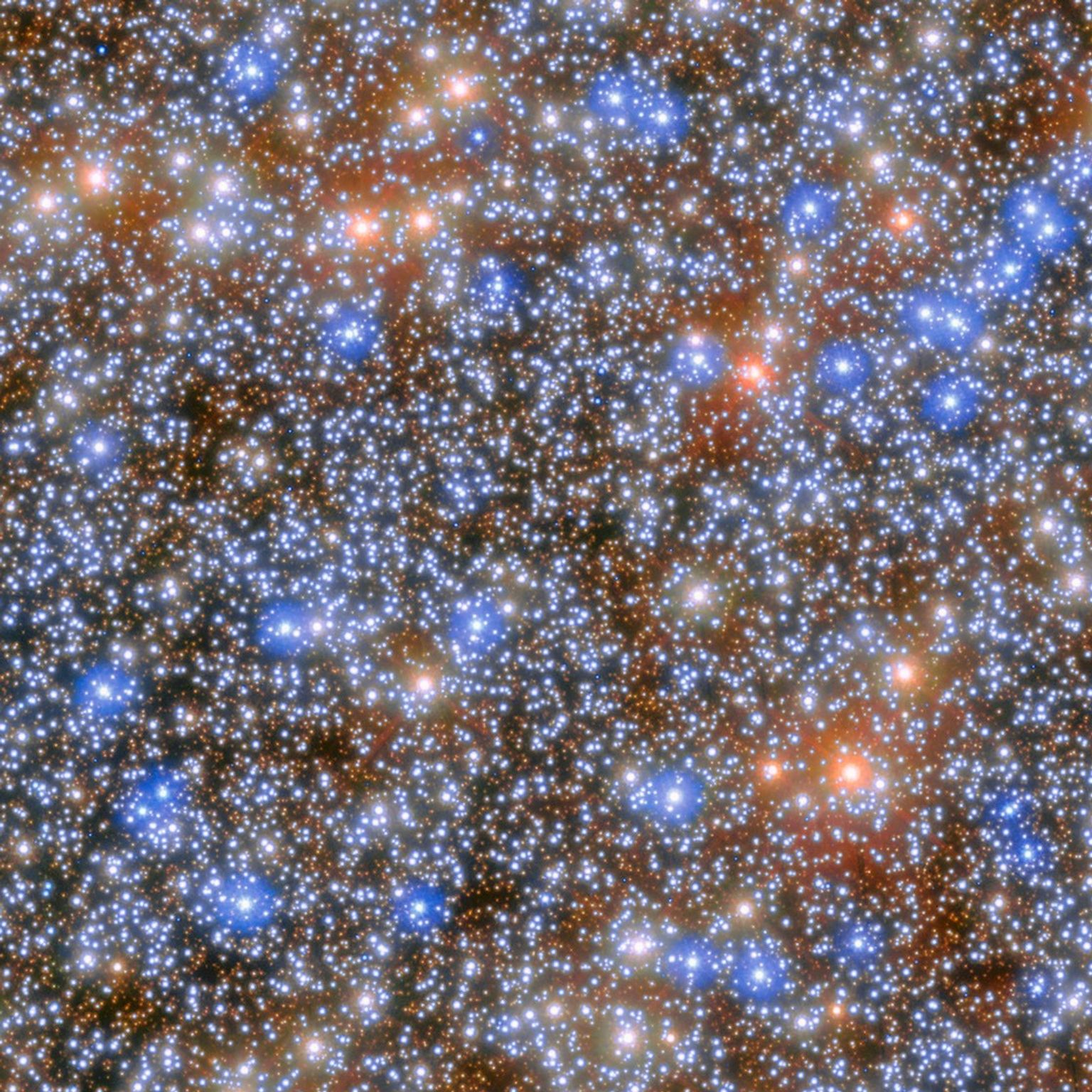
This NASA/ESA/CSA James Webb Space Telescope Picture of the Month shows the giant molecular cloud Orion A, an area of the sky replete with star-forming clouds.
ESA/Webb, NASA & CSA, T. Megeath, M. Zamani (ESA/Webb) Acknowledgement: M. H. Özsaraç
This image, captured by NASA’s James Webb Space Telescope and released on June 5, 2026, shows just a small portion of one of the Orion Molecular Clouds, a long and massive filament of cold gas and dust beyond the Orion Nebula. Every stage of star formation — from the youngest stellar embryos to protoplanetary discs to newly-minted pre-main sequence stars — is contained within this scene which stretches 150 light-years across.
This NASA Hubble Space Telescope image features a swarm of galaxies in the galaxy cluster called CL0016+1609 or MACS J0018.5+1626.
NASA, ESA, H. Ebeling (University of Hawaii), D. Coe (STScI, ESA, JWST); Image Processing: G. Kober (NASA/Catholic University of America)
This NASA Hubble Space Telescope image features a galaxy cluster, called CL0016+1609 or MACS J0018.5+1626, that is very bright at X-ray wavelengths and is one of the most extensively studied clusters at X-ray and radio wavelengths. The X-ray observations of this cluster revealed that it is two clusters merging along our line of sight.
Researchers requested time to observe CL0016+1609 with Hubble’s Advanced Camera for Surveys because that data would help them accurately measure the cluster’s dark-matter distribution, which helps them study the merger and the role of CL0016+1609 in the large-scale structure of the universe. Hubble can’t directly see dark matter, but its infrared and visible light observations can detect dark matter’s gravitational lensing effects on the normal matter Hubble observes.
The data in this image also includes observations with Hubble’s Wide Field Camera 3 taken as part of an observing program that obtained the first Hubble infrared images of 46 massive galaxy clusters and looked for distant galaxies gravitationally lensed by these clusters. Called RELICS (Reionization Lensing Cluster Survey), this survey found some 300 high-redshift candidate galaxies lensed by these clusters.
You can see the faint vertical arc of one of these distant galaxies in the image above. Look for it just to the left of the large elliptical galaxies in the center of the image. Another brighter, though shorter arc is visible just above and to the right of the large elliptical galaxies in the center of the image.
PhysCOS Activities at AAS 248 – Thursday, 18 June 2026
18 June 2026
Dear Physics of the Cosmos (PhysCOS) community members-
If you’re attending the American Astronomical Society’s 2026 Summer Meeting (AAS 248) in Pasadena CA, please join us for the following PhysCOS-organized activities (all times Pacific):
Thursday 18 June
10a ‑ 11:30a, Ballroom G: (Special Session) Planning for the Future of Astrophysics and the ASTRA Initiative
Additionally, the following activities may be of special interest to the PhysCOS community:
Thursday 18 June
10a ‑ 11:30a, Ballroom F: Gravitational-Wave Astronomy in the Next-Generation Era
10a ‑ 10:40a, Ballroom C: High Energy Astrophysics
And please drop by the PhysCOS table in the Exhibit Hall!
For more information on PhysCOS throughout the meeting, check out our meeting webpage.
Wishing you the best,
Dr Francesca Civano & Dr Brian Humensky
PhysCOS Chief Scientists, NASA GSFC
Dr Bernard Kelly
PhysCOS Support Scientist, NASA GSFC
American Astronomical Society
The 248th Meeting of the AAS
The 248th AAS meeting (joint with the High Energy Astrophysics and the Laboratory Astrophysics Divisions) will be held 14-18 June 2026 in Pasadena, California.
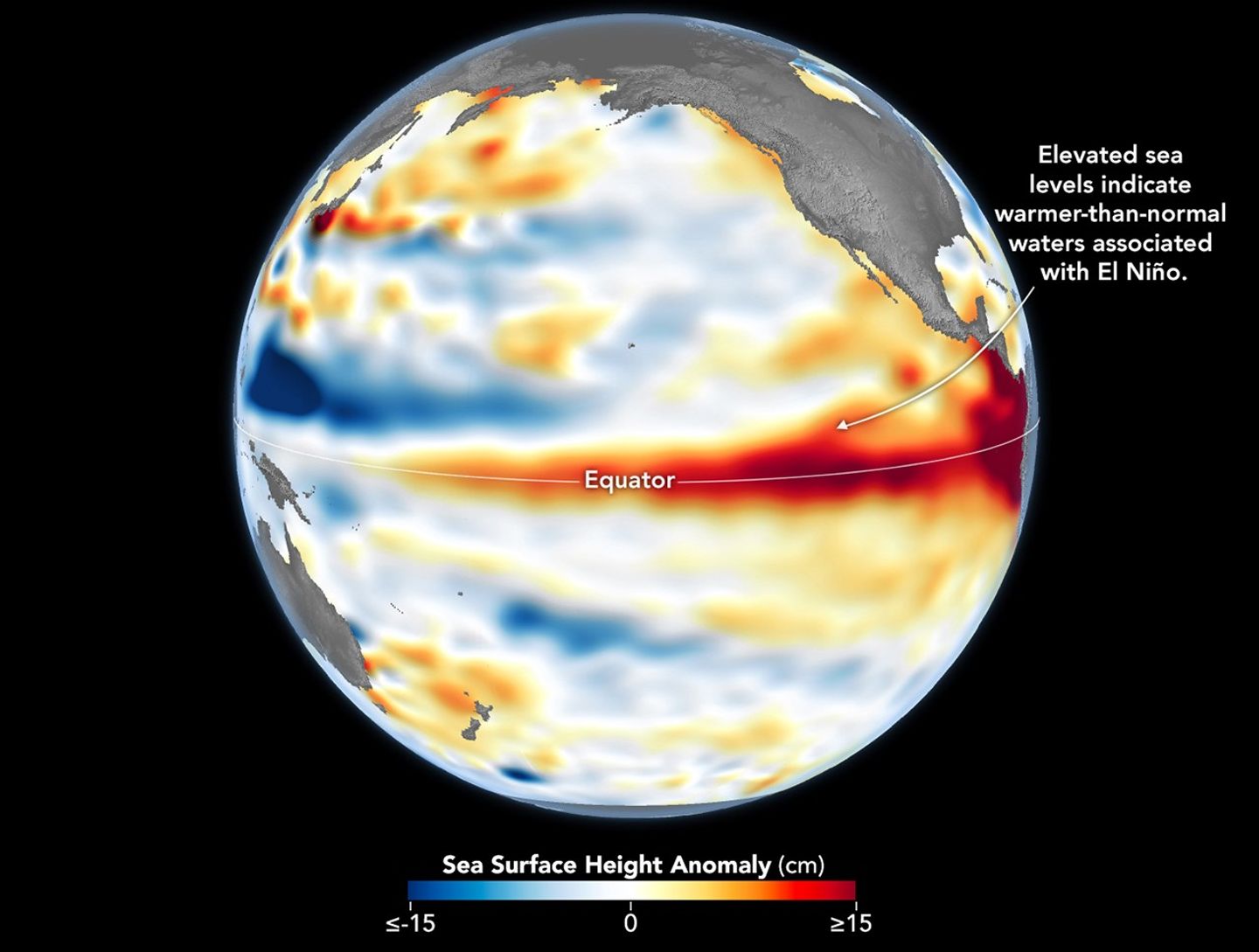
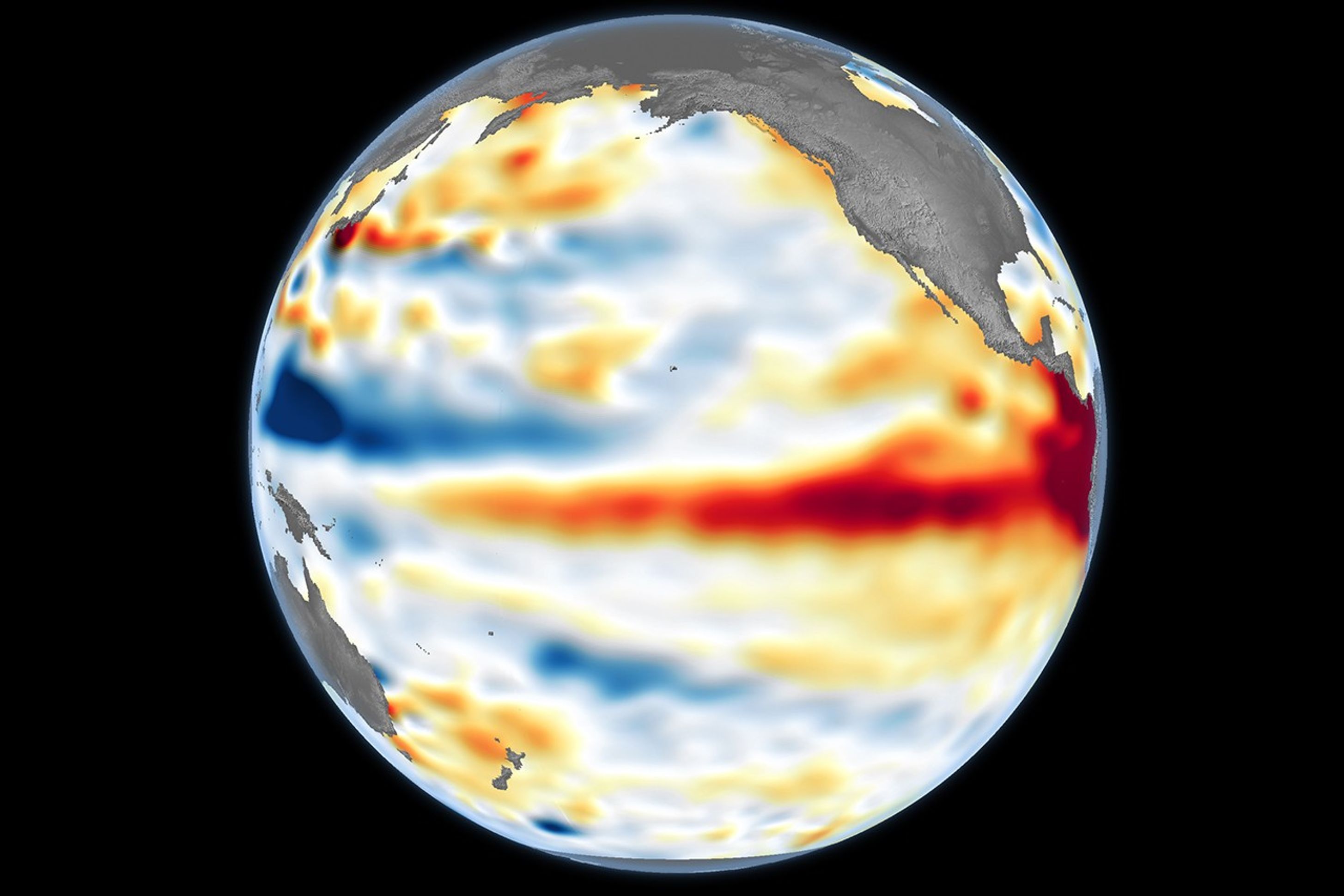
Higher-than-normal sea surfaces (red) are visible in the central and eastern Pacific on June 8, 2026, a few days before El Niño was declared. Data for the map were acquired by the Sentinel-6 Michael Freilich satellite and processed by scientists at NASA’s Jet Propulsion Laboratory (JPL).
NASA Earth Observatory/Lauren Dauphin
El Niño, characterized by warmer-than-normal water temperatures in parts of the equatorial Pacific, made its return in June 2026. Observations of sea surface height from the Sentinel-6 Michael Freilich satellite that month indicated that the 2026 event was continuing to strengthen.
The natural, recurring phenomenon can have widespread effects, typically bringing wetter conditions to the U.S. Southwest and drought to countries in the western Pacific, such as Indonesia and Australia. NOAA declared an El Niño on June 11, after sea surface temperatures in the central and eastern equatorial Pacific measured at least 0.5 degrees Celsius above average for several consecutive months.
Meanwhile, NASA scientists have been observing a complementary sign of El Niño: areas of elevated sea surface height. When ocean water warms, it expands in volume and causes the sea surface to rise—making the water’s height a reliable indicator of ocean temperatures. Warmer-than-normal temperatures, hence higher sea surface heights, in parts of the equatorial Pacific Ocean are associated with El Niño.
The map above depicts sea surface height anomalies across the central and eastern Pacific Ocean as observed on June 8, 2026. Shades of red indicate sea levels that were higher than average. Normal sea level conditions appear white, and lower areas are blue.
Data for the map were acquired by the Sentinel-6 Michael Freilich satellite—launched in 2020 by NASA and led by ESA (European Space Agency)—and processed by scientists at NASA’s Jet Propulsion Laboratory (JPL). Note that signals related to seasonal cycles and long-term trends have been removed to highlight sea level anomalies associated with El Niño and other short-term natural phenomena.
Earlier in spring 2026, the satellite started to detect precursor signs of El Niño as swells of warm water hundreds of miles wide, known as Kelvin waves, moved from the western Pacific to the eastern Pacific. That happens when trade winds in the western equatorial Pacific weaken and then temporarily reverse to blow from the west. Warm water piles up in the east, deepening the warm surface layer, lowering the thermocline, and suppressing the upwelling that usually keeps waters along the Pacific coasts of the Americas cooler.
This buildup of heat beneath the water’s surface is what sea surface height observations capture. It goes beyond surface temperature measurements to indicate how much heat is stored in the subsurface. That’s important because a shallow warm layer might not have much impact on climate and weather, while a large reservoir of heat below the surface can matter more.
According to JPL sea level researcher Severine Fournier, deputy project scientist for Sentinel-6 Michael Freilich, conditions in the western Pacific on June 8 looked similar to those from the same time in 1997, a year when an exceptionally strong El Niño emerged. Warm conditions in the eastern Pacific in 2026 have lagged behind, however, with fewer Kelvin waves built up by the same date.
Still, more warm Kelvin waves appeared to be approaching the eastern Pacific, meaning El Niño was still strengthening. Whether it catches up to 1997 depends on ocean activity in the coming weeks. “For now, it looks like it’s going to be a big one—more so than I would have said last week—but we still need more observations to know what’s going to happen.”
NASA Earth Observatory image by Lauren Dauphin, using modified Copernicus Sentinel data (2023) processed by the European Space Agency and further processed by Josh Willis, Severin Fournier, and Kevin Marlis/NASA/JPL-Caltech. Story by Kathryn Hansen.

 Login