Electricity powers the world, and electricians are the ones who get it where it needs to go. An electrician is an expert who is trained to make sure electrical systems and equipment are installed safely and working correctly. Electricians are involved in a variety of systems, including power, lighting, communications, and more – anything that needs electricity to run.
While electricians ensure systems and equipment have the power they need, electrical technicians focus on building, modifying, or testing electronic devices.
What are some of the different types of work electricians and electrical technicians do at NASA?
At NASA, electricians keep the lights on and the power flowing for rocket launches, scientific research, and everything in between. Their skills support engineers and scientists in building and testing spacecraft, aircraft, satellites, telescopes, and the equipment that makes human spaceflight possible. Electricians make sure all facilities and equipment have the power and functionality they need to be safe and ready to support NASA’s missions.
Electrical technicians at the agency help bring big ideas to life. They might build and wire control systems, connect tiny sensors to circuit boards, or write the software to make a device work in a specific way. They also test instruments in conditions that mimic space – extreme temperatures, intense vibrations, and even a vacuum – to make sure they will survive and perform well during their missions. Technicians use specialized tools, earn certifications, and work with incredible precision.
Being an electrician or electrical technician at NASA is careful, hands‑on work carried out with expertise. Because space hardware is headed to places like low-Earth orbit, the Moon, or even Mars, every detail has to be perfect.
What are the different certification levels for electricians?
The information below is a general overview of the career path of an electrician. Specific guidelines for these roles vary from state to state. It’s important to look up the license requirements in your state.
Apprentice electrician: This four-year job training program provides an entry into the industry. An apprentice works as an assistant to an experienced supervisor, gaining vital hands-on experience to move ahead as an electrician.
Journeyman electrician: A journeyman is an electrician who has finished an apprenticeship, then passed a test. At this stage, the electrician is licensed and allowed to work without supervision.
Master electrician: This is the highest certification possible for an electrician. Typically, a master electrician is someone who has completed approximately 4,000 hours as a journeyman, then passed a licensing exam. These electricians are qualified to work on complicated projects. They can also serve as supervisors for apprentices or journeymen following in their footsteps.
How can I become an electrician?
There are many options that provide the training needed to get started as an electrician or electrical technician.
Many community colleges, trade schools, and technical institutes offer a two-year program leading to an associate degree in electrical technology. Additionally, trade unions and apprenticeship programs provide real-world experience in the field.
Additionally, all branches of the U.S. military offer electronics training that may be transferrable to college credits or civilian certifications.
How can I start preparing today to become an electrician?
It’s never too early to set the stage for an electrifying career! In high school, you can take courses in math, science, and technical education. At the same time, you can start learning about basic electrical concepts such as circuitry and safety.
Begin researching associate degree programs and apprenticeship opportunities so you can consider which pathway seems right for you. Weighing these options now will help you understand program requirements and ensure you’re ready to take the next step.
You can also gain useful experience through part-time work, or shadowing electricians on the job.
What skills will I need to be a successful electrician?
Technical skills focus on the basics – how electricity works, how to stay safe, and how to read schematics and wiring diagrams. Some jobs also call for special hands‑on abilities, like soldering tiny components, putting together cables, or even having some familiarity with chemistry.
Being curious, open‑minded, and a good communicator matters, too. Any time you’re building or improving a device, you must understand who will use it and what they need it to do. Asking questions, sharing ideas, and being able to take feedback are essential to consistently building systems and devices that work well.
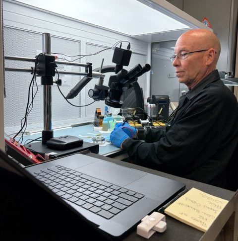
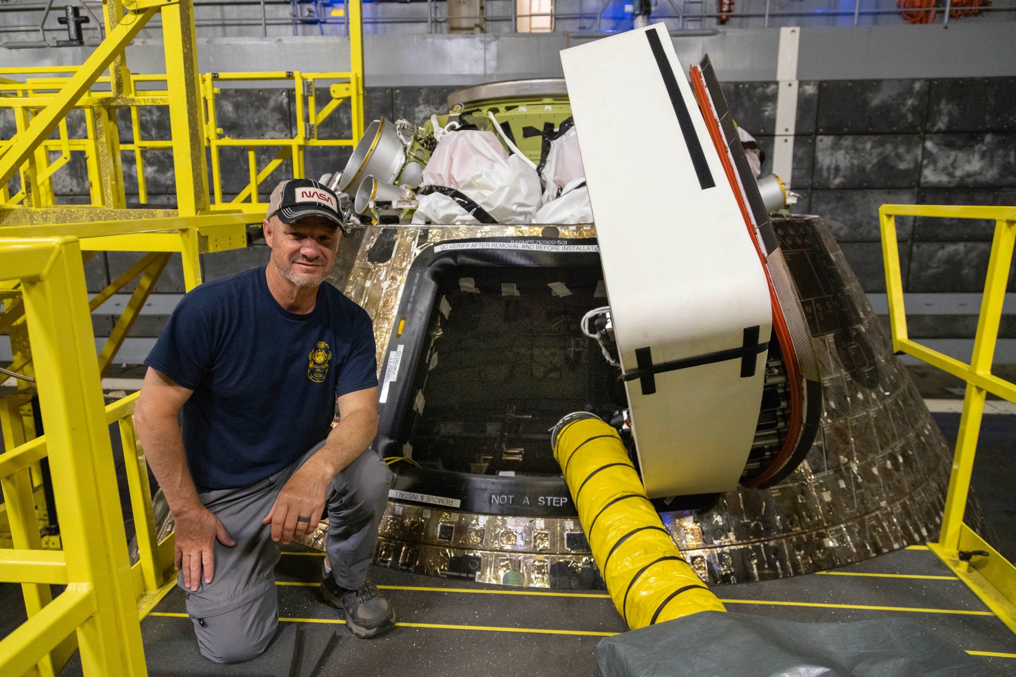
David McClaeb, electronic technician, NASA’s Goddard Space Flight Center in Greenbelt, Maryland
Advice from NASA electricians and electronic technicians
“As an aerospace technician, you have the opportunity to make a big difference. You can make a really big impact.” – Christopher Johnson, aerospace electrical engineering technician, NASA’s Kennedy Space Center in Florida
“What I wish I knew in high school is how many opportunities there are for electricians. I didn’t realize how big of a scale it really was. Everything needs electricity, and the sky’s the limit on what you can do with it. NASA needs electricians for everything from their testing campaigns to keeping their facilities running.” – Levi James, electrician apprentice, NASA’s Glenn Research Center at Armstrong Test Facility in Sandusky, Ohio
“It’s so gratifying when somebody comes in and says, ‘Hey, we want to build this, but it looks really difficult,’ and we say, ‘Yeah, it looks difficult, but we can do it’ – and we build it and then we hand it over to them, and then we’re on to the next thing. It’s a challenge, and I’m telling you, it is just so fun.” – David McClaeb, electronic technician, NASA’s Goddard Space Flight Center in Greenbelt, Maryland
At NASA, electricians keep the lights on and the power flowing for rocket launches, scientific research, and everything in between. Their skills support engi...
Curiosity Blog, Sols 4927–4933: Let’s Drive to That Smooth Area
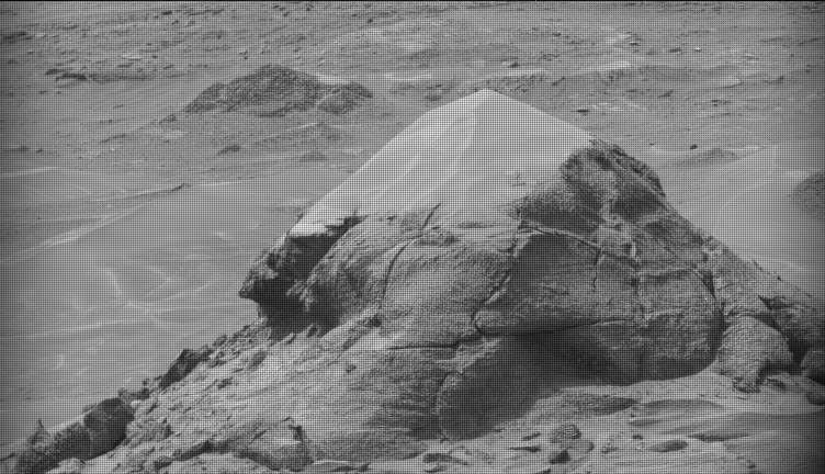
NASA’s Mars rover Curiosity acquired this image showing a breathtaking diversity of polygons, veins, and other textural features waiting for investigation by the Mars Science Laboratory team. Curiosity captured the image using its Left Navigation Camera on June 17, 2026 – Sol 4928, or Martian day 4,928 of the Mars Science Laboratory mission – at 17:47:52 UTC.
NASA/JPL-Caltech
By Susanne P. Schwenzer, Professor of Planetary Mineralogy at The Open University, UK
Earth planning date: Thursday, June 18, 2026
In the area Curiosity is currently exploring, the science team has mapped several areas with different-looking surface texture on the orbital images. If you wanted to have a look yourself at what there is to see, check the “Where is Curiosity?” map. You’ll discover different shades of orange and beige as well as more rough and more smooth-looking textures. This is what the geomorphologists in our team use to map the areas for exploration by the rover. Of course, we then supplement this all with ground-based images, including bespoke “drive direction imaging,” which is taken after each drive by the Mast Camera. Drive planning is done using a combination of all this information. So there shouldn’t be any surprises, right?
On Monday the team planned three sols in preparation for a Thursday planning to account for the U.S. federal holiday weekend. The workspace turned out to be a little spiky, so we could not find an area we could DRT. APXS still found one good bedrock target, “Rio Baker,” which also had MAHLI documentation. In addition, ChemCam investigated “Rica Aventura,” a textured bedrock, and “Tabebuia,” a darker-looking individual block, using its LIBS and conducted a passive spectral observation on a second dark float block called “Lago Ranco.” Of course, the team also wanted to look into the distance with ChemCam remote imaging, extending our investigation of the Cordillera base outcrop.
Imaging is always high on the list. In Monday’s plan Mastcam is looking into the modern dunes with the “Tacaza” mosaic, and with more mosaics looking forward to the future parking areas, some of which looked really smooth from that vantage point. We also continue our environmental and atmospheric observations looking for dust devils, the opacity of the atmosphere, and monitoring pressure and temperature. After all this, the rover drove about 35 meters (about 115 feet) to an area that looked really smooth in all images we had available at that point. So we were hoping for a good spot to deploy the DRT, but didn’t think we could be in for a surprise.
The drive ended exactly as planned, spot-on in the middle of that — from a distance — smooth-looking area. But when we opened the post-drive images on Thursday morning, we were all reacting with a lot of surprise. From up close, the parking spot looks anything but smooth. You can see the surprise in the title image of this blog. There are polygons, veins, lamination, and probably more, once we inspect the higher-resolution images taken today. “Higher-resolution” is the key for why we were in for such a surprise! The features are quite small, a few centimeters across, and therefore we could not see them in the orbital images or from a distance in our navigation and mast camera images. The camera resolution from a distance just isn’t enough to see them. But up close, the terrain revealed all its beauty! And I am sure there will be more in the even higher resolution of today’s MAHLI and ChemCam RMI imager images!
So, what did we plan after we caught our breath on Thursday? First, you guessed it, images, images, and more images. Mastcam takes a full panorama with its “left eye” and adds a range of closer-up mosaics with its higher-resolution “right eye.” In addition there is a ChemCam Remote Micro Imager image to document structures further afield at high resolution. ChemCam is investigating three targets using LIBS: “Rio Chimore” is a lighter-toned band; you can see some of those in the cover image of this blog, too. The other two LIBS targets are “Rio de Lava,” a vein target, and “Rio de Salta,” one of the polygons. APXS is also looking at the bedrock and the ridges, at the targets “Pampa Grande” and “Iquique Ridge.” MAHLI is having the above-mentioned close “hand lens” look. Let’s see what we will discover when we get those images.
Finally, Curiosity drove up the hill along very smooth-looking terrain that is just littered with tiny polygons. Let’s see if we are in for another surprise reverberating around all our offices — and across two continents, as I had the good fortune to be among the first ones, here in England (Or maybe it was our French ChemCam colleagues, who are in a time zone one hour ahead of me?). Whichever it is, this terrain has a lot to say about the geologic history of Mars!
In preparing to visit the Moon’s surface, soon-to-be lunar explorers in NASA’s Apollo program first ventured into a variety of unfamiliar landscapes on Earth. A couple of these trips, in the summers of 1965 and 1966, took astronauts to Alaska’s remote Katmai National Park for simulations of field geology in Moon-like environments.
In one exercise, which they called “playing the Moon game,” pairs of astronauts were placed at unfamiliar field sites and asked to pretend as if they were on the Moon. By the account of William Phinney, Apollo’s science training coordinator, they were tasked with collecting representative geologic samples and practicing how to communicate their observations to scientists.
September 29, 2025
The Alaskan setting for the Moon game was an unusual volcanic landscape called the Valley of Ten Thousand Smokes. The valley is full of debris deposited by the 1912 eruption of Novarupta—the largest volcanic event on Earth in the 20th century.
The images above, acquired on September 29, 2025, with the OLI (Operational Land Imager) on Landsat 9, show the massive ash flow deposited by Novarupta. The layer measures up to 660 feet (200 meters) thick and was emplaced at a searing 1,380 degrees Fahrenheit (750 degrees Celsius).
The Valley of Ten Thousand Smokes, shown in the 1917 photo below, is so named because of the abundance of fumaroles—gas and steam-emitting vents—that filled the valley for a decade after the eruption. A few hundred persisted more than 10 years, with some lasting until the 1990s.
1917
Scientists initially suspected that the monster eruption occurred at Mount Katmai, a neighboring volcano with a large caldera located 6 miles (10 kilometers) east of Novarupta’s dome. However, they later determined that the eruption actually occurred at Novarupta—whose name means “new eruption”—after stealing magma from beneath Katmai. As the magma chamber emptied, Katmai collapsed, forming the 2.5-mile-wide (4-kilometer-wide) caldera present today.
The volcanic landscape in the Valley of Ten Thousand Smokes is far fresher than the ancient lava flows that formed the Moon’s volcanic features. But for the Apollo astronauts, it offered an “excellent opportunity to view volcanic materials and landforms in nearly pristine condition,” Phinney wrote. They studied evidence of fumaroles and examined vertical sections of the deposits where streams had eroded deep gorges.
June 9, 1991
Researchers continue to visit this Alaskan wilderness in search of clues that could help decipher the geology of the Moon and Mars. In 2024, the Goddard Instrument Field Team (GIFT) trekked to the Valley of Ten Thousand Smokes to study its icy volcanic landscape. Like the valley, Mars contains glaciers and ice sheets layered with dust and ash, a dynamic and difficult-to-interpret environment.
Advancing lunar science, the GIFT team also collected samples from rock formations comparable to the Moon’s Gruithuisen Domes. These mysterious features are made of hardened lava with a different composition than the surrounding rock. With more to learn about our nearest celestial neighbor, the spirit of the Moon game lives on in the 21st century.
NASA Earth Observatory images by Lauren Dauphin, using Landsat data from the U.S. Geological Survey. Photos from National Geographic Society Katmai expeditions photographs, Archives and Special Collections, Consortium Library, University of Alaska Anchorage, and from the U.S. Geological Survey Volcano Hazards Program. Story by Lindsey Doermann.
NASA has selected Sean Gallagher as the agency’s chief information officer (CIO). In this role, he is responsible for the agency’s entire portfolio of Information Technology products and services. Gallagher has been serving in an acting capacity since January and his permanent role is effective immediately.
“Sean Gallagher’s leadership has been instrumental in strengthening NASA’s IT foundation and ensuring our workforce has the secure, modern tools needed to enable groundbreaking missions every day,” said NASA Deputy Administrator Matt Anderson. “As CIO, Sean will continue advancing the agency’s technology capabilities to support discovery, innovation, and mission success across NASA.”
Most recently, Gallagher also has served as the deputy chief information officer for Operations in the Office of the Chief Information Officer at NASA Headquarters in Washington, as well as a senior advisor for Transformation. This team provides services to tens of thousands of end users located in the U.S. and abroad in support of NASA missions, enabling discoveries, faster data sharing, increased workforce productivity, and more. Gallagher has worked with all NASA centers to implement efficient and effective IT operating models.
Previously, Gallagher was the CIO of NASA’s Glenn Research Center in Cleveland, leading IT initiatives for aeronautics, space, research and engineering, and test missions. He joined NASA in 2012 as Glenn’s deputy CIO and previously worked at Booz Allen Hamilton as a senior associate supporting a variety of federal, defense, and commercial customers.
Gallagher developed his leadership and management experience as a Signal Corps officer in the United States Army. He also served as a platoon leader managing the combat service support readiness of a tactical communications unit, a human resource manager for the 40th Signal Battalion, and as a network engineer for the 11th Signal Brigade. He has a bachelor’s degree in physics from John Carroll University and a master’s degree in computer information systems from the University of Phoenix.
For more information about NASA’s missions, visit:
NASA’s Commercial Satellite Data Acquisition program (CSDA) announced contract awards with eight commercial satellite data providers offering a range of data types to support the agency’s Earth science research and application goals.
The CSDA program On-Ramp 2 Multiple Award contract is a firm-fixed-price indefinite-delivery/indefinite-quantity (IDIQ) multiple-award contract with a maximum cumulative value of $476 million and a performance period through November 2028.
The CSDA IDIQ contract includes an on‑ramp provision that allows NASA to periodically reopen the solicitation, giving new vendors the opportunity to submit proposals. This mechanism also enables existing CSDA vendors to propose new data products, whether newly developed or derived from new instruments, that were not available during the original proposal period.
Newly Added Contract Holders
Vendor
Sensor
HydroSat
Thermal Infrared Visible and Near-Infrared (VNIR)
Ororatech
Thermal Infrared – Medium Wavelength Infrared (MWIR) and Long Wavelength Infrared (LWIR)
ImageSat
Optical Multispectral Instrument (MSI)
Satlantis
Optical MSI / Greenhouse Gas (GHG) Emissions
Kuva Space
Hyperspectral – VNIR and Short Wavelength Infrared (SWIR)
Wyvern
Hyperspectral – VNIR
Orbital Sidekick
Hyperspectral – VNIR and SWIR
Muon Space
Global Navigation Satellite System – Radar (GNSS-R)
Current CSDA Contract Holders with New Products
Vendor
Sensor
Airbus
Optical MSI / Synthetic Aperture Radar (SAR)
ICEYE
SAR
GHGSat
GHG Emissions
Planet Labs
Optical MSI / Hyperspectral
PlanetiQ
Global Navigation Satellite System – Radio Occultation (GNSS-RO)
Tomorrow.io
Microwave Sounder
“NASA’s Earth science community relies on a diverse suite of observations from spaceborne, airborne, and in situ assets to better understand our changing planet,” said CSDA Project Manager Dana Ostrenga. “The commercial providers added through this latest CSDA contract on-ramp complement NASA’s existing Earth observation capabilities and our current portfolio of commercial partners, expanding the range of data available for evaluation and use. Together, these observations provide researchers with a more comprehensive view of Earth’s atmosphere, land, oceans, cryosphere, and solid Earth, helping advance scientific discovery and applications that benefit our communities.”
Following issuance of the contract awards, the selected vendors’ data products will be made available to authorized CSDA data users via the Satellite Data Explorer (SDX), CSDA’s web-based data discovery and data access tool that allows approved users to search, discover, access, task, and download the data the program has acquired from its commercial partners.
The Vendor Selection Process
The award process begins with the CSDA issuing a request for proposals that is posted on Sam.gov, the U.S. government’s official system for managing federal contract proposals. Interested companies then submit proposals to enter into an IDIQ contract with CSDA. A Solicitation Evaluation Board is formed to determine whether the proposals are competitive and meet the CSDA’s technical requirements for continuous observations, orbit platforms, and data that aligns with NASA Earth Science Division (ESD) goals. The CSDA makes its selections from the proposals that meet the requirements and then submits them to NASA leadership for approval. Once approved, the contracts are then awarded and the companies are able to get their data evaluated by CSDA. Once the evaluations are complete, the commercial data providers can then compete for competitive task orders through CSDA.
About the CSDA Program
NASA’s Earth Science Division (ESD) established the CSDA Program as the agency’s central mechanism for identifying, acquiring, and evaluating commercial Earth observation (EO) data. The program augments NASA’s and partner agencies’ Earth-observing capabilities by acquiring commercial satellite data that offer higher spatial resolution, increased revisit frequency, complementary measurement capabilities, and taskable observations. To learn more about the program, its commercial partners, data evaluation process, and more, visit the CSDA website.
Become an Authorized Data User
Commercial data discoverable through the SDX is made available to CSDA authorized data users. To become an authorized user, fill out the CSDA Program Data Authorization Form. Note: Use of SDX also requires an Earthdata Login.
An F-15 aircraft flies above the world’s largest compass rose above NASA’s Armstrong Flight Research Center in Edwards, California, on Monday, April 20, 2026. NASA’s Crossflow Attenuated Natural Laminar Flow (CATNLF) test article is attached to the bottom of the F-15. The project aims to lower fuel costs for future commercial aircraft by testing a scale-model wing designed to improve laminar flow.
Credits: NASA/Jim Ross
Flight tests are a big part of how NASA turns breakthrough ideas into reality. From flying humans faster than the speed of sound to proving designs that helped shape the space shuttle, flight testing transforms bold concepts into safer, more efficient technologies that benefit the public.
“Flight tests are a way to safely and effectively prove new technology, which helps certification authorities certify equipment,” said Wayne Ringelberg, chief pilot at NASA’s Armstrong Flight Research Center in Edwards, California. “It helps industry iterate and make systems better, and it promotes research in areas where new ideas can be developed.”
For nearly 80 years, teams at NASA Armstrong have used flight testing in the Southern California desert to push the limits of aerodynamics and advance aviation. Thanks to that work, NASA-developed innovations are aboard every U.S. commercial aircraft and inside every control tower today.
“The space side of NASA uses flight test, too. Every mission, like Artemis II, is never routine,” Ringelberg said. “Everything we’re doing when flying a test mission is something new or different.”
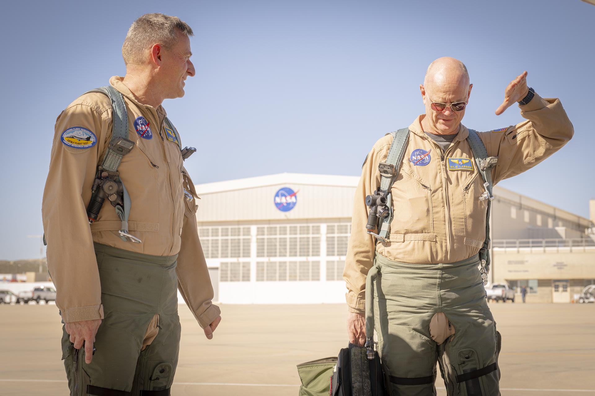
NASA test pilots Jim Less, left, and Nils Larson walk away from a hangar at NASA’s Armstrong Flight Research Center in Edwards, California, on Thursday, Feb. 4, 2026. The pilots support the agency’s Crossflow Attenuated Natural Laminar Flow (CATNLF) project, which aims to lower fuel costs for future commercial aircraft by testing a scale-model wing designed to improve laminar flow.
NASA/Christopher LC Clark
Every NASA test flight — whether it’s studying new software, hardware, or the revolutionary technology of an experimental X-plane — relies on engineers, researchers, pilots, maintenance crew, control room operators, and many others working together.
“Experienced operators and engineers evaluate how things work in flight,” Ringelberg said. “Most new technologies are designed to work in a lab or can be tested in a wind tunnel or other facility, but you never really know how they’ll perform until you fly them.”
Preflight tests often include computer analysis, simulation, wind tunnel testing, and ground tests focused on an aircraft’s ability to withstand the forces of flight and the environments through which it may fly. After hardware or software is deemed safe to fly, researchers turn the mission over to the flight test team.
To support testing, NASA Armstrong maintains an aircraft fleet modified to create space for new hardware or instruments, as well as the ability to integrate new software. These aircraft are flying laboratories, and pilots are trained to accomplish experimental missions.
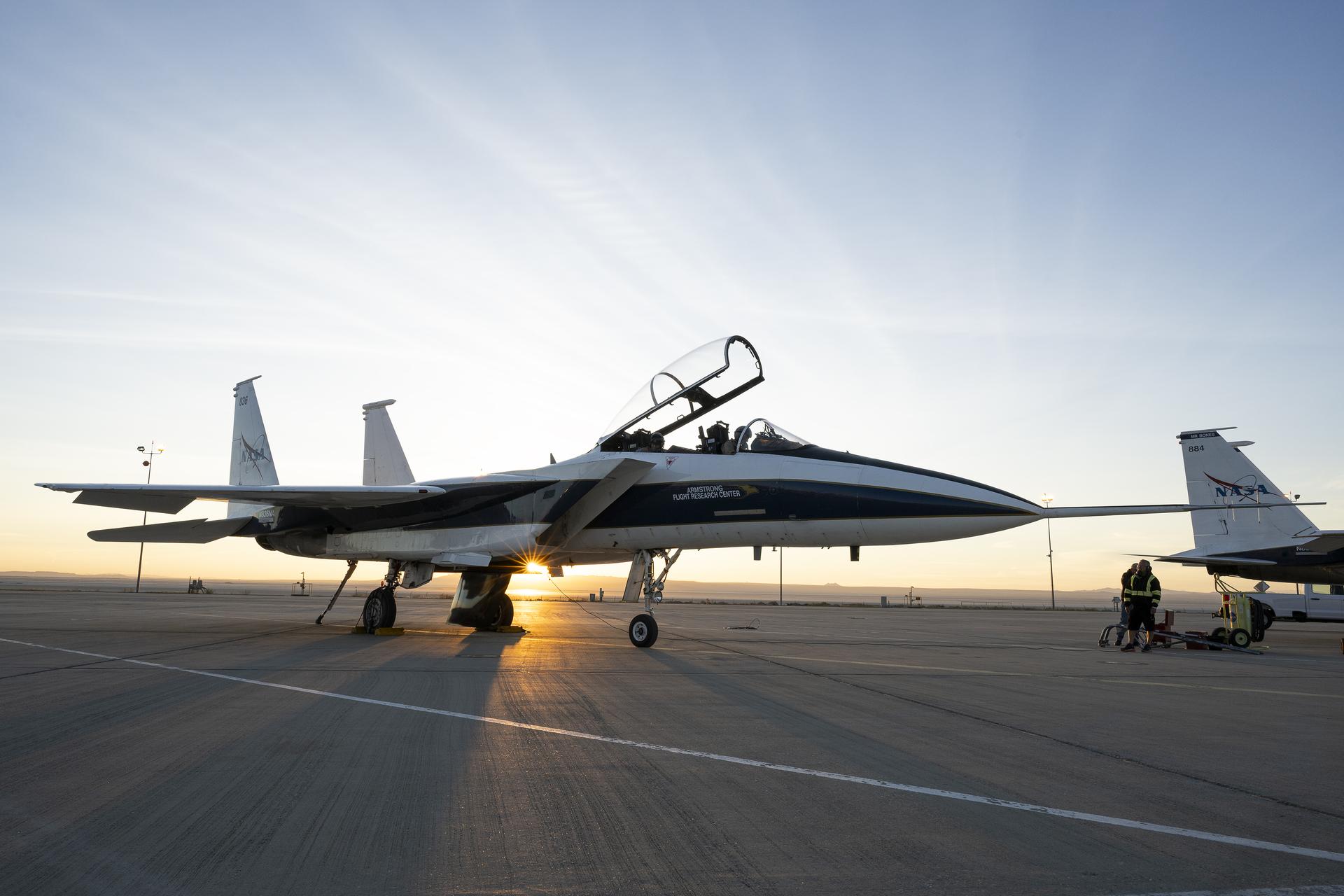
An F-15 research aircraft sits on the ramp at NASA’s Armstrong Flight Research Center in Edwards, California, on Tuesday, March 17, 2026. NASA pilots Jim Less, front seat, and Carrie Worth prepare for the flight. The agency’s Crossflow Attenuated Natural Laminar Flow (CATNLF) test article is attached to the bottom of the F-15. The project aims to lower fuel costs for future commercial aircraft by testing a scale-model wing designed to improve laminar flow.
NASA/Carla Escamilla
For example, flight testing recently helped NASA gather critical data on laminar flow, or the smooth flow of air, over a wing. The work could lower fuel costs for future airliners. Computer modeling, wind tunnel tests, and other methods helped advance the research, but to find out even more about how the wing concept could reduce drag for future airliners, NASA used a scale model in actual flight.
NASA researchers strapped the Crossflow Attenuated Natural Laminar Flow (CATNLF) model wing to the belly of one of NASA Armstrong’s F-15s. The arrangement allowed them to collect all the information they would need without doing the extensive, costly modifications required to install a full-scale wing on an aircraft.
After a flight series is complete, engineers and researchers analyze the data. Did the instrument work as designed? Did the experimental aircraft perform safely at a high altitude? Did the software operate as planned? Each test raises its own set of questions to evaluate.
NASA continues working with academia, the Department of War, and industry partners to advance U.S. aviation through flight test and bring new benefits to the flying public.
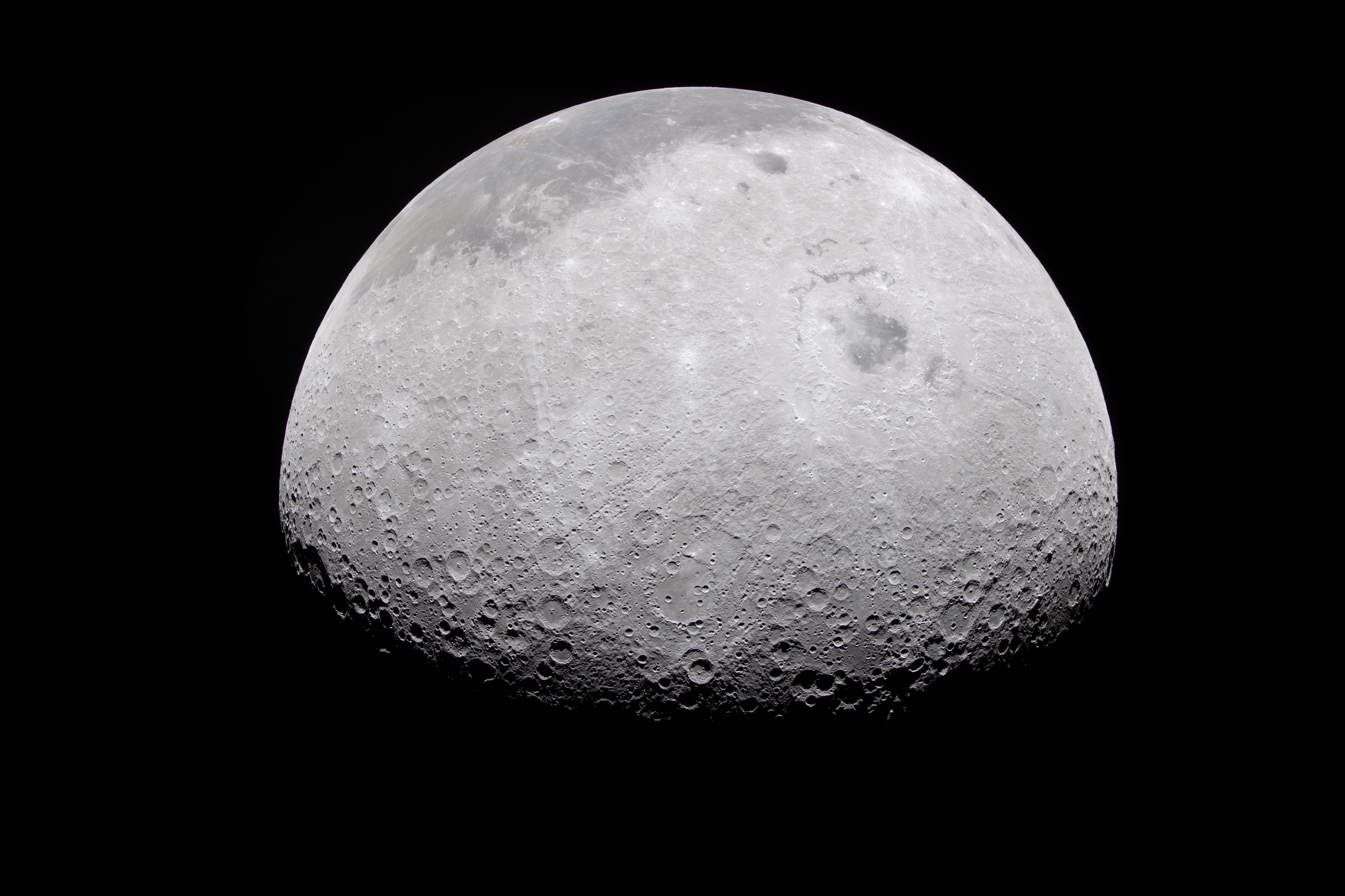
The Moon’s rocky, uneven, and otherworldly surface features are highlighted by the terminator – the difference between light and darkness.
NASA
The Moon appears half-illuminated in this photo captured by the Artemis II crew on flight day 6. The terminator – the difference between light and darkness – provides a stark contrast and even greater perspective of the Moon’s rocky, uneven, and otherworldly surface features. The near side, which is what we can see from Earth, appears in the dark gray regions at the top of this image.
Preparations for Next Moonwalk Simulations Underway (and Underwater)
NASA / Lillian Gipson/Getty Images
THIS PAGE WAS UPDATED ON JUNE 23, 2026
This Aeronautics Research Mission Directorate (ARMD) solicitations page compiles the opportunities to collaborate with NASA’s aeronautical innovators and/or contribute to their research to enable new and improved air transportation systems.
Most opportunities to participate in research are officially announced through the Web-based NASA Solicitation and Proposal Integrated Review and Evaluation System, better known as NSPIRES. You are encouraged to visit the NSPIRES web site, create an account, and sign up for automated email announcements.
Other types of collaborative opportunities, such as those involving Requests for Information or academic research contests, also are included on this page.
This ARMD Solicitations page has four major sections:
Quick list of open solicitations with key dates listed.
August 3, 2026 Deadline for proposals on Open Fan Flight Demonstrations NRA
Currently Open Solicitations
NASA Research Announcement – Development Plan for Open Fan Flight Demonstration – OPEN
As part of NASA’s Advanced Air Vehicles Program, the Subsonic Vehicle Technologies and Tools project endeavors to advance knowledge, technologies, and concepts that enable accelerated introduction of radical aircraft and engine technologies across a range of vehicle classes.
This is achieved through partnerships with industry to ensure that these technologies are applicable to planned products to increase the chances of inclusion in future aircraft systems.
This research announcement solicits proposals for providing an open fan flight demonstration plan with optional accompanying risk reduction activities. The flight demonstration plan will inform the project of the scope of a possible future flight demonstration and provide insight into the roadmap, risk reduction areas, and areas of potential investment.
The Project F.I.R.E. team receives their “Future Game-Changer” award during the 2024 Gateways to Blue Skies forum held at NASA’s Ames Research Center in California. Gateways to Blue Skies is one of several Aeronautics Innovation Challenges open to the academic community.
NASA / Brandon Torres
Aeronautics Innovation Challenges – OPEN
NASA’s nationwide team of aeronautical innovators are committed to giving students of all ages opportunities to solve some of the biggest technical challenges facing the aviation community today. Through NASA-sponsored challenges and competitions, students representing multiple disciplines will put their skills to work by designing and building solutions to real-world problems.
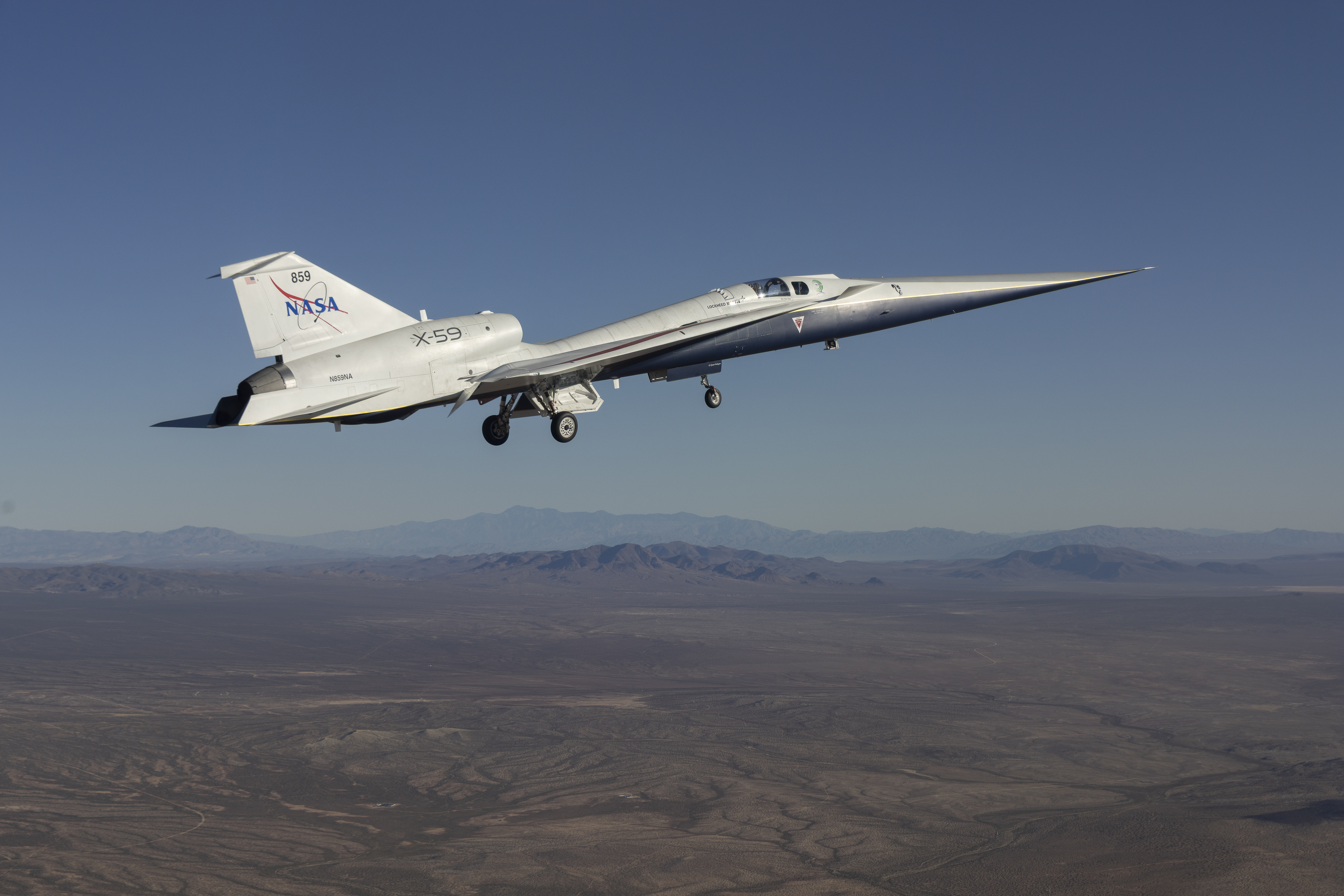
NASA’s X-59 quiet supersonic research aircraft lifts off for its first flight Tuesday, Oct. 28, 2025, from U.S. Air Force Plant 42 in Palmdale, California. The aircraft’s first flight marks the start of flight testing for NASA’s Quesst mission, the result of years of design, integration, and ground testing and begins a new chapter in NASA’s aeronautics research legacy.
NASA/Lori Losey
NASA ARMD Aeronautics Flight Accelerator – CLOSED
NASA’s Aeronautics Research Mission Directorate is seeking information from U.S. industry, academia, and government organizations regarding potential partnerships for research, development, and flight testing under the Aeronautics Flight Accelerator initiative. NASA is requesting input on technologies, concepts, and flight test campaigns suitable for cost shared maturation leading to flight within the next three years. Areas of interest span subsonic (including vertical lift), supersonic, and hypersonic flight technologies.
THIS IS NOT A REQUEST FOR PROPOSAL. NO PROPOSALS SHOULD BE SUBMITTED.
RFI Release Date: April 7, 2026 Responses Were Due: May 7, 2026, 1:00PM Pacific Daylight Time (PDT)
High school students visit the Glenn Research Center Manufacturing Facility and learn about careers in the STEM manufacturing field.
NASA/Marvin Smith
FY26 NASA Aerospace Skilled Technical Workforce Hubs (NAS_Hub) – CLOSED
This opportunity seeks proposals to establish state or regionally focused Skilled Technical Workforce Hubs (NAS_Hubs) that will serve as strategic centers for developing and sustaining a skilled technical workforce aligned with aerospace industry and NASA mission needs. The NAS_Hub Notice of Funding Opportunity has been released and may be found in NASA’s Solicitation and Proposal Integrated Review and Evaluation System (NSPIRES) on the NAS_Hub landing page.
Key Dates
Pre-Proposal Webinar: February 18, 2026, 2:00 to 3:00 p.m. ET
Office Hours Session: March 3, 2026, 2:00 to 3:00 p.m. ET
Proposal Deadline: March 23, 2026, at 11:59 p.m. ET
Anticipated Award Notification: June 2026
About the Opportunity
The rapid expansion of the space economy and renewed national priorities in human space exploration have created an urgent demand for a robust skilled technical workforce—individuals in critical science- and engineering-based roles who do not require a bachelor’s degree. To address nationwide shortages and ensure U.S. competitiveness in aerospace and defense, NASA’s Office of STEM Engagement is launching the NASA Aerospace Skilled Technical Workforce Hubs (NAS_Hub) initiative.
Through this notice NASA seeks lead organizations to establish hubs that:
Collaborate with aerospace employers to align education and training with industry-defined workforce needs.
Partner with community colleges and high school Career and Technical Education programs to deliver hands-on, industry-aligned learning experiences.
Coordinate with state or regional workforce development system.
Build clear and sustainable employment pathways into high-demand aerospace technical careers.
NAS_Hubs will serve as focal points for aligning education, workforce, industry, and government partners to accelerate workforce readiness over a three-year period of performance.
Eligibility
Eligible applicants include:
State, county, city, township, special district, and tribal governments
Public and private institutions of higher education
Nonprofit organizations
For-profit organizations and small businesses
Proposals must include partnerships with, at a minimum:
Three aerospace industry collaborators supporting NASA’s work
Community college career and technical education program
High school career and technical education program
State or regional workforce development system
NASA Center or other NASA facility
Award Information
Maximum Annual Award: $500,000
Maximum Total Award: $1,500,000 over three years
Cost Sharing: Not required
How to Apply
Proposals must be submitted electronically via NSPIRES. Registration in NSPIRES and an active SAM.gov registration are required.
Pre-Proposal Webinar and Technical Assistance
NASA will host an interactive pre-proposal webinar for the NAS_Hub opportunity on Feb. 18, 2026, from 2:00 to 3:00 p.m. ET. This session will provide an in-depth overview of this funding opportunity, including program goals, eligibility requirements, proposal preparation guidance, and submission tips. Proposers will also have the opportunity to receive technical assistance and clarification from NASA staff. Prior to attending a webinar, proposers are strongly encouraged to review the full NAS_Hub notice and to check the NAS_Hub landing page in NSPIRES regularly for updates and additional guidance.
Please note that registration is requiredfor the webinar. Connection details will be provided upon completion of registration. Webinar dates, times, registration links, and connection information will be posted on the NAS_Hub landing page in NSPIRES, which also will feature recordings and presentation materials from the webinar after the event for those unable to attend.
NASA’s Advanced Capabilities for Emergency Response Operations (ACERO) project used this request for information to identify technologies that addressed current challenges facing the wildland firefighting community. NASA was seeking information on data collection, airborne connectivity and communications solutions, unmanned aircraft systems traffic management, aircraft operations and autonomy, and more. This would support development of a partnership strategy for future collaborative demonstrations.
Interested parties were requested to respond to this notice with an information package submitted via https://nari.arc.nasa.gov/acero-rfi no later than 4 pm ET, October 15, 2023. Submissions were accepted only from U.S. companies.
This request for information is being used to gather market research for NASA to make informed decisions regarding potential partnership strategies and future research to enable Advanced Air Mobility (AAM). NASA is seeking information from public, private, and academic organizations to determine technical needs and community interests that may lead to future solicitations regarding AAM research and development.
This particular RFI is just one avenue of multiple planned opportunities for formal feedback on or participation in NASA’s AAM Mission-related efforts to develop these requirements and help enable AAM.
The respond by date for this RFI closed on Feb. 1, 2025, at 6 p.m. EST.
ROA-2025 NRA Amendment 1 – CLOSED
Advanced Air Vehicles Program Fellowship Opportunities
This announcement solicits proposals from accredited U.S. institutions for research training grants to begin the academic year. This Notice of Funding Opportunity is designed to support independently conceived research projects by highly qualified graduate students in disciplines needed to help advance NASA’s mission, thus affording these students the opportunity to directly contribute to advancements in STEM-related areas of study. These opportunities are focused on innovation and the generation of measurable research results that contribute to NASA’s current and future science and technology goals.
Research proposals are sought to address the key challenges summarized in the Elements section at the end of the Amendment 1 document, and which reference NASA’s Hypersonic Technology project.
Reflecting the Fiscal Year 2026 budget changes, the Transformational Tools & Technologies project opportunities originally described in this announcement were cancelled. Proposals citing this project will not be evaluated.
Notices of Intent are not required.
A budget breakdown for each proposal is required, detailing the allocation of the award funds by year. The budget document may adhere to any format or template provided by the applicant’s institution. Two pre-proposal teleconferences for potential proposers will be held and meeting links will be posted on NSPIRES.
Proposals were due by 5 p.m. EDT on June 11, 2025.
NASA Research Opportunities in Aeronautics
Competition for NRA awards is open to both academia and industry.
The current open solicitations for ARMD Research Opportunities are ROA-2024 and ROA-2025.
Here is some general information to know about the NRA process.
NRA solicitations are released by NASA Headquarters through the Web-based NASA Solicitation and Proposal Integrated Review and Evaluation System (NSPIRES).
Participation is open to all categories of organizations, including educational institutions, industry, and nonprofits.
Any updates or amendments to an NRA is posted on the appropriate NSPIRES web pages as noted in the Amendments detailed below.
ARMD sends notifications of NRA updates through the NSPIRES email system. In order to receive these email notifications, you must be a Registered User of NSPIRES. However, note that NASA is not responsible for inadvertently failing to provide notification of a future NRA. Parties are responsible for regularly checking the NSPIRES website for updated NRAs.
NASA’s Jason Peterson is the range operations manager at NASA’s Stennis Space Center. For Artemis II, he supported the team responsible for delivering video and communication feeds for launch and splashdown.
Credits: NASA/Danny Nowlin
Jason Peterson’s responsibilities for NASA’s Artemis II mission went beyond his usual role as the range operations manager at NASA’s Stennis Space Center near Bay St. Louis, Mississippi.
For Peterson, working at NASA is a surreal full-circle moment.
“I grew up in DeLisle, Mississippi, right down the road from NASA,” said Peterson. “You would hear NASA testing, the windows would shake, and you knew they were out there. Not in a million years would I have ever dreamed I would work with NASA.”
His career journey took a few turns before reaching the space agency.
“I got out of school, welded, went to college and then to the Air Force. The path to NASA really started to develop from there,” said Peterson.
Peterson spent 24 years in the U.S. Air Force and Air National Guard, working in airfield and air-to-ground range operations, followed by a few years working as an aircraft dispatcher at Airbus Final Assembly Line.
Peterson credits his military experience with preparing him for the 12-to-16-hour workdays that helped bring the Artemis II test flight around the Moon and into view for audiences around the world.
He supported the team responsible for delivering video and communication feeds for the launch of NASA’s SLS (Space Launch System) rocket with the Artemis II crew aboard the Orion spacecraft, and then splashdown in the Pacific Ocean.
During the nearly 10-day mission, NASA astronauts Reid Wiseman, Victor Glover, Christina Koch, and CSA (Canadian Space Agency) astronaut Jeremy Hansen completed a record-setting lunar flyby, taking them 252,756 miles at their farthest distance from Earth.
Aboard the USS John P. Murtha, Peterson was the first on the ship to spot the capsule returning with the crew.
“The sonic boom was the moment it truly hit me. Even though I was tracking the capsule, it did not fully register until then. Chills went down my neck and back. You realize our astronauts are coming home. It was an incredible and emotional moment.”
JASON PETERSON
Range Operations Manager for NASA Stennis
Jason Peterson, NASA Stennis range operations manager, is shown with the Orion spacecraft aboard the USS John P. Murtha on April 13, 2026. Peterson was the first to spot the capsule returning with the Artemis II crew as he supported the team responsible for delivering video and communication feeds during splashdown operations. Credits: NASA
NASA
Peterson operated one of six cameras providing live coverage by using a high‑resolution, multi‑sensor system with thermal capabilities. Using the ship’s heading and Orion’s predicted trajectory, he located the capsule within minutes and began tracking it.
Orion entered Earth’s atmosphere at about 400,000 feet above the planet’s surface, traveling nearly 35 times the speed of sound and about 1,956 statute miles from its splashdown point off the coast of California. Peterson tracked Orion from the release of the small parachutes that first slow and steady the capsule, through the main parachutes opening, and all the way to splashdown.
“You are fully locked in, keeping it centered, in focus, and steady,” said Peterson.
Peterson’s focus on the mission began weeks earlier at NASA’s Kennedy Space Center in Florida.
In the days leading to launch, Peterson worked with the team running full systems checks, staging communications gear, and preparing drones and fixed‑wing camera assets. He helped configure and operate the systems that ensured live video flowed from the launch pad, the crowds, and surrounding air and ground platforms.
On April 1, the launch day of Artemis II, the team unloaded and set up high‑resolution sensors, connection terminals, routers, monitors, fiber lines, and drone equipment. They flew drones to capture crowd scenes and aerial views before liftoff.
As the SLS rocket launched, Peterson’s full attention was on positioning the drone and maintaining the shot.
“There is not much time to step back and take in the moment, as you are concentrating on precision,” said Peterson.
As the mission got underway, Peterson and the team packed up, returned to the facility, and downloaded the day’s footage.
The Artemis II crew were more than halfway to the Moon as Peterson arrived in San Diego on April 4. In the days leading to splashdown, the team loaded and installed high‑fidelity cameras and supporting equipment, all to help the world witness a historic milestone when the Artemis II crew returned to Earth on April 10.
Next up will be Artemis III. NASA will launch four astronauts from NASA Kennedy aboard the Orion spacecraft on the SLS rocket. Building on the successful Artemis II crewed test flight in April, Artemis III will pave the way for future surface missions, with experts like Peterson helping every step of the way.
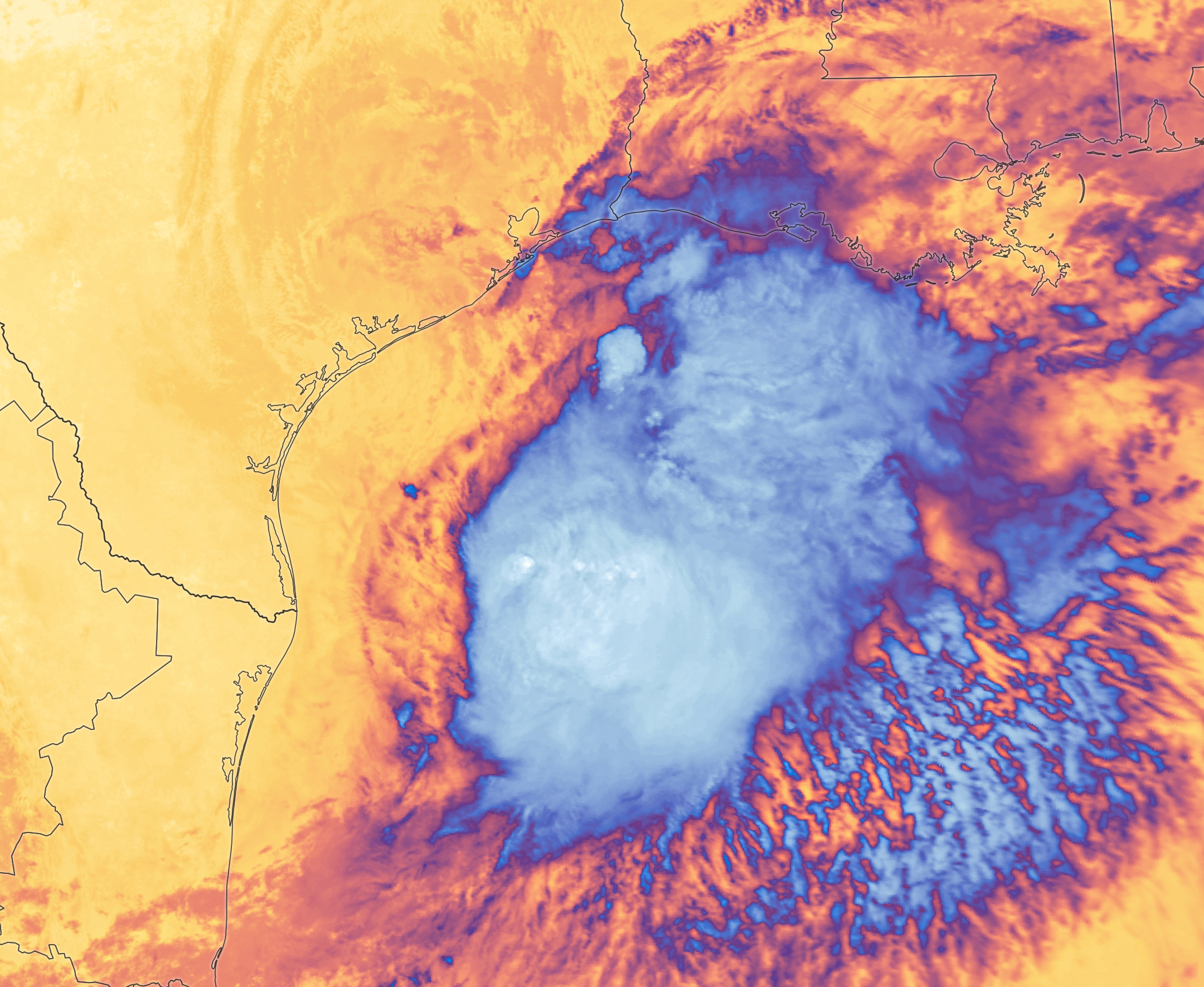
Tropical Storm Arthur’s white storm clouds cover the waters off the U.S. Gulf Coast. Some clouds extend inland over parts of Texas and Louisiana.
NASA Earth Observatory/Michala Garrison
White and purple areas of cloud off the Gulf Coast indicate the cooler areas of cloud tops associated with Tropical Storm Arthur.
NASA Earth Observatory/Michala Garrison
Natural color
brightness temperature
Images from the MODIS (Moderate Resolution Imaging Spectroradiometer) on NASA’s Terra satellite show Tropical Storm Arthur on the morning of June 17, 2026. The left image is natural color; the right shows infrared signals known as brightness temperature. NASA Earth Observatory images by Michala Garrison.
Tropical Storm Arthur, the first named storm of the 2026 Atlantic hurricane season, brought high winds and heavy rain to the U.S. Gulf Coast in mid-June.
NASA’s Terra satellite captured this natural-color image (left) at 10:30 a.m. Central Time (15:30 Universal Time) on June 17. The second image (right) depicts infrared signals known as brightness temperature, which help distinguish cooler cloud tops (white and purple) from the warmer surface below (yellow and orange). Around the time these images were acquired, the system had just recently been designated a tropical storm, according to the National Hurricane Center (NHC).
Though Arthur stayed below hurricane strength, it still delivered strong winds to parts of the Gulf Coast as it tracked northeast. The storm had maximum sustained winds of 40 miles (65 kilometers) per hour around the time these images were captured. Tropical-storm-force winds extended 175 miles (280 kilometers) from the storm’s center, the NHC reported. Measurements at Galveston, Texas, for instance, showed a gust of 48 miles per hour.
The storm also produced heavy rainfall that the National Weather Service warned could lead to life-threatening flash flooding. Estimates from IMERG (the Integrated Multi-Satellite Retrievals for GPM), a product of the GPM (Global Precipitation Measurement) mission, showed high rainfall rates over Gulf waters and extending inland on June 17.
As Arthur weakened and became less organized, it continued to bring abundant moisture to central Gulf Coast states on June 18. The National Weather Service reported rainfall rates of 3 inches (7.6 centimeters) per hour in southeastern Louisiana. Forecasts indicated that storm-total rainfall amounts could exceed 12 inches (30 centimeters) in areas, with some locations seeing totals approaching 20 inches (51 centimeters).
NASA Earth Observatory images by Michala Garrison, using MODIS data from NASA EOSDIS LANCE and GIBS/Worldview. Story by Kathryn Hansen.
Curiosity Blog, Sols 4920-4926: Surveying the Bands
NASA’s Mars rover Curiosity acquired this image of small butte, “Miraflores,” using its Mast Camera (Mastcam) on June 11, 2026 — Sol 4922, or Martian day 4,922 of the Mars Science Laboratory mission — at 09:12:13 UTC.
NASA/JPL-Caltech/MSSS
Written by William Farrand, Senior Research Scientist, Space Science Institute
Earth planning date: Friday, June 12, 2026
Rather than going from stage to stage at a music festival to hear different bands playing different varieties of music, Curiosity has been ascending up Mount Sharp through physical bands of exposed rocks with textural and tonal differences.
Planning for sols 4920 and 4921 were done with the rover in the middle of a unit with a rougher texture and dark-toned bedrock. With the rougher-textured bedrock, brushing wasn’t possible, but APXS chemistry and MAHLI micro-imaging were planned on “as is” bedrock targets “Salto La Cascada” and “Puerto de Rosas.” ChemCam was targeted to perform LIBS spectroscopy on a bedrock target “Kishuara” and a small, layered float rock “La Rosita.” ChemCam’s Remote Micro-Imager (RMI) collected views of the “Mishe Mokwa” butte and another looking at dunes with tonal differences. Mastcam mosaics were collected on the “Valle Grande” channel, “Kimsa Chata” butte, nearby troughs, and the aircraft carrier shaped rock “El Matir.”
Another drive brought Curiosity closer to the upper border of the dark-toned band. Again, brushing of the rocks was not possible, but APXS and MAHLI were collected on dark-toned bedrock targets “Santa Gracia” and “Laguna San Rafael” with ChemCam LIBS also targeting the bedrock. Mastcam mosaics were collected of a layered rock and nearby troughs and a mosaic of the nearby smaller butte, “Miraflores” which displays an interesting layered structure with ragged dark-toned rocks on one side and a stack of dust piled on top (see accompanying image). Other activities included a long-distance RMI mosaic of a bright unit on “Mishe Mokwa”, and Navcam dust-devil surveys in both sols.
Communicating between Earth and Mars has come to seem routine, but at times can still be a challenging endeavor and this was demonstrated to the team on Friday when we did not get a timely downlink of data for the drive planned for Sol 4923. Without these images another drive, in situ examinations, or targeted remote sensing could not be planned. However, there are always interesting things to be done on Mars and the three-sol plan (4924 to 4926) included a 360-degree Mastcam mosaic, the automatic AEGIS targeting of LIBS measurements on each sol, a Navcam dust-devil survey, APXS atmospheric measurements, as well as several other environmental activities.
On Monday, the delayed downlink will be used to plan the first investigation of the next band of surface materials, this one being smooth-textured and light-toned, as well as another drive to continue the surveying of the bands.
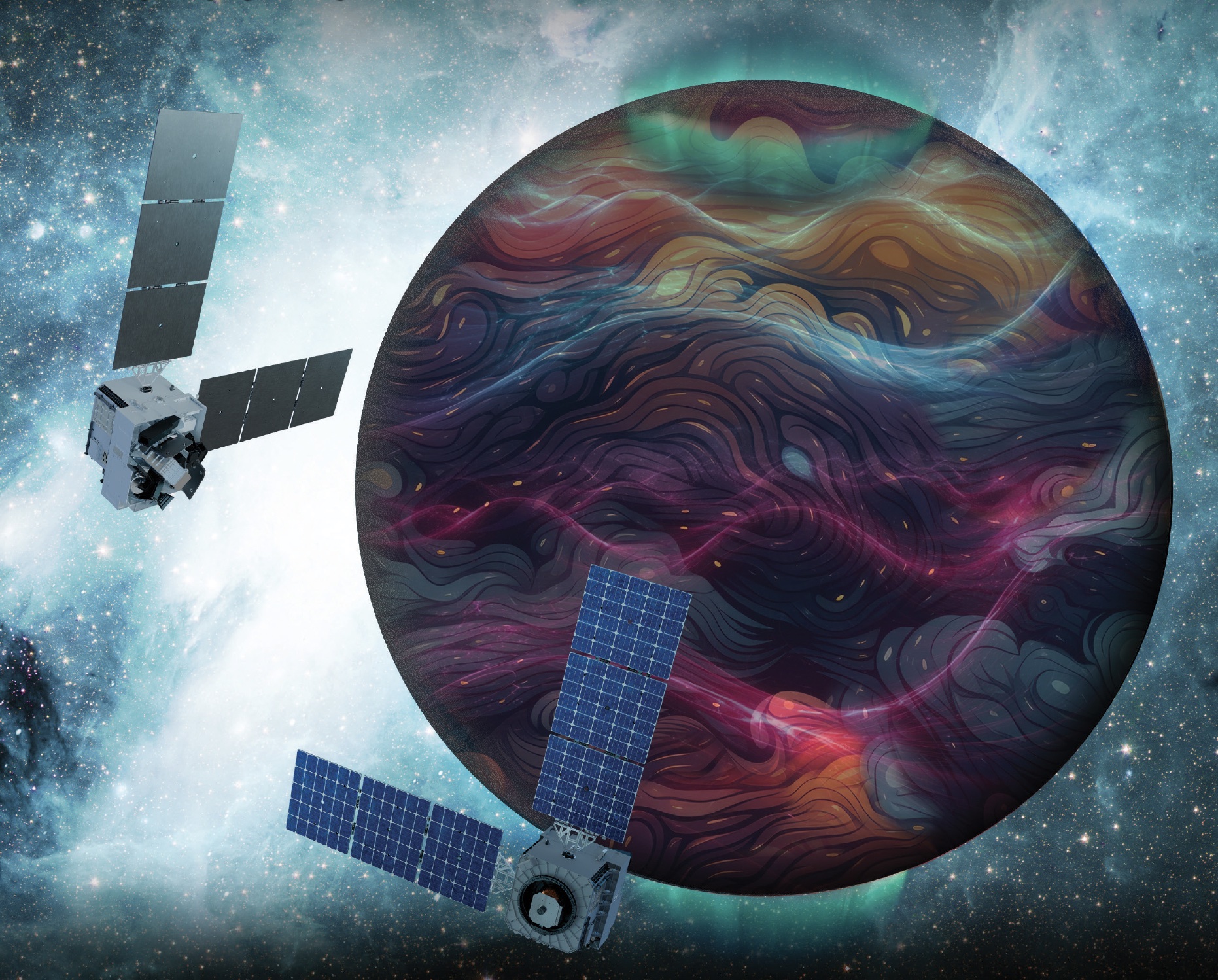
Artist’s rendition of the DAPHNE (Dynamic Atmosphere-Ionosphere Explorer) mission concept. The coloring represents auroras and atmospheric waves in Earth’s atmosphere.
Credit: Laboratory for Atmospheric and Space Physics/Mary Tostanoski
NASA selected a mission concept to research how space weather and dynamics within Earth’s atmosphere influence the space environment and help improve prediction capabilities for impacts on crucial technology, such as GPS and low Earth orbit satellites, as well as astronauts in space.
The DAPHNE (Dynamic Atmosphere-Ionosphere Explorer) mission will enter Phase B of development, which includes planning and design for flight and mission operations. It will use identical twin satellites to study how changes in Earth’s lower atmosphere influence our planet’s upper atmosphere, where space weather is manifested.
“NASA is advancing the United States’ leadership as a space weather-ready nation, and by providing new insights into Earth’s atmosphere we can better predict and prepare for impacts in our daily lives on Earth and in space,” said Nicky Fox, associate administrator, Science Mission Directorate, NASA Headquarters in Washington. “As NASA sends astronauts beyond Earth’s magnetic protection to the Moon, Mars, and beyond, DAPHNE will join the NASA science fleet strategically located across the solar system to provide data that will help mission planners predict and mitigate the effects of space weather for the benefit of all.”
The DAPHNE mission’s low-risk high-return concept will provide coordinated, multi-point measurements of neutral winds, temperature, and composition in the thermosphere. The ionosphere and thermosphere regions are where Earth’s neutral atmosphere transitions into the ionized plasma of space. In this thin shell that surrounds the planet, the atmosphere is in constant motion, shaped by the influence of solar activity and changes in the lower atmosphere and in near-Earth space.
Fundamental observations and physical insights from the DAPHNE mission will incorporate lower-atmospheric energy data to advance space weather predictive capabilities. The mission is led by Aimee Merkel from the Laboratory for Atmospheric and Space Physics at the University of Colorado, Boulder.
The mission will be subject to a confirmation review in 2027, which will assess the progress of the mission and the availability of funds. If confirmed, the total estimated cost of the mission, excluding launch, will not exceed $250 million in fiscal year 2023 dollars, with a mission launch date of no earlier than 2029.
The DAPHNE mission was proposed as a concept study in response to the DYNAMIC (Dynamical Neutral Atmosphere-Ionosphere Coupling) mission announcement of opportunity. Funding and management oversight for this mission is provided by the Solar Terrestrial Probes program at NASA’s Goddard Space Flight Center in Greenbelt, Maryland.
For more information on NASA’s heliophysics missions, visit:
NASA has selected eight new companies and will acquire new data products from six existing Commercial Satellite Data Acquisition contract holders to expand the range of commercial satellite data available to researchers, civil agencies, and decision-makers. Such measurements supplement NASA’s Earth satellites by contributing high-resolution and frequent observations to enhance the agency’s set of data.
Leveraging commercial data demonstrates NASA’s commitment to strong public-private partnerships, allowing the agency to expand scientific insight while reducing costs and accelerating the delivery of data to researchers and decision-makers.
Collectively, NASA and commercial Earth observations provide insight into our home planet – benefitting Americans, providing environmental intelligence, strengthening disaster response, and improving public safety.
The Commercial Satellite Data Acquisition Program On-Ramp 2 Multiple Award contract is a firm-fixed-price, indefinite-delivery/indefinite-quantity multiple-award contract. The original maximum contract value was $476 million, with a performance period that began in 2023 and continues through Nov. 15, 2028.
Contract awardees are:
Airbus DS Geo Inc.
GHGSat Inc.
Hydrosat Inc.
ICEYE US Inc.
ImageSat International
Kuva US Inc.
Muon Space Inc.
Orbital Sidekick Inc.
OroraTech USA Inc.
Planet Labs Federal Inc.
Space Sciences and Engineering LLC, doing business as PlanetiQ
SATLANTIS US
Tomorrow Companies Inc., doing business as Tomorrow.io
Wyvern Inc.
The agency’s Commercial Satellite Data Acquisition mission works to execute a cost-effective way to augment and complement the suite of Earth observations captured by NASA and its partners by identifying, evaluating, and acquiring commercial satellite data.
For more information about NASA’s Commercial Satellite Acquisition program, visit:
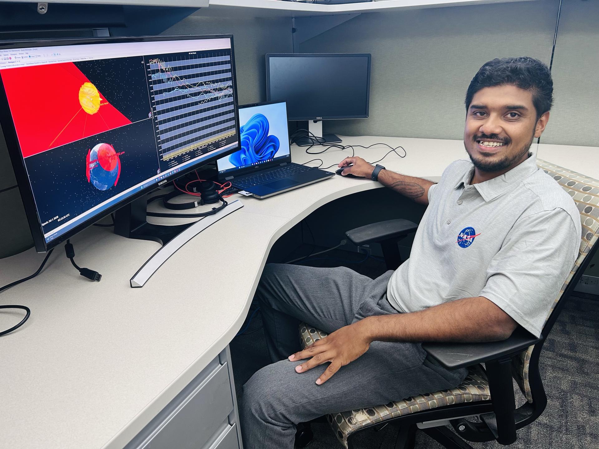
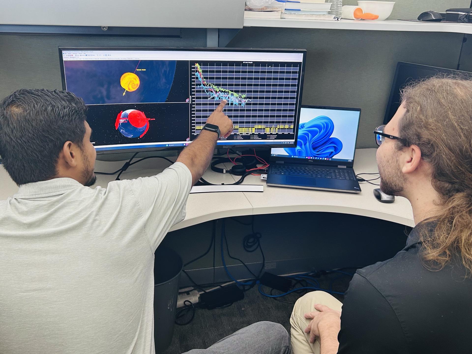
Rohit Goeptar, an electromagnetic/radio frequency analyst with NASA’s Launch Services Program at the agency’s Kennedy Space Center in Florida, reviews a radio frequency link budget analysis for NASA’s Nancy Grace Roman Space Telescope from his office. Goeptar is among the engineers and technicians sworn in as new NASA civil servants as part of NASA Administrator Jared Isaacman’s workforce directive to restore technical core competencies within the civil servants ranks.
NASA/Amanda Griffin
Rohit Goeptar was born into a poor family in Suriname, South America, the kind where both parents work three jobs and they still can only provide food and shelter for their family. At around age six, his family moved to California to start a new life. Only two years later, he moved back to South America with his father while his mother stayed in the United States and remarried. When he was 13, he became a U.S. citizen and he and his brothers returned to live with their mother in California.
At 19, Goeptar joined the U.S. Marine Corps where he spent six years as a technical operator. During one deployment to the Philippines, Goeptar helped set up communication systems for individuals who needed to contact their loved ones after a typhoon ripped through entire towns.
“I was lost, the Marine Corps gave me an opportunity,” Goeptar recalled.
While the Marines taught him useful skills, his life had not been the easiest. He lost not one, but two, fathers to suicide, and a short first marriage ended with him being unhoused on the streets of Kissimmee, Florida, for six months. But Goeptar eventually found his way.
As with most underdog stories, there was another person in the shadows behind his rise to success.
“Your brain works in mysterious ways,” his now wife told him a short while after they met. She then filled out college applications for him, and he eventually applied to NASA’s Kennedy Space Center in Florida.
While raising three kids, going to school full-time pursuing a computer engineering and electrical engineering degree simultaneously, Goeptar got the call that changed his life.
“In spring 2025, I was driving to pick my son up from school when a gentleman from Kennedy calls, telling me he’s seen my resume and do I have time for a quick interview,” Goeptar recounted.
He pulled on the side of the road and took part in an impromptu job interview.
Two weeks later, he had an in-person interview with others from Kennedy and two weeks after that, he had a contractor badge at America’s premier spaceport.
After starting as an intern under the Expendable Launch Vehicle Integrated Support, or ELVIS, contract, then moving to part-time until he graduated from the University of Central Florida (UCF) in Orlando, then full-time at the beginning of 2026, Goeptar was one of the ELVIS contractors who applied and were picked up to become civil servants recently.
Rohit Goeptar, an electromagnetic/radio frequency analyst with NASA’s Launch Services Program at the agency’s Kennedy Space Center in Florida, reviews a radio frequency link budget analysis for NASA’s Nancy Grace Roman Space Telescope with a colleague.
NASA/Amanda Griffin
Now an employee of NASA’s Launch Services Program, Goeptar works with electromagnetic interference, electromagnetic compatibility, and radio frequency. It is his job throughout the entirety of the mission to analyze and ensure avionic boxes or anything electrically powered doesn’t interfere with any other systems. He also ensures independent systems are compatible when brought together. And finally, he conducts model radio frequency link analysis for different rockets and science demonstrations payloads. These may belong to NASA or commercial partners, and he is responsible for ensuring uninterrupted communication with the ground. In his short time at Kennedy, Goeptar has worked on Sentinel-6B, JPSS-4 (Joint Polar Satellite System), and IMAP (Interstellar Mapping and Acceleration Probe) missions.
And as far as his wife’s assessment that his brain works differently, he proved that within a year at Kennedy when he noticed an analytical issue his team wasn’t tracking. Once a rocket launches, it does a pitch, yaw, and roll. The analysis the team had been conducting didn’t account for this movement, which meant it wasn’t as accurate as it could be. He presented his solution to the team lead, and it now enables NASA data and partner data to be much more in sync.
“There is no greater feeling, being able to serve. It’s more than serving the public, it’s serving our country. It’s serving the future of our country,” Goeptar said with tears brimming in his eyes. “Being able to give back to that same government that gave me an opportunity to be where I’m at today. There’s no greater feeling than that.”
Meanwhile, Goeptar’s 11-year-old takes most of the credit for his landing at the space center, a NASA enthusiast, his son believes he spoke it into existence.
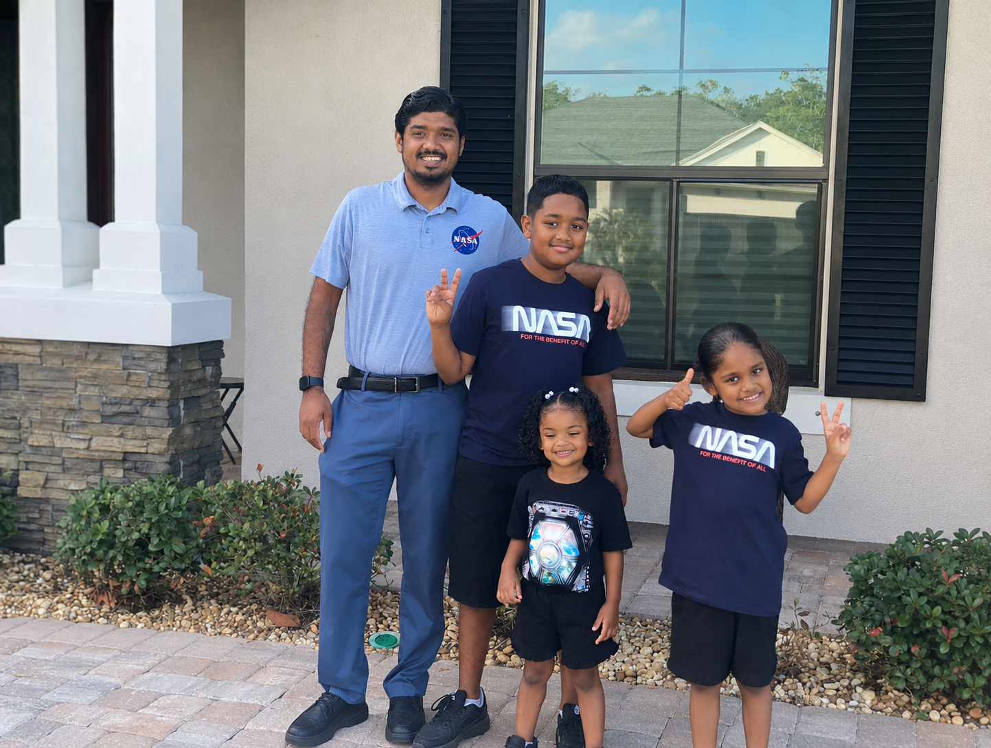
Rohit Goeptar, an electromagnetic/radio frequency analyst with NASA’s Launch Services Program at the agency’s Kennedy Space Center in Florida, poses for a photograph with his children.
NASA/Rohit Goeptar
“One day he wants to become an astronaut,” Goeptar said with joy on his face. “And I told him I will guide him until the day that I die. Maybe my last mission could be the one my son flies on. I’m not going to stop until that day happens.”
Rohit’s positive streak continues as he recently was accepted into electrical engineering master’s programs at both Johns Hopkins University, and UCF.
Desert Field Test With NASA Advanced Rover Prototype
PIA26701
Credits: NASA/JPL-Caltech
Downloads
Desert Field Test With NASA Advanced Rover Prototype
PNG (27.94 MB)
PIA26701 Figure A
JPEG (26.03 MB)
PIA26701 Figure B
JPEG (951.75 KB)
PIA26701 Figure C
JPEG (16.03 MB)
PIA26701 Figure D
JPEG (16.46 MB)
Description
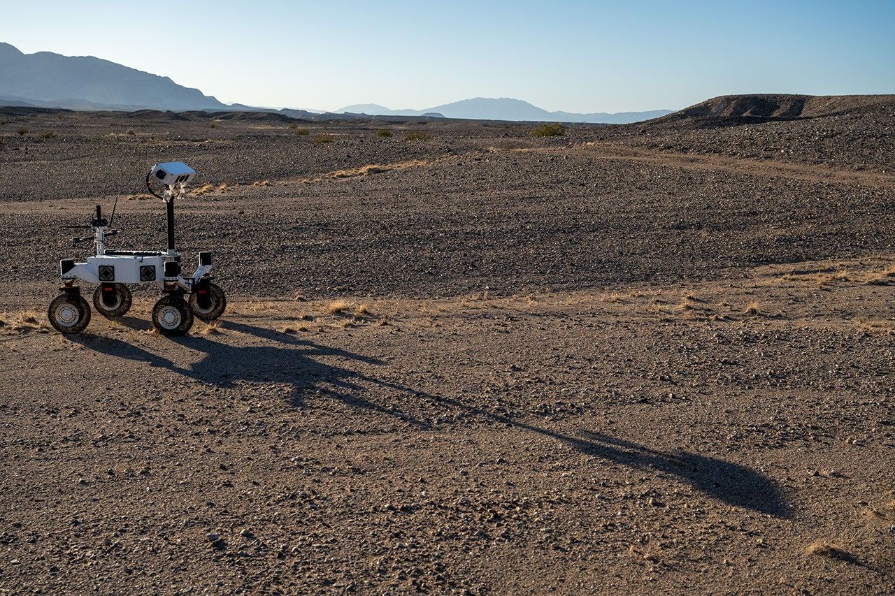
A prototype four-wheel rover developed at NASA’s Jet Propulsion Laboratory with advanced mobility and robotic autonomy capabilities trundled across the Colorado Desert near Plaster City, California, during a field test in March 2026. Called ERNEST (Exploration Rover for Navigating Extreme Sloped Terrain), the rover served here as a testbed for autonomy software developed for a potential lunar mission requiring higher speeds and much greater mileage than can be achieved with current planetary rovers.
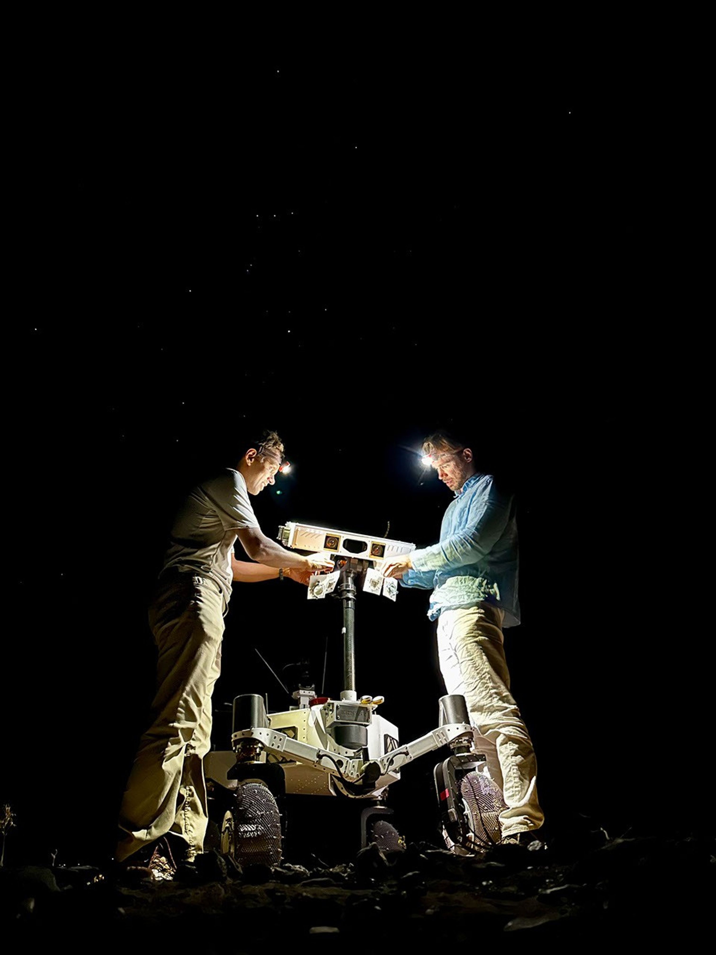
ERNEST was trailed by engineers as it traveled about 16 miles over the course of 37 hours of drive time. That’s more than 10 times the speed at which NASA’s Perseverance rover can navigate on Mars. The team also tested how well the rover traveled at dusk, dawn, and nighttime to simulate the experience of large terrain shadows in polar regions on the Moon.
Figure A
Figure A shows the rover traveling toward its shadow.
Figure B
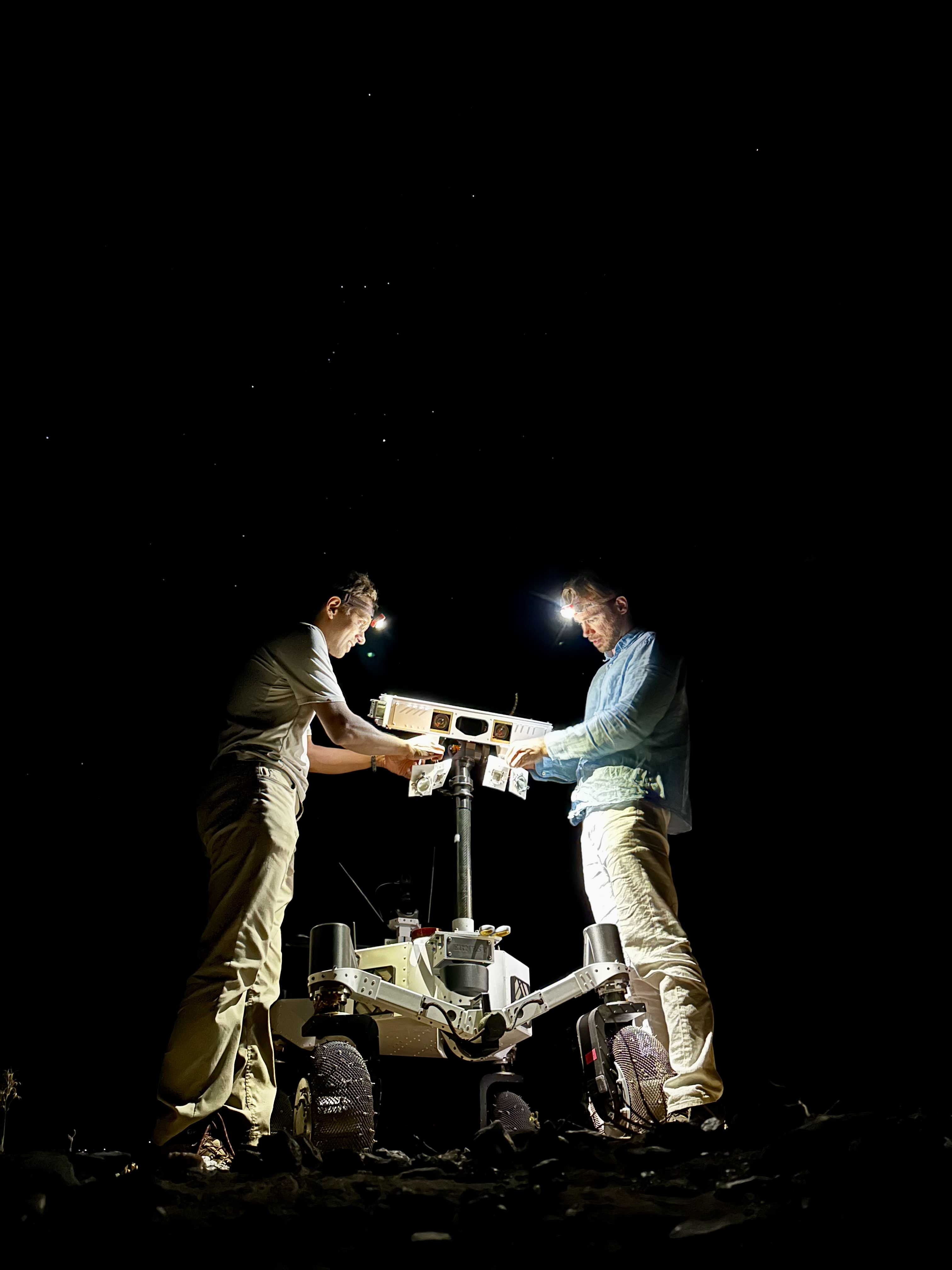
Figure B shows two team members setting up illuminators on the rover at night.
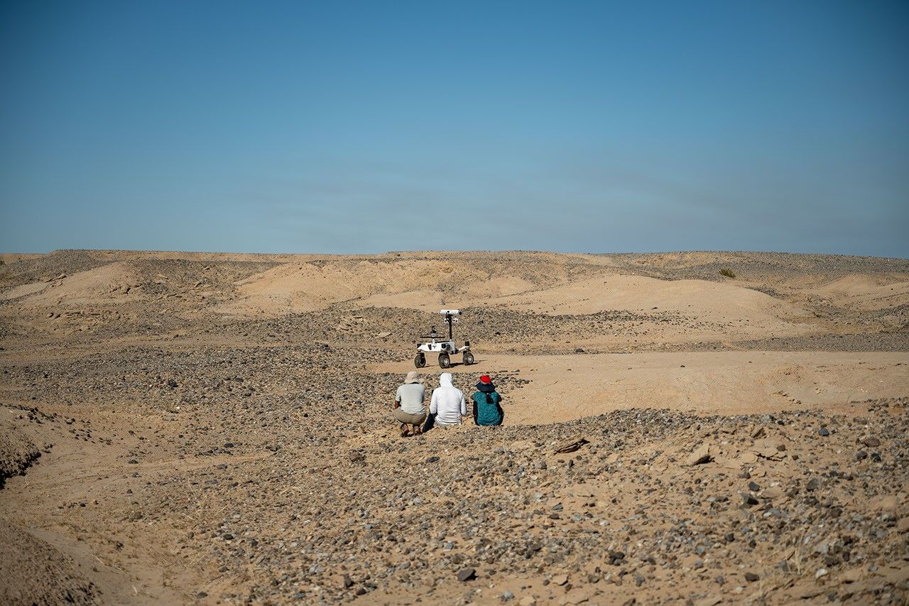
Figure C
Figure C shows three team members observing the rover during its long-range traverse.
Figure D
Figure D shows the rover with one wheel up on a rock.
Work on ERNEST began in 2022 and was initially supported by JPL internal research and development funds. It is currently funded by NASA’s Mars Exploration Program and the agency’s Exploration Science Strategy Integration Office under its Science Mission Directorate in Washington. Caltech in Pasadena, California, manages JPL for NASA.
Developed at NASA’s Jet Propulsion Laboratory, ERNEST (Exploration Rover for Navigating Extreme Sloped Terrain) is used in a desert field test to help refine mobility hardware and autonomy software that could be used for a potential future long-range lunar rover mission.
During the field test, which took place in March 2026 in the Colorado Desert of Southern California, the JPL team deployed ERNEST at all times of the day — including dusk, dawn, and nighttime, when lighting conditions create long shadows like those seen on the Moon’s polar regions.
On a bleak stretch of the Colorado Desert in Southern California, a compact four-wheeled rover recently trundled about 16 miles (26 kilometers) with minimal intervention from the team of engineers trailing it. Called ERNEST (Exploration Rover for Navigating Extreme Sloped Terrain), this prototype is being used by NASA to advance both robotic autonomy and the ability to traverse challenging landscapes.
Developed at NASA’s Jet Propulsion Laboratory in Southern California, ERNEST is 4 feet (1.2 meters) long. Not only can it lift each of its mesh wheels to get past obstacles that would stymie Curiosity and Perseverance, NASA’s six-wheeled Mars rovers, but the prototype also has enhanced independent decision-making capabilities. These mobility and autonomy advances could be infused into future missions that will venture to previously inaccessible areas of the Red Planet or the Moon.
ERNEST serves as a testbed for a potential future lunar rover mission requiring high speeds and extreme distances. In a recent field test, the prototype traveled 16 miles over the course of 37 hours, going an order of magnitude above the top speed at which NASA’s current Mars rovers can navigate. Credit: NASA/JPL-Caltech
In the field, ERNEST served as a testbed for a potential future lunar mission requiring higher speeds and much greater mileage than can be accomplished by current rovers. This technology could be used to inform future designs for exploration efforts on the Moon and beyond.
“This testing is helping us refine the mobility hardware and autonomy software to navigate extreme distances across a wide range of terrain and lighting conditions anticipated on the Moon,” said Issa Nesnas, a principal technologist at JPL who led the recent testing as head of autonomy for a NASA mission concept for a potential future long-range lunar rover.
Engineers from JPL set up illuminators after transporting ERNEST for a pre-sunrise test during a seven-day desert field campaign.
NASA/JPL-Caltech
Nesnas’ team is using ERNEST to demonstrate it is possible to build a rover that’s twice as big as the prototype and capable of a long-distance Moon mission. During the recent campaign, ERNEST traveled at speeds up to 0.6 mph (1 kph) over 37 hours of driving, across seven days of intermittent testing. That’s an order of magnitude above the top speed Perseverance and Curiosity can navigate.
“You could do a science road trip across the Moon — or Mars — with this vehicle,” said James Keane, a JPL planetary scientist working on lunar missions.
The initial goal of the team that developed ERNEST was mechanical: to design a relatively simple, low-cost rover that advances the trusted rocker-bogie suspension system featured on every Mars rover since NASA’s Sojourner. This passive system keeps relatively constant weight on all six wheels, thanks to pivot points and struts that enable each one to adapt to the changing surface.
The mobility and autonomy advances developed at JPL for the ERNEST prototype rover could be infused into future NASA missions to previously inaccessible areas of the Red Planet or the Moon. Credit: NASA/JPL-Caltech
On ERNEST, the active suspension lets the rover manage weight distribution among its wheels. Two powered joints in front articulate a gimbal that allows the rover to drive using different gaits like squirming, wheel-walking, and obstacle-climbing. With a clutch mechanism, it can switch between active and passive suspension, which is less terrain capable but more energy efficient. With four steerable wheels, it can drive in any direction, including sideways.
“We started by postulating that we could do better in designing a planetary surface robotic mobility system,” said Hari Nayar, a JPL principal technologist leading the ERNEST team. “While the rocker-bogie system has been very successful over the past 30 years, there’s been a lot of research in that time on mobility and understanding terrain interaction.”
Before arriving at today’s version of ERNEST, the team built two earlier prototypes, each about 2 feet (0.6 meters) long, to test 11 active suspension configurations. In a trailer filled with lunar regolith simulant, they ran experiments at different slope angles over several months before landing on a final design.
Then the team scaled up, including adding a rectangular head mounted on a 4.5-foot-tall (1.4-meter-tall) mast. The hardware was completed in September 2024, but the rover still needed a human operator to joystick it, sending commands to instruct the rover on how to move over obstacles.
In order to train the rover to think on its own, the ERNEST team turned to reinforcement learning, a type of artificial intelligence where the robot learns by interacting with its environment. The Dynamics and Real-Time Simulation Laboratory at JPL developed a high-fidelity virtual testing environment that replicates the rover’s behavior. The team fed the simulator data collected by engineers who documented the response of the actual rover hardware to a variety of terrain types. On a high-performance computing cluster, the team ran many simulations at once, sometimes completing thousands of hours of tests over a single weekend.
After months of virtual training, the ERNEST team was ready to see if the rover could use its new autonomous algorithms to figure out how to drive over terrain features that would halt a passive-suspension rover. They set up an obstacle course with sand ripples, rubble piles, steps, and steep slopes in JPL’s Mars Yard, an outdoor terrain proving ground. Then they watched as the rover maneuvered the terrain on its own. Since then, ERNEST has completed many such courses.
Nayar’s team is starting a new autonomy project which involves integrating the rover’s ability to determine when and how to use its active suspension with longer-range intelligent navigation. The goal is to enable ERNEST to plan an efficient path so that it can tackle surmountable obstacles and circumnavigate hazardous ones. These capabilities could contribute to potential future rover missions encountering formidable landscapes on Mars or more rugged areas of the Moon.
Work on ERNEST began in 2022 was initially supported by JPL internal research and development funds. It is currently funded by NASA’s Mars Exploration Program and the agency’s Exploration Science Strategy and Integration Office in its Science Mission Directorate at NASA Headquarters in Washington. Caltech in Pasadena, California, manages JPL for NASA.
Engineers from NASA’s Jet Propulsion Laboratory are field-testing advanced capabilities for potential future Moon and Mars rovers. In the Colorado Desert nea...
Even small asteroids lead complex lives. During its flyby of the asteroid Donaldjohanson last year, NASA’s Lucy spacecraft revealed the asteroid to be a wobbly, peanut-shaped body that has undergone a lot of activity in its relatively short history. Formed as fragments coalesced after a violent collision 155 million years ago, the asteroid was transformed by the small but inexorable force of the Sun’s radiation, all while retaining signs of the brief presence of liquid water in its distant past.
Zooming through the main asteroid belt toward one of the Jupiter Trojan asteroid groups, the Lucy spacecraft collected the first close-up images and other data at Donaldjohanson on April 20, 2025, as it passed 650 miles away from the asteroid. The data revealed that, instead of spinning simply around one axis like most other asteroids and planets, Donaldjohanson has a more complicated two-axis rotation. Scientists also saw Donaldjohanson’s peanut shape and the craters and ridges on its surface.
A timelapse video made from images taken by NASA’s Lucy spacecraft as it approached the asteroid Donaldjohanson on April 20, 2025. The L’LORRI (Lucy Long Range Reconnaissance Imager) instrument, the spacecraft’s high-resolution black-and-white imager, collected these images over two hours as the spacecraft rapidly closed in on the asteroid from an initial separation of more than 58,000 miles (93,000 km), until the spacecraft passed a mere 650 miles (1000 km) from the 5-mile- (8 km-) wide asteroid.
NASA/Goddard/SwRI/JHU-APL
Lucy’s encounter with the asteroid was planned as a dress rehearsal for the spacecraft and mission team before its primary asteroid encounters, which begin with Lucy’s flyby of the Trojan asteroid Eurybates on Aug. 12, 2027. The instruments performed as expected, and, as a bonus, scientists got a rare opportunity to study a previously unexplored asteroid up close and to compare it to two asteroids with similar compositions but different histories: Bennu, the target of NASA’s OSIRIS-REx sample-return mission, and Ryugu, the site of JAXA’s (Japan Aerospace Exploration Agency) Hayabusa2 sample-return mission.
With Earth-based telescopes, observers saw fluctuations in the light Donaldjohanson reflects, regular patterns of peaks and valleys, typical of an elongated object rotating once every 10.5 Earth days. But Lucy’s data revealed another pattern: Donaldjohanson appears to be rotating like a wobbly top. Paper authors reported that the asteroid rotates end-over-end once every 10.5 Earth days, and wobbles back and forth around its long axis once every 26.5 days.
The asteroid Donaldjohanson is shown slowly rotating in a tumbling, non-principal axis motion, with its angular momentum vector and rotation axes indicated. The surface is colored by gravity slope, which measures the angle between the local surface and the direction of gravity. Higher values (warmer colors) indicate steeper terrain relative to the local gravitational pull. Regions with limited stereo image coverage have been masked out where the shape model is less well constrained.
Kel Elkins/NASA’s Science Visualization Studio/DLR
Peanut shape
While the Earth-based observations hinted at Donaldjohanson’s elongated shape, the Lucy flyby revealed a “bilobate” structure: two lobes connected by a neck, like a peanut. These lobes are likely two fragments from an asteroid collision that gently came together afterward by their mutual gravity.
Donaldjohanson likely rotated at least 10 times faster when it formed, having slowed to its current rate in the last 20 to 60 million years, the team estimates. As it slowed, the balance between the centrifugal force pushing things apart and gravity pulling things together changed and loose rocky material slid down slopes creating the worn-down appearance of many craters, as the flyby images showed.
The paper’s authors say that the asteroid’s slowing rotation is likely caused by a subtle consequence of solar heating known as the YORP effect. Each part of the asteroid’s Sun-warmed surface radiates heat away as infrared light, and that radiation imparts a tiny recoil force to the surface. Because the asteroid’s shape isn’t symmetric, this results in a net torque, or twist, that can change the asteroid’s rotation. Thus, YORP can slow asteroid spins down or speed them up, as in the case of Bennu (once every four hours) and Ryugu (once about every seven hours), which both likely used to rotate much slower than they do today.
Fleeting water
As it passed by Donaldjohanson at 30,000 mph, Lucy recorded the signatures of iron-rich clay minerals on the surface. These clays must have formed in the distant past with the help of liquid water. However, the exposure must have been brief, Lucy scientists concluded, because iron in clays tends to be replaced with other elements, such as magnesium, as water lingers.
Indeed, scientists saw magnesium-rich clays at Bennu and Ryugu, which suggested prolonged water exposure, perhaps lasting millions of years, when they were still part of larger asteroids.
This difference in water exposure history, and other characteristics, may mean that the parent bodies of these asteroids formed at different times or in different regions of the solar system before relocating to the main belt.
Compare, contrast
Donaldjohanson is thought to be made from rocky remnants of a larger, carbon- and water-rich asteroid that collided with another object in the main asteroid belt. Bennu and Ryugu are thought to have formed in the same way and in the same region.
But Donaldjohanson is different. At 155 million years old, it is much younger than Bennu and Ryugu, which formed 1 to 2 billion years ago. Donaldjohanson also has remained in the asteroid belt since birth, while its wandering cousins migrated into orbits around the Sun that bring them close to Earth’s orbit about once a year (which made them perfect close targets for sample return missions).
During its April 20, 2025, encounter with the main-belt asteroid Donaldjohanson, NASA’s Lucy spacecraft discovered evidence for iron-rich clays on the surface using its infrared spectrometer. These clays, which are similar to those found in carbon-rich meteorites such as QUE 97990, indicate that water was briefly present in the asteroid during the distant past.
NASA/Goddard/SwRI/Dan Gallagher
“It’s helpful for scientists to compare Donaldjohanson with asteroids like Bennu and Ryugu, which are seemingly similar asteroids, because every subtle difference is another clue to our origin story,” said Simone Marchi, Lucy deputy principal investigator and lead author of the study at the Boulder, Colorado, office of the Southwest Research Institute.
“Once we start learning more about the Trojans, a completely different population of space rocks with very different histories, our understanding of solar system formation is destined to be challenged,” said Marchi.
Named after a fossilized skeleton of a human ancestor discovered in Ethiopia in 1974, NASA’s Lucy will be the first mission to explore Jupiter’s Trojan asteroids, a population of well-preserved space rocks that formed early in our solar system’s history and could help scientists understand how the planets formed and moved around before settling in their current configuration.
Lucy’s principal investigator is based out of the Boulder, Colorado, branch of Southwest Research Institute, headquartered in San Antonio. NASA’s Goddard Space Flight Center in Greenbelt, Maryland, provides overall mission management, systems engineering, and safety and mission assurance. Lockheed Martin Space in Littleton, Colorado, built the spacecraft. Lucy is the 13th mission in NASA’s Discovery Program. NASA’s Marshall Space Flight Center in Huntsville, Alabama, manages the Discovery Program for the agency’s Science Mission Directorate in Washington.
For more information on NASA’s Lucy mission, visit:
Zooming through the main asteroid belt toward one of the Jupiter Trojan asteroid groups, the Lucy spacecraft collected the first close-up images and other data at Donaldjohanson on April 20, 2025, as it passed 650 miles away from the asteroid. The data revealed that, instead of spinning simply around one axis like most other asteroids and planets, Donaldjohanson has a more complicated two-axis rotation. Scientists also saw Donaldjohanson’s peanut shape and the craters and ridges on its surface.
This NASA/ESA/CSA James Webb Space Telescope Picture of the Month shows the giant molecular cloud Orion A, an area of the sky replete with star-forming clouds.
ESA/Webb, NASA & CSA, T. Megeath, M. Zamani (ESA/Webb) Acknowledgement: M. H. Özsaraç
This image, captured by NASA’s James Webb Space Telescope and released on June 5, 2026, shows just a small portion of one of the Orion Molecular Clouds, a long and massive filament of cold gas and dust beyond the Orion Nebula. Every stage of star formation — from the youngest stellar embryos to protoplanetary discs to newly-minted pre-main sequence stars — is contained within this scene which stretches 150 light-years across.

 Login