On July 3, one of NASA’s two Mars-destined ESCAPADE (Escape and Plasma Acceleration and Dynamics Explorers) spacecraft captured photos of Earth and the Moon in visible and thermal infrared light. At the time, the spacecraft was 363,250 miles (584,600 kilometers) from Earth and 115,600 miles (186,100 kilometers) from the Moon, making the Moon appear relatively large.
Taken with the Sun only partly illuminating Earth and the Moon, the visible light image shows the two bodies as crescents, with only around 8% of each face sunlit. Yet in the thermal infrared image, the shadowed hemisphere of Earth is illuminated by its own heat from both the atmosphere and surface, glowing at minus 10 to minus 44 degrees Fahrenheit (250 to 280 kelvins). Without the insulating blankets of oceans and atmospheres, the Moon’s far side remains at a much cooler minus 280 degrees Fahrenheit (100 kelvins).
visible light
thermal infrared light
Caption: In these images from NASA’s ESCAPADE mission, Earth (left) and Moon (right) can be seen. The image to the left of the slider shows visible light reflected by the Sun while the infrared image to the right shows the bodies’ emitted energy. White rings have been added in the thermal image to show the actual size of Earth and the Moon. Credit: NASA/UCB-SSL/NAU-Radiant/Lucint
NASA/UCB-SSL/NAU-Radiant/Lucint
In these images from NASA’s ESCAPADE mission, Earth (left) and Moon (right) can be seen. The image to the left of the slider shows visible light reflected by the Sun while the infrared image to the right shows the bodies’ emitted energy. White rings have been added in the thermal image to show the actual size of Earth and the Moon.
NASA/UCB-SSL/NAU-Radiant/Lucint
visible light
thermal infrared light
ESCAPADE Photos of Earth and Moon
July 3, 2026
In these images from NASA’s ESCAPADE mission, Earth (left) and Moon (right) can be seen. The image to the left of the slider shows visible light reflected by the Sun while the infrared image to the right shows the bodies’ emitted energy. White rings have been added in the thermal image to show the actual size of Earth and the Moon. Credit: NASA/UCB-SSL/NAU-Radiant/Lucint
The ESCAPADE mission used its Visible and Infrared Observation System cameras, provided by Northern Arizona University in Flagstaff, to capture the images, which are more than just road trip photo album snaps.
“We are thrilled that ESCAPADE was able to accommodate these excellent space-qualified cameras which will search for visible Martian aurora and investigate thermal properties of the Martian surface and atmosphere,” said Rob Lillis, the mission’s principal investigator at the University of California, Berkeley. “Since Earth and the Moon are well-known targets, imaging them provides an important calibration check for ESCAPADE’s cameras.”
The ESCAPADE spacecraft, which were built by Rocket Lab, are currently in a “loiter” orbit around Lagrange point 2, a location in space about a million miles from Earth. In November 2026, the spacecraft will fly by Earth to use the planet’s gravity to slingshot their way to Mars. When the spacecraft arrive in September 2027, they will study how a million-mile-per-hour stream of material flowing from the Sun, known as solar wind, interacts with the Martian environment and how that drives atmospheric loss at the Red Planet.
The ESCAPADE mission is funded by NASA’s Heliophysics Division and is part of the NASA Small Innovative Missions for Planetary Exploration program. The UC Berkeley’s Space Sciences Laboratory leads the mission with key partners Rocket Lab; NASA’s Goddard Space Flight Center in Greenbelt, Maryland; Embry-Riddle Aeronautical University; Advanced Space; and Blue Origin.
By Mara Johnson-Groh NASA’s Goddard Space Flight Center, Greenbelt, Md.
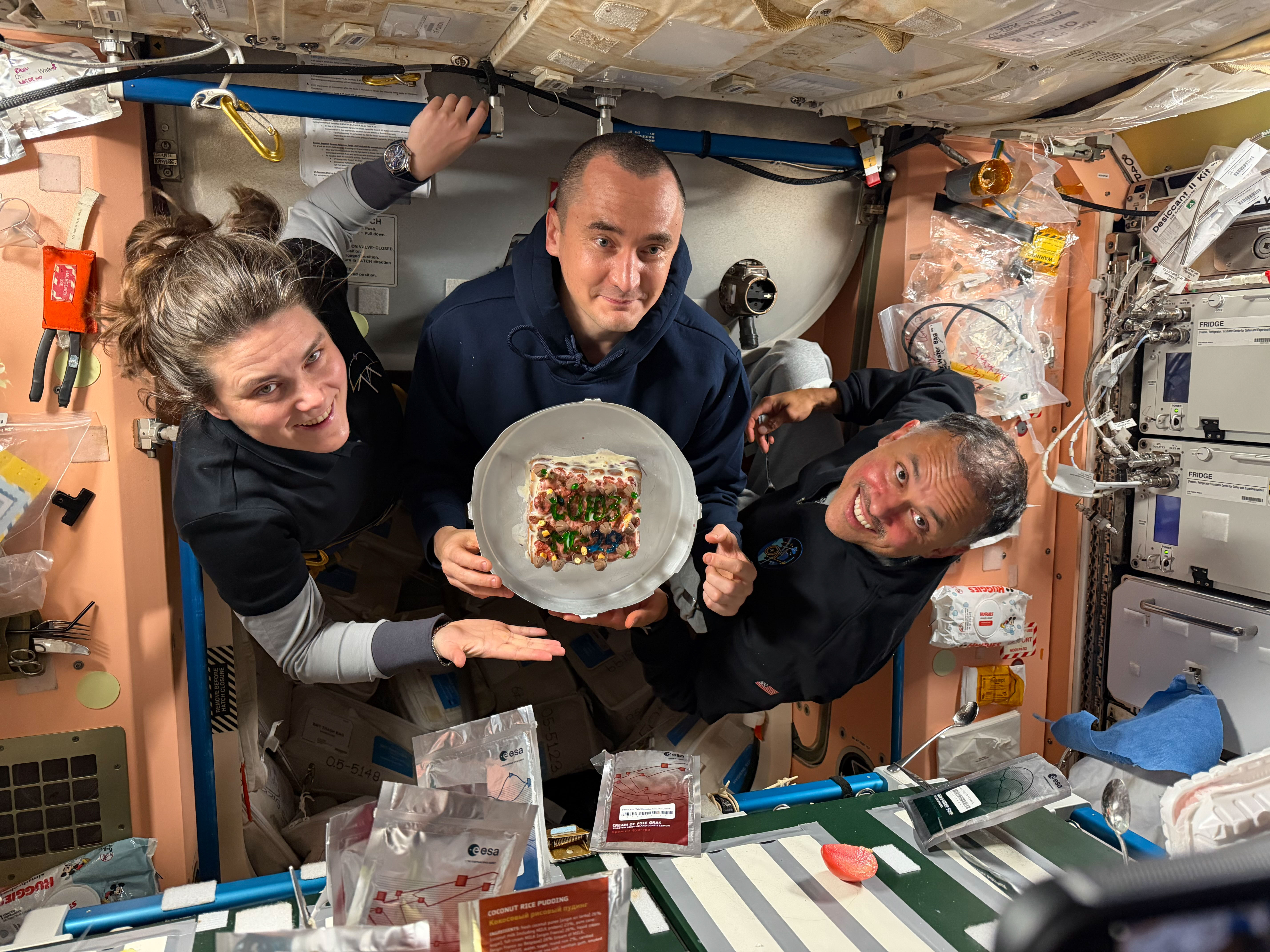
From left, Expedition 74 flight engineers Anna Kikina and Pyotr Dubrov of Roscosmos, and Anil Menon of NASA pose for a July 18, 2026, photo while holding a cake celebrating their recent arrival aboard the International Space Station. The trio arrived at the space station on July 14, 2026, after launching from the Baikonur Cosmodrome in Kazakhstan earlier the same day.
Kikina, Dubrov, and Menon are in the second week of their planned eight-and-a-half-month mission. They are using their new skills to conduct space research while still familiarizing themselves with living and working in space.
Preparations for Next Moonwalk Simulations Underway (and Underwater)
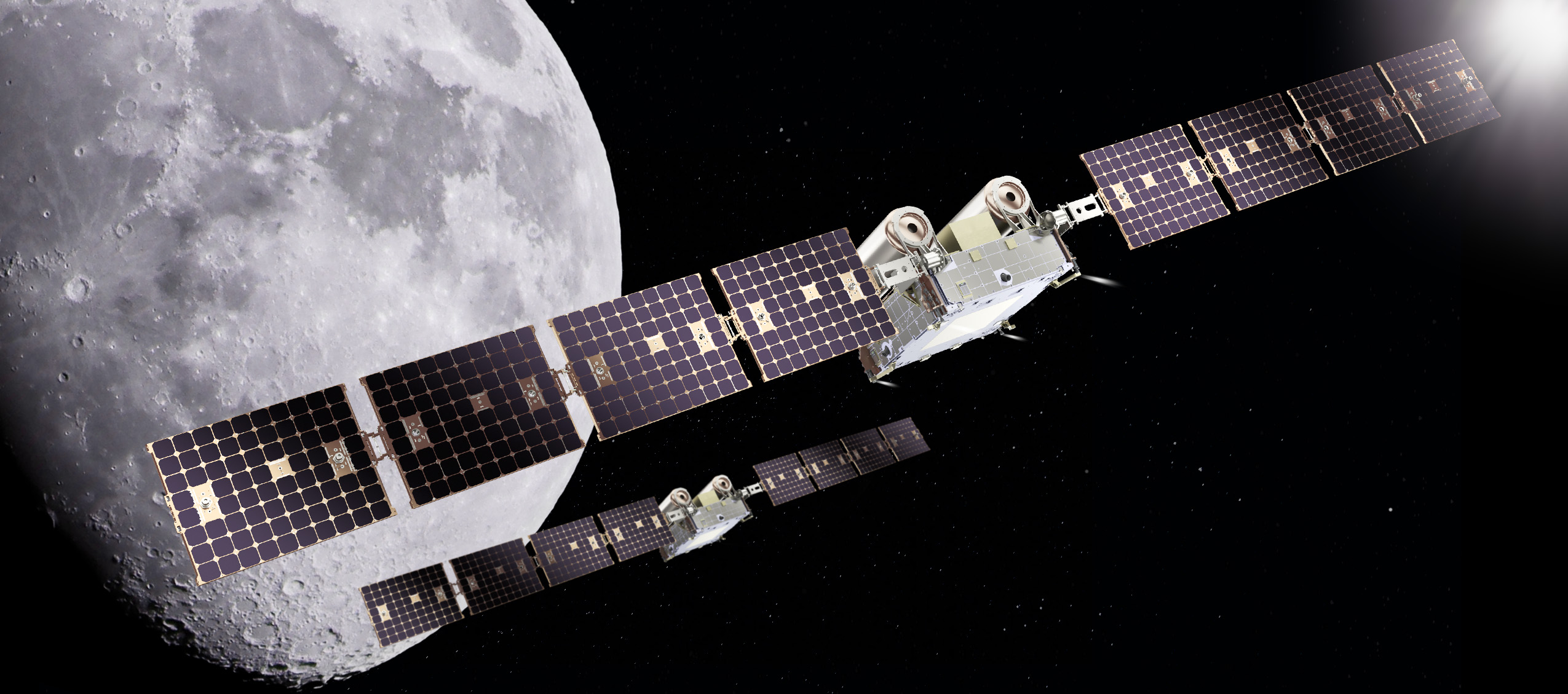
An artist’s rendering of NASA’s CAPSTONE 02 spacecraft in lunar orbit. The mission features two identical small spacecraft that will further mature technologies to support Artemis, Moon Base, and deep space exploration.
Terran Orbital
NASA is working with industry to advance the next phase of cislunar infrastructure for the agency’s Artemis program and Moon Base, including orbital assets and demonstrations. Under a contract awarded to Advanced Space, the agency’s CAPSTONE 02 mission will demonstrate rendezvous and proximity operations, autonomous navigation, and cislunar communication capabilities while continuing to characterize the radiation environment at the Moon.
The CAPSTONE 02 mission, targeted for launch in 2027, will use two small spacecraft in lunar orbit to facilitate these demonstrations to support future NASA lunar and deep space missions.
NASA’s original CAPSTONE demonstration, short for Cislunar Autonomous Positioning System Technology Operations and Navigation Experiment, became the first U.S. commercial mission to the Moon and the first spacecraft to operate in a near rectilinear halo orbit around the Moon. This is a nearly stable orbit, thanks to the interactive pull of gravity from both the Earth and the Moon.
The mission successfully validated communications, networking, and autonomous navigation capabilities while gathering operational experience in cislunar space. The second CAPSTONE mission expands upon these accomplishments by transitioning from orbit validation to demonstrations that will inform future lunar exploration and infrastructure development.
Achieving our most ambitious space exploration goals requires iterative, risk-tolerant demonstrations in partnership with industry. Technology development through flight testing is how we convert hard problems into the lasting capabilities needed for a permanent presence at the Moon.
Christopher Baker
Lead of the In‑Space Infrastructure portfolio within the Research and Technology Mission Directorate at NASA Headquarters in Washington, DC.
NASA’s CAPSTONE 02 mission will demonstrate advanced relative navigation technologies for rendezvous and proximity operations in cislunar space. These techniques are more sophisticated than those used in low Earth orbit and are designed to support NASA astronauts as they dock with Moon landers in cislunar orbit, enabling safe crew transfers to and from the lunar surface.
The demonstration will fly two identical spacecraft of approximately 400 kilograms (882 pounds) from Terran Orbital Systems, Inc. Mission operators will conduct a series of rendezvous and proximity operations and loitering – or formation flying – techniques in lunar orbit with each spacecraft to better understand the trajectories of the spacecraft under the simultaneous influence of Earth and Moon gravities, otherwise known as three-body orbits.
The CAPSTONE 02 mission will use ground tracking measurements, optical sensors, and celestial bodies to help one spacecraft locate and rendezvous with another. The mission will apply navigation strategies similar to those planned for Orion’s approach to a lunar lander in deep space, helping NASA build confidence in these techniques for future exploration.
Each CAPSTONE 02 spacecraft will have the ability to switch between ‘chaser’ and ‘target’ roles, testing a broad range of operational scenarios under a variety of environmental conditions in cislunar space. Transporting crew to the lunar surface from cislunar orbit depends on knowing how well navigation systems will perform during these operations. Since these conditions can’t be fully recreated on Earth, they must be tested in space.
The CAPSTONE 02 mission also will serve as an operational testbed, enabling testing of three NASA-developed navigation software suites. Each software application will collect data during CAPSTONE 02’s low energy transfer trajectory, which will take it from the Earth to beyond the Moon before settling into a lunar orbit. The spacecraft will carry an optical imaging payload from Lawrence Livermore National Laboratory to support the navigation demonstration as well as capture imagery of the Moon. In addition, the mission will further mature the Cislunar Autonomous Positioning System navigation software that was first demonstrated on CAPSTONE as a method of determining spacecraft position relative to other spacecraft without relying on Earth-based tracking.
The suite of technologies on CAPSTONE 02 are designed to automate routine navigation tasks, reduce reliance on traditional space-to-ground data, and enable new mission concepts that may be derived from increased inter-satellite coordination. Additionally, the CAPSTONE 02 spacecraft are designed for cost-effective, rapid deployment, demonstrating a scalable and repeatable mission model.
“This mission represents an important step in the maturation of cislunar capabilities,” said Sean Fuller, Moon Base CAPSTONE manager. “By expanding on the lessons learned from CAPSTONE to demonstrate increasingly sophisticated operational concepts, CAPSTONE 02 lays the foundation for lunar infrastructure and commercial services that support Artemis, Moon Base, and future missions to deep space.”
The CAPSTONE 02 mission is funded by NASA’s Human Spaceflight Mission Directorate with support from the Research and Technology Mission Directorate. The mission is managed by Small Spacecraft & Distributed Systems, based at NASA’s Ames Research Center in California’s Silicon Valley, within the Research and Technology Mission Directorate. NASA used a Small Business Innovation Research Phase III contract to fund the mission.
To learn more about NASA’s CAPSTONE mission, visit:
An image shows the B-1 and B-2 test stands at NASA’s Stennis Space Center near Bay St. Louis, Mississippi, on July 7, 2026. The test stand features dual, vertical firing positions built in the 1960s to test Saturn V rocket stages that carried humans to the Moon during the Apollo Program. The B-1 position, right, is equipped for single engine tests, while the B-2 position is designed to test full rocket stages. NASA announced an agreement with Blue Origin on July 24, 2026, to use the B-2 test stand for engine testing to advance rocket development for future missions to the Moon under the Artemis program.
Credit: NASA/Danny Nowlin
NASA and Blue Origin announced Friday they recently agreed to conduct second stage hot fire testing for the company’s New Glenn rocket on the B-2 test stand at the agency’s Stennis Space Center near Bay St. Louis, Mississippi.
The annex to a reimbursable Space Act Agreement signed earlier this month highlights NASA’s commitment to working alongside commercial partners toward Artemis missions in 2027 and beyond.
“Stennis continues to be a hub for the commercial space industry,” said Sen. Roger Wicker. “Mississippi warmly welcomes Blue Origin’s return to the coast and to our legendary rocket testing facilities.”
“The success of Artemis II has roots at NASA Stennis, and I’m excited about the prospect of Blue Origin establishing a rigorous test program in Mississippi as part of future American crewed missions to the Moon and beyond. I hope its use of B-2 test stand becomes a long-term arrangement that broadens our state’s contribution to space exploration. I will certainly do what I can to make that a reality,” said Sen. Cindy Hyde-Smith.
“Mississippi continues to play a vital role in America’s space program, and this agreement between NASA and Blue Origin is another major win for Stennis Space Center. The world-class capabilities at the B-2 test stand will help advance the next generation of rocket propulsion while supporting high-skilled jobs and strengthening our nation’s leadership in space exploration. I look forward to seeing the innovation that comes from this partnership,” said Rep. Mike Ezell.
Testing, targeted to begin this fall, directly supports NASA’s work to achieve the national goal of landing American astronauts on the surface of the Moon and building a Moon Base near the lunar South Pole. These efforts aim to strengthen American leadership in space, unlock scientific discovery, drive innovation with industry, and prepare for human missions to Mars.
“Winning the new space race means moving faster and working alongside a strong commercial industry. Supporting Blue Origin at NASA’s Stennis Space Center puts world-class American infrastructure to work advancing the capabilities needed to return astronauts to the Moon, establish a sustained lunar presence, and prepare for Mars. Partnerships like this strengthen our industrial base and help ensure the United States remains the world’s leader in space,” said NASA Administrator Jared Isaacman.
Building on the successful Artemis II flight from April, Artemis III is a highly choreographed, multi-launch campaign that will require four astronauts to test rendezvous and docking capabilities of NASA’s Orion spacecraft with commercial human landing systems from Blue Origin and SpaceX in low Earth orbit.
In addition, Blue Origin’s New Glenn will be used to launch missions that will land on the Moon.
“We are proud to partner with NASA and build on our shared commitment to returning America to the Moon and our broader mission to build a road to space for the benefit of Earth,” said Blue Origin CEO Dave Limp. “Stennis helped take Americans to the Moon, and through this partnership, it will help take us back.”
In May, NASA announced the first three Moon Base missions to begin building sustained operations, including an award to Blue Origin to launch a robotic mission this fall. The company’s Blue Moon Mark 1 Endurance lander will deliver NASA payloads to the lunar South Pole’s Shackleton Connecting Ridge, demonstrating capabilities that reduce risk for astronauts to land on the Moon during Artemis IV and V in 2028.
To support upcoming testing at Stennis, NASA will provide the engineers, equipment, and building services needed to design, build, and install parts that will prepare the B-2 for second stage testing of the rocket named in honor of the late NASA astronaut John Glenn, the first American to orbit Earth. The rocket’s second stage is powered by two BE‑3 engines that use liquid oxygen and liquid hydrogen propellants, with each engine generating 200,000 pounds of thrust in vacuum.
In addition to providing hands‑on technical support, NASA also will assist Blue Origin’s test operations by providing dedicated workspace and sharing agency expertise and lessons learned from propulsion testing conducted at the test stand.
Blue Origin will work toward second stage rocket testing on a stand with a history of testing rocket stages for Moon missions dating back to the 1960s. The agency constructed the stand to test the Saturn V rocket stages that carried humans to the Moon during the Apollo Program. More recently, NASA conducted a Green Run test series of the SLS core stage on the stand before the Artemis I test flight.
For more information about NASA’s Artemis program, visit:
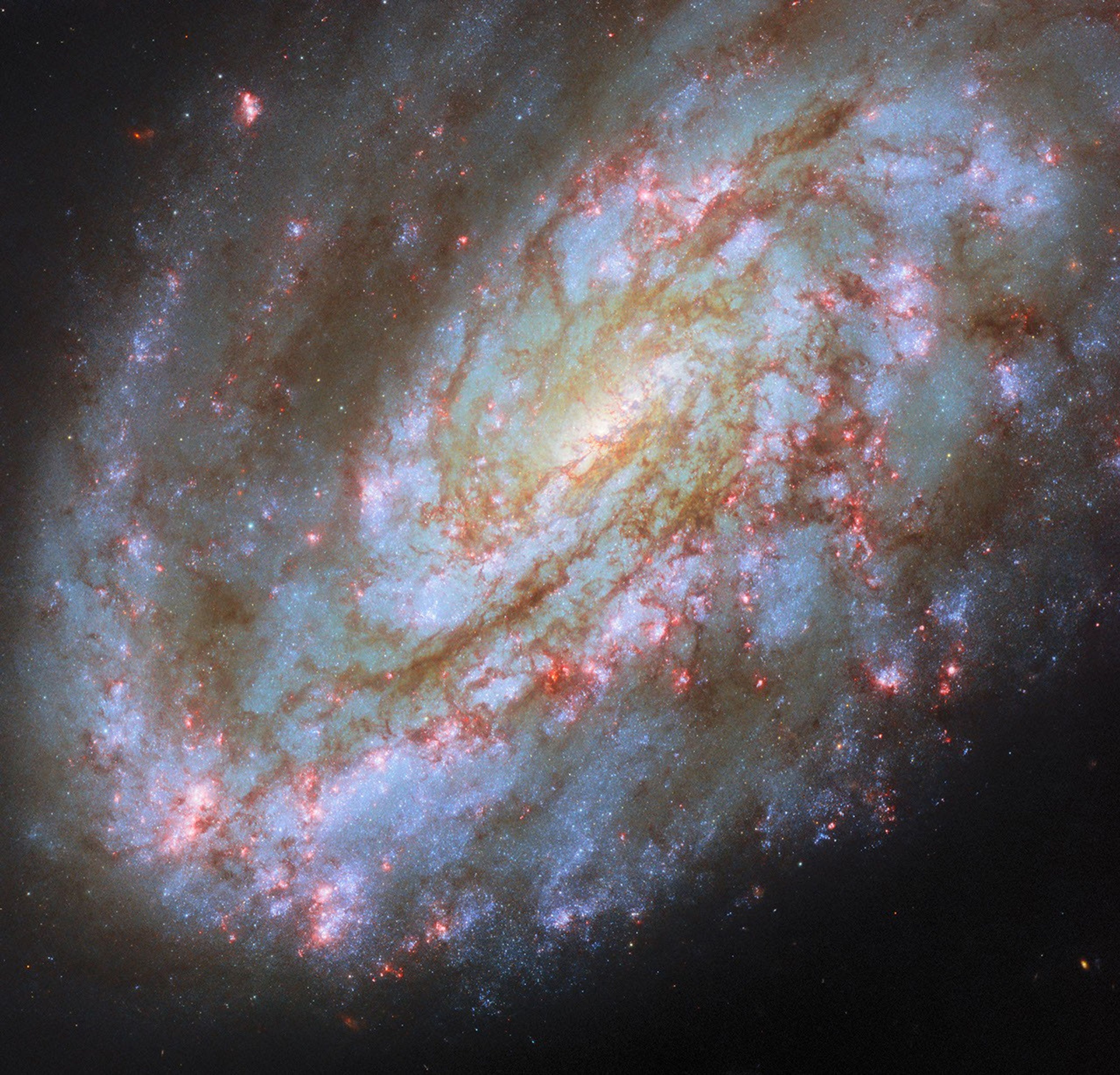
This NASA/ESA Hubble Space Telescope image features the spiral galaxy NGC 4654, located 72 million light-years away in the constellation Virgo (the Maiden).
NASA, ESA/Hubble, D. Thilker, J. Lee, and the PHANGS-HST Team
The subject of this NASA/ESA Hubble Space Telescope image is a spiral galaxy struggling against titanic forces that appear on galactic scales in space. This is NGC 4654, an intermediate spiral galaxy in the constellation Virgo (the Maiden). It is classified as an “intermediate” because its overall shape lies between spiral galaxies that have a bar across their centers and those that don’t. NGC 4654 has a weak bar structure at its center and is located 72 million light-years from Earth in the Virgo Cluster, a particularly massive and populous galaxy cluster.
NGC 4654 is particularly asymmetric, with a rounded and clearly-defined edge on one side and a long tail of gas stretching out from the opposite side — outside the field of view captured in this image. This gaseous tail is the result of ram pressure stripping, a force that galaxies can experience as they plow through space. NGC 4654 moves with such high velocity that it sweeps up and rams through the hot, rarefied gas filling the space between the Virgo Cluster’s galaxies. This intracluster medium in turn exerts a “ram pressure” on the galaxy, compressing the galaxy’s leading edge and dragging its gas behind the galaxy, creating the elongated tail.
It’s not just the galaxy’s gas that is unevenly distributed: its stars are too, and this is more unusual for a spiral galaxy. While the spiral arm on its leading edge is rich with stars and gas, the opposite arm noticeably lacks stars, influencing the galaxy’s lopsided spiral shape. Astronomers think that ram pressure alone is unlikely to cause this effect. Rather, NGC 4654 was also subjected to the gravitational force of fellow Virgo Cluster galaxy NGC 4639. While the two galaxies are far apart now, it’s thought that a fly-by interaction between them around 500 million years ago ripped away NGC 4654’s gas along one side, limiting star formation there and creating the asymmetry in its shape.
Many galaxies that undergo ram pressure stripping suffer reduced star formation rates as the cold gas that collapses to form their stars is pulled away and lost. NGC 4654, however, is still forming nearly two Suns’ worth of stars every year, a rate comparable to other galaxies of similar size. The active star formation is visible in the latest Hubble data included in this image. The data picks up on a wavelength of red light emitted by the clouds of energized gas where newborn stars lurk. The bright pink bubbles that appear across NGC 4654 — from its forward spiral arm, to around its weak bar, and out to the edge of its disk — are areas where these newborn stars shine.
The data used in this image came from two observing programs (#15654, #17502) that aim to link the gas in galaxies with star formation. By observing many prominent galaxies in the vicinity of our own, researchers hope to better understand how gas moves in galaxies, where and when it collapses to form stars and star clusters, and what effect those new stars have on the gas around them.
A dry, tan-colored valley containing a few circular irrigated fields runs roughly north-south through the image.
NASA Earth Observatory / Lauren Dauphin
Grid-like arrays of solar panels cover parts of a valley floor in a brown, dry-looking area of Utah.
NASA Earth Observatory / Lauren Dauphin
A dry, tan-colored valley containing a few circular irrigated fields runs roughly north-south through the image.
NASA Earth Observatory / Lauren Dauphin
Grid-like arrays of solar panels cover parts of a valley floor in a brown, dry-looking area of Utah.
NASA Earth Observatory / Lauren Dauphin
June 16, 2024
June 6, 2026
The nearly one million photovoltaic panels of a solar energy and battery storage facility in Utah appear in the right image, acquired with the OLI (Operational Land Imager) on Landsat 8 on June 6, 2026. The same sensor captured the left image on June 16, 2024. NASA Earth Observatory images by Lauren Dauphin.
Historically, central Utah’s Castle Valley has been a coal hub, with mining operations on the slopes of the Wasatch Plateau to the west active since the late 1800s. A different energy development arrived in the region in June 2026, when a large solar power and battery storage plant came online in the sunny valley about 130 miles (210 kilometers) southeast of Salt Lake City.
The recently constructed Green River Energy Center, seen in the Landsat 8 image above (right), features nearly one million solar panels and roughly 500 batteries on several square miles of previously undeveloped land. The facility has 400 megawatts of solar-generating capacity with another 400 megawatts of battery storage. That places it among the many utility-scale solar power and battery storage projects that the U.S. Energy Information Administration expects to be plugged into the country’s grid in 2026.
The Utah facility is slated to supply power to Salt Lake City and other areas across the state, according to news reports, and project staff estimate it could produce enough electricity for more than 100,000 homes. With its integrated battery storage, the plant has the potential to generate power at all hours, even when the Sun isn’t shining. And the Green River Energy Center can build on Castle Valley’s energy legacy by utilizing existing transmission lines originally built for coal-fired power plants in the area.
Though Utah adopted coal as its state rock and has long relied on it for energy, other sources, such as solar and geothermal, are becoming larger parts of the state’s energy mix. In 2025, coal fueled about half of the state’s electricity generation, down from about 75 percent in 2015. Meanwhile, solar grew to account for about 14 percent of generation in 2025, up from nearly zero a decade before. Satellite data can be useful to planners and policymakers involved in energy transitions for assessing the potential of renewable energy systems and tracking their adoption and performance.
NASA Earth Observatory images by Lauren Dauphin, using Landsat data from the U.S. Geological Survey. Story by Lindsey Doermann.
Curiosity Blog, Sols 4954–4960: Celebrating Our Rover Engineers Past and Present
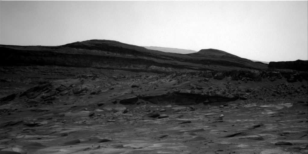
In this image acquired by NASA’s Mars rover Curiosity, the relatively light-toned bedrock in the foreground gives way to darker-toned rocks in the middle of the image, along what could be an erosional surface. Curiosity acquired the image using its Right Navigation Camera on July 15, 2026 — Sol 4955, or Martian day 4,955 of the Mars Science Laboratory mission — at 05:51:59 UTC.
NASA/JPL-Caltech
Written by Lucy Thompson, Senior Research Scientist, University of New Brunswick, Canada
Earth planning date: Friday, July 27, 2026
As an APXS uplink lead and strategic planner, I have the privilege of working with the rover engineers most days that I am on operations. The APXS instrument measures the chemistry of rocks, unconsolidated materials and the atmosphere, and is situated on the end of Curiosity’s robotic arm. This means that any target of interest that we wish to analyze has to be safe to deploy the arm, APXS, and MAHLI (the closeup imager) to. We therefore rely on the rover engineers for their assessment and to sequence the arm moves to place us safely on the targets. Recently, our workspaces have been dusty with varied relief, but the rover engineers have successfully found areas that they have been able to brush and deploy APXS and MAHLI. This week was no exception, despite some of our workspaces appearing less than ideal upon initial observation. The team managed to find rock targets of interest (x5), which the rover engineers were able to safely place the arm on and brush so that we could analyze them with APXS and MAHLI. This ensures that we acquire high-quality compositional data and images as we continue our ascent of Mount Sharp, through rock layers of varying tone and texture, tracking potential changes in chemistry, and the depositional and alteration environment.
The rover engineers are also responsible for safely driving Curiosity to the areas of interest identified by the science team. They must assess the terrain for potential hazards such as large resistant blocks that could damage the rover wheels, sand/soil patches where we could get stuck, and high slopes that the rover could slip on. Despite unexpected damage to the wheels early in the mission and getting a little bogged down in some soil/sand just as we started to climb Mount Sharp, the engineers have successfully navigated us safely along more than 23 miles (37 kilometers) of drive distance and more than 4,400 feet (about 1.35 kilometers) of elevation gain. We recently requested to drive to specific locations in order to image what the team thinks could be an erosional surface within the Mg-sulfate/carbonate-bearing unit (see the image accompanying this post). Of course, the engineers were able to accommodate our desires, with the first stop crossed off in Monday’s plan, and the drive that is being planned this weekend taking us toward the next stop.
The rover engineers also ensure that our drilling activities execute safely and successfully, and are responsible for sequencing the arm motion required to deliver the drilled samples to our internal CheMin and SAM instruments. This required completely reconfiguring how we drill after a motor failed back in 2016, with extensive behind-the-scenes work at JPL for nearly a year and a half before we resumed. Curiosity has since drilled more than 20 rock targets.
So, thanks to the rover engineers and all the engineers and scientists on Curiosity’s team, we have had another full week of activities at Gale crater. We continue to track the chemistry, textures, tone and sedimentary structures of the sulfate/carbonate unit as we climb Mount Sharp and get ever closer to the Yardang unit with APXS, ChemCam, MAHLI and Mastcam. Curiosity continues to also monitor the local environment within Gale and the atmosphere in general.
Continuing agency efforts to bring space closer to home, NASA+ is heading to more streaming platforms. On Thursday, NASA announced its programming is on Fire TV Channels. Fire TV customers can easily access this content by asking Alexa+ on compatible devices.
Future programming on Fire TV may include science mission launches, a test flight for rendezvous and docking with human landing systems, robotic lunar deliveries, the first crewed mission to the Moon under Artemis, and more. As always, NASA+ also remains available for free, with no ads, through the NASA app and on the agency’s website.
“The National Aeronautics and Space Act of 1958 calls on us to share our story of space exploration with the broadest possible audience, and our streaming partners help us accomplish that,” said Rebecca Sirmons, general manager of NASA+ at the agency’s Headquarters in Washington. “Artemis II captured the hearts and minds of viewers globally, inspiring the Artemis generation. As we work toward building humanity’s first Moon Base, we will continue to provide transparent, engaging content coverage every step of the way.”
Earlier this year during its Ignition event, NASA shared plans for a bold path forward for the agency, including increasing its cadence of Artemis missions to the lunar surface, and building the first Moon Base, among other agency priorities. This distribution partnership is another step in executing NASA’s promise to the public for a greater look into the agency, making mission and educational content available on multiple devices for viewers on their preferred channels.
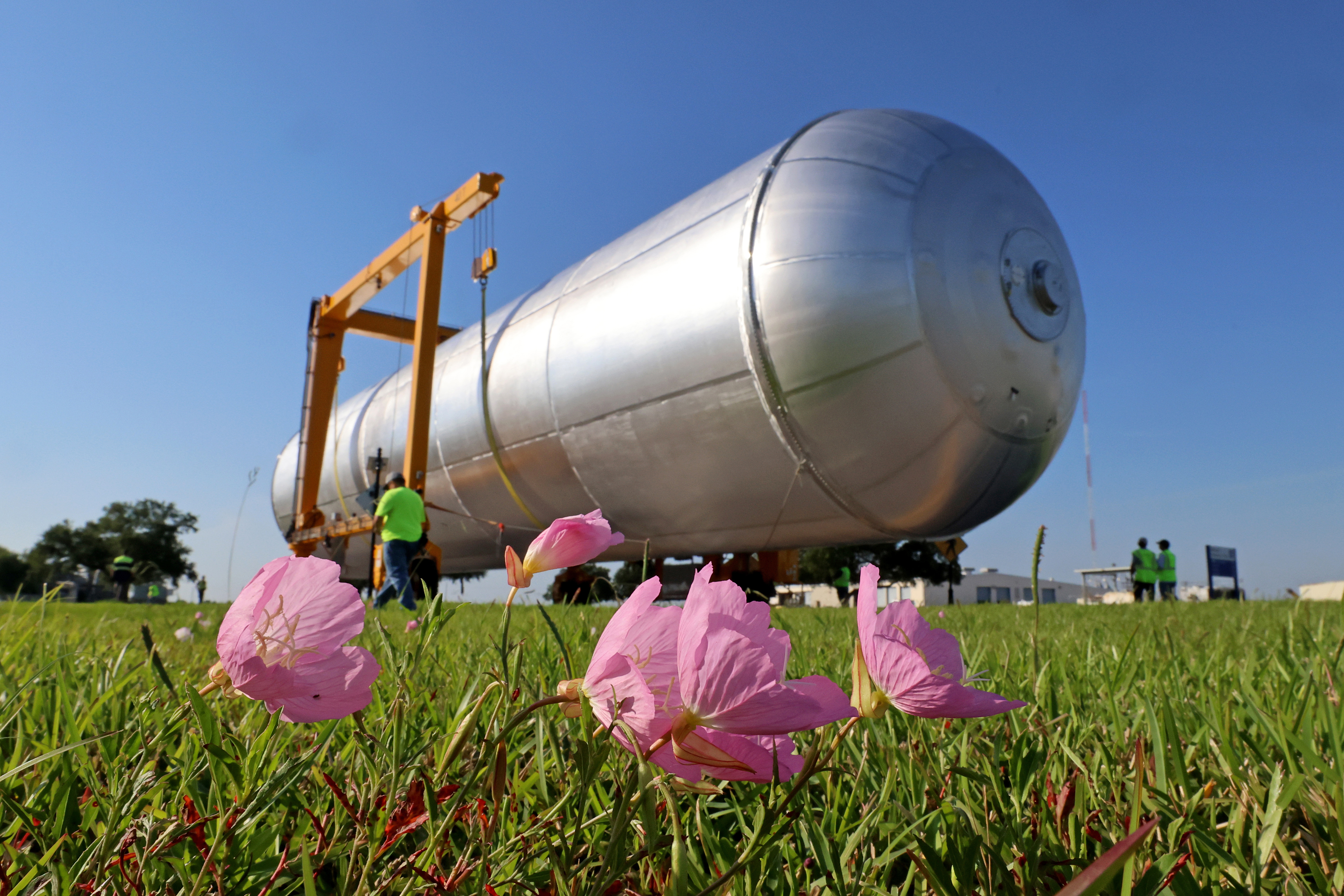
Crews at NASA’s Michoud Assembly Facility in New Orleans transport the 130-foot-tall Artemis IV liquid hydrogen tank out of a production cell inside the main factory building into a detached test building on a separate portion of the 829-acre site on May 15, 2026. The liquid hydrogen tank will form part of the core stage for the SLS (Space Launch System) rocket, providing thousands of gallons of super-cold propellant to one of four RS-25 engines.
This illustration depicts charged particles from a solar storm stripping away charged particles of Mars’ atmosphere, one of the processes of Martian atmosphere loss studied by NASA’s MAVEN mission.
NASA/GSFC
NASA MAVEN (Mars Atmosphere and Volatile Evolution) mission scientists have uncovered a key puzzle piece in understanding certain types of auroras on Mars, finding that they form in a similar way to Earth-based auroras.
Results published Thursday in Nature Communications show the same mechanism that circulates and catapults charged particles into Earth’s atmosphere is happening at Mars on much smaller scales because of differences in the two planets’ magnetic fields.
The MAVEN spacecraft, in orbit around Mars, experienced a loss of signal with ground stations on Earth on Dec. 6, 2025. On June 3, NASA declared the mission had concluded after finding the spacecraft to be unrecoverable. However, data from the mission is still being used to inform NASA science and future missions to Mars.
When the Sun’s magnetic field lines get close to Earth’s magnetosphere, the large magnetic bubble protecting the planet, they can reconnect and inject energy and mass throughout Earth’s magnetosphere and magnetotail, ultimately firing electrons back into the atmosphere to generate Earth’s auroras. This process, called the Dungey cycle, drives electrical currents, accelerates charged particles that create auroras, and controls the circulation of plasma in Earth’s magnetosphere and ionosphere.
This new study shows that a miniature version of the Dungey cycle is happening over Mars’ strong crustal magnetic fields, which gives scientists a better look into the physics of Martian auroras.
“We knew that magnetic reconnection was happening at Mars but did not expect it to be like the Dungey cycle,” said Shaosui Xu, lead author of the study and associate research physicist at the Space Sciences Laboratory at the University of California, Berkeley.
Mars does not have a global magnetic field like Earth. Earth’s magnetic field is created by our planet’s churning core, while Mars has numerous miniature magnetospheres that arise from intensely magnetized crust scattered around the planet. These regions were formed around 4 billion years ago when lava cooled in the presence of Mars’ ancient global magnetic field, which has since disappeared due to intense solar wind stripping the planet’s atmosphere.
The MAVEN mission has observed highly localized auroras over these crustal fields, similar to Earth’s auroras at the poles, but it wasn’t until now that scientists could fully understand the physics of how they form. The study used several instruments aboard the MAVEN spacecraft to build up a picture of the Dungey-like behavior: the Magnetometer and Solar Wind Electron Analyzer instruments, which were used to determine the magnetic configuration and derive electrical currents, and the STATIC (Suprathermal and Thermal Ion Composition) instrument, which was used to measure plasma flows in the ionosphere.
“We really pushed the limit of STATIC to get the data we needed,” said Xu. “It was the final piece to the puzzle in understanding these localized auroras.”
The realization that a Dungey-like cycle was happening within these crustal magnetic fields answered the question of how the electrons were being energized to create the auroras. It also shows that a Dungey-like mechanism can happen on both large and small scales, giving more insight into where in the solar system this process could be taking place.
“This is a remarkable result that changes how we think of Martian auroras and is another important step toward understanding why Mars and Earth have evolved so differently despite being governed by the same underlying physics.” said Shannon Curry, MAVEN’s principal investigator and a research scientist at the Laboratory for Atmospheric and Space Physics at the University of Colorado Boulder. “I am incredibly proud of our team’s work on this discovery and excited to uncover new insights into the Red Planet and its evolution.”
By finding out more about this process, scientists also are gaining a better understanding of how the solar environment interacts with the Red Planet as a whole, which is essential for future robotic and crewed missions.
“I remember in graduate school discussing with my advisor how the cycling of crustal magnetic fields could work at Mars,” said Xu. “It’s incredible to be part of the team that found the answer to that question.”
The MAVEN mission is part of NASA’s Mars Exploration Program portfolio. The mission’s principal investigator is based at the Laboratory for Atmospheric and Space Physics at the University of Colorado Boulder, which also is responsible for managing science operations and public outreach and communications. NASA’s Goddard Space Flight Center in Greenbelt, Maryland, manages the MAVEN mission. Lockheed Martin Space built the spacecraft and is responsible for mission operations. NASA’s Jet Propulsion Laboratory in Southern California provides navigation and Deep Space Network support.
For more information on NASA’s MAVEN mission, visit:
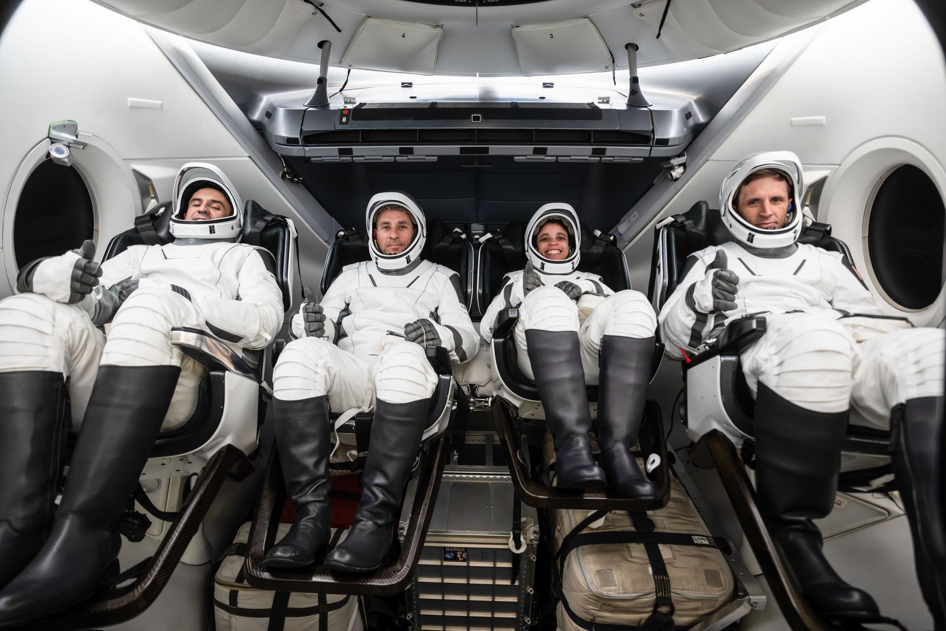
NASA’s SpaceX Crew-13 members are pictured in their pressure suits seated inside a mockup Dragon spacecraft during a preflight training session at the company’s headquarters in Hawthorne, California. From left are Roscosmos Sergey Teteryatnikov, NASA astronauts Luke Delaney and Jessica Watkins, and CSA (Canadian Space Agency) astronaut Joshua Kutryk.
Credit: SpaceX
NASA and its partners will discuss the upcoming crew rotation mission to the International Space Station during a pair of news conferences on Monday, Aug. 3, from the agency’s Johnson Space Center in Houston.
Mission leadership will provide an overview of NASA’s SpaceX Crew‑13 mission at 12 p.m. EDT. Next, crew members will discuss their training and mission preparations at 2 p.m. This is Crew-13’s final media availability prior to traveling to the agency’s Kennedy Space Center in Florida for launch.
NASA will stream these events live. Learn where to watch online:
The Crew-13 mission will carry NASA astronauts Jessica Watkins and Luke Delaney, CSA (Canadian Space Agency) astronaut Joshua Kutryk, and Roscosmos cosmonaut Sergey Teteryatnikov to the orbiting laboratory. The crew will launch aboard a SpaceX Dragon spacecraft on the company’s Falcon 9 rocket from Space Launch Complex 40 at Cape Canaveral Space Force Station in Florida no earlier than mid-September.
International media attending in person must email the NASA Johnson newsroom at jsccommu@mail.nasa.gov by 5 p.m., Tuesday, July 21. United States-based media attending in person must respond by 5 p.m., Thursday, July 30. Media joining virtually must respond by 10 a.m. the day of the event. NASA’s media accreditation policy is available online.
Briefing participants are as follows (all times Eastern and subject to change based on real-time operations):
12 p.m.: Mission Overview News Conference
Joel Montalbano, deputy associate administrator, Human Spaceflight Mission Directorate, NASA Headquarters
Dana Weigel, manager, Low Earth Orbit Program, NASA Johnson
Mathieu Caron, director, Astronauts, Life Sciences, and Space Medicine, CSA
Julianna Scheiman, director, NASA Science and Dragon Programs, SpaceX
Following the news conference, crew members will be available for limited media interviews. All interview requests must be submitted by 5 p.m. on July 30, to the NASA Johnson newsroom at: jsccommu@mail.nasa.gov.
This will be the second flight to the space station for Watkins, who was selected as a NASA astronaut in 2017. Watkins grew up in Lafayette, Colorado, and earned an undergraduate degree in geological and environmental sciences from Stanford University, as well as a doctorate in geology from the University of California, Los Angeles. As a geologist, she studied the Martian surface and was a member of the Curiosity rover science team at NASA’s Jet Propulsion Laboratory in Southern California. Watkins first launched to the space station as a crew member aboard NASA’s SpaceX Crew-4 mission, spending a total of 170 days in space across space station Expeditions 67/68 in 2022. She will be the first NASA astronaut to launch aboard a SpaceX Dragon spacecraft twice.
Selected as a NASA astronaut in 2021, Delaney earned a bachelor’s degree in mechanical engineering at the University of North Florida and a master’s degree in aerospace engineering at the Naval Postgraduate School. The Florida native is a distinguished naval aviator who participated in exercises throughout the Asia Pacific region and conducted missions in support of Operation Enduring Freedom. As a test pilot, Delaney evaluated developmental aircraft systems and served as a test pilot instructor. He also worked as a research pilot at NASA’s Langley Research Center in Hampton, Virginia, where he supported airborne science missions. This is the first spaceflight for Delaney.
The Crew-13 mission also is the first spaceflight for Kutryk. Prior to his selection as a CSA astronaut in 2017, he served as a CF-18 fighter pilot, flying missions in support of Canada’s NATO, U.N., and North American Aerospace Defense Command commitments. A native of Fort Saskatchewan, Alberta, Kutryk also worked as an experimental and operational test pilot at the Aerospace Engineering Test Establishment in Cold Lake, Alberta. Kutryk received a bachelor’s degree in mechanical engineering from the Royal Military College of Canada in Kingston, Ontario, and he is a distinguished graduate of the United States Air Force Test Pilot school in Edwards, California. He has master’s degrees in space studies, flight test engineering, and defense studies.
This mission will be Teteryatnikov’s first trip to the orbiting laboratory. He graduated from the Naval Academy, St. Petersburg, Russia, in 2011 as an engineer specializing in ship power plant operations. Before his selection as a test cosmonaut, Teteryatnikov served in various naval engineering roles, including undersea vessels and specialized engine room operations. He was selected for the Gagarin Research and Test Cosmonaut Training Center Cosmonaut Corps in 2021 and has served as a test cosmonaut since 2023.
Preparations for Next Moonwalk Simulations Underway (and Underwater)
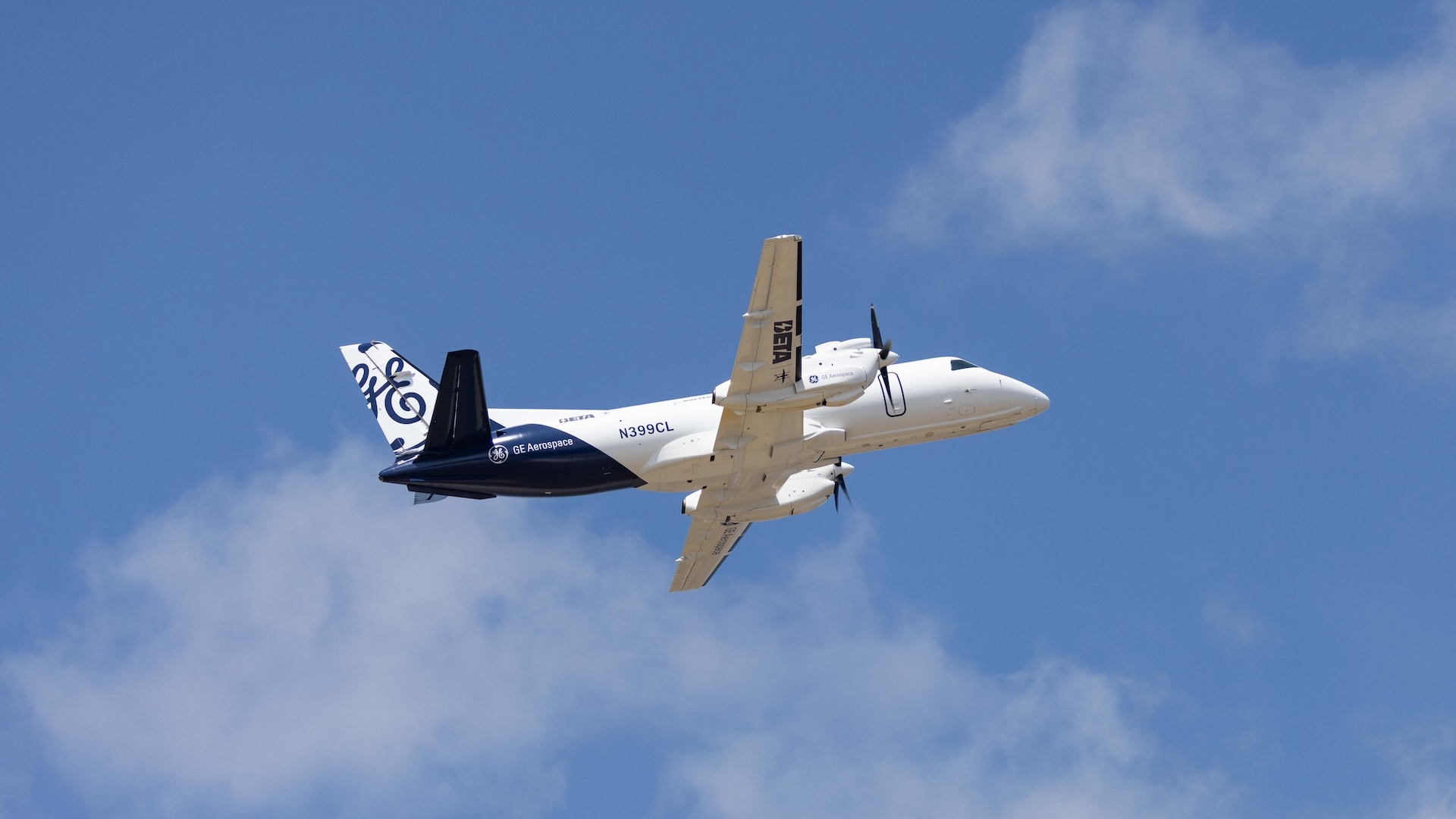
A modified Saab 340B aircraft in flight powered in part by a hybrid electric system built by GE Aerospace, along with NASA, BETA Technologies, and Boeing.
GE Aerospace
An aircraft powered by a megawatt-class hybrid-electric engine developed in collaboration with NASA and built by GE Aerospace, demonstrated flight of an innovation that can inform new generations of fuel-saving aircraft power systems.
Mounted to a Saab 340B aircraft, the engine flew at Farnborough International Air Show in the United Kingdom. It was the public debut of a system that has in recent months made historic test flights, becoming the first hybrid electric-powered aircraft to fly above 30,000 feet.
“This achievement reflects what NASA does best in aeronautics: we explore bold possibilities, validate them through rigorous research and testing, and work with industry to turn breakthrough ideas into technologies that bring real value for the American people,” said Laurie Grindle, director of the Aeronautics Division within the agency’s Research and Technology Mission Directorate at NASA Headquarters in Washington.
The testing leveraged work done through NASA’s former Electrified Powertrain Flight Demonstration project and the agency’s ongoing Subsonic Vehicle Technologies and Tools project – years of collaborative research that included key testing at NASA test facilities.
The engine integrates electric motors, a gas turbine, and energy storage capabilities. It was designed to demonstrate the capacity to power an aircraft around the size of a regional-class jet, reducing fuel burn and costs without sacrificing performance. The unit’s technology and designs are expected to be used to help develop future hybrid systems that could lower airline operating costs.
The demonstration flight came after years of rapid development for the technology. For NASA, it also validates work that stretches back to a time when hybrid aviation propulsion seemed almost beyond the horizon of possibility.
This achievement reflects what NASA does best in aeronautics: we explore bold possibilities, validate them through rigorous research and testing, and work with industry to turn breakthrough ideas into technologies that bring real value for the American people.
LAURIE A. GRINDLE
Director of the Aeronautics Division within the agency's Research and Technology Mission Directorate
“This is the culmination of more than 15 years of work, and we did that because it’s going to have an impact for aircraft that will help reduce energy use and help U.S. companies and the public,” said Ralph Jansen, aerospace engineer at NASA’s Glenn Research Center in Cleveland. “It’s about having a vision that no one believes can happen and then doing the work to define and execute the research and development needed to make it happen.”
This accomplishment was possible because of the collaborative effort of hundreds of people working on Electrified Powertrain Flight Demonstration and Subsonic Vehicle Technologies and Tools projects across NASA centers, in conjunction with GE Aerospace and its partner companies.
Hybird-Electric Evolves
In recent years, aviation has seen a boom in small aircraft and drones powered by electrical systems drawing from batteries. But large passenger and cargo planes require complex engines capable of supplying massive amounts of power. So more than a decade ago when NASA began contemplating hybrid systems, just the possibility of using electric motors to supplement some energy was a daunting engineering challenge.
NASA spent about seven years performing preliminary research, working with small businesses and other partners to consider technological obstacles and the potential commercial viability of hybrid systems. During that time, the agency addressed several barriers to implementation including the power, thermal, and battery technology, and the integration of the power system, engine, and aircraft.
Through the agency’s Electrified Powertrain Flight Demonstration award, GE Aerospace and NASA worked with researchers to develop lighter and more efficient power systems and shrink key components – sometimes dramatically.
NASA and GE Aerospace also leveraged agency facilities and resources to further their research. In 2022, GE Aerospace tested an integrated version of its propulsion system at NASA’s Electric Aircraft Testbed at the agency’s Neil A. Armstrong Test Facility in Sandusky, Ohio. Testing allowed the system to operate in conditions simulating 45,000 feet in altitude, the range in which commercial single-aisle aircraft fly.
The team added components, including electric motors, power converters, propellers, and a GE Aerospace commercial engine, followed by more ground tests and eventual flight tests. For the researchers who’d spent years on the concept, seeing the engine powering an aircraft in flight was a major step in a long journey.
“I’ve got to say, I was pretty touched seeing it fly. It was just awesome,” Jansen said. “It’s just like a regular plane, which is probably the best thing of all.”
NASA’s current support for this research is through the Aeronautics Division of its Research and Technology Mission Directorate.
New NASA Earth Missions Gear Up to Start Science Flights
Satellite imagery captured wildfires burning hot enough to generate pyrocumulonimbus clouds north of Lake Superior in July 2026. NASA aircraft will help scientists study the powerful storms as they develop.
Credits: CSU/CIRA & NOAA
Landslides in Alaska. Air quality in Atlanta. Fire clouds out West. From the Arctic fringes to farm country, NASA’s newest class of suborbital Earth Venture missions is gearing up to deliver science that will benefit communities in the United States and beyond.
The six projects will mobilize hundreds of scientists and pilots from NASA, the U.S. Navy, universities, and other institutions over the next several years. While the investigations range across topics, a defining feature of suborbital missions is the use of sensors mounted on aircraft.
Airborne remote sensing serves as a bridge between ground-based instruments and satellites. Data collected via planes, helicopters, drones, and balloons can fill in gaps in computer models used by weather forecasters, city planners, and others.
When wildfires create their own weather
The first project to take wing this summer is Injected Smoke and PYRocumulonimbus Experiment (INSPYRE), led by the Naval Research Laboratory. From mission headquarters in Colorado, the team will chase one of the least understood forms of severe weather on Earth: towering “fire clouds” generated when extreme wildfires burn hot enough to brew their own thunderstorms.
Pyrocumulonimbus clouds crackle with lighting in imagery captured over Utah and Colorado by the GOES-18 satellite in early July 2026.
CSU/CIRA & NOAA
Smoky and crackling with lightning, these unique storms can create blind spots for aviators above and spark new blazes below. Measuring and mapping the dangerous storms as they develop in real-time will help scientists forecast them in the future. Several aircraft, including NASA’s high-altitude ER-2, flying out of Montana, will carry a large suite of instruments over wildfire-generated storm systems. Among them will be two state-of-the-art infrared wildfire trackers, which were developed at NASA’s Jet Propulsion Laboratory (JPL) in Southern California and will be flying as part of the agency’s FireSense program.
Testing the air over farmland, megacities
Agricultural emissions represent an important and understudied part of Earth’s land and atmosphere systems. The FarmFlux mission, which kicks off this year, will deploy more than a dozen sensors to measure ozone, methane, ammonia, particulates, and other pollutants rising from agricultural lands and animal farms stretching from the Midwest to California’s Central Valley. These emissions affect human health, global climate, and stratospheric ozone. The mission is led by NASA’s Goddard Space Flight Center in Greenbelt, Maryland, along with Colorado State University, and Boston University.
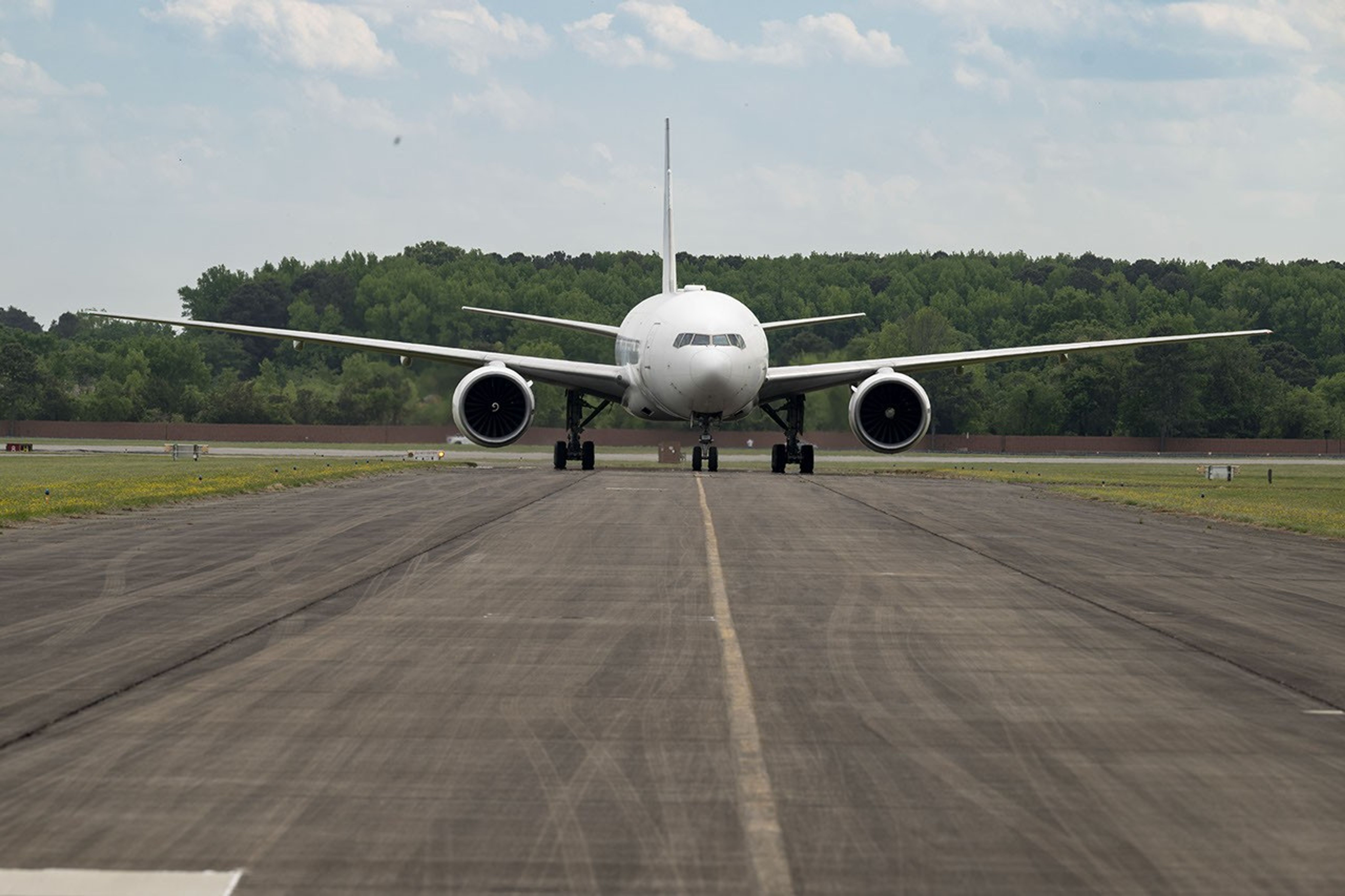
NASA’s 777 aircraft is gearing up to start science flights. Structural modifications – like enlarged cabin windows and instrument portals – have transformed the former passenger plane into a flying laboratory. It’s seen here at Langley Research Center in Hampton, Virginia, in April 2026.
NASA/Ryan Hill
Two North American cities with air quality concerns are Atlanta and Mexico City. But the causes differ, with weather and terrain playing a role. To explore these differences, the Hemispheric Airborne Measurements of Air Quality (HAMAQ) mission will investigate areas of poor air in the two capitals and test how satellite information can help forecasting and mitigation efforts. The team will deploy two aircraft at different altitudes: NASA’s P-3B will fly close to the surface, directly measuring fine particle and gaseous pollutants, while the recently acquired 777 science jet will soar high above, mapping pollution with remote sensors. NASA’s Langley Research Center in Hampton, Virginia, is leading the mission.
Fast-changing north
As the Arctic warms at least twice as fast as the rest of Earth, data collected today can help guide communities on the front lines of change.
Alaska’s glaciers are losing ice and contributing to sea level rise. NASA is tracking the changes from land, air, and space.
NASA
The Snow4Flow campaign, led by the University of Arizona, seeks to measure and model how far and fast glaciers are retreating in the far north. Traversing remote icescapes across Alaska, the Yukon, Arctic Canada, Greenland, and Svalbard, Norway, they’ll sound both the near-surface and frozen depths of hundreds of glaciers while flying over in a modernized WWII-era aircraft outfitted with a scanning laser altimeter and two custom radars. Their observations, combined with satellite data and advanced models of snowfall and glacier flow, will advance our understanding of how glaciers behave in different regions of the Arctic. The mission seeks to uncover not just what these glaciers look like beneath the surface today, but the processes that will drive changes in the future.
As permafrost thaws, rivers on the doorstep of the Arctic become conveyor belts of carbon and sediment. NASA Goddard, and the City College of New York lead a multidisciplinary team studying how rivers, lagoons, and estuaries across Alaska’s North Slope interact with the Arctic Ocean. The project, called Frontlines of Rapidly Transforming Ecosystems (FORTE) will combine optical and radar measurements from satellites, planes, high-tech research vessels, drones, and underwater autonomous systems to track microscopic marine life, water flow, and chemistry. The team will collaborate with local and tribal communities to sustain observations over time and apply NASA assets to address emerging local needs and decision-making priorities.
Landslide triggers
When a slow-moving landslide in California suddenly collapsed and buried a section of coastal highway in 2017, scientists at NASA JPL wanted to know how precipitation swings played a role. JPL studies how water infiltrates and destabilizes hillslopes all over the world. The Landslide Change Characterization Experiment (LACCE) project will combine airborne synthetic aperture radar with land-based sensors to track how slopes in California are responding to a world of intensifying droughts and downpours. The project also takes aim at emerging landslide hazards in Alaska, where rapidly retreating glaciers are accelerating slope movements that have the potential to create mega-tsunamis.
This series of images shows the collapse of the Mud Creek landslide in May 2017 along the Big Sur coast in Central California, and the subsequent repairs to Highway 1, which was damaged during the event.
Andy Ritchie/USGS Pacific Coastal and Marine Science Center
NASA’s Earth Venture Suborbital program, designed to be nimble and high impact, was established following a recommendation by the National Research Council in 2007. In the decades since, teams have studied phenomena, including blizzards, coral reefs, and ocean whirlpools.
Preparations for Next Moonwalk Simulations Underway (and Underwater)
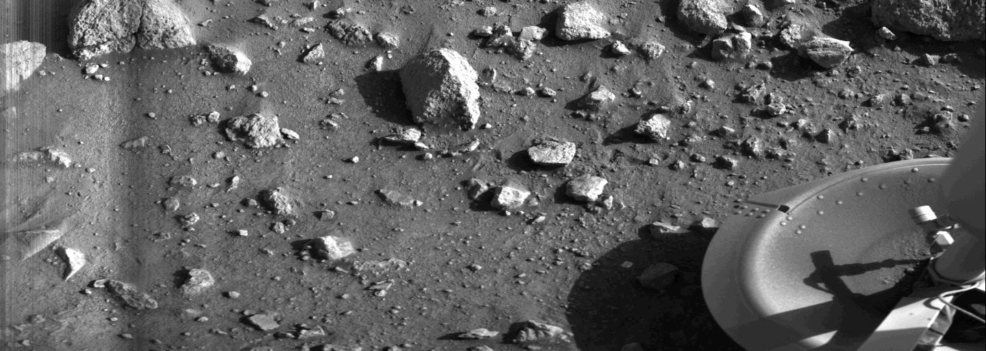
This historic image — the first from the surface of Mars — confirmed that NASA’s Viking 1 lander had become the first spacecraft to touch down on the Red Planet on July 20, 1976.
NASA/JPL-Caltech
Fifty years ago, NASA’s Viking 1 and 2 landers made the first successful landings on Mars, opening a new era in planetary exploration. Behind that achievement was a team at NASA’s Langley Research Center in Hampton, Virginia, whose steady leadership and technical expertise helped turn an ambitious idea into a mission that reshaped how we explore other worlds.
Building the Blueprint for Mars
NASA selected Langley in 1968 to lead the massive Viking project, the first U.S. mission designed to land safely on Mars and search for signs of life. Project Manager James S. Martin Jr. set the tone from the start. He wanted clear priorities, tough engineering reviews, and the discipline to test every system until the team was confident it would perform on Mars.
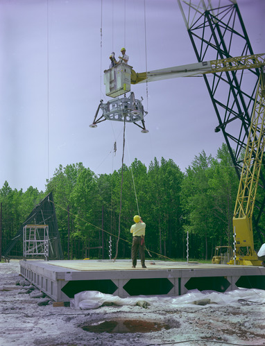
A full-scale Viking model is suspended in the air at NASA Langley’s Landing and Impact Research Facility.
NASA
Entry, Descent, and Landing
Langley engineers faced a challenge unlike anything attempted before: slowing a spacecraft plunging into the Martian atmosphere at more than 10,000 miles per hour. So they leaned into their expertise in atmospheric entry aerodynamics, heat shielding, and parachute technology. Their work produced the protective aeroshell and heat shield, as well as the supersonic parachute. These systems didn’t come from theory alone — they were shaped by years of wind‑tunnel tests, analysis, and problem‑solving. Langley still excels at entry, descent, and landing systems today.
Science and Safety, Hand in Hand
Langley also helped create a new approach to finding safe landing sites. Teams combined images from Viking’s orbiters with radar data from Earth‑based observatories to identify regions that balanced scientific value with engineering safety — a method now standard for Mars missions.
Viking also changed how mission teams operated. Engineers and scientists adopted the sol — a Martian day slightly longer than 24 hours — to keep daily work aligned with local time on Mars, a practice still used for surface missions.
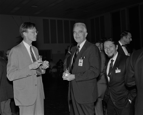
From left to right, Dr. Thomas Mutch, Brown University, James Martin, Viking Project manager; and Dr. Gerald Soffen, Viking Project scientist talk at a Viking Science Review.
NASA
A Mission Reborn: From Voyager to Viking
Viking grew out of a pivotal program shift. The earlier Voyager Mars lander concept was canceled because it was too costly and risky, relying on two large landers stacked on a single Saturn V rocket. Langley helped chart a more realistic path forward, pairing each lander with its own orbiter and using Titan IIIE‑Centaur rockets instead. The new design preserved scientific ambition while making the mission achievable.
A Legacy That Endures
Viking provided an early model for how NASA could explore the solar system: scout with orbiters, certify landing sites with real data, and land only with systems tested well beyond their limits. That “planetary playbook,” shaped heavily by Langley, provided a guide for future Mars missions like Curiosity and Perseverance.
The two landers returned thousands of images and groundbreaking data, revealing Mars as a world with weather, geologic history, and complexity that scientists are still studying today. And while no human has ever set foot on the Martian surface, Viking proved that reaching another planet — and working on it — was within reach.
As the 50th anniversary of those landings arrives, Langley’s influence is unmistakable. The center continues to advance new entry, descent, and landing technologies, and explore concepts that will support future human explorers. The same spirit that guided Viking still drives the work happening in Hampton today — steady, curious, and always looking toward the next horizon.
Famous scientist Dr. Carl Sagan, center, speaks with two other men at a Viking Science Symposium Biology Conference at NASA Langley.
On the morning of July 20, 1976, roughly 40 minutes after mission controllers received word that the Viking 1 lander had successfully touched down on the surface of Mars, this photo gave us our first view from the surface of another planet.
NASA/JPL
“Touchdown, we have touchdown!” At 5:12 a.m. PDT, July 20, 1976, mission controllers at NASA’s Jet Propulsion Laboratory erupted in cheers as they learned that the Viking 1 lander had survived its descent through the thin Martian atmosphere. Forty minutes later, the lander’s first image began to appear on their monitors, slowly forming line by line from left to right. For the first time, humans were able to see Mars’s rocky terrain from its surface.
Dr. Thomas Mutch, leader of the Viking lander imaging team, described the moment: “I studied the black screen, waiting for that narrow strip that will signal the first few lines of the first picture. And it appeared. A sliver of electronic magic. Areas of brightness and darkness. The picture begins to fill the screen. Rocks and sand are visible and — finally at the far right — one of the spacecraft foot pads, a symbolic artifact that stamps our accomplishment with the sign of reality. Time and time again I repeat, ‘It’s incredible.’”
Fifty years ago today, the Viking 1 lander became NASA’s first robot to explore Mars’s surface and begin the search for signs of life in our solar system. Viking 1 was joined six weeks later by its twin lander, Viking 2, which explored a different region of Mars, while two mission orbiters that delivered the landers to the Red Planet continued to collect data from space and helped relay communications to Earth.
Learn more about what Viking found and NASA’s legacy of discovery on Mars at Viking: 50 Years on Mars.
Seattle, Washington—sometimes known as the “Emerald City”—was glimmering in the morning sunlight when an astronaut aboard the International Space Station took this photo on June 16, 2026. The city’s parks and tree-filled neighborhoods lend a lush, green look to the metropolis, while tall buildings downtown cast long shadows and ships navigate surrounding waterways.
The broad contours of the city’s landscape and the water around it owe their shape to the advance and retreat of glaciers during the last ice age. Between roughly 18,000 and 16,000 years ago, the Puget lobe of the Cordilleran ice sheet covered the area in a mass of ice up to 3,300 feet (1,000 meters) thick. The glacier scoured the basins now occupied by Puget Sound and the region’s lakes.
The glacier left its mark above water, too. Several of Seattle’s notorious hills (of which there are seven or more, depending on who’s counting) are drumlins. These elongated mounds of glacial debris run north-south, parallel to the direction of the ice’s movement. East-west travelers in the city, facing challenging ups and downs, may attest to this topographic trend.
The ice also transported large boulders called glacial erratics from more northerly locations and deposited them around the region. A particularly large erratic, the Wedgwood Rock, stands about 20 feet (6 meters) tall and draws its name from the North Seattle neighborhood in which it rests.
June 16, 2026
In more recent times, humans have undertaken projects to rework the topography. Notable alterations include leveling Denny Hill north of downtown and filling in tideflats at the mouth of the Duwamish River south of downtown, which created around 1,300 acres of new land. Seattle’s professional sports stadiums sit atop this fill.
This photo was acquired after several development projects to update waterfront infrastructure downtown, initiated in 2010, were completed. These include a new ferry dock and terminal, a rebuilt seawall, and a tunnel to replace an above-ground highway and create more inviting public access to the waterfront.
Some replumbing of the region’s waterways is apparent from the astronaut’s perspective, as well. In the 1910s, the Army Corps of Engineers built canals on either side of Lake Union to connect Puget Sound (an inlet of the Pacific Ocean) with Lake Washington. Starting in 1916, the Montlake Cut connected Lake Washington to Lake Union, and the Ballard Locks, northwest of Lake Union, began raising and lowering watercraft between the freshwater lakes and tidal Puget Sound. As a result of this project, Lake Washington’s water level dropped about 9 feet (3 meters) and ceased draining from its natural outlet at its southern end.
Today, the waters in and around Seattle support many uses: container ships, cruise ships, car and passenger ferries, floatplanes, and recreational craft ply the sound and lakes. And as for Seattle’s emerald nickname, pockets of old-growth forest still exist within city limits, containing centuries-old trees such as Douglas fir, Western red cedar, and Western hemlock. Seattleites often spot wildlife such as bald eagles, coyotes, and sea lions in the city’s various habitats.
Astronaut photograph ISS074-E-723719 was acquired on June 16, 2026, with a Nikon Z9 digital camera using a focal length of 560 millimeters. It is provided by the ISS Crew Earth Observations Facility and the Earth Science and Remote Sensing Unit at NASA Johnson Space Center. The image was taken by a member of the Expedition 74 crew. The image has been cropped and enhanced to improve contrast, and lens artifacts have been removed. The International Space Station Program supports the laboratory as part of the ISS National Lab to help astronauts take pictures of Earth that will be of the greatest value to scientists and the public, and to make those images freely available on the Internet. Additional images taken by astronauts and cosmonauts can be viewed at the NASA/JSC Gateway to Astronaut Photography of Earth. Story by Lindsey Doermann.
NASA Pushes New Wing Design to Find Structural Limits
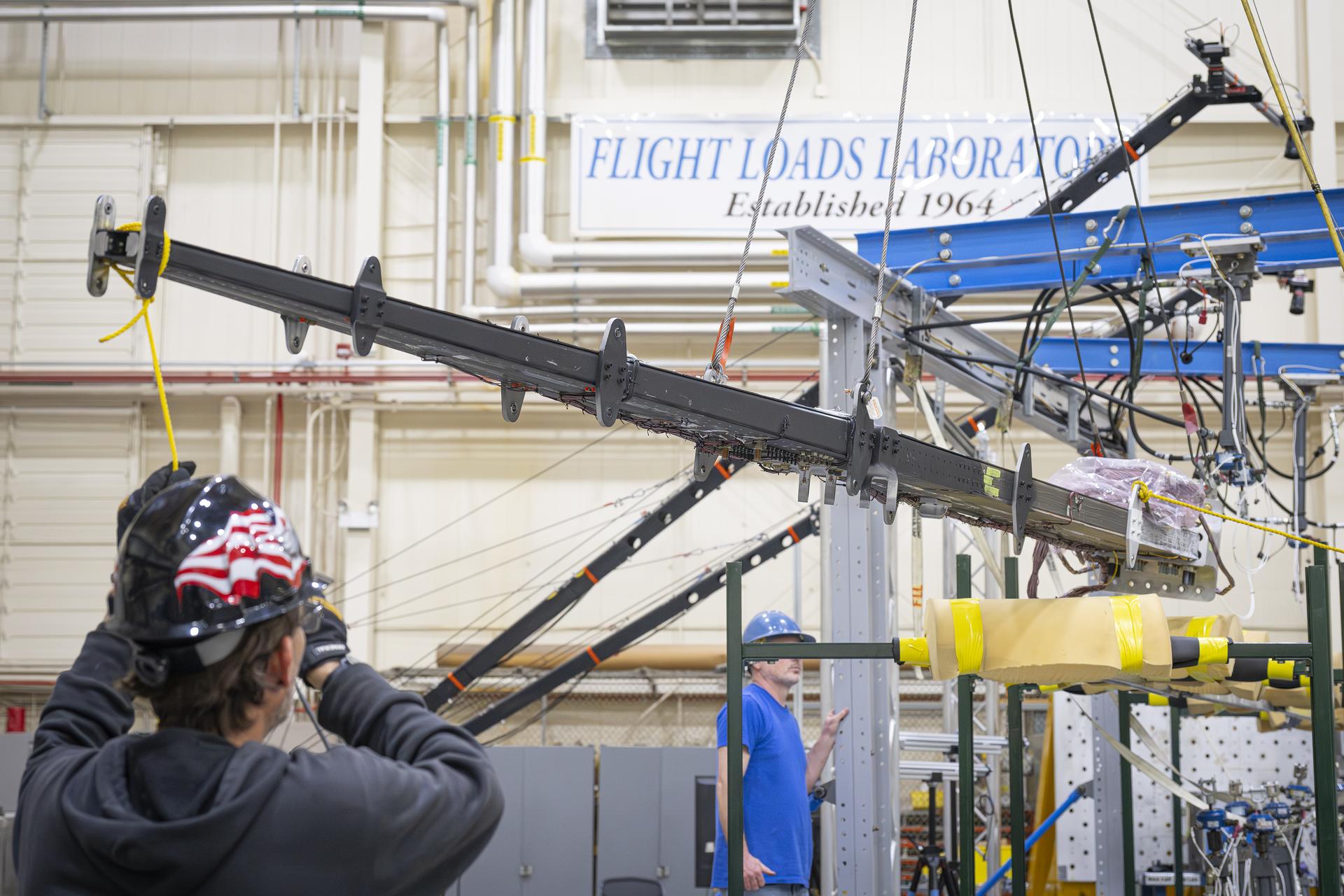
The 15-foot Structural Wing Experiment Evaluating Truss-bracing test article is fully installed in the Flight Loads Laboratory at NASA’s Armstrong Flight Research Center in Edwards, California, on Wednesday, May 20, 2026. The model is part of NASA’s research to develop technologies for future ultra-efficient aircraft.
Credits: NASA/Carla Escamilla
NASA researchers recently put a new wing design, appearing long and thin with a lightweight structural design, through a series of grueling tests to find its structural limits. What they found left them encouraged about the wing’s potential, even when they pushed it past its intended limits.
The 15-foot Structural Wing Experiment Evaluating Truss-bracing (SWEET-15) test article is part of NASA’s research to develop future ultra-efficient aircraft. The design incorporates a long wing supported by an aerodynamic strut, based on NASA’s earlier Transonic Truss‑Braced Wing concept.
The research team is working to understand whether SWEET-15’s design and its new lightweight structural designs could help commercial airliners save fuel. But first, they need to understand how it behaves under the kinds of force wings experience in flight.
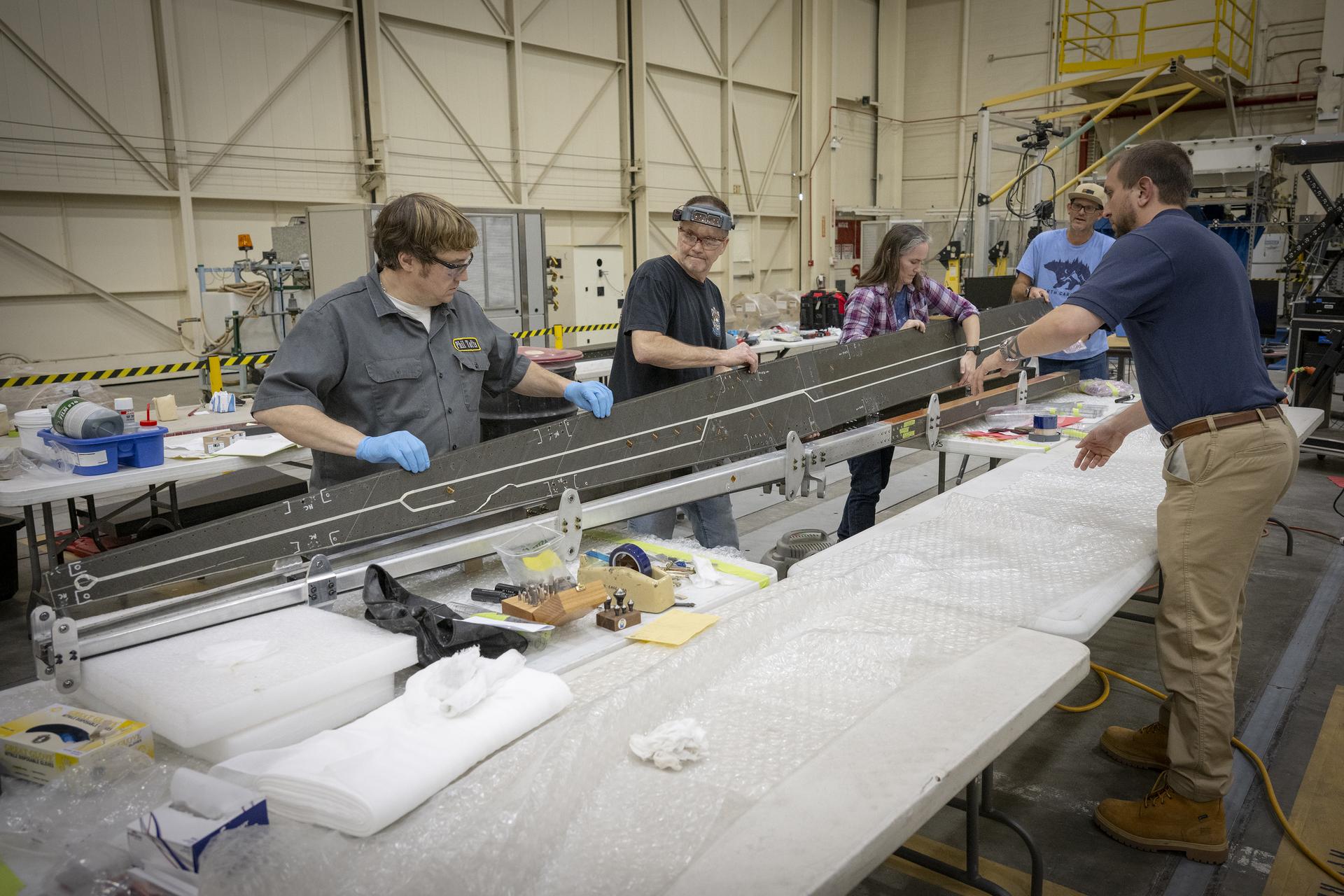
Lab technicians Phil Tofts, Chris McLain, and Jeff Howell and NASA engineers Erin Anderson and Richard Larson prepare the 15-foot Structural Wing Experiment Evaluating Truss-bracing model in the Flight Loads Laboratory at NASA’s Armstrong Flight Research Center in Edwards, California, on Thursday, Dec. 11, 2025. The model is part of NASA’s research to develop technologies for future ultra-efficient aircraft.
NASA/Christopher LC Clark
The SWEET-15 design originated with combining five different advanced composite manufacturing and assembly technologies that enabled the novel structural design. The 15-foot-long test article was then designed and fabricated at NASA’s Langley Research Center in Hampton, Virginia, before traveling to NASA’s Armstrong Flight Research Center in Edwards, California, for testing.
Over several months, NASA engineers intentionally bent the test wing in the Flight Loads Laboratory at NASA Armstrong. Numerous strain and load sensors, including fiber-optic strain sensors, were placed throughout the structure to track how the wing responded as forces increased.
The data from the sensors confirmed the predictions made by NASA’s computer models. According to initial findings, the wing withstood the anticipated in-flight forces without issue. The results provided the team with confidence in the new manufacturing approaches and methods for connecting wing parts used in SWEET-15, which could support future efficient aircraft designs. The manufacturing approach, developed at NASA Langley used the Integrated Structural Assembly of Advanced Composites robot, aims to produce lighter and stronger composite structures for aerospace vehicles.
Lab technicians Jeff Howell, left and Chris Mount install the 15-foot Structural Wing Experiment Evaluating Truss-bracing model in the Flight Loads Lab at NASA’s Armstrong Flight Research Center in Edwards, California, Wednesday, February 11, 2026. The model is part of NASA’s research to develop technologies for future ultra-efficient aircraft.
NASA/Christopher LC Clark
The test concluded with a deliberate test-to-failure, where engineers increased loads beyond the wing’s design limits to determine how and where it would fail. The structure ultimately failed at roughly 127% of its design limit load, with visible damage appearing near the back edge of the wing and in the upper wing cover. This element of testing provided valuable insight into how the joints connecting the wing to its main strut and a secondary one, called a jury strut, behave under forces beyond the expected flight envelope.
This marks the first time a representative composite truss-braced wing configuration has undergone this type of structural evaluation. It was made possible only through NASA collaboration across centers and projects, with researchers utilizing agency resources such as the Fiber Optic Sensing System developed to gather data on both aircraft and spacecraft.
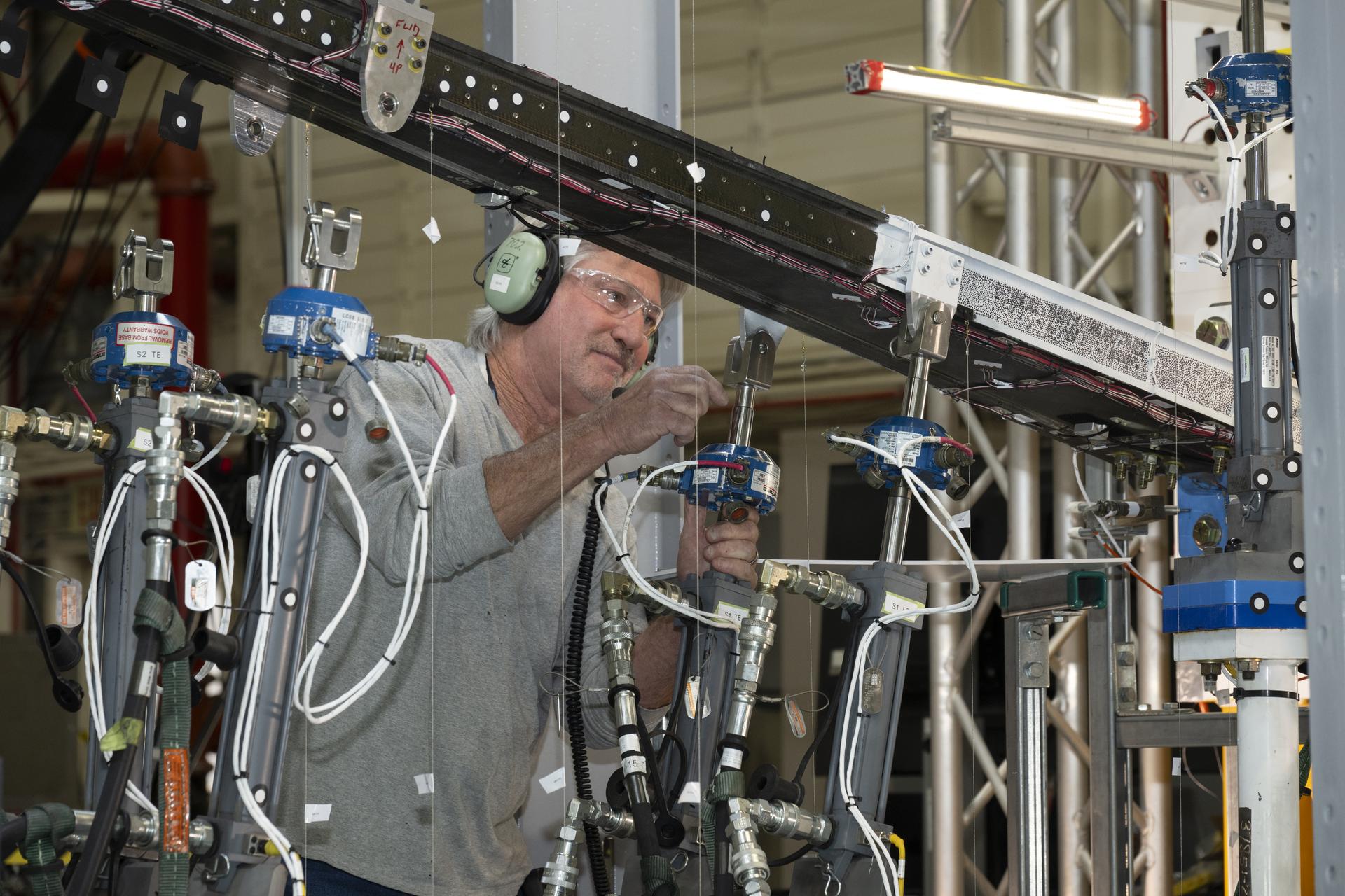
NASA research engineer Walter Hargis regulates the 15-foot Structural Wing Experiment Evaluating Truss-bracing model in the Flight Loads Laboratory at NASA’s Armstrong Flight Research Center in Edwards, California, on Tuesday, March 31, 2026. The model is part of NASA’s research to develop technologies for future ultra-efficient aircraft.
NASA/Ryan Kline
To prepare for the testing, engineers at NASA Langley designed, analyzed, and manufactured the wing and completed safety preparations and lab setup.
Researchers will now analyze the data collected during testing to inform future airframe designs and support NASA’s ongoing efforts to develop more efficient aviation technologies.
The work is being conducted through NASA’s Subsonic Flight Demonstrator project in the agency’s Research Technology Mission Directorate. The successful testing of multiple innovative components marks a milestone in NASA’s aeronautics research.
The Growing Crescent of Mars as NASA’s Psyche Mission Approaches
PIA26586
Credits: NASA/JPL-Caltech/ASU
Downloads
The Growing Crescent of Mars as NASA’s Psyche Mission Approaches
PNG (3.48 MB)
Description
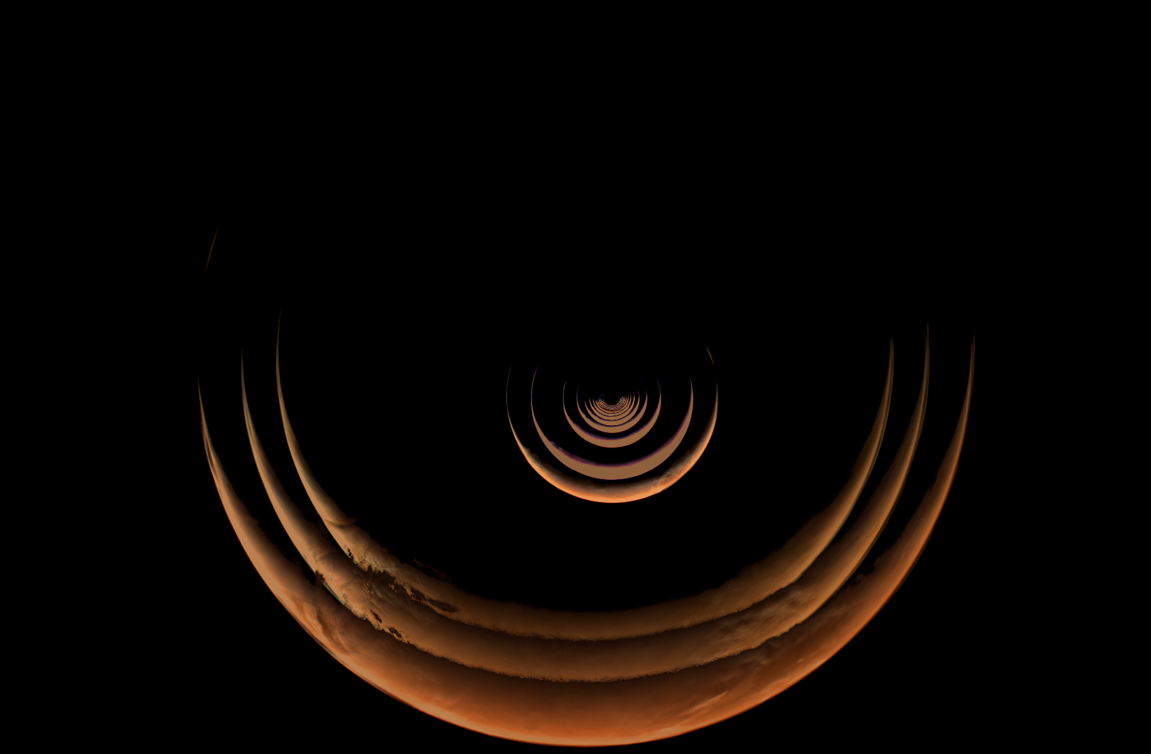
This composite of images taken by NASA’s Psyche mission shows the crescent of Mars grow as the spacecraft approached the planet for a gravity assist from May 2 to May 15, 2026. The series begins with the smallest crescent at the center of the of the image as Mars is farthest from the spacecraft, and progressively grows as the spacecraft gets closer. After these views were captured by the spacecraft’s multispectral imager instrument, Mars began to overfill the field of view as Psyche made close approach with the planet and captured a series of high-resolution images of the surface.
Because Psyche approached Mars from a high phase angle, the planet appeared as a thin crescent in the days running up to the close approach, lit by sunlight reflecting off its surface. Using these views of the approach, close approach, and departure from Mars, the Psyche team compiled a stunning time-lapse of its entire Mars encounter.
For more information about NASA’s Psyche mission, visit:
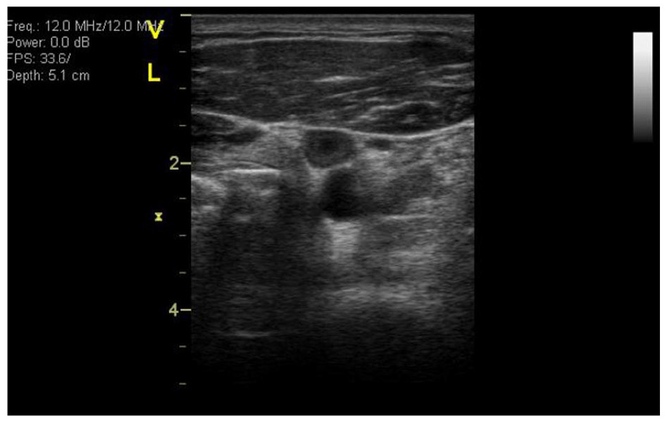
In April 2026, NASA’s Office of the Chief Health and Medical Officer (OCHMO) initiated a working group to review updated VTE case information, additional data gathered revealing altered blood flow status within a cohort of astronauts, and discuss progress of research and clinical activities intended to mitigate the risk of VTE during spaceflight with new evidence-based clinical practice recommendations.
Recommendations
The following is a summary of the working group’s recommendations:
The working group’s conclusions emphasized that stasis in the left internal jugular vein (IJV) is consistently viewed as a dominant risk factor for VTE in microgravity, though there is active debate regarding the relative contributions of slow qualitative flow, endothelial factors and/or retrograde flow.
Limitations of current in-flight ultrasound capabilities to accurately measure stasis/slow flow was cited as a concern, especially if using only stasis as a factor for indicating the need for prophylaxis.
Additional review of assessing stasis with ultrasound in-flight was recommended.
After reviewing the risk factors, additional discussions following the working group led to the majority of the panel agreeing that stasis and retrograde flow warranted use of prophylaxis.
The working group also recommended assessing all other risk factors other than stasis to also determine when prophylaxis is warranted.
Based on a literature review and summary of the panel contributions, a VTE Risk Score for Astronauts Algorithm was developed, which includes providing anticoagulation prophylaxis for stasis alone, or a combination of other thrombosis risk factors that are weighted by terrestrial literature.
Risk of Venous Thromboembolism During Spaceflight
NASA initially formed a working group in October 2024 after diagnosing venous thromboembolisms (VTEs) in astronauts during ISS missions. Experts reviewed case data, updated Clinical Practice Guidelines, and examined possible causes.
NASA has selected Chugach Intelligence Solutions LLC to provide comprehensive operations, maintenance, and repair services for NASA’s Ames Research Center in California’s Silicon Valley.
The Ames Facilities Support Services II contract ensures that the center’s historic and specialized facilities are properly maintained, fully operational, and capable of supporting the agency’s missions and tenant partners in the NASA Research Park.
The hybrid contract has a five-year period of performance, consisting of a 12-month base period and four 12-month option periods, with the possibility of a six-month extension. The performance period is expected to begin Thursday, Aug. 13. The contract includes cost-plus-award-fee core requirements, firm-fixed-price phase-in, and indefinite-delivery/indefinite-quantity task orders, providing flexibility to address both routine and emergent facility needs. The award has a maximum potential value of approximately $158 million, inclusive of all options and total indefinite-delivery/indefinite-quantity ceiling value.
For more information about NASA and its missions, visit:

 Login