❌

Normal view

Just in time for the Aussie summer, there's up to AU$300 off some of Dyson's popular purifying fans

16 September 2026 at 02:41

It’s that time of year again when we’re not always sure whether to leave the house dressed for summer or winter. And while this transitional phase can be a nightmare for wardrobe choices, it means that summer is right around the corner, so it’s time to start thinking about how you’ll stay cool at home and beat the heat.

And let’s not forget that this is an El Niño year, so spring and summer will be drier than usual and potentially hotter, with a higher probability of bushfires. So, along with the heat, we’ll also need to contend with the smoke and ash in the air, which could cause respiratory disorders.

Long story short, it’s time to invest in a good purifying fan to see us through the coming months here in Australia.

Fortunately, Amazon understands this and has slashed up to AU$300 on some of Dyson’s powerful, bladeless fans to help keep you and the family cool when the temperature rises. I’ve highlighted three of my favourites below, all of which will not just purify the air you breathe at home and keep you cool, but will keep you toasty in the colder months. That’s good value for a gadget you can use year-round. If Dyson doesn’t tickle your fancy, I’ve also listed some highly recommended alternatives from the likes of Vornado and Shark.

Pure Hot+Cool HP00 Purifier: was $499 now $399.20
The HP00 is a three-in-one model, covering cooling, purifying and heating, making it a truly versatile unit and a good price — well, for a Dyson. Its 360º HEPA filtration system captures 99.95% of particles as small as 0.1 microns, while 70º oscillation helps circulate purified air around your room.View Deal

The Pure Hot+Cool Link offers the same three-in-one functionality as the HP00, but has the added benefit of smartphone connectivity, letting you monitor air quality and control the machine remotely from your phone. View Deal

Purifier Hot+Cool HP2 De-NOx: was $1199 now $899
You also get three-in-one functionality with this Dyson fan, but it combines HEPA H13 filtration with advanced gas removal, including the continuous destruction of formaldehyde that can be released by nearly everything we own in our homes today, including new furniture. It can be controlled via the MyDyson app and offers 350º oscillation. View Deal

Want more suggestions?

It’s not just Dyson that makes powerful and effective fans for cooling your home. I’ve picked out some other models below that many of the TechRadar team and I use ourselves.

Educators & Teens Get Hands-On With TEMPO Data to Help Investigate Local Air Quality

6 August 2026 at 20:33

4 min read

Educators & Teens Get Hands-On With TEMPO Data to Help Investigate Local Air Quality

A workshop participant, seen from behind, sits at a laptop displaying the TEMPO-Lab Data Viewer. The screen shows a colorful satellite map of air quality data over the central United States, with toggleable data layers for NO2, HCHO, ozone, and fire detections listed on the left panel. The participant holds a small notebook and pen while working through the tool at a table scattered with sticky notes and water bottles.
An educator explores NASA’s TEMPO mission data using the CosmicDS TEMPO-Lab viewer during a hands-on immersion session at the BEST AQI Leadership Institute.
Credit: Devika Elakara

The NASA Science Activation Program’s Cosmic Storytelling with NASA Data (CosmicDS) project, led by Harvard University in Cambridge, Massachusetts, works to bring authentic NASA data into the hands of educators and learners. From July 27–29, 2026, the CosmicDS team partnered with the Smithsonian Institution’s BEST AQI (Breathing Easier: Supporting Teen Air Quality Investigations) project to host a Leadership Institute at the Center for Astrophysics | Harvard & Smithsonian (CfA) in Cambridge, MA. The Institute brought together 13 formal and informal educators who serve as advisors to BEST AQI, an initiative that guides teens through their own air quality research to support actions that improve air quality in their communities.

On Day 1 of the Institute, the CosmicDS Science Principal Investigator Pat Udomprasert led a hands-on immersion session introducing educators to TEMPO-Lab, a free online tool built with NASA Science Activation Program funding. TEMPO-Lab lets learners explore and analyze near-real-time air quality measurements collected by NASA’s TEMPO (Tropospheric Emissions: Monitoring of Pollution) mission, which measures pollution across North America hourly during daylight hours. During Days 2 and 3 of the Institute, as educators worked together to co-develop BEST AQI curriculum and resources, they used TEMPO-Lab to build case studies covering a variety of real-world air quality scenarios, including wildfire smoke and emissions from rush-hour traffic, power plants, and agriculture. These case studies will give the teens in their programs a strong foundation for investigating air quality where they live and deciding what actions they might take in their own communities.

One moment made the workshop especially memorable. During a science briefing, TEMPO scientist Heesung Chong shared that a new beta-version ground-level ozone data product had recently become available. TEMPO-Lab’s flexible design made it possible for CosmicDS software developer and educator John Lewis to integrate the new data product into the tool overnight, letting workshop participants explore cutting-edge ozone data themselves the very next morning. It was a striking example of how CosmicDS’s data tools can match the pace of active NASA science, giving educators and their learners access to data almost as soon as scientists themselves do.

“The BEST AQI Leadership Institute reinforced the value of the TEMPO-Lab as a tool for empowering youth to investigate local air quality issues using authentic NASA data. Educators were excited not only by the scientific capabilities of the platform, but by its potential to help young people use evidence to make informed decisions and contribute to positive change in their communities.”

— Erika Wright, Education Specialist, Smithsonian Astrophysical Observatory (SAO), and BEST AQI Principal Investigator

Equipping educators with both the technical skills and the curriculum to bring NASA air quality data into their classrooms matters because it builds data literacy skills that teens can carry into any career, while also giving them the tools to investigate issues that affect their health and their own communities. Air quality is a subject teens can see, smell, and feel the effects of — and BEST AQI is designed to help them turn that lived experience into evidence-based understanding and, ultimately, action.

The CosmicDS team will continue supporting these efforts in the year ahead. The 13 educators who attended this Leadership Institute plan to share the BEST AQI toolkit and TEMPO-Lab with approximately 100 additional educators across their partner sites in South Dakota, Maryland, and New York, potentially extending this work to thousands of teen air quality researchers.

Experience TEMPO-Lab at https://projects.cosmicds.cfa.harvard.edu/tempo-lab and learn more about the CosmicDS project at https://cosmicds.cfa.harvard.edu.

Cosmic DS is supported by NASA cooperative agreement award number 80NSSC21M0002 and is part of the NASA Science Activation Program portfolio, which connects learners with authentic NASA science experiences through partnerships with educators and community organizations.

Share

Details

Last Updated
Aug 07, 2026
Editor
NASA Science Editorial Team

Accelerating Earth Solutions (ROSES A.13)

31 July 2026 at 21:20

We are seeking virtual panelists and/or external (email) reviewers for Accelerating Earth Solutions (ROSES A.13).

Here are the rules:

  • Use the comments box below to tell us about anything that might be conflict of interest.
  • Other than that just click the buttons.
This field is for validation purposes and should be left unchanged.
Please provide your name:(Required)
Please provide your email address:(Required)
Have you ever served on a NASA panel?(Required)
Are you volunteering to serve as a panelist, an executive secretary, or an external reviewer?(Required)
Please select one or more relevant area(s) of expertise:(Required)

The post Accelerating Earth Solutions (ROSES A.13) appeared first on NASA Science.

New NASA Earth Missions Gear Up to Start Science Flights  

20 July 2026 at 19:25
6 Min Read

New NASA Earth Missions Gear Up to Start Science Flights  

Satellite imagery captured wildfires burning hot enough to generate pyrocumulonimbus clouds north of Lake Superior in July 2026. NASA aircraft will help scientists study the powerful storms as they develop.
Credits:
CSU/CIRA & NOAA

Landslides in Alaska. Air quality in Atlanta. Fire clouds out West. From the Arctic fringes to farm country, NASA’s newest class of suborbital Earth Venture missions is gearing up to deliver science that will benefit communities in the United States and beyond. 

The six projects will mobilize hundreds of scientists and pilots from NASA, the U.S. Navy, universities, and other institutions over the next several years. While the investigations range across topics, a defining feature of suborbital missions is the use of sensors mounted on aircraft. 

Airborne remote sensing serves as a bridge between ground-based instruments and satellites. Data collected via planes, helicopters, drones, and balloons can fill in gaps in computer models used by weather forecasters, city planners, and others.  

When wildfires create their own weather 

The first project to take wing this summer is Injected Smoke and PYRocumulonimbus Experiment (INSPYRE), led by the Naval Research Laboratory. From mission headquarters in Colorado, the team will chase one of the least understood forms of severe weather on Earth: towering “fire clouds” generated when extreme wildfires burn hot enough to brew their own thunderstorms.  

Pyrocumulonimbus clouds crackle with lighting in imagery captured over Utah and Colorado by the GOES-18 satellite in early July 2026.
CSU/CIRA & NOAA

Smoky and crackling with lightning, these unique storms can create blind spots for aviators above and spark new blazes below. Measuring and mapping the dangerous storms as they develop in real-time will help scientists forecast them in the future. Several aircraft, including NASA’s high-altitude ER-2, flying out of Montana, will carry a large suite of instruments over wildfire-generated storm systems. Among them will be two state-of-the-art infrared wildfire trackers, which were developed at NASA’s Jet Propulsion Laboratory (JPL) in Southern California and will be flying as part of the agency’s FireSense program.  

Testing the air over farmland, megacities 

Agricultural emissions represent an important and understudied part of Earth’s land and atmosphere systems. The FarmFlux mission, which kicks off this year, will deploy more than a dozen sensors to measure ozone, methane, ammonia, particulates, and other pollutants rising from agricultural lands and animal farms stretching from the Midwest to California’s Central Valley. These emissions affect human health, global climate, and stratospheric ozone. The mission is led by NASA’s Goddard Space Flight Center in Greenbelt, Maryland, along with Colorado State University, and Boston University. 

A Boeing 777 wide-body twin-engine aircraft looms on a taxiway, viewed directly from the front.
NASA’s 777 aircraft is gearing up to start science flights. Structural modifications – like enlarged cabin windows and instrument portals – have transformed the former passenger plane into a flying laboratory. It’s seen here at Langley Research Center in Hampton, Virginia, in April 2026.
NASA/Ryan Hill

Two North American cities with air quality concerns are Atlanta and Mexico City. But the causes differ, with weather and terrain playing a role. To explore these differences, the Hemispheric Airborne Measurements of Air Quality (HAMAQ) mission will investigate areas of poor air in the two capitals and test how satellite information can help forecasting and mitigation efforts. The team will deploy two aircraft at different altitudes: NASA’s P-3B will fly close to the surface, directly measuring fine particle and gaseous pollutants, while the recently acquired 777 science jet will soar high above, mapping pollution with remote sensors.  NASA’s Langley Research Center in Hampton, Virginia, is leading the mission. 

Fast-changing north 

As the Arctic warms at least twice as fast as the rest of Earth, data collected today can help guide communities on the front lines of change.  

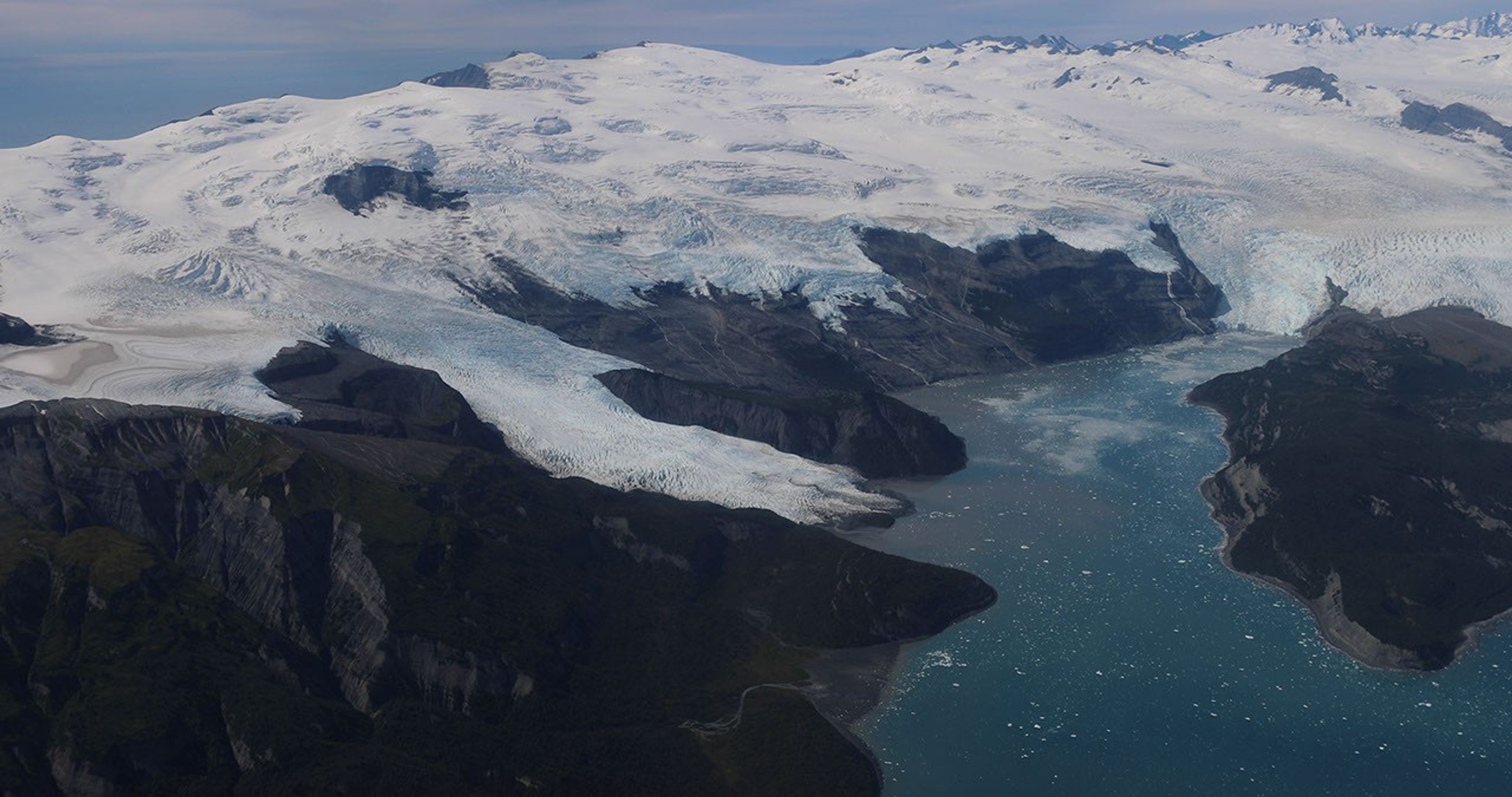
Amid a rugged landscape, a snow-white glacier spills into dark blue water.
Alaska’s glaciers are losing ice and contributing to sea level rise. NASA is tracking the changes from land, air, and space.
NASA

The Snow4Flow campaign, led by the University of Arizona, seeks to measure and model how far and fast glaciers are retreating in the far north. Traversing remote icescapes across Alaska, the Yukon, Arctic Canada, Greenland, and Svalbard, Norway, they’ll sound both the near-surface and frozen depths of hundreds of glaciers while flying over in a modernized WWII-era aircraft outfitted with a scanning laser altimeter and two custom radars. Their observations, combined with satellite data and advanced models of snowfall and glacier flow, will advance our understanding of how glaciers behave in different regions of the Arctic. The mission seeks to uncover not just what these glaciers look like beneath the surface today, but the processes that will drive changes in the future. 

As permafrost thaws, rivers on the doorstep of the Arctic become conveyor belts of carbon and sediment. NASA Goddard, and the City College of New York lead a multidisciplinary team studying how rivers, lagoons, and estuaries across Alaska’s North Slope interact with the Arctic Ocean. The project, called Frontlines of Rapidly Transforming Ecosystems (FORTE) will combine optical and radar measurements from satellites, planes, high-tech research vessels, drones, and underwater autonomous systems to track microscopic marine life, water flow, and chemistry. The team will collaborate with local and tribal communities to sustain observations over time and apply NASA assets to address emerging local needs and decision-making priorities.  

Landslide triggers 

When a slow-moving landslide in California suddenly collapsed and buried a section of coastal highway in 2017, scientists at NASA JPL wanted to know how precipitation swings played a role. JPL studies how water infiltrates and destabilizes hillslopes all over the world. The Landslide Change Characterization Experiment (LACCE) project will combine airborne synthetic aperture radar with land-based sensors to track how slopes in California are responding to a world of intensifying droughts and downpours. The project also takes aim at emerging landslide hazards in Alaska, where rapidly retreating glaciers are accelerating slope movements that have the potential to create mega-tsunamis.  

This series of images shows the collapse of the Mud Creek landslide in May 2017 along the Big Sur coast in Central California, and the subsequent repairs to Highway 1, which was damaged during the event.
Andy Ritchie/USGS Pacific Coastal and Marine Science Center

NASA’s Earth Venture Suborbital program, designed to be nimble and high impact, was established following a recommendation by the National Research Council in 2007. In the decades since, teams have studied phenomena, including blizzards, coral reefs, and ocean whirlpools.  

About the Author

Sally Younger

Share

Details

Last Updated
Jul 20, 2026

Ontario Wildfire Smoke Moves East

16 July 2026 at 05:00
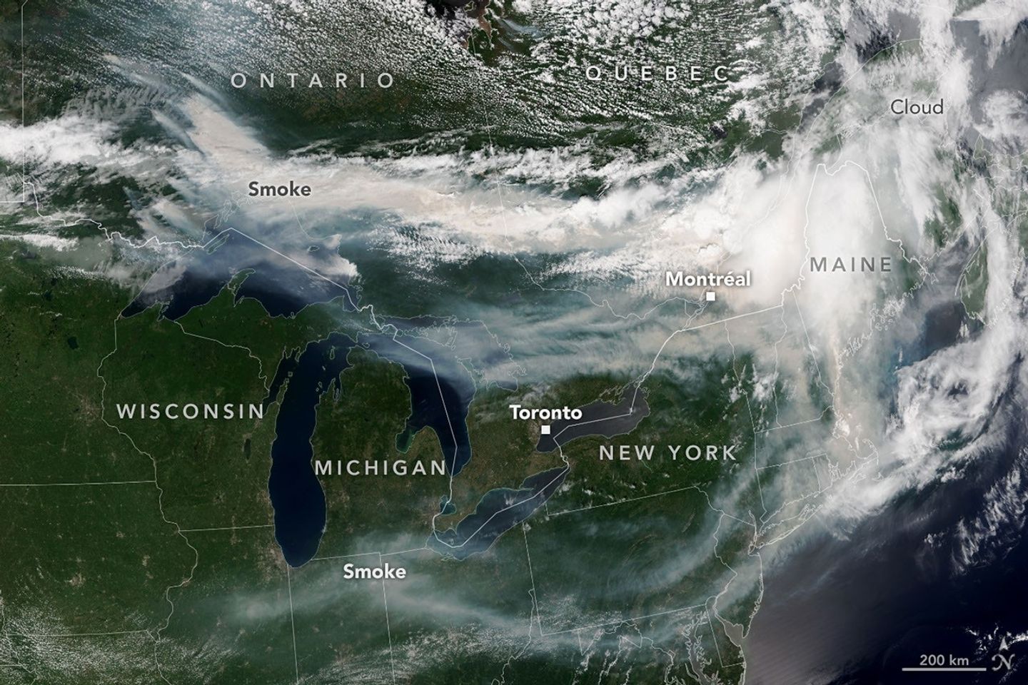
A satellite image shows brown smoke from wildfires in Ontario, Canada, streaming east across parts of Canada and the U.S. Areas of white clouds are mixed in with the smoke.
Smoke from wildland fires pours eastward over Canada and the U.S. in an image captured on the afternoon of July 14, 2026, by the VIIRS (Visible Infrared Imaging Radiometer Suite) on the NOAA-21 satellite.
NASA Earth Observatory/Lauren Dauphin

After a slow start to Canada’s 2026 fire season, activity picked up by the end of June amid dry, warm conditions and returned closer to the 25-year average. By mid-July, almost 850 fires were actively burning across the country, according to the Canadian Interagency Forest Fire Centre. More than 180 of those were burning in Ontario.

This NOAA-21 image, acquired on the afternoon of July 14, 2026, shows smoke billowing from the Ontario fires. Winds carried the smoke primarily southeast over much of the southern part of the province, as well as parts of Quebec and the U.S. Midwest and Northeast, tinting the sky shades of gray and yellow and the Sun orange in many areas.

The smoke’s impact on air quality varied, depending largely on altitude. In areas where smoke was high in the atmosphere, air quality impacts were negligible; where it drifted closer to the ground, conditions worsened. Air quality in Toronto, for instance, reached unhealthy levels, according to AirNow. People in the southern parts of the province were also grappling with a heat wave, compounding the health risks.

Much of the smoke came from fires in Northwestern Ontario, where eight blazes saw significant growth on July 13 and 14. The fires prompted officials to issue evacuation orders for several communities in this part of the province, according to news reports.

As of July 14, fires across Canada have burned 1.9 million hectares (4.7 million acres) since the start of the year—still well below the season totals from the extreme fire years of 2023 and 2025. How the rest of the season plays out remains to be seen. A seasonal fire outlook—compiled by wildland fire experts from the U.S., Canada, and Mexico—shows where fire conditions are more or less likely through July, August, and September.

NASA Earth Observatory image by Lauren Dauphin, using VIIRS data from NASA EOSDIS LANCE , GIBS/Worldview , and the Joint Polar Satellite System (JPSS). Story by Kathryn Hansen.

Downloads

A satellite image shows brown smoke from wildfires in Ontario, Canada, streaming east across parts of Canada and the U.S. Areas of white clouds are mixed in with the smoke.

July 14, 2026

JPEG (3.96 MB)

References & Resources

You may also be interested in:

Stay up-to-date with the latest content from NASA as we explore the universe and discover more about our home planet.

Fighting Fire With Fire
3 min read

In fire-prone ecosystems in Australia’s Northern Territory, prescribed burns are lit to minimize the severity of fires later in the…

Article
Fires Tear Through Nebraska Grasslands
3 min read

Dry, warm, and windy conditions across the U.S. Great Plains led to extreme fire activity in March 2026.

Article
Cottonwood Fire Chars Utah
5 min read

The blaze burned more than 150 square miles and swept through parts of a ski resort.

Article

The post Ontario Wildfire Smoke Moves East appeared first on NASA Science.

Ontario Wildfire Smoke Moves East

16 July 2026 at 05:00
A satellite image shows brown smoke from wildfires in Ontario, Canada, streaming east across parts of Canada and the U.S. Areas of white clouds are mixed in with the smoke.
Smoke from wildland fires pours eastward over Canada and the U.S. in an image captured on the afternoon of July 14, 2026, by the VIIRS (Visible Infrared Imaging Radiometer Suite) on the NOAA-21 satellite.
NASA Earth Observatory/Lauren Dauphin

After a slow start to Canada’s 2026 fire season, activity picked up by the end of June amid dry, warm conditions and returned closer to the 25-year average. By mid-July, almost 850 fires were actively burning across the country, according to the Canadian Interagency Forest Fire Centre. More than 180 of those were burning in Ontario.

This NOAA-21 image, acquired on the afternoon of July 14, 2026, shows smoke billowing from the Ontario fires. Winds carried the smoke primarily southeast over much of the southern part of the province, as well as parts of Quebec and the U.S. Midwest and Northeast, tinting the sky shades of gray and yellow and the Sun orange in many areas.

The smoke’s impact on air quality varied, depending largely on altitude. In areas where smoke was high in the atmosphere, air quality impacts were negligible; where it drifted closer to the ground, conditions worsened. Air quality in Toronto, for instance, reached unhealthy levels, according to AirNow. People in the southern parts of the province were also grappling with a heat wave, compounding the health risks.

Much of the smoke came from fires in Northwestern Ontario, where eight blazes saw significant growth on July 13 and 14. The fires prompted officials to issue evacuation orders for several communities in this part of the province, according to news reports.

As of July 14, fires across Canada have burned 1.9 million hectares (4.7 million acres) since the start of the year—still well below the season totals from the extreme fire years of 2023 and 2025. How the rest of the season plays out remains to be seen. A seasonal fire outlook—compiled by wildland fire experts from the U.S., Canada, and Mexico—shows where fire conditions are more or less likely through July, August, and September.

NASA Earth Observatory image by Lauren Dauphin, using VIIRS data from NASA EOSDIS LANCE , GIBS/Worldview , and the Joint Polar Satellite System (JPSS). Story by Kathryn Hansen.

Downloads

A satellite image shows brown smoke from wildfires in Ontario, Canada, streaming east across parts of Canada and the U.S. Areas of white clouds are mixed in with the smoke.

July 14, 2026

JPEG (3.96 MB)

References & Resources

You may also be interested in:

Stay up-to-date with the latest content from NASA as we explore the universe and discover more about our home planet.

Fighting Fire With Fire

3 min read

In fire-prone ecosystems in Australia’s Northern Territory, prescribed burns are lit to minimize the severity of fires later in the…

Article

Fires Tear Through Nebraska Grasslands

3 min read

Dry, warm, and windy conditions across the U.S. Great Plains led to extreme fire activity in March 2026.

Article

Cottonwood Fire Chars Utah

5 min read

The blaze burned more than 150 square miles and swept through parts of a ski resort.

Article

Aldi just announced a new range of cooling fans with prices starting at £6.99 — coming to the middle aisle very soon

  • Aldi has announced a new range of mini cooling fans
  • There's a tripod fan, a multi-directional globe fan, and an evaporative cooler
  • They'll be available in the middle aisle from July 2, starting at £6.99

Aldi, famed for its bargain home gadgets, has just announced a new set of budget-friendly cooling fans to help you stay cool without burning a hole in your wallet. The set of three fans will be available in the middle aisle of Aldi stores from July 2, so although they won't be able to stop you sweating during the current heatwave, you can make sure you're prepared the next time the temperature soars.

For me, the most interesting fan in the collection is the £6.99 Fan with Flexible Tripod. Not only is this the cheapest option, it's also the most flexible — literally. Its Joby GorillaPod-style legs bend and grip, so you can position it just right on your desk, wrap it around the handlebar of a pushchair, or attach it to a treadmill at the gym.

Three cooling fans on white background

(Image credit: Aldi)

Another intriguing option is the Portable Air Cooler with LED (£14.99), which lowers the temperature in your room using water and ice evaporative technology. Water absorbs quite a lot of heat when it evaporates, which has a significant cooling effect, which makes this kind of device (also charmingly known as a 'swamp cooler') an effective way to keep your cool without raising your electricity bill.

Finally, we have the Globe Fan with Multi Direction (£39.99), which looks more like a typical desk fan, but has an unusual "360-degree auto-rotating" head that pans all the way around your room. It comes with a remote control, and has three modes: Natural Wind, Drying (for laundry), and Sleep.

If you can't wait until next week and are willing to splash some more cash for quicker relief, we've rounding up all the best Amazon Prime Day deals on heatwave essentials including fans, portable air conditioners, and ice cream makers.

Rising Aircraft Emissions Threaten Air Quality, Health

16 June 2026 at 16:35

As the world continues to witness unprecedented growth in air travel, a groundbreaking study published in Communications Earth & Environment reveals alarming insights into the global repercussions of accelerating aircraft emissions on air quality and human health. This landmark research meticulously quantifies how expanding aviation activities contribute to deteriorating atmospheric conditions and exacerbate public health crises worldwide, underscoring an urgent need for global policy interventions and technological innovation.

The aviation sector, responsible for a substantial portion of anthropogenic greenhouse gas and pollutant outputs, has long been scrutinized for its environmental footprint. Yet, the intricate dynamics linking aircraft emissions to widespread air quality degradation and subsequent health implications have remained largely underexplored until now. Quadros, Nelen, Snellen, and colleagues harnessed sophisticated atmospheric modeling techniques combined with epidemiological data to elucidate these complex pathways with unprecedented precision.

Aircraft engines emit a cocktail of pollutants, including nitrogen oxides (NOx), particulate matter (PM), volatile organic compounds (VOCs), and carbon dioxide (CO2). These emissions initiate a cascade of atmospheric chemical reactions, creating secondary pollutants such as ozone and fine particulate matter, which profoundly impair air quality. The study’s simulation results reveal that aircraft emissions alone contribute significantly to elevated ground-level ozone concentrations, particularly in densely populated and heavily trafficked air corridors.

One of the study’s pivotal findings focuses on the spatial distribution of pollution burdens. Regions adjacent to major airports and common flight routes exhibit air quality dips notably beyond local vehicular and industrial contributions. The researchers found that the transboundary nature of aircraft emissions facilitates the transport of chemically reactive species across continents, linking aviation activities not only to local but also to regional and global air pollution episodes.

In terms of human health, the implications are disturbing. The researchers applied integrated exposure-response functions to estimate the morbidity and mortality attributable to aviation-induced pollution. Their assessments suggest a substantial increase in respiratory ailments, cardiovascular diseases, and premature deaths attributable to aircraft emissions. Particularly vulnerable populations, such as urban dwellers, children, elderly individuals, and those with preexisting conditions, face disproportionate risks.

Moreover, the study highlights the synergistic effects of aircraft emissions with other urban pollutants, exacerbating harmful synergistic interactions that amplify health risks. For instance, the NOx and VOCs emitted interact under sunlight to generate ozone, a potent respiratory irritant, and exacerbate asthma symptoms. The authors stress the importance of recognizing these nonlinear effects for robust public health policy formulation.

Climate feedback mechanisms linked to aviation emissions emerge as a critical concern in the report. The authors delineate how nitrogen oxides released at high altitudes not only affect surface-level ozone but also perturb the radiative balance of the atmosphere. This creates complex feedback loops that potentially accelerate climate warming, indicating that the environmental cost of aviation extends beyond conventional pollutants to include broader climatic impacts.

Technology advances and mitigation strategies receive thorough evaluation in the study. The authors discuss current emission reduction technologies such as lean-burn engines, sustainable aviation fuels (SAFs), and operational measures like optimized flight paths and altitude adjustments. Despite their promise, the research cautions that without comprehensive adoption and scaling, these technologies alone may fall short of offsetting the forecasted growth in emissions.

The aviation sector is projected to expand considerably over the coming decades, driven by economic growth and increasing globalization. The study’s projections indicate that without stringent regulatory frameworks and aggressive emission reduction commitments, the global burden of aviation-induced air pollution and related health impacts will escalate dramatically, particularly in emerging economies with rapidly growing air traffic.

Policy recommendations form a cornerstone of the researchers’ conclusions. They advocate for coordinated international efforts to tighten emission standards, mandate SAF usage, and invest in next-generation propulsion technologies such as electric and hydrogen-powered aircraft. Furthermore, integrating aviation sector goals into broader air quality management and climate policies is deemed essential to maximize health and environmental benefits.

In addition to technological and regulatory measures, the report emphasizes the role of real-time monitoring networks and data-sharing frameworks. Enhanced surveillance of aircraft emissions and their atmospheric transformations can enable dynamic policy responses, better inform public health advisories, and foster transparency and accountability among stakeholders ranging from airlines to regulators.

The health economics dimension discussed in the study reveals enormous societal costs tied to aviation-related air pollution. Hospitalizations, lost productivity, and long-term healthcare expenditures attributed to pollution-induced diseases impose substantial financial burdens on governments and communities alike, reinforcing the public health imperative for aggressive mitigation.

Further research priorities identified in the report call for improved characterization of ultrafine particles emitted by aircraft engines, nuanced understanding of population exposure patterns near airports, and exploration of co-benefits arising from simultaneous air quality and climate interventions. Interdisciplinary collaboration combining atmospheric science, epidemiology, engineering, and policy studies is championed as the pathway to innovative solutions.

In light of this new research, the aviation industry stands at a crossroads. Balancing the undeniable economic and social advantages of air travel with its adverse environmental and health externalities necessitates transformative thinking and collaborative global action. The study’s revelations provide an indispensable scientific foundation for stakeholders to forge a sustainable aviation future.

This comprehensive investigation serves as a clarion call for urgent recognition of the aviation sector’s hidden consequences, urging policymakers, industry players, and the public to engage in proactive, science-informed strategies that safeguard air quality and human health on a planetary scale.

Subject of Research:
The study focuses on evaluating the global impact of increasing aircraft emissions on air quality and related human health outcomes, analyzing both direct and indirect effects through sophisticated atmospheric and epidemiological modeling.

Article Title:
Global air quality and human health impacts of growing aircraft emissions

Article References:
Quadros, F.D.A., Nelen, R., Snellen, M. et al. Global air quality and human health impacts of growing aircraft emissions. Commun Earth Environ (2026). https://doi.org/10.1038/s43247-026-03732-4

Image Credits: AI Generated

DOI: 10.1038/s43247-026-03732-4

Keywords:
Aircraft emissions, air quality, human health, nitrogen oxides, particulate matter, ozone formation, aviation pollution, atmospheric modeling, public health impact, sustainable aviation fuels

Air Pollution’s Daily Pulse Over the Northeast

11 June 2026 at 05:01
7:05 am
3:05 pm
A map of morning nitrogen dioxide shows elevated concentrations of the gas over a region stretching from New York City to Washington, D.C., at 7:05 a.m. on May 18, 2026. A second map of the same area shows much lower concentrations that afternoon.
TEMPO detected high concentrations of nitrogen dioxide during the morning commute at 7:05 a.m. local time on May 18, 2026 (left), along the New York-Washington corridor. The instrument detected lower levels of the gas at 3:05 p.m. (right), after chemical reactions involving nitrogen dioxide had contributed to elevated ozone concentrations in the afternoon.
NASA Earth Observatory/Michala Garrison
7:05 am
3:05 pm
TEMPO detected high concentrations of nitrogen dioxide during the morning commute at 7:05 a.m. local time on May 18, 2026 (left), along the New York-Washington corridor.The instrument detected lower levels of the gas at 3:05 p.m. EDT (right), after chemical reactions involving nitrogen dioxide had contributed to elevated ozone concentrations in the afternoon. NASA Earth Observatory images by Michala Garrison.

More than 35 million people live along the New York–Washington corridor and breathe the region’s air. While air quality has improved significantly in recent decades, outbreaks of ground-level ozone remain common, particularly in the warm summer months, when the chemical reactions that produce the pollutant accelerate and stagnant air allows ozone to accumulate.

A reminder of this seasonal phenomenon came earlier than usual in 2026, when a mid-May heat wave prompted the New York State Department of Health and the New York Department of Environmental Conservation to issue a health advisory on May 17 over concerns about ozone. The code orange advisory warned young people, older adults, and those working or exercising outdoors to limit activity due to ozone’s respiratory and cardiovascular health impacts.

As expected, ground-based air-quality sensors operated by state and federal agencies showed ozone reaching unhealthy levels for sensitive groups on May 18, something that typically happens several times per year. Meanwhile, NASA’s TEMPO (Tropospheric Emissions: Monitoring of Pollution) instrument observed the event from geostationary orbit 22,000 miles (35,000 kilometers) above the equator, a unique vantage point that allows the sensor to collect frequent observations of air pollution.

TEMPO detects nitrogen dioxide (NO2), a gas emitted by burning fuels, particularly by motor vehicles, that contributes to ozone formation. “There’s often a clear and interesting pattern in TEMPO’s nitrogen dioxide data during ozone alert days,” said Hazem Mahmoud, an atmospheric scientist at NASA’s Atmospheric Science Data Center at Langley Research Center. “We see high concentrations of nitrogen dioxide during the early morning commute that drop off sharply in the late afternoon as ozone increases.”

The decline occurs as sunlight fuels photochemical reactions involving nitrogen dioxide, volatile organic compounds, and oxygen that lead to ozone formation. By late afternoon, these reactions deplete much of the available nitrogen dioxide, slowing ozone production until the cycle begins again the next day.

The pair of images above underscores the pattern. The image on the left was acquired at 7:05 a.m. local time when nitrogen dioxide concentrations were high during the morning commute. By 3:05 p.m. (right), most of the nitrogen dioxide had declined substantially, and surface ozone levels were elevated (below). Meanwhile, afternoon sea breezes appear to have transported the remaining nitrogen dioxide slightly to the west. Note that the data shown is provisional, and processing methods are still being refined.

Sensors on earlier polar-orbiting satellites, such as OMI (Ozone Monitoring Instrument) and TROPOMI (Tropospheric Monitoring Instrument), sampled nitrogen dioxide over New York once per day. After its launch in 2023, TEMPO began providing data every hour, allowing researchers to track the evolution and dispersion of air pollution at much finer time scales. 

“TEMPO is helping fill data gaps between ground stations and allowing us to ask new questions,” Mahmoud said. The mission provides data that can improve not only air quality forecasts during crisis situations, such as wildfires, but also the atmospheric models used to forecast the daily rhythms of urban pollution. Such models help researchers understand how natural factors such as winds, humidity levels, and air temperatures influence pollution plumes over the course of a day.

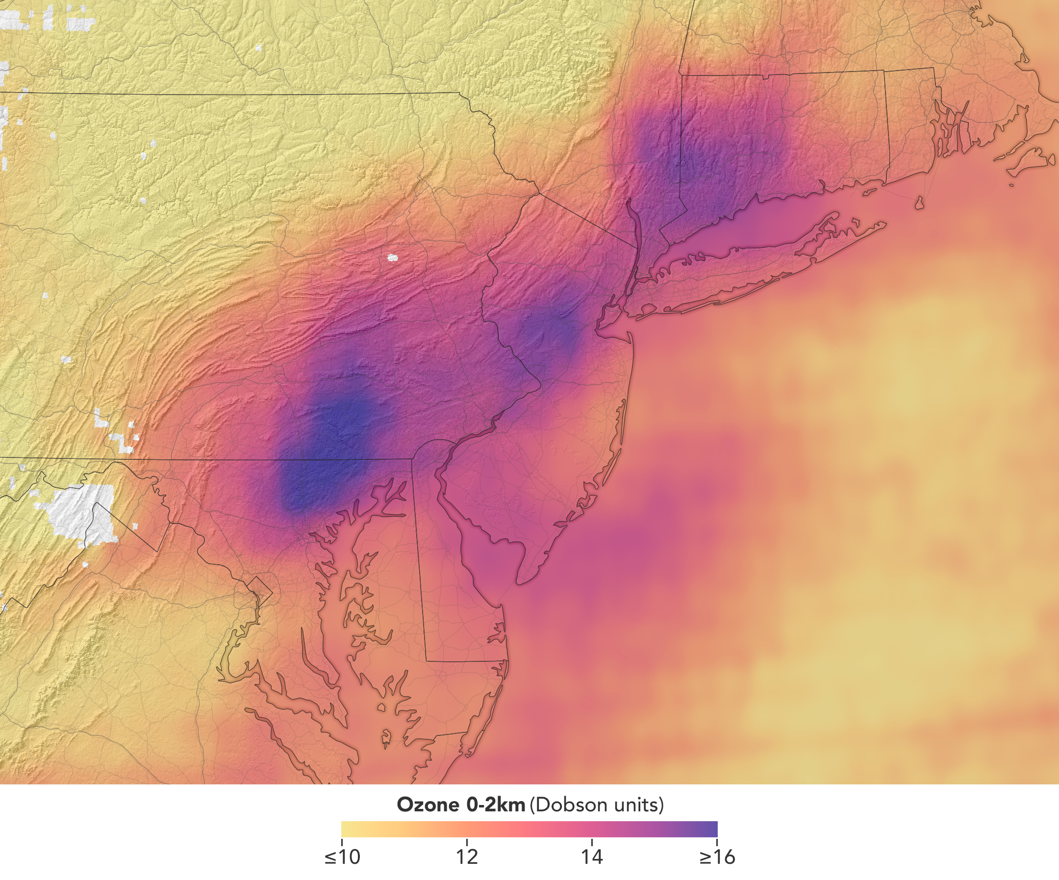
In a map of the eastern U.S., elevated ozone concentrations appear as a purple patch in an area extending from New York City to Washington, D.C.
TEMPO detected elevated ozone concentrations in an area extending from New York City to Washington, D.C., at 5:05 p.m. on May 18, 2026.
NASA Earth Observatory/Michala Garrison

TEMPO also detects ozone directly, but determining how much of that ozone is near the surface versus higher in the atmosphere can be challenging. Most of Earth’s ozone resides in the stratosphere, well above the troposphere, where people live and breathe. At times, however, stratospheric ozone can be transported downward into the troposphere. During events known as stratospheric intrusions, it can even descend far enough to affect air quality at the surface and add to the ozone produced at ground level.

By combining TEMPO observations with other sources of information, researchers are studying the processes that influence the distribution of ozone vertically in the atmosphere. On May 18, NASA’s ground-based tropospheric lidar network (TOLNet) in New York City recorded high concentrations of ozone near the surface, indicating that TEMPO was detecting mostly surface-level ozone associated with urban emissions and not ozone aloft, said Mahmoud.

However, on May 19, the same sensor observed a layer of ozone descending from above 5 kilometers (3 miles), he added, a clue that some of the ozone TEMPO detected that day may have originated in the stratosphere. “This is the type of information that leads to better air quality forecast models and more accurate alerts,” Mahmoud said. “Alerts can affect tens of millions of people and lead to disruptions in school, sports, and other activities, so it’s essential that they be as accurate as possible.”

On June 6, New York authorities issued another health advisory for ozone. People interested in following the event can access daily near-real-time TEMPO observations of ozone, nitrogen dioxide, and other gases on NASA’s Worldview browser, on an interactive Harvard & Smithsonian Center for Astrophysics browsing tool, and on NASA’s Earthdata portal.   

NASA Earth Observatory images by Michala Garrison, using TEMPO data from NASA Earthdata. Story by Adam Voiland.

Downloads

A map of morning nitrogen dioxide shows elevated concentrations of the gas over a region stretching from New York City to Washington, D.C., at 7:05 a.m. on May 18, 2026. A second map of the same area shows much lower concentrations that afternoon.

Nitrogen Dioxide – May 18, 2026 7:05 AM EDT

JPEG (2.52 MB)

A map of morning nitrogen dioxide shows elevated concentrations of the gas over a region stretching from New York City to Washington, D.C., at 7:05 a.m. on May 18, 2026. A second map of the same area shows much lower concentrations that afternoon.

Nitrogen Dioxide – May 18, 2026 3:05 PM EDT

JPEG (2.25 MB)

In a map of the eastern U.S., elevated ozone concentrations appear as a purple patch in an area extending from New York City to Washington, D.C.

Ozone – May 18, 2026 5:05 PM EDT

JPEG (2.10 MB)

References & Resources

You may also be interested in:

Stay up-to-date with the latest content from NASA as we explore the universe and discover more about our home planet.

Smoke Shrouds Northern Thailand
3 min read

Seasonal fires have darkened skies over Southeast Asia.

Article
Winter’s End Is Written in the Clouds
3 min read

As winter turned to spring, the skies over the Gulf of Alaska displayed textbook examples of numerous cloud formations.

Article
Extreme January Cold
3 min read

Following a significant winter storm, frigid temperatures lingered in late January 2026 across a vast swath of the U.S.

Article

The post Air Pollution’s Daily Pulse Over the Northeast appeared first on NASA Science.

Air Pollution’s Daily Pulse Over the Northeast

11 June 2026 at 05:01


7:05 am
3:05 pm

A map of morning nitrogen dioxide shows elevated concentrations of the gas over a region stretching from New York City to Washington, D.C., at 7:05 a.m. on May 18, 2026. A second map of the same area shows much lower concentrations that afternoon.
TEMPO detected high concentrations of nitrogen dioxide during the morning commute at 7:05 a.m. local time on May 18, 2026 (left), along the New York-Washington corridor. The instrument detected lower levels of the gas at 3:05 p.m. (right), after chemical reactions involving nitrogen dioxide had contributed to elevated ozone concentrations in the afternoon.
NASA Earth Observatory/Michala Garrison

7:05 am

3:05 pm


TEMPO detected high concentrations of nitrogen dioxide during the morning commute at 7:05 a.m. local time on May 18, 2026 (left), along the New York-Washington corridor.The instrument detected lower levels of the gas at 3:05 p.m. EDT (right), after chemical reactions involving nitrogen dioxide had contributed to elevated ozone concentrations in the afternoon. NASA Earth Observatory images by Michala Garrison.

More than 35 million people live along the New York–Washington corridor and breathe the region’s air. While air quality has improved significantly in recent decades, outbreaks of ground-level ozone remain common, particularly in the warm summer months, when the chemical reactions that produce the pollutant accelerate and stagnant air allows ozone to accumulate.

A reminder of this seasonal phenomenon came earlier than usual in 2026, when a mid-May heat wave prompted the New York State Department of Health and the New York Department of Environmental Conservation to issue a health advisory on May 17 over concerns about ozone. The code orange advisory warned young people, older adults, and those working or exercising outdoors to limit activity due to ozone’s respiratory and cardiovascular health impacts.

As expected, ground-based air-quality sensors operated by state and federal agencies showed ozone reaching unhealthy levels for sensitive groups on May 18, something that typically happens several times per year. Meanwhile, NASA’s TEMPO (Tropospheric Emissions: Monitoring of Pollution) instrument observed the event from geostationary orbit 22,000 miles (35,000 kilometers) above the equator, a unique vantage point that allows the sensor to collect frequent observations of air pollution.

TEMPO detects nitrogen dioxide (NO2), a gas emitted by burning fuels, particularly by motor vehicles, that contributes to ozone formation. “There’s often a clear and interesting pattern in TEMPO’s nitrogen dioxide data during ozone alert days,” said Hazem Mahmoud, an atmospheric scientist at NASA’s Atmospheric Science Data Center at Langley Research Center. “We see high concentrations of nitrogen dioxide during the early morning commute that drop off sharply in the late afternoon as ozone increases.”

The decline occurs as sunlight fuels photochemical reactions involving nitrogen dioxide, volatile organic compounds, and oxygen that lead to ozone formation. By late afternoon, these reactions deplete much of the available nitrogen dioxide, slowing ozone production until the cycle begins again the next day.

The pair of images above underscores the pattern. The image on the left was acquired at 7:05 a.m. local time when nitrogen dioxide concentrations were high during the morning commute. By 3:05 p.m. (right), most of the nitrogen dioxide had declined substantially, and surface ozone levels were elevated (below). Meanwhile, afternoon sea breezes appear to have transported the remaining nitrogen dioxide slightly to the west. Note that the data shown is provisional, and processing methods are still being refined.

Sensors on earlier polar-orbiting satellites, such as OMI (Ozone Monitoring Instrument) and TROPOMI (Tropospheric Monitoring Instrument), sampled nitrogen dioxide over New York once per day. After its launch in 2023, TEMPO began providing data every hour, allowing researchers to track the evolution and dispersion of air pollution at much finer time scales. 

“TEMPO is helping fill data gaps between ground stations and allowing us to ask new questions,” Mahmoud said. The mission provides data that can improve not only air quality forecasts during crisis situations, such as wildfires, but also the atmospheric models used to forecast the daily rhythms of urban pollution. Such models help researchers understand how natural factors such as winds, humidity levels, and air temperatures influence pollution plumes over the course of a day.

In a map of the eastern U.S., elevated ozone concentrations appear as a purple patch in an area extending from New York City to Washington, D.C.
TEMPO detected elevated ozone concentrations in an area extending from New York City to Washington, D.C., at 5:05 p.m. on May 18, 2026.
NASA Earth Observatory/Michala Garrison

TEMPO also detects ozone directly, but determining how much of that ozone is near the surface versus higher in the atmosphere can be challenging. Most of Earth’s ozone resides in the stratosphere, well above the troposphere, where people live and breathe. At times, however, stratospheric ozone can be transported downward into the troposphere. During events known as stratospheric intrusions, it can even descend far enough to affect air quality at the surface and add to the ozone produced at ground level.

By combining TEMPO observations with other sources of information, researchers are studying the processes that influence the distribution of ozone vertically in the atmosphere. On May 18, NASA’s ground-based tropospheric lidar network (TOLNet) in New York City recorded high concentrations of ozone near the surface, indicating that TEMPO was detecting mostly surface-level ozone associated with urban emissions and not ozone aloft, said Mahmoud.

However, on May 19, the same sensor observed a layer of ozone descending from above 5 kilometers (3 miles), he added, a clue that some of the ozone TEMPO detected that day may have originated in the stratosphere. “This is the type of information that leads to better air quality forecast models and more accurate alerts,” Mahmoud said. “Alerts can affect tens of millions of people and lead to disruptions in school, sports, and other activities, so it’s essential that they be as accurate as possible.”

On June 6, New York authorities issued another health advisory for ozone. People interested in following the event can access daily near-real-time TEMPO observations of ozone, nitrogen dioxide, and other gases on NASA’s Worldview browser, on an interactive Harvard & Smithsonian Center for Astrophysics browsing tool, and on NASA’s Earthdata portal.   

NASA Earth Observatory images by Michala Garrison, using TEMPO data from NASA Earthdata. Story by Adam Voiland.

Downloads

A map of morning nitrogen dioxide shows elevated concentrations of the gas over a region stretching from New York City to Washington, D.C., at 7:05 a.m. on May 18, 2026. A second map of the same area shows much lower concentrations that afternoon.

Nitrogen Dioxide – May 18, 2026 7:05 AM EDT

JPEG (2.52 MB)

A map of morning nitrogen dioxide shows elevated concentrations of the gas over a region stretching from New York City to Washington, D.C., at 7:05 a.m. on May 18, 2026. A second map of the same area shows much lower concentrations that afternoon.

Nitrogen Dioxide – May 18, 2026 3:05 PM EDT

JPEG (2.25 MB)

In a map of the eastern U.S., elevated ozone concentrations appear as a purple patch in an area extending from New York City to Washington, D.C.

Ozone – May 18, 2026 5:05 PM EDT

JPEG (2.10 MB)

References & Resources

You may also be interested in:

Stay up-to-date with the latest content from NASA as we explore the universe and discover more about our home planet.

Smoke Shrouds Northern Thailand

3 min read

Seasonal fires have darkened skies over Southeast Asia.

Article

Winter’s End Is Written in the Clouds

3 min read

As winter turned to spring, the skies over the Gulf of Alaska displayed textbook examples of numerous cloud formations.

Article

Extreme January Cold

3 min read

Following a significant winter storm, frigid temperatures lingered in late January 2026 across a vast swath of the U.S.

Article

Up, Up, and Away With Weather Balloons 

10 June 2026 at 21:18

By Erica McNamee of NASA’s Goddard Space Flight Center in Greenbelt, MD 

As a kid, you were always taught to hold tight to balloons—tie them around your wrist, even, to keep them close. This week, a group of a dozen undergraduate students participating in NASA’s 2026 Student Airborne Research Program (SARP), unlearned old balloon-wrangling habits—and let go. 

Their purpose:  to collect data about the atmosphere with the help of a weather balloon. For this fieldwork day, in a windy area on the Texas Gulf Coast, the group released an ozonesonde, a small instrument attached to a weather balloon that measures ozone concentrations as it rises through the atmosphere.   

“I’ve never done any atmospheric fieldwork outside like this, so this has been an awesome new opportunity for me,” said Marin Stevens, SARP intern and chemistry student from the University of Colorado at Colorado Springs.  

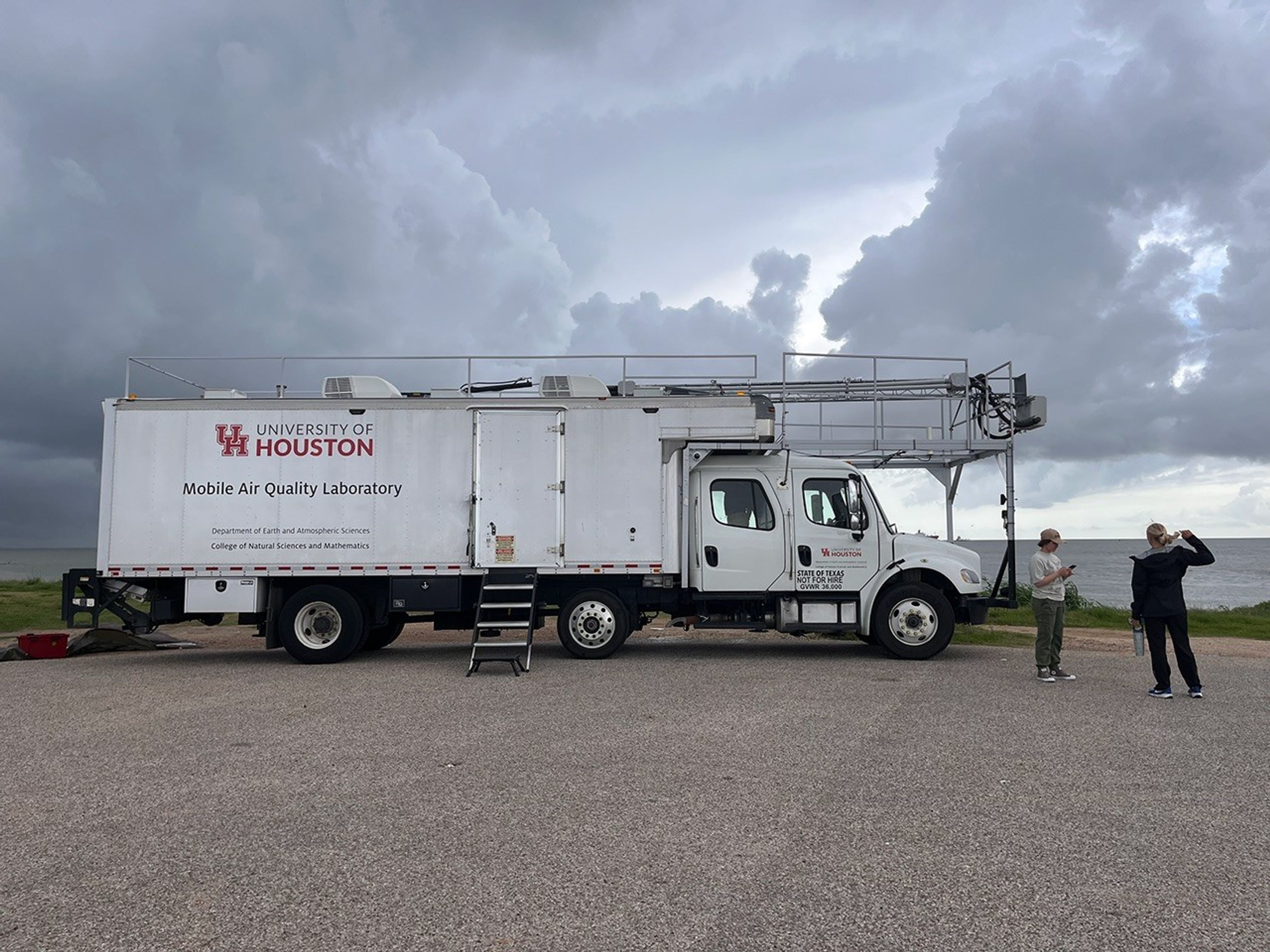
With the support of program mentors and faculty, and aboard the University of Houston’s Mobile Air Quality Laboratory (MAQL), the SARP interns participated in every step of the process.  

A large white truck is centered in the image. Stairs lead up to the back end of the truck, up to a currently closed door. The truck has a label on the back saying “University of Houston Mobile Air Quality Laboratory”. Two people are standing to the right of the image. Dark clouds billow in the background of the image.
The Mobile Air Quality Laboratory (MAQL) stands ready for some fieldwork.
NASA/Erica McNamee

Let’s set the scene: About 45 minutes away from this year’s SARP home base at the Lone Star Flight Museum in Houston, the MAQL drove down the Texas City Dike, a long strip of land jutting into the Texas Gulf Coast—an open space perfect for releasing the weather balloon. Among the 45 total students in the program, this group was assigned to meet the mobile lab at the balloon release location at  8 a.m. Central Time, just after a rainstorm rolled through. 

Inside the lab, the students prepared ozonesondes for takeoff, completing the final steps that include measuring and pipetting cathode and anode solutions into the instrument cells attached to the sensor and testing each instrument’s response and baseline. 

Outside the mobile laboratory, gusts of wind made it difficult to keep the balloon still while it was being filled with helium. Four students donned leather gloves to minimize oils from their fingers touching the balloon, which can make it pop faster after deployment. They wrangled the balloon while faculty advisor Travis Griggs, instructional assistant professor of atmospheric science from the University of Houston, filled it.  

The center of the image shows a large white balloon. Beneath the balloon are five people in a circle, gently holding at the bottom of the balloon to keep it upright. In the background of the image, other people watch.
SARP students prepare the weather balloon for takeoff by filling it up with helium, while making sure it doesn’t pop or fly away.
NASA/Sofie Bates

Five students worked together to keep the balloon from flying away as they strung it to the ozonesonde, protected in a small foam container. 

After confirming the launch location, time, and expected flight path with the Federal Aviation Administration (just a phone call away), it was time to set the weather instrument free.   

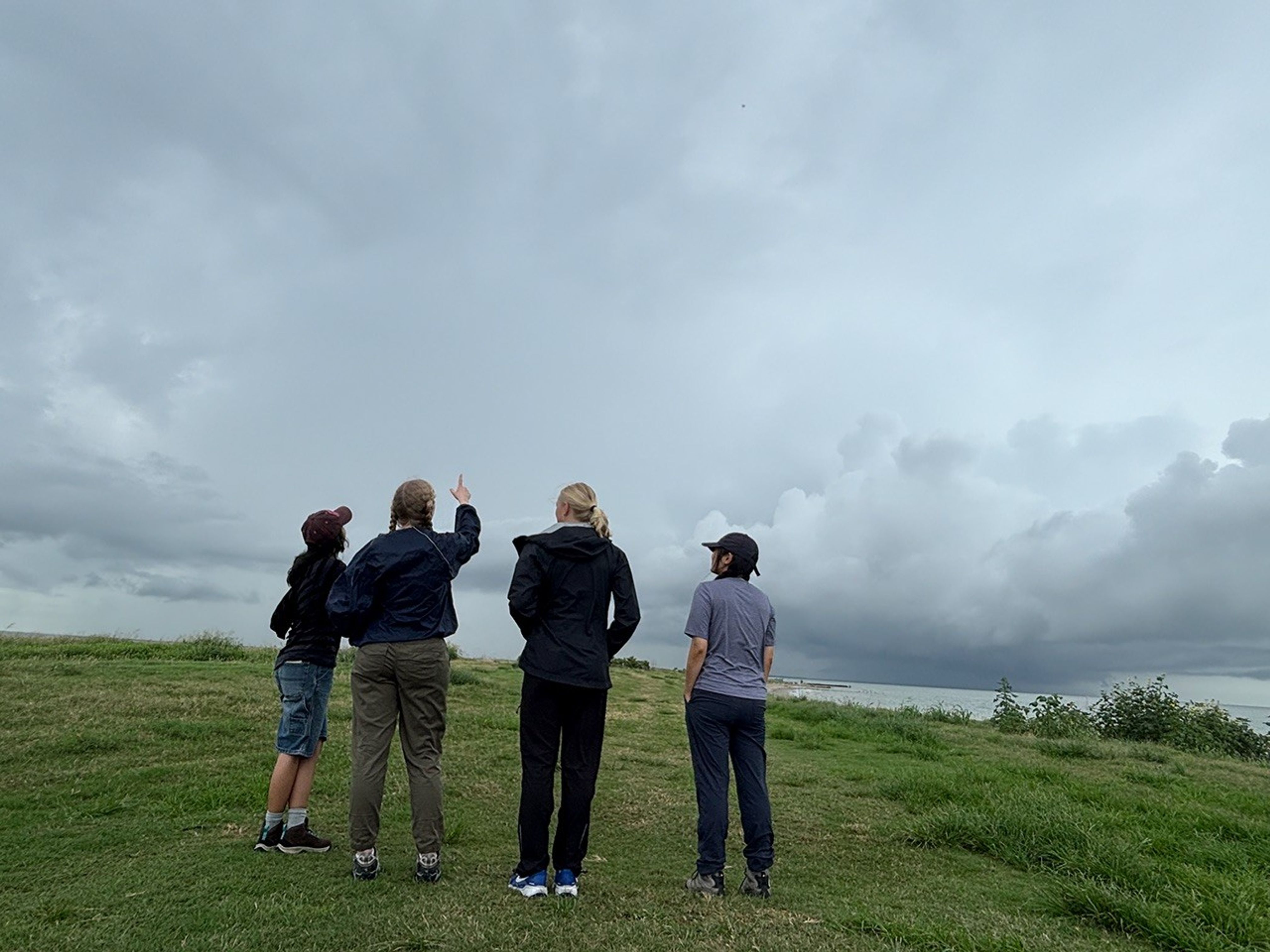
Four students stand in a line centered in the image facing away from the camera. They’re looking up at the sky — a dark and cloud filled sky — and standing on dark green grass. One student, second from the left, points up at the sky.
Even though it’s hard to see, there’s a tiny dot up in the sky—that’s the weather balloon! These students are admiring their work, watching their science experiment float up into the atmosphere to collect data.
NASA/Sofie Bates

“It was like a fight to stay on the ground, with the balloon whipping around in the wind,” said Zayna Haider, SARP intern and atmospheric and climate science student from the University of Washington. “It just flew away as soon as we let it go.” 

But the work had only just begun. The students huddled back inside the MAQL, monitoring data as long as the balloon kept sending it—until it popped or landed, whichever came first. Throughout the day, they repeated this process with two other balloons.  

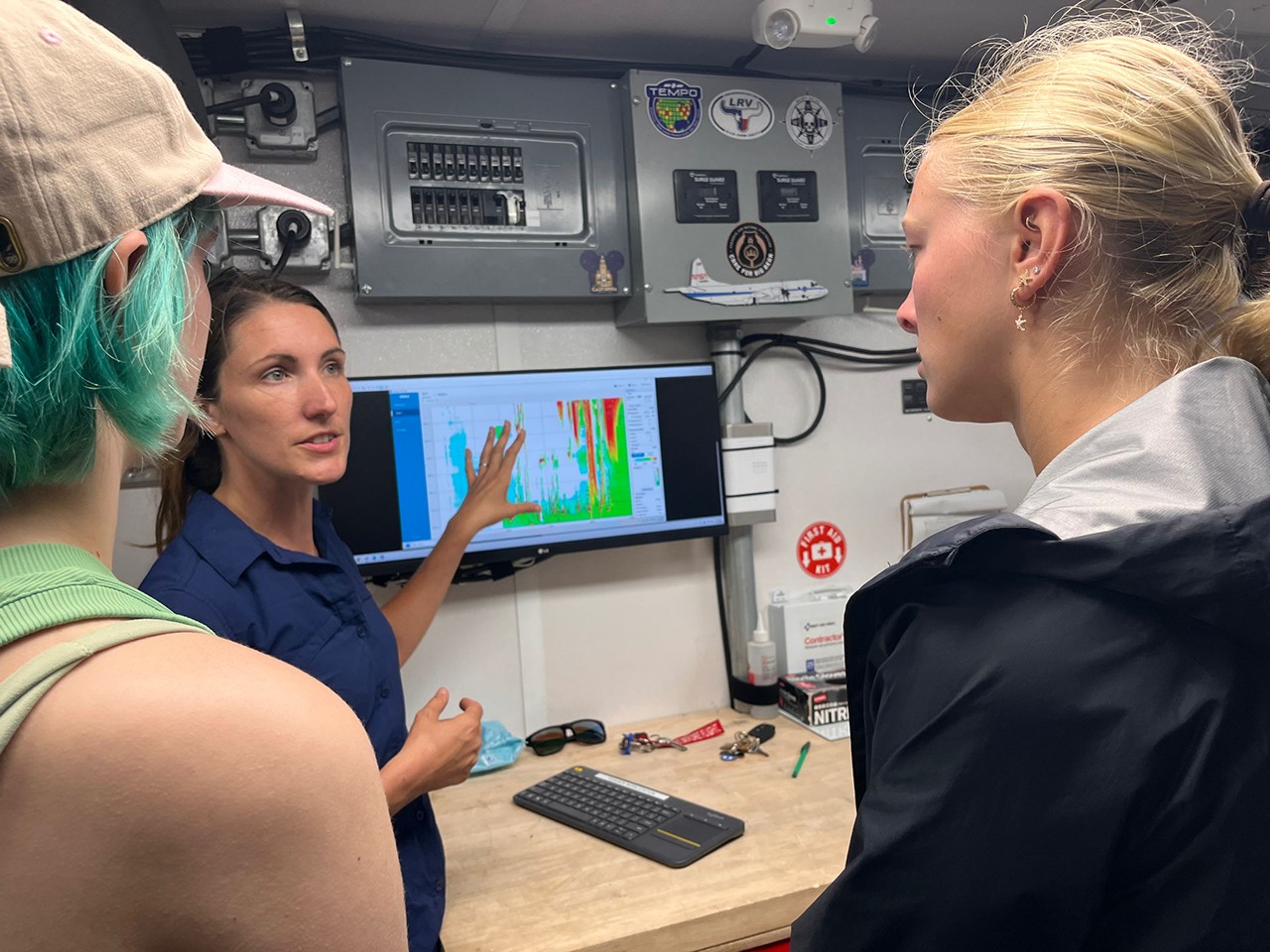
In the background of the image is a computer screen showing science data in green, orange, and red colors. Two students, in the foreground of the image, are looking at the screen, while a woman stands in front of it, looking at the students and pointing at the screen.
Students inside the Mobile Air Quality Laboratory reviewed the data from the weather balloon they had just launched.
NASA/Erica McNamee

This day gave many SARP participants, just starting their science careers, their first glimpse at hands-on fieldwork that reached the edges of the atmosphere. Next, they would use this data and what they learned from the experience for their end-of-internship research presentation.  

“This is beyond what I ever thought it could be,” Stevens said. “I’m super excited for the next seven weeks.” 

The post Up, Up, and Away With Weather Balloons  appeared first on NASA Science.

NASA-Funded Study Shows Wildfire Smoke’s Hidden Ozone Toll

4 June 2026 at 19:01
5 Min Read

NASA-Funded Study Shows Wildfire Smoke’s Hidden Ozone Toll

Canadian wildfire smoke carried carbon monoxide — a building block of ground-level ozone — thousands of miles downwind in June 2023.
Credits:
NASA’s Goddard Space Flight Center

Wildfire smoke is stoking a new challenge for cleaner air. A NASA-supported study published Thursday found that, over the last decade, wildfires have worsened ground-level ozone pollution across much of the contiguous United States, creating unhealthy air far from active flames.

Wildfires have become an increasingly important contributor to ground-level ozone, or smog, across much of the United States, researchers report June 4 in the journal Science. Nationally, fires offset nearly four years’ worth of ozone-control gains, with larger setbacks in the West and Midwest.

Smoke often is associated with the soot, ash, and other fine particles that make the air look hazy. But wildfires also emit gases such as carbon monoxide, which can help form surface ozone in sunlight when other pollutants are present. Surface ozone is an invisible pollutant harmful to human health, plants, and crops. As smoke plumes travel and mix with other pollution, those reactions can drive ozone increases hundreds or even thousands of miles from active fires.

“NASA Earth observations, along with ground monitoring networks, help reveal air quality risks from wildfires that can cross state lines, giving air quality managers better decision-making information as wildfire smoke affects more communities,” said John Haynes, manager of NASA Earth Action’s Health and Air Quality program at the agency’s Headquarters in Washington. “This is a strong example of NASA science serving communities here in the U.S.”

Building a clearer ozone picture

High in the atmosphere, ozone shields Earth from harmful ultraviolet radiation. Near the ground, however, ozone can irritate lungs, worsen asthma and other respiratory diseases, and increase health risks for children, older adults, outdoor workers, and people with existing health conditions.

To track surface ozone changes, researchers turned to deep learning, a form of artificial intelligence that finds patterns across large datasets. They used it to build a first-of-its-kind dataset estimating daily surface ozone from 2003 to 2024 on a kilometer-by-kilometer grid — about 0.6 miles on each side — across the contiguous U.S. The work received support from NASA’s Health and Air Quality program and other NASA grants.

The scientists combined data from about 1,000 ground-based air quality stations with atmospheric model data, weather information, wildfire pollution data, and satellite-derived information, including products from the Visible Infrared Imaging Radiometer Suite (VIIRS) and the Moderate Resolution Imaging Spectroradiometer (MODIS) instruments.

Smoke from Canada’s 2023 wildfires spread across North America. Tan to deep red colors show smoke intensity, estimated from black carbon in NASA’s GEOS-FP model.
NASA’s Scientific Visualization Studio (SVS) and NASA’s Global Modeling Assimilation Office (GMAO)

Their analysis revealed two distinct periods. From 2003 to 2015, U.S. ground-level ozone generally declined as emissions of ozone-forming pollutants decreased. After 2015, however, those gains slowed or reversed in many places. By comparing estimated ozone levels with scenarios that removed wildfire influence, the researchers found that pollution from wildfires was a main factor in that shift.

Without the wildfire contribution, ground-level ozone in the Midwest, for example, would likely have continued to decline. Instead, wildfires erased about 5.3 years’ worth of ozone-control progress since 2015.

“People in the Midwest may think fires burning far away will not affect them,” said the study’s corresponding author Jun Wang, an atmospheric scientist at the University of Iowa in Iowa City. “But once wildfire pollution is in the air, it can move across regions. Pollution from one place can affect air quality in another.”

Measuring the health toll

The study also found that wildfire-driven ozone increased exposure to unhealthy air and likely contributed to premature deaths. Premature deaths associated with long-term wildfire-related ozone exposure in the U.S. increased by an estimated 318 deaths per year after 2013, with the post-2013 average 46% higher than in the previous decade. The researchers calculated premature deaths using average lifespan, ozone exposure estimates, and population density.

The 2023 Canadian wildfires showed how widely those risks can spread, with smoke-driven ozone increases stretching across the Midwest and into parts of the Northeast and South. Overall, from 2022 to 2024, wildfires exposed an additional 43 million people in the U.S. to conditions that did not meet current federal air quality standards for ozone, the researchers estimated.

Capturing that national picture is difficult from ground monitors alone. Ground monitors remain the backbone of U.S. air quality tracking, but they do not cover every community. NASA’s scientifically validated satellite observations and models help researchers and agencies see air quality patterns across states, regions, and fire seasons.

That broader air quality work includes newer missions such as TEMPO (Tropospheric Emissions: Monitoring of Pollution). Launched in 2023, TEMPO is NASA’s first mission to use a space-based spectrometer to provide hourly daytime measurements of air quality over North America. Its view is sharp enough to distinguish pollution patterns, including surface ozone, across areas only a few square miles wide, a major improvement over earlier satellites.

Together, these capabilities help researchers and agencies see smoke-related ozone patterns that might otherwise be harder to detect, especially in rural and remote areas.

The work also points toward a practical use of NASA science during fire season. Wang’s team has used NASA support to develop FireAQ, a decision-support system that brings satellite observations, model forecasts, and fire and aerosol products into weekly briefings with state and local air quality officials. The goal is to help officials see where smoke-related pollution may move next and give communities better information.

About the Author

Emily DeMarco

Emily DeMarco

Writer/Editor (IV), Earth Science Division

Share

Details

Last Updated
Jun 05, 2026
Contact
Emily DeMarco
Location
Goddard Space Flight Center
❌