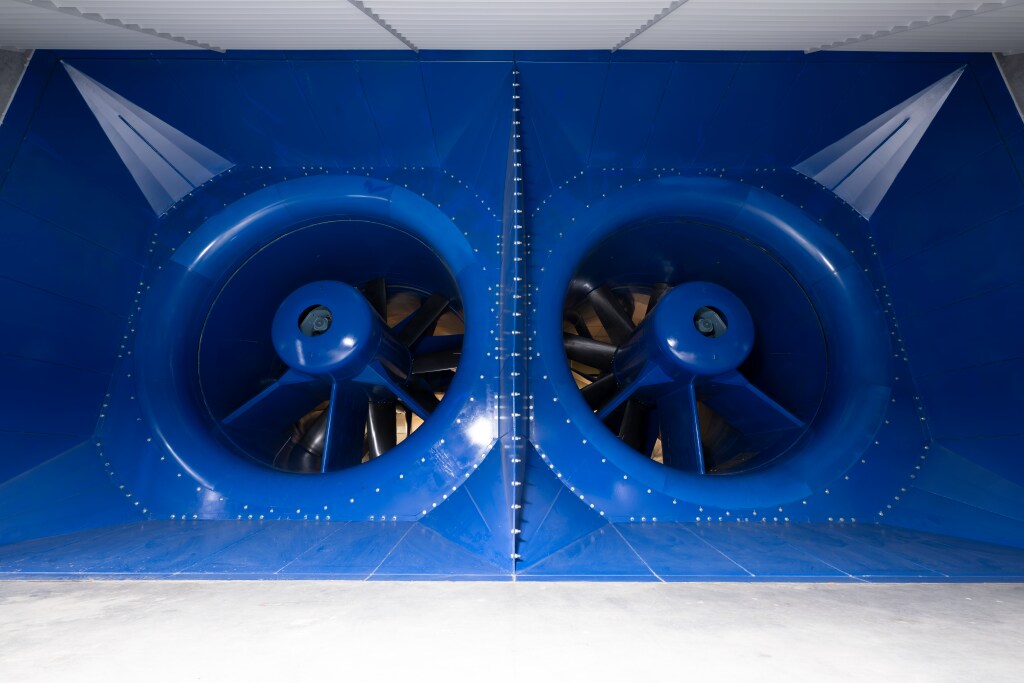
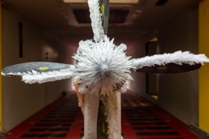
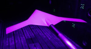
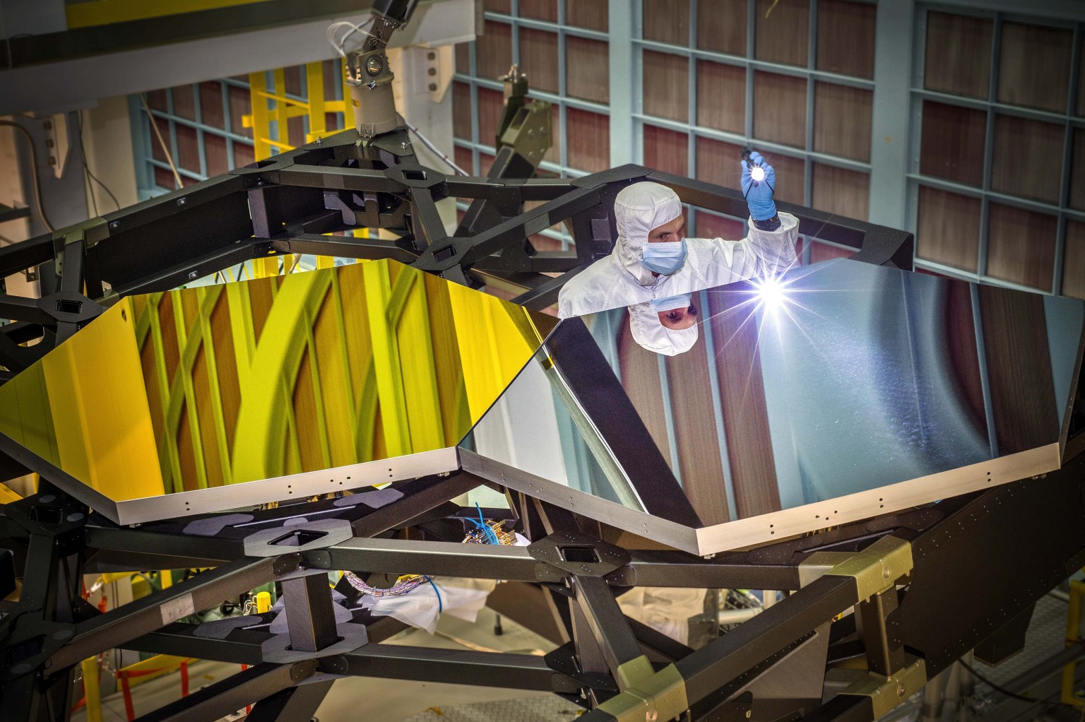
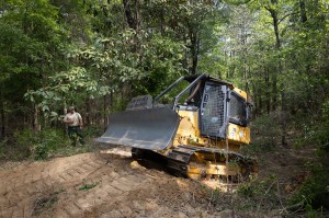
The Flight Dynamics Research Facility (FDRF) is a large, subsonic wind tunnel with a vertical test section for conducting flight dynamics research for stability, controllability, free-fall and aircraft spin, and spin recovery testing of atmospheric vehicles.
Characteristics
Test Section Dimensions: 20 ft. diam. by 24 ft. high
NASA astronaut Andre Douglas, ESA (European Space Agency) astronaut Luca Parmitano, and NASA astronauts Randy Bresnik and Frank Rubio take a photo together on June 9, 2026. The four were announced as the Artemis III crew.
NASA’s Artemis III mission in low Earth orbit will test integrated operations between the Orion spacecraft and one or both commercial landers from SpaceX and Blue Origin respectively.
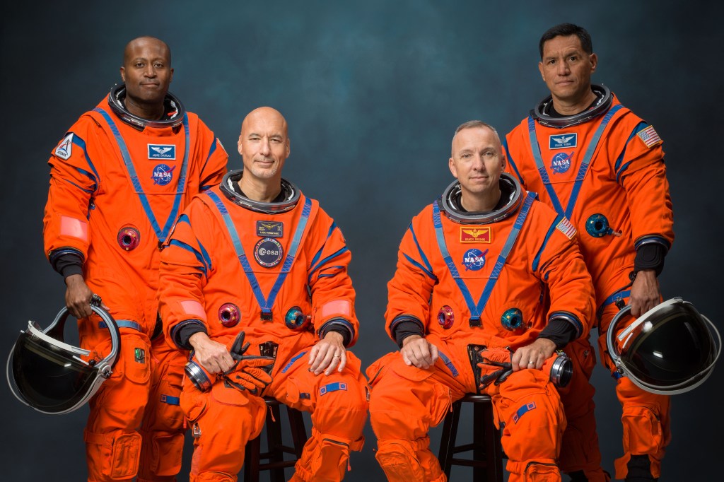
La tripulación de Artemis III posa para una foto oficial en sus trajes espaciales naranjas (de izquierda a derecha: Andre Douglas, Luca Parmitano, Randy Bresnik y Frank Rubio).
La NASA dio el martes otro paso hacia una de las misiones tripuladas más complejas de la historia reciente al ofrecer nuevos detalles sobre Artemis III y anunciar a los cuatro miembros principales de la tripulación y a un suplente para este vuelo de prueba. En 2027, la misión llevará a cabo una serie de exigentes pruebas cerca de la Tierra que son esenciales para Artemis IV, la primera misión tripulada al Polo Sur lunar, prevista para 2028.
En la misión Artemis III, el cohete SLS (por las siglas en inglés de Sistema de Lanzamiento Espacial) de la agencia lanzará la nave espacial Orion y a su tripulación desde el Centro Espacial Kennedy de la NASA, en Florida, a la órbita terrestre baja. Tras las verificaciones de los sistemas de Orion, la nave espacial demostrará por primera vez sus capacidades de encuentro y acoplamiento con versiones de prueba de uno o ambos sistemas comerciales estadounidenses de aterrizaje humano, que están siendo desarrollados por Blue Origin y SpaceX. Esta misión, cuidadosamente coreografiada, incluye una espectacular campaña de múltiples lanzamientos de los cohetes más potentes del mundo y pondrá a prueba el equipamiento integrado entre Orion y los módulos de aterrizaje, así como las interfaces de los sistemas, el software, la propulsión y las comunicaciones.
Los astronautas asignados a la tripulación son los siguientes:
el astronauta de la ESA (Agencia Espacial Europea) Luca Parmitano, piloto
el astronauta de la NASA Andre Douglas, especialista de misión
el astronauta de la NASA Frank Rubio, especialista de misión
Durante el evento del martes, el astronauta de la NASA Bob Hines fue nombrado miembro suplente de la tripulación. La tripulación comenzará a entrenarse de inmediato en los sistemas de la nave espacial Orion y también colaborará en el desarrollo y las operaciones de las versiones de prueba de los módulos de aterrizaje de Blue Origin y SpaceX.
“Hoy damos otro paso audaz en el regreso de la humanidad a la Luna, basándonos en los extraordinarios cimientos sentados por los astronautas de Artemis II”, dijo el administrador de la NASA, Jared Isaacman. “Sus logros reavivaron el entusiasmo mundial por la exploración, y ahora le pasan la antorcha al equipo de Artemis III: Randy, Luca, Frank y Andre. Artemis III demostrará el poder de la innovación estadounidense y la colaboración internacional mientras ponemos a prueba operaciones complejas de encuentro y acoplamiento, y avanzamos las tecnologías que algún día nos llevarán más adentro del sistema solar. Esta misión requerirá la coordinación más impresionante de lanzamientos de cohetes de carga pesada de la historia, aprovechando el talento y las capacidades de equipos de todo el ámbito gubernamental y de la comunidad de vuelos espaciales. Los astronautas de Artemis III, junto con la ESA y nuestros socios internacionales, y las decenas de miles de las personas más brillantes y capaces de la agencia y la industria, están dando inicio a una nueva edad dorada de la exploración, impulsando las esperanzas y los sueños de la próxima generación, así como los astronautas del programa Apolo lo hicieron por tantos de nosotros”.
Esta también es la primera vez que se asigna a un astronauta de la ESA a una misión de Artemis.
“Artemis III ampliará los límites de las operaciones de naves espaciales en órbita. La asignación de Luca como piloto refleja la profundidad de la experiencia europea en los vuelos espaciales tripulados y se basa en su amplia experiencia operativa en situaciones de alta presión”, dijo Josef Aschbacher, director general de la ESA. “Al mismo tiempo, el Módulo de Servicio Europeo de la ESA volverá a aportar las capacidades fundamentales que proporcionan energía a Orion, lo que demuestra la presencia duradera de Europa en el corazón mismo del programa Artemis. La noticia que hoy llega desde Houston es un poderoso reconocimiento del papel de la ESA al hacer posible el regreso de la humanidad a la Luna, y un avance clave en nuestra colaboración con la NASA. Los europeos pueden enorgullecerse de formar parte de este apasionante viaje”.
Avances de la misión
La NASA y sus socios están avanzando en los preparativos para el vuelo de prueba. Este verano boreal, los equipos de ingeniería conectarán el módulo de la tripulación y el módulo de servicio de Orion, e integrarán el sistema de acoplamiento de la nave espacial, que volará por primera vez. Continúan las pruebas del escudo térmico, ya que cada uno de los bloques ha sido sometido a inspecciones ultrasónicas y se ha instalado en la estructura del escudo térmico.
El procesamiento del cohete también está muy avanzado. Los técnicos de SLS están integrando la sección del motor con el resto de la etapa central antes de instalar los cuatro motores RS-25 este verano boreal. Con todos los segmentos de los propulsores sólidos del cohete ya en el centro Kennedy de la NASA y el acondicionamiento del lanzador móvil avanzando según lo previsto, también se prevé que el apilamiento del cohete comience este verano. La NASA continúa con el diseño y la fabricación de un segmento espaciador que reemplazará la etapa superior en Artemis III.
Blue Origin está desarrollando una versión tripulada de su módulo de aterrizaje lunar Blue Moon, mientras que SpaceX está desarrollando una versión de módulo de aterrizaje lunar tripulado de su nave Starship. Ambas empresas están construyendo unidades de prueba para Artemis III. La NASA brinda apoyo directo a ambos proveedores de módulos de aterrizaje durante el diseño, el desarrollo, las pruebas y la evaluación, lo que incluye compartir la experiencia y las capacidades de la agencia obtenidas en misiones anteriores.
Durante el evento, la NASA ofreció actualizaciones de la agencia y de ambos socios comerciales, así como detalles sobre las operaciones previstas para Artemis III, las cuales respaldarán una mayor cadencia de misiones, aumentarán la producción e impulsarán mejoras en la cadena de suministro del programa Artemis.
La misión Artemis III se basa en el exitoso vuelo de Artemis II, que se completó en abril, y ayudará a la agencia a prepararse para enviar a los primeros astronautas, estadounidenses, a Marte.
Artemis III contempla el lanzamiento en rápida sucesión de los cohetes más potentes del mundo. El módulo de aterrizaje de exploración (pathfinder) de Blue Origin, que puede permanecer en órbita durante varias semanas, se lanzará primero y esperará a la tripulación. La NASA usará el cohete SLS para enviar a los astronautas a bordo de Orion a orbitar la Tierra, antes de un encuentro en el espacio con la unidad de prueba del módulo de aterrizaje de la empresa, con la cual Orion permanecerá acoplada durante unos dos días para llevar a cabo pruebas y demostraciones tecnológicas, incluido el ingreso al módulo de aterrizaje.
Tras completar las operaciones acoplada con Blue Origin, Orion se separará y esperará a Starship. El módulo de exploración Starship de SpaceX se lanzará y se encontrará con Orion para pasar aproximadamente un día acoplados para verificaciones y pruebas. Después de eso, Orion y su tripulación se desacoplarán y regresarán a casa, amerizando de manera segura en el océano Pacífico, donde un equipo de la Marina de Estados Unidos y la NASA recuperará a los astronautas.
En total, se prevé que la tripulación permanezca en el espacio durante unas dos semanas. La duración exacta de la misión se determinará en tiempo real en función de las operaciones de lanzamiento, encuentro y acoplamiento.
Más información sobre los miembros de la tripulación de Artemis III Esta será la tercera misión espacial de Bresnik, quien fue lanzado a bordo del trasbordador espacial Atlantis en la misión STS-129 a la Estación Espacial Internacional en 2009. Posteriormente, viajó a la estación espacial en la nave espacial Soyuz MS-05 desde el Cosmódromo de Baikonur, en Kazajistán, y se desempeñó como ingeniero de vuelo en la Expedición 52 y como comandante de la Expedición 53 de la estación. Originario de California, se graduó en The Citadel con un título en matemáticas y fue seleccionado por la NASA en la promoción de candidatos a astronautas de 2004. Coronel retirado del Cuerpo de Marines de Estados Unidos, ha acumulado más de 7.000 horas de vuelo en 95 tipos de aeronaves y es miembro de la Sociedad de Pilotos de Pruebas Experimentales. Desde 2018, se ha desempeñado como asistente del jefe de la Oficina de Astronautas para asuntos de exploración, supervisando el desarrollo y las pruebas de la nave espacial y los sistemas que operarán durante las misiones de Artemis.
Artemis III también será el tercer vuelo espacial de Parmitano. Seleccionado por la ESA como astronauta en 2009, primero se desempeñó como ingeniero de vuelo en la primera misión de larga duración de la Agencia Espacial Italiana (ASI, por sus siglas en italiano) a la estación espacial, despegando en una nave Soyuz desde Baikonur en 2013. Regresó al laboratorio orbital en 2019 a bordo de Soyuz MS-13 para su segunda misión, durante la cual ejerció de comandante de la Expedición 61 y se convirtió en el tercer europeo, y el primer italiano, en comandar la estación. Parmitano obtuvo una licenciatura en ciencias políticas en la Universidad de Nápoles Federico II y una maestría en ingeniería de pruebas de vuelo experimentales en el Instituto Superior de la Aeronáutica y del Espacio en Toulouse, Francia. Graduado de la Academia de la Fuerza Aérea Italiana, se convirtió en piloto de pruebas en 2007 y fue ascendido a coronel en 2019. Ha acumulado más de 2.000 horas de vuelo en 40 tipos de aeronaves.
Este será el segundo viaje al espacio de Rubio, quien fue lanzado a bordo de la nave espacial Soyuz MS-22 desde Baikonur a la estación espacial el 21 de septiembre de 2022 y regresó el 27 de septiembre de 2023, batiendo el récord del vuelo espacial individual más largo realizado por un astronauta estadounidense, con 371 días en órbita. Rubio fue seleccionado por la NASA en la promoción de candidatos a astronautas de 2017. Originario de Florida, se graduó en la Academia Militar de Estados Unidos en 1998, obtuvo un doctorado en medicina en la Universidad de Servicios Uniformados de las Ciencias de la Salud en 2010 y ha servido durante más de 28 años en el Ejército de Estados Unidos como aviador, médico y astronauta.
La misión es el primer vuelo espacial de Douglas. Fue seleccionado por la NASA en la promoción de candidatos a astronautas de 2021 y anteriormente se desempeñó como miembro suplente y de la tripulación de cierre de la misión Artemis II de la agencia. Originario de Virginia, Douglas obtuvo una licenciatura en ingeniería mecánica en la Academia de la Guardia Costera de Estados Unidos y cuatro títulos de posgrado en distintas instituciones, entre ellos un doctorado en ingeniería de sistemas de la Universidad George Washington. Durante su tiempo en la Guardia Costera, llevó a cabo operaciones de búsqueda y rescate, salvamento marítimo e interdicción de drogas. Además, su trabajo en el Laboratorio de Física Aplicada de la Universidad Johns Hopkins incluyó el diseño y la prueba de vehículos autónomos multidominio, sistemas de exploración espacial y numerosas plataformas de guerra submarina.
Como miembro suplente de la tripulación, Hines se entrenará junto con Bresnik, Parmitano, Rubio y Douglas. En caso de que un miembro principal de la tripulación no pueda participar en la misión, se uniría a la tripulación de Artemis III. Hines se desempeñó anteriormente como piloto de la misión SpaceX Crew 4 de la NASA a la Estación Espacial Internacional. Seleccionado por la NASA en la promoción de candidatos a astronautas de 2017, antes de su selección se desempeñó como piloto de investigación en el Centro Espacial Johnson de la agencia. Es coronel de la Fuerza Aérea de Estados Unidos, con más de 27 años de servicio como piloto instructor, piloto de combate y piloto de pruebas.
Como parte de una edad de oro de innovación y exploración, la NASA enviará astronautas en misiones cada vez más difíciles para explorar más de la Luna con fines de descubrimiento científico y beneficios económicos, establecer una presencia humana duradera en la superficie lunar y continuar sentando las bases para las primeras misiones tripuladas a Marte.
The Artemis III crew poses for an official portrait (from left: Andre Douglas, Luca Parmitano, Randy Bresnik, Frank Rubio).
Credit: NASA/Bill Stafford
Taking another step toward one of the most complex human spaceflight missions in recent history, NASA on Tuesday provided new Artemis III details and announced the four prime crew members and a backup for the test flight. The mission will undertake a series of challenging tests in Earth orbit in 2027, essential for Artemis IV, the first planned crewed mission to the lunar South Pole in 2028.
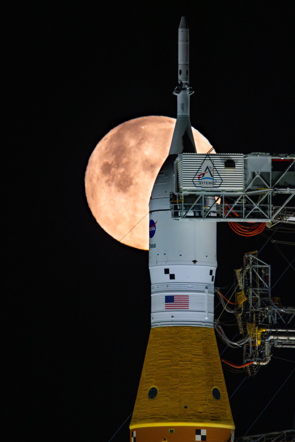
During Artemis III, the agency’s SLS (Space Launch System) rocket will launch the Orion spacecraft and its crew from NASA’s Kennedy Space Center in Florida to low Earth orbit. After Orion systems checkouts, the spacecraft will, for the first time, demonstrate rendezvous and docking capabilities with test versions from one, or both, American commercial human landing systems in development by Blue Origin and SpaceX. This highly choreographed mission includes a dramatic multi-launch campaign of the world’s most powerful rockets, testing integrated hardware between Orion and the landers, including system interfaces, software, propulsion, and communications.
As part of Tuesday’s event, NASA astronaut Bob Hines was named as a backup crew member. The crew will begin training immediately on Orion spacecraft systems, as well as assist in the development and operations of the test versions of Blue Origin and SpaceX landers.
“Today we take another bold step in humanity’s return to the Moon, building on the extraordinary foundation laid by the Artemis II astronauts,” said NASA Administrator Jared Isaacman. “Their achievements reignited global excitement for exploration, and now they pass the torch to the Artemis III team, Randy, Luca, Frank, and Andre. Artemis III will demonstrate the power of American innovation and international partnership as we test complex rendezvous and docking operations and advance the technologies that will one day carry us deeper into the solar system. This mission will require the most awe-inspiring coordination of heavy-lift rocket launches in history, drawing on the talent and capability of teams across government and the spaceflight community. The Artemis III astronauts, alongside ESA and our international partners, and the tens of thousands of the best and brightest across the agency and industry, are ushering in a new Golden Age of exploration carrying forward the hopes and dreams of the next generation just as the Apollo astronauts did for so many of us.”
This also is the first time an ESA astronaut has been assigned an Artemis mission.
“Artemis III will push the boundaries of spacecraft operations in orbit. Luca’s assignment as pilot reflects the depth of European expertise in human spaceflight and draws on his extensive operational experience in high-pressure situations,” said Josef Aschbacher, ESA’s director general. “At the same time, ESA’s European Service Module will once again provide the critical capabilities that power Orion, demonstrating Europe’s enduring role at the very heart of the Artemis program. The news out of Houston today is a powerful recognition of ESA’s role in enabling humanity’s return to the Moon – and a key advancement in our partnership with NASA. Europeans can take pride in being part of this exciting journey.”
Mission progress
NASA and its partners are making progress preparing for the test flight.
Engineers will connect the Orion crew module and service module this summer and integrate the spacecraft’s docking system, which will fly for the first time. Heat shield testing continues with individual blocks having undergone ultra-sonic inspections and installation onto the heat shield structure.
Rocket processing also is well underway. Technicians for SLS are integrating the engine section to the rest of the core stage ahead of installing the four RS-25 engines this summer. With all solid rocket booster segments now at NASA Kennedy and mobile launcher refurbishments on track, rocket stacking also is scheduled to begin this summer. NASA continues design and fabrication of a spacer that will replace the upper stage on Artemis III.
Blue Origin is developing a crewed lunar version of the company’s Blue Moon lander, while SpaceX is developing a crewed lunar lander version of the company’s Starship, with both companies building test articles for Artemis III. NASA is supporting both lander providers hands-on throughout design, development, testing, and evaluation, including sharing agency expertise and capabilities gained from previous missions.
In addition to status updates from NASA and both commercial partners, the agency discussed details during the event about the planned operations for Artemis III, which will support an increased mission cadence, ramp up production, and drive supply chain improvements for the Artemis program.
The Artemis III mission builds on the successful Artemis II flight completed in April and will help the agency prepare to send the first astronauts, Americans, to Mars.
Artemis III includes launching the world’s most powerful rockets in short order. Blue Origin’s lander pathfinder, which is able to stay in orbit for multiple weeks, will launch first and await the crew. NASA will send the astronauts aboard Orion by SLS to orbit Earth, before rendezvousing in space with the company’s lander test article and spending about two days docked together for tests and technology demonstrations, including entering the lander.
After completing docked operations with Blue Origin, Orion will detach and await Starship. SpaceX’s Starship pathfinder will launch and meet up with Orion to spend about a day connected for checkouts and testing. After that, Orion and its crew will undock and return home, splashing safely down in the Pacific Ocean where a team from the U.S. Navy and NASA will recover the astronauts.
In total, the crew is expected to remain in space for about two weeks, with exact mission length to be determined in real-time based on launch, rendezvous, and docked operations.
Learn more about Artemis III crew members
This will be the third mission to space for Bresnik, having launched aboard space shuttle Atlantis on the STS-129 mission to the International Space Station in 2009. He later flew on the Soyuz MS-05 spacecraft from the Baikonur Cosmodrome in Kazakhstan to the space station, serving as a flight engineer for the station’s Expedition 52 and commander of Expedition 53. A California native, he graduated from The Citadel with a degree in mathematics and was selected by NASA in the 2004 astronaut candidate class. A retired U.S. Marine colonel, he has logged more than 7,000 hours in 95 types of aircraft and is a fellow in the Society of Experimental Test Pilots. Since 2018, he has served as assistant to the chief of the Astronaut Office for exploration, overseeing the development and testing of the spacecraft and systems that will operate during Artemis missions.
Artemis III also will be the third spaceflight for Parmitano. Selected by ESA as an astronaut in 2009, he first served as a flight engineer on the Italian Space Agency’s (ASI) first long-duration mission to the space station, launching on a Soyuz from Baikonur in 2013. He returned to the orbital laboratory in 2019 aboard Soyuz MS-13 for his second mission, during which he served as commander of Expedition 61, becoming the third European, and the first Italian, to command the station. Parmitano earned a bachelor’s degree in political sciences from the University of Naples Federico II and a master’s degree in experimental flight test engineering from the Institut Supérieur de l’Aéronautique et de l’Espace in Toulouse, France. A graduate of the Italian Air Force Academy, he became a test pilot in 2007 and was promoted to colonel in 2019. He has logged more than 2,000 flight hours across 40 types of aircraft.
Rubio is making his second trip to space. He launched aboard the Soyuz MS-22 spacecraft from Baikonur to the space station on Sept. 21, 2022, and returned on Sept. 27, 2023, breaking the record for the longest single-duration spaceflight by an American astronaut with 371 days in orbit. Rubio was selected by NASA in the 2017 astronaut candidate class. A Florida native, he graduated from the U.S. Military Academy in 1998, earned a doctor of medicine from the Uniformed Services University of the Health Sciences in 2010, and has served for more than 28 years in the U.S. Army as an aviator, a physician, and an astronaut.
The mission is Douglas’ first spaceflight. Selected by NASA in the 2021 astronaut candidate class, he previously served as a backup and closeout crew member for the agency’s Artemis II mission. A Virginia native, Douglas earned a bachelor’s degree in mechanical engineering from the U.S. Coast Guard Academy and four postgraduate degrees from various institutions, including a doctorate in systems engineering from George Washington University. During his time in the Coast Guard, he conducted search and rescue, maritime salvage, and drug interdiction operations. Additionally, his time at the Johns Hopkins University Applied Physics Laboratory involved designing and testing multidomain autonomous vehicles, space exploration systems, and numerous undersea warfare platforms.
Serving as a backup crew member, Hines will train alongside Bresnik, Parmitano, Rubio, and Douglas. Should a primary crew member be unable to participate in the mission, he would join the Artemis III crew. Hines previously served as pilot of NASA’s SpaceX Crew-4 mission to the International Space Station. Selected by NASA in the 2017 astronaut candidate class, he served as a research pilot at the agency’s Johnson Space Center prior to his selection. He is a colonel in the U.S. Air Force with more than 27 years of service as an instructor pilot, fighter pilot, and test pilot.
As part of the Golden Age of innovation and exploration, NASA will send Artemis astronauts on increasingly difficult missions to explore more of the Moon for scientific discovery, economic benefits, establish an enduring human presence on the lunar surface, and to build on our foundation for the first crewed missions to Mars.
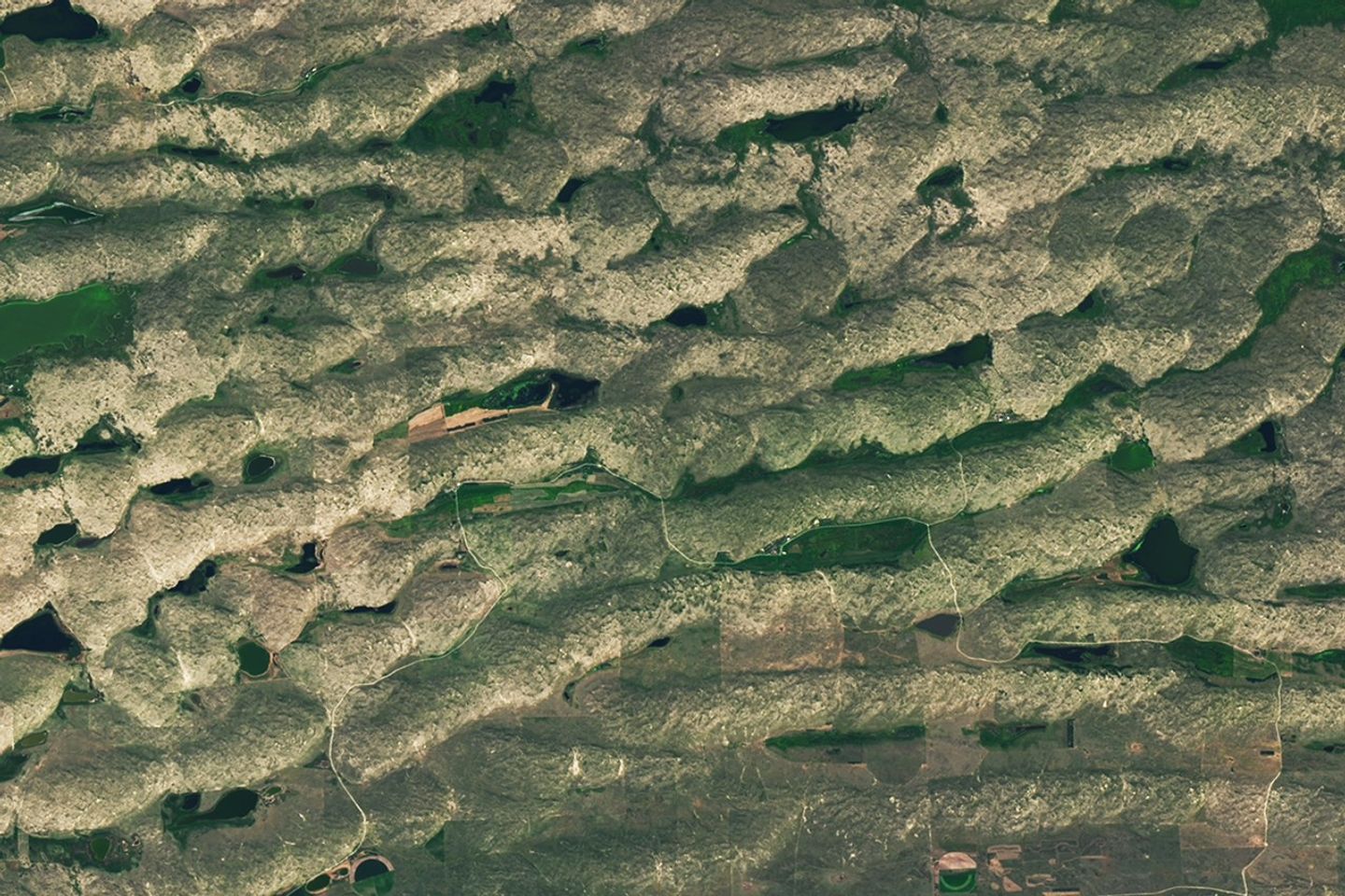
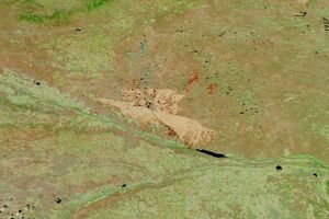
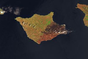
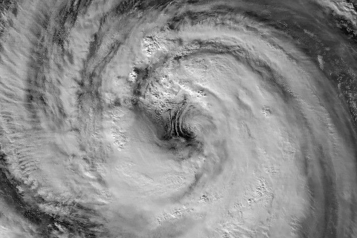
Every month, NASA Earth Observatory features a puzzling satellite image. The June 2026 puzzler appears above.
Your Challenge Identify the location shown in this satellite image. Share what clues you see, where you think it is, and what makes this place interesting or unique to you.
How to Answer Submit your response using this form and select “Puzzler Answer” as the topic. Please include your preferred name or alias.
You can keep it simple and just guess the location. Want to impress us? Tell us which satellite and instrument captured the image, which spectral bands were used, or point out a subtle detail about the geology or history of the area. If something catches your eye, or if this is your home or means something to you, we’d love to hear about it.
The Prize We can’t offer prize money or a trip to space to see Earth like satellites and astronauts do. But we can offer something almost as rewarding: puzzler bragging rights.
About a week after the challenge, we’ll post the answer at the top of this page, along with a link to an Earth Observatory Image of the Day story that explains the image in more detail. We’ll recognize the first person who correctly guesses the location, and we may also highlight readers who share especially thoughtful or interesting answers. By submitting a response, you acknowledge that your comments may be edited, excerpted, and published on this page.
Until then, zoom in, look closely, and enjoy the challenge. See you at the reveal!
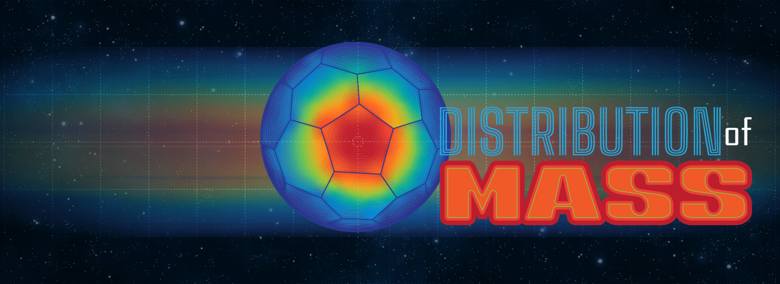
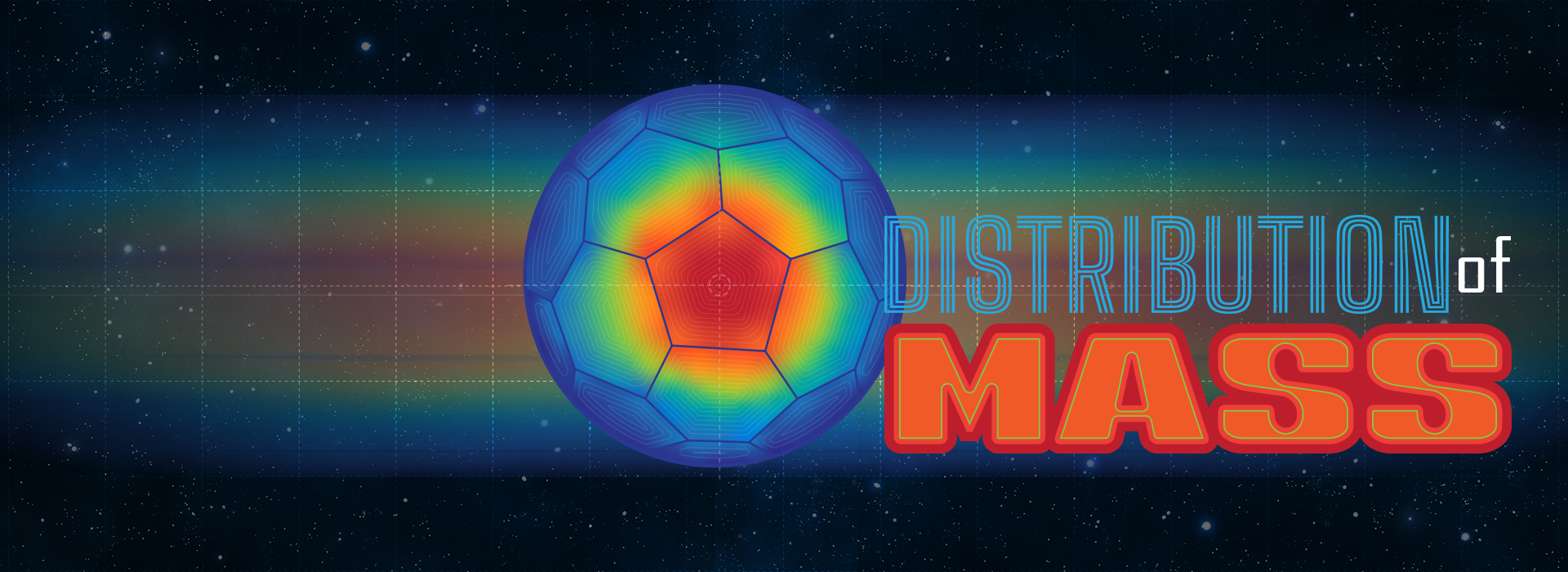
Mass distributionaffects everything from galaxy shapes to aircraft design to planetary rotation. It’s used to map stars in our universe, figure out what planets are made of, and even to determine how luggage is loaded onto an airplane.
Mass distribution can be a tricky thing to understand. So, let’s explore it using an everyday example: a soccer ball.
How Does Mass Distribution Affect Center of Mass?
Have you ever kicked a soccer ball and wondered why it curves, spins, or sometimes wobbles? Mass distribution plays a part.
On the outside, soccer balls look simple – a series of geometric shapes woven together in a pattern. But on the inside, they are carefully engineered. The key to a great soccer ball is something you can’t see: how the mass is distributed inside the ball.
When engineers build a soccer ball, they try to make sure its mass is evenly balanced in all areas. This is because the way a ball spins and flies depends on how its mass is arranged. If one part of the ball is slightly heavier, its center of mass shifts. If the ball’s center of mass isn’t precisely balanced, the ball won’t move smoothly.
Scientists and engineers use tools like precision scales, computer models, and repeated testing to determine an object’s mass distribution. These efforts help them design balanced airplanes, rockets, and even soccer balls. Their goal is to achieve dynamic balance, meaning the object can travel smoothly without unexpected movements.
How Does Gravity Affect How We Study Mass Distribution?
On Earth, gravity hides some of the details about how objects move. In microgravity, astronauts can observe motion more clearly. In 2019, Adidas partnered with NASA and sent soccer balls to the International Space Station.
Astronauts conducted tests to help engineers confirm their designs and understand the physics behind ball motion in ways they simply can’t on Earth. The results of the space station experiments have already helped improve the accuracy and consistency of modern soccer balls.
Try It Yourself
You don’t need to go to space to explore the physics of a ball in motion. Try this experiment at home or school:
Grab different types of sports balls (soccer ball, basketball, tennis ball)
Spin each one on the ground or between your hands
Watch for wobbling, flipping, or smooth spinning
Can you tell which balls are well balanced? Or which ones might have uneven mass distribution?
Career Corner
Are you interested in a career that explores the science and engineering of mass distribution? Many different occupations can help you strike the perfect balance. Here are a few examples:
Computer-Aided Design (CAD) Technician/Drafter: These specialists convert sketches and engineering designs into technical drawings. They use powerful computer software to create detailed 3D and 2D drawings of objects. A two-year associate degree from a technical or community college is key to this career path.
Computational fluid dynamics engineer: These engineers use computer simulation tools to model and analyze fluid behavior in real-world situations. They might study airflow around sport ball designs or explore ways to improve aircraft wings. They need a strong background in engineering and the ability to analyze complex problems.
Physicist: These scientists study matter and energy. They develop models and theories to explain how things work, conduct experiments, and use math to better understand the universe. A career in physics demands a strong understanding of math and complex problem-solving and usually requires an advanced college degree.
Have you ever kicked a soccer ball and wondered why it curves, spins, or sometimes wobbles? NASA astronaut Jessica Meir aboard the International Space Statio...
A period of unsettled weather brought scattered showers and thunderstorms to California’s Bay Area on May 27, 2026. That afternoon, a break in the clouds left downtown San Francisco and nearby communities beneath mostly cloud-free skies, allowing an astronaut aboard the International Space Station to take this photograph.
The image captures two of the region’s iconic bridges. The Golden Gate Bridge connects the northern San Francisco Peninsula with Marin County to the north, while the San Francisco-Oakland Bay Bridge spans the bay toward Oakland to the east.
Near the center of the image, Golden Gate Park stands out as a long, rectangular strip of green amid the dense urban landscape. Spanning more than 1,000 acres (400 hectares), the park encompasses meadows, gardens, wooded areas, and lakes. Additional green space toward the north around the Golden Gate Bridge is part of a national recreation area.
The nadir (downward-looking) perspective also provides a clear view of the patchwork of street grids, which were laid out over San Francisco’s hilly terrain as the city grew in successive stages. In the heart of the downtown area, Market Street runs southwest to northeast and serves as a prominent divider between two distinct grid orientations: one aligned with the bay and the other aligned with the street.
Along the northeastern and eastern waterfront, various structures extend into the bay. Toward the north, these include a historic wharf, seawalls, and piers—most built in the early 1900s, though some date back into the 1800s. The adjacent waters support heavy maritime traffic, including cargo and container ships, cruise vessels, and regional ferries.
Breaking waves are visible along the western coast, including at Ocean Beach, the 3.5-mile stretch of sandy shore adjacent to Golden Gate Park. On May 27, the National Weather Service warned of hazardous conditions at the region’s beaches due to strong northerly winds. Long-period swells from the northwest contributed to the increased risk of rip currents as well as sneaker waves in the days after this image was acquired.
Astronaut photograph ISS074-E-619284 was acquired on May 27, 2026, with a Nikon Z9 digital camera using a focal length of 800 millimeters. It is provided by the ISS Crew Earth Observations Facility and the Earth Science and Remote Sensing Unit at NASA Johnson Space Center. The image was taken by a member of the Expedition 74 crew. The image has been cropped and enhanced to improve contrast, and lens artifacts have been removed. The International Space Station Program supports the laboratory as part of the ISS National Lab to help astronauts take pictures of Earth that will be of the greatest value to scientists and the public, and to make those images freely available on the Internet. Additional images taken by astronauts and cosmonauts can be viewed at the NASA/JSC Gateway to Astronaut Photography of Earth. Story by Kathryn Hansen.
Researchers tested soccer balls aboard the International Space Station to study how internal mass affects motion and stability in microgravity.
NASA
As the FIFA World Cup approaches, NASA is bringing space science and engineering to soccer fans worldwide. From June 11 to July 19, 2026, NASA will host an exhibit at FIFA Fan Festival™ Houston where visitors can learn how research aboard the International Space Station benefits life on Earth and experience missions in low Earth orbit, the Moon, and beyond through the Artemis program.
On June 11, as the FIFA World Cup begins, NASA’s exhibit at Fan Festival Houston will open to the public. The event is free to attend and open for every match of the tournament in East Downtown, Houston. On June 20, Johnson Space Center Director Vanessa Wyche will introduce select Artemis II crew members following their historic mission around the Moon. The crew will participate in World Cup activities ahead of the Netherlands-Sweden match in Houston and will appear on the Fan Festival Houston main stage to share their experience with fans.
The connection between NASA and the World Cup goes beyond the exhibit floor, reaching all the way to orbit. NASA spinoff technologies are innovations developed for space exploration that go on to shape commercial products and everyday life – even on the soccer field.
For more than 25 years, research aboard the International Space Station has enabled breakthroughs in science, technology, and human health while advancing innovations that benefit people on Earth. That work includes studies that improve understanding of the aerodynamics and physics involved in soccer ball flight.
In partnership with the ISS National Laboratory in 2019, researchers used the station’s microgravity environment to study how a soccer ball’s internal mass affects its motion, stability, and rotation. The findings have improved understanding of how embedded technologies, including match-ball sensors, can influence performance during play. The research contributed to studies used in the development and evaluation of soccer balls for major international tournaments, including FIFA World Cup competition.
Understanding the relationship between an object’s center of mass and its geometric center is key to predicting how free-flying objects move, including spacecraft, satellites, and aircraft.
Since 2022, Adidas has embedded electronics inside official match balls used in major tournaments. The sensors track speed, position, and contact in real time to support officiating and broadcast technology. But those sensors also add mass in specific locations inside the ball, and uneven mass distribution can affect how a ball moves through the air.
The space-based research has helped improve understanding of how internal mass, including embedded sensors, can influence stability and rotation in real-world playing conditions.
This work builds on earlier research into how spinning objects behave in microgravity.
Engineers at NASA’s Ames Research Center in Silicon Valley, California tested Adidas’ Brazuca ball, developed for the 2014 FIFA World Cup, in wind tunnel conditions at the Fluid Mechanics Laboratory. Researchers studied aerodynamic behavior, including how low-spin kicks can produce “knuckling,” where the ball moves unpredictably due to unstable airflow across the seams. NASA engineers measured the speeds and flow conditions where this effect was most pronounced.
Adjustments in panel shape, seam depth, and surface texture can influence flight consistency, helping determine whether a ball curves, dips, or holds its line during play.
Now, NASA and Adidas are presenting that science through a STEMonstration that compares how differently balanced soccer balls spin and move in microgravity. The experiment shows how the same physics that governs motion in space also shape the game millions watch on Earth.
Through research aboard the International Space Station and technology developed for exploration, NASA continues to demonstrate how discoveries made for space can benefit people on Earth—including athletes and fans participating in the world’s most popular sport.
Have you ever kicked a soccer ball and wondered why it curves, spins, or sometimes wobbles? NASA astronaut Jessica Meir aboard the International Space Statio...
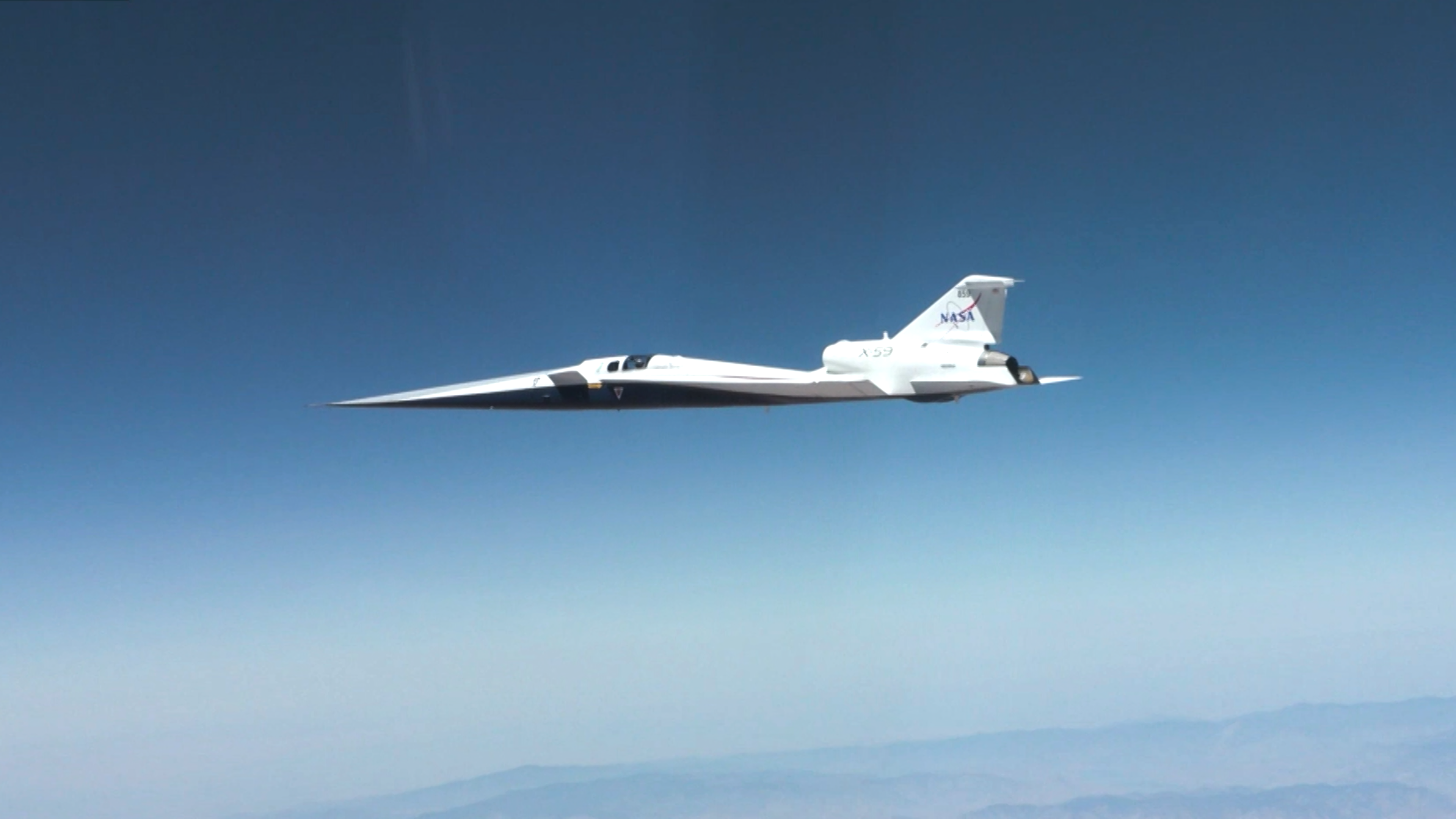
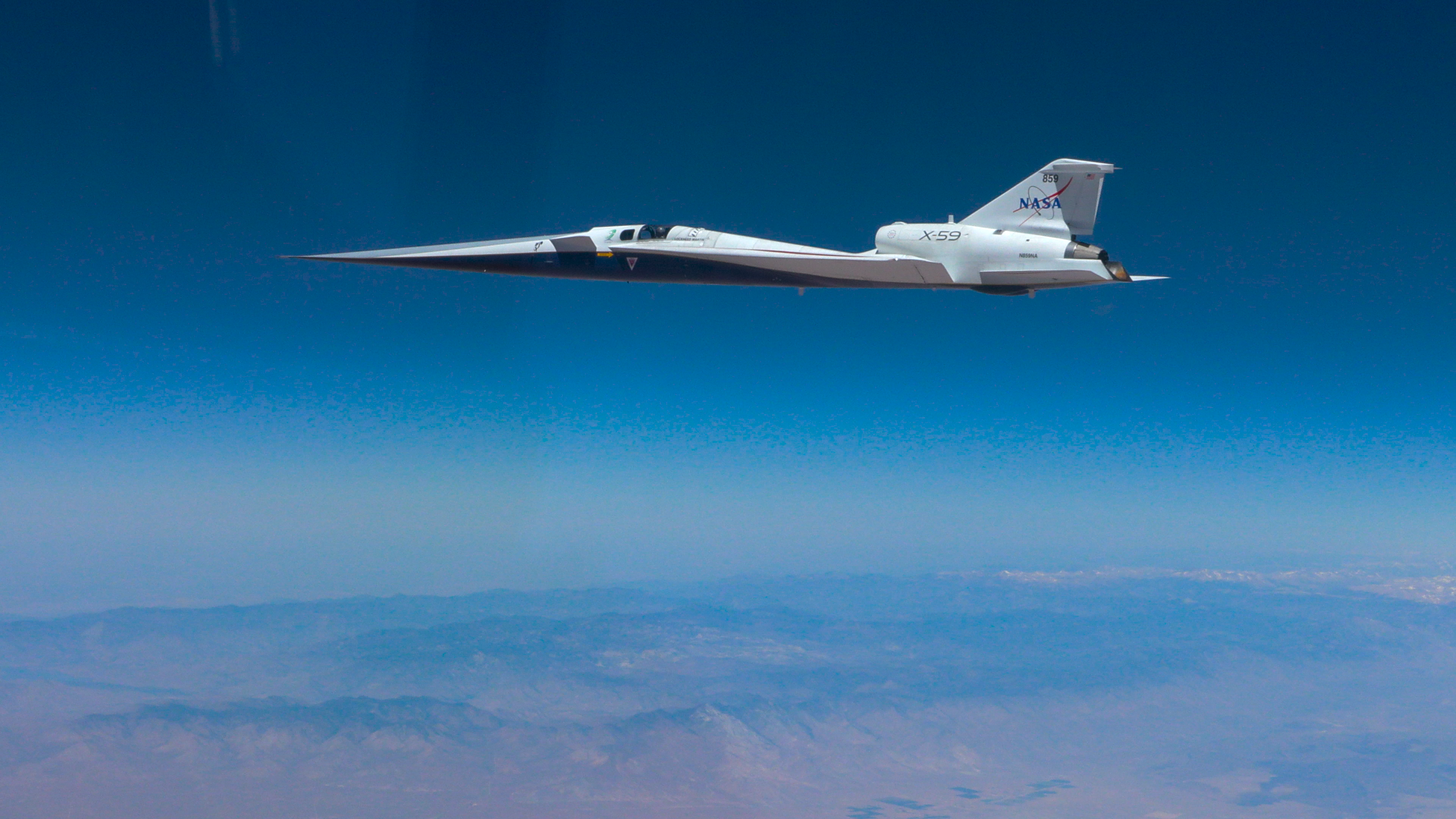
On June 5, 2026, NASA’s experimental X-59 aircraft flew faster than the speed of sound for the first time, setting the stage for demonstrating its quiet supersonic capabilities later this year. NASA test pilot Jim “Clue” Less took off and landed at Edwards Air Force Base in California, reaching a top speed of approximately Mach 1.1 (713 mph). The flight lasted 81 minutes, with the team focusing on flying qualities at both subsonic and then supersonic speeds.
The X-59 is the centerpiece of NASA’s Quesst mission, which aims to demonstrate quiet supersonic flight and help enable commercial supersonic flight over land worldwide. These advancements will help travelers reach their preferred destinations faster, spending less time in the air.
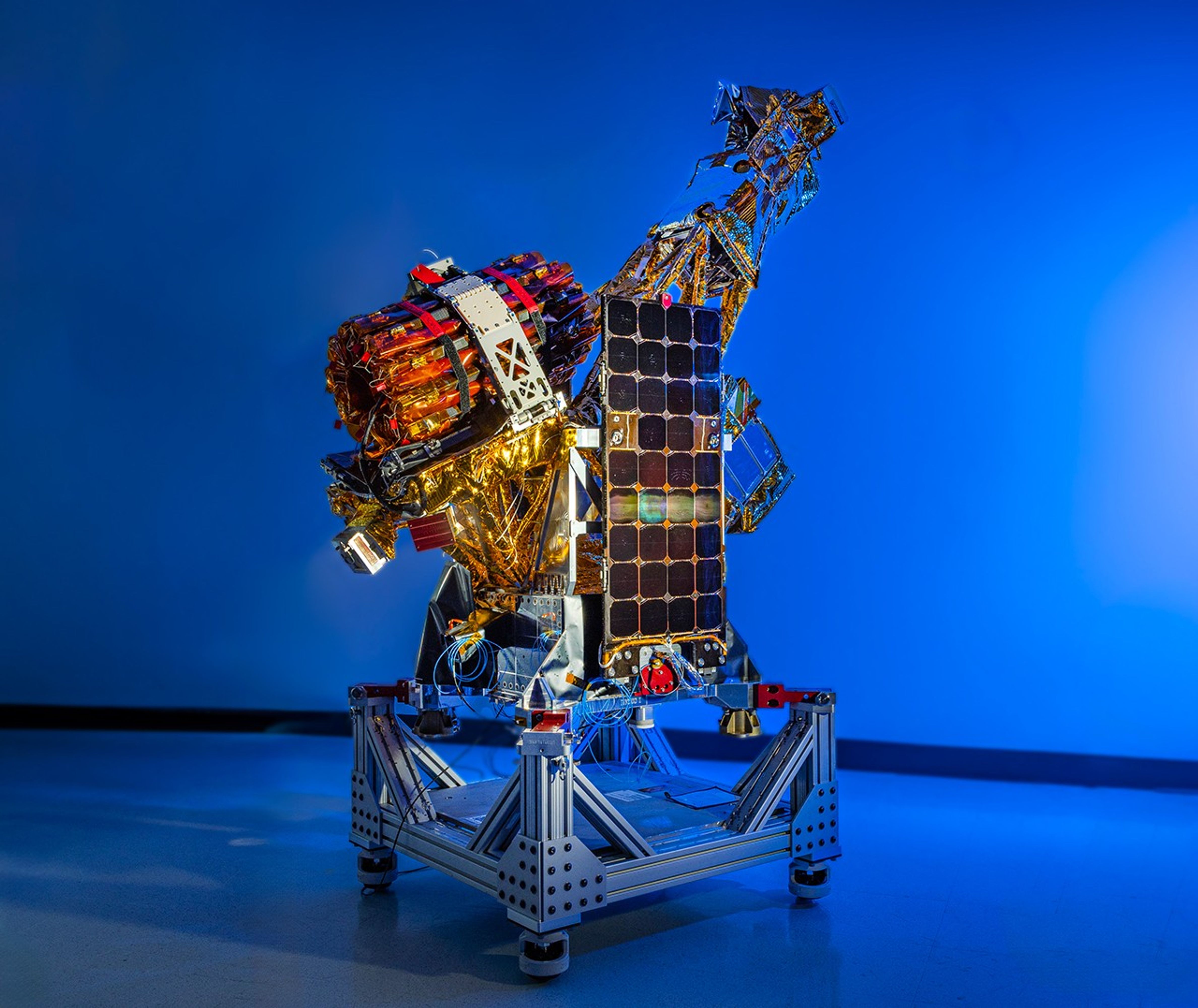
One of the three satellites that make up NASA’s INCUS (Investigation of Convective Updrafts) mission sits on a fixture at the facilities of Blue Canyon Technologies in Lafayette, Colorado. The satellite completed testing in preparation for launch in late May 2026. The mission will make the first space-based survey of the dynamics of tropical convective storms.
The three nearly identical satellites will fly in tight coordination in low Earth orbit, with the first and second satellites separated by 30 seconds, and the second and third satellite separated by 90 seconds.
Each satellites carries a radar designed to observe the vertical motion of air and water — known as convective mass flux — as storms develop and evolve. The middle satellite will also carry a microwave radiometer.
The INCUS mission is set to launch in 2027 from NASA’s Wallops Flight Facility in Virginia.
Funded through the Earth Venture Mission-3 acquisition under NASA’s Earth System Science Pathfinder Program and led by principal investigator Sue van den Heever at Colorado State University in Fort Collins, INCUS is one of several missions fulfilling the clouds, convection, and precipitation requirements of NASA’s Earth System Observatory, a set of interconnected missions set to study our home planet’s dynamic natural systems and how they interact. The mission is also part of FALCON (Fleet for the Atmosphere Linking Commercial Observations with NASA), a fleet of atmosphere-observing satellites that will combine hardware contributions from NASA centers, universities, and commercial partners.
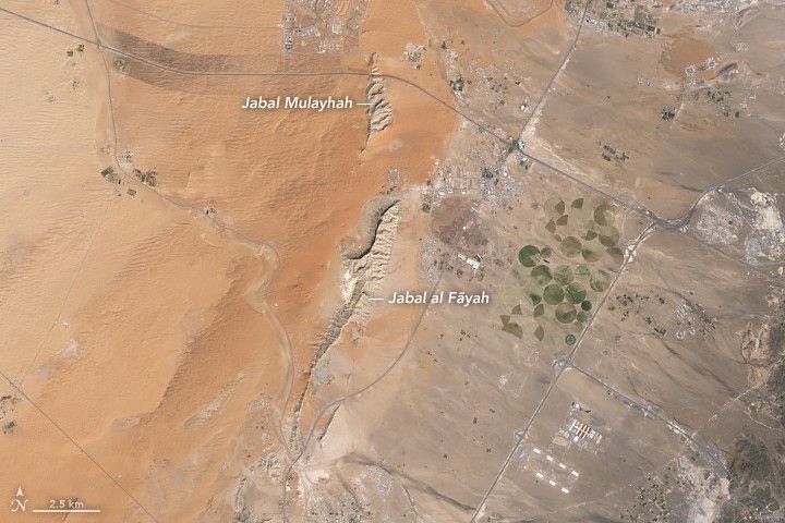
Jabal al Fāyah rises from the Rub’ al Khali desert in an image captured by the OLI (Operational Land Imager) on Landsat 8 on October 23, 2025.
NASA Earth Observatory / Lauren Dauphin
About an hour’s drive east of Dubai’s gleaming towers and artificial islands, a quieter, more natural landscape takes shape. At the far northern edge of the Rub’ al Khali, a saffron-colored sand sea laps against the Al-Hajar Mountains. A series of pale ridges rises finlike from the desert plain, with the largest—Jabal al Fāyah—standing 412 meters (1,352 feet) above sea level.
The Landsat 8 satellite captured this image of the ridges cutting across the Emirate of Sharjah in the northern part of the United Arab Emirates on October 23, 2025. To geologists, the limestone ridges are a reminder of the region’s watery past, signs that this land lay underwater tens of millions of years ago when the sedimentary rock layers were deposited.
Jabal al Fāyah functions as a barrier, trapping windblown sand in dune fields to its west. The weathering of iron-bearing minerals in the sand grains gives the dune fields their orange hue. To the east, the branching channels of overlapping alluvial fans extending from the Al-Hajar Mountains carry gravels and eroded sediments from basalts and other dark mafic rocks.
The dark rocks to the east—part of the Samail Ophiolite—are known to geologists for being among the world’s largest, best-preserved, and most accessible exposures of ancient oceanic lithosphere, the rigid outer layer of Earth that includes both the crust and upper mantle. Oceanic lithosphere like this is normally subducted and recycled back into the mantle when tectonic plates collide. But in this area, a large section from beneath the Tethys Sea was scraped off and thrust onto the Arabian plate in a process called obduction.
Dubai lies to the west of the limestone ridges, and the Al-Hajar Mountains lie to the east, in an image acquired by the OLI (Operational Land Imager) on Landsat 8 on October 23, 2025.
NASA Earth Observatory / Lauren Dauphin
The Jabal al Fāyah ridges themselves are made up of marine limestone that was deposited on top of the ophiolite over tens of millions of years spanning the late Cretaceous through the early to mid-Paleocene. Limestone typically forms along continental margins in warm, shallow oceans, often in lagoons and coral reefs, out of the calcium carbonate found in the shells and skeletons of marine life. In many parts of the ridges, coral fragments and marine invertebrate fossils are visible embedded in the rock. A feature called Fossil Rock sits a few kilometers north of Jabal al Fāyah and adjacent to the limestone ridge Jabal Mulayḩah. It contains an abundance of snail, clam, and sea urchin remains.
For archaeologists, the ridges are at the center of a much more recent tale of human adaptation and survival that has played out in just the past few hundred thousand years. The ridges and parts of the surrounding landscape—inscribed as a UNESCO World Heritage site in 2025—are dotted with dozens of archaeological sites that trace human occupation on the Arabian Peninsula back to between 210,000 and 120,000 years ago, to the Middle Paleolithic. That was a period when waves of anatomically modern humans (Homo sapiens) migrated out of Africa and shared the planet with other groups such as Neanderthals.
Many of the sites contain stone flakes, blades, scrapers, hand axes, and other stone tools. The archaeological treasure trove offers early evidence of modern humans surviving in a harsh desert environment and raises questions about the routes modern Homo sapiens may have taken on their journey out of Africa.
Geological evidence indicates that lakes periodically formed on the east side of the ridge, providing critical food and water resources that would have supported early inhabitants in this unforgiving climate. Rocky overhangs along the ridge would have provided shelter from the heat and wind. Some of the sites show evidence of intermittent occupation beginning as early as 210,000 years ago, making this one of the earliest signs of human habitation on the Arabian Peninsula.
NASA Earth Observatory images by Lauren Dauphin, using Landsat data from the U.S. Geological Survey. Story by Adam Voiland.
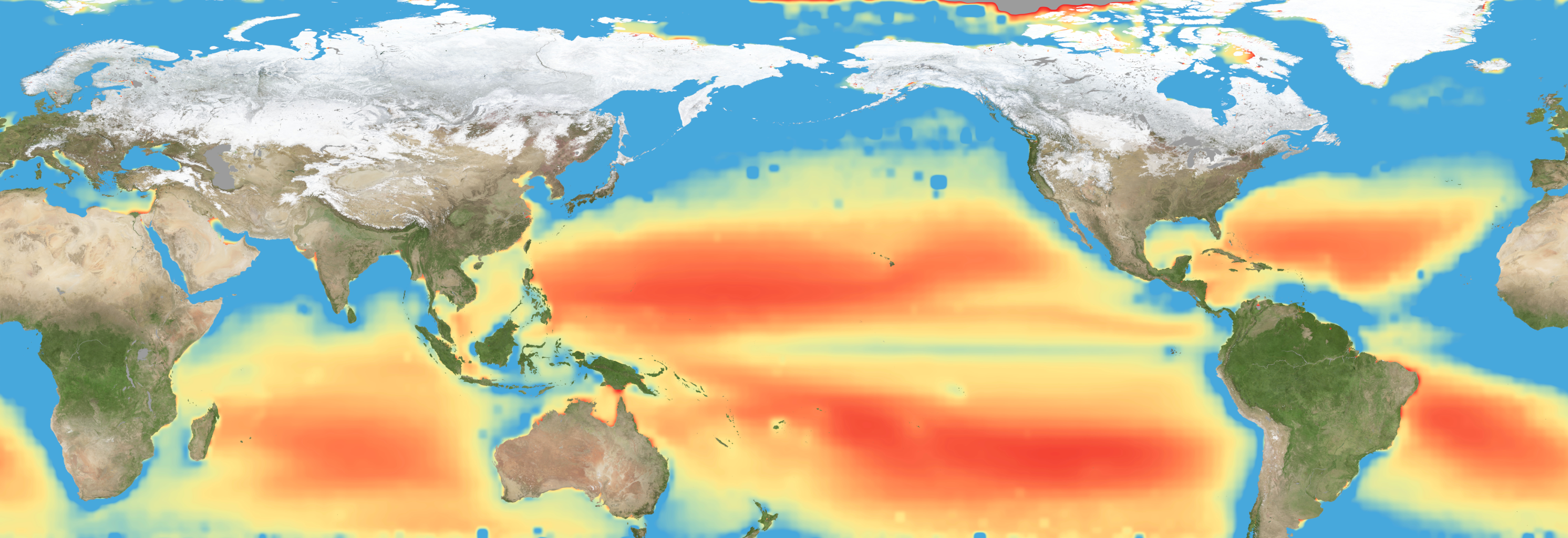
Warming waters decrease upwelling and lead to stress on marine microorganisms due to limited availability of vital nutrients. Red indicates the regions of highest nutrient-related stress.
Kel Elkins/NASA’s Scientific Visualization Studio
Editor’s note: This article was updated on June 5.
A new study combining NASA satellite observations, ocean surveys, and genetic testing on marine microorganisms found evidence that warming ocean waters may be limiting nutrient availability across much of the global ocean. The researchers report that this nutrient stress affects microscopic marine organisms and could influence marine ecosystems over time.
The research, published June 5 in Science Advances, tracked the condition of phytoplankton, which form the base of ocean food webs. Rather than measuring nutrients like nitrogen, iron, and phosphorus directly, the researchers inferred stress by tracking subtle shifts in the ratio of carbon to chlorophyll in phytoplankton observed from space. When the amount of chlorophyll decreases relative to carbon as seen in satellite data, it’s an indication that the plankton are stressed.
“As our ocean continues to change, the ability to observe and track ocean conditions through sustained, high quality remote sensing observations has never been more important,” said Laura Lorenzoni, Program Scientist for NASA’s Ocean Biology and Biogeochemistry Program at NASA Headquarters in Washington. “This is fundamental, as plankton communities are the base of the marine food web on which important economic activities rely.”
The research team combined two decades of data from NASA’s Aqua satellite’s Moderate Resolution Imaging Spectroradiometer (MODIS) sensor with plankton samples collected on research cruises around the world. The approach linked large-scale satellite observations with genetic markers in Prochlorococcus, a tiny but abundant marine microbe that shows signs of nutrient stress in its DNA. The result is a global map revealing where phytoplankton are thriving and where they’re struggling.
Ocean chlorophyll, as observed with NASA’s Moderate Resolution Imaging Spectroradiometer (MODIS) instrument between January 2010 through May 2016.
Marit Jentoft-Nilsen/NASA’s Goddard Space Flight Center
The strongest indications of nutrient stress on plankton appeared in the subtropical gyres, which are vast, relatively calm regions of the Atlantic, Pacific, and Indian oceans. In these areas, a layer of warm surface water stifles the flow of colder water from deeper in the ocean.
“When the surface of the ocean warms, it generates this very stable situation where a layer of low-density water sits on top of higher-density cold water,” said study coauthor Adam Martiny, an oceanographer at the University of California, Irvine. “You’ve probably experienced that if you’ve ever been to a lake in the summertime—it’s super warm right on the surface, and very cold deeper down when you stick your legs in.”
This layering blocks the upward flow of nutrient-rich water, limiting the availability of ocean surface nutrients that are crucial for plankton. In the South Pacific, one of the most nutrient-poor regions, a layer of warm surface water contributed to nitrogen and iron shortages, producing the most severe nutrient-related stress that the team discovered.
But the researchers were surprised to find that parts of the North Atlantic experience less nutrient stress than expected. Although there was evidence of a lack of phosphorus, the impact on microorganisms was comparatively mild.
That difference may reflect the biology of the organisms themselves. Phytoplankton can partially compensate for phosphorus shortages by recycling phosphorus more efficiently or replacing phosphorus-rich molecules inside their cells. Nitrogen shortages are harder to overcome because nitrogen is crucial for the proteins and cellular machinery required for photosynthesis and nutrient uptake.
The study revealed that nutrient stress is strongly correlated with seasons and major weather cycles such as El Niño and the Pacific Decadal Oscillation, which lead to warming waters in the Pacific Ocean. During La Niña events, which cool water over a large part of the Pacific, stronger upwelling brought more nutrients to surface waters and reduced stress in some regions. Superimposed on those multi-year cycles, however, was a longer-term trend.
From 2002 through 2021, average sea-surface temperatures increased across nearly 90% of the ocean area examined in the study. Over the same period, nutrient stress generally intensified, consistent with previous hypothesis that warming oceans may become increasingly stratified and less able to replenish surface nutrients.
In many nutrient-poor regions of the Southern Hemisphere, however, the researchers found evidence that nutrient stress had not increased as much as expected despite significant warming. They suspect that microbes capable of capturing nitrogen from the air may partially offset the effects of reduced nutrient mixing.
That finding hints that marine ecosystems may possess more resilience to warming climates than some models predict. It also underscores the complexity of forecasting how ocean biology will respond to continued warming.
“We have two really powerful tools,” said study coauthor Michael Behrenfeld, a biochemist with Oregon State University in Corvallis, Oregon. The tools include satellite observations and cellular studies. “Both produce big data sets, but they are kind of opposites. We have very detailed data about microscopic phytoplankton … and then we have global coverage with satellites.”
By combining satellites that monitor the entire ocean with genetic clues carried inside microscopic plankton, the researchers say they are gaining a new way to track biological responses to changing environmental conditions near real time.
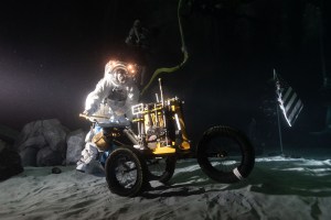
Preparations for Next Moonwalk Simulations Underway (and Underwater)
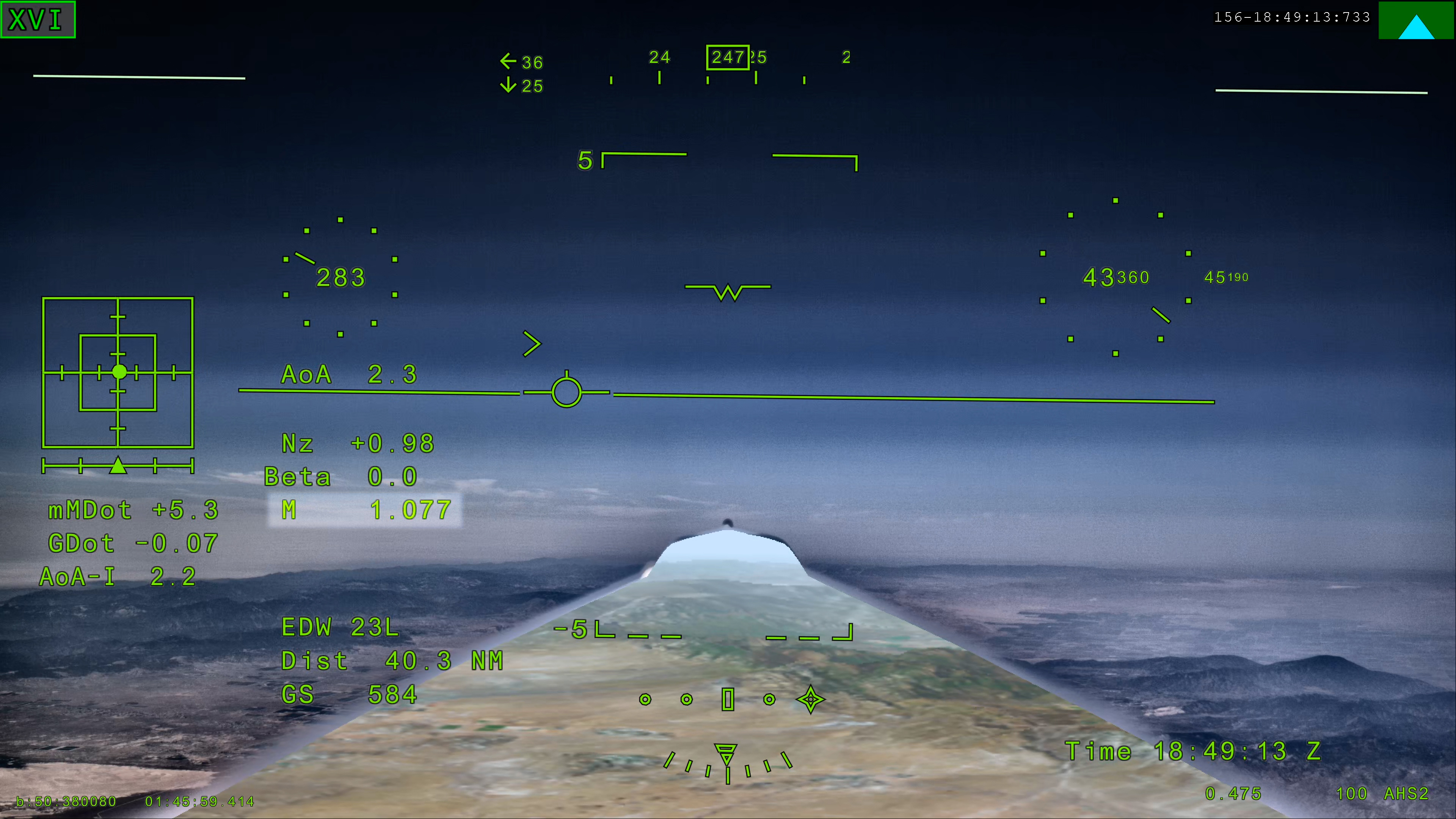
NASA’s X-59 eXternal Vision System shows Mach 1.077 on Friday, June 5, 2026, marking the aircraft’s first time reaching supersonic speed in support of NASA’s Quesst mission. The moment represents a milestone for the aircraft as it transitions to include test flights faster than the speed of sound.
NASA
NASA’s experimentalX-59 aircraft marked a major milestone Friday, June 5, when it flew faster than the speed of sound for the first time, setting the stage for demonstrating its quiet supersonic capabilities later this year.
NASA test pilot Jim “Clue” Less took off and landed at Edwards Air Force Base in California, reaching a top speed of approximately Mach 1.1 (713 mph) and altitude of 43,400 feet. The X-59’s flight began at 11:08 a.m. PDT and lasted 81 minutes, with the team focusing on flying qualities at both subsonic and then supersonic speeds.
In the coming days, we expect to take the next step and push to Mach 1.4
jared isaacman
NASA Administrator
”X-59 is getting ready for its quiet supersonic debut. Since the aircraft’s first flight on Oct. 28, 2025, the team has made tremendous progress, flying 16 times in the last 90 days and getting into a steady test rhythm. In the coming days, we expect to take the next step and push to Mach 1.4,” said NASA Administrator Jared Isaacman “I’m grateful to the NASA team and Lockheed Martin Skunk Works for their help getting us to this point, and I hope this is the first of many collaborations as we rebuild NASA’s X-plane portfolio.”
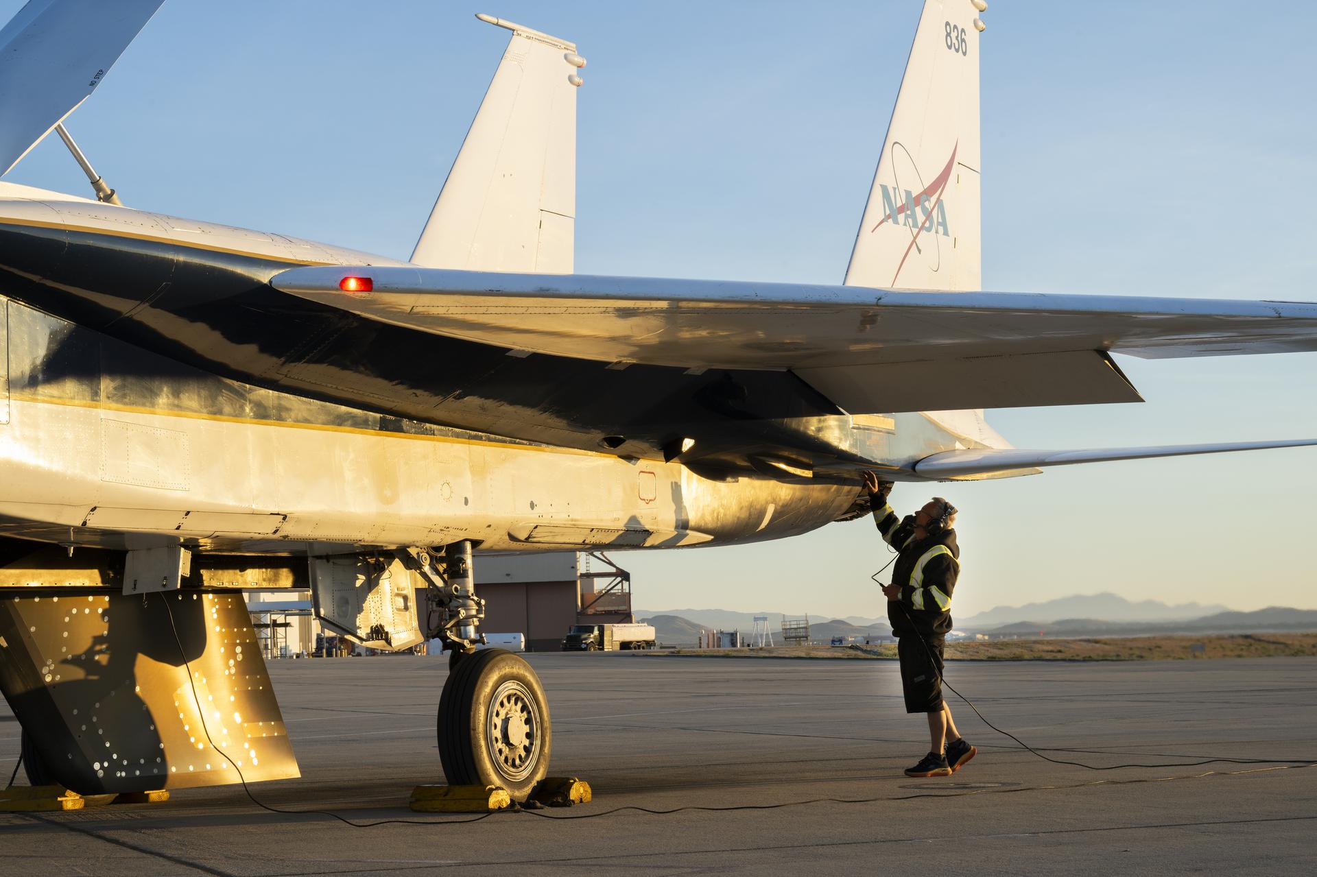
The X-59 is designed to fly at supersonic speeds while creating only a quiet thump instead of a loud sonic boom. For this flight, a NASA F‑15 chase plane flew nearby to monitor the X‑59. The loud sonic booms from the F-15 obscured any sound made by the X-59.
“The X-59’s first supersonic flight is a testament to America’s enduring leadership in science, engineering, and aerospace innovation,” said Michael Kratsios, Assistant to the President for Science and Technology and Director of the Office of Science and Technology Policy. “This achievement comes as the Trump Administration continues work to unleash supersonic flight and enable American ingenuity.”
This first supersonic flight is a significant milestone, but an event even more critical to the mission is upcoming. In just days, the aircraft is expected to make its first “mission conditions” flight, reaching a cruising speed of Mach 1.4 (925 mph) and altitude of approximately 55,000 feet. The X-59 also will be accompanied by a chase plane for this flight.
NASA’s X-59 quiet supersonic research aircraft completed its first supersonic flight Friday, June 5, 2026, marking the first time the aircraft exceeded the speed of sound in support of NASA’s Quesst mission. The milestone represents a major step in flight testing as the aircraft expands into the supersonic portion of its flight envelope.
NASA / Lori Losey
This speed and altitude are the base conditions for the X-59 when it will eventually fly over several U.S. communities enabling NASA to gather data about how people may perceive its quiet thump. NASA will share this data with U.S. and international regulators to help establish new data-driven noise standards to enable a future viable market for supersonic commercial flight over land.
For the last several months, the X-59 has been participating in an ongoing series of flights where the plane has been flying at a wide range of speeds and altitudes – a process known as envelope expansion. These tests are the first phase of the X-59’s flight testing. They are focused on performance and involve chase plane monitoring. When the aircraft completes this phase it will enter another, focused on its sound profile in order to verify its quiet thump capability.
The X-59 is the centerpiece of NASA’s Quesst mission, which aims to demonstrate quiet supersonic flight and help enable commercial supersonic flight over land worldwide. These advancements will help travelers reach their preferred destinations faster, spending less time in the air.
Through Quesst’s development of the X-59, NASA also will deliver design tools and technology for quiet supersonic airliners that will achieve the high speeds desired by commercial operators without disturbing people on the ground. NASA will validate design tools through ground and flight testing, providing U.S. aircraft manufacturers the ability to explore new quiet supersonic concepts, and provide them with confidence that their resulting designs will meet quiet flight requirements.
NASA’s X-59 quiet supersonic research aircraft completed its first supersonic flight Friday, June 5, 2026, marking the first time the aircraft exceeded the s...
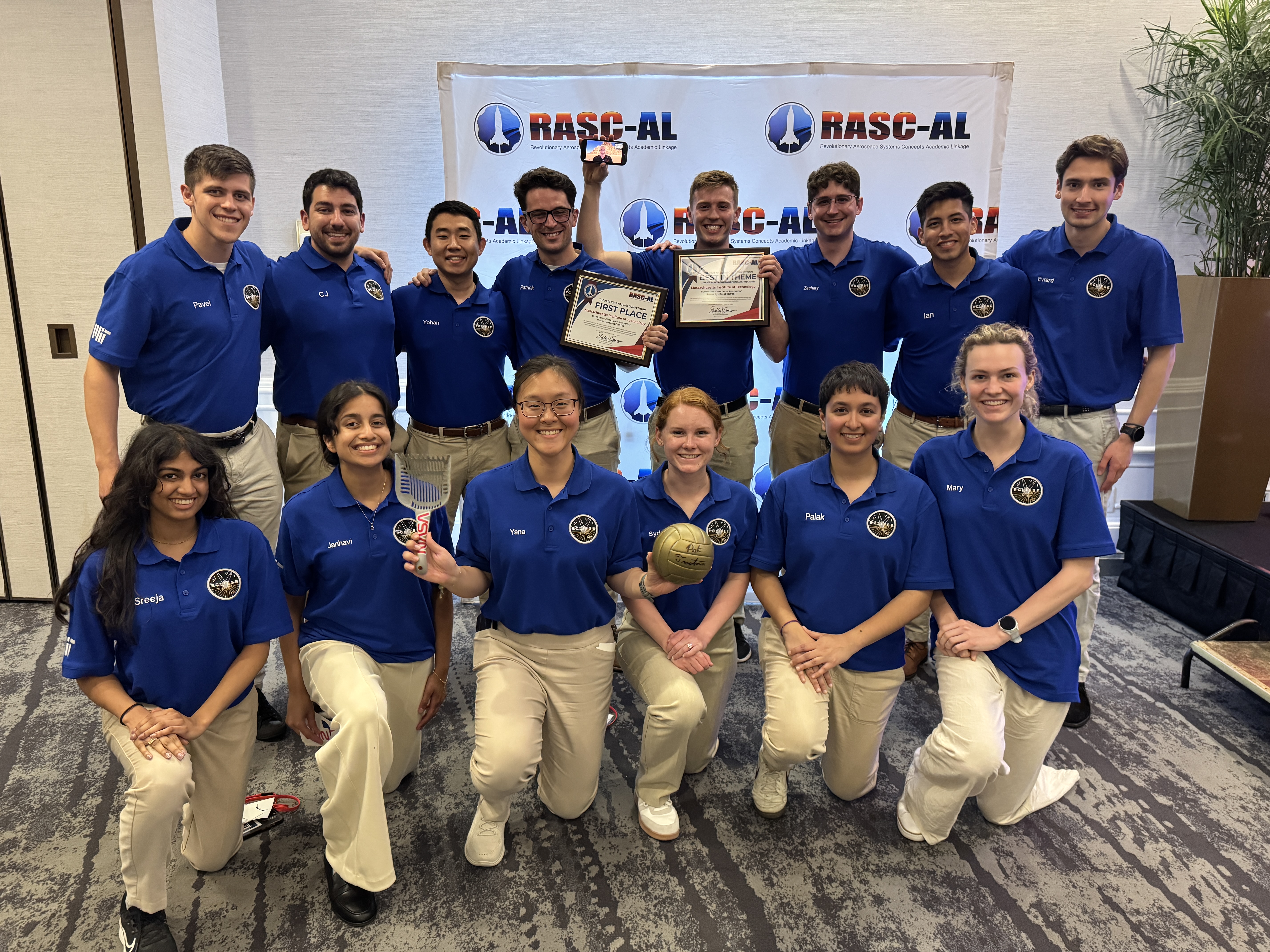
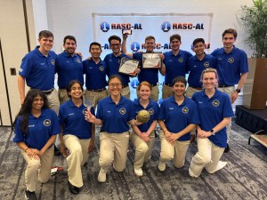
The Massachusetts Institute of Technology team that won the 2026 RASC-AL competition for their project, Exploration-Class Lunar Integrated Power SystEm.
Credit: National Institute of Aerospace
NASA announced the Massachusetts Institute of Technology project, Exploration-Class Lunar Integrated Power SystEm, as the first place winner for the 2026 Revolutionary Aerospace Systems Concepts – Academic Linkage (RASC-AL) competition, which challenges students to bridge gaps in aerospace technology by innovating new system concepts and prototypes.
Another team from the same university won second place overall for their project, Mars Exploration Layered Infrastructure for Operations, Research, and Advancement, while Virginia Polytechnic Institute and State University took third place with the Mars Pylon Network.
Empowering the next generation, the competition also supports the agency’s workforce development priorities by offering university teams hands-on experience in mission architecture development, systems engineering, and technical communication.
“The winning teams demonstrated how academic innovation can support Artemis mission goals,” said Daniel Mazanek, program sponsor for RASC-AL and senior space systems engineer, NASA’s Langley Research Center in Hampton, Virginia. “Their work highlights the important role student research plays in shaping future space exploration, and the results showcase how disciplined analysis can elevate innovative ideas into viable exploration concepts.”
Fourteen finalists attended the multi-day RASC-AL Forum in Cocoa Beach, Florida, and gave formal presentations outlining their mission architectures, technology solutions, and supporting analysis. These discussions provided students with real-time engineering feedback, exposing them to the rigor and scrutiny applied to human spaceflight concepts under development within the agency.
Awards were presented to teams demonstrating the highest levels of technical rigor, innovation, and mission alignment. In addition to the top prizes, other awards included:
Best in Communications, Position, Navigation, and Time Architectures for Mars Surface Operations Theme: Massachusetts Institute of Technology Mars Exploration Layered Infrastructure for Operations, Research, and Advancement MELIORA)
Best in Lunar Sample Return Concept Theme: South Dakota State University Sample Extraction of Lunar Elements for Network Entry (SELENE)
Best in Lunar Surface Power and Power Management and Distribution Architectures Theme: Massachusetts Institute of Technology Exploration-Class Lunar Integrated Power SystEm (ECLIPSE)
Best in Lunar Technology Demonstrations Leveraging Common Infrastructure Theme: Massachusetts Institute of Technology CLPS-enabled Highly-autonomous End-to-End isruSystem Evaluations to Build Understanding and Resilient Growth by Experimenting with Regolith (CHEESEBURGER)
Best Prototype:
Embry-Riddle Aeronautical University, Worldwide Campus Advanced Utilization of Resources for Energy & Viability Off-Earth (Project AUREVO) University of Illinois, Urbana-Champaign with Leonardo de Vinci Engineering School Mining and Advanced Transformation of Regolith for Infrastructure and eXpansion (MATRIX)
“The RASC-AL program allows students to demonstrate their ability to transform innovative concepts into technically sound studies, with emphasis on technical rigor, clear communication, and systems-level thinking,” said Christopher Jones, program sponsor for RASC-AL and chief technologist for the Systems Analysis and Concepts Directorate at NASA Langley. “These are the hallmarks of effective engineering that we’re looking for and reflect the standards required for real-world aerospace problem-solving,”
The NASA RASC-AL competition represents a cross-agency collaboration. The competition is administered by the National Institute of Aerospace and managed by the NASA Tournament Lab, part of the agency’s Prizes, Challenges, and Crowdsourcing Program.
NASA’s Artemis II Moon Mission Research Continues on Earth
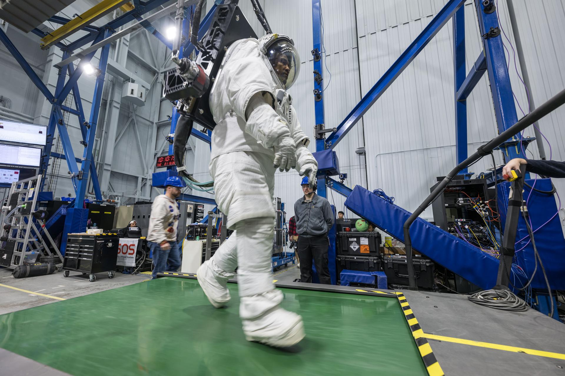
Artemis II astronaut Victor Glover walks on a treadmill while in a space suit harnessed to NASA’s Active Response Gravity Offload System at NASA’s Johnson Space Center. Glover is simulating a walk on a planetary surface while in a suit that has been offloaded to lunar gravity. Artemis II astronauts completed this and other suited tasks before their mission launched and within a few days of landing, giving researchers a chance to assess how quickly upon landing crews’ bodies adapt to a different gravity. Results will help scientists better understand how soon after landing crews can complete mission-critical tasks on the surface of the Moon or Mars.
NASA/Robert Markowitz
Since NASA’s Artemis II crew members safely splashed down in the Pacific Ocean on April 10 after their record-setting mission around the Moon, science teams have been busy collecting more data and combing through observations collected on the test flight. Results from these science investigations will help support safe human exploration of deep space and provide a blueprint for how future missions will conduct science on the lunar surface as NASA builds a Moon Base and develops an enduring human presence there.
Postflight crew health, performance data
In the hours, days, and weeks after landing, the Artemis II crew members, NASA astronauts Reid Wiseman, Victor Glover, Christina Koch, and CSA (Canadian Space Agency) astronaut Jeremy Hansen, contributed critical data to help the agency understand how the human body reacts to spaceflight. Collecting this data as soon as possible after landing was important to understand how the body adapts from microgravity to Earth’s gravity. The data will inform NASA’s understanding of how quickly crews can complete mission-critical tasks after landing on a planetary surface like the Moon or Mars, where there won’t be landing support personnel to assist.
Within a day of splashdown, researchers collected a suite of data for the Artemis II Spaceflight Standard Measures study, which is part of a larger effort across the astronaut corps to gather a baseline set of health measurements on blood pressure, heart rate, eye health, and motor control. Crew members also completed a mini obstacle course, which included lying down, standing up, unfurling a rope ladder, ladder climbing, and more, to assess how their bodies were adapting to Earth’s gravity.
Once the crew returned to NASA’s Johnson Space Center in Houston, researchers guided them through further medical check-ups and tests of motor control. Over the next several days, the crew completed obstacle courses wearing spacesuits offloaded to lunar gravity, which is roughly one-sixth the force of Earth’s gravity. Researchers are now analyzing this data to gain insight into how crews may perform as they adapt to the gravity of a planetary surface.
As part of the Immune Biomarkers study, researchers are comparing blood and saliva samples collected after the Artemis II splashdown with samples collected preflight and during the mission. Among other topics, the study investigates whether and how dormant viruses reawaken in astronauts’ bodies while in space.
Some crew members completed postflight cognition tests and a simulated manual spacecraft docking task to assess motor control for the ARCHeR (Artemis Research for Crew Health & Readiness) study. This, combined with data collected through a wrist-worn device while crew members were in space, is used to understand the effect of space hazards on well-being and performance.
Initial data collections for Artemis II health studies concluded 45 days after splashdown. However, medical teams will continually monitor astronaut health throughout the Artemis II crew members’ lifetimes.
Once this data is processed and anonymized, information will be available for scientists to study the effects of spaceflight via a request to NASA’s Life Sciences Data Archive. The results from this work could lead to new technologies and studies that help predict the adaptability of crews on future missions to the Moon and Mars.
Analyzing astronaut-derived organ chips flown around Moon
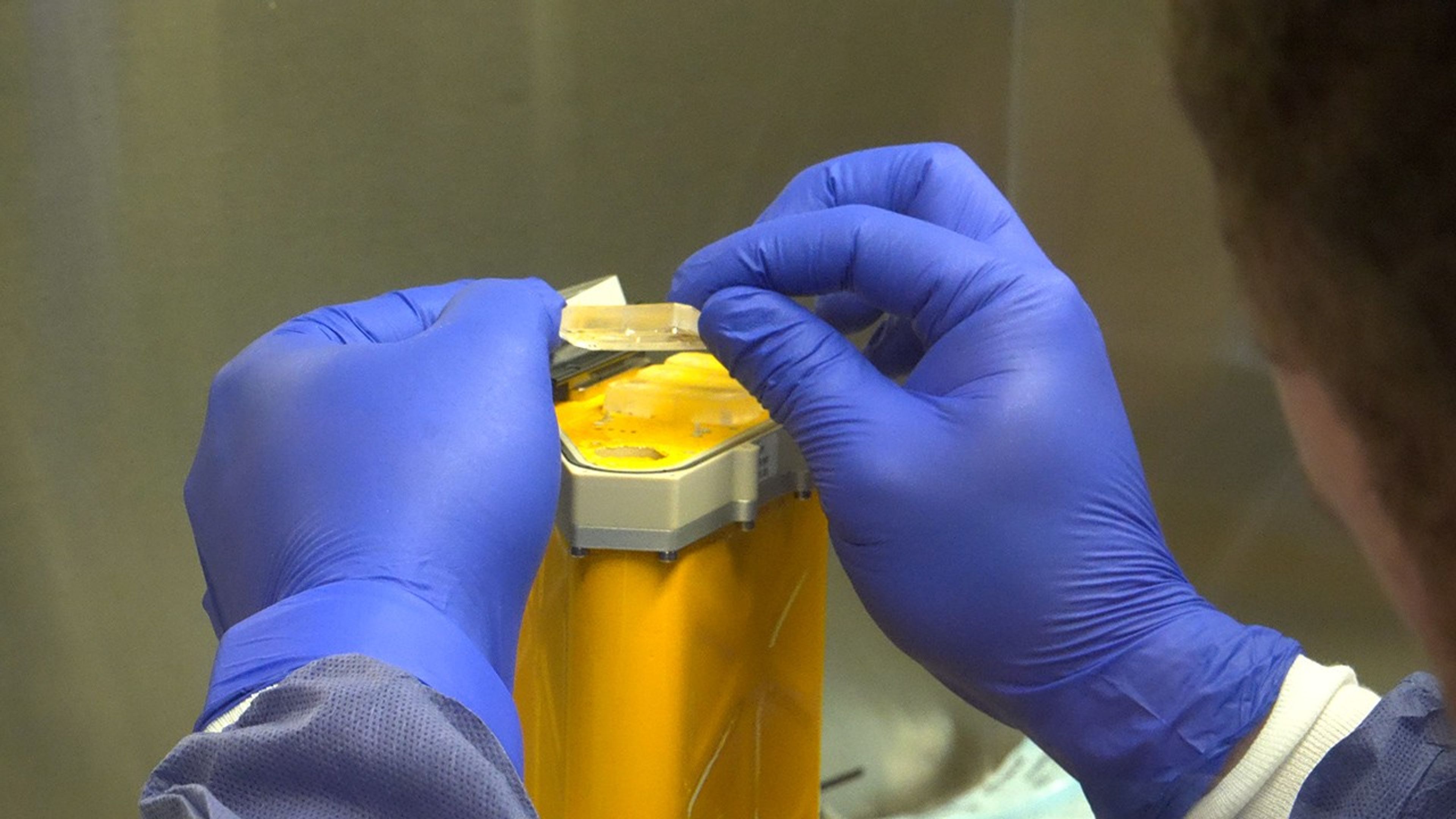
A scientist handles AVATAR organ chips following their journey around the Moon aboard Orion. The chips contain cells from each astronaut and are being prepared for detailed analysis.
NASA
Organ chips from NASA’s AVATAR (A Virtual Astronaut Tissue Analog Response) investigation are being analyzed at chip developer Emulate’s laboratory in Boston. The organ chips included bone marrow cells from each Artemis II astronaut. They flew around the Moon with the astronauts, and now researchers are studying these organ chips to determine how deep space radiation and microgravity affect human health at the molecular level.
Scientists are comparing the chips flown aboard the spacecraft to ground controls and crew blood samples using advanced techniques, including single-cell RNA sequencing. The analysis will characterize how organ chips model individual responses to spaceflight, which is data that could allow NASA to send future astronauts’ AVATAR chips ahead on missions to develop personalized medical kits. The researchers plan to share early findings at scientific conferences while full analysis continues.
Lunar imagery, audio for data release
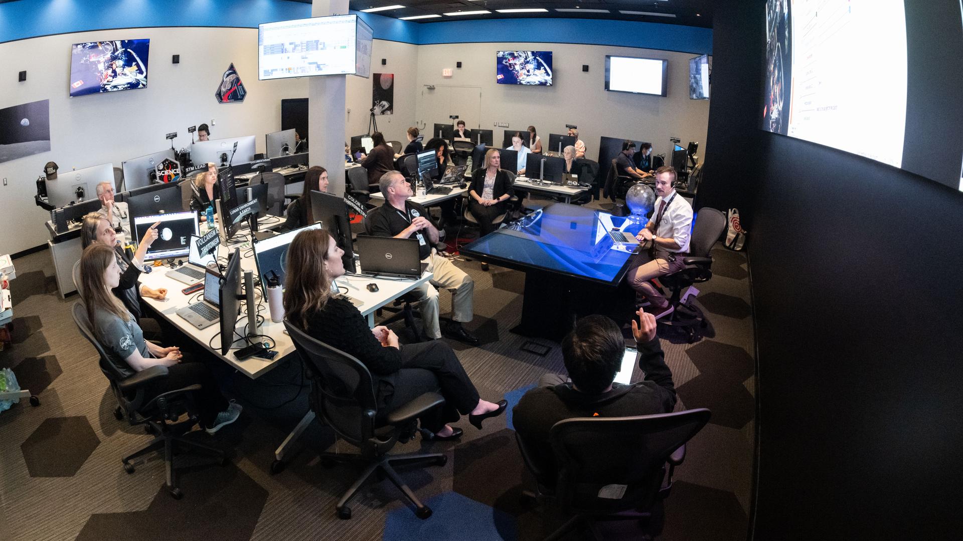
In this April 3, 2026, image, the Artemis II lunar science team is shown working in the Science Evaluation Room in the Mission Control Center at NASA’s Johnson Space Center in Houston. The team is putting together a plan of science observations for the Artemis II crew, which was headed toward the Moon aboard Orion. As they passed the Moon at closest approach on April 6, the crew applied the geology skills they learned in the classroom and in Moon-like environments on Earth as they photographed and described nuances of geologic features such as impact craters, ancient lava flows, and surface cracks and ridges. The crew noted differences in color, brightness, and texture — details that provide clues to surface composition and history.
NASA/Bill Stafford
On April 6, the Artemis II crew members studied features on and around the Moon for nearly seven hours during Orion’s closest approach to the lunar surface. Their work was guided by a minute-by-minute observation plan developed by the Artemis II lunar science team.
Scientists are reviewing the data collected from the mission, which includes images, video, and audio files, to release a report of their initial data interpretations later this year. The report will cover observations of impact flashes, variations in color on the lunar surface, and the shape and texture of faults and ridges. The team also will publish a report on how Artemis II lunar science observations were planned, organized, and executed for the benefit of future Artemis missions.
NASA will publish more than 100 science-related audio recordings with transcripts, as well as approximately 11,500 Earth and Moon image and video files from the mission science campaign, with accompanying data. While many of these images already are public, these records will be available through NASA’s Planetary Data System, a public archive of data from all of NASA’s planetary missions. To get the data ready, the team is converting files into standard formats that anyone can easily open and add information to make the data searchable in NASA’s archive for generations to come.
For more information on NASA’s Artemis II science efforts, visit:
Preparations for Next Moonwalk Simulations Underway (and Underwater)
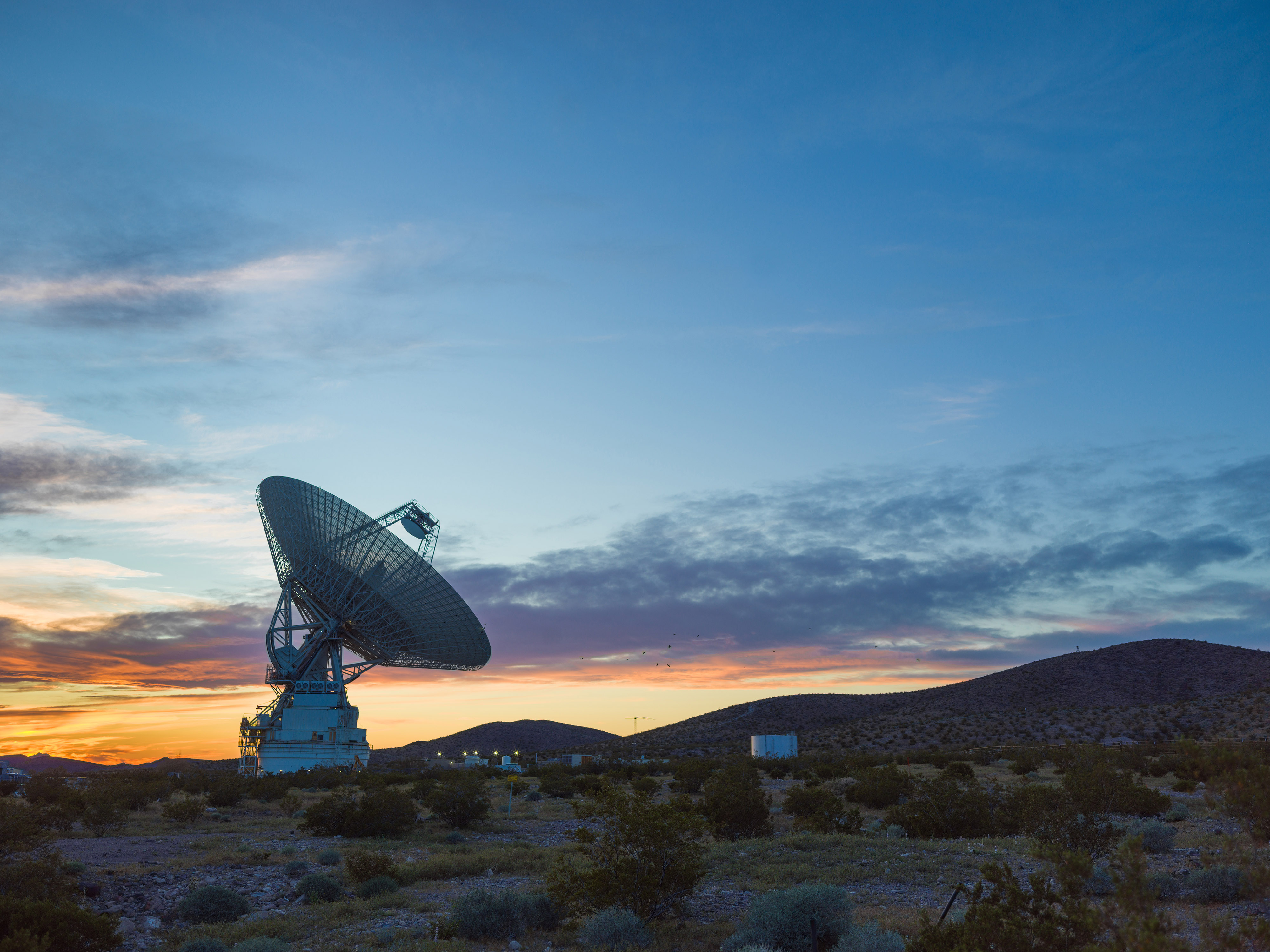
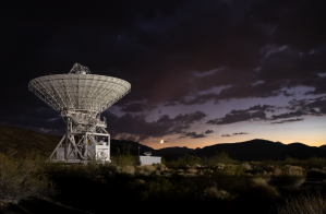
This sunset photo shows Deep Space Station 14, the 230-foot-wide (70-meter) antenna at the Goldstone Deep Space Communications Complex near Barstow, California, part of NASA’s Deep Space Network.
NASA/JPL
NASA has completed the investigation into the damage sustained last year at its 70-meter radio-frequency antenna, known as the Deep Space Station 14 (DSS-14), at the Goldstone Deep Space Communications Complex near Barstow, California. The agency has classified the event as a Type A mishap based on the total cost of damages. The antenna will remain offline to complete repairs and previously scheduled upgrades.
“NASA takes safety and any departure from established procedures seriously, and the investigation at Goldstone made clear that we must strengthen our processes. We are acting on the investigation’s findings,” said Joel Montalbano, acting associate administrator for NASA’s Space Operations Mission Directorate at the agency’s headquarters in Washington. “We will update and improve procedures, rebuild core in-house capabilities, and reinforce operational discipline across the Deep Space Network. NASA remains focused on learning from this and modernizing systems, so DSS-14 and the broader network are ready to support our ambitious future missions.”
On Sept. 16, 2025, the DSS‑14 antenna over‑rotated while actively tracking the Juno mission, placing excessive stress on cabling and associated structural supports. Water lines tied to the antenna’s fire‑suppression system also were damaged, causing significant flooding in the facility. There were no injuries.
NASA convened a Mishap Investigation Board, bringing together experts from across the agency to examine the technical, organizational, and cultural factors behind the incident. The board conducted on‑site inspections, interviews, and detailed reviews of technical documentation and operational logs from all three Deep Space Network sites. The board completed its final report in April and submitted it for agency concurrence.
The investigation issued findings and recommendations that emphasize training, technical rigor, operational procedures, system design, clear roles and responsibilities, and safety assurance. At the same time, teams already are applying lessons learned across all network sites to improve operational consistency. These steps will help bolster the network and reduce the risk of future mishaps.
In its final report, the board found the mishap primarily stemmed from software weaknesses, human error, and an undetected failure in the antenna’s hydraulic limit system. Investigators determined an electrical issue at the antenna the previous day caused the control system to misreport the antenna’s rotation state, an issue that went unnoticed and triggered multiple limit-stops during the Juno track on Sept. 16. While working to identify the limit-stop problem, operators performed several troubleshooting steps that inadvertently bypassed software and hardware safeguards, which ultimately led to the over-rotation incident. After flooding in the antenna base was observed, operators attempted to stow the antenna as a safety precaution, however, because the system had already passed the rotation limits, this action drove the antenna further into over‑rotation, causing additional damage.
Additionally, the investigation found the antenna’s hydraulic limit system, its final mechanical safeguard, was inoperable on Sept. 16 after being damaged in an undocumented prior incident. The system also had not been adequately tested for an undetermined period of time.
Investigators also concluded workplace culture pressured operators to work as expeditiously as possible, often stretching beyond their usual roles, expertise, and training, to keep the antenna operating. The board states the cultural conditions observed at Goldstone were not present at the network’s other sites, where roles and responsibilities are followed more consistently. Other contributing factors outlined in the report include inadequate procedures, reliance on undocumented practices and tacit knowledge, and gaps in the antenna’s control logic. NASA will accept this as the final report.
The agency estimates repairs will cost between $4.1 and $4.6 million, with a final figure to be determined after the antenna’s systems are fully assessed. The antenna will remain offline as it enters its previously scheduled extended maintenance and upgrade period, originally set to begin in August and expected to be completed by October 2028. These upgrades are part of broader network improvements essential to supporting future exploration and science missions, as well as enhancing the nation’s planetary defense capabilities.
“We are committed to learning everything we can from this incident, and we’ve already begun putting those lessons into practice,” said Kevin Coggins, deputy associate administrator for NASA’s SCaN (Space Communications and Navigation) Program at the agency’s headquarters. “Our teams are working to strengthen and standardize processes and training across all three network sites to ensure it remains resilient, consistent, and ready to support the next generation of missions. Every challenge is an opportunity to improve, and this is no exception.”
The Deep Space Network continues to provide full coverage for more than 40 missions despite the DSS‑14 incident. The network’s 13 other antennas, located at complexes in California, Australia, and Spain, are supporting all tracking needs without interruption. A dedicated scheduling team allocates antenna time across the network to meet each mission’s science and data‑return objectives. The team also maintains continuous coverage when an antenna goes offline for maintenance or an unexpected outage.
To view the report, which includes redactions to protect proprietary and privacy-sensitive material, visit:
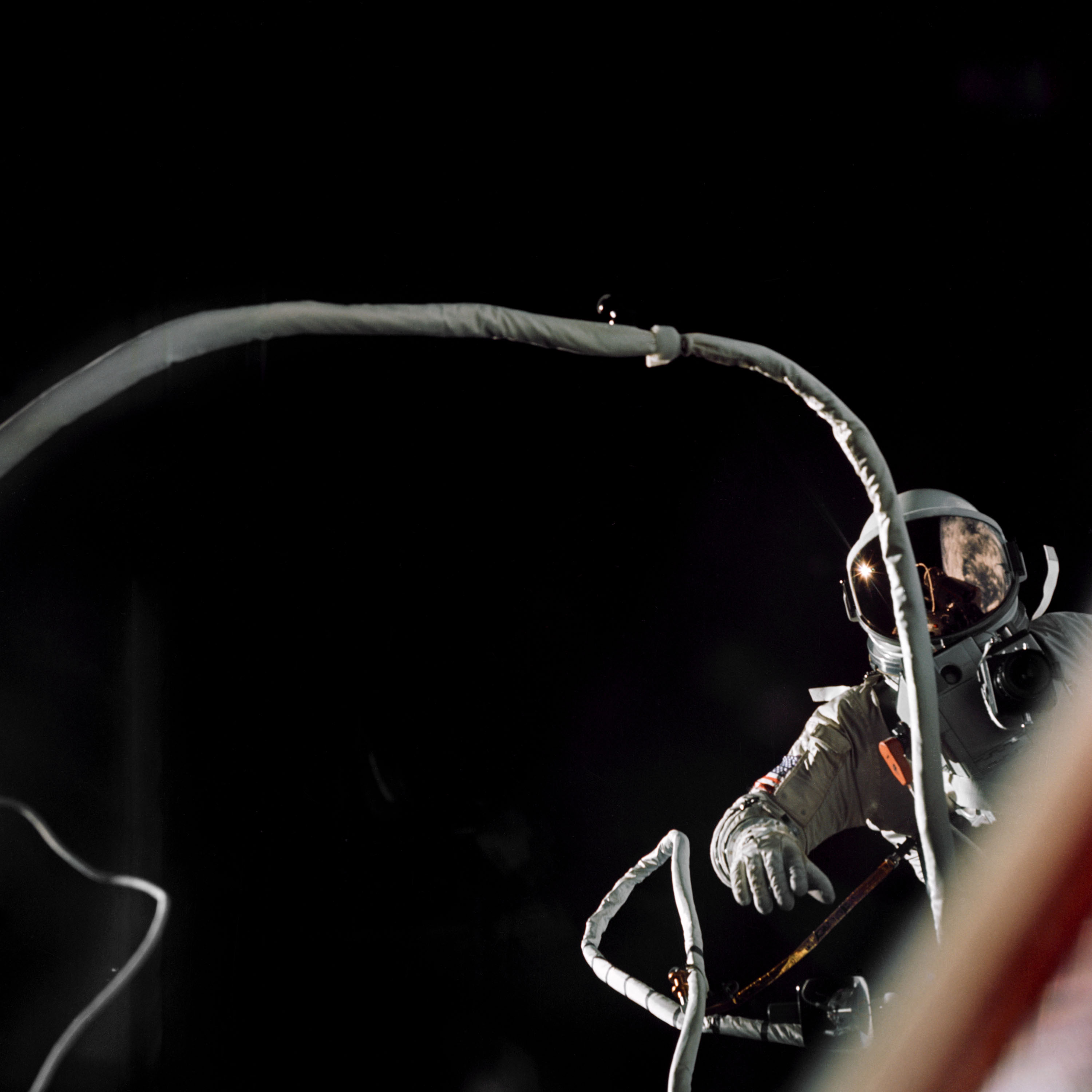
A year after America’s first spacewalk, Gemini IX-A Eugene Cernan stepped outside his spacecraft for an ambitious extravehicular activity scheduled for 167 minutes. The challenges he faced led NASA to reevaluate plans, equipment, and training for future spacewalks.
NASA
One year after Gemini IV astronaut Edward H. White completed NASA’s first spacewalk the agency prepared for a demanding second excursion. Originally scheduled for Gemini VIII, the extravehicular activity (EVA) was reassigned to Gemini IX-A after that mission ended early, with Gene Cernan taking on the task.
On June 5, 1966—the mission’s third day—Cernan exited the spacecraft and quickly found himself fighting his own equipment. His spacesuit was so rigid that even simple movements required intense effort. He struggled to complete the simplest maneuvers.
Within minutes, Cernan was exhausted and sweating profusely. His spacesuit was cooled only through the circulation of oxygen and as he worked to complete the goals of the EVA, his helmet fogged over completely, obstructing his view and his heart rate rose to about 180 beats per minute. As concerns grew that he might lose consciousness, the EVA was called off and Cernan’s spacewalk ended after two hours and eight minutes.
When Gemini IX-A returned to Earth, doctors found that Cernan had lost 13 pounds during the three-day mission, most of it water lost during his EVA.
The challenges Cernan faced that day reshaped NASA’s approach to spacewalking. His experience directly influenced improved training methods, refined EVA procedures, and precipitated advances in spacesuit design—key steps in preparing astronauts for lunar surface missions just a few years later.
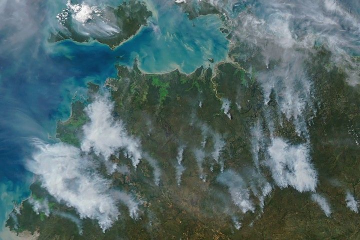
Smoke streams from fires in Australia’s Northern Territory in an image captured by the MODIS (Moderate Resolution Imaging Spectroradiometer) on NASA’s Aqua satellite on May 28, 2026.
NASA Earth Observatory/Michala Garrison
In May and June of most years, NASA satellites typically begin to detect large numbers of wildland fires throughout the Top End and Arnhem Land regions of Australia’s Northern Territory. On some days, especially in the afternoon, the blazes can resemble sizable wildfires in satellite imagery, spreading widely and producing expansive smoke plumes.
That was the case when NASA’s Aqua satellite acquired this image of smoke and fires on the afternoon of May 28, 2026. Often, however, fires burning in this area look smaller and less imposing. In the mornings just a few days earlier and later, for instance, NASA satellites detected little smoke despite observing many thermal anomalies, or hotspots, that indicated fire activity.
The pattern of burning, location, and timing are consistent with prescribed fires lit intentionally to manage the landscape. Land managers tend to light fires in the morning, and smoke builds over the course of the day. The process sometimes creates sizable plumes when there are updrafts and winds of moderate strength that carry smoke away from the fires, as happened on May 28 and again on June 2. The fires typically burn through the fire-adapted grasses, underbrush, and scattered trees in the region’s tropical savanna ecosystems.
Over the past few decades, the region’s land managers have combined deep-rooted Indigenous land management practices and modern technologies to establish large-scale landscape management programs such as the West Arnhem Land Fire Abatement project and Arnhem Land Fire Abatement. The goal of such efforts is to intentionally burn some of the savanna underbrush to create firebreaks and reduce fuel loads early in the dry season, reducing more destructive and emissions-intensive fires later in the season. The dry season generally begins in May and extends through September, according to Australia’s Bureau of Meteorology.
While research is ongoing, there are signs that the prescribed burning efforts are having the intended effect. Analysis of satellite observations of the fires suggests that prescribed burning efforts have shifted fire activity from late to early in the dry season, leading to a reduction in high-intensity fires and emissions.
NASA Earth Observatory image by Michala Garrison, using MODIS data from NASA EOSDIS LANCE and GIBS/Worldview. Story by Adam Voiland.
Preparations for Next Moonwalk Simulations Underway (and Underwater)
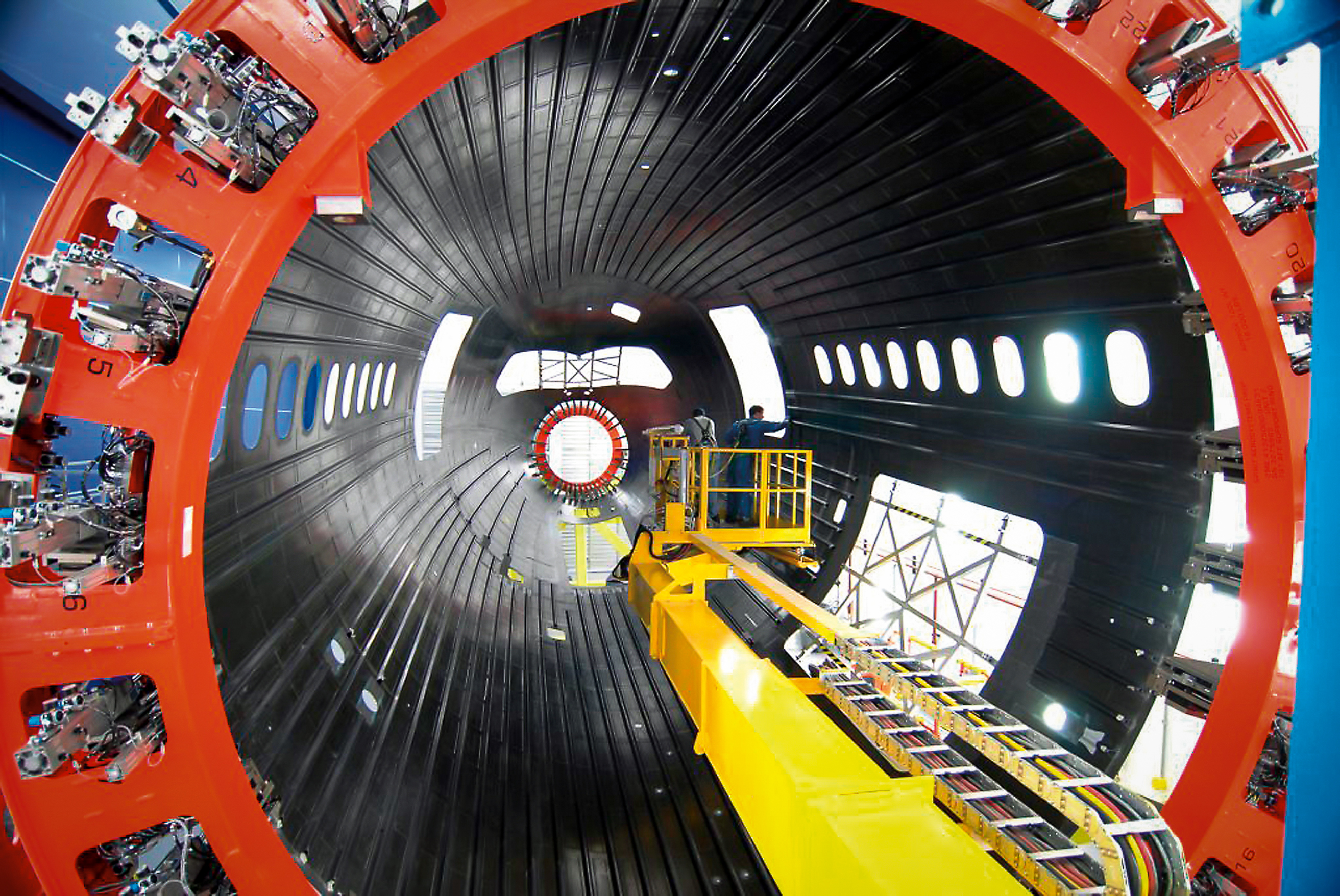
Boeing assembles a composite aircraft fuselage section in one of its production facilities. Composite materials are used in major portions of modern aircraft, including sections of the fuselage and wings on aircraft such as the Boeing 787. NASA’s HiCAM project aims to help accelerate manufacturing processes for future composite aircraft.
Boeing
NASA’s Hi-Rate Composite Aircraft Manufacturing (HiCAM) project brought together its full team of Advanced Composites Consortium partners for a 2026 spring review at NASA’s Langley Research Center in Hampton, Virginia.
The meeting took place May 5-7, bringing together about 150 people from the consortium, a 22-member public-private partnership.
The review gave NASA and industry partners a chance to look at recent progress and plan for the work ahead. NASA announced recent portfolio decisions, selecting technologies that can have the greatest impact on manufacturing rate for the next airplane program.
During the meeting, teams reviewed the latest results from the project’s Development Phase and discussed early progress under Phase 2, known as the Demonstration Phase. This phase will scale up key manufacturing technologies in the coming years.
A major part of the event included full-day workshops focused on assembly demonstrations of two large aircraft structures: the wing and fuselage. These sessions brought together NASA researchers, industry engineers, and partners to share updates, exchange ideas, and discuss long-term plans. Many teams said they noticed stronger collaboration and coordination across the group this year.
That collaboration supports HiCAM’s goal of large-scale manufacturing demonstrations of a composite fuselage barrel and wing box in 2028 and 2029. These demonstrations represent major project milestones and will help show how advanced composite materials and processes could support faster, lower cost aircraft production.
NASA and its partners continue to make steady progress toward the project’s goals. The project’s work could help pave the way for new manufacturing methods for lightweight composite structures that make future aircraft easier to build and more efficient to operate.
NASA-Funded Study Shows Wildfire Smoke’s Hidden Ozone Toll
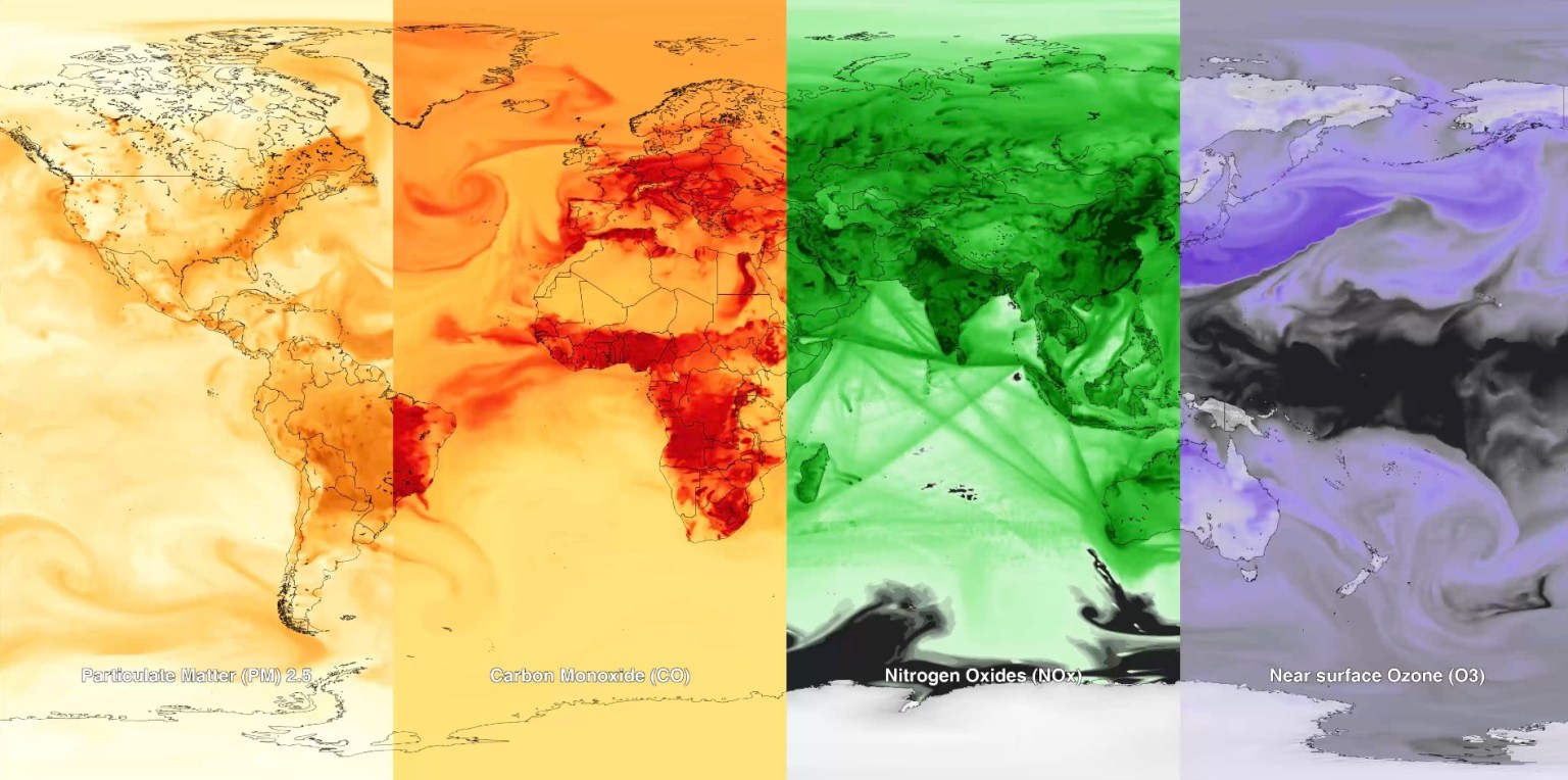
Canadian wildfire smoke carried carbon monoxide — a building block of ground-level ozone — thousands of miles downwind in June 2023.
Credits: NASA’s Goddard Space Flight Center
Wildfire smoke is stoking a new challenge for cleaner air. A NASA-supported study published Thursday found that, over the last decade, wildfires have worsened ground-level ozone pollution across much of the contiguous United States, creating unhealthy air far from active flames.
Wildfires have become an increasingly important contributor to ground-level ozone, or smog, across much of the United States, researchers report June 4 in the journal Science. Nationally, fires offset nearly four years’ worth of ozone-control gains, with larger setbacks in the West and Midwest.
Smoke often is associated with the soot, ash, and other fine particles that make the air look hazy. But wildfires also emit gases such as carbon monoxide, which can help form surface ozone in sunlight when other pollutants are present. Surface ozone is an invisible pollutant harmful to human health, plants, and crops. As smoke plumes travel and mix with other pollution, those reactions can drive ozone increases hundreds or even thousands of miles from active fires.
“NASA Earth observations, along with ground monitoring networks, help reveal air quality risks from wildfires that can cross state lines, giving air quality managers better decision-making information as wildfire smoke affects more communities,” said John Haynes, manager of NASA Earth Action’s Health and Air Quality program at the agency’s Headquarters in Washington. “This is a strong example of NASA science serving communities here in the U.S.”
Building a clearer ozone picture
High in the atmosphere, ozone shields Earth from harmful ultraviolet radiation. Near the ground, however, ozone can irritate lungs, worsen asthma and other respiratory diseases, and increase health risks for children, older adults, outdoor workers, and people with existing health conditions.
To track surface ozone changes, researchers turned to deep learning, a form of artificial intelligence that finds patterns across large datasets. They used it to build a first-of-its-kind dataset estimating daily surface ozone from 2003 to 2024 on a kilometer-by-kilometer grid — about 0.6 miles on each side — across the contiguous U.S. The work received support from NASA’s Health and Air Quality program and other NASA grants.
The scientists combined data from about 1,000 ground-based air quality stations with atmospheric model data, weather information, wildfire pollution data, and satellite-derived information, including products from the Visible Infrared Imaging Radiometer Suite (VIIRS) and the Moderate Resolution Imaging Spectroradiometer (MODIS) instruments.
Smoke from Canada’s 2023 wildfires spread across North America. Tan to deep red colors show smoke intensity, estimated from black carbon in NASA’s GEOS-FP model.
NASA’s Scientific Visualization Studio (SVS) and NASA’s Global Modeling Assimilation Office (GMAO)
Their analysis revealed two distinct periods. From 2003 to 2015, U.S. ground-level ozone generally declined as emissions of ozone-forming pollutants decreased. After 2015, however, those gains slowed or reversed in many places. By comparing estimated ozone levels with scenarios that removed wildfire influence, the researchers found that pollution from wildfires was a main factor in that shift.
Without the wildfire contribution, ground-level ozone in the Midwest, for example, would likely have continued to decline. Instead, wildfires erased about 5.3 years’ worth of ozone-control progress since 2015.
“People in the Midwest may think fires burning far away will not affect them,” said the study’s corresponding author Jun Wang, an atmospheric scientist at the University of Iowa in Iowa City. “But once wildfire pollution is in the air, it can move across regions. Pollution from one place can affect air quality in another.”
Measuring the health toll
The study also found that wildfire-driven ozone increased exposure to unhealthy air and likely contributed to premature deaths. Premature deaths associated with long-term wildfire-related ozone exposure in the U.S. increased by an estimated 318 deaths per year after 2013, with the post-2013 average 46% higher than in the previous decade. The researchers calculated premature deaths using average lifespan, ozone exposure estimates, and population density.
The 2023 Canadian wildfires showed how widely those risks can spread, with smoke-driven ozone increases stretching across the Midwest and into parts of the Northeast and South. Overall, from 2022 to 2024, wildfires exposed an additional 43 million people in the U.S. to conditions that did not meet current federal air quality standards for ozone, the researchers estimated.
Capturing that national picture is difficult from ground monitors alone. Ground monitors remain the backbone of U.S. air quality tracking, but they do not cover every community. NASA’s scientifically validated satellite observations and models help researchers and agencies see air quality patterns across states, regions, and fire seasons.
That broader air quality work includes newer missions such as TEMPO (Tropospheric Emissions: Monitoring of Pollution). Launched in 2023, TEMPO is NASA’s first mission to use a space-based spectrometer to provide hourly daytime measurements of air quality over North America. Its view is sharp enough to distinguish pollution patterns, including surface ozone, across areas only a few square miles wide, a major improvement over earlier satellites.
Together, these capabilities help researchers and agencies see smoke-related ozone patterns that might otherwise be harder to detect, especially in rural and remote areas.
The work also points toward a practical use of NASA science during fire season. Wang’s team has used NASA support to develop FireAQ, a decision-support system that brings satellite observations, model forecasts, and fire and aerosol products into weekly briefings with state and local air quality officials. The goal is to help officials see where smoke-related pollution may move next and give communities better information.

 Login