Laser Interferometer Lunar Antenna: a Sub-Hertz GW Detector on the Moon
Speaker
Volker Quetschke, University of Texas Rio Grande Valley
Abstract
The moon offers unique opportunities and challenges to realize interferometric gravitational wave detectors that are sensitive over a range of frequencies that are currently not covered. Compared with Earth-based detectors, the moon’s reduced gravity and lower seismic activity allow us to shift the sensitivity to lower frequencies.
An update on the Laser Interferometer Lunar Antenna (LILA) project—a next generation gravitational-wave detector on the surface of the Moon—will be presented. The LILA detector will have unique access to sub-Hertz frequencies of gravitational waves. This frequency range of waves cannot be measured by any ongoing or upcoming experiment on the Earth or in space, thus fundamentally changing the landscape of multi-messenger astrophysics that otherwise cannot be achieved. LILA will provide early warnings prior to mergers of black holes and neutron stars. Measurements in the deci-Hertz regime can vastly improve measurements of the Hubble constant, the equation of state of neutron stars, and tests of General Relativity. Furthermore, LILA will uniquely observe phenomena like white dwarf mergers as Type Ia supernovae progenitors, tidal disruption around intermediate mass black holes, and novel dark matter probes.
A preliminary design for the LILA project and the planned future development stages will be shown: the LILA Autonomous Interferometry Technology Demonstration (LILA-AITD), the Initial LILA (iLILA) strainmeter and the full, operational LILA Observatory.
1 July 2026 2:00pm -3:00pm ET 11:00am – 12:00 pm PT
Community
Physics of the Cosmos
Type
Seminar
Why and Where Do We Want to Put Telescopes on the Moon?
Speaker
Nivedita Mahesh, CU Boulder
Abstract
The Moon is emerging as a uniquely valuable platform for astrophysics, enabling observations that neither Earth nor free-flying spacecraft can support. This talk surveys the scientific motivation across four complementary regimes. At low radio frequencies, the radio-quiet lunar farside opens a window onto the cosmological Dark Ages and the magnetospheres of exoplanets. In the mid-band gravitational-wave regime, the Moon’s low seismic activity bridges the sensitivity gap between terrestrial and space-based detectors. At ultraviolet wavelengths, its natural vacuum and long coherence times allow high-resolution stellar imaging beyond what is possible on Earth. And in the far-infrared, the cold, stable conditions of permanently shadowed regions offer a naturally cryogenic, absorption-free site for probing star and planet formation and the obscured Universe.
For each regime, I will share updates from the mission concept leads on the efforts now developing within the Astrophysics from the Moon, Mars & Beyond (AMMB) Science Interest Group. Together, these cases point to a paradigm shift: astrophysics from the Moon is becoming not just desirable but necessary.
Constraints on Dynamical Dark Energy from the Full Dark Energy Survey
Speaker
Sujeong Lee, Ohio University
Abstract
The nature of dark energy remains one of the central open questions in cosmology, and recent analyses have reported a weak but intriguing preference for an evolving equation of state. I will present constraints on the w0-wa parameterization from the full six-year Dark Energy Survey (DES) dataset, combining growth and geometric probes — supernovae, BAO, and weak lensing and galaxy clustering (3x2pt) — within a single survey. The DES-only combination yields the tightest such constraints using multiple probes from any single survey, and adding external CMB and DESI BAO data gives a 3.0-sigma deviation from a cosmological constant, with the best-fit always favoring w0 > -1, wa < 0. Because DES relies on different probes and systematics than DESI, this provides an independent cross-check on the recent hints for dynamical dark energy. I will discuss how to interpret these results, and what they imply for Stage IV surveys. This work realizes the multi-probe dark energy program envisioned at the inception of DES.
1 July 2026 2:00pm -3:00pm ET 11:00am – 12:00 pm PT
community
Cosmic Origins
Type
Seminar
Why and Where Do We Want to Put Telescopes on the Moon?
Speaker
Nivedita Mahesh, CU Boulder
Abstract
The Moon is emerging as a uniquely valuable platform for astrophysics, enabling observations that neither Earth nor free-flying spacecraft can support. This talk surveys the scientific motivation across four complementary regimes. At low radio frequencies, the radio-quiet lunar farside opens a window onto the cosmological Dark Ages and the magnetospheres of exoplanets. In the mid-band gravitational-wave regime, the Moon’s low seismic activity bridges the sensitivity gap between terrestrial and space-based detectors. At ultraviolet wavelengths, its natural vacuum and long coherence times allow high-resolution stellar imaging beyond what is possible on Earth. And in the far-infrared, the cold, stable conditions of permanently shadowed regions offer a naturally cryogenic, absorption-free site for probing star and planet formation and the obscured Universe.
For each regime, I will share updates from the mission concept leads on the efforts now developing within the Astrophysics from the Moon, Mars & Beyond (AMMB) Science Interest Group. Together, these cases point to a paradigm shift: astrophysics from the Moon is becoming not just desirable but necessary.
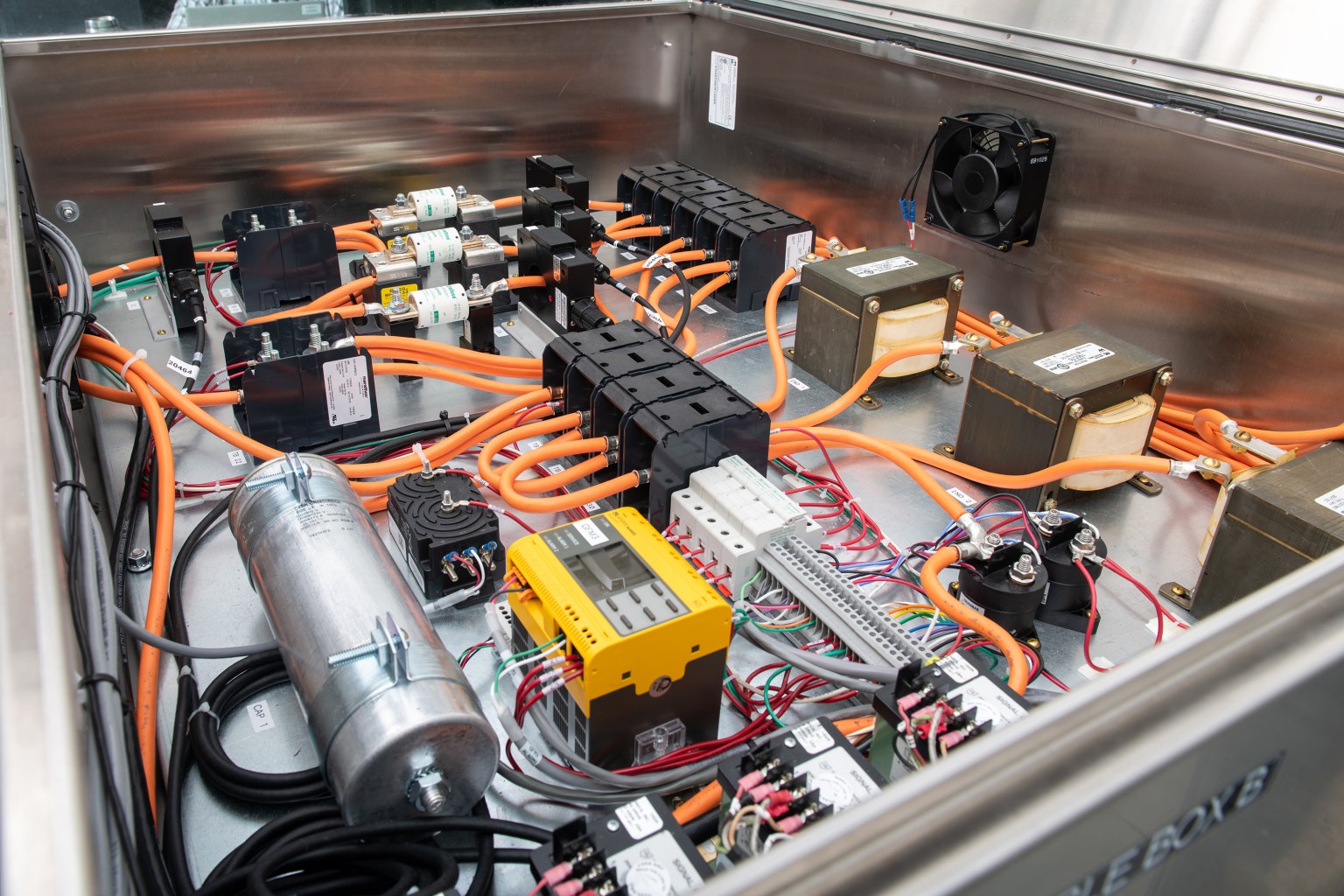
Electricity powers the world, and electricians are the ones who get it where it needs to go. An electrician is an expert who is trained to make sure electrical systems and equipment are installed safely and working correctly. Electricians are involved in a variety of systems, including power, lighting, communications, and more – anything that needs electricity to run.
While electricians ensure systems and equipment have the power they need, electrical technicians focus on building, modifying, or testing electronic devices.
What are some of the different types of work electricians and electrical technicians do at NASA?
At NASA, electricians keep the lights on and the power flowing for rocket launches, scientific research, and everything in between. Their skills support engineers and scientists in building and testing spacecraft, aircraft, satellites, telescopes, and the equipment that makes human spaceflight possible. Electricians make sure all facilities and equipment have the power and functionality they need to be safe and ready to support NASA’s missions.
Electrical technicians at the agency help bring big ideas to life. They might build and wire control systems, connect tiny sensors to circuit boards, or write the software to make a device work in a specific way. They also test instruments in conditions that mimic space – extreme temperatures, intense vibrations, and even a vacuum – to make sure they will survive and perform well during their missions. Technicians use specialized tools, earn certifications, and work with incredible precision.
Being an electrician or electrical technician at NASA is careful, hands‑on work carried out with expertise. Because space hardware is headed to places like low-Earth orbit, the Moon, or even Mars, every detail has to be perfect.
What are the different certification levels for electricians?
The information below is a general overview of the career path of an electrician. Specific guidelines for these roles vary from state to state. It’s important to look up the license requirements in your state.
Apprentice electrician: This four-year job training program provides an entry into the industry. An apprentice works as an assistant to an experienced supervisor, gaining vital hands-on experience to move ahead as an electrician.
Journeyman electrician: A journeyman is an electrician who has finished an apprenticeship, then passed a test. At this stage, the electrician is licensed and allowed to work without supervision.
Master electrician: This is the highest certification possible for an electrician. Typically, a master electrician is someone who has completed approximately 4,000 hours as a journeyman, then passed a licensing exam. These electricians are qualified to work on complicated projects. They can also serve as supervisors for apprentices or journeymen following in their footsteps.
How can I become an electrician?
There are many options that provide the training needed to get started as an electrician or electrical technician.
Many community colleges, trade schools, and technical institutes offer a two-year program leading to an associate degree in electrical technology. Additionally, trade unions and apprenticeship programs provide real-world experience in the field.
Additionally, all branches of the U.S. military offer electronics training that may be transferrable to college credits or civilian certifications.
How can I start preparing today to become an electrician?
It’s never too early to set the stage for an electrifying career! In high school, you can take courses in math, science, and technical education. At the same time, you can start learning about basic electrical concepts such as circuitry and safety.
Begin researching associate degree programs and apprenticeship opportunities so you can consider which pathway seems right for you. Weighing these options now will help you understand program requirements and ensure you’re ready to take the next step.
You can also gain useful experience through part-time work, or shadowing electricians on the job.
What skills will I need to be a successful electrician?
Technical skills focus on the basics – how electricity works, how to stay safe, and how to read schematics and wiring diagrams. Some jobs also call for special hands‑on abilities, like soldering tiny components, putting together cables, or even having some familiarity with chemistry.
Being curious, open‑minded, and a good communicator matters, too. Any time you’re building or improving a device, you must understand who will use it and what they need it to do. Asking questions, sharing ideas, and being able to take feedback are essential to consistently building systems and devices that work well.
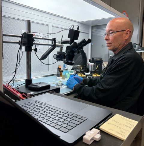
David McClaeb, electronic technician, NASA’s Goddard Space Flight Center in Greenbelt, Maryland
Advice from NASA electricians and electronic technicians
“As an aerospace technician, you have the opportunity to make a big difference. You can make a really big impact.” – Christopher Johnson, aerospace electrical engineering technician, NASA’s Kennedy Space Center in Florida
“What I wish I knew in high school is how many opportunities there are for electricians. I didn’t realize how big of a scale it really was. Everything needs electricity, and the sky’s the limit on what you can do with it. NASA needs electricians for everything from their testing campaigns to keeping their facilities running.” – Levi James, electrician apprentice, NASA’s Glenn Research Center at Armstrong Test Facility in Sandusky, Ohio
“It’s so gratifying when somebody comes in and says, ‘Hey, we want to build this, but it looks really difficult,’ and we say, ‘Yeah, it looks difficult, but we can do it’ – and we build it and then we hand it over to them, and then we’re on to the next thing. It’s a challenge, and I’m telling you, it is just so fun.” – David McClaeb, electronic technician, NASA’s Goddard Space Flight Center in Greenbelt, Maryland
Curiosity Blog, Sols 4927–4933: Let’s Drive to That Smooth Area
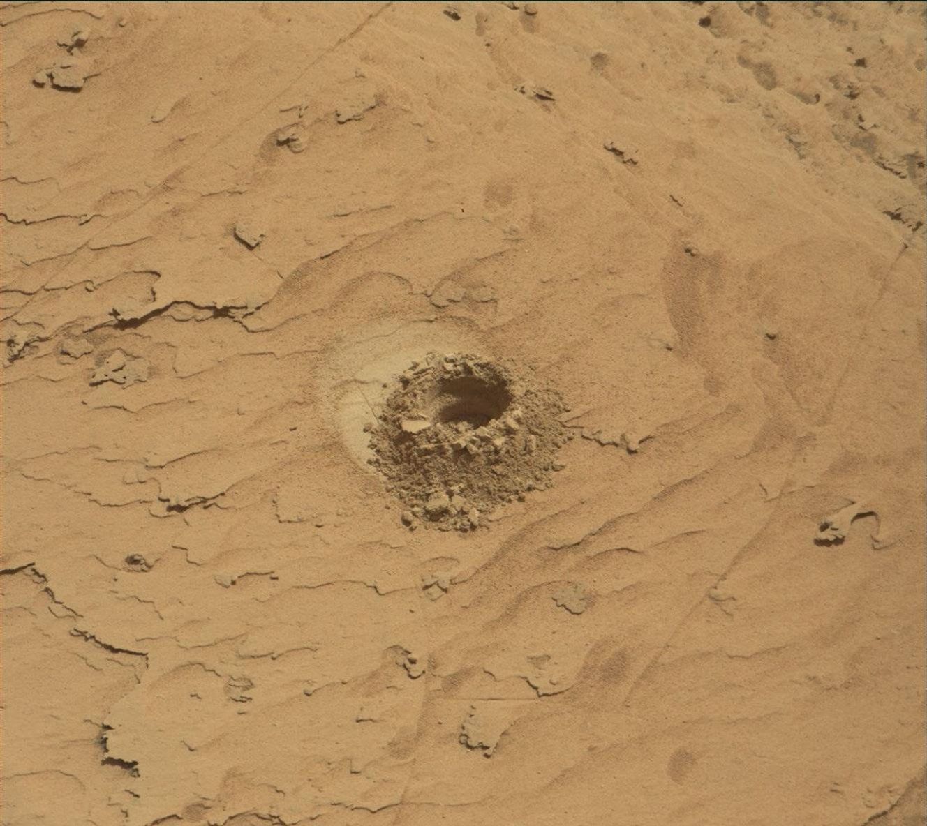
NASA’s Mars rover Curiosity acquired this image showing a breathtaking diversity of polygons, veins, and other textural features waiting for investigation by the Mars Science Laboratory team. Curiosity captured the image using its Left Navigation Camera on June 17, 2026 – Sol 4928, or Martian day 4,928 of the Mars Science Laboratory mission – at 17:47:52 UTC.
NASA/JPL-Caltech
By Susanne P. Schwenzer, Professor of Planetary Mineralogy at The Open University, UK
Earth planning date: Thursday, June 18, 2026
In the area Curiosity is currently exploring, the science team has mapped several areas with different-looking surface texture on the orbital images. If you wanted to have a look yourself at what there is to see, check the “Where is Curiosity?” map. You’ll discover different shades of orange and beige as well as more rough and more smooth-looking textures. This is what the geomorphologists in our team use to map the areas for exploration by the rover. Of course, we then supplement this all with ground-based images, including bespoke “drive direction imaging,” which is taken after each drive by the Mast Camera. Drive planning is done using a combination of all this information. So there shouldn’t be any surprises, right?
On Monday the team planned three sols in preparation for a Thursday planning to account for the U.S. federal holiday weekend. The workspace turned out to be a little spiky, so we could not find an area we could DRT. APXS still found one good bedrock target, “Rio Baker,” which also had MAHLI documentation. In addition, ChemCam investigated “Rica Aventura,” a textured bedrock, and “Tabebuia,” a darker-looking individual block, using its LIBS and conducted a passive spectral observation on a second dark float block called “Lago Ranco.” Of course, the team also wanted to look into the distance with ChemCam remote imaging, extending our investigation of the Cordillera base outcrop.
Imaging is always high on the list. In Monday’s plan Mastcam is looking into the modern dunes with the “Tacaza” mosaic, and with more mosaics looking forward to the future parking areas, some of which looked really smooth from that vantage point. We also continue our environmental and atmospheric observations looking for dust devils, the opacity of the atmosphere, and monitoring pressure and temperature. After all this, the rover drove about 35 meters (about 115 feet) to an area that looked really smooth in all images we had available at that point. So we were hoping for a good spot to deploy the DRT, but didn’t think we could be in for a surprise.
The drive ended exactly as planned, spot-on in the middle of that — from a distance — smooth-looking area. But when we opened the post-drive images on Thursday morning, we were all reacting with a lot of surprise. From up close, the parking spot looks anything but smooth. You can see the surprise in the title image of this blog. There are polygons, veins, lamination, and probably more, once we inspect the higher-resolution images taken today. “Higher-resolution” is the key for why we were in for such a surprise! The features are quite small, a few centimeters across, and therefore we could not see them in the orbital images or from a distance in our navigation and mast camera images. The camera resolution from a distance just isn’t enough to see them. But up close, the terrain revealed all its beauty! And I am sure there will be more in the even higher resolution of today’s MAHLI and ChemCam RMI imager images!
So, what did we plan after we caught our breath on Thursday? First, you guessed it, images, images, and more images. Mastcam takes a full panorama with its “left eye” and adds a range of closer-up mosaics with its higher-resolution “right eye.” In addition there is a ChemCam Remote Micro Imager image to document structures further afield at high resolution. ChemCam is investigating three targets using LIBS: “Rio Chimore” is a lighter-toned band; you can see some of those in the cover image of this blog, too. The other two LIBS targets are “Rio de Lava,” a vein target, and “Rio de Salta,” one of the polygons. APXS is also looking at the bedrock and the ridges, at the targets “Pampa Grande” and “Iquique Ridge.” MAHLI is having the above-mentioned close “hand lens” look. Let’s see what we will discover when we get those images.
Finally, Curiosity drove up the hill along very smooth-looking terrain that is just littered with tiny polygons. Let’s see if we are in for another surprise reverberating around all our offices — and across two continents, as I had the good fortune to be among the first ones, here in England (Or maybe it was our French ChemCam colleagues, who are in a time zone one hour ahead of me?). Whichever it is, this terrain has a lot to say about the geologic history of Mars!
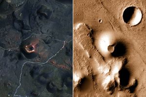
In preparing to visit the Moon’s surface, soon-to-be lunar explorers in NASA’s Apollo program first ventured into a variety of unfamiliar landscapes on Earth. A couple of these trips, in the summers of 1965 and 1966, took astronauts to Alaska’s remote Katmai National Park for simulations of field geology in Moon-like environments.
In one exercise, which they called “playing the Moon game,” pairs of astronauts were placed at unfamiliar field sites and asked to pretend as if they were on the Moon. By the account of William Phinney, Apollo’s science training coordinator, they were tasked with collecting representative geologic samples and practicing how to communicate their observations to scientists.
September 29, 2025
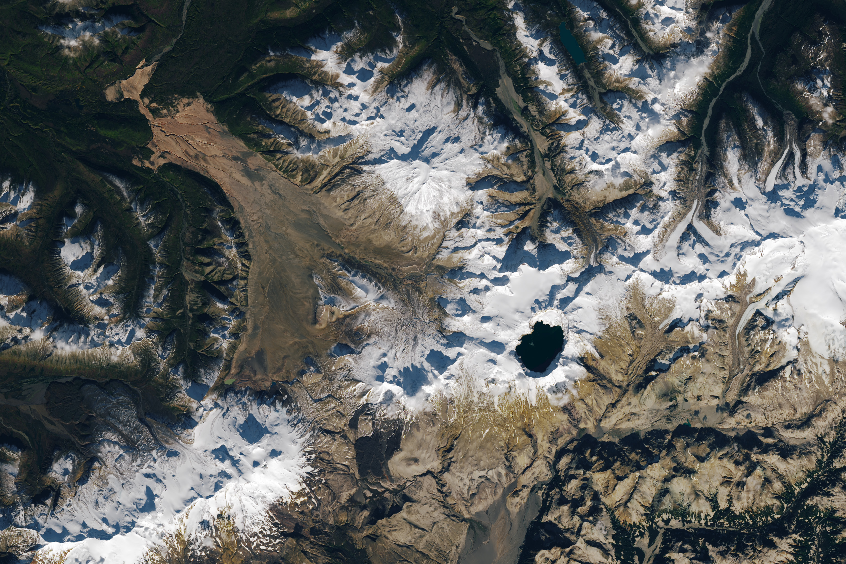
The Alaskan setting for the Moon game was an unusual volcanic landscape called the Valley of Ten Thousand Smokes. The valley is full of debris deposited by the 1912 eruption of Novarupta—the largest volcanic event on Earth in the 20th century.
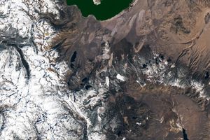
The images above, acquired on September 29, 2025, with the OLI (Operational Land Imager) on Landsat 9, show the massive ash flow deposited by Novarupta. The layer measures up to 660 feet (200 meters) thick and was emplaced at a searing 1,380 degrees Fahrenheit (750 degrees Celsius).
The Valley of Ten Thousand Smokes, shown in the 1917 photo below, is so named because of the abundance of fumaroles—gas and steam-emitting vents—that filled the valley for a decade after the eruption. A few hundred persisted more than 10 years, with some lasting until the 1990s.
1917
Scientists initially suspected that the monster eruption occurred at Mount Katmai, a neighboring volcano with a large caldera located 6 miles (10 kilometers) east of Novarupta’s dome. However, they later determined that the eruption actually occurred at Novarupta—whose name means “new eruption”—after stealing magma from beneath Katmai. As the magma chamber emptied, Katmai collapsed, forming the 2.5-mile-wide (4-kilometer-wide) caldera present today.
The volcanic landscape in the Valley of Ten Thousand Smokes is far fresher than the ancient lava flows that formed the Moon’s volcanic features. But for the Apollo astronauts, it offered an “excellent opportunity to view volcanic materials and landforms in nearly pristine condition,” Phinney wrote. They studied evidence of fumaroles and examined vertical sections of the deposits where streams had eroded deep gorges.
June 9, 1991
Researchers continue to visit this Alaskan wilderness in search of clues that could help decipher the geology of the Moon and Mars. In 2024, the Goddard Instrument Field Team (GIFT) trekked to the Valley of Ten Thousand Smokes to study its icy volcanic landscape. Like the valley, Mars contains glaciers and ice sheets layered with dust and ash, a dynamic and difficult-to-interpret environment.
Advancing lunar science, the GIFT team also collected samples from rock formations comparable to the Moon’s Gruithuisen Domes. These mysterious features are made of hardened lava with a different composition than the surrounding rock. With more to learn about our nearest celestial neighbor, the spirit of the Moon game lives on in the 21st century.
NASA Earth Observatory images by Lauren Dauphin, using Landsat data from the U.S. Geological Survey. Photos from National Geographic Society Katmai expeditions photographs, Archives and Special Collections, Consortium Library, University of Alaska Anchorage, and from the U.S. Geological Survey Volcano Hazards Program. Story by Lindsey Doermann.
NASA has selected Sean Gallagher as the agency’s chief information officer (CIO). In this role, he is responsible for the agency’s entire portfolio of Information Technology products and services. Gallagher has been serving in an acting capacity since January and his permanent role is effective immediately.
“Sean Gallagher’s leadership has been instrumental in strengthening NASA’s IT foundation and ensuring our workforce has the secure, modern tools needed to enable groundbreaking missions every day,” said NASA Deputy Administrator Matt Anderson. “As CIO, Sean will continue advancing the agency’s technology capabilities to support discovery, innovation, and mission success across NASA.”
Most recently, Gallagher also has served as the deputy chief information officer for Operations in the Office of the Chief Information Officer at NASA Headquarters in Washington, as well as a senior advisor for Transformation. This team provides services to tens of thousands of end users located in the U.S. and abroad in support of NASA missions, enabling discoveries, faster data sharing, increased workforce productivity, and more. Gallagher has worked with all NASA centers to implement efficient and effective IT operating models.
Previously, Gallagher was the CIO of NASA’s Glenn Research Center in Cleveland, leading IT initiatives for aeronautics, space, research and engineering, and test missions. He joined NASA in 2012 as Glenn’s deputy CIO and previously worked at Booz Allen Hamilton as a senior associate supporting a variety of federal, defense, and commercial customers.
Gallagher developed his leadership and management experience as a Signal Corps officer in the United States Army. He also served as a platoon leader managing the combat service support readiness of a tactical communications unit, a human resource manager for the 40th Signal Battalion, and as a network engineer for the 11th Signal Brigade. He has a bachelor’s degree in physics from John Carroll University and a master’s degree in computer information systems from the University of Phoenix.
For more information about NASA’s missions, visit:
Associate Administrator for the Office of International and Interagency Relations
Kathleen Karika is NASA’s associate administrator for the agency’s Office of International and Interagency Relations (OIIR). The office is responsible for executive leadership and coordination for all NASA international and interagency activities and partnerships, policy interactions between NASA and other U.S. Executive Branch offices and agencies, and administration of export control. She also serves as the agency’s senior accountable officer for the White House’s Made in America Council.
Karika joined NASA in 2025, after spending 15 years in the U.S. commercial space industry, where she led international business development teams and engaged across the U.S. government, and with allies and partners, on commercial, civil, and national security space missions. She most recently served as director of Research Operations at Virgin Galactic, where she managed business development for suborbital microgravity research missions for the U.S. and international governments, academia, and industry.
Prior to joining Virgin Galactic, Karika oversaw capture activities for international government satellite pursuits at both Maxar (now Vantor and Intuitive Machines) and Lockheed Martin. She also held positions at NASA’s Ames Research Center in California’s Silicon Valley, Avascent (now Oliver Wyman), and the U.S. House of Representatives Science, Space, and Technology Committee.
Karika holds a Bachelor of Science in Applied Mathematical Sciences and a Master of International Affairs from Texas A&M University. She served on the Board of Directors for the American Astronautical Society from 2014-2025, where she served terms as the vice president of International and the vice president of Education and Young Professionals.
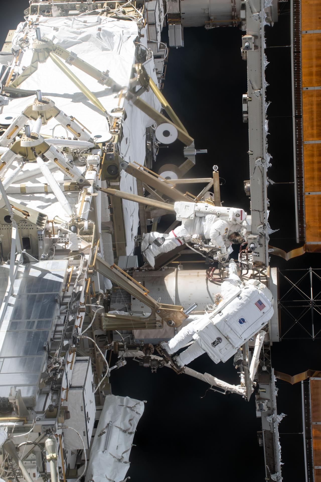
NASA astronauts Jessica Meir (top) and Chris Williams are pictured during a spacewalk on March 18, 2026, to complete the installation of a solar array modification kit on the International Space Station.
NASA/Jack Hathaway
Spacewalk preparations filled the schedule aboard the International Space Station on Tuesday as a pair of astronauts gear up for next week’s external robotics repair job. CubeSat maintenance and eye checks rounded out the day for the Expedition 74 crew.
NASA flight engineers Chris Williams and Jessica Meir will once again wear their spacesuits and work together in the vacuum of space to repair a wrist joint on the Canadarm2 robotic arm starting at 7:35 a.m. EDT on Tuesday, June 30. The duo will spend about six hours and 40 minutes on the outside of the orbital lab replacing the malfunctioned wrist joint on Canadarm2 that has been in operation for over 25 years. NASA and the Canadian Space Agency (CSA) analyzed the issue and determined a spacewalk was necessary to replace the wrist joint with a spare already on the station. NASA and CSA officials will preview the upcoming spacewalk tasks during a news conference on NASA’s YouTube channel at 2 p.m. on Thursday, June 25.
Williams tried on his spacesuit Tuesday and tested the suit in its powered configuration with assistance from flight engineer Sophie Adenot from ESA (European Space Agency). The duo worked inside the Quest airlock checking the pressurized suit’s comfort and mobility and its communications and life support systems while engineers on the ground monitored.
Williams then joined Meir and reviewed on a computer a 3D interactive animation of the procedures and maneuvers they will use to return the Canadarm2 to full motion. Afterward, the pair took turns servicing emergency jet packs that will be installed on the spacesuits the day the spacewalk begins. Meir also installed batteries inside the pistol grip tools — designed especially for microgravity — they will use to work on the robotic arm.
Adenot and NASA flight engineer Jack Hathaway, who will monitor the spacewalkers from inside the orbital outpost, studied their spacewalk support roles including carefully adjusting the Canadarm2 into position during the repair work. Hathaway also had time for CubeSat work first removing a small satellite orbital deployer that was stowed inside the Kibo laboratory module’s airlock. Next, he installed a set of CubeSats inside the NanoRacks CubeSat deployer that will soon be placed outside Kibo’s airlock for deployment into Earth orbit. The tiny satellites were designed by university students for a variety of communications and technology investigations.
Station commander Sergey Kud-Sverchkov joined flight engineer Sergei Mikaev in the Harmony module for eye checks using standard medical imaging hardware. Doctors on the ground were examining how living in space affects the retina, lens, and cornea. Roscosmos flight engineer Andrey Fedyaev continued testing artificial intelligence tools to boost crew efficiency and communications in space.
The Moon is emerging as a uniquely valuable platform for astrophysics, enabling observations that neither Earth nor free-flying spacecraft can support. This talk surveys the scientific motivation across four complementary regimes. At low radio frequencies, the radio-quiet lunar farside opens a window onto the cosmological Dark Ages and the magnetospheres of exoplanets. In the mid-band gravitational-wave regime, the Moon’s low seismic activity bridges the sensitivity gap between terrestrial and space-based detectors. At ultraviolet wavelengths, its natural vacuum and long coherence times allow high-resolution stellar imaging beyond what is possible on Earth. And in the far-infrared, the cold, stable conditions of permanently shadowed regions offer a naturally cryogenic, absorption-free site for probing star and planet formation and the obscured Universe.
For each regime, I will share updates from the mission concept leads on the efforts now developing within the Astrophysics from the Moon, Mars & Beyond (AMMB) Science Interest Group. Together, these cases point to a paradigm shift: astrophysics from the Moon is becoming not just desirable but necessary.
Swara Ravindranath | Deputy Chief Scientist of NASA’s Cosmic Origins Program (NASA GSFC)
Abstract
Cosmic Origins Science covers a broad range of topics that are fundamental to our understanding of the evolution of structure in the Universe and the physical processes that can explain the formation of galaxies, stars, and planets that we observe today. The various space telescopes that operate across the electromagnetic spectrum have been crucial to address some of the most fundamental questions related to our cosmic origins. The landscape of Space Astronomy is evolving fast with innovative technology, industry partnerships, and new commercial launch capabilities. In this talk, I will review the Cosmic Origins Program and discuss the new opportunities that offer strategic pathways for focused-science missions.
Ad ASTRA Workshop Abstract and Mission Concept Deadline Extended to 1 July 2026
23 June 2026
Dear Astrophysics Strategic Technology & Research Accelerator (ASTRA) community members-
As we prepare for our Ad ASTRA Community Science workshop, we are writing to share important updates regarding workshop abstract submissions, as well as ASTRA Mission Concept submissions.
Ad ASTRA Workshop
The deadline for abstract submission for the Workshop has been extended to 1 July 2026.
Submit workshop abstracts via the workshop webpage. If you have already submitted an abstract and would like to modify it based on the guidelines above, please delete your previous contribution and send another submission. Note while talks will be focused on science and technological capability themes, we encourage participants to present their mission concepts as posters, and will offer the opportunity to present as posters any abstracts for which there is insufficient room in the parallel sessions.
ASTRA Mission Concepts
The deadline for submitting ASTRA Mission Concept Documents has also been extended to 1 July 2026.
The most recent decadal survey in Astronomy and Astrophysics (released in late 2021) identified the most compelling science goals, presented a program of ground- and space-based activities for future investment, and recommended critical actions to support the foundations of the profession as well as the technologies and tools needed to carry out the science. At the request of NASA, NSF, and DOE, this midterm assessment reviews progress towards the priorities from the decadal survey.
The National Academies of Sciences, Engineering, and Medicine (the National Academies) shall convene an ad hoc committee to review the responses of NASA’s Astrophysics program, NSF’s Astronomy program, and DOE’s Cosmic Frontiers program (hereafter the Agencies’ programs) to previous National Academies advice, primarily the 2020 National Academies decadal survey, “Pathways to Discovery in Astronomy and Astrophysics for the 2020s” (Astro2020).
The committee’s review will include the following tasks:
Scientific and Technical Landscape: Identify and evaluate the most significant scientific discoveries, technological advancements that could impact implementation, changes to the facilities landscape, and relevant programmatic changes in astronomy and astrophysics since the publication of Astro2020.
Alignment with Decadal Priorities: Assess the extent to which the programs of the relevant agencies align with the strategies, goals, and priorities outlined in Astro2020 and other pertinent National Academies reports in the context of the Agencies’ current strategic priorities and budgets thus far allotted to them.
Recommendations for Maximizing Scientific Return: Considering 1 – the advice provided since the publication of Astro2020 by any Federal Advisory Committees active at the time, 2 – the Agencies’ strategic plans, and 3 – the mid-decade contingencies described in the decadal survey, recommend actions that maximize the scientific return of the Agencies’ programs.
Foundational and Enabling Activities: Evaluate progress and alignment with recommendations on foundational activities, including workforce development, technology maturation, and data infrastructure.
Consideration of International Partnerships and Cross-Agency Opportunities: Assess opportunities to advance the implementation of priorities outlined in Astro2020 that are presented by changes in international partnerships and cross-agency cooperative capabilities.
The review should not revisit or alter the scientific priorities or mission recommendations provided in the decadal survey and related National Academies reports but may assess progress in implementation of the recommended science and activities portfolio and on other potential activities in preparation for the next decadal survey.
From Civil War battlegrounds to industrial landmarks to the country’s earliest national parks, these places helped shape the United States we know today.
Samuel Pierpont Langley conducted the first successful flight of an unpiloted, engine-driven, heavier-than-air craft from a houseboat near Chopawamsic Island…
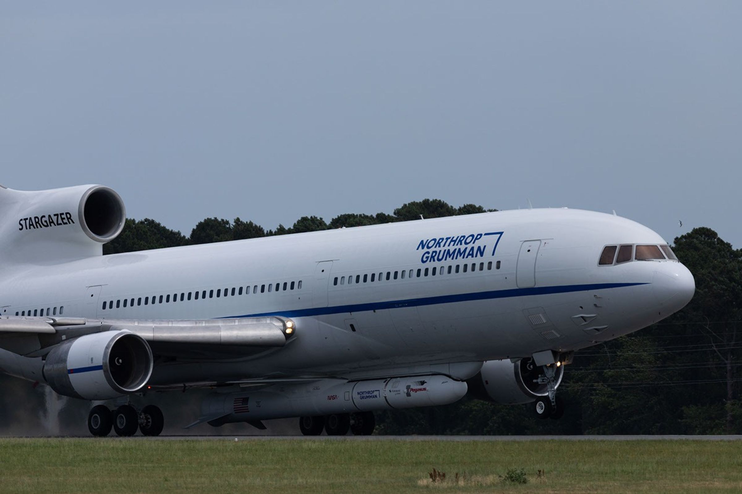
Northrop Grumman’s Stargazer took off Thursday, June 18, 2026, from NASA’s Wallops Flight Facility in Virginia. The modified L-1011 aircraft carried the company’s Pegasus XL rocket hosting LINK, a robotic servicing spacecraft from Katalyst Space. LINK will launch from the air-deployed Pegasus XL later this month on a mission to boost the orbit of NASA’s Neil Gehrels Swift Observatory.
NASA/Jeanette Kazmierczak
An airplane carrying a rocket loaded with a robotic spacecraft designed to raise NASA’s Neil Gehrels Swift Observatory departed the agency’s Wallops Flight Facility in Virginia on Thursday, June 18.
Stargazer, a modified L-1011 operated by Northrop Grumman, took off for Kwajalein Atoll, part of the Republic of the Marshall Islands in the South Pacific Ocean. Attached to the belly of the aircraft was one of the company’s Pegasus XL rockets with LINK inside.
NASA contracted Katalyst Space to design and build LINK to rendezvous and dock with Swift and lift it back to a higher altitude.
Spacecraft in low Earth orbit experience drag caused by our planet’s atmosphere, which gradually reduces their altitude if they do not have propulsion systems to counteract the effect.
Recent solar activity magnified this effect on Swift, which began to sink faster than anticipated.
Katalyst selected Northrop Grumman’s Pegasus XL launch vehicle as the best means of reaching Swift on a short timeline based on orbital and programmatic needs.
Stargazer will carry Pegasus and LINK to Kwajalein Atoll, part of the Republic of the Marshall Islands in the South Pacific Ocean with stopovers in California and Hawai’i.
NASA/Jamie Adkins
Later this month, Stargazer will carry the rocket to an altitude of around 40,000 feet before releasing it.
After several seconds in free-fall, Pegasus XL will fire the first of its three-stage rocket motors, delivering LINK into orbit in about 10 minutes.
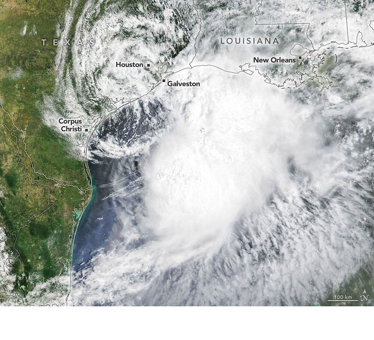
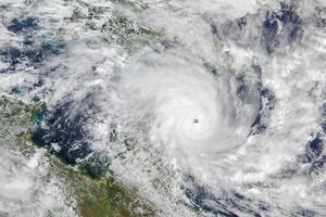
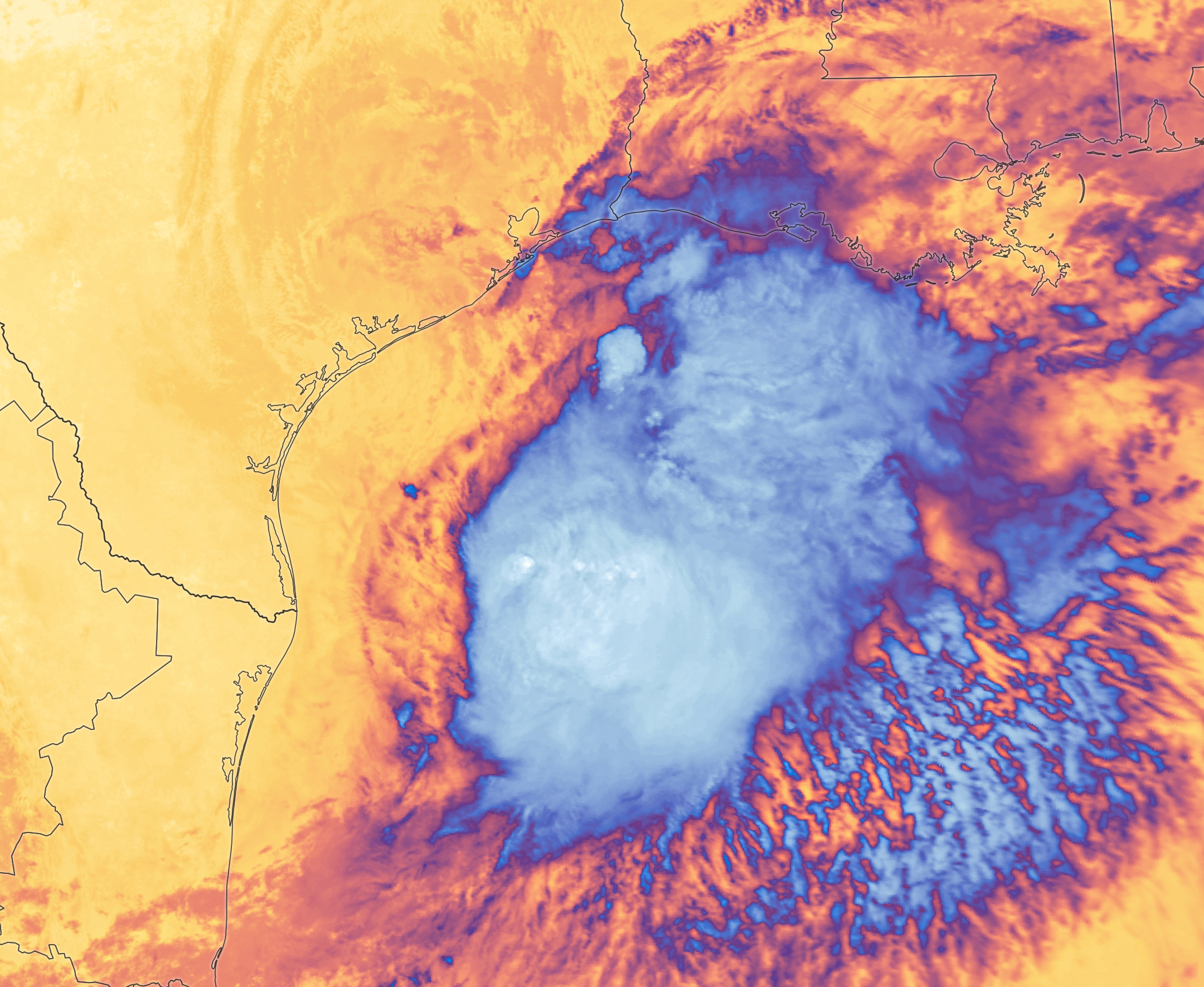
Tropical Storm Arthur’s white storm clouds cover the waters off the U.S. Gulf Coast. Some clouds extend inland over parts of Texas and Louisiana.
NASA Earth Observatory/Michala Garrison
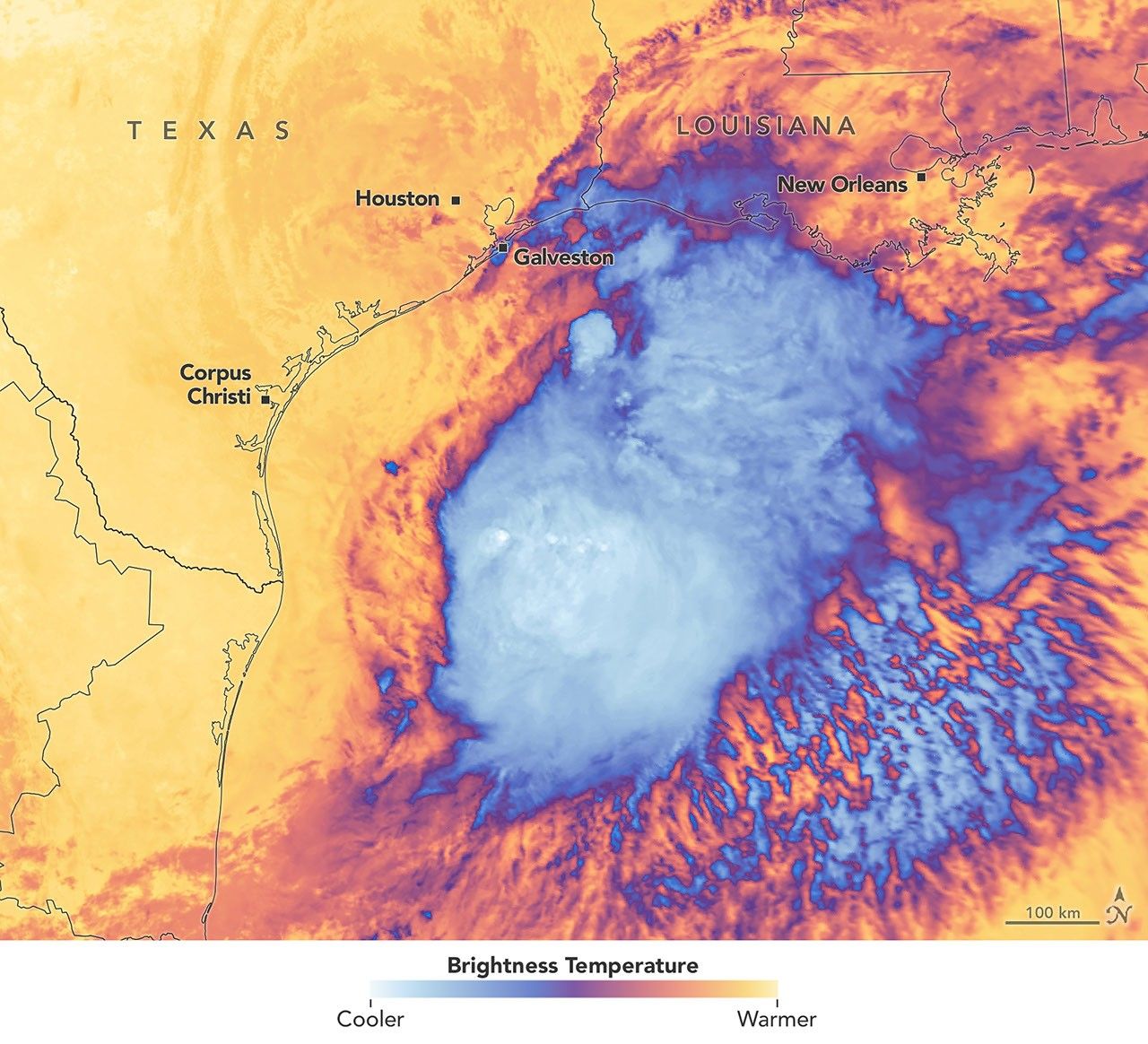
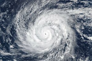
White and purple areas of cloud off the Gulf Coast indicate the cooler areas of cloud tops associated with Tropical Storm Arthur.
NASA Earth Observatory/Michala Garrison
Natural color
brightness temperature
Images from the MODIS (Moderate Resolution Imaging Spectroradiometer) on NASA’s Terra satellite show Tropical Storm Arthur on the morning of June 17, 2026. The left image is natural color; the right shows infrared signals known as brightness temperature. NASA Earth Observatory images by Michala Garrison.
Tropical Storm Arthur, the first named storm of the 2026 Atlantic hurricane season, brought high winds and heavy rain to the U.S. Gulf Coast in mid-June.
NASA’s Terra satellite captured this natural-color image (left) at 10:30 a.m. Central Time (15:30 Universal Time) on June 17. The second image (right) depicts infrared signals known as brightness temperature, which help distinguish cooler cloud tops (white and purple) from the warmer surface below (yellow and orange). Around the time these images were acquired, the system had just recently been designated a tropical storm, according to the National Hurricane Center (NHC).
Though Arthur stayed below hurricane strength, it still delivered strong winds to parts of the Gulf Coast as it tracked northeast. The storm had maximum sustained winds of 40 miles (65 kilometers) per hour around the time these images were captured. Tropical-storm-force winds extended 175 miles (280 kilometers) from the storm’s center, the NHC reported. Measurements at Galveston, Texas, for instance, showed a gust of 48 miles per hour.
The storm also produced heavy rainfall that the National Weather Service warned could lead to life-threatening flash flooding. Estimates from IMERG (the Integrated Multi-Satellite Retrievals for GPM), a product of the GPM (Global Precipitation Measurement) mission, showed high rainfall rates over Gulf waters and extending inland on June 17.
As Arthur weakened and became less organized, it continued to bring abundant moisture to central Gulf Coast states on June 18. The National Weather Service reported rainfall rates of 3 inches (7.6 centimeters) per hour in southeastern Louisiana. Forecasts indicated that storm-total rainfall amounts could exceed 12 inches (30 centimeters) in areas, with some locations seeing totals approaching 20 inches (51 centimeters).
NASA Earth Observatory images by Michala Garrison, using MODIS data from NASA EOSDIS LANCE and GIBS/Worldview. Story by Kathryn Hansen.
Curiosity Blog, Sols 4920-4926: Surveying the Bands
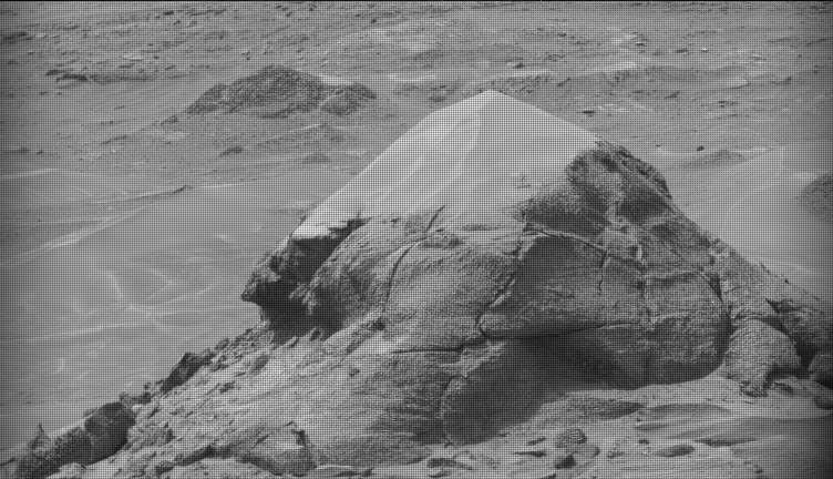
NASA’s Mars rover Curiosity acquired this image of small butte, “Miraflores,” using its Mast Camera (Mastcam) on June 11, 2026 — Sol 4922, or Martian day 4,922 of the Mars Science Laboratory mission — at 09:12:13 UTC.
NASA/JPL-Caltech/MSSS
Written by William Farrand, Senior Research Scientist, Space Science Institute
Earth planning date: Friday, June 12, 2026
Rather than going from stage to stage at a music festival to hear different bands playing different varieties of music, Curiosity has been ascending up Mount Sharp through physical bands of exposed rocks with textural and tonal differences.
Planning for sols 4920 and 4921 were done with the rover in the middle of a unit with a rougher texture and dark-toned bedrock. With the rougher-textured bedrock, brushing wasn’t possible, but APXS chemistry and MAHLI micro-imaging were planned on “as is” bedrock targets “Salto La Cascada” and “Puerto de Rosas.” ChemCam was targeted to perform LIBS spectroscopy on a bedrock target “Kishuara” and a small, layered float rock “La Rosita.” ChemCam’s Remote Micro-Imager (RMI) collected views of the “Mishe Mokwa” butte and another looking at dunes with tonal differences. Mastcam mosaics were collected on the “Valle Grande” channel, “Kimsa Chata” butte, nearby troughs, and the aircraft carrier shaped rock “El Matir.”
Another drive brought Curiosity closer to the upper border of the dark-toned band. Again, brushing of the rocks was not possible, but APXS and MAHLI were collected on dark-toned bedrock targets “Santa Gracia” and “Laguna San Rafael” with ChemCam LIBS also targeting the bedrock. Mastcam mosaics were collected of a layered rock and nearby troughs and a mosaic of the nearby smaller butte, “Miraflores” which displays an interesting layered structure with ragged dark-toned rocks on one side and a stack of dust piled on top (see accompanying image). Other activities included a long-distance RMI mosaic of a bright unit on “Mishe Mokwa”, and Navcam dust-devil surveys in both sols.
Communicating between Earth and Mars has come to seem routine, but at times can still be a challenging endeavor and this was demonstrated to the team on Friday when we did not get a timely downlink of data for the drive planned for Sol 4923. Without these images another drive, in situ examinations, or targeted remote sensing could not be planned. However, there are always interesting things to be done on Mars and the three-sol plan (4924 to 4926) included a 360-degree Mastcam mosaic, the automatic AEGIS targeting of LIBS measurements on each sol, a Navcam dust-devil survey, APXS atmospheric measurements, as well as several other environmental activities.
On Monday, the delayed downlink will be used to plan the first investigation of the next band of surface materials, this one being smooth-textured and light-toned, as well as another drive to continue the surveying of the bands.
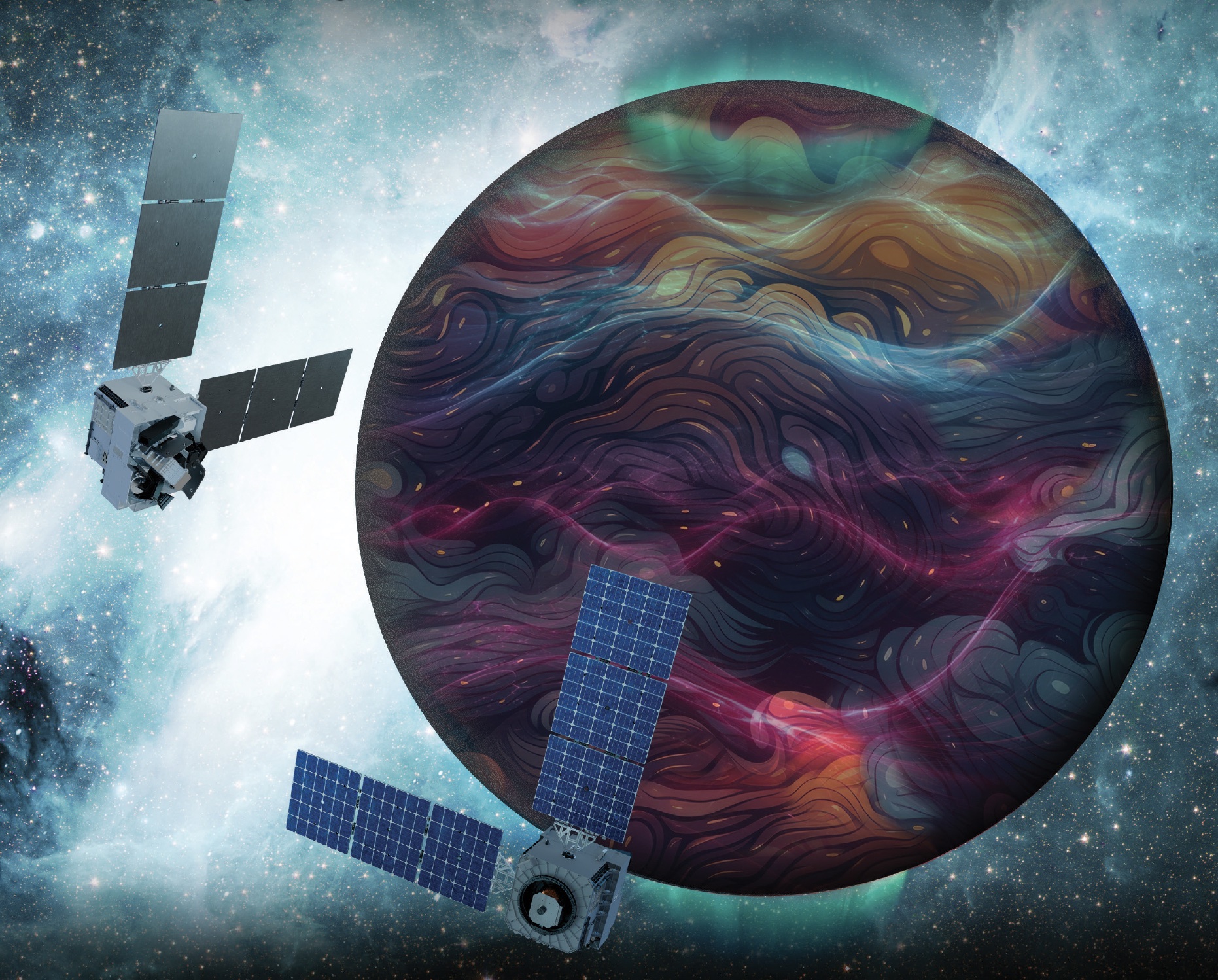
Artist’s rendition of the DAPHNE (Dynamic Atmosphere-Ionosphere Explorer) mission concept. The coloring represents auroras and atmospheric waves in Earth’s atmosphere.
Credit: Laboratory for Atmospheric and Space Physics/Mary Tostanoski
NASA selected a mission concept to research how space weather and dynamics within Earth’s atmosphere influence the space environment and help improve prediction capabilities for impacts on crucial technology, such as GPS and low Earth orbit satellites, as well as astronauts in space.
The DAPHNE (Dynamic Atmosphere-Ionosphere Explorer) mission will enter Phase B of development, which includes planning and design for flight and mission operations. It will use identical twin satellites to study how changes in Earth’s lower atmosphere influence our planet’s upper atmosphere, where space weather is manifested.
“NASA is advancing the United States’ leadership as a space weather-ready nation, and by providing new insights into Earth’s atmosphere we can better predict and prepare for impacts in our daily lives on Earth and in space,” said Nicky Fox, associate administrator, Science Mission Directorate, NASA Headquarters in Washington. “As NASA sends astronauts beyond Earth’s magnetic protection to the Moon, Mars, and beyond, DAPHNE will join the NASA science fleet strategically located across the solar system to provide data that will help mission planners predict and mitigate the effects of space weather for the benefit of all.”
The DAPHNE mission’s low-risk high-return concept will provide coordinated, multi-point measurements of neutral winds, temperature, and composition in the thermosphere. The ionosphere and thermosphere regions are where Earth’s neutral atmosphere transitions into the ionized plasma of space. In this thin shell that surrounds the planet, the atmosphere is in constant motion, shaped by the influence of solar activity and changes in the lower atmosphere and in near-Earth space.
Fundamental observations and physical insights from the DAPHNE mission will incorporate lower-atmospheric energy data to advance space weather predictive capabilities. The mission is led by Aimee Merkel from the Laboratory for Atmospheric and Space Physics at the University of Colorado, Boulder.
The mission will be subject to a confirmation review in 2027, which will assess the progress of the mission and the availability of funds. If confirmed, the total estimated cost of the mission, excluding launch, will not exceed $250 million in fiscal year 2023 dollars, with a mission launch date of no earlier than 2029.
The DAPHNE mission was proposed as a concept study in response to the DYNAMIC (Dynamical Neutral Atmosphere-Ionosphere Coupling) mission announcement of opportunity. Funding and management oversight for this mission is provided by the Solar Terrestrial Probes program at NASA’s Goddard Space Flight Center in Greenbelt, Maryland.
For more information on NASA’s heliophysics missions, visit:

 Login