Login

Digging Back in Time in the UAE
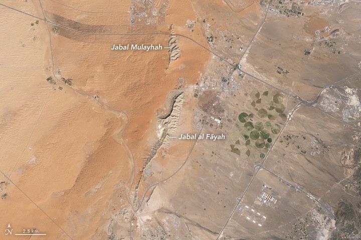
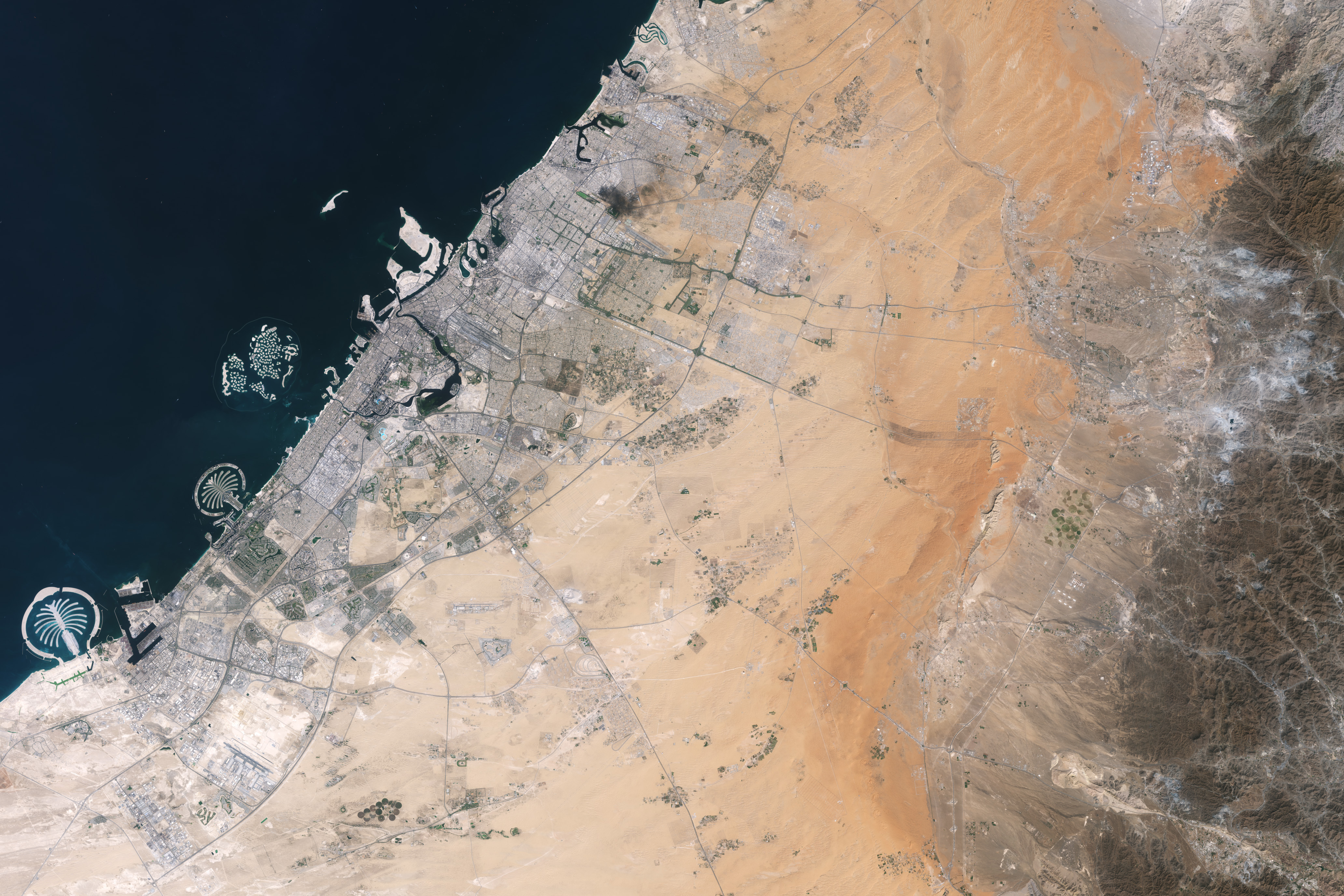
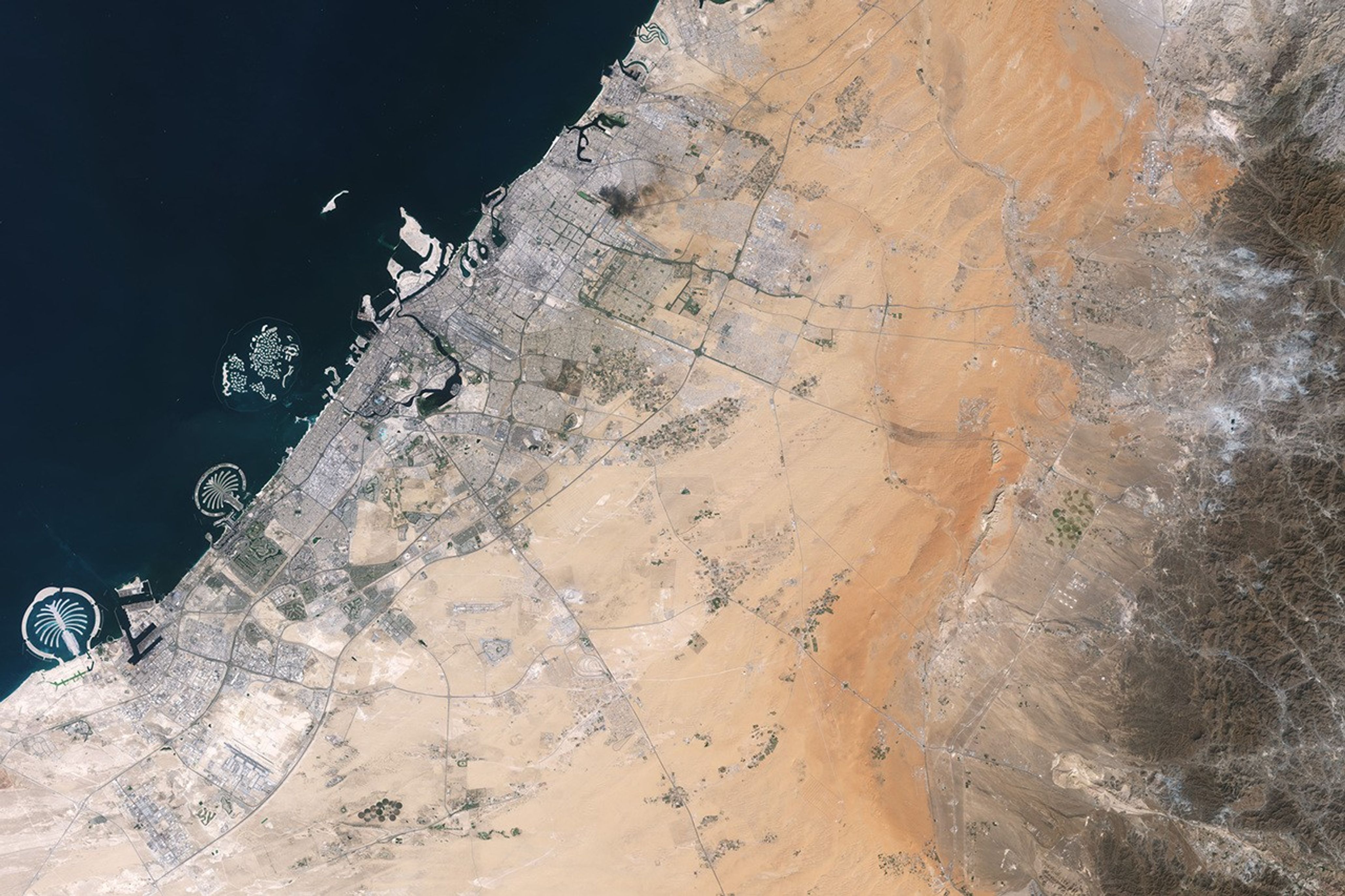
About an hour’s drive east of Dubai’s gleaming towers and artificial islands, a quieter, more natural landscape takes shape. At the far northern edge of the Rub’ al Khali, a saffron-colored sand sea laps against the Al-Hajar Mountains. A series of pale ridges rises finlike from the desert plain, with the largest—Jabal al Fāyah—standing 412 meters (1,352 feet) above sea level.
The Landsat 8 satellite captured this image of the ridges cutting across the Emirate of Sharjah in the northern part of the United Arab Emirates on October 23, 2025. To geologists, the limestone ridges are a reminder of the region’s watery past, signs that this land lay underwater tens of millions of years ago when the sedimentary rock layers were deposited.
Jabal al Fāyah functions as a barrier, trapping windblown sand in dune fields to its west. The weathering of iron-bearing minerals in the sand grains gives the dune fields their orange hue. To the east, the branching channels of overlapping alluvial fans extending from the Al-Hajar Mountains carry gravels and eroded sediments from basalts and other dark mafic rocks.
The dark rocks to the east—part of the Samail Ophiolite—are known to geologists for being among the world’s largest, best-preserved, and most accessible exposures of ancient oceanic lithosphere, the rigid outer layer of Earth that includes both the crust and upper mantle. Oceanic lithosphere like this is normally subducted and recycled back into the mantle when tectonic plates collide. But in this area, a large section from beneath the Tethys Sea was scraped off and thrust onto the Arabian plate in a process called obduction.
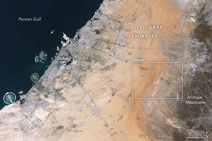
The Jabal al Fāyah ridges themselves are made up of marine limestone that was deposited on top of the ophiolite over tens of millions of years spanning the late Cretaceous through the early to mid-Paleocene. Limestone typically forms along continental margins in warm, shallow oceans, often in lagoons and coral reefs, out of the calcium carbonate found in the shells and skeletons of marine life. In many parts of the ridges, coral fragments and marine invertebrate fossils are visible embedded in the rock. A feature called Fossil Rock sits a few kilometers north of Jabal al Fāyah and adjacent to the limestone ridge Jabal Mulayḩah. It contains an abundance of snail, clam, and sea urchin remains.
For archaeologists, the ridges are at the center of a much more recent tale of human adaptation and survival that has played out in just the past few hundred thousand years. The ridges and parts of the surrounding landscape—inscribed as a UNESCO World Heritage site in 2025—are dotted with dozens of archaeological sites that trace human occupation on the Arabian Peninsula back to between 210,000 and 120,000 years ago, to the Middle Paleolithic. That was a period when waves of anatomically modern humans (Homo sapiens) migrated out of Africa and shared the planet with other groups such as Neanderthals.
Many of the sites contain stone flakes, blades, scrapers, hand axes, and other stone tools. The archaeological treasure trove offers early evidence of modern humans surviving in a harsh desert environment and raises questions about the routes modern Homo sapiens may have taken on their journey out of Africa.
Geological evidence indicates that lakes periodically formed on the east side of the ridge, providing critical food and water resources that would have supported early inhabitants in this unforgiving climate. Rocky overhangs along the ridge would have provided shelter from the heat and wind. Some of the sites show evidence of intermittent occupation beginning as early as 210,000 years ago, making this one of the earliest signs of human habitation on the Arabian Peninsula.
NASA Earth Observatory images by Lauren Dauphin, using Landsat data from the U.S. Geological Survey. Story by Adam Voiland.
References & Resources
- Armitage, S., et al. (2011) The Southern Route “Out of Africa”: Evidence for an Early Expansion of Modern Humans into Arabia. Science, 331(6016), 453-456.
- Bretzke, K., et al. (2025) Archaeology, chronology, and sedimentological context of the youngest Middle Palaeolithic assemblage from Jebel Faya, United Arab Emirates. Archaeological and Anthropological Sciences, 17(60).
- Bretzke, K., et al. (2022) Multiple phases of human occupation in Southeast Arabia between 210,000 and 120,000 years ago. Scientific Reports, 12, 1600.
- Bretzke, K., et al. (2013) The environmental context of Paleolithic settlement at Jebel Faya, Emirate Sharjah, UAE. Quaternary International, 300, 83-93.
- Condé Nast Traveller (2025, July 15) This new UNESCO World Heritage site in the UAE preserves the Middle East’s earliest evidence of modern humans. Accessed June 4, 2026.
- Kamran, K., via Substack (2025, February 18) The Stone Blades of Jebel Faya: Rewriting the Story of Early Humans in Arabia. Accessed June 4, 2026.
- Phys.org (2022, February 1) Early human settlement on the Arabian Peninsula less influenced by climate than previously thought. Accessed June 4, 2026.
- Smithsonian (2025) What does it mean to be human? Accessed June 4, 2026.
- UNESCO (2025) Faya Palaeolandscape. Accessed June 4, 2026.
- Visit Sharjah (2025) Fossil Rock. Accessed June 4, 2026.
You may also be interested in:
Stay up-to-date with the latest content from NASA as we explore the universe and discover more about our home planet.
The coastal province features striking tropical karst landscapes and sandy beaches alongside a mix of natural land cover and developed…

Ireland is best known for its many greens, but the striking grays of the island’s Burren region also stand out…

The circular geologic feature in northwestern Africa can be hard to recognize from the ground, but it is obvious when…
Discover More from NASA Earth Science
Subscribe to Earth Observatory Newsletters
Subscribe to the Earth Observatory and get the Earth in your inbox.

Earth Observatory Image of the Day
NASA's Earth Observatory brings you the Earth, every day, with in-depth stories and stunning imagery.

Explore Earth Science

Earth Science Data
Open access to NASA’s archive of Earth science data

The post Digging Back in Time in the UAE appeared first on NASA Science.