What's in the photo? Submerged sandbanks and seagrass beds in shallow water
Which satellite took the photo? Landsat 8
When was it taken? Feb. 15, 2020
This ethereal satellite snap shows beautiful, "painting-like" folds within an ancient underwater structure in the Bahamas.
The Great Bahama Bank (GBB) is a massive submerged platform stretching around 330 miles (530 kilometers) across a shallow ocean channel between Andros Island and the Exuma islands, according to Britannica. The crescent-shaped bank surrounds a darkly colored ocean drop-off known as "The Tongue of the Ocean," which plunges to depths of 6,500 feet (2,000 meters), according to NASA's Earth Observatory.
The photographed section of the GBB is around 23 miles (37 km) across and features a series of submerged sandbanks — most of which are covered with dense seagrass beds — that lie between 7 and 40 feet (2 to 12 m) below the ocean's surface.
The varying water depth and seagrass concentration cause multiple hues of green and blue to shine across the sandbanks, which have been carved into smooth, folding ribbons by ocean currents over thousands of years.
"The varying colors and curves remind us of graceful strokes on a painting," Earth Observatory representatives wrote.
The Great Bahama Bank is a crescent-shaped structure spanning around 330 miles (530 kilometers) between Andros Island and the Exuma islands. (Image credit: NASA/Landsat)
"There are many nice seagrass and sand patterns worldwide, but none like this anywhere on Earth," Serge Andréfouet, an oceanographer at the French National Research Institute for Sustainable Development who first shared the 2001 image, told the Earth Observatory. "I am not surprised it is still a favorite, especially for people who see it for the first time."
The sandbanks are like giant underwater dunes carved out by ocean currents.
"Tides and ocean currents in the Bahamas sculpted the sand and seaweed beds into these multicolored, fluted patterns in much the same way that winds sculpted the vast sand dunes in the Sahara Desert," Earth Observatory representatives wrote in 2001.
The GBB lies atop a roughly 3-mile-thick (5 km) bed of limestone dating to the age of the dinosaurs, more than 65 million years ago. This hefty mass, made up of the remains of long-dead coral reefs, is so large that Earth's crust directly below the GBB has "sagged under the weight," according to the University of Texas at Austin's Marine Science Institute.
The Great Bahama Bank surrounds the edge of a deep sea drop-off known as the "Tongue of the Ocean," creating a striking contrast when viewed from above. (Image credit: USGS/ESA)
Before the end of the last ice age, around 12,000 years ago, this limestone slab had risen to more than 400 feet (120 m) above sea level and only resubmerged as global sea levels rose due to the melting of glaciers, according to the Marine Science Institute.
A 2026 satellite photo captured a gleaming halo of phytoplankton encircling the remote Chatham Islands. The stunning sight is the result of a hidden underwater structure, which has also helped kill hundreds of cetaceans.
A 2026 satellite photo captured a stunning scene of sediment swirling across the West Florida Shelf after an extreme cold snap that covered large parts of the eastern U.S. in snow.
A 2020 astronaut photo shows the unusual cetacean-like shape of Belize's Lighthouse Reef. It's home to the famous Great Blue Hole, which doubles as the island's "blowhole" when viewed from space.
A simple method to thicken Arctic sea ice has shown promising results in its very first field experiment, performed in Cambridge Bay, Nunavut, Canada.
Researchers are considering several controversial geoengineering techniques to slow the catastrophic melt of Arctic sea ice, including stratospheric aerosol injection, which involves shooting tiny sulfur particles into the sky to blot out the sun. But in a new study, scientists evaluated the merits of a much safer and more straightforward approach: pumping seawater onto existing sea ice in winter and letting it freeze into a reinforcing layer.
Known as sea ice thickening, this method has been used by Nordic and Arctic communities for decades, and ice hockey rinks employ a similar technique to keep their ice sturdy, two of the study's authors told Live Science in an email.
"Practical applications [that already exist] include building ice roads and creating platforms for offshore oil exploration," said Edward Blanchard-Wrigglesworth, a research associate professor in the University of Washington's Department of Atmospheric Sciences, and Andrea Ceccolini, an honorary professor at University College London and the CEO of the startup Real Ice, which studies artificial sea ice thickening methods and receives funding from the U.K. government.
Modeling work hints that sea ice thickening could become a climate adaptation tool for Arctic communities by limiting coastal erosion near towns, facilitating travel and supporting animal migrations and hunting.
Now, researchers have assessed the method's efficacy in the field for the first time. Their results, published May 22 in the journal Earth's Future, indicate that both the thickness and brightness of sea ice can be enhanced significantly on small scales — making the ice more reflective, and therefore more resilient to melting.
In the experiment, the team set up eight test areas and three control sites in Cambridge Bay during the winter of 2024 to 2025. Using submersible pumps that each consume less power than a toaster, they flooded the test areas either once or twice with up to 8 inches (20 centimeters) of seawater, while the control sites were never flooded. In spring, one control site was used for a melt pond drainage experiment, which involved drilling small holes in the ice to remove meltwater and expose the brighter ice underneath.
Overall, the test areas grew up to 12.6 inches (32 cm) thicker than the control sites by the end of winter, which is roughly equivalent to the ice thinning that has happened in the Arctic over the past 50 years, according to the study. Test areas that were flooded twice showed greater thickening than those flooded once. And in the melt period from late May to September, sea ice in the test areas appeared brighter and had slower melt rates, remaining thicker than the ice in the control sites. The melt pond drainage experiment also resulted in brighter sea ice than the other control sites.
When water is pumped onto sea ice, it saturates the snow that sits on top of the ice. "The snow-water mixture freezes into a new layer of ice, while the reduction in snow insulation allows colder atmospheric temperatures to accelerate natural ice growth from below," Blanchard-Wrigglesworth and Ceccolini explained.
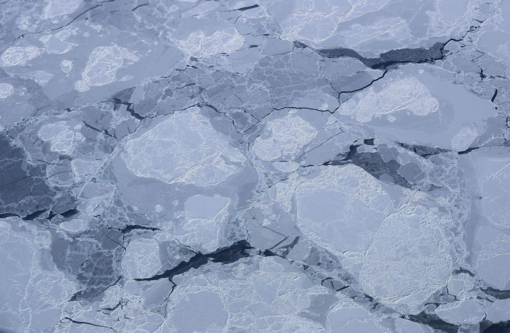
Sea ice thickening could boost the amount of sunlight that is reflected back to space in the Arctic, thus cooling the region. (Image credit: Mario Tama/Getty Images)
Thicker sea ice is usually brighter than thin sea ice, which boosts the amount of sunlight that is reflected back into space. "The broader implication is that these effects could enhance the Arctic's reflectivity through both increased surface brightness and longer-lasting sea ice," the researchers said. "If similar results could eventually be achieved at larger scales, increased Arctic albedo could contribute to regional cooling, with potential knock-on benefits such as slowing permafrost thaw and reducing ice loss from Greenland."
However, there is still a big question mark over how scalable and economically viable sea ice thickening is, given that it requires people and machines working in the field. According to a 2016 study, 10 million wind-powered pumps would be needed to cover just 10% of the Arctic Ocean, and 100 million to cover the entire Arctic. "It is reasonable to ask whether such an endeavor is financially feasible or even logistically possible," the authors of that study wrote.
Yearly sea ice extent in the Arctic has shrunk by 20% since 1979, and this loss is accelerating with global warming. Therefore, if we want Arctic sea ice thickening to work at a large scale, "the pumps must be deployed almost immediately, while there is still a sufficient area of sea ice over which to flood," researchers wrote in a 2021 study.
The ecological and social impacts of Arctic sea ice thickening are not well understood, and further research will delay deployment, meaning it might be too late to roll out sea ice thickening by the time scientists have the data they need to ensure its safety and feasibility.
For these reasons and others, including governance issues and high maintenance needs, "sea-ice thickening is simply not feasible for use at a scale and at a rate that would be meaningful for sea ice protection," researchers wrote in a review published last year.
Deployment on anything but local scales would be challenging, Blanchard-Wrigglesworth and Ceccolini agreed. Nevertheless, the researchers said their most recent winter trials, which have yet to be published, showed encouraging results. In those trials, the sea ice in test areas grew 20 inches (50 cm) thicker than in control sites, The Guardian reported.
"We expect to have a clearer picture once the current melt season is complete," the researchers told Live Science. "In parallel, we are developing underwater robotic technology that could support autonomous deployments. Earlier this year, we conducted the first Arctic field tests of a prototype re-icing drone in Finland."
The drone is currently being refined in collaboration with the BioRobotics Institute in Pisa, Italy, according to The Guardian.
June global sea surface temperatures have climbed to record highs, prompting concerns over extreme weather, flooding, sea level rise and stress to global ocean ecosystems.
The record, announced by the European Union's Copernicus Earth observation program on July 1, surpassed the previous record set in June 2024, with experts warning that more temperature records will likely be set over the coming months.
"Current conditions could indicate the beginning of a new phase, leading, once more, to uncharted territory," Carlo Buontempo, director of the Copernicus Climate Change Service at the European Centre for Medium-Range Weather Forecasts (ECMWF), said in a statement. "With ocean temperatures at these levels and El Niño on the horizon, we are likely to see more temperature records fall in the coming months.”
The record temperature was set on June 21, when the Copernicus Climate Change Service recorded global ocean surface temperatures of 20.86 degrees Celsius (69.55 degrees Fahrenheit), beating the record temperature of 20.83 C (69.49 F) set in 2023 and 2024. This measurement was corroborated by the Copernicus Marine Service, an independent dataset that reported temperatures of 21.0 C (69.8 F).
Graphs to show increasing global sea surface temperatures from two independent data sources (Image credit: Copernicus)
The recent sea surface heating did not occur evenly across the globe. In some areas, such as the Mediterranean, temperatures in June were up to 8 C (14.4 F) higher than average for the period from 1990 to 2020, as per data recorded on June 29, according to the European Space Agency.
The most significant rises in temperature were set in the Mediterranean, the Baltic Sea, bands across the Pacific and off the coasts of Northern Canada.
Warmer ocean temperatures have wide-ranging impacts. "Higher ocean temperatures keep the atmosphere warm for longer, provide extra energy to storms and increase evaporation, thus enhancing the potential for extreme precipitation and flooding," Copernicus Climate Change Service representatives said in the statement. "Ocean warming also contributes to sea level rise and ice melt, and stresses marine ecosystems."
According to data from the Copernicus Climate Change Service, the newly declared El Niño in the Pacific Ocean — the warm phase of a natural climate cycle. This El Niño is likely to reach levels that have not been seen in decades, with more temperature records expected to be set over the coming months as this Pacific heat is injected into an already warming world.
The service added that it remains to be seen whether these temperature spikes are temporary or indicative of longer term trends.
Life on Earth could continue for another 1.8 billion years, according to new research. This figure, which is based on complex climate models, is far longer than many previous studies indicated.
In the new study, published May 28 in the journal JGR Atmospheres, researchers suggest that plant life could continue about 1.8 billion years into the future. That nears the time when Earth would lose its oceans to space, either through radiation splitting water atoms or runaway evaporation, in about 2 billion years.
"We were trying to show that life on Earth — complex vegetation — could survive longer into the future than previous studies had shown," study co-author Jacob Haqq-Misra, an astrobiologist at space exploration charity Blue Marble Space, told Live Science.
The boundaries of life
Life on Earth relies on photosynthesis, the process used by plants, algae and some bacteria to turn sunlight into energy. The mechanism chemically converts carbon dioxide and water into sugars and oxygen. It requires both CO2 and sunlight.
But at certain temperatures, plants' photosynthetic machinery shuts down. Eventually, the sun will warm Earth to the point that plants are no longer able to photosynthesize, which would in turn cause entire food webs to collapse and all life to perish.
Another issue is that as the sun dies and it gets brighter, there will be less carbon dioxide in the atmosphere, effectively starving plants.
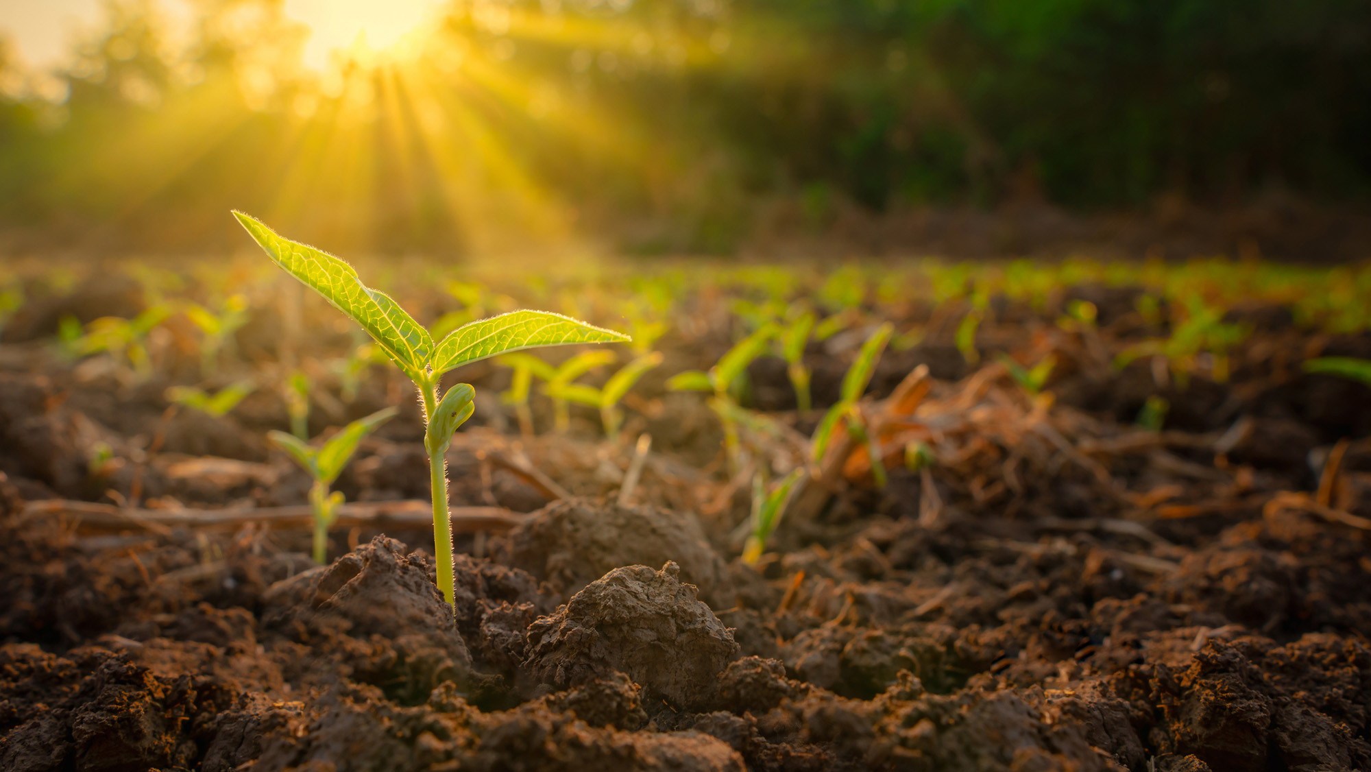
Plants turn sunlight into energy, but at certain temperatures this ability shuts down. (Image credit: lamyai via Getty Images)
"The Earth has stayed pretty hospitable in terms of surface temperature for most of the last 4 billion years because it has a built-in thermostat" by storing CO2 in rocks and releasing it during volcanic eruptions, Robert Graham, a planetary science researcher at the University of Chicago, who was not involved in the research, told Live science.
When it is hotter, the planet pulls more carbon dioxide out of the atmosphere and stores it in rocks underground, Graham said. This offsets the warming to keep the temperature stable but means that the carbon dioxide isn't accessible to plants.
Climate models and extreme plants
In the new study, Haqq-Misra and colleague Eric Wolf, a research scientist at Blue Marble Space, used 29 climate models to estimate what would happen to Earth's vegetative biosphere under different scenarios. They used the two extreme cases as limits — when Earth is too hot for life but the CO2 was stable; and when there is not enough CO2, but the temperature was stable. They then looked at the range of CO2 and sunlight conditions in between those extremes. This enabled them to include situations in which Earth was very efficient at pulling carbon from the atmosphere when temperatures started rising.
They also included information about a variety of plants. Some plants can survive on a much lower ratio of atmospheric CO2 than others. The study included plants that have a special photosynthetic process (known as crassulacean acid metabolism), such as succulents and orchids. These plants can sustain themselves on relatively tiny amounts of CO2. The same is true of some marine plants, which can dissolve and access carbon in the ocean system.
Other experts were impressed by the findings.
"Haqq-Misra and Wolf have used a sophisticated 3D climate model to show that Earth's climate may remain hospitable to plant life significantly longer into the future than predicted" by simpler models, said Graham, who authored one of those earlier studies. "It's an advance over previous work and suggests that complex biospheres like that of Earth are more resilient to environmental change from stellar brightening than previously suggested."
Looking to the future
Andrew Rushby, an astrobiologist at Birkbeck University of London who was not involved in the research, told Live Science that the paper updated the concept of the lifetime of the biosphere. However, he cautioned that the results remained "broad estimates."
"It is not possible for us to predict or know the possible evolutionary adaptations that the photosynthetic biosphere may undergo in response to increasing solar output and lower [atmospheric CO2], especially over billions of years," he said.
In their paper, the authors wrote that "limits posed by thermal stress or starvation may only reflect our observations of the biosphere today rather than hard limits on how the biosphere may evolve." There is also no way of knowing how life might adapt to new circumstances.
Haqq-Misra said that he found the results comforting. "Earth's system is resilient, and we are part of something that could have a much, much longer future," he said.
The results could also help scientists figure out what the thresholds could be on other planets. "Part of the challenge is starting with these Earth-based models, and then generalizing the physics as much as possible to be able to simulate a wider range of atmospheres," he said.
How much do you know about our blue planet? Test your terran knowledge with our Earth quiz!
Trees in China that were planted as part of huge reforestation projects appear to grow faster than those in natural forests, a new study finds. This is possibly because the reforestation trees are responding more strongly to the rising atmospheric carbon dioxide, scientists say.
China is quickly turning green. The country has planted 66 billion trees since 1978, with plans for 34 billion more by the middle of this century, as part of its "Great Green Wall" to slow the spread of the Gobi and Taklamakan deserts.
These new forests absorb large amounts of CO2, but it is unclear exactly how they differ from natural ones, study first author Yuhang Luo, a landscape ecologist at Peking University in Shenzhen, China, told Live Science.
Luo and his colleagues set out to study how differences between natural and planted forests, including species diversity, tree density and age, might affect how the forests respond to rising CO2 and climate change.
"Planted forests are widely used in climate mitigation strategies, but most global ecosystem models do not distinguish between forest types or represent age-related dynamics adequately," Luo said. "So we felt it was important to clarify how these factors interact — not just for scientific understanding, but also for improving the models and assumptions that underpin real-world forest policy and carbon accounting."
Planted forests are those purposefully created by humans, such as those in the Great Green Wall. Natural forests, on the other hand, grow without human intervention.
The researchers used satellite data to track leaf area index, a measure of canopy density and a key driver of carbon uptake, to determine how fast the different forest types grew, and found a striking difference: Planted forests increased their leaf area 66% faster than natural ones.
Most of that difference was due to planted forests being, on average, much younger than the natural ones — and young trees grow faster than old ones. But even when comparing forests of similar age and growing conditions, the planted ones still grew 4.6% faster, and the difference was even more pronounced in mixed and evergreen forests.
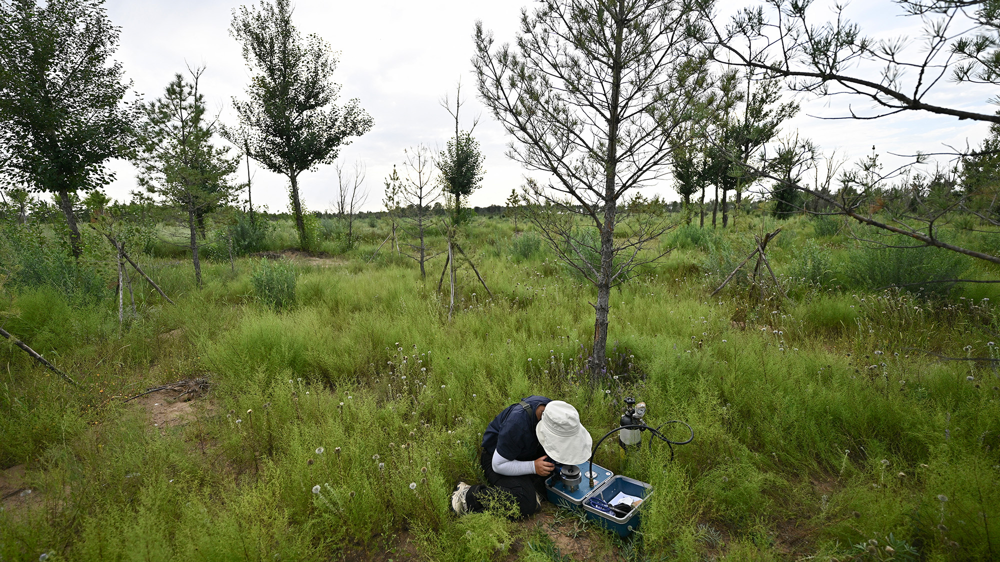
A researcher working in the Great Green Wall in August 2025. So far, 66 million trees have been planted as part of the project. (Image credit: PEDRO PARDO via Getty Images)
This is largely due to how planted forests are managed. They tend to feature fast-growing species like eucalyptus and poplar and are often actively managed, with people removing competing vegetation and even fertilizing them. These interventions reduce competition for light, water, and nutrients, amplifying the fertilization effect of rising atmospheric CO2.
This discrepancy peaks in planted forests when trees are around 30 to 40 years old and then declines noticeably after age 40. In contrast, natural forests grow more slowly but steadily, so have an advantage over the long term.
"Planted forests can be a powerful short-term tool for carbon uptake, but this advantage is temporary," Luo said. "For long-term carbon storage and resilience, natural forests remain irreplaceable."
Kevin Dsouza, who worked on reforestation models during his postdoctoral research at the University of Waterloo and was not involved in the new study, said the results make intuitive sense, as the sprawling leaves of young, fast-growing trees could lead to increased carbon take-up. But he is not sure that leaf area is the best measurement for tracking growth and carbon sequestration.
"It's not a bad proxy, but it doesn't give you the full picture," he said. "The canopy is just the top of the tree and the carbon is stored in all sorts of different places like wood, bark, roots and soil."
Another study of Chinese forests found that natural forests actually accumulate more carbon above ground than planted ones in their early years, Dsouza pointed out, so these results should be considered carefully alongside other factors.
Luo said the findings show that most global climate models are missing something when it comes to understanding how various forest types play a role in carbon sequestration and climate change.
"Land use management works in more subtle and specific ways than we had assumed," he said. "It is not just about planting more trees. It is also about when you plant them, what species you choose, and how you manage them over time."
Luo hopes these findings will help guide reforestation efforts, to ensure we get the most benefit from planting new forests to help mitigate the effects of climate change.
"Our work offers a more practical guide for forest-based climate action: when to plant, what to plant, how long the benefits last, and what current models are getting wrong. We hope that helps people make better decisions," he said.
Editor's note: A picture caption in this article was corrected at 5:16 ET on July 1 to say 66 billion trees had been planted.
What's in the photo? The petrified remains of ancient lava and a skull-like caldera
Who took the photo? An unnamed astronaut on board the International Space Station
When was it taken? Sept. 23, 2019
This eye-catching satellite snap shows off a sprawling mass of petrified lava surrounding the jet-black slopes of a potentially dangerous volcano in the heart of the Sahara. A smaller volcanic "skull" lurks near the shadowy peak's base.
Toussidé (also known as Tarso Toussidé) is a "potentially active" stratovolcano located within the Tibesti Mountains, which cover around 40,000 square miles (100,000 square kilometers) of northern Chad and southern Libya. The dark peak stands 10,712 feet (3,265 meters) above sea level, making it the second-tallest mountain in the Tibesti region.
The name Toussidé roughly translates to "which killed the local people with fire" in the language of the nearby Indigenous people, hinting at a destructive and deadly history. However, according to the Smithsonian Institution's Global Volcanism Program, there is no evidence that the volcano has erupted during the Holocene — the current geological epoch, which began around 12,000 years ago. It is unclear if it has actually killed anyone.
The dark blob surrounding the volcano is known as a massif. It is made up of layers of overlapping magmatic rock left by multiple ancient lava flows that effusively erupted, or slowly poured from, the volcano's summit.
The shadowy structure, which is up to 20 miles (32 kilometers) across at its widest point, stands out against the surrounding sand-covered plateau, which has been carved into a network of crisscrossing canyons by eons of wind blasting, according to NASA's Earth Observatory.
The massif surrounding Toussidé is made of overlapping lava flows. If you look closely at this image, you can see how they criss-cross over one another. The Trou au Natron caldera is also more clearly visible in this photo, which was captured by the European Space Agency's Copernicus satellite in September 2021. (Image credit: ESA/Copernicus)
Just southeast of the massif (in the upper right of the photo), there is a small, white circle containing several dark patches. This is Trou au Natron — a roughly 3,300-foot-deep (1,000 m) volcanic crater, or caldera, which looks eerily like a giant skull when viewed directly from above.
The cranium-like caldera likely formed during an explosive eruption more than 120,000 years ago. It was once filled with a giant salt lake that was home to ancient algae and other microorganisms. When the lake dried out, around the start of the Holocene, the receding water left behind a thick layer of white salt surrounding a pair of eyelike volcanic cones.
Toussidé is one of the youngest mountains in the Tibesti range, which formed by similar effusive eruptions long before the stratovolcano was born. The entire region likely once matched the massif's dark hue before being relentlessly bombarded by sand and wind. In another 100,000 years or so, the massif may blend in with the surrounding plateau, according to the Earth Observatory.
Trou au Natron's salty white floor and volcanic cones make it look eerily like a skull when viewed from above. The dark slopes of Toussidé can also be seen in the background of this image. (Image credit: Gerhard Holub/Wikimedia)
While the shadowy volcano has remained dormant for several millennia, it occasionally puffs out steam from small vents, or fumaroles, near its summit, suggesting that it is still technically active, according to the European Space Agency. However, geologists have not properly assessed its eruptive potential.
A 2014 astronaut photo shows a pair of volcanic lakes appearing to stare up into space from the Chiltepe Peninsula of Nicaragua's Lake Managua. These "eyes" and "skull" were created by violent eruptions thousands of years ago.
This false-color satellite photo from 2014 shows the immense heat emanating from lava lakes at the summits of a pair of simultaneously erupting volcanoes in Congo.
For the first time, scientists have measured metal pollutants leaching from a piece of space junk in the atmosphere. They caught a burst of lithium as a SpaceX rocket burned up high above Earth’s surface. Such pollutants can damage the ozone layer and may impact global climate.
Humans have been launching metal things into orbit around Earth for nearly 70 years. But the pace of launches has skyrocketed in the past decade. And private companies plan to boost the number of launches in the near future. Consider SpaceX’s Starlink system. This system provides internet to far-flung places. It will eventually consist of more than 40,000 satellites. Already, nearly 10,000 Starlink satellites orbit Earth.
Each piece of Starlink equipment has a planned life of about five years. After that, the satellite burns up in the upper atmosphere. This releases metals. They include lithium, aluminum and copper. Those metals may speed up chemical reactions that destroy ozone. That’s a problem, because the ozone layer of Earth’s atmosphere protects life on Earth from getting too much ultraviolet (UV) light from the sun.
Metal pollution from space junk may also affect Earth’s climate. Such metals could change the balance of light that reaches the ground or gets bounced back to space.
The stratosphere is the layer of the atmosphere that extends from 14 to 64 kilometers (9 to 31 miles) above Earth. A 2023 study found that about 10 percent of particles there contain pollutants from burnt-up satellites and rocket parts.
This diagram shows different layers of the atmosphere. The breakup of meteors forms natural metal layers. But space junk can also cause pollution in the upper atmosphere that may mess with the ozone layer. R. Wing et al/Communications Earth & Environment 2026
Scientists wanted to see if they could directly trace such particles to a piece of space debris. They got their chance on February 19, 2025. That day, the researchers observed a cloud of lithium about 100 kilometers (60 miles) above Germany. It was blowing away from the upper stage of a Falcon 9 rocket. This rocket part contains fuel and an engine. The rocket part made a fireball as it broke apart over Ireland and the United Kingdom.
“A few hours after the reentry of this rocket, we could see 10 times more lithium than we would have observed otherwise,” says Claudia Stolle. She’s a meteorologist at the Leibniz Institute of Atmospheric Physics. That’s in Germany.
The measurements relied on lidar. Lidar sends out laser pulses and detects the light that bounces back. The laser light is tuned to specific wavelengths that reflect off particular materials, such as lithium.
The team also ran computer models of the atmosphere. These showed that the wind had carried the lithium from the spot where the rocket came down to the area over Kühlungsborn, Germany. That’s where the lidar was located.
The researchers shared their findings February 19. The work appeared in Communications Earth and Environment.
The technique could help monitor potential harms from space debris. Meteorites — space rocks that fall to Earth — bring metals into the atmosphere. But falling space junk may one day boost metal pollution by around 40 percent, Stolle’s team estimated. Tracking such contaminants and their effects will become increasingly important.
More companies and countries are planning to launch satellites into orbit, Stolle notes. “All of them will burn up sooner or later.”
Leaching lithium
R. Wing et al/Communications Earth & Environment 2026
Using a technique called lidar, researchers in northern Germany caught a burst of lithium in the upper atmosphere. The lithium came from a piece of a Falcon 9 rocket. Carried by the wind, the lithium spread from one point to a wider area. This type of spread is called a plume. The figure on the left is a heat map. It shows the density of lithium (per cubic centimeter) at different altitudes over time (shown in local German time). The plot on the right shows the lithium density at different altitudes at 1:30 a.m. on February 20. The amount of lithium is higher in the center of the plume and lower at the plume’s edges.
Data Dive:
Look at Figure A. When did the density of lithium increase?
What was the altitude of the lithium plume?
What was the lithium density at the center of the plume?
Look at Figure B. How tall was the plume, top to bottom, at 1:30 a.m. on February 20?
If the data continued recording after 2:00 a.m. on Feb 20, what would it likely look like?
fjo3 shares a report from the AFP: The latest heatwave sweeping across Europe is a stark reminder that it is the world's fastest-warming continent, stretching into an Arctic that is heating at an even greater pace. Britain, France, Italy and Spain have issued red alerts and health warnings for much of their territory this week as the region endures its second heat episode since May.
Here is a look at why Europe is warming faster than elsewhere: The planet as a whole is around 1.4C warmer than in preindustrial times, defined as 1850-1900. By comparison, Europe is around 2.4C hotter than the preindustrial era, according to the EU's Copernicus Climate Change Service. The long-term rise in global average temperatures is mainly due to greenhouse gas emissions from burning oil, gas and coal, but it varies by regions due to a combination of factors. Land warms faster than the ocean as water can absorb more heat and cool through evaporation.
Shifts in atmospheric circulation have driven more frequent and more intense heatwaves in the European summer, according to Copernicus. High-pressure systems, which bring settled weather and higher temperatures, have become more common in Europe, Copernicus director Carlo Buontempo said. [...] Another major reason is geography as Europe is connected to the Arctic, which is 3.2C warmer than in preindustrial times. The region's rising temperatures are partly due to a process known as the albedo feedback. Bright snow and ice reflect much of the sun's heat back into space, but as they melt they reveal darker, heat-absorbing surfaces such as land and the ocean.
In other parts of Europe, areas where snow was very frequent in winter have seen this coverage shrink, exposing dark land. Stricter air quality regulations have reduced aerosol emissions since the 1980s. But tackling the pollutant had the side effect of contributing to global warming, as these tiny airborne particles have a cooling effect by reflecting sunlight and making clouds more reflective.
Earth's oldest known impact crater formed when a meteorite slammed into what is now Australia about 3 billion years ago — 470 million years later than scientists previously claimed, a new study suggests.
The impact crater, known as the North Pole Dome crater, is located in Western Australia's Pilbara region, which is home to some of the planet's oldest rocks. It remains a record-breaking structure, beating the world's next-oldest known meteorite impact crater — the Yarrabubba impact structure, also in Western Australia — by roughly 800 million years.
"While the site had previously been identified as an ancient impact structure, its exact age remained uncertain," study first author Chris Kirkland, a professor in the School of Earth and Planetary Sciences at Curtin University in Australia, said in a statement. "The impact left a 'mineral clock' behind. By dating minerals that were remade or newly grown in the damaged rocks, we can now pin down when this extraordinary event happened."
For the new study, Kirkland and his colleagues used advanced mineral dating techniques to estimate the ages of zircon, apatite, calcite and muscovite in shatter cones from the North Pole Dome crater. The researchers analyzed two samples of shatter-cone-bearing rocks, as well as a shocked quartz vein — a sheet-like deposit that typically forms when superhot, mineral-rich water circulates in the cracks between shocked rocks.
Researchers analyzed zircon and other minerals in North Pole Dome rocks. (Image credit: Curtin University)
"The key evidence comes from zircon, a tiny but extraordinarily resilient mineral that can keep geological time for billions of years," Kirkland said. "Some zircons at North Pole Dome have unusual branching, skeletal shapes. We interpret these as impact-modified crystals, formed when older zircon was disrupted, partly recrystallised, and in places regrown during the intense heating caused by the impact."
The age recorded in zircon was the same as that locked inside apatite minerals, giving the researchers confidence that the impact occurred a little more than 3 billion years ago. The younger shatter cones in the Science Advances study may have formed subsequently due to tectonic and thermal activity, the team wrote in the new paper, which was published Tuesday (June 23) in the journal Geology.
"Ancient impact craters are incredibly difficult to date because over billions of years, rocks are altered by heat, pressure and fluids, which can obscure or reset the original impact signals," Kirkland said. "The new age places the North Pole Dome structure as Earth's oldest known impact crater and the only recognised example from the Archean eon [4 billion to 2.5 billion years ago], a time when the planet's earliest continents were forming."
Planet Earth quiz: What do you know about our planet's most amazing features?
A massive wave of warm water is making its way across the Pacific Ocean as the newly declaredEl Niño gets into full swing, satellite images show.
The band, called a Kelvin wave, marks a swell of higher-than-average sea levels that stretches hundreds of miles along the equator. The anomaly is caused by warmer waters linked to El Niño — the warm phase of a natural climate pattern whose current iteration could become one of the strongest ever recorded.
The Sentinel-6 Michael Freilich satellite captured the deviations from average sea surface height on June 8. Red areas indicate higher sea surfaces than usual, while blue areas mark areas with lower surface heights.
Developed and launched in 2020 by NASA and the European Space Agency and operated by the European Organisation for the Exploitation of Meteorological Satellites (EUMETSAT), Sentinel-6 Michael Freilich measures changes in sea surface height down to fractions of an inch every 10 days.
The data complements measurements of sea surface temperature that have shown Pacific waters warming at unpreceded rates over the past several months, leading scientists to declare thestart of a new El Niño on June 11. When ocean water warms, it expands and takes up more space. That translates to an increase in the height of the water relative to the satellite and the center of Earth, which is then picked up by the satellite's sensitive equipment. At some points along the equator, sea surfaces are now more than 6 inches (15 centimeters) higher than usual.
Kelvin waves like this one form when winds in the western Pacific near the equator weaken and temporarily reverse, blowing from west to east instead of east to west. That lets warm water gradually build up in the east, deepening the layer of warm surface waters and preventing colder waters from rising from below. The wave has now reached the western coast of South America.
NASA hadalready observed a few other Kelvin waves this year, suggesting an El Niño event was soon to follow. In January, Sentinel-6 Michael Freilich detected one near Micronesia that dissipated around mid-February. Another emerged in March and elevated sea levels near Peru by mid-May.
Changes in sea surface temperature or height can alter atmospheric circulation patterns and affect the weather. El Niño often increases rainfall in the southwestern U.S., Colombia, Peru and Ecuador, while rainfall in the western Pacific tends to decrease. The most recent El Niño, which lasted from June 2023 to April 2024, boosted global mean temperatures that made 2024 the hottest year on record and the first to breach the 1.5 degrees Celsius (2.7 degrees Fahrenheit) warming limit — a guardrail set by the Paris Agreement beyond which the effects of climate change become more and more catastrophic.
The June 8 conditions in the western Pacific were similar to those that occurred 1997 during a particularly strong El Niño, according to astatement from NASA. 2026 has seen fewer Kelvin waves so far than 1997, but this year’s El Niño is still ramping up.
"For now, it looks like it's going to be a big one — more so than I would have said last week — but we still need more observations to know what's going to happen," Severine Fournier, a sea level researcher at NASA’s Jet Propulsion Lab, said in the statement.
How much do you know about our blue planet? Test your terran knowledge with our Earth quiz!
Taming Nature: Inside China's efforts to control the region's water
China is facing water scarcity that affects millions of people, so the country is embarking on water projects on a scale the planet has never seen. This three-part series investigates three elements of this effort: the world's biggest dam, a doomed effort to create a "river in the sky," and a colossal water transfer project.
China controls some of the largest rivers in Asia, experiences heavy rain and has vast stores of water locked in glaciers in the west. But despite these abundant resources, China has a water problem. While central and southern regions are quenched by massive rivers like the Yangtze, the northeastern megacities like Beijing and Tianjin have endured serious water scarcity as agriculture, industry and population size rapidly increased.
To address the imbalance, China has undertaken one of the biggest engineering projects in the world: rerouting the flow of one of the world's mightiest rivers and its tributary, and ferrying the water thousands of miles from the center and south of the country to the thirsty north.
Called the South-to-North Water Transfer Project (SNWTP), the vast system of canals, pipes, dams, reservoirs and pumps moves staggering amounts of water via two routes through central and eastern China.
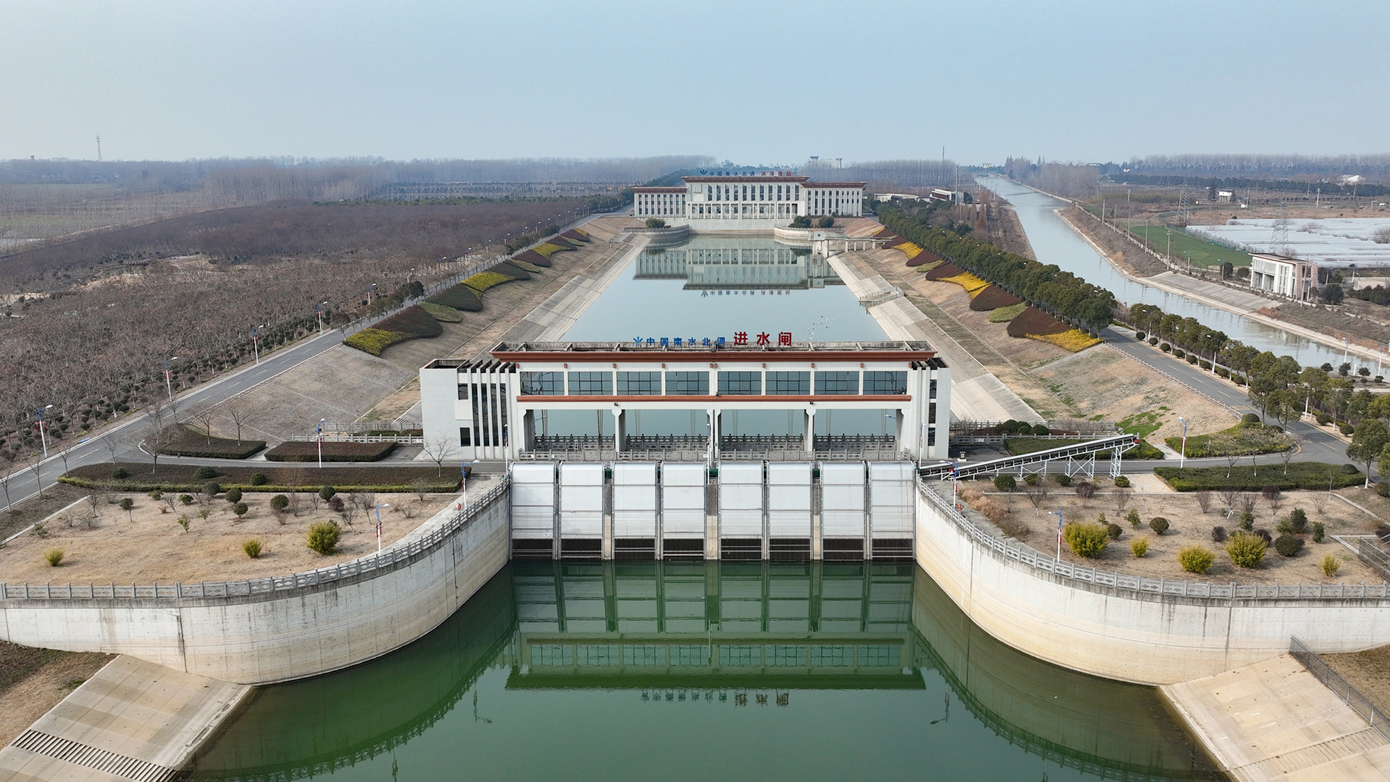
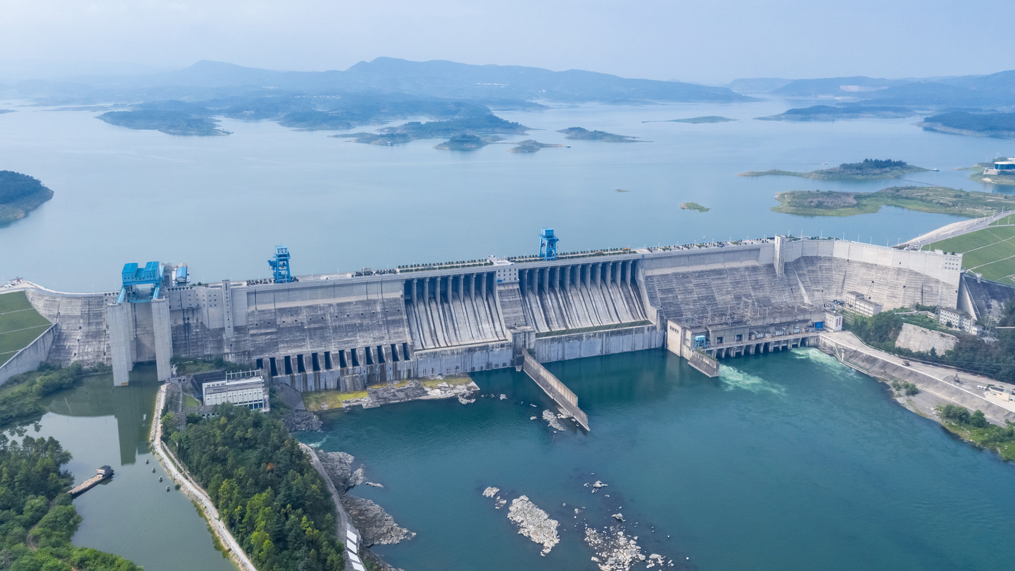
The Hongze Station on the eastern route of the South-North Water Transfer Project in Huai 'an City, China. (Image credit: CFOTO via Getty Images)
"It binds into a single network four major river basins, six provinces, three megacities, myriad bureaucracies, and more than 700 million people," Michael Webber, a professor emeritus in the School of Geography, Earth and Atmospheric Sciences at the University of Melbourne who specializes in regional economic development in China, wrote in a 2023 journal article.
But even this is not enough to satisfy the water needs in the North: China is currently expanding these routes and is planning a third, western route for the project, which would snake through the Tibetan Plateau before feeding the water-parched north and east. The route is attractive to Chinese officials because the river-and-glacier-threaded plateau, dubbed the Water Tower of Asia, has abundant water resources and is the source of numerous major rivers.
However, experts say the routes could worsen conditions in parts farther south that provide the water. What's more, the Tibetan portion of the project has stoked fears and suspicion in neighbors, as unofficial plans swirl suggesting major transboundary rivers could be diverted away from other countries and further into China.
The huge plan is "unbelievable," Mark Wang, a professor of human geography at the University of Melbourne, told Live Science. "The proposals [have] underestimated the negative impacts — environmental, earthquakes, evaporation and economic cost," as well as the international impacts, Wang added.
Water imbalance
Construction of the SNWTP began in 2002. The eastern route has operated since 2013 and transports water from the mighty Yangtze from Yangzhou, near Shanghai, to the megacity Tianjin, which has a population of 15 million people. The central route, which goes from Danjiangkou to Beijing and Tianjin, began flowing the following year, carrying water from the Han River, or Hanjiang. Together, they have moved 21 cubic miles (88 cubic kilometers) of water more than 1,800 miles (2,900 kilometers) since they began operating, according to the Chinese government — more than double the maximum amount of water held in Lake Mead.
The Danjiangkou reservoir was expanded to supply the Central route, which flows to Beijing. (Image credit: silkwayrain via Getty Images)
The motivation for this project is obvious: China must support nearly 20% of the world's population with just 6% of its freshwater reserves. And this water is not distributed evenly across the country. Northern China has nearly half of the country's population and more than half of its agriculture but just one-fifth of the country's freshwater reserves.
In some places, the imbalance is even more dramatic. Tibet, in the west, has 4.8 million cubic feet (136,800 cubic meters) of water per person, while Tianjin, in the Northeast, has just 3,990 cubic feet (113 cubic m) per person. The United Nations considers less than 1,000 cubic m (35,000 cubic feet) of fresh water available per person water scarcity and less than 500 cubic meters (18,000 cubic feet) per person as "absolute water scarcity." The average in the U.S. is 314,300 cubic feet (8,900 cubic m).
Water transfer
China has a long history of rerouting water to serve its needs. Parts of the eastern route, for instance, use the Grand Canal, which was first built in the fifth century B.C.
"Control of water has been a key theme in Chinese history and mythology," Tom Harper, a lecturer at the University of East London specializing in Chinese foreign policy and international relations, told Live Science.
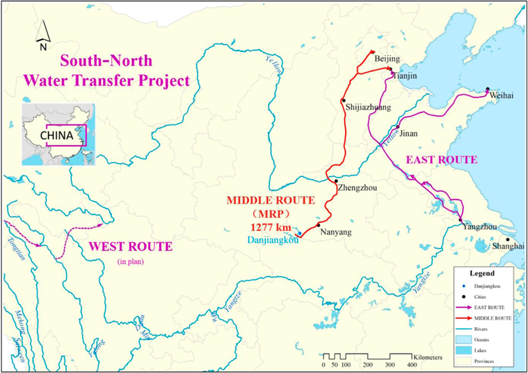
Map showing the two completed routes and the official plan for the western route. (Image credit: Zhang et al. (2022): CC BY 4.0)
Currently, the eastern route, which stretches 715 miles (1,150 km) from the Yangtze River to eventually reach Tianjin, transfers around 4 cubic miles (15 cubic km) of water per year.
This water needs to travel 213 feet (65 m) uphill, meaning pumping stations have to raise the water along the route.
The central route, meanwhile, relies on gravity to channel around 3 cubic miles (13 cubic km) of water 790 miles (1,270 km) from Danjiangkou Reservoir, on the Han River in Hubei province, to eventually reach Tianjin.
The Danjiangkou Reservoir already existed before the commencement of the project, but it was significantly expanded to raise the water level — and required 350,000 people to be relocated as a result.
The routes are now key to providing water to Beijing and Tianjin. For example, around 70% of Beijing's water comes from the route, experts told Live Science.
Fixing the fixes
The Chinese government and many Chinese scientists have boasted that the project has increased the water supply to people in northern China, raised the groundwater table in northern regions, and increased economic activity and agriculture in the region.
A major part of the project also focused on improving water quality: Freshwater supplies in China are heavily polluted, which reduces the amount of drinkable water.
"These were reservoirs, these were rivers, these were groundwater resources that had severe pollution impacts," Darrin Magee, a dam expert at Western Washington University, told Live Science. "So in the south where we had abundant water resources, the quality tended to be very bad in some areas."
To rectify this, the SNWTP installed water-cleaning stations along the route and the government implemented measures to reduce water pollution, including shutting down or relocating hundreds of manufacturing businesses that dumped their waste into waterways along the routes.
Along the eastern route, "pollution was terrible," Wang noted. "The central government put in a lot of effort… and they have control of the pollution again in a short period of time," he noted, adding that the water quality has significantly improved along the routes.
However, experts have said that the massive project has damaged ecosystems, displaced hundreds of thousands of people and fueled saltwater intrusion into underground reserves in water-providing areas, as the Yangtze River's freshwater flow is reduced.
"When the South-North Water Transfer was being proposed, many, many Chinese scientists were also against it because you just create lots and lots of new problems, whatever you fix," Emily Yeh, a professor of geography at the University of Colorado Boulder who specializes in Tibet, told Live Science. "Why not conserve water instead?"
Other experts agreed. "The water problem in China, it's not just physical water scarcity, it's the structural problem," Wang said. The biggest driver of water consumption is farming irrigation, which is water-intensive and leads to significant water loss. Conserving that water would go a long way to alleviating water scarcity, Wang added.
If China's "first priority is conservation, you won't need a large-scale, world's largest mega project," Wang said. Chinese authorities seem to be realizing this. They're also attempting large-scale water conservation policies, Wang said.
But the country is forging ahead with engineering projects.
The SNWTP's sources, particularly along the Han River, have less water per capita than the world's average, so siphoning off large amounts of the river's water could severely strain local areas. This has become such a problem that Chinese authorities are now undertaking even more engineering projects to alleviate the problem caused by the SNWTP. For instance, a new, smaller diversion is being added near the Danjiangkou reservoir, because people downstream are not getting sufficient water, Wang said.
The project is "a fix to fix the fix to fix the fix," environmental researcher Stevan Harrell wrote in the Made in China Journal — emphasizing the ever-growing number of engineering projects to deal with poor water governance.
Western route
Even though the two existing routes provide vast amounts of water to the North, and other water-conservation measures are being rolled out, Chinese authorities say the supply to the North is still not enough to meet demand, and that more water diversion is necessary.
The SNWTP's planned western route through the Tibetan Plateau won't start operations until at least 2050, but since its earliest planning stages, it has been mired in controversy.
The western route's official path would take 4 cubic miles (17 cubic km) of water per year from the Tongtian, Yalong and Dadu rivers — all tributaries that eventually feed into the Yangtze. The route would cross about 190 miles (300 km) of the Tibetan Plateau to the Yellow River, which then flows to the water-scarce north and east. The government has commissioned more feasibility studies for this route as part of the country's newly announced five-year plan.
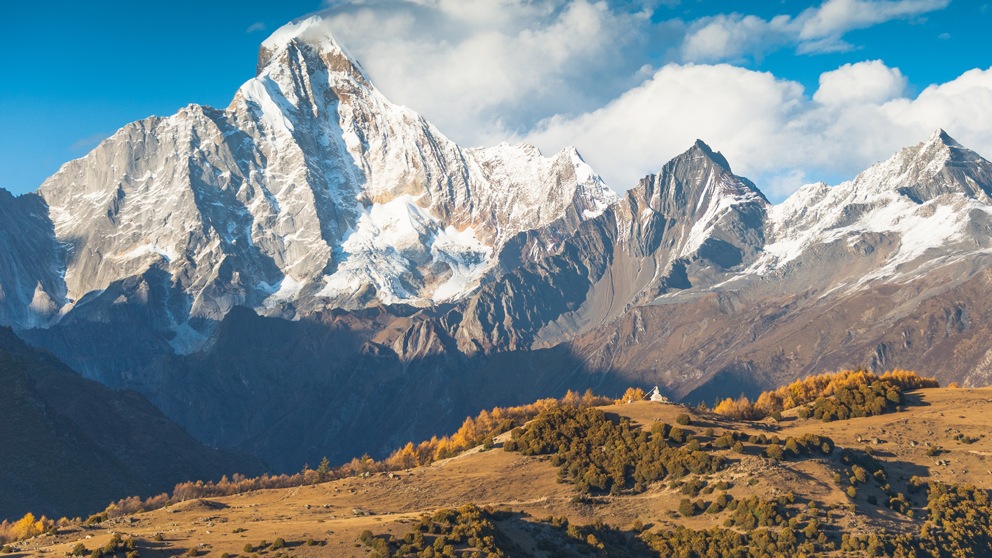
The Tibetan Plateau's high, rugged and earthquake-prone landscape creates numerous challenges to potential infrastructure projects (Image credit: primeimages via Getty Images)
The construction of such a massive project is fraught with difficulty. The Tibetan Plateau rises 10,000 to 15,000 feet (3,000 to 4,500 m) above sea level. These high altitudes present several problems, such as challenges in construction and maintenance, and difficulties in preventing water from freezing.
To transfer water across the plateau, the route would require pumping stations, along with a series of 300- to 1,000-foot-tall (100 to 300 m) dams, which would rank among the tallest dams in the world. The project would also require cutting 200 miles (300 km) of tunnels through the mountains, including the Bayan Har Mountains, which separate the upper Yangtze and Yellow River drainage basins.
In 2018, Chinese scientists attempted to overcome the difficult terrain by transferring water through the air. But the "Sky River," or Tianhe project, ultimately proved unfeasible and has been effectively cancelled.
But China has not been deterred by these obstacles. The ongoing construction of the Dianzhong Water Diversion Project, in Yunnan province in southwest China, provides a test case for transferring water across mountainous, earthquake-prone landscapes. The damless design relies on a 380-mile-long (610 km) series of 58 tunnels, as well as pumps, to carry water through the mountainous and seismically active terrain. It is the "the world's longest water tunnel that could fit two high speed trains" and is "seen as a pilot demonstration project that will inspire and inform the design for the Western Routes," according to the Hong Kong-based think tank CWR. The first stage of the Dianzhong project is due for completion later this year, with a second phase recently announced.
Red flag
While the official western route has yet to break ground, alternative proposals have caused serious concern in neighboring countries. One unofficial plan developed in the 1990s, which politicians and academics subsequently considered completely unworkable, suggested funneling 48 cubic miles (200 cubic km) of water (four times the flow of the Yellow River) away from the Brahmaputra River, which flows into India and Bangladesh, and diverting the water toward the Yellow River basin, which serves the North and East of China.
A second controversial proposal, known as the Red Flag River project, suggests diverting 14 cubic miles (60 cubic km) of water 3,700 miles (6,000 km) from the Lancang, Nu and Yarlung Tsangpo rivers (called the Mekong, Salween and Brahmaputra rivers when they leave China) across the Tibetan Plateau to the northern Xinjiang region, which has high water stress and is facing desertification. Officials suggested the plan could turn Xinjiang into China's "California." The diverted water could also potentially be rerouted toward Beijing, experts told Live Science.
Some experts have called these "semi-official" proposals, as they have no official government backing but have been discussed openly by researchers with heavy government backing and support in China, which the government wouldn't allow if these people were truly speaking out of turn, Wang said.
Science Spotlight
(Image credit: Marilyn Perkins / Future)
Science Spotlight takes a deeper look at emerging science and gives you, our readers, the perspective you need on these advances. Our stories highlight trends in different fields, how new research is changing old ideas, and how the picture of the world we live in is being transformed thanks to science.
Despite no official government backing, the plans have worried neighboring countries, particularly India, due to fears that any water diversions on international rivers could significantly reduce vital downstream supplies. Massive water engineering projects are already being built in Tibet, such as the upcoming Motuo megadam on the Yarlung Tsangpo — close to the proposed starting point for the Red Flag River project.
"There's a lot of concern that there might be water diversion, because China has been talking about this for many, many years," Tenzin Norgay, a researcher at the nonprofit organization International Campaign for Tibet, told Live Science. "If it happens, it's going to be a huge risk to downstream countries."
Researchers have calculated that the Red Flag project would likely siphon around 20% of the rivers' upstream flows, though the overall water loss for the whole of each river is less than that. Regardless of the actual amount of diversion, the lack of international consultations and transparency is exacerbating suspicions, experts told Live Science.
A changing climate
While China is forging ahead with attempts to redistribute China's water and reduce water scarcity via the SNWTP, climate change could scramble those plans. An increased risk of droughts over the coming decades could compromise the SNWTP's ability to move water.
"Short to medium term, [we'll] see an increase in runoff as melting begins earlier each year," Magee said. "But over the long term, decreased snowpack means less secure water resources for most of China."
Taming nature
The government is really imagining Tibet as a source of ecological service for the rest of the country
Emily Yeh, professor of geography at the University of Colorado Boulder
China's water management approaches include vast dam-building projects, cloud seeding, monumental tree-planting schemes and water-transfer projects, all of which rely on technological and engineering solutions to control the natural world, experts told Live Science.
When it comes to megaprojects, "If there's any country that will do it, it's China," Magee said. "The People's Republic of Engineers."
Other experts agreed. "It is part of this idea that you can engineer your way out of these problems, even if it's with trees rather than with machines," Yeh said. "A large-scale engineering approach to the natural world has been a characteristic of Chinese approaches to perceived or real environmental problems."
This is particularly true for the Tibetan Plateau. "The government is really imagining Tibet as a source of ecological service for the rest of the country," Yeh said.
Other experts agreed that Chinese authorities typically take an engineering approach to attempt to manage nature.
But Wang noted that China faces big pressures, which is why its government is looking for big solutions.
"If you understand China's energy issues, you understand why China is doing this. If you understand the water and food security issues, you understand so many things China has done," Wang said.
The eruption, the first on La Palma in 50 years, began Sept. 19, 2021, when a fissure opened up on the western flank of Cumbre Vieja — a volcanic ridge that runs through the southern half of the island — and spewed massive lava fountains into the air. The violent outburst created a 660-foot-tall (200 meters) vent, dubbed Tajogaite, which continued to slowly pump out lava until Dec. 13, 2021.
The concentric cloud rings in this image are made up of steam, smoke and ash — known as an eruption plume — that rose above Tajogaite for weeks.
Normally, such a plume would continue to climb into the cold air of the stratosphere — the second layer of the atmosphere, which extends from around 6 to 31 miles (10 to 50 kilometers) above Earth's surface. However, when this image was captured, a rare "temperature inversion" created a layer of elevated warm air that acted as a lid, preventing the plume from rising and forcing it to spread outward, according to NASA's Earth Observatory.
At the start of the eruption, giant fiery fountains shot out of the ground near the town of Todoque, which was destroyed by the resulting lava flows. (Image credit: DESIREE MARTIN/AFP via Getty Images)
The trapped plume created concentric rings that formed from the natural ebb and flow in the intensity of volcanic activity. This pulse in the emissions given off by the volcano is visible in time-lapse footage captured by the Izaña Atmospheric Research Center on Tenerife, another Canary Island.
The official name for this type of concentric cloud formation is a "gravity wave," according to the National Weather Service. However, the formation has nothing to do with gravity, and it's completely separate from the ripples in space-time called gravitational waves.
"River of fire"
During the 85-day eruption, around 7.1 billion cubic feet (200 million cubic meters) of lava — reaching temperatures of up to 2,000 degrees Fahrenheit (1,100 degrees Celsius) — seeped from the ground.
This molten rock traveled around 4 miles (6.4 kilometers), destroying around 3,000 buildings in the town of Todoque, before falling into the Atlantic Ocean in a fiery waterfall. The estimated damage exceeded 700 million euros ($780 million), according to the Spanish newspaper El País.
This photo, also captured Oct. 1 by the European Space Agency's Copernicus satellite, shows the infrared heat radiating from the lava flow as it flows into the sea to create new land. (Image credit: ESA/Copernicus)
Where lava fell into the sea, around 4.6 million square feet (430,000 square meters) of new land was created. The reaction between the molten rock and the water also released high levels of volcanic gases, such as sulfur dioxide and hydrogen cyanide.
At least one person, a 72-year-old man who returned to his home prematurely, is believed to have died from inhaling these toxic fumes, according to AFP. Thousands of wild and agricultural animals are also thought to have been killed by the gases.
The damage was "truly terrible," Marie Edmonds, a volcanologist at the University of Cambridge, told Live Science at an event on La Palma in April 2025. "Most shocking to me is the closeness of the vent to the communities," she added when describing what it was like to visit the area. "It must have been absolutely terrifying to see the eruption so close."
A false-color satellite photo from 2023 shows a devilish pair of lava flows and an enormous plume of smoke spewing from Klyuchevskoy, the tallest volcano in Europe and Asia.
A 2014 astronaut photo shows a pair of volcanic lakes appearing to stare up into space from the Chiltepe Peninsula of Nicaragua's Lake Managua. These "eyes" and "skull" were created by violent eruptions thousands of years ago.
A new study suggests Antarctic ice loss may be reliably projected over the next several decades. Scientists say the next 30 to 50 years could be a crucial period for understanding and preparing for Antarctic ice loss and its impact on rising sea levels. A new study published in Nature and led by Monash University [...]
Coastal farmland in the Mid-Atlantic is being overtaken by rising seas faster than forests, revealing an overlooked rural front in climate-driven marsh migration. Ghost forests, the eerie stands of dead trees left behind when saltwater moves inland, have become a stark sign of sea level rise along the Mid-Atlantic coast. Yet a new Nature Sustainability [...]
A decade-long search through Taiwan’s remote forests led to the discovery of East Asia’s tallest tree and hundreds of other towering giants. An 84-meter-tall tree is surprisingly easy to miss. Hidden within Taiwan’s steep mountains and dense old-growth forests are some of the tallest trees on Earth, including giant conifers that rise higher than a [...]

 Login