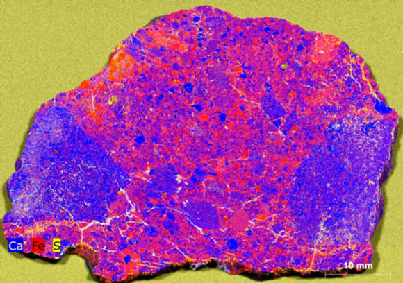
Planetary scientists analyzing a lunar meteorite known as Northwest Africa (NWA) 12593 have uncovered evidence of an asteroid impact that occurred 3.5 billion years ago on the Moon, helping to reconstruct a period of intense bombardment that left lasting marks across the inner Solar System.
Well-known microbes that grow on our crops, our gardens, even our skin have been found thriving at two to three times the flying height of a commercial jetliner.
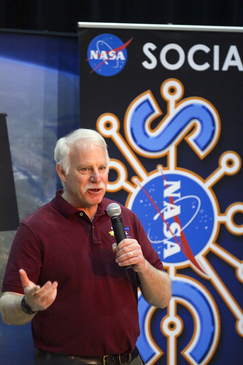
Irons, now an emeritus scientist at NASA Goddard Space Flight Center, played an integral role in shaping the Landsat program into what it is today. He served as deputy project scientist for Landsat 7 before taking over as project scientist for Landsat 8. From the earliest days of Landsat 8—then called the Landsat Data Continuity Mission (LDCM)—all the way through launch and operation, Irons worked across the agency and with colleagues at the USGS to ensure that Landsat continued providing critical data to researchers around the world. He championed rigorous calibration standards and fought to keep the thermal band on Landsat 8. Now, with projects like OpenET relying on evapotranspiration data derived from Landsat thermal imagery, the strength of his vision has only become more apparent.
Irons also served as the director of NASA Goddard’s Earth Science Division during the turbulent early days of the COVID-19 pandemic. Contending with global disruption, he prioritized making sure that everyone had the support that they needed to continue doing great work. As a leader and a scientist, Irons left a legacy of collaboration and innovation that lives on today.
We checked in with Irons about his role in Landsat’s history, what it takes to be a good leader, and winning the Pecora award:
NASA missions are so collaborative. Are there mentors, colleagues, or teams that you would want to share this recognition with or give special mention to?
One reason I feel so honored is that prior recipients have been my supervisors, mentors, role models, and colleagues whose work I admired and who inspired me. There’s a long list of people who have been recipients, and I am very honored to be added to that list.
There are also many people who have not yet been recognized who are very deserving. I’ve written letters of support for others, and I hope I’m called on again because there are more people who deserve recognition than there are awards to give out.
One of the things highlighted in the Pecora Award announcement was your commitment to the long-term continuous data record of Landsat. Looking at the Landsat program, why is this continuity so critical for Earth science today?
Data continuity is the backbone of the Landsat program. We are looking for change over time. When we talk about climate change and the impact of humans on the land surface, those changes are multi-decadal. We wouldn’t be able to understand, characterize, and monitor those changes without a continuous data record.
And it’s really important that the data record is well-calibrated. When we see changes between data from one Landsat sensor relative to another, we need to be confident that it’s a change occurring on the Earth, not a change in the performance of the sensors.
That’s another major contribution cited in your award: how much you pushed for rigorous data calibration and quality assurance. How did you establish those processes, and how did that make Landsat the gold standard of satellite data?
Early in my career, I got in trouble over calibration. NASA was flying an airborne sensor called the Thematic Mapper Simulator, intended to anticipate the capabilities of Landsat 4 and 5. But the operators kept changing the radiometric gain in-flight to maximize the dynamic range. I told NASA Headquarters that we couldn’t compare that data to the actual Thematic Mappers if they kept changing the gain—it wasn’t the same radiometry! The HQ manager got really upset, but I weathered the storm and stuck to my guns.
Later, when Landsat 4 and 5 were returned to the U.S. government from private operation, there had been no real calibration since launch. I advocated for a ground system component at USGS EROS to perform calibration. I didn’t build it, but I did advocate for USGS to hire a brilliant guy named Jim Storey, who developed the software for the precise geolocation of pixels in the data.
When I became Landsat 8 Project Scientist, we needed a pre-launch calibration lead. I advocated for Brian Markham. Brian just did a remarkable job ensuring the calibration of the Operational Land Imager (OLI) and its cross-calibration with previous instruments. He was modest, humble, and built a highly effective team across private industry and agencies.
Another important part of your legacy was the effort to ensure that thermal-infrared measurements continued onto Landsat 8. Why was retaining those measurements so important?
Back when USGS charged for data, the use of thermal data was minimal. Some well-respected papers even claimed it wouldn’t be possible to use thermal data to estimate evapotranspiration rates. Based on that, the Director of Earth Sciences at NASA HQ was convinced that the thermal capability wasn’t providing a return on investment.
But while this debate was ongoing, people began developing methodologies for estimating evapotranspiration and water consumption using thermal data—prominently Martha Anderson at the USDA, and researchers at the University of Idaho. It became crucial for monitoring agricultural water use in the West, and was even used in adjudicating water rights. It was also useful for cloud detection and fire monitoring.
I felt strongly that dropping the thermal capability was inconsistent with our directive to continue the Landsat data record. However, due to time pressures and budget constraints, the decision was initially made to fly Landsat 8 without a thermal instrument. But then, when our schedule was pushed back by an independent review board, a window opened up. Center Director Ed Weiler, who had moved to HQ, supported putting a thermal sensor on the payload. Kathy Richardson and engineer Fernando Pellerano were assigned to build it on an incredibly tight schedule, and they did an unbelievable job.
Now, deriving evapotranspiration rates for water consumption is considered essential. Ironically, for Landsat 9, NASA HQ even briefly considered launching a satellite with only a thermal sensor!
You were the Project Scientist from the earliest days of the Landsat Data Continuity Mission (LDCM) all the way through the Landsat 8 launch and beyond. What was the biggest challenge you faced during its development?
There were a lot of problems. Laughs. Because of the Land Remote Sensing Policy Act of 1992, the government was exploring commercial data buys for the follow-on mission. NASA spent five painful years attempting to implement LDCM as a commercial data buy. Only one company ultimately responded to the RFP, and it wasn’t a good deal for NASA, so it was rejected.
Then we were directed to put the Landsat sensor on an NPOESS platform (combining civilian and military weather satellite requirements). That platform wasn’t technically suitable, and the program ultimately fell apart.
Finally, the Office of Science and Technology Policy directed us to launch a free-flyer. Bill Ochs took over as project manager, and he deserves so much credit for the success of Landsat 8. He essentially rescued the project and put it on a path to success.
Reflecting on the partnership between USGS and NASA, how did you help build that, and what makes long-term interagency collaboration possible?
Darrell Williams and I worked very hard to establish a good relationship between NASA Goddard and USGS EROS. I took many trips to Sioux Falls. With Landsat 7, the EROS Center Director at the time, Don Lauer, brought in new people with great experience, like Jim Storey, Doug Daniels, and Jim Nelson. They developed the geometric rectification software for Landsat 7, and by the time we worked on Landsat 8, they had the right people in place to develop the whole data processing system. And we all got along really well with them. We still keep in touch with a number of them and consider them friends.
With Landsat 10 on the horizon, are there emerging applications or discoveries you’re excited about?
Yes. A major emerging capability is using Landsat data in concert with other systems, like ESA’s Sentinel-2, or with LIDAR and radar for 3D forest mapping. The community has asked for more frequent observations, especially more frequent thermal observations to measure water consumption more precisely without extrapolating over long gaps during the growing season.
There’s also great interest in using Landsat for water quality assessment, combining it with the PACE mission to monitor coastal and inland water quality. And tracking glacial velocities, glacial retreat, and even population displacement in conflict regions are all expanding areas. Landsat is truly foundational.
What was your biggest takeaway about leadership from your role as Director for the Earth Science Division at Goddard?
I was asked to step up after my predecessor, Piers Sellers—who was an absolute superstar—passed away. My main goal was simply to create an environment where the highly diverse researchers within the division could be successful. I wanted to minimize bureaucratic hindrances so they could focus on their work.
What I learned is that there is a limit to authority. Dictating doesn’t work. You have to lead, engage people, bring them into discussions, and get their buy-in. I used to joke that the job was like working with 1,400 valedictorians! It’s a high-achieving, dedicated group. My challenge was sometimes just reminding them to respect the work of the person down the hall, because people can get so fiercely focused on their own research.
My primary goal during my tenure was to provide stability, especially since it spanned what was then the longest government shutdown in history, followed by the COVID-19 pandemic. I was incredibly impressed by how productive the division remained through a complete disruption in how they worked.
What is the most important piece of advice you would give to young scientists?
Persistence. Persistence in pursuing your interests is critical. The only reason Landsat 8 was a success was that we persisted through several failed attempts to reformulate the program, schedule challenges, and budget uncertainties.
Funding and mission success aren’t entitlements based on your name or reputation. You have to work hard, keep putting forward proposals, do good work, and persist through rejections. If you really believe in what you’re doing, Goddard is a great place to work. You can get a lot done. But it takes persistence.
This interview was condensed and lightly edited for clarity.
The ancient history of our planet’s impact events is coming into focus, thanks to researchers who have triangulated similarly aged impacts on Earth, the Moon, and the asteroid 4 Vesta in a new study.
The lunar meteorite NWA 12593 correlates not only with impact events observed across three locations in our solar system but also contains evidence of three separate impact events that occurred at different times.
The findings, revealed in a recent paper published in Geology, show that scientists are using this new impact data to fill in the volatile early-Earth period when life began.
Early Earth Impacts
The Archean period, roughly 4 to 2.5 billion years ago, was a consequential time from which our earliest fossil records date, corresponding to around 3.5 billion years ago. Researchers believe that life likely first arose at this time, yet it may have faced adversity from bombardment by space rocks between 3.2 and 3.5 billion years ago, although scientists disagree on how intense this impact activity was.
Our planet’s geological activity eventually destroys evidence of the ancient past through erosion, subduction, and burial, continually reshaping the surface. Yet those early years are essential to understanding the origins of water, atmospheres, and life on Earth.
“On Earth, the first fossil evidence of life shows up around 3.5 billion years ago, meaning that life is emerging and evolving before then. The question that we often have, even going back further, is what was the impact record when life was emerging?” said lead author Carolyn Crow, a planetary scientist at the University of Colorado Boulder.
“It is important for understanding how life is taking hold, how life is emerging,” Crow added. “The cadence of these catastrophic events is an important part of the equation.”
A Neighbor Remembers
While Earth’s surface is constantly renewed by geological processes, our nearest significant neighbor, the Moon, is much more stable, retaining its geological record for longer periods. Because of this, lunar meteorites provide a resource for scientists to understand the impact of Earth and the inner solar system by matching them to known impacts on our planet and in the asteroid belt.
For the recent study, the team focused on a lunar meteorite discovered in northwest Africa, designated NWA 12593, and identified three separate impact events in a single sample.
Radiometric dating traced the oldest to 3.5 million years ago, intriguingly close to the time of the earliest known fossils. Extraordinary in power, this impact produced the mineral zirconia by melting the lunar surface into a lava-like flow. Without the precise laboratory conditions required to produce stable cubic zirconia, only traces of mineral remained in the sample.
According to the team, the first impact aligns with previously known impact events on Earth, and the fourth-largest object in the asteroid belt, 4 Vesta. It’s extremely rare to find such corresponding evidence between three bodies, providing important data on this time of frequent collisions.
“It’s not very common, which is why we’re very excited about it,” says Crow. “It’s pretty rare to have all three records line up like this.”
Later Impacts
Evidence of later impacts included breccia composed of large, angular, broken mineral fragments cemented together. The team believes the breccia resulted from a second impact that struck the melt sheet formed by the first.
“Breccias are similar to what you would see if you went and chipped out a chunk of concrete. You would see all these little rocks, and then it’s fused together by the cement,” says Crow. “But the meteorite is fused together by the impact process. You get all these chunks of different kinds of rocks that the impact hit into. These all get mixed up, and then it gets fused together like your concrete sidewalk.”
As for the third impact, the evidence for this is the meteorite’s mere presence on Earth; an event that occurred some time after the first would have ejected the lunar breccia, the researchers say, allowing it to eventually land on our planet.
In total, the sample reveals an intriguing impact history, preserving a record of bombardment that provides solid evidence for a flurry of activity in the inner solar system during a violent chapter in the early history of our Solar System.
Ryan Whalen covers science and technology for The Debrief. He holds an MA in History and a Master of Library and Information Science with a certificate in Data Science. He can be contacted at ryan@thedebrief.org, and follow him on Twitter @mdntwvlf.
A mysterious geological structure that resembles a human hand with outstretched fingers has been revealed beneath East Antarctica. The discovery shows the frozen continent still hides many geological secrets.

 Login