❌

Reading view

NASA Field-Tests AI Fleet Capability for Science, Exploration

NASA scientists and industry partners recently field-tested an artificial intelligence application that could make future solar system exploration missions more efficient, return more science data, and allow for faster scientific discoveries.
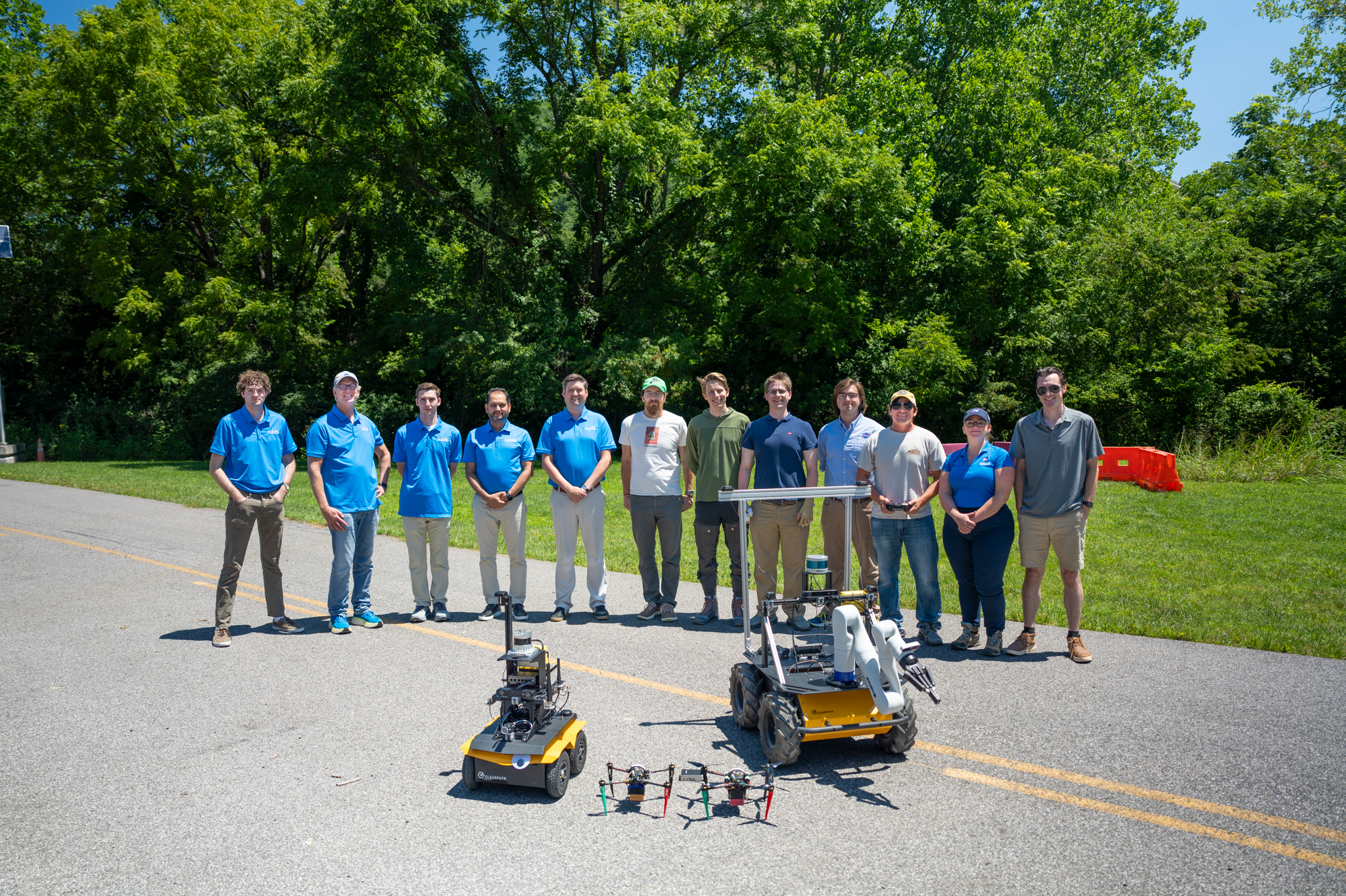
Team photo of twelve people standing on a road with trees behind them. In the foreground are four robots: two rovers and two drones.
Members of the ASTRA (Adaptive Sensing Technology for Responsive Autonomy) team with the fleet of robots they field-tested in July 2026. Left to right: Stephen Scarano, Karl Wunderlich, Zach Logan, Mohammad Goli, and James O’Hara of Noblis; James Marshall, Connor Firth, Leyton McKinney, Connor Williams, Steven Hard, Bethany Theiling, and Michael Monaghan of NASA’s Goddard Space Flight Center in Greenbelt, Maryland.
Noblis/Sean Sullivan

This summer at the Virginia Tech Transportation Institute in Blacksburg, Virginia, a fleet of three robots worked together, and researchers assessed the fleet’s ability to act like an independent science team. To begin each test, a drone was assigned to choose an area of interest based on initial science goals provided by human experts. Then, the fleet’s programming weighed risks against potential science payoffs and calculated which robotic team member was best suited to investigate. As the fleet carried out its plan, it continually checked for environmental hazards, reassessed its strategy to adapt to new information, and reported back to its human managers, NASA’s Adaptive Sensing Technology for Responsive Autonomy (ASTRA) team.

Three robotic explorers in a grassy field: a drone parked between two rovers. The larger rover has a multi-jointed arm extending from it.
The ASTRA + Noblis fleet. The drone (center) uses environmental and scientific sensors to scout the area, identify places of interest, and collect data from overhead. The rover on the left uses lidar to map its surroundings in detail, help the fleet navigate obstacles, and gather context for scientific samples. The rover on the right uses a robotic arm to collect samples.
NASA/Bethany Theiling

The project’s ultimate goal is to provide a trustworthy extension of the human science team in situations where humans are too far away to give real-time instructions, like on uncrewed missions to the outer planets of our solar system, or where the risk to human explorers is unacceptably high, like in areas of the Moon and Mars that are difficult for astronauts to explore.

One of the questions the field test was designed to answer: Once the fleet has started working on a science objective, will it change tasks autonomously based on new information? In the testing, the fleet showed it could focus on its original objectives and follow up on new possibilities. When the lead drone found an additional area of interest in the course of its work, it didn’t abandon its current task, but it did pause to process the opportunity and pull in another robotic asset to investigate the new question.
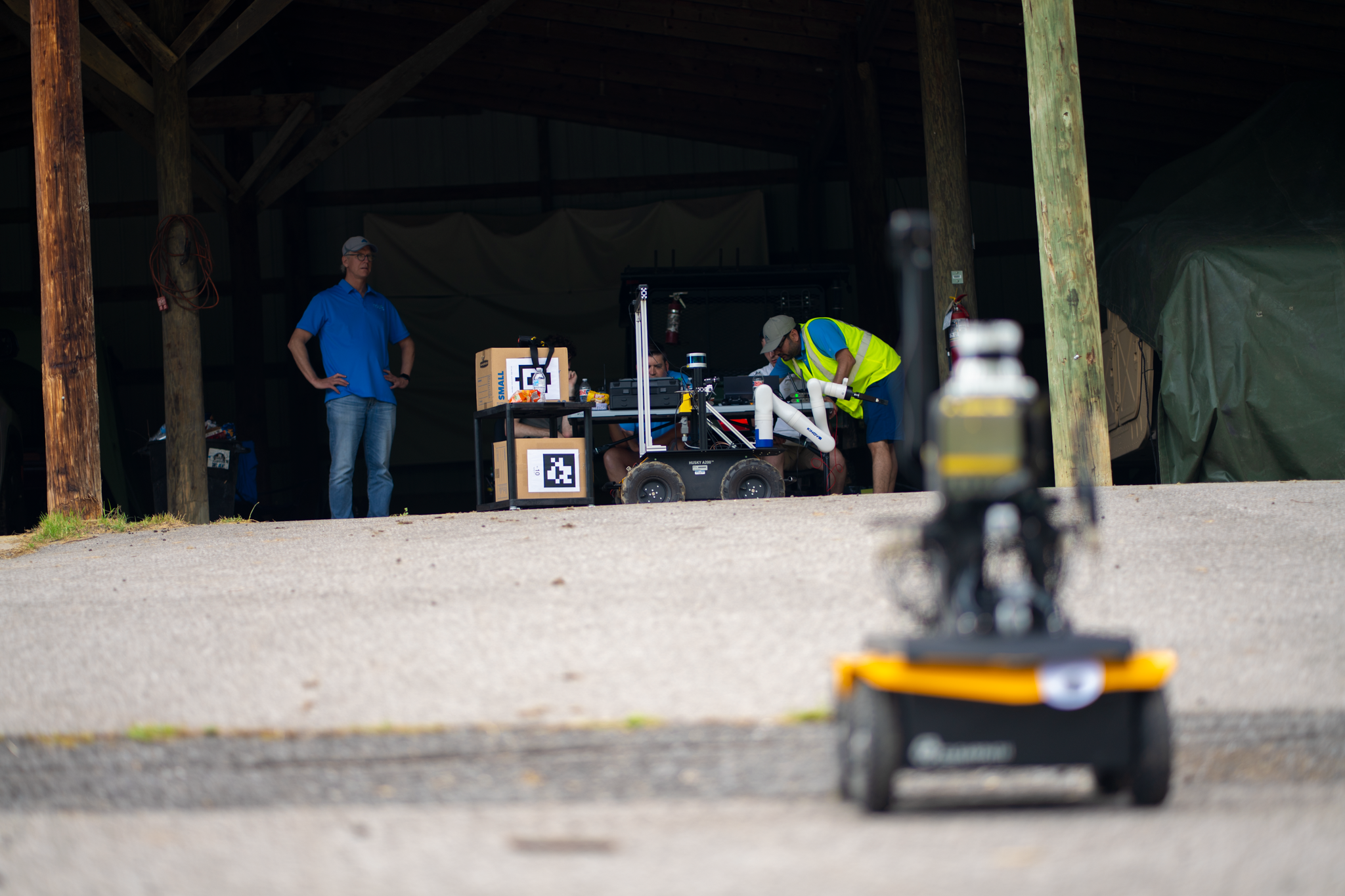
A small robot on the move across pavement. In the background, people observe its progress and work on another robot.
Mohammad Goli, Zach Logan, and James O’Hara test communications on the sampling rover as Karl Wunderlich observes rover actions during a July 2026 field test in Blacksburg, Virginia. Noblis provided the robotic fleet’s ground capability (two rovers shown here).
Noblis/Sean Sullivan

Crucially, the fleet’s decision-making programs handled both objective and subjective information. What robotic assets are available? How far away are they, and how fast can each one move? How much does the science team want the knowledge that can be gained by mapping this area or by taking a sample of that material? Would the humans want to learn from a newly spotted point of interest more than they’d want the fleet to focus on its original task? How risky is each job for the robot attempting it, and is the danger acceptable to the mission planners?

“We want to find a way for missions to do things that they could never do before because they didn’t have a decision-maker on board that can weigh all these criteria at the same time,” says Bethany Theiling, ASTRA principal investigator and field lead, of NASA’s Goddard Space Flight Center in Greenbelt, Maryland.

This ability to consider subjective criteria alongside simple facts, then deliver decisions that satisfy the people behind the project, is what the ASTRA team is working to develop. The mission team will consider the robotic fleet to be successful if it can correctly act without direct instructions based on its physical capabilities and on the team’s priorities and risk assessments.

Theiling led the testing campaign in collaboration with Noblis, Aurora Engineering, and the University of Tulsa.

Similar Landscapes, Different Worlds

About Planetary Analogs

Our planet isn't the only place with ice, volcanoes, impact craters, quakes, and erosion. Studying extreme environments on Earth helps us to understand other worlds better, too.

Learn More
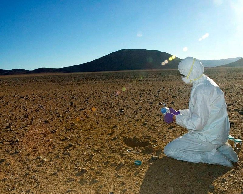
A researcher in a clean suit kneels in the desert, collecting samples.
NASA scientist Mary Beth Wilhelm collects soil samples from Chile’s Atacama Desert. Studying ancient life in the driest places on Earth helps us to understand conditions on Mars.
NASA

The post NASA Field-Tests AI Fleet Capability for Science, Exploration appeared first on NASA Science.
  •  

Curiosity Blog, Sols 4995-5001: 5,000 (Martian) Days on Mars

4 min read

Curiosity Blog, Sols 4995-5001: 5,000 (Martian) Days on Mars

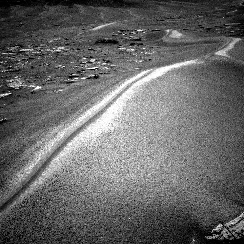
A black-and-white photograph from the Mars Curiosity rover showing a large, sweeping sand dune with a sharp, brightly sunlit crest. To the left are scattered flat rocks, and more rolling dunes stretch into the distant background.
NASA’s Mars rover Curiosity acquired this image along Chocolatal ripple using its Right Navigation Camera on Aug. 28, 2026 — Sol 4998, or Martian day 4,998 of the Mars Science Laboratory mission — at 13:58:36 UTC.
NASA/JPL-Caltech

Written by William Farrand, Senior Research Scientist, Space Science Institute

Earth planning date: Friday, Aug. 28, 2026

The span of sols spanned by this blog post is noteworthy in several ways. First, Curiosity became a world-class (for Mars at least) mountaineer by passing the 1 kilometer mark of elevation from its landing site on the floor of Gale crater. This writer was on the Mars Exploration Rover science team and we were excited when the Spirit rover got to the top of Husband Hill in Gusev crater in August 2005. But that was a climb of 106 meters (about 348 feet) above its landing site, and Curiosity has passed 1000 meters (about 0.62 miles). 

Second, Saturday, Aug. 29, marked 5,000 Martian days (or sols) since Curiosity landed on Mars (that’s more than 5,137 Earth days, because a day on Mars lasts 24.6 hours). Congratulations are in order to the engineers and scientists who have made this landmark possible. 

Finally, in terms of its science activities Curiosity is examining a wind-formed, long, narrow, large ripple which has been named “Chocolatal.” Further examination will help determine if this feature could be classified as a “transverse aeolian ridge” or TAR. TARs have been observed across the Martian surface based on orbital imaging. The long axis of a TAR is oriented perpendicular to the local predominant wind direction. While this is not the first potential TAR that has been examined by Curiosity, its location, higher on the slopes of Mount Sharp invites questions about whether it will be composed of the same types of granular materials found in the lower TARs, or whether it has a different range of grain sizes and/or layering. 

Other questions to be addressed include how the ridge formed, whether it is active, how it has migrated, and, if it is immobile, then how has it stabilized?

At the start of the planning week, Curiosity was en route to the sand ripple and encountered interesting science targets along the way. In Monday’s two-sol plan, in-situ examinations were planned of the light-toned bedrock occurring along the rover’s path. Some of the rocks encountered near the rover had dark-toned thick coatings or remnant layers, and these were targeted for chemical examination by the rover’s ChemCam Laser Induced Breakdown Spectroscopy (LIBS) instrument. Mastcam and ChemCam Remote Micro Imager (RMI) mosaics were planned, for layers in buttes along the rover’s path, and on more distant sets of sand ripples.

A midweek planning session took advantage of the last drive, leaving the rover only a few meters from Chocolatal. ChemCam was able to target sand at the base of Chocolatal as well as nearby bedrock. Stand-off Mastcam high-resolution image mosaics of the ripple were also targeted. The drive planned midweek took the rover right into Chocolatal with one of its wheels and then backing off a little, so in the end-of-week plan, contact science could be planned within the trenched region.

The final planning session of the week, which extended through the landmark Sol 5000, involved MAHLI mosaics of the right wall of the trench to see if there is layering, and to assess any variations in grain size. It’s noteworthy that these MAHLI mosaics are being named in honor of our late colleague Paul Geissler, who was one of the foremost experts on the study of Martian TARs and who was working with the MAHLI team before his untimely passing earlier in the year. In-situ APXS measurements were planned of the coarse-grained surface of the ripple, and ChemCam LIBS measurements were planned on the top of Chocolatal, a sinuous feature looking like a “mohawk” haircut (see the accompanying image). LIBS was also planned on a dark band on its flank and at the back of the scuff/trench. Other activities in the three-sol plan included Mastcam mosaics, an AM Navcam dust-devil survey, Navcam suprahorizon survey, and APXS atmospheric measurements.

With 5000 sols of outstanding scientific accomplishments, the Curiosity science and engineering team looks forward to the next 5000 sols.

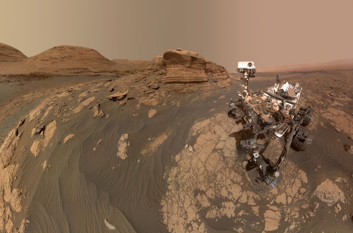
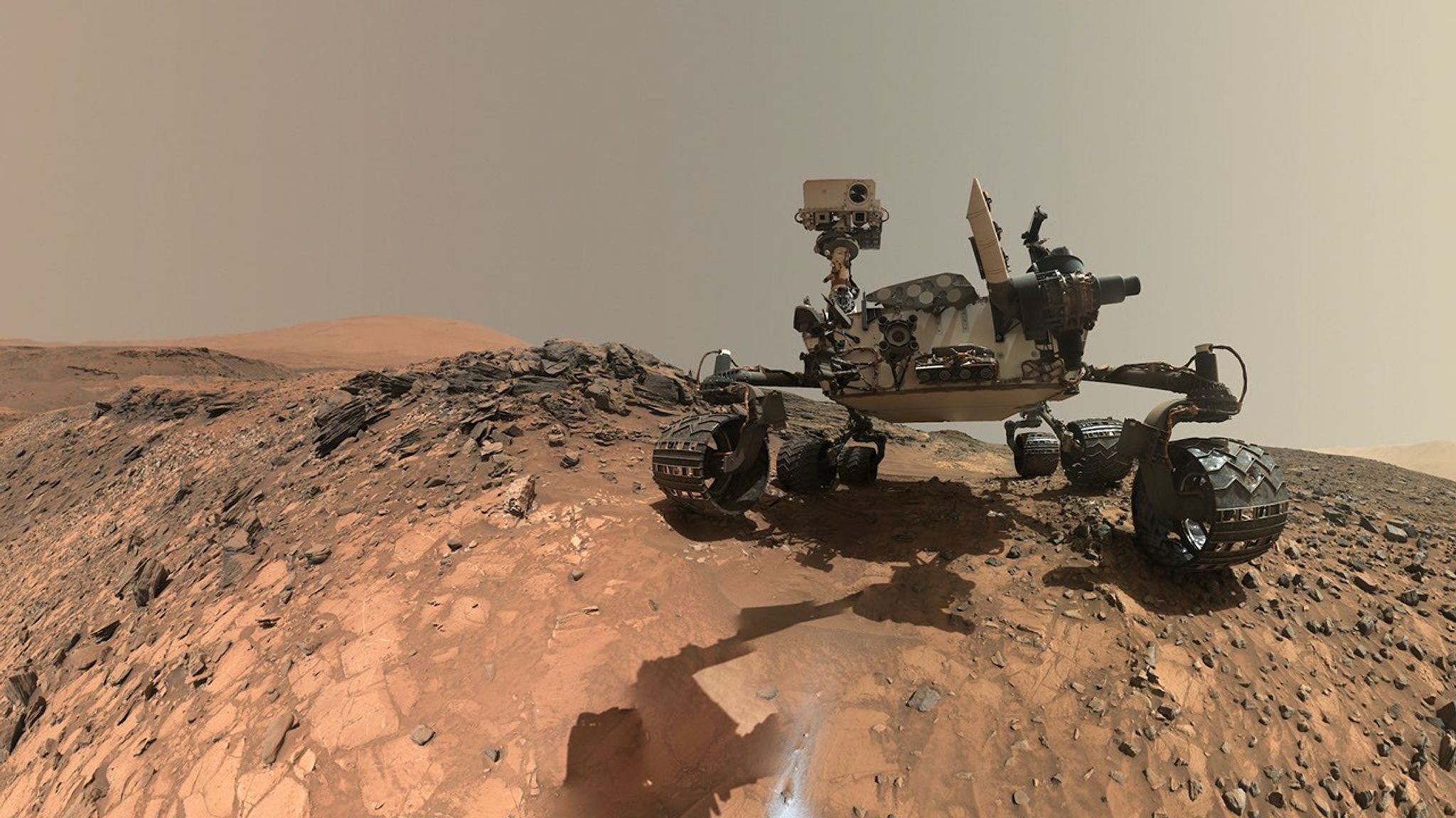
A rover sits on the hilly, orange Martian surface beneath a flat grey sky, surrounded by chunks of rock.
NASA’s Curiosity rover at the base of Mount Sharp
NASA/JPL-Caltech/MSSS

Share

Details

Last Updated
Sep 09, 2026

Related Terms

  •  

Curiosity Blog, Sols 4968-4974: Rock Climbing Towards the Discontinuity

3 min read

Curiosity Blog, Sols 4968-4974: Rock Climbing Towards the Discontinuity

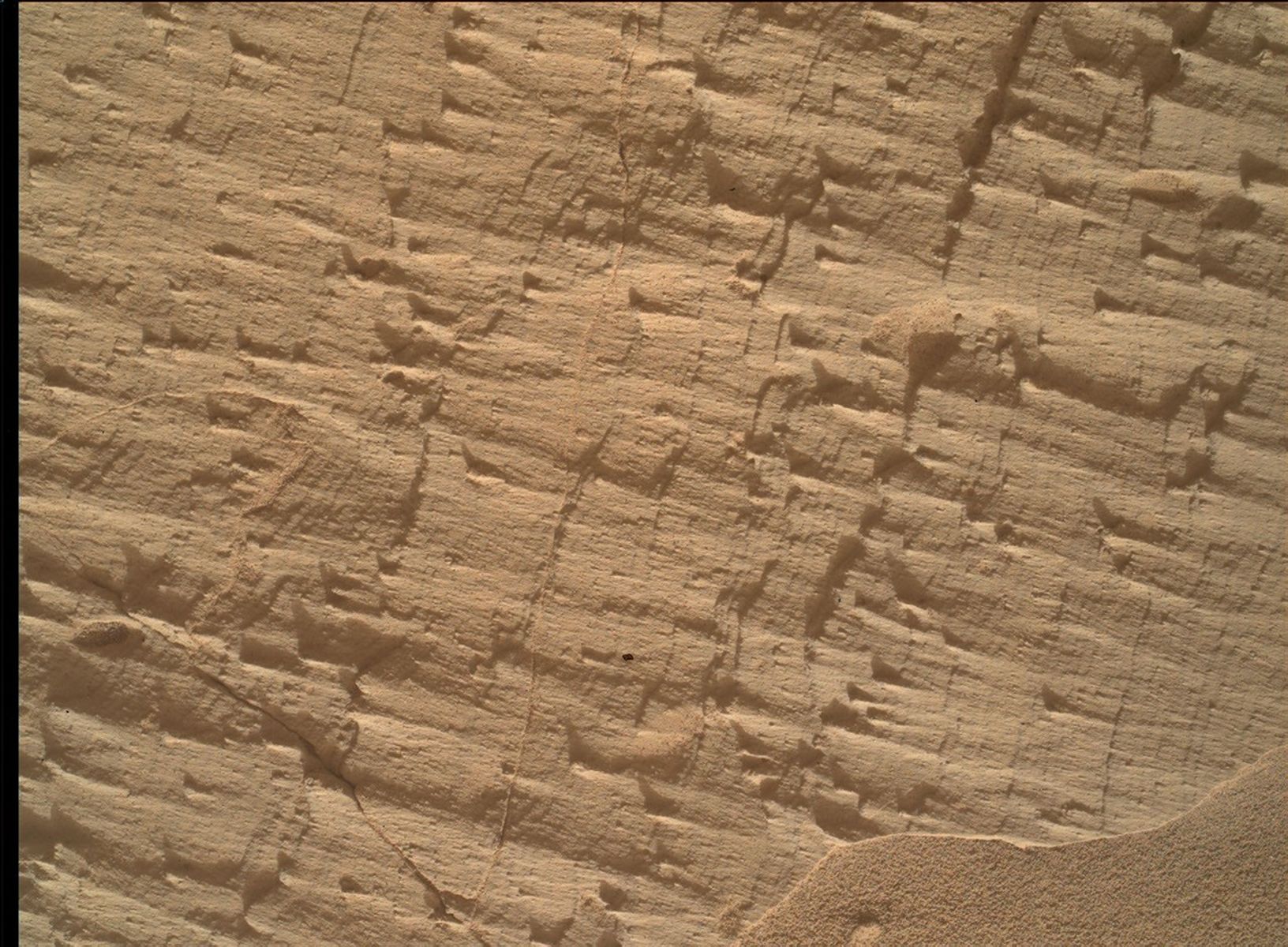
A close-up color photograph taken by the Curiosity rover showing a rough, tan-colored rock surface on Mars. The rock is highly textured, covered in fine parallel layers, small raised ridges, and thin cracks that cast tiny shadows. In the bottom right corner, a small drift of smooth, fine sand rests against the jagged rock.
NASA’s Mars rover Curiosity acquired this image, a frame of the “Longquimay” mosaic showing fine-scale sedimentary textures in a bedrock block near the supersurface, using its Mars Hand Lens Imager (MAHLI), located on the turret at the end of the rover’s robotic arm. Curiosity acquired the image on Aug. 1, 2026 — Sol 4972, or Martian day 4,972 of the Mars Science Laboratory mission — at 23:35:43 UTC.
NASA/JPL-Caltech/MSSS

Written by Lucy Lim, Planetary Scientist at NASA’s Goddard Space Flight Center

Earth planning date: Friday, July 31, 2026

As mentioned in the previous blog, Curiosity has been exploring a large-scale feature in Gale’s sedimentary record suspected to be an “erosional supersurface.” The “supersurface” represents a period in time when a net depositional environment changed to a net erosional one before returning to a depositional regime, thus producing a discontinuity in the rock record. The erosion can involve wind, water, or both. Sometimes there are clues about these environmental changes in the layers below and above the supersurface. So far we’ve been seeing some patterns that look like aeolian features and also some “lens” deposits that sometimes appear consistent with fluvial origins. We need higher-resolution imaging of these features.

This week Curiosity came within detailed imaging range of a section of the “Cerro Paine Grande” vertical exposure just below the candidate supersurface before climbing on top of it. Mastcam was the star of the show on both planning days this week, capturing large stereo mosaics of the vertical face of the outcrop and a 360-degree panorama after the rover climbed on top of it.

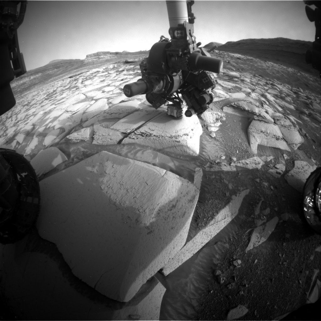
A black-and-white photograph taken by the Curiosity rover on Mars. The rover's mechanical arm extends from the left side of the frame toward the center, revealing a complex cluster of scientific instruments at its end. Below the arm, the Martian terrain consists of large, flat slabs of cracked, textured bedrock. The background is filled with scattered, lighter-colored rocks and patches of dark sand with small wind ripples.
NASA’s Mars rover Curiosity acquired this image, showing the rover arm in action in the “Longquimay” workspace at the top of a steep climb. Curiosity captured the image using its Right Navigation Camera on Aug. 2, 2026 — Sol 4972, or Martian day 4,972 of the Mars Science Laboratory mission — at 00:49:52 UTC.
NASA/JPL-Caltech

Roving to the top took full advantage of Curiosity’s climbing capabilities, leaving the rover at an approximate 24-degree tilt in its final parking spot. The rover planners managed to reach the right posture for contact science at the same time — quite a feat, and one that approached the mission’s contact science tilt record of 27 degrees!

Meanwhile, MAHLI and our geochemical instruments provided detailed characterization of the rock layers beneath the discontinuity. I was the Geology and Mineralogy Theme Lead for the Sol 4968 (Monday) planning cycle, during which “Puyehue” in the light-toned bedrock block of the workspace was co-targeted with APXS, MAHLI, and ChemCam LIBS. The other two targeted LIBS observations in the plan went to a similar-looking nearby bedrock block (“Lago Palena”) and an intriguing layered block off to the side of the workspace (“Piedras Juntas”). Another APXS measurement went to a sand target, “Cormudesi,” which will help us assess the consistency of sand compositions along the rover’s traverse.

In the Sol 4972 workspace atop the slope, the bedrock was sharply divided between a smooth bedding-parallel surface on the local top of the outcrop and the darker-toned, rougher, angled exposure of the same rocks. The light-toned top surface was measured by MAHLI, APXS, and the LIBS at target “Sierra de Sangre,” whereas the darker-toned laminated face was targeted by APXS and MAHLI at “Laguna del Laja.” The fine-scale sedimentary structures in the textured material were also documented by a MAHLI mosaic (“Longquimay”) supported by Mastcam M100 imaging.

Rounding out the week’s science observations were several long-distance ChemCam RMI mosaics on more distant targets such as sedimentary structures above the rover’s current stratigraphic position, and finally our regular cadence measurements of the modern Martian environment, including atmospheric opacity and a ChemCam passive-sky survey to monitor abundances of minor atmospheric gases.

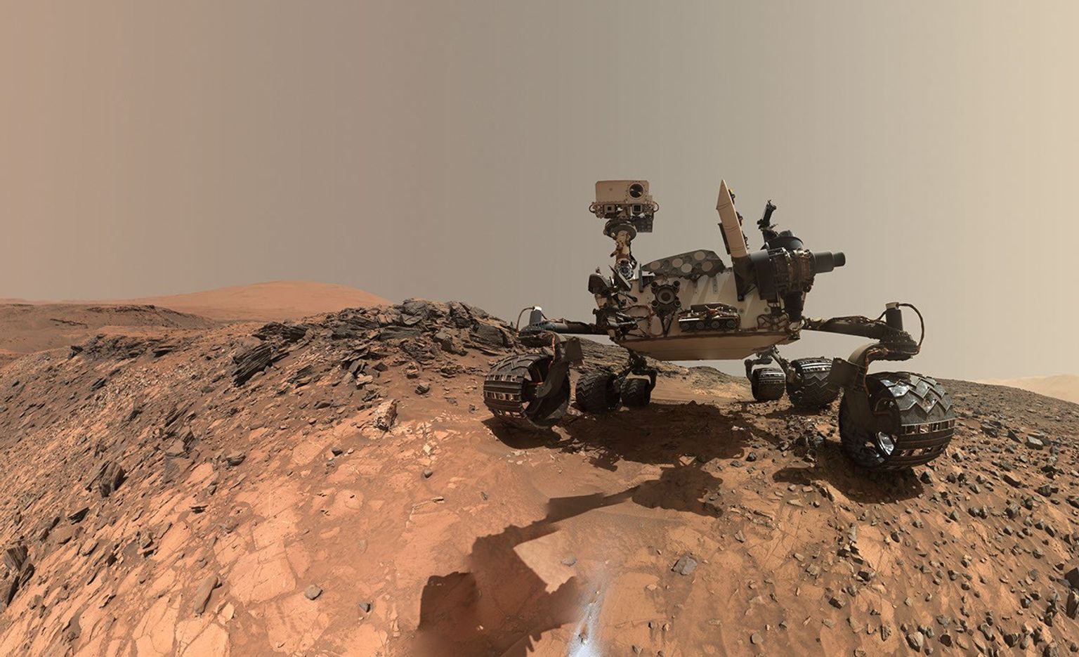
A rover sits on the hilly, orange Martian surface beneath a flat grey sky, surrounded by chunks of rock.
NASA’s Curiosity rover at the base of Mount Sharp
NASA/JPL-Caltech/MSSS

Share

Details

Last Updated
Aug 11, 2026

Related Terms

The post Curiosity Blog, Sols 4968-4974: Rock Climbing Towards the Discontinuity appeared first on NASA Science.
  •  

Curiosity Blog, Sols 4968-4974: Rock Climbing Towards the Discontinuity

3 min read

Curiosity Blog, Sols 4968-4974: Rock Climbing Towards the Discontinuity

A close-up color photograph taken by the Curiosity rover showing a rough, tan-colored rock surface on Mars. The rock is highly textured, covered in fine parallel layers, small raised ridges, and thin cracks that cast tiny shadows. In the bottom right corner, a small drift of smooth, fine sand rests against the jagged rock.
NASA’s Mars rover Curiosity acquired this image, a frame of the “Longquimay” mosaic showing fine-scale sedimentary textures in a bedrock block near the supersurface, using its Mars Hand Lens Imager (MAHLI), located on the turret at the end of the rover’s robotic arm. Curiosity acquired the image on Aug. 1, 2026 — Sol 4972, or Martian day 4,972 of the Mars Science Laboratory mission — at 23:35:43 UTC.
NASA/JPL-Caltech/MSSS

Written by Lucy Lim, Planetary Scientist at NASA’s Goddard Space Flight Center

Earth planning date: Friday, July 31, 2026

As mentioned in the previous blog, Curiosity has been exploring a large-scale feature in Gale’s sedimentary record suspected to be an “erosional supersurface.” The “supersurface” represents a period in time when a net depositional environment changed to a net erosional one before returning to a depositional regime, thus producing a discontinuity in the rock record. The erosion can involve wind, water, or both. Sometimes there are clues about these environmental changes in the layers below and above the supersurface. So far we’ve been seeing some patterns that look like aeolian features and also some “lens” deposits that sometimes appear consistent with fluvial origins. We need higher-resolution imaging of these features.

This week Curiosity came within detailed imaging range of a section of the “Cerro Paine Grande” vertical exposure just below the candidate supersurface before climbing on top of it. Mastcam was the star of the show on both planning days this week, capturing large stereo mosaics of the vertical face of the outcrop and a 360-degree panorama after the rover climbed on top of it.

A black-and-white photograph taken by the Curiosity rover on Mars. The rover's mechanical arm extends from the left side of the frame toward the center, revealing a complex cluster of scientific instruments at its end. Below the arm, the Martian terrain consists of large, flat slabs of cracked, textured bedrock. The background is filled with scattered, lighter-colored rocks and patches of dark sand with small wind ripples.
NASA’s Mars rover Curiosity acquired this image, showing the rover arm in action in the “Longquimay” workspace at the top of a steep climb. Curiosity captured the image using its Right Navigation Camera on Aug. 2, 2026 — Sol 4972, or Martian day 4,972 of the Mars Science Laboratory mission — at 00:49:52 UTC.
NASA/JPL-Caltech

Roving to the top took full advantage of Curiosity’s climbing capabilities, leaving the rover at an approximate 24-degree tilt in its final parking spot. The rover planners managed to reach the right posture for contact science at the same time — quite a feat, and one that approached the mission’s contact science tilt record of 27 degrees!

Meanwhile, MAHLI and our geochemical instruments provided detailed characterization of the rock layers beneath the discontinuity. I was the Geology and Mineralogy Theme Lead for the Sol 4968 (Monday) planning cycle, during which “Puyehue” in the light-toned bedrock block of the workspace was co-targeted with APXS, MAHLI, and ChemCam LIBS. The other two targeted LIBS observations in the plan went to a similar-looking nearby bedrock block (“Lago Palena”) and an intriguing layered block off to the side of the workspace (“Piedras Juntas”). Another APXS measurement went to a sand target, “Cormudesi,” which will help us assess the consistency of sand compositions along the rover’s traverse.

In the Sol 4972 workspace atop the slope, the bedrock was sharply divided between a smooth bedding-parallel surface on the local top of the outcrop and the darker-toned, rougher, angled exposure of the same rocks. The light-toned top surface was measured by MAHLI, APXS, and the LIBS at target “Sierra de Sangre,” whereas the darker-toned laminated face was targeted by APXS and MAHLI at “Laguna del Laja.” The fine-scale sedimentary structures in the textured material were also documented by a MAHLI mosaic (“Longquimay”) supported by Mastcam M100 imaging.

Rounding out the week’s science observations were several long-distance ChemCam RMI mosaics on more distant targets such as sedimentary structures above the rover’s current stratigraphic position, and finally our regular cadence measurements of the modern Martian environment, including atmospheric opacity and a ChemCam passive-sky survey to monitor abundances of minor atmospheric gases.

A rover sits on the hilly, orange Martian surface beneath a flat grey sky, surrounded by chunks of rock.
NASA’s Curiosity rover at the base of Mount Sharp
NASA/JPL-Caltech/MSSS

Share

Details

Last Updated
Aug 11, 2026

Related Terms

  •  

Curiosity Blog, Sols 4961-4967: Approaching a Break in the Rock Record?

3 min read

Curiosity Blog, Sols 4961-4967: Approaching a Break in the Rock Record?

A black and white image taken from the deck of the Curiosity rover on Mars, looking out over a desolate, rocky landscape. In the foreground, parts of the rover's hardware, including mechanical joints, structural panels, and a dark strut bearing the 'JPL' logo, are visible. The middle ground features relatively flat terrain covered in dusty soil, dotted with light-colored, exposed rock plates and shallow depressions. In the background, rolling hills or mountains rise, displaying distinct, horizontal sedimentary layers against a clear, featureless sky.
NASA’s Mars rover Curiosity acquired this image showing distant light-colored rocks sitting directly underneath dark-colored rocks, a possible “erosional supersurface” — a geologic term that describes places where layers of sediment have been stripped away by wind or water at a regional scale before newer layers are deposited atop them, marking a break in the rock record. Curiosity captured the image using its Left Navigation Camera on July 23, 2026 — Sol 4963, or Martian day 4,963 of the Mars Science Laboratory mission — at 15:53:13 UTC.
NASA/JPL-Caltech

Written by Abigail Fraeman, Deputy Project Scientist, Jet Propulsion Laboratory, California Institute of Technology

Earth planning date: Friday, July 24, 2026

Curiosity spent the week continuing to climb her way up through the layers of Mount Sharp, exploring the sedimentary rock strip chart of Martian history. The rover has reached a layer where the science team had spotted a possible “erosional supersurface” by analyzing orbital data alongside images of the layers in the buttes above us. “Erosional supersurface” is a geologic term that describes places where layers of sediment have been stripped away by wind or water at a regional scale before newer layers are deposited atop them. These surfaces are common in wind-blown sand (aeolian) deposits, and they mark a break in the rock record. After eyeing this unusual section of Mount Sharp for the last few months, it’s exciting to finally be so close to this feature. Curiosity’s science instruments will give us the geologist’s-eye view of this region that we need to really understand this feature, including its composition and centimeter-scale geometry.

Our two plans this week focused on imaging the possible supersurface from a few different locations. This past weekend we backed away from the feature to get a good rover’s-eye view of the feature, which set us up nicely on Monday to collect two massive Mastcam mosaics across the entire layer. ChemCam provided additional support by collecting some long-distance RMI images of the most interesting areas of the supersurface. We also took the time to measure the composition of rocks at the bottom of this surface with a MAHLI and APXS target named “Monte Darwin” and ChemCam LIBS targets named “Patacamaya,” “Tarucachi,” and “Mojoncasa.”

Monday’s drive took us closer to the supersurface, while taking some MAHLI and Mastcam images of our wheels along the way, and the drive we planned today will bring us right up to the base of the layer. The science team was able to use Monday’s image to pick the most scientifically interesting spot to cross this surface, while also juggling constraints made by the reality of where we can drive our rather large rover — there’s some pretty sandy and steeply sloping terrain around here, so we also found a spot that looks like it’ll be one of the easier areas to traverse. Hopefully next week we’ll go up and over the supersurface — stay tuned.

A rover sits on the hilly, orange Martian surface beneath a flat grey sky, surrounded by chunks of rock.
NASA’s Curiosity rover at the base of Mount Sharp
NASA/JPL-Caltech/MSSS

Share

Details

Last Updated
Jul 31, 2026

Related Terms

  •  
  •  

Agora dá para conversar com a Meta AI pelas DMs do Threads

Usuários do Threads em todo o mundo já podem enviar mensagens para a Meta AI por meio da área de mensagens diretas (direct messages, ou DMs) da rede social, segundo informações do Engadget.

Antes disso, já era possível interagir com o chatbot da empresa comandada por Mark Zuckerberg em certos mercados por meio de menções em posts, mas essa nova opção permite iniciar conversas mais privadas com a ferramenta.

Segundo a Meta, é possível compartilhar posts do Threads, imagens, links e vídeos com a Meta AI, bem como manter conversas duradouras e explorar tópicos de interesse do usuário. “A experiência de mensagens diretas (DMs) oferece às pessoas maior flexibilidade sobre como e onde interagem com a Meta AI”, afirmou a companhia em um comunicado.

Meta AI nas DMs do Threads
Divulgação/Meta

O próprio sistema de DMs é uma adição relativamente recente ao Threads, que só foi ganhar esse recurso no ano passado. Com essa atualização, a rede social fica em paridade com as outras plataformas da Meta (Facebook, Instagram e WhatsApp), que já permitem o envio de mensagens privadas para a Meta AI há algum tempo.

A empresa disse ainda que pretende continuar testando a interação com a Meta AI em feeds públicos em mercados selecionados e que considera aumentar sua disponibilidade. Nos lugares nos quais essa função já pode ser acessada, basta incluir @meta.ai na sua postagem com o prompt. Para diminuir a frequência com que ela aparece no seu feed, selecione a opção “Não tenho interesse”.

  •  

Curiosity Blog, Sols 4954–4960: Celebrating Our Rover Engineers Past and Present

3 min read

Curiosity Blog, Sols 4954–4960: Celebrating Our Rover Engineers Past and Present

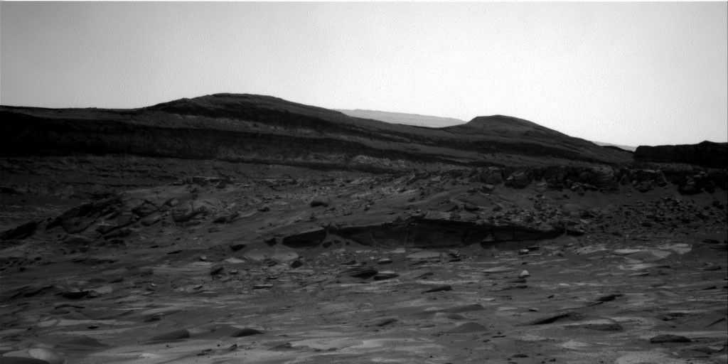
A black and white landscape photograph taken on Mars by the Curiosity rover. In the foreground, scattered rocks and uneven sandy terrain lead up to a rocky outcropping with distinct horizontal geological layers. Behind this ridge, dark, smooth-topped hills rise against a bright, featureless sky.
In this image acquired by NASA’s Mars rover Curiosity, the relatively light-toned bedrock in the foreground gives way to darker-toned rocks in the middle of the image, along what could be an erosional surface. Curiosity acquired the image using its Right Navigation Camera on July 15, 2026 — Sol 4955, or Martian day 4,955 of the Mars Science Laboratory mission — at 05:51:59 UTC.
NASA/JPL-Caltech

Written by Lucy Thompson, Senior Research Scientist, University of New Brunswick, Canada

Earth planning date: Friday, July 27, 2026

As an APXS uplink lead and strategic planner, I have the privilege of working with the rover engineers most days that I am on operations. The APXS instrument measures the chemistry of rocks, unconsolidated materials and the atmosphere, and is situated on the end of Curiosity’s robotic arm. This means that any target of interest that we wish to analyze has to be safe to deploy the arm, APXS, and MAHLI (the closeup imager) to. We therefore rely on the rover engineers for their assessment and to sequence the arm moves to place us safely on the targets. Recently, our workspaces have been dusty with varied relief, but the rover engineers have successfully found areas that they have been able to brush and deploy APXS and MAHLI. This week was no exception, despite some of our workspaces appearing less than ideal upon initial observation. The team managed to find rock targets of interest (x5), which the rover engineers were able to safely place the arm on and brush so that we could analyze them with APXS and MAHLI. This ensures that we acquire high-quality compositional data and images as we continue our ascent of Mount Sharp, through rock layers of varying tone and texture, tracking potential changes in chemistry, and the depositional and alteration environment. 

The rover engineers are also responsible for safely driving Curiosity to the areas of interest identified by the science team. They must assess the terrain for potential hazards such as large resistant blocks that could damage the rover wheels, sand/soil patches where we could get stuck, and high slopes that the rover could slip on. Despite unexpected damage to the wheels early in the mission and getting a little bogged down in some soil/sand just as we started to climb Mount Sharp, the engineers have successfully navigated us safely along more than 23 miles (37 kilometers) of drive distance and more than 4,400 feet (about 1.35 kilometers) of elevation gain. We recently requested to drive to specific locations in order to image what the team thinks could be an erosional surface within the Mg-sulfate/carbonate-bearing unit (see the image accompanying this post). Of course, the engineers were able to accommodate our desires, with the first stop crossed off in Monday’s plan, and the drive that is being planned this weekend taking us toward the next stop.

The rover engineers also ensure that our drilling activities execute safely and successfully, and are responsible for sequencing the arm motion required to deliver the drilled samples to our internal CheMin and SAM instruments. This required completely reconfiguring how we drill after a motor failed back in 2016, with extensive behind-the-scenes work at JPL for nearly a year and a half before we resumed. Curiosity has since drilled more than 20 rock targets.

So, thanks to the rover engineers and all the engineers and scientists on Curiosity’s team, we have had another full week of activities at Gale crater. We continue to track the chemistry, textures, tone and sedimentary structures of the sulfate/carbonate unit as we climb Mount Sharp and get ever closer to the Yardang unit with APXS, ChemCam, MAHLI and Mastcam. Curiosity continues to also monitor the local environment within Gale and the atmosphere in general. 

A rover sits on the hilly, orange Martian surface beneath a flat grey sky, surrounded by chunks of rock.
NASA’s Curiosity rover at the base of Mount Sharp
NASA/JPL-Caltech/MSSS

Share

Details

Last Updated
Jul 23, 2026

Related Terms

  •  
  •  

Steamy Nights at the Galactic Equator

Here's an observing guide to both familiar and lesser-known deep-sky objects that inhabit our galaxy's equatorial zone.

The post Steamy Nights at the Galactic Equator appeared first on Sky & Telescope.

  •  

Hayabusa 2 Completes Flyby Past Asteroid Torifune

Japan’s Hayabusa 2 mission has revealed another "snowman" asteroid — a pair of asteroids attached with a narrow neck. The contact binary could help shed light on planet formation.

The post Hayabusa 2 Completes Flyby Past Asteroid Torifune appeared first on Sky & Telescope.

  •  

Curiosity Blog, Sols 4927–4933: Let’s Drive to That Smooth Area

4 min read

Curiosity Blog, Sols 4927–4933: Let’s Drive to That Smooth Area

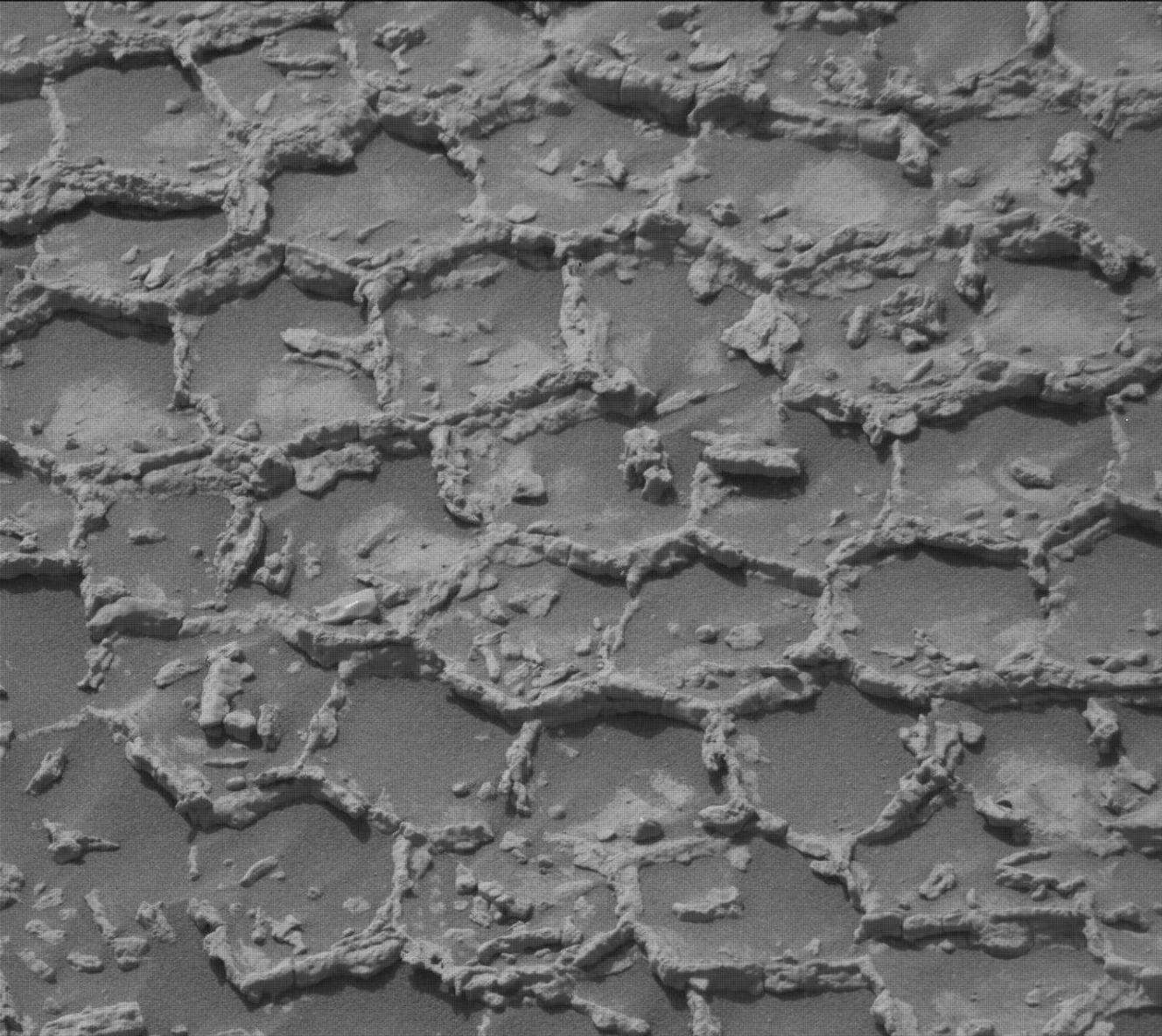
A black-and-white landscape photograph of the Martian surface taken by the Curiosity rover. The ground features a heavily textured, polygonal cracked pattern, with light-colored material forming raised veins or ridges along many of the cracks. Several dark, flat rock slabs and smaller loose rocks are scattered across the foreground and middle ground. On the right side of the image, the textured tread marks of the rover's wheels are clearly visible pressed into the soil, curving slightly as they trail off into the distance.
NASA’s Mars rover Curiosity acquired this image showing a breathtaking diversity of polygons, veins, and other textural features waiting for investigation by the Mars Science Laboratory team. Curiosity captured the image using its Left Navigation Camera on June 17, 2026 – Sol 4928, or Martian day 4,928 of the Mars Science Laboratory mission – at 17:47:52 UTC.
NASA/JPL-Caltech

By Susanne P. Schwenzer, Professor of Planetary Mineralogy at The Open University, UK

Earth planning date: Thursday, June 18, 2026

In the area Curiosity is currently exploring, the science team has mapped several areas with different-looking surface texture on the orbital images. If you wanted to have a look yourself at what there is to see, check the “Where is Curiosity?” map. You’ll discover different shades of orange and beige as well as more rough and more smooth-looking textures. This is what the geomorphologists in our team use to map the areas for exploration by the rover. Of course, we then supplement this all with ground-based images, including bespoke “drive direction imaging,” which is taken after each drive by the Mast Camera. Drive planning is done using a combination of all this information. So there shouldn’t be any surprises, right?

On Monday the team planned three sols in preparation for a Thursday planning to account for the U.S. federal holiday weekend. The workspace turned out to be a little spiky, so we could not find an area we could DRT. APXS still found one good bedrock target, “Rio Baker,” which also had MAHLI documentation. In addition, ChemCam investigated “Rica Aventura,” a textured bedrock, and “Tabebuia,” a darker-looking individual block, using its LIBS and conducted a passive spectral observation on a second dark float block called “Lago Ranco.” Of course, the team also wanted to look into the distance with ChemCam remote imaging, extending our investigation of the Cordillera base outcrop.

Imaging is always high on the list. In Monday’s plan Mastcam is looking into the modern dunes with the “Tacaza” mosaic, and with more mosaics looking forward to the future parking areas, some of which looked really smooth from that vantage point. We also continue our environmental and atmospheric observations looking for dust devils, the opacity of the atmosphere, and monitoring pressure and temperature. After all this, the rover drove about 35 meters (about 115 feet) to an area that looked really smooth in all images we had available at that point. So we were hoping for a good spot to deploy the DRT, but didn’t think we could be in for a surprise.

The drive ended exactly as planned, spot-on in the middle of that — from a distance — smooth-looking area. But when we opened the post-drive images on Thursday morning, we were all reacting with a lot of surprise. From up close, the parking spot looks anything but smooth. You can see the surprise in the title image of this blog. There are polygons, veins, lamination, and probably more, once we inspect the higher-resolution images taken today. “Higher-resolution” is the key for why we were in for such a surprise! The features are quite small, a few centimeters across, and therefore we could not see them in the orbital images or from a distance in our navigation and mast camera images. The camera resolution from a distance just isn’t enough to see them. But up close, the terrain revealed all its beauty! And I am sure there will be more in the even higher resolution of today’s MAHLI and ChemCam RMI imager images!

So, what did we plan after we caught our breath on Thursday? First, you guessed it, images, images, and more images. Mastcam takes a full panorama with its “left eye” and adds a range of closer-up mosaics with its higher-resolution “right eye.” In addition there is a ChemCam Remote Micro Imager image to document structures further afield at high resolution. ChemCam is investigating three targets using LIBS: “Rio Chimore” is a lighter-toned band; you can see some of those in the cover image of this blog, too. The other two LIBS targets are “Rio de Lava,” a vein target, and “Rio de Salta,” one of the polygons. APXS is also looking at the bedrock and the ridges, at the targets “Pampa Grande” and “Iquique Ridge.” MAHLI is having the above-mentioned close “hand lens” look. Let’s see what we will discover when we get those images.

Finally, Curiosity drove up the hill along very smooth-looking terrain that is just littered with tiny polygons. Let’s see if we are in for another surprise reverberating around all our offices — and across two continents, as I had the good fortune to be among the first ones, here in England (Or maybe it was our French ChemCam colleagues, who are in a time zone one hour ahead of me?). Whichever it is, this terrain has a lot to say about the geologic history of Mars!

A rover sits on the hilly, orange Martian surface beneath a flat grey sky, surrounded by chunks of rock.
NASA’s Curiosity rover at the base of Mount Sharp
NASA/JPL-Caltech/MSSS

Share

Details

Last Updated
Jun 24, 2026

Related Terms

  •  

Curiosity Blog, Sols 4927–4933: Let’s Drive to That Smooth Area

4 min read

Curiosity Blog, Sols 4927–4933: Let’s Drive to That Smooth Area

A black-and-white landscape photograph of the Martian surface taken by the Curiosity rover. The ground features a heavily textured, polygonal cracked pattern, with light-colored material forming raised veins or ridges along many of the cracks. Several dark, flat rock slabs and smaller loose rocks are scattered across the foreground and middle ground. On the right side of the image, the textured tread marks of the rover's wheels are clearly visible pressed into the soil, curving slightly as they trail off into the distance.
NASA’s Mars rover Curiosity acquired this image showing a breathtaking diversity of polygons, veins, and other textural features waiting for investigation by the Mars Science Laboratory team. Curiosity captured the image using its Left Navigation Camera on June 17, 2026 – Sol 4928, or Martian day 4,928 of the Mars Science Laboratory mission – at 17:47:52 UTC.
NASA/JPL-Caltech

By Susanne P. Schwenzer, Professor of Planetary Mineralogy at The Open University, UK

Earth planning date: Thursday, June 18, 2026

In the area Curiosity is currently exploring, the science team has mapped several areas with different-looking surface texture on the orbital images. If you wanted to have a look yourself at what there is to see, check the “Where is Curiosity?” map. You’ll discover different shades of orange and beige as well as more rough and more smooth-looking textures. This is what the geomorphologists in our team use to map the areas for exploration by the rover. Of course, we then supplement this all with ground-based images, including bespoke “drive direction imaging,” which is taken after each drive by the Mast Camera. Drive planning is done using a combination of all this information. So there shouldn’t be any surprises, right?

On Monday the team planned three sols in preparation for a Thursday planning to account for the U.S. federal holiday weekend. The workspace turned out to be a little spiky, so we could not find an area we could DRT. APXS still found one good bedrock target, “Rio Baker,” which also had MAHLI documentation. In addition, ChemCam investigated “Rica Aventura,” a textured bedrock, and “Tabebuia,” a darker-looking individual block, using its LIBS and conducted a passive spectral observation on a second dark float block called “Lago Ranco.” Of course, the team also wanted to look into the distance with ChemCam remote imaging, extending our investigation of the Cordillera base outcrop.

Imaging is always high on the list. In Monday’s plan Mastcam is looking into the modern dunes with the “Tacaza” mosaic, and with more mosaics looking forward to the future parking areas, some of which looked really smooth from that vantage point. We also continue our environmental and atmospheric observations looking for dust devils, the opacity of the atmosphere, and monitoring pressure and temperature. After all this, the rover drove about 35 meters (about 115 feet) to an area that looked really smooth in all images we had available at that point. So we were hoping for a good spot to deploy the DRT, but didn’t think we could be in for a surprise.

The drive ended exactly as planned, spot-on in the middle of that — from a distance — smooth-looking area. But when we opened the post-drive images on Thursday morning, we were all reacting with a lot of surprise. From up close, the parking spot looks anything but smooth. You can see the surprise in the title image of this blog. There are polygons, veins, lamination, and probably more, once we inspect the higher-resolution images taken today. “Higher-resolution” is the key for why we were in for such a surprise! The features are quite small, a few centimeters across, and therefore we could not see them in the orbital images or from a distance in our navigation and mast camera images. The camera resolution from a distance just isn’t enough to see them. But up close, the terrain revealed all its beauty! And I am sure there will be more in the even higher resolution of today’s MAHLI and ChemCam RMI imager images!

So, what did we plan after we caught our breath on Thursday? First, you guessed it, images, images, and more images. Mastcam takes a full panorama with its “left eye” and adds a range of closer-up mosaics with its higher-resolution “right eye.” In addition there is a ChemCam Remote Micro Imager image to document structures further afield at high resolution. ChemCam is investigating three targets using LIBS: “Rio Chimore” is a lighter-toned band; you can see some of those in the cover image of this blog, too. The other two LIBS targets are “Rio de Lava,” a vein target, and “Rio de Salta,” one of the polygons. APXS is also looking at the bedrock and the ridges, at the targets “Pampa Grande” and “Iquique Ridge.” MAHLI is having the above-mentioned close “hand lens” look. Let’s see what we will discover when we get those images.

Finally, Curiosity drove up the hill along very smooth-looking terrain that is just littered with tiny polygons. Let’s see if we are in for another surprise reverberating around all our offices — and across two continents, as I had the good fortune to be among the first ones, here in England (Or maybe it was our French ChemCam colleagues, who are in a time zone one hour ahead of me?). Whichever it is, this terrain has a lot to say about the geologic history of Mars!

A rover sits on the hilly, orange Martian surface beneath a flat grey sky, surrounded by chunks of rock.
NASA’s Curiosity rover at the base of Mount Sharp
NASA/JPL-Caltech/MSSS

Share

Details

Last Updated
Jun 24, 2026

Related Terms

The post Curiosity Blog, Sols 4927–4933: Let’s Drive to That Smooth Area appeared first on NASA Science.
  •  

Playing the Moon Game 

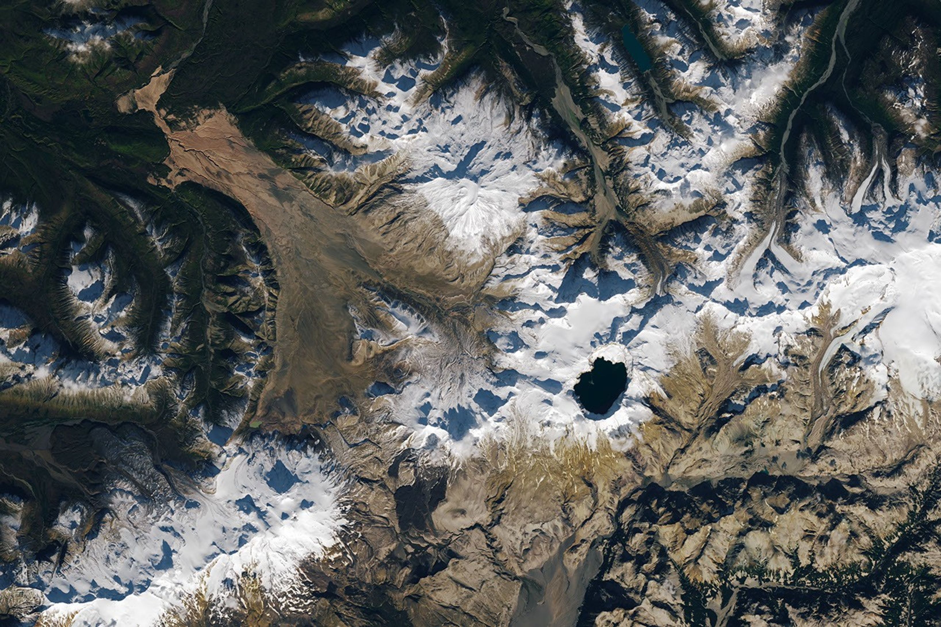
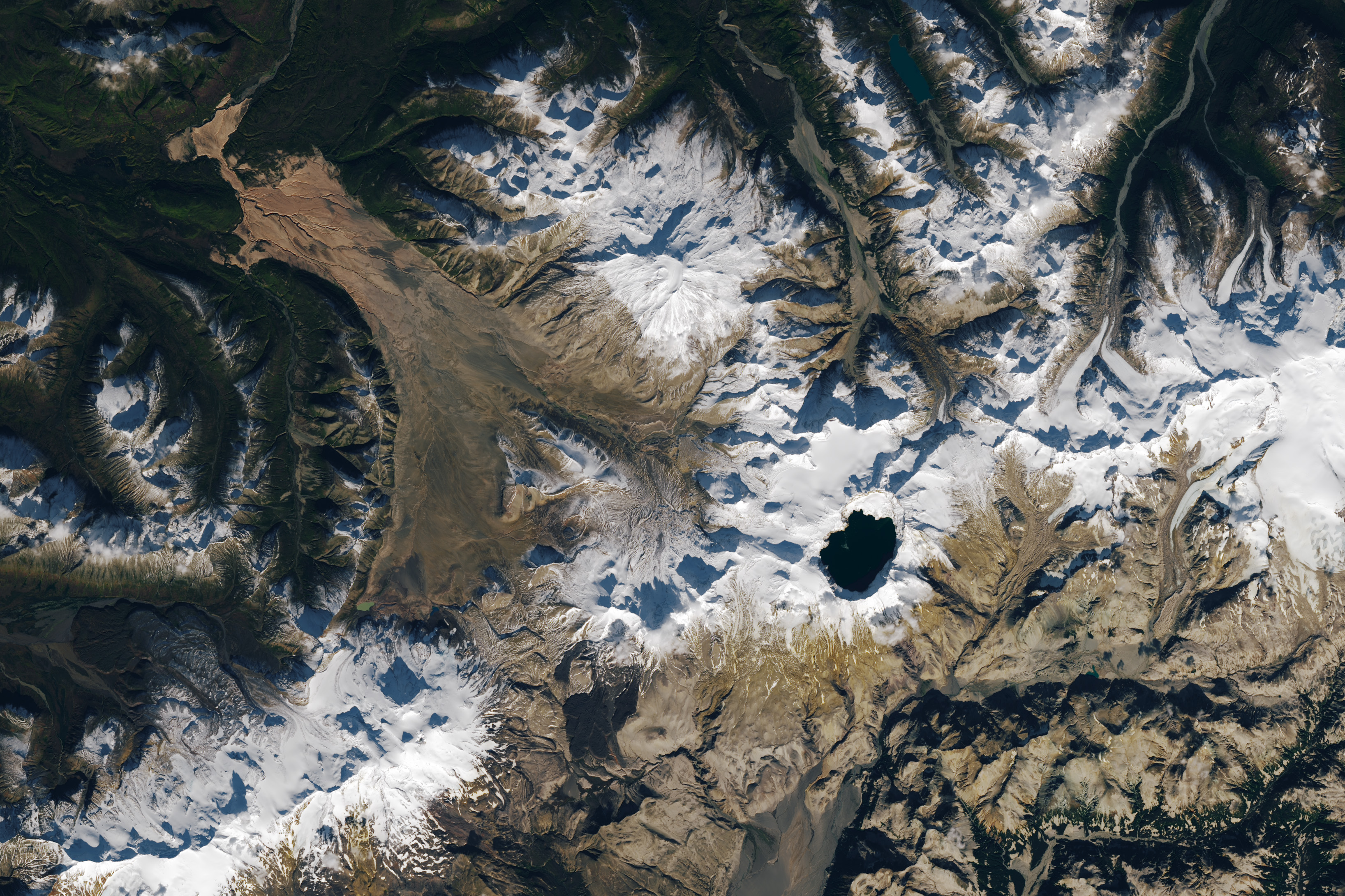
A satellite image shows part of Alaska’s Katmai National Park. A chain of snowy mountain peaks stretches from the bottom left corner to the right side of the image. The Valley of Ten Thousand Smokes is a long, tan-colored feature runs toward the northwest in the upper-left.
September 29, 2025

In preparing to visit the Moon’s surface, soon-to-be lunar explorers in NASA’s Apollo program first ventured into a variety of unfamiliar landscapes on Earth. A couple of these trips, in the summers of 1965 and 1966, took astronauts to Alaska’s remote Katmai National Park for simulations of field geology in Moon-like environments.

In one exercise, which they called “playing the Moon game,” pairs of astronauts were placed at unfamiliar field sites and asked to pretend as if they were on the Moon. By the account of William Phinney, Apollo’s science training coordinator, they were tasked with collecting representative geologic samples and practicing how to communicate their observations to scientists.

A detailed satellite image centers on the Valley of Ten Thousand Smokes in Alaska. The tan-colored feature runs southeast-to-northwest. Snowy peaks appear on the right side of the image, and green, forested valleys fill the left side.
September 29, 2025

The Alaskan setting for the Moon game was an unusual volcanic landscape called the Valley of Ten Thousand Smokes. The valley is full of debris deposited by the 1912 eruption of Novarupta—the largest volcanic event on Earth in the 20th century.

The images above, acquired on September 29, 2025, with the OLI (Operational Land Imager) on Landsat 9, show the massive ash flow deposited by Novarupta. The layer measures up to 660 feet (200 meters) thick and was emplaced at a searing 1,380 degrees Fahrenheit (750 degrees Celsius). 

The Valley of Ten Thousand Smokes, shown in the 1917 photo below, is so named because of the abundance of fumaroles—gas and steam-emitting vents—that filled the valley for a decade after the eruption. A few hundred persisted more than 10 years, with some lasting until the 1990s.

Three people stand in the foreground of this black-and-white photo, silhouetted by steam coming from a fumarole. A dark, barren landscape dotted with plumes of rising steam extends into the background.
1917

Scientists initially suspected that the monster eruption occurred at Mount Katmai, a neighboring volcano with a large caldera located 6 miles (10 kilometers) east of Novarupta’s dome. However, they later determined that the eruption actually occurred at Novarupta—whose name means “new eruption”—after stealing magma from beneath Katmai. As the magma chamber emptied, Katmai collapsed, forming the 2.5-mile-wide (4-kilometer-wide) caldera present today.

The volcanic landscape in the Valley of Ten Thousand Smokes is far fresher than the ancient lava flows that formed the Moon’s volcanic features. But for the Apollo astronauts, it offered an “excellent opportunity to view volcanic materials and landforms in nearly pristine condition,” Phinney wrote. They studied evidence of fumaroles and examined vertical sections of the deposits where streams had eroded deep gorges.

This photo shows a broad valley filled with tan-colored volcanic material in the foreground and snowy mountains in the background. The ashy volcanic deposits create a mostly flat valley floor, except where steep-sided chasms formed by erosion run through it.
June 9, 1991

Researchers continue to visit this Alaskan wilderness in search of clues that could help decipher the geology of the Moon and Mars. In 2024, the Goddard Instrument Field Team (GIFT) trekked to the Valley of Ten Thousand Smokes to study its icy volcanic landscape. Like the valley, Mars contains glaciers and ice sheets layered with dust and ash, a dynamic and difficult-to-interpret environment.

Advancing lunar science, the GIFT team also collected samples from rock formations comparable to the Moon’s Gruithuisen Domes. These mysterious features are made of hardened lava with a different composition than the surrounding rock. With more to learn about our nearest celestial neighbor, the spirit of the Moon game lives on in the 21st century.

NASA Earth Observatory images by Lauren Dauphin, using Landsat data from the U.S. Geological Survey. Photos from National Geographic Society Katmai expeditions photographs, Archives and Special Collections, Consortium Library, University of Alaska Anchorage, and from the U.S. Geological Survey Volcano Hazards Program. Story by Lindsey Doermann. 

Downloads

A satellite image shows part of Alaska’s Katmai National Park. A chain of snowy mountain peaks stretches from the bottom left corner to the right side of the image. The Valley of Ten Thousand Smokes is a long, tan-colored feature runs toward the northwest in the upper-left.

September 29, 2025

JPEG (2.64 MB)

References & Resources

You may also be interested in:

Stay up-to-date with the latest content from NASA as we explore the universe and discover more about our home planet.

Scoria Cones on Earth and Mars

7 min read

The hill-shaped features are a sign of explosive volcanic activity—a rarity on the Red Planet.

Article

A Volcanic Medley Near Mammoth Lakes 

4 min read

A massive, old caldera and more recently formed craters shape the landscape in the eastern Sierra Nevada.

Article

A Full Moon Checkup

3 min read

Once a month during the full Moon, Landsat 9 turns from Earth to image the lunar surface, helping keep the…

Article
  •  

Playing the Moon Game 

A satellite image shows part of Alaska’s Katmai National Park. A chain of snowy mountain peaks stretches from the bottom left corner to the right side of the image. The Valley of Ten Thousand Smokes is a long, tan-colored feature runs toward the northwest in the upper-left.
September 29, 2025

In preparing to visit the Moon’s surface, soon-to-be lunar explorers in NASA’s Apollo program first ventured into a variety of unfamiliar landscapes on Earth. A couple of these trips, in the summers of 1965 and 1966, took astronauts to Alaska’s remote Katmai National Park for simulations of field geology in Moon-like environments.

In one exercise, which they called “playing the Moon game,” pairs of astronauts were placed at unfamiliar field sites and asked to pretend as if they were on the Moon. By the account of William Phinney, Apollo’s science training coordinator, they were tasked with collecting representative geologic samples and practicing how to communicate their observations to scientists.

A detailed satellite image centers on the Valley of Ten Thousand Smokes in Alaska. The tan-colored feature runs southeast-to-northwest. Snowy peaks appear on the right side of the image, and green, forested valleys fill the left side.
September 29, 2025

The Alaskan setting for the Moon game was an unusual volcanic landscape called the Valley of Ten Thousand Smokes. The valley is full of debris deposited by the 1912 eruption of Novarupta—the largest volcanic event on Earth in the 20th century.

The images above, acquired on September 29, 2025, with the OLI (Operational Land Imager) on Landsat 9, show the massive ash flow deposited by Novarupta. The layer measures up to 660 feet (200 meters) thick and was emplaced at a searing 1,380 degrees Fahrenheit (750 degrees Celsius). 

The Valley of Ten Thousand Smokes, shown in the 1917 photo below, is so named because of the abundance of fumaroles—gas and steam-emitting vents—that filled the valley for a decade after the eruption. A few hundred persisted more than 10 years, with some lasting until the 1990s.

Three people stand in the foreground of this black-and-white photo, silhouetted by steam coming from a fumarole. A dark, barren landscape dotted with plumes of rising steam extends into the background.
1917

Scientists initially suspected that the monster eruption occurred at Mount Katmai, a neighboring volcano with a large caldera located 6 miles (10 kilometers) east of Novarupta’s dome. However, they later determined that the eruption actually occurred at Novarupta—whose name means “new eruption”—after stealing magma from beneath Katmai. As the magma chamber emptied, Katmai collapsed, forming the 2.5-mile-wide (4-kilometer-wide) caldera present today.

The volcanic landscape in the Valley of Ten Thousand Smokes is far fresher than the ancient lava flows that formed the Moon’s volcanic features. But for the Apollo astronauts, it offered an “excellent opportunity to view volcanic materials and landforms in nearly pristine condition,” Phinney wrote. They studied evidence of fumaroles and examined vertical sections of the deposits where streams had eroded deep gorges.

This photo shows a broad valley filled with tan-colored volcanic material in the foreground and snowy mountains in the background. The ashy volcanic deposits create a mostly flat valley floor, except where steep-sided chasms formed by erosion run through it.
June 9, 1991

Researchers continue to visit this Alaskan wilderness in search of clues that could help decipher the geology of the Moon and Mars. In 2024, the Goddard Instrument Field Team (GIFT) trekked to the Valley of Ten Thousand Smokes to study its icy volcanic landscape. Like the valley, Mars contains glaciers and ice sheets layered with dust and ash, a dynamic and difficult-to-interpret environment.

Advancing lunar science, the GIFT team also collected samples from rock formations comparable to the Moon’s Gruithuisen Domes. These mysterious features are made of hardened lava with a different composition than the surrounding rock. With more to learn about our nearest celestial neighbor, the spirit of the Moon game lives on in the 21st century.

NASA Earth Observatory images by Lauren Dauphin, using Landsat data from the U.S. Geological Survey. Photos from National Geographic Society Katmai expeditions photographs, Archives and Special Collections, Consortium Library, University of Alaska Anchorage, and from the U.S. Geological Survey Volcano Hazards Program. Story by Lindsey Doermann. 

Downloads

A satellite image shows part of Alaska’s Katmai National Park. A chain of snowy mountain peaks stretches from the bottom left corner to the right side of the image. The Valley of Ten Thousand Smokes is a long, tan-colored feature runs toward the northwest in the upper-left.

September 29, 2025

JPEG (2.64 MB)

References & Resources

You may also be interested in:

Stay up-to-date with the latest content from NASA as we explore the universe and discover more about our home planet.

Scoria Cones on Earth and Mars
7 min read

The hill-shaped features are a sign of explosive volcanic activity—a rarity on the Red Planet.

Article
A Volcanic Medley Near Mammoth Lakes 
4 min read

A massive, old caldera and more recently formed craters shape the landscape in the eastern Sierra Nevada.

Article
Restless Kīlauea Launches Lava and Ash
3 min read

Episode 43 of the Hawaiian volcano’s current eruption was marked by high lava fountains and widespread ash dispersal.

Article

The post Playing the Moon Game  appeared first on NASA Science.
  •  

Curiosity Blog, Sols 4920-4926: Surveying the Bands

3 min read

Curiosity Blog, Sols 4920-4926: Surveying the Bands

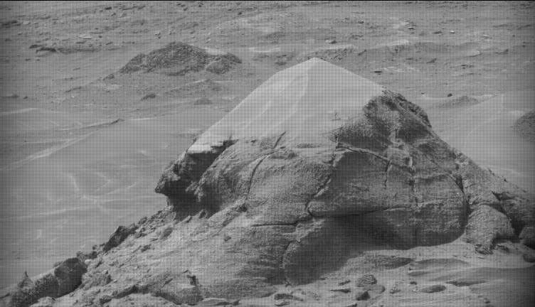
A black-and-white image of a barren Martian landscape featuring a prominent, roughly pyramidal rock outcropping in the foreground. The rock's lower half is rugged with deep cracks and textured layers, while its peak appears lighter and smoother, possibly covered in dust. The surrounding terrain stretches into the background with scattered smaller rocks and another low mound in the distance.
NASA’s Mars rover Curiosity acquired this image of small butte, “Miraflores,” using its Mast Camera (Mastcam) on June 11, 2026 — Sol 4922, or Martian day 4,922 of the Mars Science Laboratory mission — at 09:12:13 UTC.
NASA/JPL-Caltech/MSSS

Written by William Farrand, Senior Research Scientist, Space Science Institute

Earth planning date: Friday, June 12, 2026

Rather than going from stage to stage at a music festival to hear different bands playing different varieties of music, Curiosity has been ascending up Mount Sharp through physical bands of exposed rocks with textural and tonal differences.

Planning for sols 4920 and 4921 were done with the rover in the middle of a unit with a rougher texture and dark-toned bedrock. With the rougher-textured bedrock, brushing wasn’t possible, but APXS chemistry and MAHLI micro-imaging were planned on “as is” bedrock targets “Salto La Cascada” and “Puerto de Rosas.” ChemCam was targeted to perform LIBS spectroscopy on a bedrock target “Kishuara” and a small, layered float rock “La Rosita.” ChemCam’s Remote Micro-Imager (RMI) collected views of the “Mishe Mokwa” butte and another looking at dunes with tonal differences. Mastcam mosaics were collected on the “Valle Grande” channel, “Kimsa Chata” butte, nearby troughs, and the aircraft carrier shaped rock “El Matir.”

Another drive brought Curiosity closer to the upper border of the dark-toned band. Again, brushing of the rocks was not possible, but APXS and MAHLI were collected on dark-toned bedrock targets “Santa Gracia” and “Laguna San Rafael” with ChemCam LIBS also targeting the bedrock. Mastcam mosaics were collected of a layered rock and nearby troughs and a mosaic of the nearby smaller butte, “Miraflores” which displays an interesting layered structure with ragged dark-toned rocks on one side and a stack of dust piled on top (see accompanying image). Other activities included a long-distance RMI mosaic of a bright unit on “Mishe Mokwa”, and Navcam dust-devil surveys in both sols.

Communicating between Earth and Mars has come to seem routine, but at times can still be a challenging endeavor and this was demonstrated to the team on Friday when we did not get a timely downlink of data for the drive planned for Sol 4923. Without these images another drive, in situ examinations, or targeted remote sensing could not be planned. However, there are always interesting things to be done on Mars and the three-sol plan (4924 to 4926) included a 360-degree Mastcam mosaic, the automatic AEGIS targeting of LIBS measurements on each sol, a Navcam dust-devil survey, APXS atmospheric measurements, as well as several other environmental activities.

On Monday, the delayed downlink will be used to plan the first investigation of the next band of surface materials, this one being smooth-textured and light-toned, as well as another drive to continue the surveying of the bands.

A rover sits on the hilly, orange Martian surface beneath a flat grey sky, surrounded by chunks of rock.
NASA’s Curiosity rover at the base of Mount Sharp
NASA/JPL-Caltech/MSSS

Share

Details

Last Updated
Jun 18, 2026

Related Terms

The post Curiosity Blog, Sols 4920-4926: Surveying the Bands appeared first on NASA Science.

  •  

Curiosity Blog, Sols 4920-4926: Surveying the Bands

3 min read

Curiosity Blog, Sols 4920-4926: Surveying the Bands

A black-and-white image of a barren Martian landscape featuring a prominent, roughly pyramidal rock outcropping in the foreground. The rock's lower half is rugged with deep cracks and textured layers, while its peak appears lighter and smoother, possibly covered in dust. The surrounding terrain stretches into the background with scattered smaller rocks and another low mound in the distance.
NASA’s Mars rover Curiosity acquired this image of small butte, “Miraflores,” using its Mast Camera (Mastcam) on June 11, 2026 — Sol 4922, or Martian day 4,922 of the Mars Science Laboratory mission — at 09:12:13 UTC.
NASA/JPL-Caltech/MSSS

Written by William Farrand, Senior Research Scientist, Space Science Institute

Earth planning date: Friday, June 12, 2026

Rather than going from stage to stage at a music festival to hear different bands playing different varieties of music, Curiosity has been ascending up Mount Sharp through physical bands of exposed rocks with textural and tonal differences.

Planning for sols 4920 and 4921 were done with the rover in the middle of a unit with a rougher texture and dark-toned bedrock. With the rougher-textured bedrock, brushing wasn’t possible, but APXS chemistry and MAHLI micro-imaging were planned on “as is” bedrock targets “Salto La Cascada” and “Puerto de Rosas.” ChemCam was targeted to perform LIBS spectroscopy on a bedrock target “Kishuara” and a small, layered float rock “La Rosita.” ChemCam’s Remote Micro-Imager (RMI) collected views of the “Mishe Mokwa” butte and another looking at dunes with tonal differences. Mastcam mosaics were collected on the “Valle Grande” channel, “Kimsa Chata” butte, nearby troughs, and the aircraft carrier shaped rock “El Matir.”

Another drive brought Curiosity closer to the upper border of the dark-toned band. Again, brushing of the rocks was not possible, but APXS and MAHLI were collected on dark-toned bedrock targets “Santa Gracia” and “Laguna San Rafael” with ChemCam LIBS also targeting the bedrock. Mastcam mosaics were collected of a layered rock and nearby troughs and a mosaic of the nearby smaller butte, “Miraflores” which displays an interesting layered structure with ragged dark-toned rocks on one side and a stack of dust piled on top (see accompanying image). Other activities included a long-distance RMI mosaic of a bright unit on “Mishe Mokwa”, and Navcam dust-devil surveys in both sols.

Communicating between Earth and Mars has come to seem routine, but at times can still be a challenging endeavor and this was demonstrated to the team on Friday when we did not get a timely downlink of data for the drive planned for Sol 4923. Without these images another drive, in situ examinations, or targeted remote sensing could not be planned. However, there are always interesting things to be done on Mars and the three-sol plan (4924 to 4926) included a 360-degree Mastcam mosaic, the automatic AEGIS targeting of LIBS measurements on each sol, a Navcam dust-devil survey, APXS atmospheric measurements, as well as several other environmental activities.

On Monday, the delayed downlink will be used to plan the first investigation of the next band of surface materials, this one being smooth-textured and light-toned, as well as another drive to continue the surveying of the bands.

A rover sits on the hilly, orange Martian surface beneath a flat grey sky, surrounded by chunks of rock.
NASA’s Curiosity rover at the base of Mount Sharp
NASA/JPL-Caltech/MSSS

Share

Details

Last Updated
Jun 18, 2026

Related Terms

  •  
❌