❌

Reading view

Explosive 'Mountain of God' spits out the fastest-flowing lava on Earth — Earth from space

QUICK FACTS

Where is it? Ol Doinyo Lengai, Tanzania [-2.7734503796, 35.91519798]

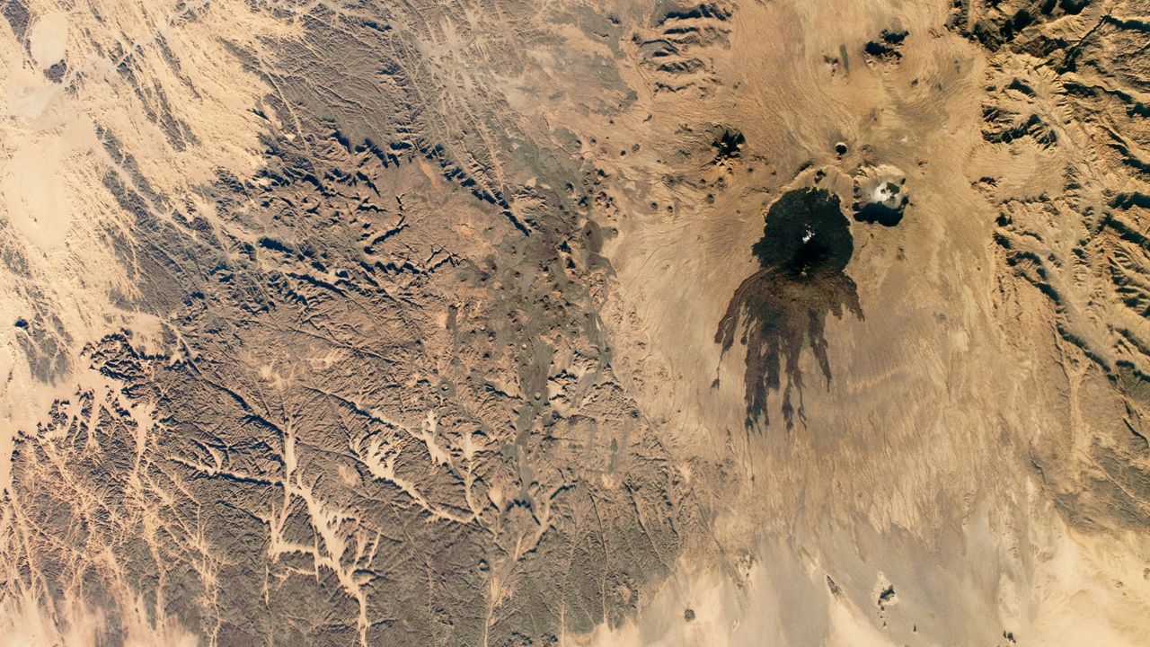
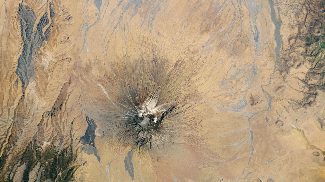
What's in the photo? The lava-stained slopes and ash cone of a highly active volcano

Who took the photo? An unnamed astronaut on board the International Space Station

When was it taken? Oct. 6, 2020

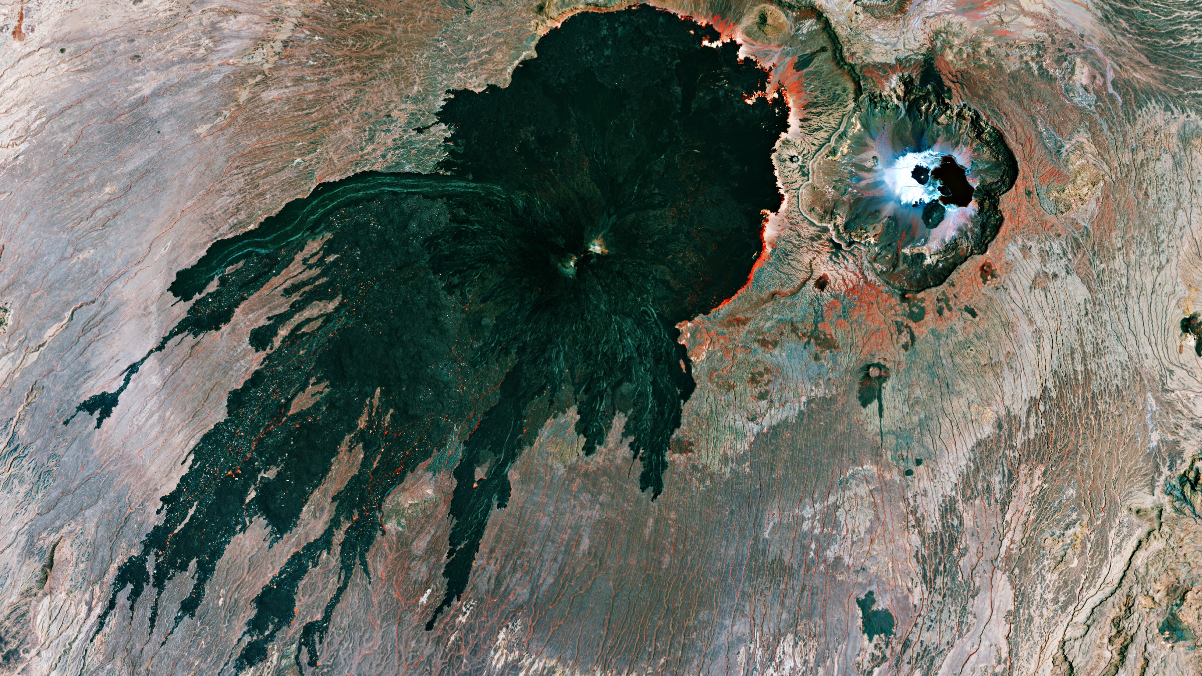
This dramatic astronaut photo shows a highly active stratovolcano in Tanzania that was recently adorned with a striking white "crown" of ash. The explosive volcano produces a rare type of lava that is unusually cool, uniquely colored and the fastest-flowing on Earth.

The volcano is officially named Ol Doinyo Lengai and stands up to 9,718 feet (2,692 meters) above the grassy plains of the Arusha region of northern Tanzania. The local Maasai people call the towering peak the "Mountain of God," because they believe it is the residence of the supreme creator god Ngai (also known as Engai or Enkai), according to the book "Sacred Mountains of the World" (Cambridge University Press, 2022).

Ol Doinyo Lengai is one of Africa's most active volcanoes; it has been erupting on and off for the past 15,000 years. It alternates between effusive eruptions, where lava seeps out of its vents, and sporadic explosive outbursts, which can drastically alter its appearance. Its most recent eruption, which is effusive, has been going on since April 2017, according to the Smithsonian Institution's Global Volcanism Program.

The sacred mountain produces a rare type of lava that consists of natrocarbonatite rock, which is rich in sodium, potassium and calcium carbonate but low in silica. As a result, it is much cooler than most other lava, dipping to temperatures below 1,100 degrees Fahrenheit (600 degrees Celsius). It also has an unusually low viscosity, which makes it "some of the fastest-flowing lava in the world," according to NASA's Earth Observatory.

When it solidifies, this unusually runny lava turns surprisingly pale, due to chemical reactions with rainwater and moisture in the air. In this image, you can see several lightly colored rivers of rock snaking down the volcano's flank. The youngest of these lava flows was created during an eruption in 1998.

For most of the past century, Ol Doinyo Lengai's summit consisted of a bowl-like depression that gradually filled with lava. But between 2007 and 2008, a series of major explosive eruptions birthed a 330-foot-tall (100 m) ash cone that now looms over the summit's center.

This explosive event has transformed the volcano's appearance when viewed from space, additional photos from the Earth Observatory show. In the featured image, a dark spot of fresh lava can be seen in the center of the cone, making it look like a crown.
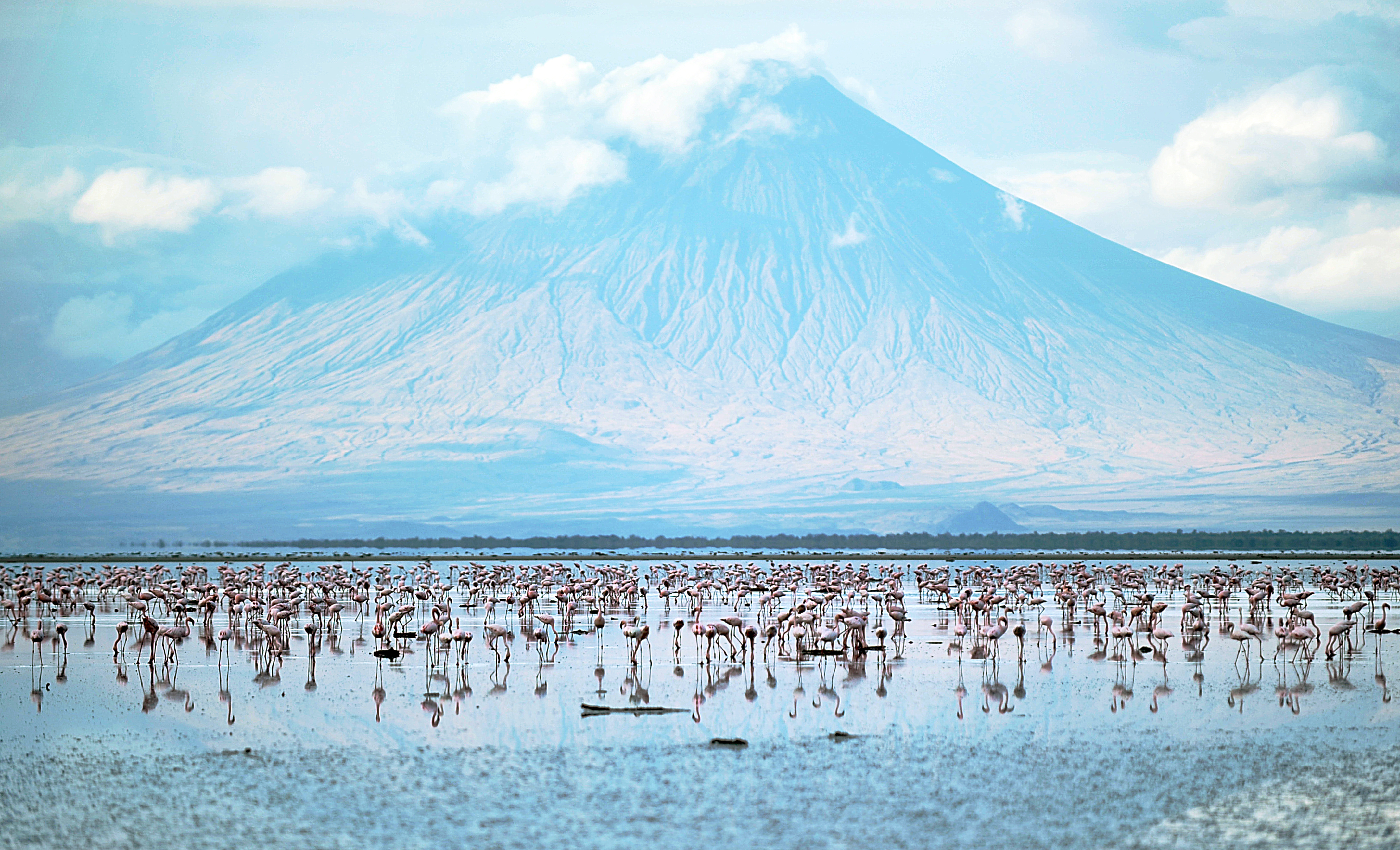
Flamingoes in a lake with a volcano in the distance

Lake Natron, near Ol Doinyo Lengai, hosts large flamingo populations. (Image credit: TONY KARUMBA/AFP via Getty Images)

Ol Doinyo Lengai is located in the East African Rift System, a roughly 2,000-mile long (3,500 kilometers) area surrounding a divergent fault line where the African Plate is splitting into the Somali and Nubian plates.

This region has been tectonically active for more than 25 million years and has created some of the continent's most interesting topographic features, including Mount Kilimanjaro and Mount Kenya, which are located on each side of Ol Doinyo Lengai, according to the Earth Observatory.

The godly mountain is around 10 miles (16 km) south of Lake Natron, a red salt lake that's famed for its large flamingo populations. The geographical features are often photographed alongside one another.

See more Earth from space
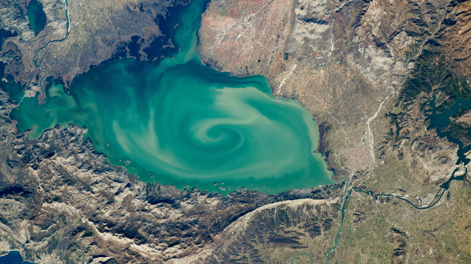
A satellite photo of a lake with a massive green swirl on its srufaceGreen vortex in 'cryptodepression' lake

A 2020 astronaut photo shows a massive, milky-green vortex in Lake Skadar, which lies on the border between Montenegro and Albania.
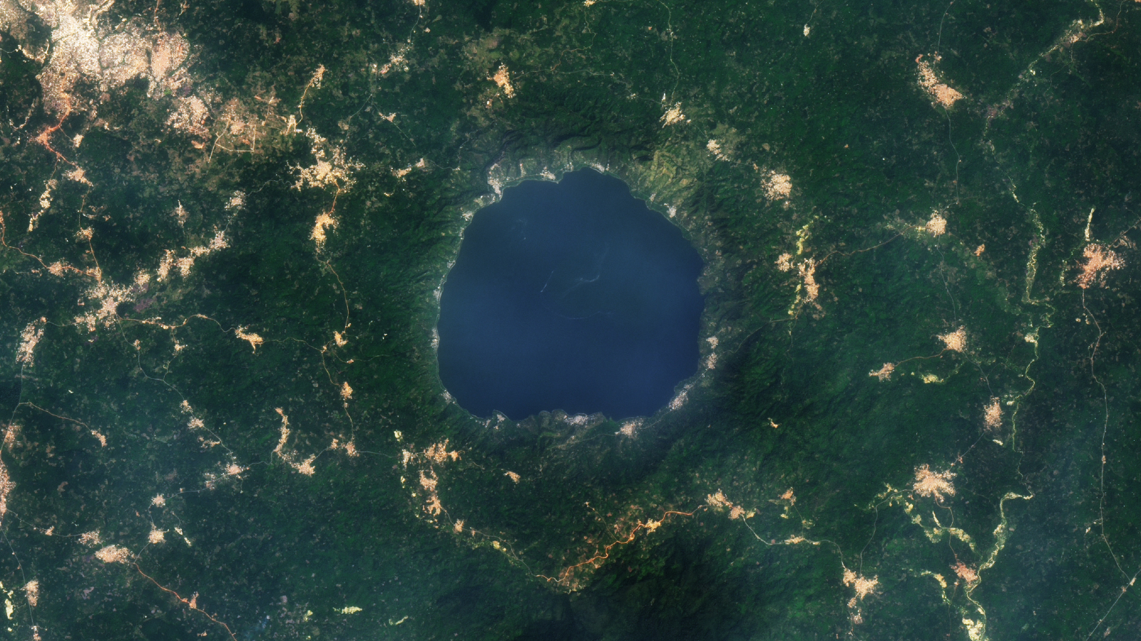
A 2015 satellite photo showing a series of golden tendrils surrounding a round blue lakeGold glitters around 'lake of souls'

A 2015 satellite photo shows a series of golden tendrils surrounding Ghana's Lake Bosumtwi, which is considered sacred to the local Asante people.
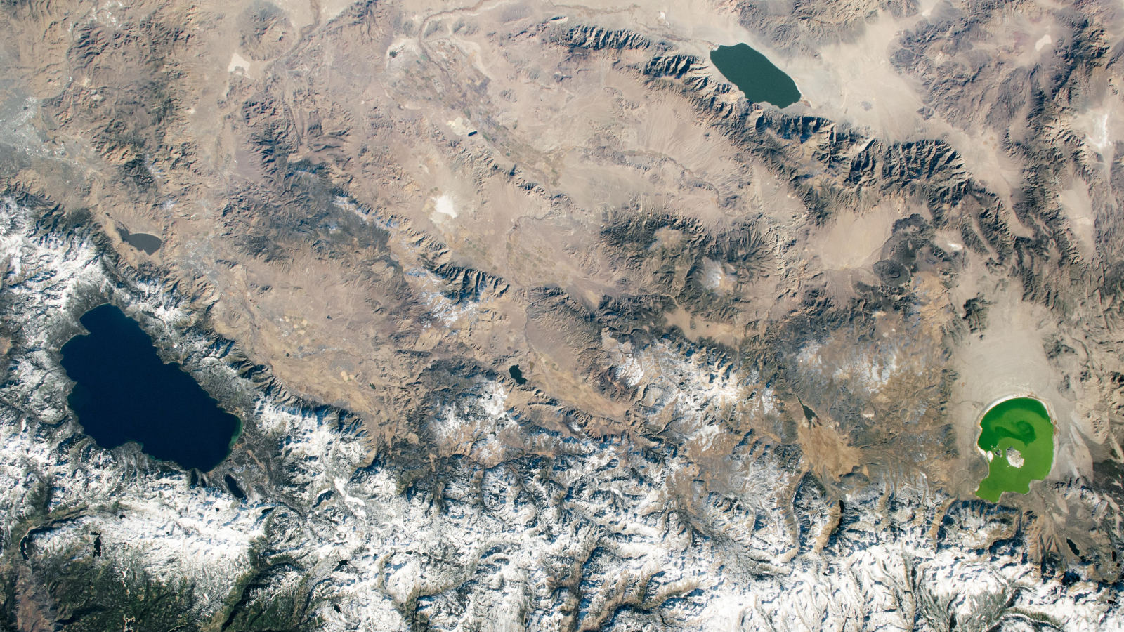
An astronaut photo showing three differently colored lakes in a triangleTrio of colorful lakes straddles states

A 2020 astronaut photo shows three uniquely colored lakes — Tahoe, Walker and Mono — straddling contrasting biomes on either side of the California-Nevada border.
  •  

EAGLE

EAGLE

Explorer for Artemis Geology, Lunar, and Earth — a NASA satellite program to study surface biology and geology on Earth, with technologies that could support future missions to the Moon and Mars.

Future Mission

NASA’s EAGLE program — Explorer for Artemis Geology, Lunar, and Earth — will be a series of satellite missions studying surface properties using technologies for Earth observation that will also benefit future missions to the Moon and Mars, where they could identify critical resources and safe landing sites.

The satellites making up the first two EAGLE missions will study biology and geology on Earth’s surface to support agriculture, disaster response, and other needs. Each mission will carry a different instrument with capabilities that complement each other. The first mission (EAGLE-VSWIR) is scheduled to take flight in 2028.

Mission Type

Orbiter

Target

Earth, Moon, Mars

Launch

No earlier than 2028

Objective

Study surface composition and changes

  • EAGLE-VSWIR

    EAGLE-VSWIR (Visible to Shortwave Infrared) will observe the Earth’s surface every 16 days with a high-resolution imaging spectrometer, which measures light reflected from the planet’s surface, separating wavelengths across the visual and into the infrared spectrum. The patterns created by light being reflected or absorbed across this spectral range act like fingerprints, letting scientists identify the composition of the surface. 

    A similar instrument, NASA’s EMIT (Earth Surface Mineral Dust Source Investigation), has been monitoring Earth from the International Space Station since July 2022, characterizing the surface mineral composition of Earth’s arid lands, monitoring ecosystem status, and tracking health and safety hazards — such as methane leaks and acid mine drainage — among other applications.

    EAGLE-VSWIR will have 25 times more capability than EMIT has today. This technological leap will allow scientists to map surface deposits of critical and rare-earth minerals, strengthen food security, and aid wildfire prevention and recovery. It can also highlight environmental hazards such as oil spills or landslide risks, and monitor water quality and availability.

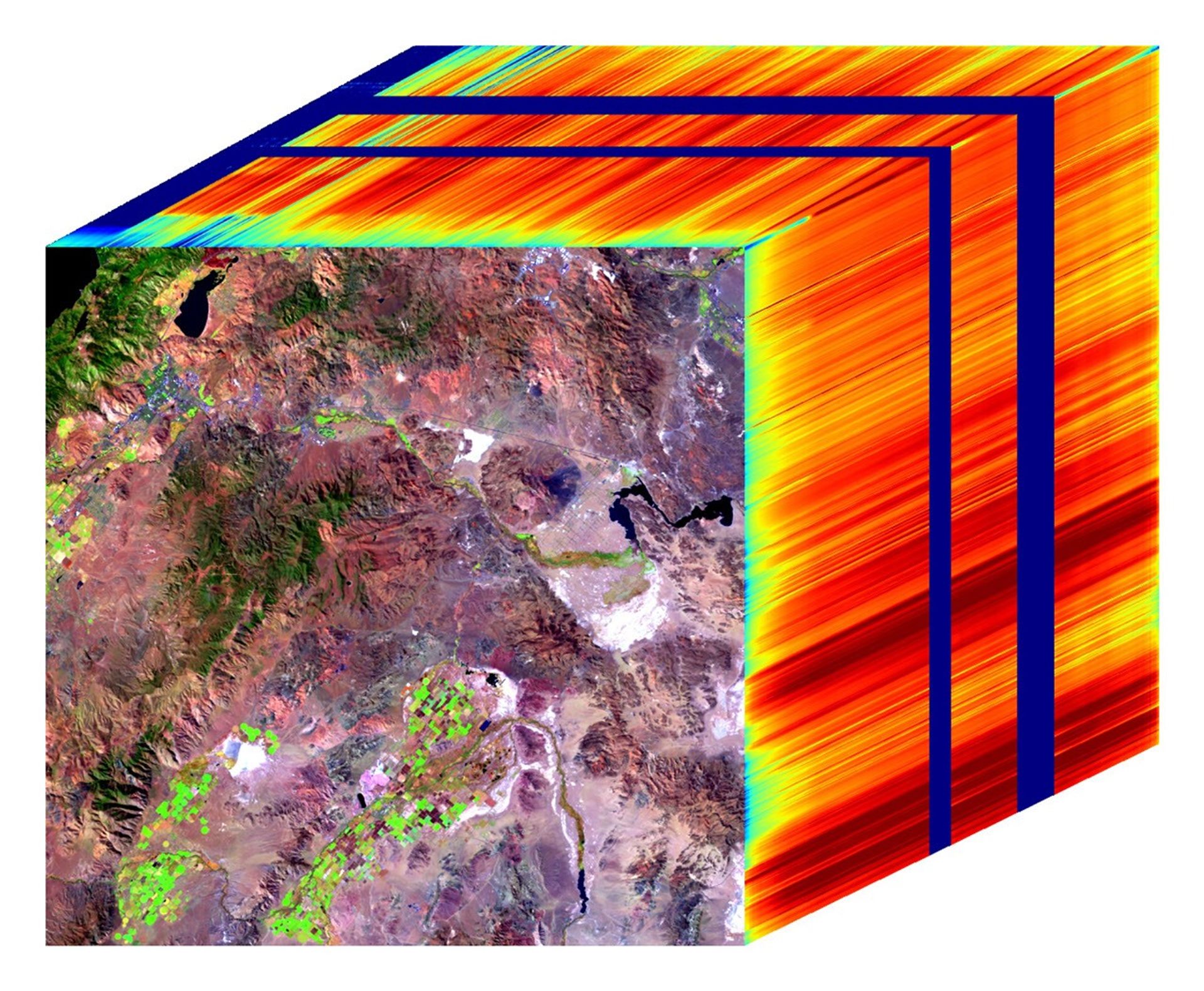
    Region of Nevada as observed by NASA's EMIT with spectrum on right edge
    The front of this image cube shows a region in Nevada observed by NASA’s EMIT imaging spectrometer; the cube’s sides show the spectral fingerprint for every point in the image and can be used to discover mineral resources. EAGLE-VSWIR will have 25 times greater performance beyond NASA’s current state-of-the-art EMIT.
    NASA/JPL-Caltech
  • EAGLE-TIR

    The EAGLE-TIR mission will provide Thermal InfraRed (TIR) imagery when it launches two to three years after EAGLE-VSWIR, measuring energy emitted from the surface and producing data that scientists can use to map temperature, composition, and critical mineral deposits. On Earth that would let researchers monitor wildfires and volcanic activity, track drought and water use by crops, study urban heat islands, observe the rates that snow or ice accumulates or melts, and better understand Earth’s resilient ecosystems.

    EAGLE-TIR follows on from ECOSTRESS (ECOsystem Spaceborne Thermal Radiometer Experiment on Space Station), which has been observing Earth from the International Space Station since 2018. ECOSTRESS was designed to study how different ecosystems respond to drought and water stress, and the data has provided a vital understanding of how plants’ water use changes throughout the day. Since ECOSTRESS also measures emitted energy in the thermal infrared, its surface-temperature products have also been used for urban planning and wildfire monitoring. 

    Further innovation and lessons learned from ECOSTRESS has led to EAGLE-TIR, which will carry a multi-band thermal radiometer. EAGLE-TIR’s great strength compared to existing missions is that it provides detailed imagery of the entire globe every two days, day and night, at multiple wavelengths not available from other instruments.

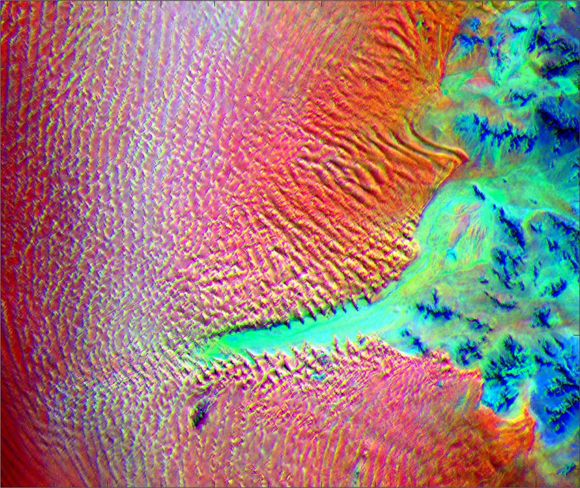
    Aerial view of Namib desert in Infrared captured by ECOSTRESS
    This image shows the minerals contained in Namibian dunes using ECOSTRESS data. EAGLE-TIR will have more spectral channels to enable even better mineral discrimination.
    NASA/JPL-Caltech
  • EAGLE Program

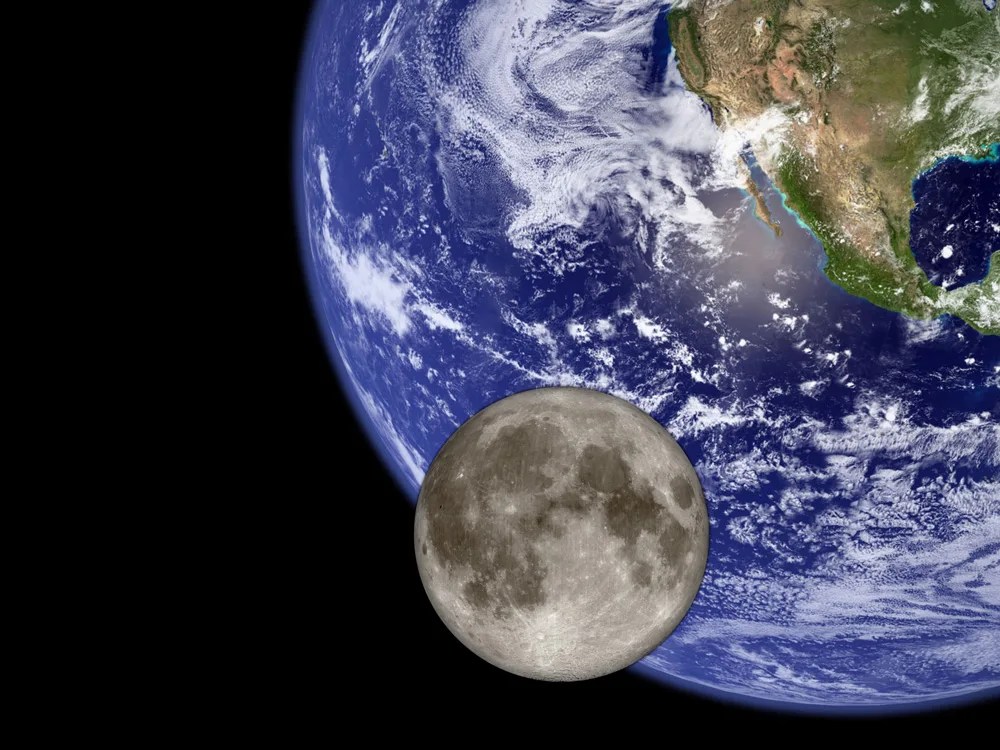
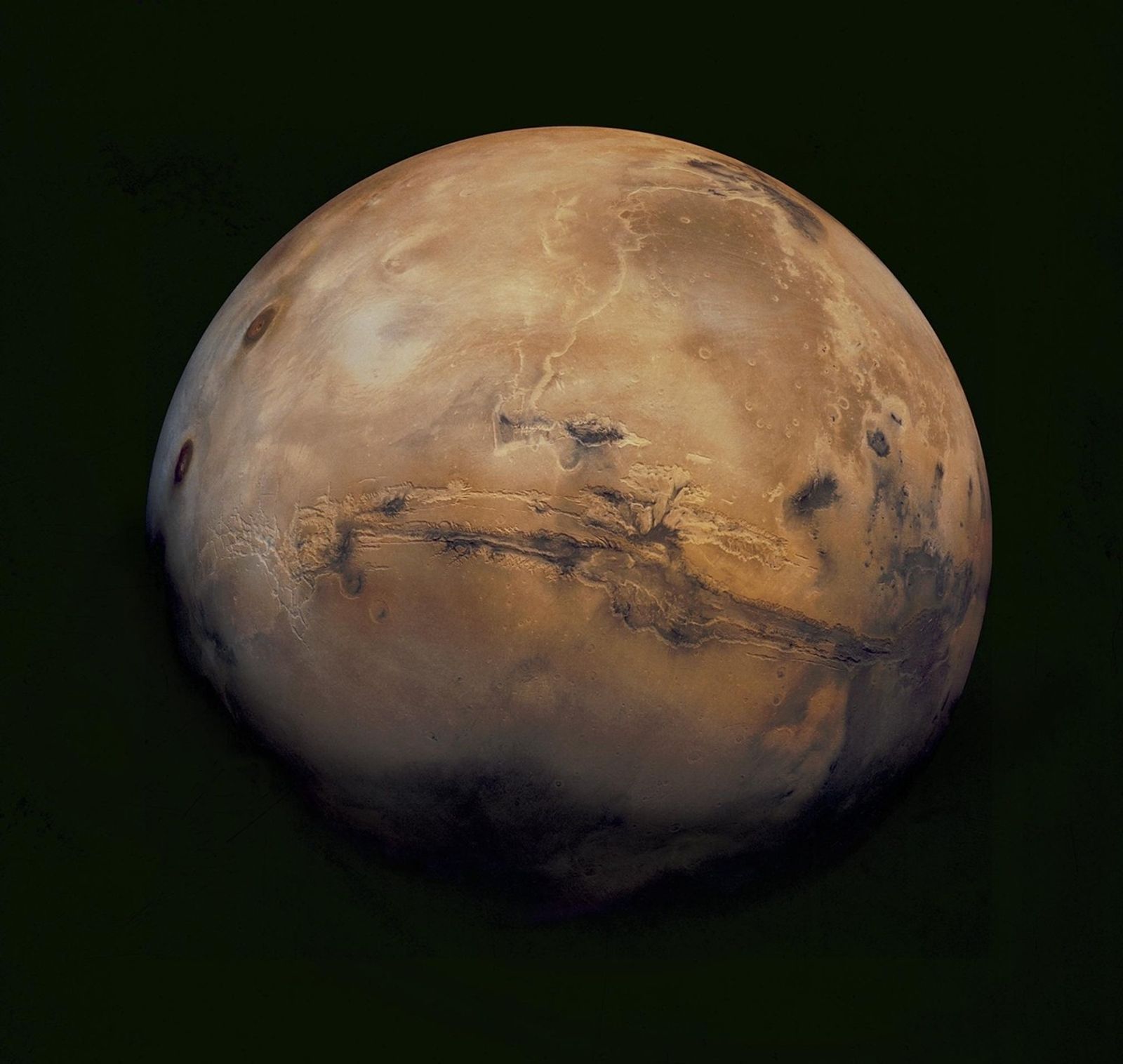
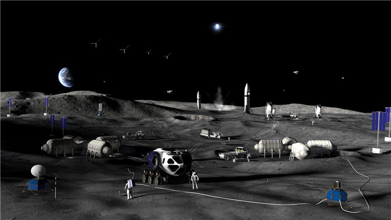
    By advancing vital techniques for measuring our planet’s surface composition, resources, and hazards, the EAGLE program addresses critical needs in Earth observation, with technologies that can also transfer to planetary exploration, where they’ll serve as pathfinders for future missions to the Moon and Mars.

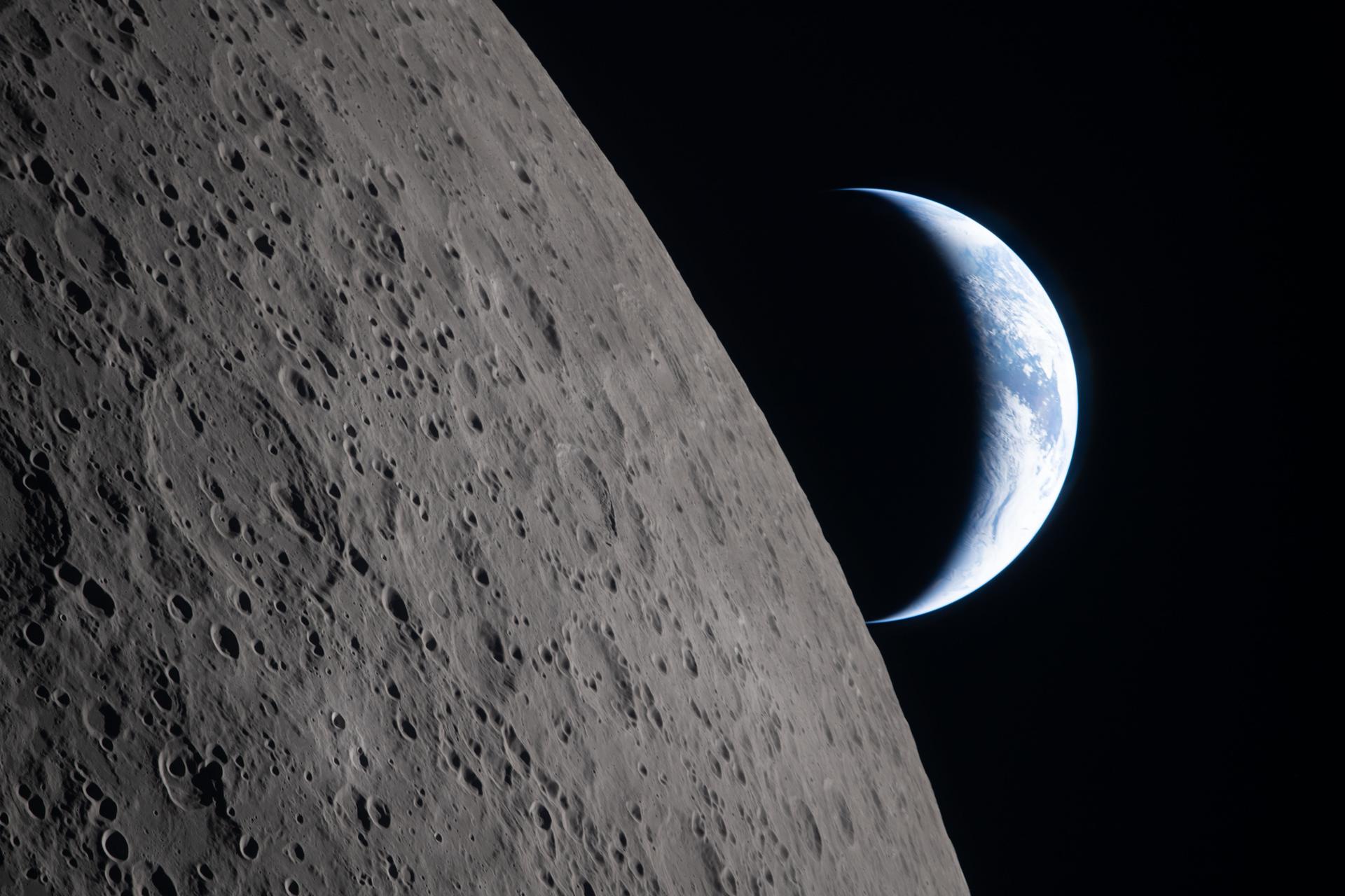
    015B0489.NEF
    As the Artemis II crew came close to passing behind the Moon and experiencing a planned loss of signal, they captured this image of a crescent Earth setting on the Moon’s limb on April 6, 2026.
    NASA
Featured Video

EAGLE

NASA unveiled the EAGLE program as one part of its “Ignition” event on March 24, 2026, when it announced a wide-ranging series of transformative agencywide initiatives. With EAGLE (the Explorer for Artemis Geology, Lunar, and Earth missions), NASA will deploy breakthrough hyperspectral images across Earth with later missions anticipated for the Moon and Mars in rapid succession. On Earth they’ll identify critical minerals for national security, enable precision agriculture, and support disaster response. On Earth and at Mars they will locate critical minerals and resources such as ice for propellants, rare-earth elements for technology, and construction materials for habitats.

EMIT

EMIT (Earth Surface Mineral Dust Source Investigation) measures the mineral composition of Earth’s dust source regions, to help scientists understand how they heat or cool our planet.

Learn More About EMIT

ECOSTRESS

ECOSTRESS (ECOsystem Spaceborne Thermal Radiometer Experiment on Space Station) is accurately measuring the temperature of plants on Earth.

Learn More About ECOSTRESS

The post EAGLE appeared first on NASA Science.

💾

Join us for continuing coverage as our leaders discuss the agency's implementation of the National Space Policy and our plans to advance science and discover...
  •  

It Appears the Reports of Venus’s Death Were Greatly Exaggerated—New Models Suggest the Planet is Still Geologically Active

New computer models of Venus’s surface features, including ridges likely caused by volcanic activity, have determined that the second rock from the Sun remains geologically active to this day.

The ETH Zurich research team behind the new Venusian models, which suggest that Venus may still have active volcanoes, said their findings could help planned NASA and ESA missions select the most promising targets. The new models could also help in the search for rocky planets outside of our Solar System, including those that may support life.

Venus Previously Considered Geologically Dormant for Over 100 Million Years

Venus has long fascinated planetary scientists due to its similarities. For example, the planet’s mass and circumference make it roughly 95% the same size as Earth overall. However, although Venus’ elliptical orbit brings it closer to Earth than any other planet in the Solar System, its extreme surface temperatures and toxic atmosphere make it inhospitable to life as we know it.

Ground and space observations have detected rift valleys on Venus’s surface, which the research team notes indicate tectonic activity. Some can measure up to 10,000 kilometers and resemble the longest ridges on Earth. Although the timing of Venus’ rift formations remains uncertain, the team said most scientists have typically considered the planet to be geologically dormant. Some estimates have put their formation more than 100 million years ago.

Curious if data captured by space and ground-based observatories could provide enough information to answer the timing question, a research team from ETH led by Taras Gerya, a Professor of Geodynamics at the Department of Earth and Planetary Sciences, decided to plug that data into computer models. According to their results, the reports of Venus’ demise may have been greatly exaggerated. 

Models Reveal Planet Likely Supports Active Volcanoes

Working under Professor Gerya’s supervision, Master’s candidate and lead author of the paper detailing the team’s work, Xi Yang, and colleagues employed computer models to simulate the planet’s rifts in high-resolution and 3D. The team said these models allowed them to “accurately replicate these rift structures” in a level of detail never achieved. The data also allowed them to perform simulations to best determine how they originally formed.

Critically, the team notes that earlier attempts to model Venus’ tectonic history and potential ongoing activity had been mostly two-dimensional. Yang’s team also said those earlier models had relied on “simplified material assumptions” that his team was able to expand upon.

After completion, the models yielded several compelling results. First, they indicated that the broad ridges geologists call ‘rift flanks’ form along the edges of rift valleys at a time when the rifts are still “geologically young.” Specifically, the team’s models suggested that these flanks formed when Venus was still either actively moving or had only recently stopped moving.

A closer look at the simulations also suggested that these geological rifts open over a much shorter time scale than previously assumed, with an estimated rate between 3 and 10 centimeters per year. The models also indicated that rift flanks tend to flatten very quickly once the movement ends.

“The older the rift system, the less steep and narrow its flanks,” they explained.

A comparison to erosion patterns on Earth also supported a more recent time frame for the rift flank formations spotted on the Venusian surface from the Magellan probe during its 1990s mission. The team said that these formations and their models suggest that “Venus remains an active planet with a more dynamic interior than had been previously believed.”

“Venus remains geologically “alive” and even hosts active volcanoes,” they explained.

Planned NASA & ESA Missions Could Confirm Models

When discussing the implications of their work, Professor Gerya said the findings “help us to better assess the tectonic activity on Venus.” The team noted that their models could also guide future missions by pinpointing potentially active regions worthy of closer examination.

The ETH team said their study also has planetary formation implications, particularly for rocky planets like Venus and Earth. Such data could prove valuable in the search for rocky exoplanets, including the type that may host life.

Moving forward, the study authors noted that NASA and the European Space Agency (ESA) are actively preparing “multiple missions” to explore Venus in further detail. ETH geophysics professors Paul Tackley and Gerya, and their team of collaborators, are already participating in ESA’s EnVision mission.

The work includes developing instruments for the orbiter to analyze the surface in greater detail. Scheduled for launch in the early 2030s, the team said that EnVision will explore the planet more thoroughly than previous efforts “from its core to its upper atmosphere.”

The study “Recent active rifting on Venus revealed by wide rift flank uplifts” was published in Nature Geoscience.

Christopher Plain is a Science Fiction and Fantasy novelist and has spent the last six years as Associate News Editor and Head Science Writer at The Debrief. Follow and connect with him on X, learn about his books at plainfiction.com, or email him at christopher@thedebrief.org.

  •  

A new method to detect volcanic eruptions

Many volcano scientists spend their time monitoring volcanoes to predict if, or when, they’ll next erupt. The challenge for these scientists is to forecast the exact probability of an eruption and the moment it will occur. 

To address this problem, a team of researchers developed an early-detection system to determine when to issue alerts about volcanic eruptions. Their motivation was that previous alert systems weren’t accurate enough because they couldn’t detect underground volcanic processes that occur right before an eruption. 

From 2014 to 2023, the researchers conducted a series of tests to accurately detect temporary, low-frequency vibrations using an instrument called a seismometer. The researchers focused on these transient signals because they come from earthquakes and other ground phenomena, which scientists often rely on to predict volcanic eruptions. These phenomena include ground tilting caused by fracturing from the movement of magma and volcanic gases. The scientists named these signals the “Jerk” signals because they occur due to sudden movements. 

The team set up their experiment at Piton de la Fournaise, a volcano at La Réunion Island off the east coast of Madagascar. They discovered the Jerk signals by detecting and analyzing mysterious short-term signals from existing and experimental seismic data. During real-time experiments, they detected signals 8 kilometers (about 5 miles) from the volcano at the Rivière de l’Est seismic station. These signals resulted from changes in ground elevation as magma moved, and they preceded eruptions by minutes and sometimes hours. 

The researchers measured the Jerk signals in units of newton-meters per second, which conveys how fast physical changes occurred in or around the volcano. In addition to real-time experiments, the team checked the Jerk signals’ accuracy by analyzing the station’s past data to determine when these signals would have occurred before an eruption.

To avoid false alarms during their experiments, the researchers needed to distinguish between the signal amplitudes of ocean tides and the transient Jerk signals. So, they used computational software to predict the signals from ocean tides. This was necessary because the instruments that record ground phenomena are also sensitive to tidal movements.  

The Jerk system sent its first automatic alarm in June 2014, 1 hour before the first volcanic tremor, signalling that magma was at the Earth’s surface. The team recorded the last signal in their study on July 2, 2023, 40 minutes before the eruption, at a slow 1.5 newton-meters per second. From 2014 to 2023, other Jerk detections occurred between a few minutes and up to 8 hours before an eruption.

To further assess the strength of the Jerk signals, the team examined previous eruption records at Piton de la Fournaise. They found that for the 24 eruptions between 1998 and 2010, a Jerk alarm would have gone off 83% of the time. Of the 48 eruptions that occurred between 1998 and 2023, including the eruptions during their real-time tests, about 42 Jerk alarms would have occurred. However, they found that the Jerk signals were more accurate during their real-time analysis than they would have been for the eruptions 20 years earlier. 

Although the researchers successfully detected pre-eruption signals, they noted that the Jerk alarms occasionally arrived too late due to the data processing time, which takes at least 10 to 15 minutes. They reported 2 late alarms: one on June 11, 2019, and the other on February 10, 2020. Therefore, after 10 years of tracking the Jerk signals, the team evaluated their success rates at 22 successful alarms out of 24 eruptions, for a 92% positive rate. 

Before using the Jerk signals, many volcanologists struggled to predict the exact moment a volcano erupts. The team concluded that, in addition to the usual methods for detecting pre-eruption earthquakes, observatory scientists could now use Jerk signals to confidently notify authorities in advance of volcanic eruptions, so they can alert people living near volcanoes worldwide. 

The post A new method to detect volcanic eruptions appeared first on Sciworthy.

  •  

Shadowy tendrils of ancient lava have scarred a dark volcano next to a 'skull' in the Sahara — Earth from space

QUICK FACTS

Where is it? Toussidé volcano, Chad [21.03731548, 16.47357325]

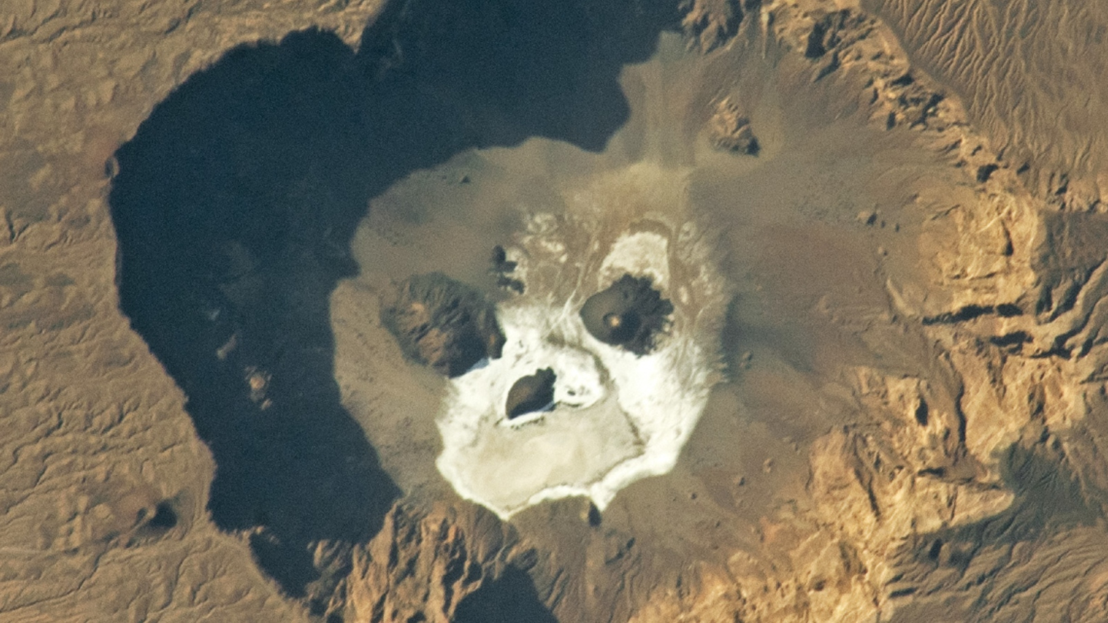
What's in the photo? The petrified remains of ancient lava and a skull-like caldera

Who took the photo? An unnamed astronaut on board the International Space Station

When was it taken? Sept. 23, 2019

This eye-catching satellite snap shows off a sprawling mass of petrified lava surrounding the jet-black slopes of a potentially dangerous volcano in the heart of the Sahara. A smaller volcanic "skull" lurks near the shadowy peak's base.

Toussidé (also known as Tarso Toussidé) is a "potentially active" stratovolcano located within the Tibesti Mountains, which cover around 40,000 square miles (100,000 square kilometers) of northern Chad and southern Libya. The dark peak stands 10,712 feet (3,265 meters) above sea level, making it the second-tallest mountain in the Tibesti region.

The name Toussidé roughly translates to "which killed the local people with fire" in the language of the nearby Indigenous people, hinting at a destructive and deadly history. However, according to the Smithsonian Institution's Global Volcanism Program, there is no evidence that the volcano has erupted during the Holocene — the current geological epoch, which began around 12,000 years ago. It is unclear if it has actually killed anyone.

The dark blob surrounding the volcano is known as a massif. It is made up of layers of overlapping magmatic rock left by multiple ancient lava flows that effusively erupted, or slowly poured from, the volcano's summit.

The shadowy structure, which is up to 20 miles (32 kilometers) across at its widest point, stands out against the surrounding sand-covered plateau, which has been carved into a network of crisscrossing canyons by eons of wind blasting, according to NASA's Earth Observatory.

A close-up aerial shot of the massif and the Trou au Natron caldera

The massif surrounding Toussidé is made of overlapping lava flows. If you look closely at this image, you can see how they criss-cross over one another. The Trou au Natron caldera is also more clearly visible in this photo, which was captured by the European Space Agency's Copernicus satellite in September 2021. (Image credit: ESA/Copernicus)

Just southeast of the massif (in the upper right of the photo), there is a small, white circle containing several dark patches. This is Trou au Natron — a roughly 3,300-foot-deep (1,000 m) volcanic crater, or caldera, which looks eerily like a giant skull when viewed directly from above.

The cranium-like caldera likely formed during an explosive eruption more than 120,000 years ago. It was once filled with a giant salt lake that was home to ancient algae and other microorganisms. When the lake dried out, around the start of the Holocene, the receding water left behind a thick layer of white salt surrounding a pair of eyelike volcanic cones.

Toussidé is one of the youngest mountains in the Tibesti range, which formed by similar effusive eruptions long before the stratovolcano was born. The entire region likely once matched the massif's dark hue before being relentlessly bombarded by sand and wind. In another 100,000 years or so, the massif may blend in with the surrounding plateau, according to the Earth Observatory.

A photo of the Trou au Natron caldera taken from the crater rim, showing off its salty white floor

Trou au Natron's salty white floor and volcanic cones make it look eerily like a skull when viewed from above. The dark slopes of Toussidé can also be seen in the background of this image. (Image credit: Gerhard Holub/Wikimedia)

While the shadowy volcano has remained dormant for several millennia, it occasionally puffs out steam from small vents, or fumaroles, near its summit, suggesting that it is still technically active, according to the European Space Agency. However, geologists have not properly assessed its eruptive potential.

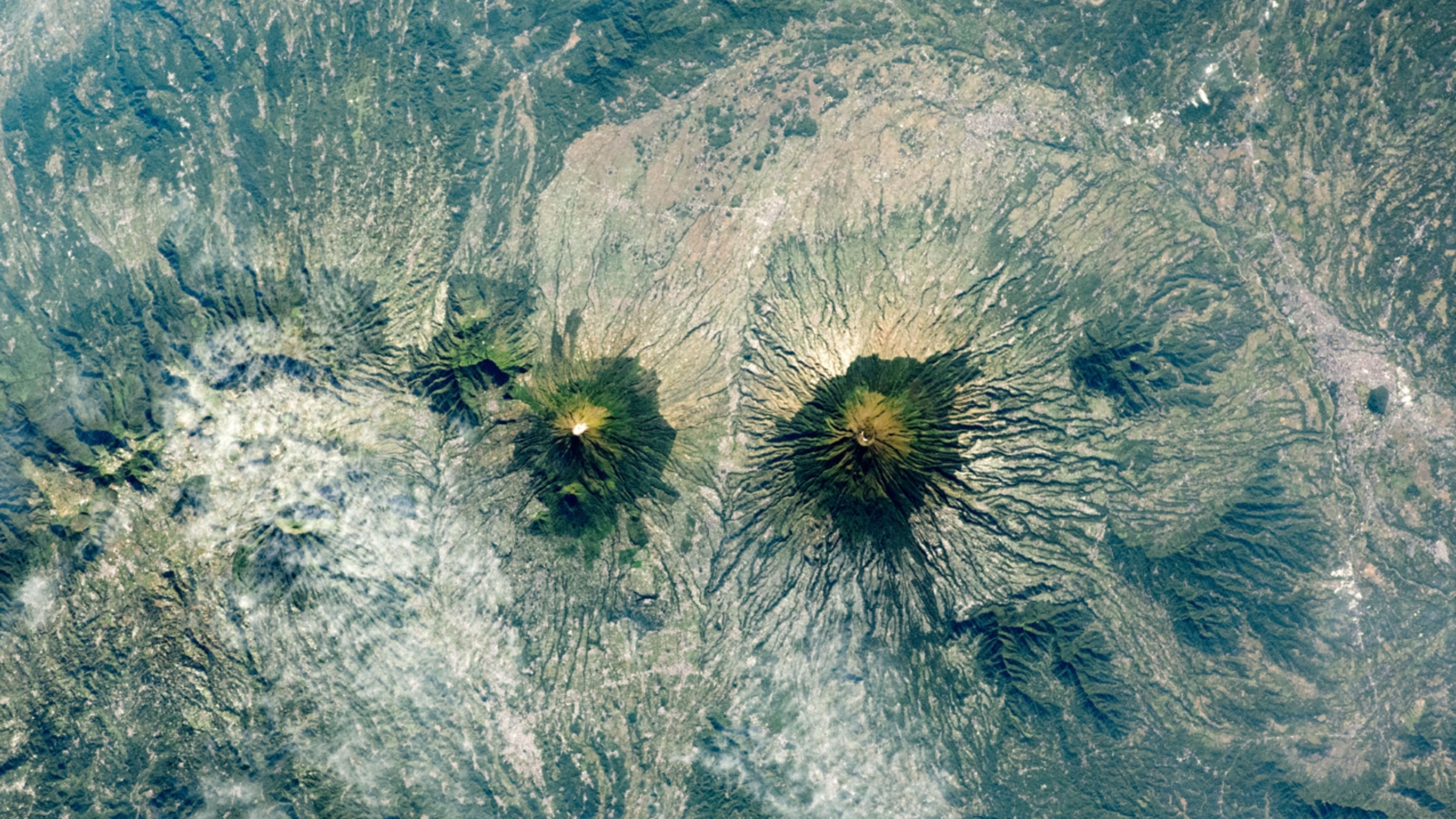
An astronaut photo of two near-identical volcanoes standing side-by-side on Indonesia's Java Island.Indonesia's 'Twin Peaks' volcanoes

A 2021 astronaut photo shows the surprising similarities between Mount Sundoro and Mount Sumbing, which lie at the heart of Java, Indonesia.

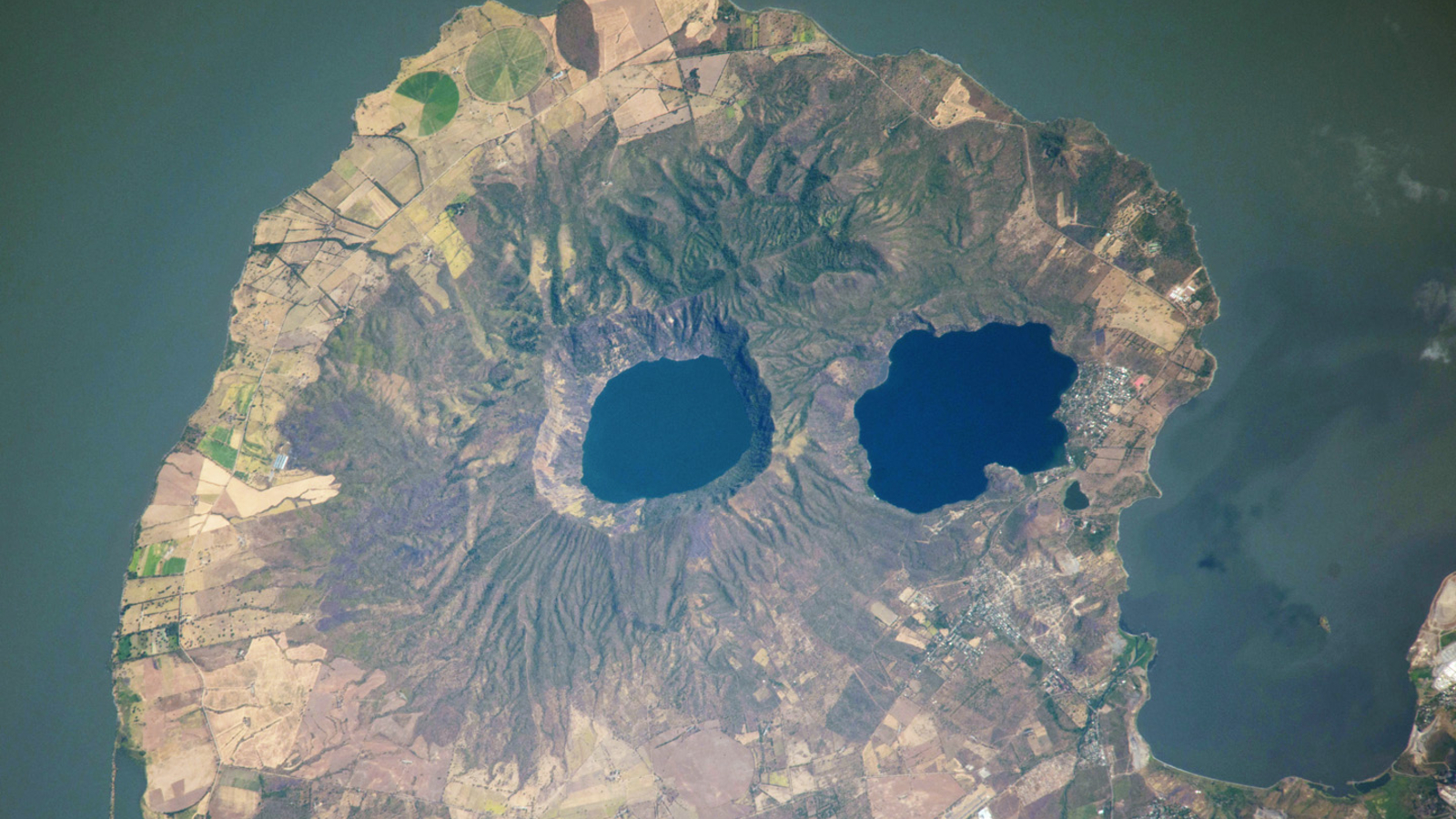
A satellite photo of a rounded peninsula in a lake, with two eye-like lakes at its centerVolcanic 'googly eyes' stare into space

A 2014 astronaut photo shows a pair of volcanic lakes appearing to stare up into space from the Chiltepe Peninsula of Nicaragua's Lake Managua. These "eyes" and "skull" were created by violent eruptions thousands of years ago.

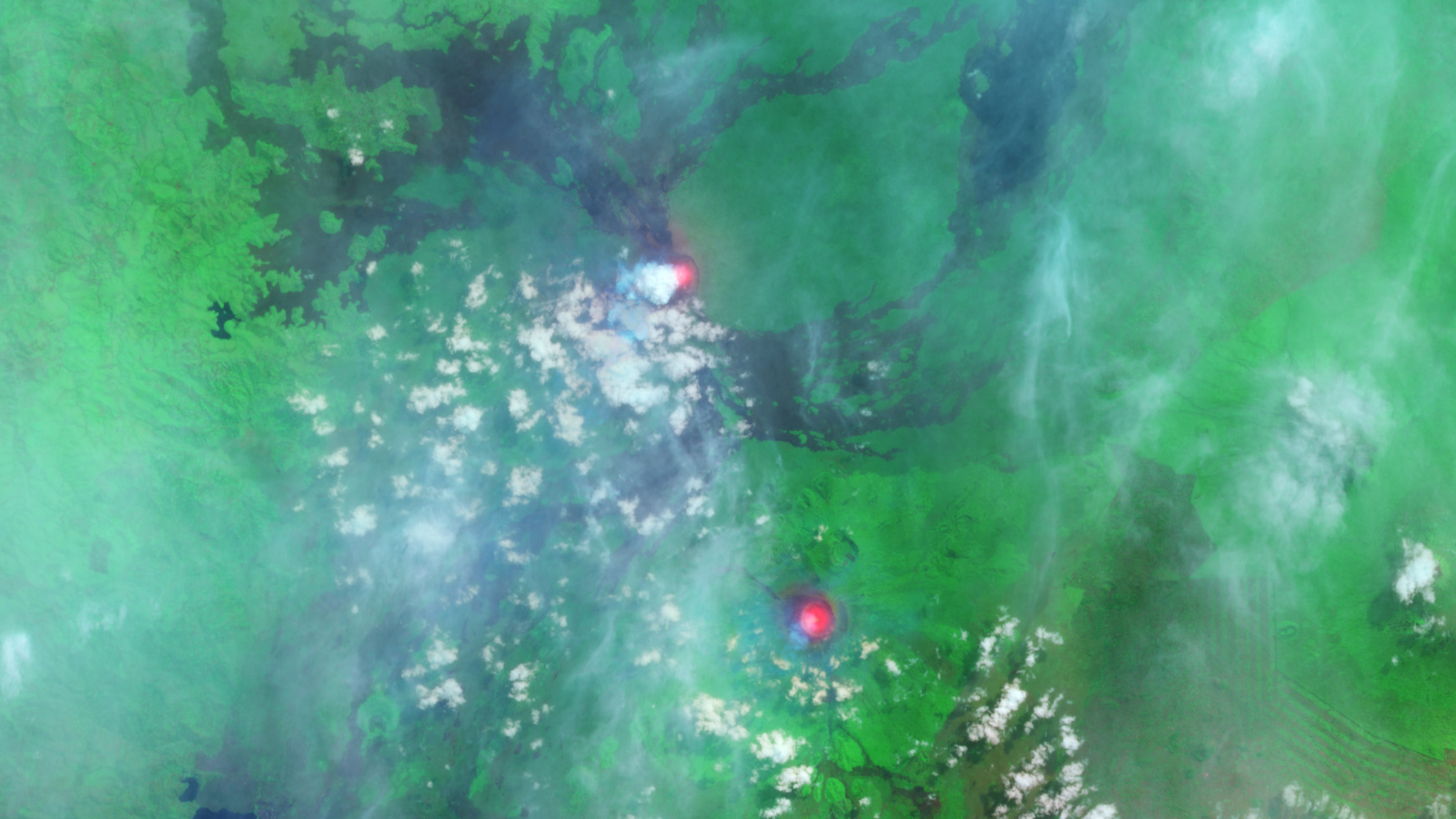
A satellite photo showing two bright red spots in a green landscapePair of 'glowing' lava lakes in Africa

This false-color satellite photo from 2014 shows the immense heat emanating from lava lakes at the summits of a pair of simultaneously erupting volcanoes in Congo.

  •  

Bizarre 'bull's-eye' cloud rings appear above erupting volcano on Atlantic island — Earth from space

QUICK FACTS

Where is it? La Palma, Canary Islands, Spain [28.62120467, -17.89960469]

What's in the photo? Concentric cloud rings over an erupting volcano

Which satellite took the photo? NASA's Aqua satellite

When was it taken? Oct. 1, 2021

This eye-catching satellite snap shows off a "bull's-eye-like" set of concentric cloud rings that formed above an erupting volcano on La Palma in Spain's Canary Islands.

The eruption, the first on La Palma in 50 years, began Sept. 19, 2021, when a fissure opened up on the western flank of Cumbre Vieja — a volcanic ridge that runs through the southern half of the island — and spewed massive lava fountains into the air. The violent outburst created a 660-foot-tall (200 meters) vent, dubbed Tajogaite, which continued to slowly pump out lava until Dec. 13, 2021.

The molten rock flowed into the Atlantic Ocean in a giant "river of fire" that destroyed a town and unleashed deadly gases that are still causing issues for locals today, Live Science previously reported.

The concentric cloud rings in this image are made up of steam, smoke and ash ‪—‬ known as an eruption plume ‪—‬ that rose above Tajogaite for weeks.

Normally, such a plume would continue to climb into the cold air of the stratosphere — the second layer of the atmosphere, which extends from around 6 to 31 miles (10 to 50 kilometers) above Earth's surface. However, when this image was captured, a rare "temperature inversion" created a layer of elevated warm air that acted as a lid, preventing the plume from rising and forcing it to spread outward, according to NASA's Earth Observatory.

Massive plumes of lava shoot out of the ground in La Palma

At the start of the eruption, giant fiery fountains shot out of the ground near the town of Todoque, which was destroyed by the resulting lava flows. (Image credit: DESIREE MARTIN/AFP via Getty Images)

The trapped plume created concentric rings that formed from the natural ebb and flow in the intensity of volcanic activity. This pulse in the emissions given off by the volcano is visible in time-lapse footage captured by the Izaña Atmospheric Research Center on Tenerife, another Canary Island.

The official name for this type of concentric cloud formation is a "gravity wave," according to the National Weather Service. However, the formation has nothing to do with gravity, and it's completely separate from the ripples in space-time called gravitational waves.

"River of fire"

During the 85-day eruption, around 7.1 billion cubic feet (200 million cubic meters) of lava — reaching temperatures of up to 2,000 degrees Fahrenheit (1,100 degrees Celsius) — seeped from the ground.

This molten rock traveled around 4 miles (6.4 kilometers), destroying around 3,000 buildings in the town of Todoque, before falling into the Atlantic Ocean in a fiery waterfall. The estimated damage exceeded 700 million euros ($780 million), according to the Spanish newspaper El País.

A satellite photo showing a glowing river of lava moving from a volcano to the sea in La Palma

This photo, also captured Oct. 1 by the European Space Agency's Copernicus satellite, shows the infrared heat radiating from the lava flow as it flows into the sea to create new land. (Image credit: ESA/Copernicus)

Where lava fell into the sea, around 4.6 million square feet (430,000 square meters) of new land was created. The reaction between the molten rock and the water also released high levels of volcanic gases, such as sulfur dioxide and hydrogen cyanide.

At least one person, a 72-year-old man who returned to his home prematurely, is believed to have died from inhaling these toxic fumes, according to AFP. Thousands of wild and agricultural animals are also thought to have been killed by the gases.

The damage was "truly terrible," Marie Edmonds, a volcanologist at the University of Cambridge, told Live Science at an event on La Palma in April 2025. "Most shocking to me is the closeness of the vent to the communities," she added when describing what it was like to visit the area. "It must have been absolutely terrifying to see the eruption so close."

An astronaut photo of two near-identical volcanoes standing side-by-side on Indonesia's Java Island.Indonesia's 'Twin Peaks' volcanoes

A 2021 astronaut photo shows the surprising similarities between Mount Sundoro and Mount Sumbing, which lie at the heart of Java, Indonesia.

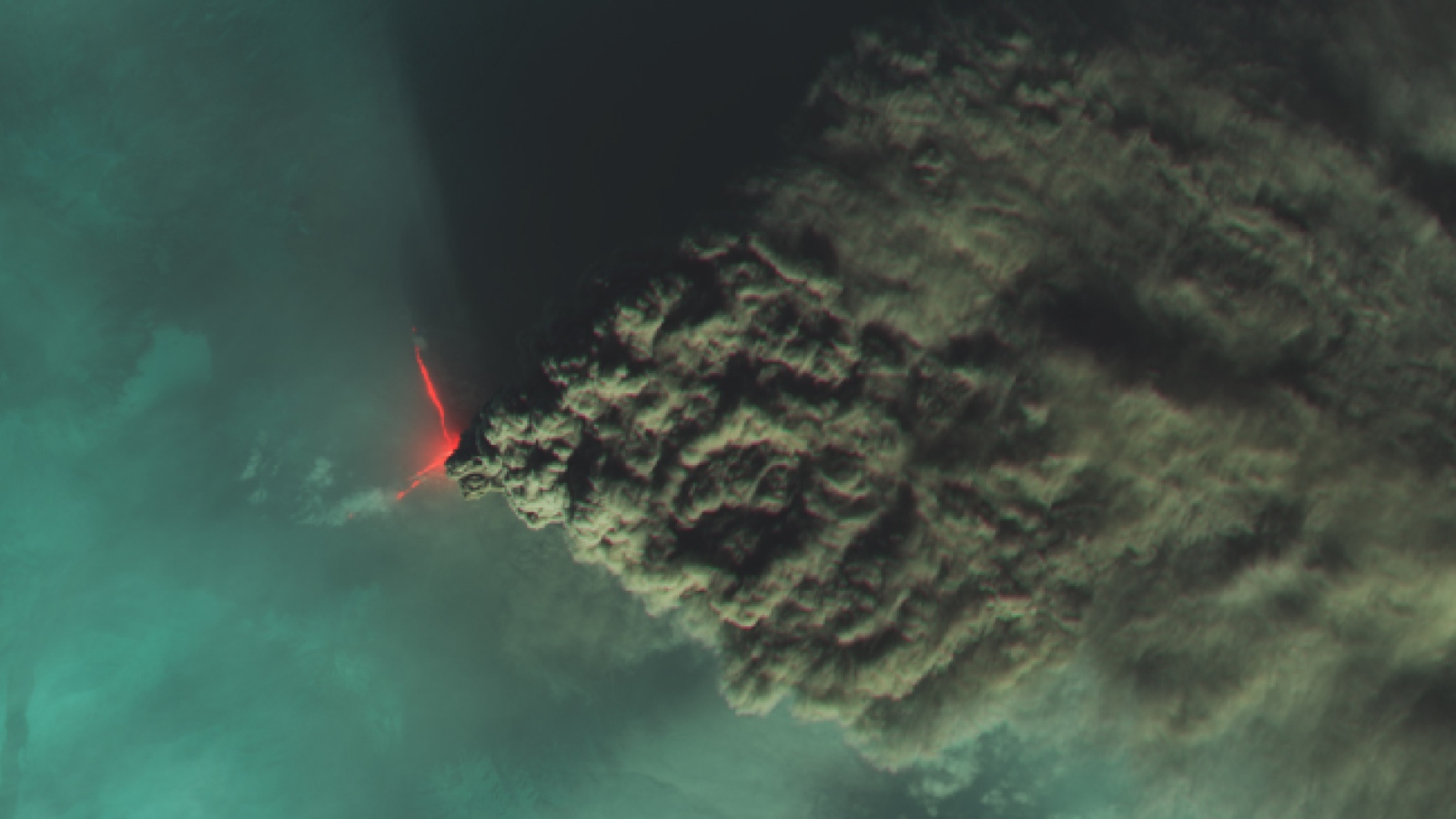
A dark cloud of smoke flows from a lava flow on a volcanoRussian volcano sprouts 'devil horns'

A false-color satellite photo from 2023 shows a devilish pair of lava flows and an enormous plume of smoke spewing from Klyuchevskoy, the tallest volcano in Europe and Asia.

A satellite photo of a rounded peninsula in a lake, with two eye-like lakes at its centerNicaragua's volcanic 'googly eyes'

A 2014 astronaut photo shows a pair of volcanic lakes appearing to stare up into space from the Chiltepe Peninsula of Nicaragua's Lake Managua. These "eyes" and "skull" were created by violent eruptions thousands of years ago.

  •  

Indonesia's near-identical, 'Twin Peaks' volcanoes form striking mirror image — Earth from space

QUICK FACTS

Where is it? Central Java, Indonesia [-7.34485373, 110.02748950]

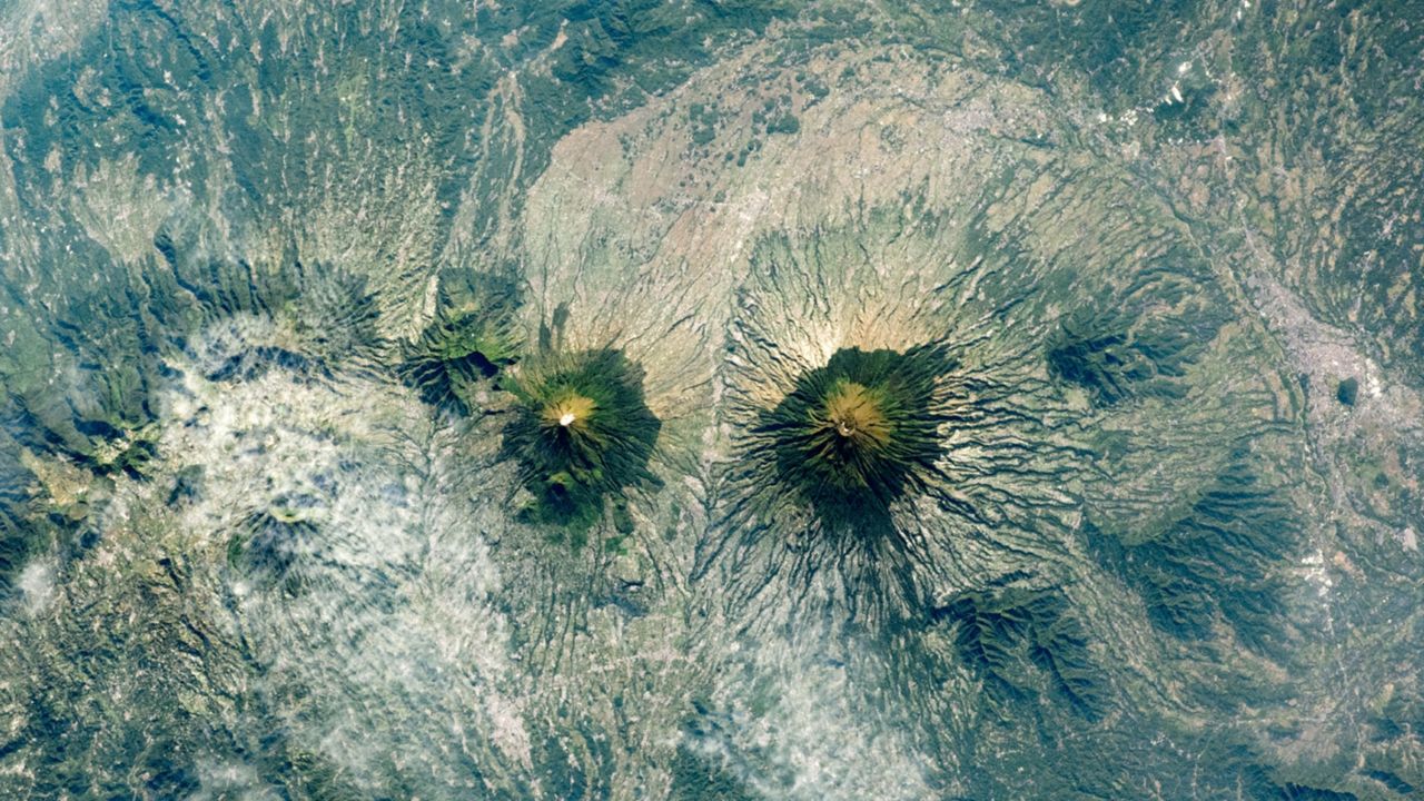
What's in the photo? Mount Sundoro (left) and Mount Sumbing (right)

Who took the photo? An unnamed astronaut on board the International Space Station

When was it taken? May 10, 2021

This awesome astronaut photo shows the striking symmetry of "twin" stratovolcanoes at the heart of Java, Indonesia. The parallel peaks are an eye-catching reminder of the region's extreme tectonic activity.

Mount Sundoro (also known as Sindoro or Sindara) on the left of the image, reaches a maximum height of 10,331 feet (3,149 meters). Its partner, Mount Sumbing, sits to the southeast (on the right of the image) and is slightly taller, at 11,056 feet (3,370 m) above sea level.

Both are considered active. Although Sumbing has not erupted since 1730, Sundoro has blown its top more recently, in 1971, and has experienced seismic activity as recently as 2012, according to the Smithsonian Institution's Global Volcanism Program.

The volcanoes' peaks are just 7.5 miles (12 kilometers) apart. A raised ridge with a major highway runs perpendicularly between them.

Each volcano also has a smaller, secondary cone on its flank left over from previous eruptions (to the upper left of Sundoro and the upper right of Sumbing in the image), and their orientations make the volcanoes look like mirror images of each other.

An aerial photograph showing Sundoro and Sumbing side-by-side with near-identical profiles

The two volcanoes also have strikingly similar profiles when viewed from ground level. (Image credit: Rizky Panuntun via Getty Images)

The slopes of both cones are covered with rings of dark-green forest that sharply terminate at their bases. The volcanic soils surrounding the mountains are excellent for growing crops such as rice, corn, coffee and sugarcane, which has led to the deforestation of their surroundings, according to NASA's Earth Observatory.

This matching coloration accentuates the similarities between the pair, especially when viewed from above.

One of the few differences between Sundoro and Sumbing is that the latter volcano has a sizable crater at its summit, which was carved out by the 1730 eruption. As a result, the larger volcano appears to have a darker point at its top.

The volcanoes are commonly referred to as "twins," due to their near-identical profiles. However, local people often call them "husband and wife," according to a local travel site. In this narrative, Sumbing is considered the husband due to its slight height advantage and "more masculine" profile.

A photo of Mount Sumbing showing farmers using the fields around its base

The land surrounding Mount Sundoro and Mount Sumbing (photographed) is rich with volcanic ash, making it ideal for growing various crops. (Image credit: Wikimedia)

Sundoro and Sumbing are part of the wider Dieng Volcanic Complex, which consists of around 20 volcanic cones stretching across central Java. Indonesia is also positioned along the "Ring of Fire," a roughly horseshoe-shaped arc of volcanoes that runs along a series of tectonic plate boundaries encircling the Pacific Ocean.

Over the past few years, there have been a number of significant eruptions in Indonesia, including a pair of violent blasts at Mount Lewotobi Laki-laki, on Flores Island, in 2024 and 2025. As of June 2026, there are seven ongoing eruptions in Indonesia — the most of any nation.

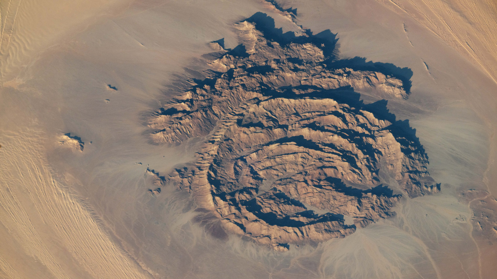
An astronaut photo of the massifRocky rings wear a 'magma hat'

A 2025 astronaut photo shows a massif made of concentric mountain ridges in the Libyan desert. The rocky walls contain ancient artworks.

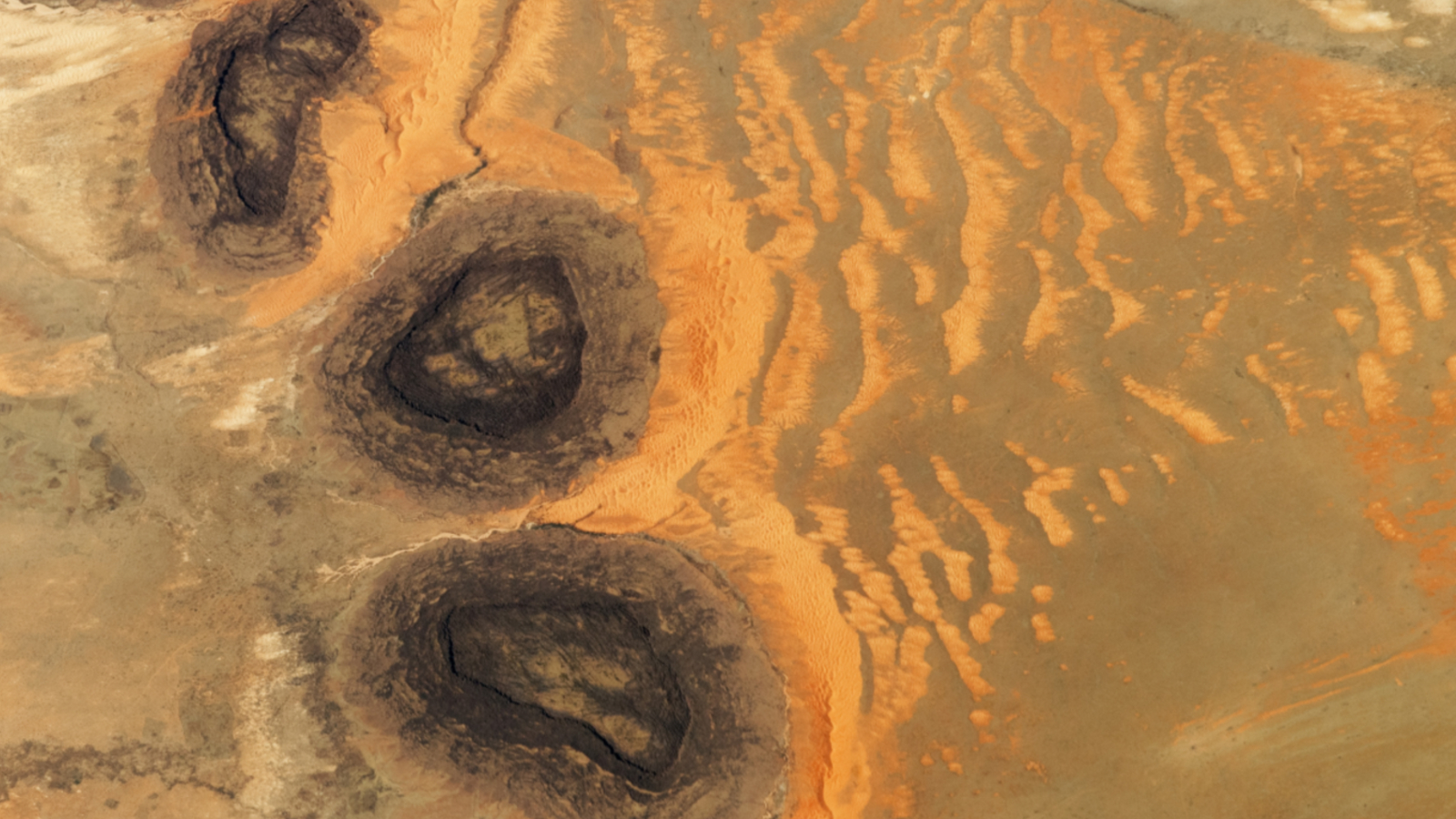
An astronaut photo of three dark mesas, partially surrounded by orange sand dunesTrio of black mesas in Sahara

A 2023 astronaut photo shows three dark hills, or mesas, towering above southern Mauritania. The structures are remnants of a single Paleozoic-era formation.

An astronaut photo of a volcanic caldera with a skull like shapeGlowering 'skull' in volcanic pit

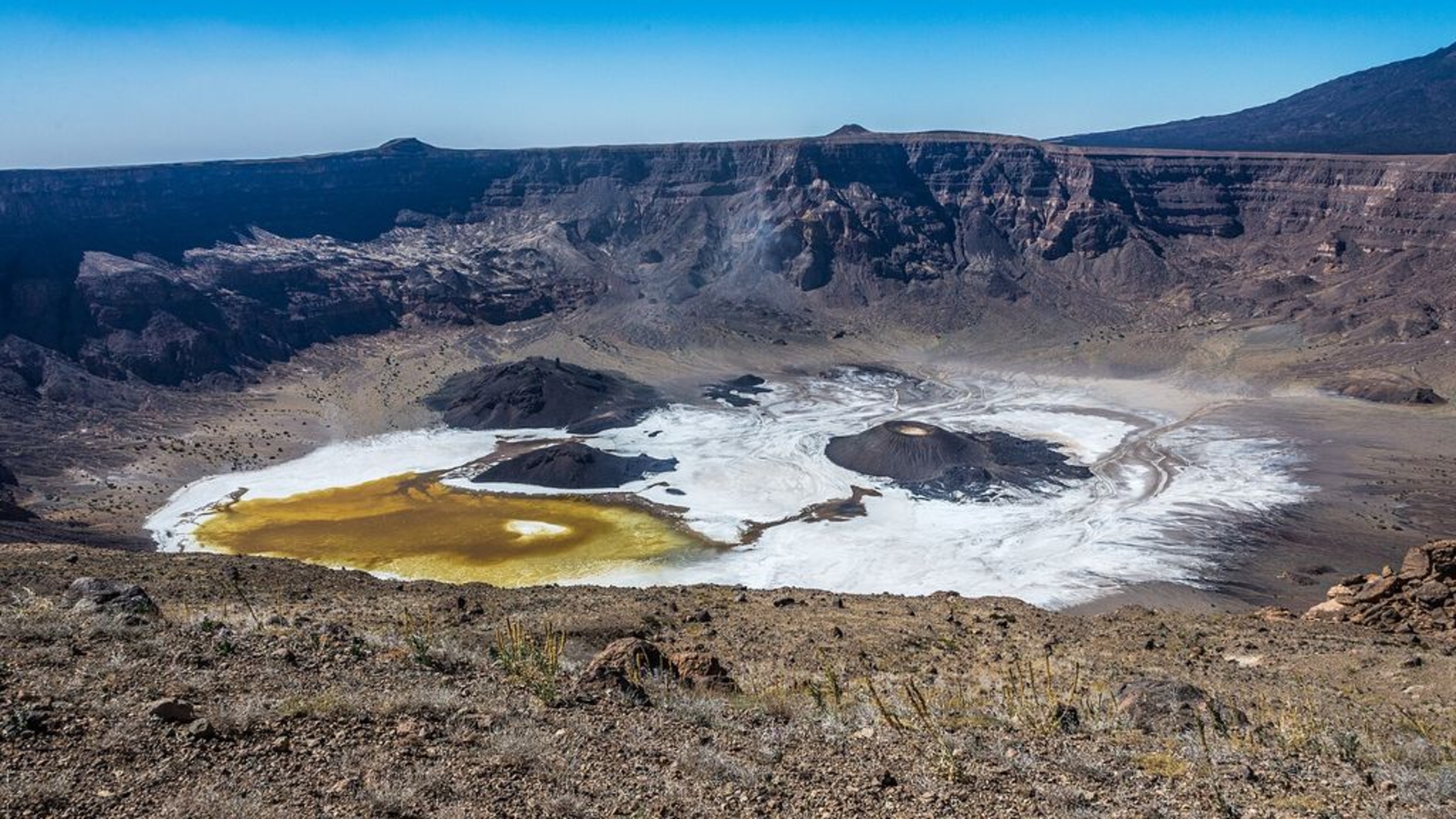
A 2023 astronaut photo shows off an unusual cranium-like structure appearing to stare up into space from the floor of a large volcanic caldera in Chad.

  •  

Pumice Rafts Encroach on Admiralty Islands

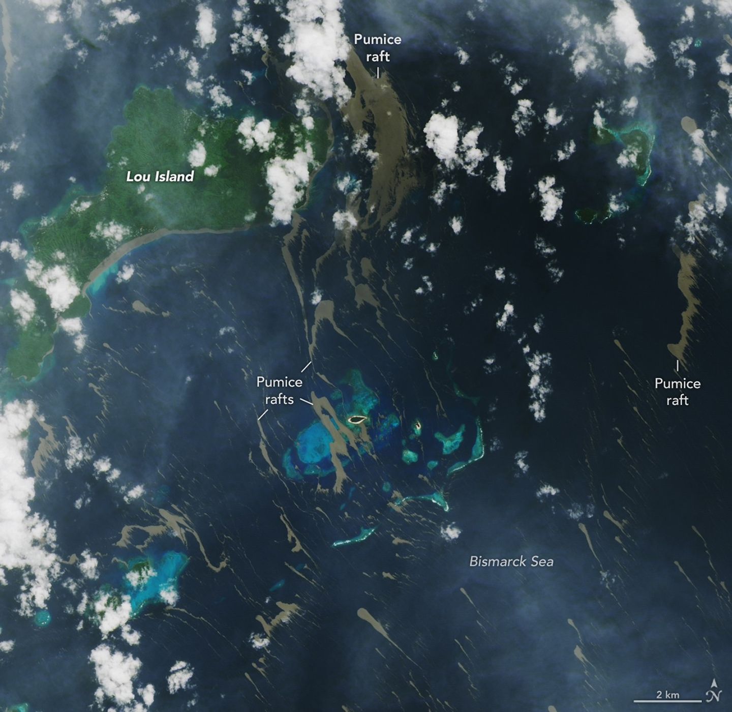
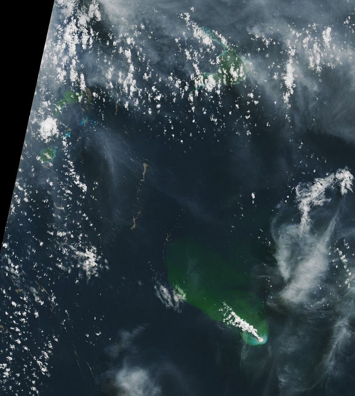
Bands of tan-colored pumice float on the Bismarck Sea near several islands and bright-blue shallow areas. The material lines the southern coast of the largest island.
June 4, 2026

On May 8, 2026, satellites detected signs of an unexpected submarine volcanic eruption in the Bismarck Sea near the islands of Papua New Guinea. Over the next several weeks, plumes of steam and ash streamed over the sea, and areas of discolored water surrounded the eruption site. Relatively little is known about the ocean floor in this area or the volcanic feature that is presently erupting. But experts think the new activity, ongoing as of mid-June, might be occurring along the Titan Ridge and has the potential to form an ephemeral new island.

Despite the unknowns, the effects of the eruption became unmistakable for some communities in Papua New Guinea’s Admiralty Islands. In early June, rafts of pumice drifted northwest from the eruption site and clogged up coastlines on several of the islands. Bands of the buoyant volcanic material are visible in this image, acquired with the OLI (Operational Land Imager) on Landsat 8 on June 4, as they drifted with surface currents on the Bismarck Sea.  

Several days after the image, news outlets reported acute impacts from thick masses of pumice reaching coastal areas. Communities on Lou Island and Baluan Island, to the south, were described by officials as among the worst affected, according to reports from local media. Outlets reported that a layer of pumice up to several meters thick blanketed the shore, cutting off access to the water. The volcanic fragments similarly choked the coast and key waterways around the much larger Manus Island, about 125 kilometers (80 miles) northwest of the volcano and out of frame.

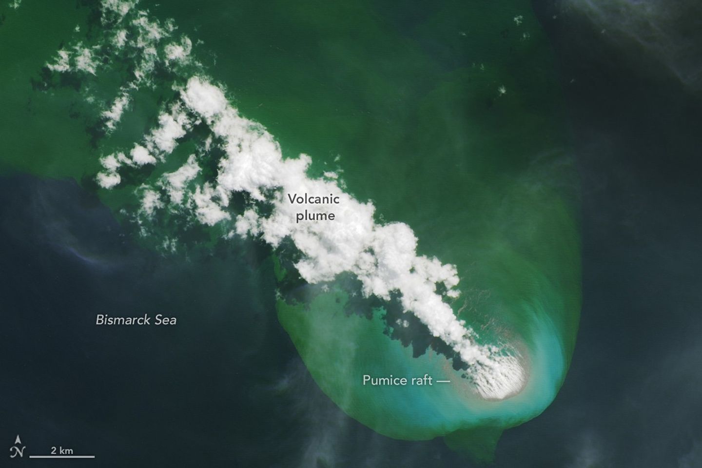
A bright-white volcanic plume and an area of greenish water extend to the northwest from an underwater eruption.
A submarine volcano produces a plume of discolored water and vents steam into the air in an image acquired on June 4, 2026, with the OLI (Operational Land Imager) on Landsat 8. Pumice is visible near the base of the plume and exhibits a thermal signature in infrared imagery.
NASA Earth Observatory/Lauren Dauphin

Studies of past pumice raft events have found that the material can remain afloat for months to years before sinking out of satellite view. Larger rafts can form with the help of ash, which serves to “weld” together fragments of the porous rock, said Jim Garvin, the chief scientist at NASA’s Goddard Space Flight Center, noting this process occurred during the 2022 eruption of Hunga Tonga-Hunga Ha‘apai. “These masses can pile up around erupting vents to protect the eruption centers and produce ephemeral new lands in some cases,” he said. When adrift, such pumice platforms can act as floating homes for marine organisms—from microalgae to bryozoans to barnacles—and enable them to disperse over long distances.

Though beneficial to life in some ways, the rafts can pose serious threats to humans and other species. Some of the larger fragments of pumice stack up to form ridges when they reach the coastlines of islands. Reports from Papua New Guinea highlight the disruptions to fishing, the transport of goods, and access to critical services that can occur when pumice accumulates along the coast.

Communities have expressed concerns over the pumice’s effects on marine ecosystems, as well. Researchers have noted that the sustained presence of pumice can block sunlight and may inhibit photosynthesis in seagrass and corals below, and the rocks may physically damage reef structures. In a review of the ecological effects of pumice reaching Japan’s coast in 2021, researchers noted the die-off of filter-feeding fish in fishery cages from ingesting pumice, warning that other wildlife may be harmed by mistakenly consuming the rocks.

New studies using an ensemble of orbital remote sensing platforms—including Landsat, hyperspectral instruments, and imaging radars—are tracking developments in this Bismarck Sea region, Garvin said. These observations can provide new perspectives on hazards as well as unique scientific opportunities for improved understanding of submarine eruptions.

NASA Earth Observatory images by Lauren Dauphin, using Landsat data from the U.S. Geological Survey. Story by Lindsey Doermann.

Downloads

Bands of tan-colored pumice float on the Bismarck Sea near several islands and bright-blue shallow areas. The material lines the southern coast of the largest island. A bright-white volcanic plume and an area of greenish water extend to the northwest from an underwater eruption.

June 4, 2026

JPEG (7.36 MB)

References & Resources

You may also be interested in:

Stay up-to-date with the latest content from NASA as we explore the universe and discover more about our home planet.

New Eruption in the Bismarck Sea

5 min read

Satellite imagery shows a surge of new volcanic activity in the ocean near Papua New Guinea.

Article

Home Reef Adds On

3 min read

The Tongan volcano expanded its mid-Pacific real estate during its latest eruptive phase.

Article

Restless Kīlauea Launches Lava and Ash

3 min read

Episode 43 of the Hawaiian volcano’s current eruption was marked by high lava fountains and widespread ash dispersal.

Article
  •  

Pumice Rafts Encroach on Admiralty Islands

Bands of tan-colored pumice float on the Bismarck Sea near several islands and bright-blue shallow areas. The material lines the southern coast of the largest island.
June 4, 2026

On May 8, 2026, satellites detected signs of an unexpected submarine volcanic eruption in the Bismarck Sea near the islands of Papua New Guinea. Over the next several weeks, plumes of steam and ash streamed over the sea, and areas of discolored water surrounded the eruption site. Relatively little is known about the ocean floor in this area or the volcanic feature that is presently erupting. But experts think the new activity, ongoing as of mid-June, might be occurring along the Titan Ridge and has the potential to form an ephemeral new island.

Despite the unknowns, the effects of the eruption became unmistakable for some communities in Papua New Guinea’s Admiralty Islands. In early June, rafts of pumice drifted northwest from the eruption site and clogged up coastlines on several of the islands. Bands of the buoyant volcanic material are visible in this image, acquired with the OLI (Operational Land Imager) on Landsat 8 on June 4, as they drifted with surface currents on the Bismarck Sea.  

Several days after the image, news outlets reported acute impacts from thick masses of pumice reaching coastal areas. Communities on Lou Island and Baluan Island, to the south, were described by officials as among the worst affected, according to reports from local media. Outlets reported that a layer of pumice up to several meters thick blanketed the shore, cutting off access to the water. The volcanic fragments similarly choked the coast and key waterways around the much larger Manus Island, about 125 kilometers (80 miles) northwest of the volcano and out of frame.

A bright-white volcanic plume and an area of greenish water extend to the northwest from an underwater eruption.
A submarine volcano produces a plume of discolored water and vents steam into the air in an image acquired on June 4, 2026, with the OLI (Operational Land Imager) on Landsat 8. Pumice is visible near the base of the plume and exhibits a thermal signature in infrared imagery.
NASA Earth Observatory/Lauren Dauphin

Studies of past pumice raft events have found that the material can remain afloat for months to years before sinking out of satellite view. Larger rafts can form with the help of ash, which serves to “weld” together fragments of the porous rock, said Jim Garvin, the chief scientist at NASA’s Goddard Space Flight Center, noting this process occurred during the 2022 eruption of Hunga Tonga-Hunga Ha‘apai. “These masses can pile up around erupting vents to protect the eruption centers and produce ephemeral new lands in some cases,” he said. When adrift, such pumice platforms can act as floating homes for marine organisms—from microalgae to bryozoans to barnacles—and enable them to disperse over long distances.

Though beneficial to life in some ways, the rafts can pose serious threats to humans and other species. Some of the larger fragments of pumice stack up to form ridges when they reach the coastlines of islands. Reports from Papua New Guinea highlight the disruptions to fishing, the transport of goods, and access to critical services that can occur when pumice accumulates along the coast.

Communities have expressed concerns over the pumice’s effects on marine ecosystems, as well. Researchers have noted that the sustained presence of pumice can block sunlight and may inhibit photosynthesis in seagrass and corals below, and the rocks may physically damage reef structures. In a review of the ecological effects of pumice reaching Japan’s coast in 2021, researchers noted the die-off of filter-feeding fish in fishery cages from ingesting pumice, warning that other wildlife may be harmed by mistakenly consuming the rocks.

New studies using an ensemble of orbital remote sensing platforms—including Landsat, hyperspectral instruments, and imaging radars—are tracking developments in this Bismarck Sea region, Garvin said. These observations can provide new perspectives on hazards as well as unique scientific opportunities for improved understanding of submarine eruptions.

NASA Earth Observatory images by Lauren Dauphin, using Landsat data from the U.S. Geological Survey. Story by Lindsey Doermann.

Downloads

Bands of tan-colored pumice float on the Bismarck Sea near several islands and bright-blue shallow areas. The material lines the southern coast of the largest island. A bright-white volcanic plume and an area of greenish water extend to the northwest from an underwater eruption.

June 4, 2026

JPEG (7.36 MB)

References & Resources

You may also be interested in:

Stay up-to-date with the latest content from NASA as we explore the universe and discover more about our home planet.

New Eruption in the Bismarck Sea
5 min read

Satellite imagery shows a surge of new volcanic activity in the ocean near Papua New Guinea.

Article
Home Reef Adds On
3 min read

The Tongan volcano expanded its mid-Pacific real estate during its latest eruptive phase.

Article
Restless Kīlauea Launches Lava and Ash
3 min read

Episode 43 of the Hawaiian volcano’s current eruption was marked by high lava fountains and widespread ash dispersal.

Article

The post Pumice Rafts Encroach on Admiralty Islands appeared first on NASA Science.

  •  
❌