❌

Reading view

European Union grants US request to restrict satellite images of Iran War region

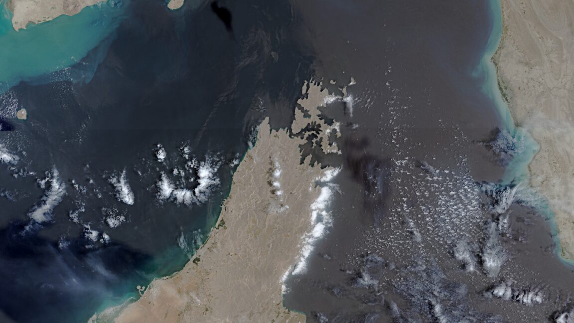
The European Union has begun delaying the release of satellite images showing shipping lanes near the Strait of Hormuz by 24 hours. The move comes in response to an earlier US government request and coincides with the Trump administration ramping up the war with Iran once again.

The unusual change in the free and open data policy for Europe’s Copernicus Earth observation program was revealed by Space News, which reviewed a copy of the decision made by the Council of the EU on July 13. The ordered delay applies to images taken by Sentinel-1 and Sentinel-2 satellites and covers the Gulf of Oman region that includes shipping lanes leading to and from the contested Strait of Hormuz.

The US government first requested that the European Union restrict Copernicus satellite imagery on May 26, according to the decision document seen by Space News. That request occurred during a shaky ceasefire period for the war that began on April 8 and ended on July 8, when the US military resumed a broader campaign of military strikes following an announcement by President Donald Trump.
Read full article

Comments

© European Union | Copernicus Sentinel-2

  •  

European Union grants US request to restrict satellite images of Iran War region

The European Union has begun delaying the release of satellite images showing shipping lanes near the Strait of Hormuz by 24 hours. The move comes in response to an earlier US government request and coincides with the Trump administration ramping up the war with Iran once again.

The unusual change in the free and open data policy for Europe’s Copernicus Earth observation program was revealed by Space News, which reviewed a copy of the decision made by the Council of the EU on July 13. The ordered delay applies to images taken by Sentinel-1 and Sentinel-2 satellites and covers the Gulf of Oman region that includes shipping lanes leading to and from the contested Strait of Hormuz.

The US government first requested that the European Union restrict Copernicus satellite imagery on May 26, according to the decision document seen by Space News. That request occurred during a shaky ceasefire period for the war that began on April 8 and ended on July 8, when the US military resumed a broader campaign of military strikes following an announcement by President Donald Trump.

Read full article

Comments

© European Union | Copernicus Sentinel-2

  •  

Robot snakes searched for Venezuela earthquake survivors in collapsed buildings

Robots slithered like snakes into the rubble of collapsed buildings to search for trapped survivors in the aftermath of Venezuela’s double earthquake disaster.

The so-called snake robots represented a unique technological aid for international search and rescue efforts following two earthquakes that struck Venezuela on June 24, killing more than 5,000 people and leaving behind 16,740 injured. Rescuers from around the world used trained dogs, seismic and acoustic listening devices, video cameras on sticks, or thermal imaging cameras to search for signs of survivors—but the snakebots equipped with a video camera could squeeze through tight spaces to search deep within fallen building debris.

“The reason why snake robots are useful is they can get into tightly packed volumes that machinery and people otherwise cannot, and that's important in search and rescue because we were able to extend the visual reach of the rescue workers in a safe way,” Howie Choset, head of the Biorobotics Lab at Carnegie Mellon University in Pittsburgh, told Ars. “In a sense, you're doing minimally invasive surgery on a structure with a snake robot.”

Read full article

Comments

© Carnegie Mellon University

  •  

Ukrainian drones deliver robots directly into battle by sea and air

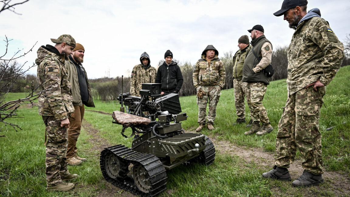
In the latest twist on battlefield innovations, Ukraine has used both flying drone carriers and drone boats to send ground robots armed with weapons or explosives into battle.

The drone-assisted deployments have enabled slower wheeled robots to bypass tough terrain and Russian defenses, and to carry out an unusual robotic amphibious assault on a contested position. Such tactics also showcase the Ukrainian military’s ongoing experimentation with using drones and robots to offset a Russian military advantage in manpower while also sparing Ukrainian soldiers from making dangerous assaults.

On July 19, a Russian military Telegram channel posted a video showing a Ukrainian hexacopter drone carrying a ground robot suspended below by a cable, according to the Ukrainian government-run news platform United24. The Russian Telegram channel described the Ukrainian heavy bomber drone as deploying a four-wheeled ARK-1 robot armed with explosive anti-tank mines on the ground where it continued toward Russian military positions—and apparently generated plenty of outraged comments from pro-Kremlin social media users.

Read full article

Comments

© Dmytro Smolienko/ Ukrinform/Future Publishing via Getty Images

  •  

Firefighting drones in the works as wildfires plague US nearly year-round

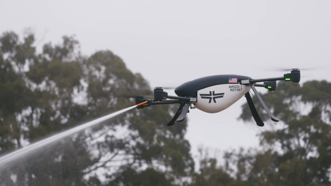
Drones capable of spraying water and fire retardants have been practicing how to snuff out wildfires early in California and Alaska this summer—demonstrating a possible rapid-response tool for firefighting as climate change transforms wildfire season into a nearly year-round risk for much of the United States.

Most drones are significantly smaller than crewed aircraft and have shorter flight ranges, meaning they cannot replace large airtankers in delivering massive payloads of water or other fire-suppressing payloads to remote wildfires. But companies and fire agencies—along with organizers of the $11 million XPRIZE competition—are testing whether drones can help firefighting crews respond more quickly to small fires and put them out before they become more destructive.

The California Department of Forestry and Fire Protection, also known as CAL FIRE, ran its own field test involving five autonomous drones that worked together to deploy between 500 and 1,000 gallons of foam combined for suppressing fires on July 15, according to the TV station KPMH. The demonstration was organized with the help of the nonprofit FireWERX and the California-based company Seneca, which is making the drones commercially available starting in 2026.

Read full article

Comments

© Seneca

  •  

Google-backed satellites for wildfire detection launch as smoke chokes US, Canada

As smoke from hundreds of burning wildfires spread across Canada and the United States, the first three operational satellites in the Google-backed FireSat program successfully launched into orbit. The satellites will begin providing wildfire detection capable of spotting even small fires in the United States, Australia, and Europe before the end of the year.

The launch of the microsatellites aboard a SpaceX Falcon 9 rocket from Vandenberg Space Force Base in California on July 7, 2026 marks a transition to “initial operational capability” for the FireSat constellation managed by the nonprofit Earth Fire Alliance. After a three-month testing period, the three satellites will begin actively providing data to fire agencies while covering every fire-prone region on Earth at least twice per day.

FireSat represents the first satellite constellation purpose-built for detecting wildfires, including spotting smaller fires that other satellites may miss. The satellites were designed by California-based satellite manufacturer Muon Space and have received over $15 million from Google to support initial deployment. Other notable financial supporters include the Bezos Earth Fund that committed $26 million.

Read full article

Comments

© Muon Space

  •  

Move over, GPS: Navigation satellites in low-Earth orbit are making a comeback

New navigation satellites in low-Earth orbit could provide 100 times stronger signal strength compared to GPS and other global navigation satellite systems operating from higher orbital altitudes—enabling greater location accuracy within dense cities, under thick foliage, and even inside buildings. Such signals would also likely prove more resilient to interference at a time when commercial flights, maritime shipping, and even various smartphone apps face increasingly widespread disruption from GPS jamming.

That vision may start to take shape when the first six production satellites of California-based Xona Space Systems are scheduled to launch in October 2026, with early service starting in 2027. Once the full constellation of 258 Pulsar satellites has been launched in the following years, Xona claims that customers will be able to accurately pinpoint their locations anywhere on Earth to within several centimeters.

“That added power means that we can get into that indoor environment that GPS can't get to today,” Adrien Perkins, co-founder and VP of engineering at Xona Space Systems, told Ars. “Our higher power allows you to get into those jamming environments a lot further than you would with GPS by itself.”

Read full article

Comments

© Xona Space Systems

  •  

US military sent explosive drone boats into combat for the first time

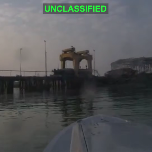
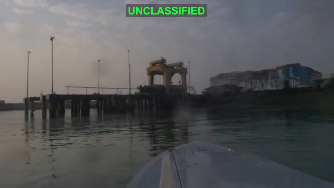
For the first time in its history, the US military sent explosive-laden drone boats into combat by attacking an Iranian midget submarine and naval port. The unprecedented use of such kamikaze sea drones by the United States comes nearly a decade after Iranian and Houthi forces first demonstrated such weapons.

The US military shared a video showing three “one-way attack surface drones” exploding after approaching an Iranian midget submarine and ship maintenance facility at Iran’s Bandar Abbas Naval Base on the night of July 12. US Central Command, the US military combat command responsible for Middle East operations, described the strikes in a social media post as the “first time American forces have employed sea drones in combat operations.”

The US drone boats were able to “make a low-speed, uncontested approach” to their targets before exploding, according to USNI News, a news service from the nonprofit US Naval Institute. USNI News also identified one of the targets as an Iranian Ghadir-class midget submarine that was out of the water while being suspended from a gantry.

Read full article

Comments

© US Central Command

  •  

Ukrainian drone strikes forced Russia to stop shipping in vital sea corridor

Ukrainian drone strikes have forced Russia to completely halt shipping in the Sea of Azov in less than a week, showing once again how a country without traditional naval power can still effectively blockade maritime corridors.

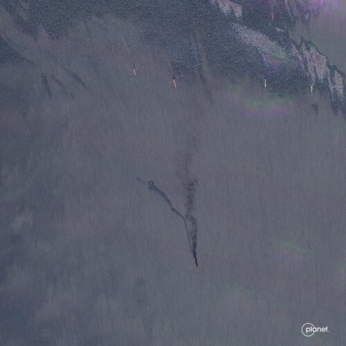
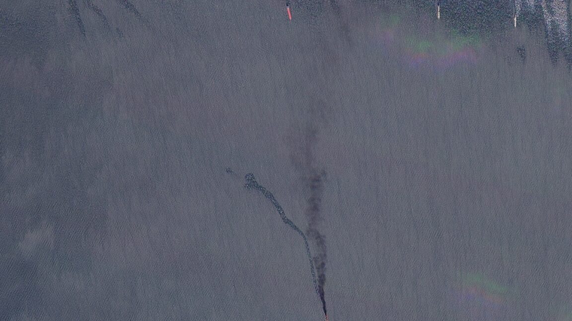
Ukraine’s Unmanned Systems Forces have flown one-way attack drones to target and strike more than 100 Russian tankers and other ships in total, along with posting video evidence showing such drone strikes occurring every night between July 6 and July 14. The campaign has forced Russia to completely shut down the shipping route that flows from Russia’s Don River into the Sea of Azov, and to halt all Kerch Strait shipping transits from the Sea of Azov into the Black Sea, according to Reuters reporting.

The shutdown of such maritime lanes has further isolated the Russian-occupied Crimean Peninsula by cutting off seaborne delivery of fuel in particular. Crimea had already been experiencing severe fuel rationing and power outages as Ukraine stepped up its mid- and long-range drone strike campaign on Russian energy infrastructure and supply lines, leaving behind damaged oil refineries with billowing black smoke and burned-out trucks littering highways.

Read full article

Comments

© Planet Labs PBC

  •  

Increased drone surveillance of illegal July 4th fireworks led to $100K fine

More cities and towns deployed drones to spot illegal fireworks during the Fourth of July celebrations commemorating America’s 250th anniversary—leading to a $100,000 fine in one instance and coming as part of a broader national trend of first responders turning to drone surveillance.

Police and fire departments have described using both increased drone surveillance and steep fines to deter people from shooting off illegal fireworks, with many departments publicizing their drone videos on social media and warning that their drones will be watching in the future. Incidents involving illegal fireworks have led to costly fires, injuries, and even multiple deaths each year, along with creating local air and noise pollution for residential neighborhoods.

This year, the $100,000 fine for illegal fireworks came from the Sacramento Fire Department in Northern California deploying its own drones for the first time on the Fourth of July, according to CBS News Sacramento. Sacramento Fire Captain Justin Sylvia described the fire department’s drones as being capable of recording scenes in high-resolution video to help investigators identify the house or closest location using Google Maps.

Read full article

Comments

© MediaNews Group/Orange County Register via Getty Images / Contributor

  •  

US seeks cheaper hunter-killer drones after Iran destroys $1B worth of Reapers

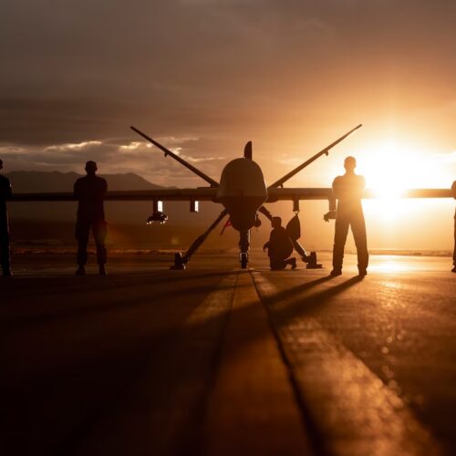
The US military has lost dozens of Reaper drones collectively worth more than $1 billion while carrying out surveillance and attack missions over Iran. Now the Pentagon is seeking large numbers of cheaper drones that can perform such missions despite the expectation that many will be lost in combat.

In a call for industry pitches, the Defense Innovation Unit’s notice described the US military’s current reliance on drones and crewed aircraft, each costing more than $30 million, as being “unsustainable against adversaries utilizing layered defenses enabled by increasingly low-cost antiaircraft capabilities.” It envisions deploying more “cost-effective” drones to “overwhelm enemy air defenses even while experiencing numerous [drone] losses.”

That is, in practice, what Ukraine’s military has been demonstrating with its long- and mid-range strike campaign against Russian supply lines, oil refineries, and various energy or industrial targets within Russia or occupied Ukraine. The Ukrainian campaign has been overwhelming Russia’s overstretched air defense capabilities by launching hundreds of relatively inexpensive drones and missiles on a daily basis to attack targets far behind the frontlines, while continuing to damage or destroy Russia’s most sophisticated air defense systems.

Read full article

Comments

  •  

Kremlin suspected of flying drones over Europe using Russian shadow fleet

Mysterious drone flights that disrupted major European airports and flew over NATO member military bases hosting US nuclear weapons may be the work of a coordinated Kremlin campaign launched from Russian-linked commercial ships.

That recent assessment from the UK-based International Institute for Strategic Studies used automatic identification system (AIS) maritime tracking data and other publicly available data to show how Russian-linked ships and “shadow fleet” vessels that transport sanctioned Russian oil were often located nearby during various drone incidents. The report suggests that the drone incidents—which impacted a dozen NATO member countries and Ireland between August 2024 and February 2026—also revealed the vulnerability of European air defenses against surveillance and harassment incursions by low-cost drones.

The IISS report identified 144 drone sightings over Europe during that time period that were unlikely to involve hobbyist recreational drones or drone activity related to the war in Ukraine. About 48 percent of the sightings took place over military bases, 26 percent happened over critical infrastructure such as ports and energy or industrial facilities, and 18 percent occurred over civilian airports. Most occurred at night or in the early morning hours before sunrise, and the drones themselves were typically described in media reports as resembling “professional” or “military-style” drones.

Read full article

Comments

© DAMIEN MEYER/AFP via Getty Images

  •  

FAA proposal: Supersonic airliners can fly over US cities if they’re quiet

A long-standing ban on commercial supersonic flights over the United States would be overturned in a new rule proposed by the US Federal Aviation Administration. That could pave the way for the possible return of commercial supersonic airliners—as long as such aircraft can reduce the ground-level impacts of their sonic booms.

The FAA originally banned overland supersonic flights by civil aircraft in 1973, following US military tests involving supersonic flights over US cities such as Oklahoma City, Chicago, and St. Louis in the 1960s. But the Trump administration has championed the repeal of the ban to pave the way for supersonic airliners that could operate without disruptive sonic booms. So the FAA’s new rulemaking action on June 30, 2026, follows the direction of an executive order issued by President Trump on June 6, 2025.

The newly proposed rule would replace the 53-year prohibition with an interim “noise-based” certification standard requiring any sonic boom overpressure at the surface to be kept below 0.11 pounds per square foot. That proposed standard is based on the Colorado-based startup Boom Supersonic having demonstrated quiet Mach cutoff flights with its XB-1 aircraft—harnessing specific atmospheric conditions while flying just beyond supersonic speeds at higher altitudes so that the aircraft’s shockwaves are refracted upward into the atmosphere rather than traveling to the ground.

Read full article

Comments

© Boom Supersonic

  •  

Odd police video shows drone removing knife from motionless suspect

In a supposed “nationwide first” use of drones to disarm a person, the Sacramento County Sheriff’s Office in California promoted a video showing how a small quadcopter drone used a dangling magnet to remove a knife from the hand of a motionless suspect.

The promotional video shared to Facebook and Instagram on June 22, 2026, uses the Mission: Impossible film franchise theme to dramatize video footage of the incident that took place earlier in the month, which involved what the video describes as a “felony suspect armed with a knife and a firearm” who “was not responding to negotiators.” The sheriff’s office is just one among hundreds of US police departments and sheriff’s offices that have deployed camera-equipped drones to assist first responders.

In a Facebook post, the Sacramento County Sheriff’s Office described having surrounded the suspect’s residence with a SWAT team after the “known felon and parolee-at-large was seen earlier with a firearm.” A first drone deployed to the scene located the suspect hiding in a corner of the garage, but also spotted the motionless suspect holding a knife in one outstretched arm.

Read full article

Comments

© Sacramento County Sheriff’s Office

  •  
❌