❌

Reading view

Zuckerberg’s superyacht ignored emergency channel, failed to aid stranded boat

Social media scuttlebutt about Mark Zuckerberg’s $300 million superyacht failing to assist stranded boaters off the coast of Alaska was partly corroborated by ship-tracking data—and eventually prompted responses from both the US Coast Guard and a spokesperson for Zuckerberg.

The incident was made public when Michael Love, a passenger aboard the replica steamship Wilderness Legacy during an Alaska cruise, posted about it on the social media platform Bluesky. The ship detoured to rescue a stranded 21-foot skiff with two women, a child and a dog, after the US Coast Guard had supposedly first radioed Zuckerberg’s superyacht, Launchpad, for help without success.

“There was near unanimous booing when the captain announced this,” Love wrote in describing the Alaska cruise passengers’ response to the lack of help from Zuckerberg’s ship.


Read full article

Comments

© Sylvain Lefevre/Getty Images
  •  

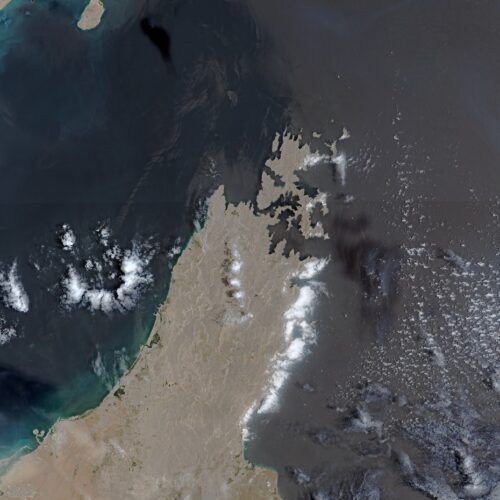
Europe's free satellite service just made it easier to track wildfires

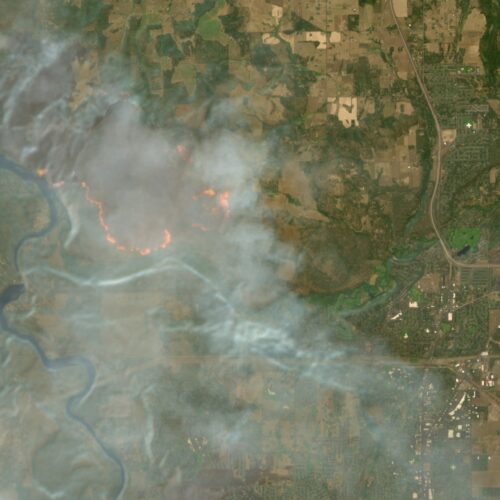
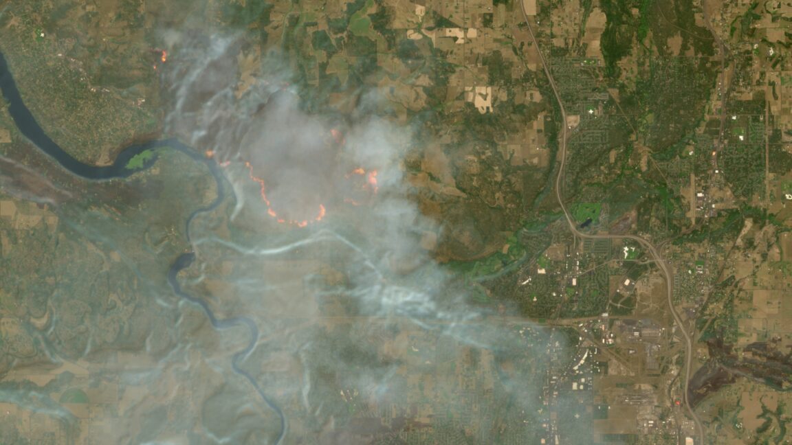
The wildfires afflicting communities across the world can now be tracked more easily by anyone using Europe’s free and open satellite imagery service—all thanks to a wildfire visualization script originating from nearly a decade ago.

The Copernicus Browser provides free access to the latest satellite imagery taken by the European Space Agency’s Sentinel satellites for the European Union’s Earth observation program. The three satellites of the Sentinel-2 mission have proven especially useful for wildfire monitoring by providing multi-spectral imaging at resolutions as granular as 10 meters in visible light and near-infrared bands—and the Copernicus Browser previously offered 10 default visualization layers using different combinations of spectral bands.

Now Copernicus Browser has also added a straightforward “wildfires” visualization layer for Sentinel-2 imagery that went live on August 4. Anyone clicking on this layer while looking at a wildfire location can see active fires in white or yellow, burning vegetation in red, and burned landscapes in dark brown or black.

Read full article

Comments

© European Union | Copernicus Sentinel-2

  •  

Explosive drone found hovering near Ukrainian cargo aircraft at German airport

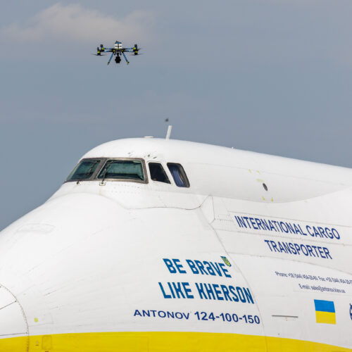
German police disarmed a drone carrying explosives after it was discovered near Ukrainian cargo aircraft parked at Leipzig airport—and authorities are looking into the possibility of a second drone after an approaching aircraft collided with something midair.

The drone, first spotted by an airport employee, was hovering close to the ground between two parked An-124 cargo aircraft owned by Ukraine’s Antonov Airlines shortly before midnight on August 4, according to The Guardian. It had apparently been modified to help avoid detection by the airport’s drone defense sensors, said Alexander Dobrindt, federal minister of the interior for Germany, during a press conference.

Dobrindt described the drone as carrying a fist-sized package of a substance believed to be the plastic explosive Semtex. Only a failed detonator prevented the drone from exploding near the Ukrainian cargo aircraft, he said.

Read full article

Comments

© Jens Schlueter/Getty Images

  •  

Google Earth risked ruin with retracted AI tool for making fake satellite pics

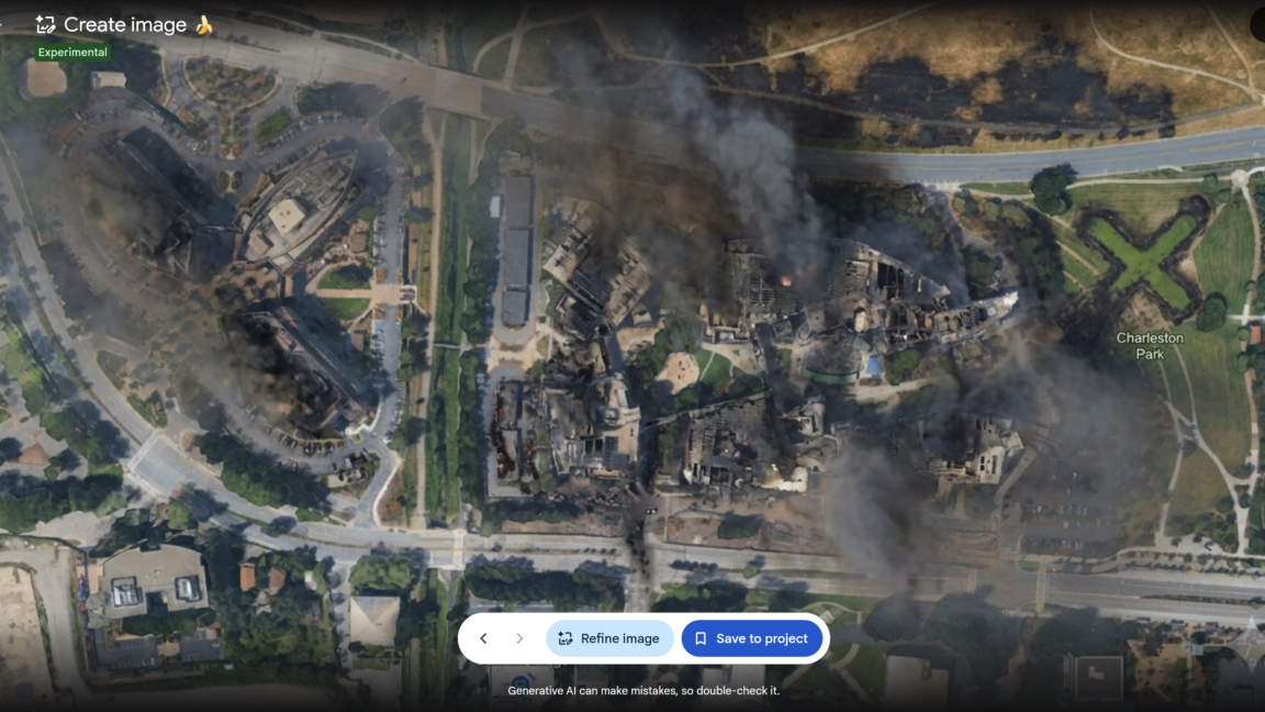
Google briefly allowed anyone to create AI-modified versions of satellite imagery available in Google Earth—before quickly reversing its decision as people shared examples of AI-generated pictures that illustrated the potential for misinformation and disinformation.

There is no shortage of generative AI tools that already allow people to create AI-modified images of real buildings and cities based on user prompts. But Google’s aborted attempt to incorporate its Nano Banana 2 AI image generator as a Google Earth feature made it even easier for anyone to create modified versions of authentic imagery depicting real locations—something that Google boasted about when initially promoting the new feature.

“For the first time, you can generate custom images using Google Earth’s satellite, aerial, and 3D imagery alongside Nano Banana, which creates concepts grounded in the real world,” wrote Bryan Horowitz, product manager for Google Earth, in a company blog post on July 30.

Read full article

Comments

© Google Earth

  •  

European Union grants US request to restrict satellite images of Iran War region

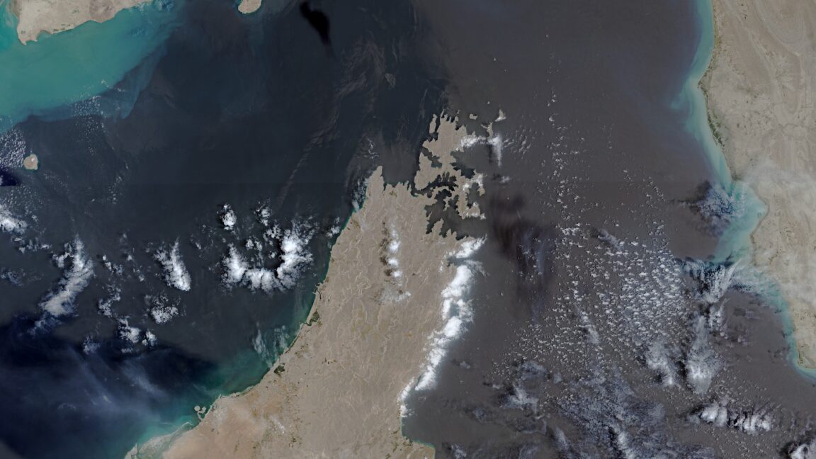
The European Union has begun delaying the release of satellite images showing shipping lanes near the Strait of Hormuz by 24 hours. The move comes in response to an earlier US government request and coincides with the Trump administration ramping up the war with Iran once again.

The unusual change in the free and open data policy for Europe’s Copernicus Earth observation program was revealed by Space News, which reviewed a copy of the decision made by the Council of the EU on July 13. The ordered delay applies to images taken by Sentinel-1 and Sentinel-2 satellites and covers the Gulf of Oman region that includes shipping lanes leading to and from the contested Strait of Hormuz.

The US government first requested that the European Union restrict Copernicus satellite imagery on May 26, according to the decision document seen by Space News. That request occurred during a shaky ceasefire period for the war that began on April 8 and ended on July 8, when the US military resumed a broader campaign of military strikes following an announcement by President Donald Trump.

Read full article

Comments

© European Union | Copernicus Sentinel-2

  •  

Robot snakes searched for Venezuela earthquake survivors in collapsed buildings

Robots slithered like snakes into the rubble of collapsed buildings to search for trapped survivors in the aftermath of Venezuela’s double earthquake disaster.

The so-called snake robots represented a unique technological aid for international search and rescue efforts following two earthquakes that struck Venezuela on June 24, killing more than 5,000 people and leaving behind 16,740 injured. Rescuers from around the world used trained dogs, seismic and acoustic listening devices, video cameras on sticks, or thermal imaging cameras to search for signs of survivors—but the snakebots equipped with a video camera could squeeze through tight spaces to search deep within fallen building debris.

“The reason why snake robots are useful is they can get into tightly packed volumes that machinery and people otherwise cannot, and that's important in search and rescue because we were able to extend the visual reach of the rescue workers in a safe way,” Howie Choset, head of the Biorobotics Lab at Carnegie Mellon University in Pittsburgh, told Ars. “In a sense, you're doing minimally invasive surgery on a structure with a snake robot.”

Read full article

Comments

© Carnegie Mellon University

  •  

Google-backed satellites for wildfire detection launch as smoke chokes US, Canada

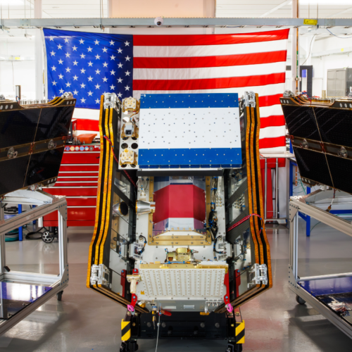
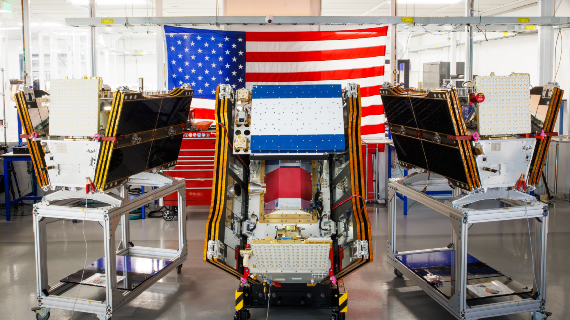
As smoke from hundreds of burning wildfires spread across Canada and the United States, the first three operational satellites in the Google-backed FireSat program successfully launched into orbit. The satellites will begin providing wildfire detection capable of spotting even small fires in the United States, Australia, and Europe before the end of the year.

The launch of the microsatellites aboard a SpaceX Falcon 9 rocket from Vandenberg Space Force Base in California on July 7, 2026 marks a transition to “initial operational capability” for the FireSat constellation managed by the nonprofit Earth Fire Alliance. After a three-month testing period, the three satellites will begin actively providing data to fire agencies while covering every fire-prone region on Earth at least twice per day.

FireSat represents the first satellite constellation purpose-built for detecting wildfires, including spotting smaller fires that other satellites may miss. The satellites were designed by California-based satellite manufacturer Muon Space and have received over $15 million from Google to support initial deployment. Other notable financial supporters include the Bezos Earth Fund that committed $26 million.

Read full article

Comments

© Muon Space

  •  

Move over, GPS: Navigation satellites in low-Earth orbit are making a comeback

New navigation satellites in low-Earth orbit could provide 100 times stronger signal strength compared to GPS and other global navigation satellite systems operating from higher orbital altitudes—enabling greater location accuracy within dense cities, under thick foliage, and even inside buildings. Such signals would also likely prove more resilient to interference at a time when commercial flights, maritime shipping, and even various smartphone apps face increasingly widespread disruption from GPS jamming.

That vision may start to take shape when the first six production satellites of California-based Xona Space Systems are scheduled to launch in October 2026, with early service starting in 2027. Once the full constellation of 258 Pulsar satellites has been launched in the following years, Xona claims that customers will be able to accurately pinpoint their locations anywhere on Earth to within several centimeters.

“That added power means that we can get into that indoor environment that GPS can't get to today,” Adrien Perkins, co-founder and VP of engineering at Xona Space Systems, told Ars. “Our higher power allows you to get into those jamming environments a lot further than you would with GPS by itself.”

Read full article

Comments

© Xona Space Systems

  •  

US military sent explosive drone boats into combat for the first time

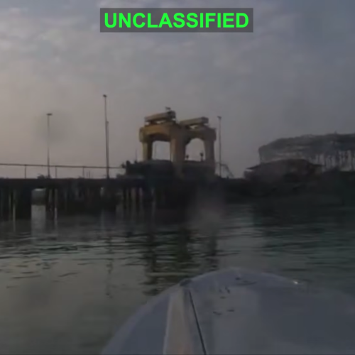
For the first time in its history, the US military sent explosive-laden drone boats into combat by attacking an Iranian midget submarine and naval port. The unprecedented use of such kamikaze sea drones by the United States comes nearly a decade after Iranian and Houthi forces first demonstrated such weapons.

The US military shared a video showing three “one-way attack surface drones” exploding after approaching an Iranian midget submarine and ship maintenance facility at Iran’s Bandar Abbas Naval Base on the night of July 12. US Central Command, the US military combat command responsible for Middle East operations, described the strikes in a social media post as the “first time American forces have employed sea drones in combat operations.”

The US drone boats were able to “make a low-speed, uncontested approach” to their targets before exploding, according to USNI News, a news service from the nonprofit US Naval Institute. USNI News also identified one of the targets as an Iranian Ghadir-class midget submarine that was out of the water while being suspended from a gantry.

Read full article

Comments

© US Central Command

  •  

Odd police video shows drone removing knife from motionless suspect

In a supposed “nationwide first” use of drones to disarm a person, the Sacramento County Sheriff’s Office in California promoted a video showing how a small quadcopter drone used a dangling magnet to remove a knife from the hand of a motionless suspect.

The promotional video shared to Facebook and Instagram on June 22, 2026, uses the Mission: Impossible film franchise theme to dramatize video footage of the incident that took place earlier in the month, which involved what the video describes as a “felony suspect armed with a knife and a firearm” who “was not responding to negotiators.” The sheriff’s office is just one among hundreds of US police departments and sheriff’s offices that have deployed camera-equipped drones to assist first responders.

In a Facebook post, the Sacramento County Sheriff’s Office described having surrounded the suspect’s residence with a SWAT team after the “known felon and parolee-at-large was seen earlier with a firearm.” A first drone deployed to the scene located the suspect hiding in a corner of the garage, but also spotted the motionless suspect holding a knife in one outstretched arm.

Read full article

Comments

© Sacramento County Sheriff’s Office

  •  

GM installs robots at flagship EV factory after laying off 1,300 workers

Dozens of new robot arms have been installed at General Motors’ flagship electric vehicle factory in Detroit—even as 1,300 workers remain out of work following what was supposed to be a temporary layoff. The latest automation push has spurred union pushback over a potentially existential issue for automakers and their workers.

General Motors installed approximately 50 robot arms at GM’s Factory Zero plant in Detroit, Michigan, according to reporting by Crain’s Detroit Business. Made by the Japanese robotics company FANUC, the robots are designed to help attach various components to vehicles during the assembly line process. But leaders at United Auto Workers (UAW), the primary US union for autoworkers, reacted with anger to the new robotic presence, given how GM has not yet called back any of the workers affected by supposedly temporary layoffs in March.

More than 1,000 union members are still “laid off indefinitely,” James Cotton, president of UAW Local 22, told The Detroit News. He said that the company could bring some of those members back to work instead of installing the 50 robots.

Read full article

Comments

© General Motors Company

  •  

As China looms, Taiwan makes more drones for defense and the US military

Taiwan’s existence as a self-governing democracy may depend heavily on having enough military drones to discourage any attempted invasion by China’s military. As the Taiwanese government aims to boost domestic production of military drones and Taiwanese citizens sign up for drone flight training, Taiwanese companies are forming international partnerships to sell more drones to the US military and other overseas buyers.

Taiwan’s Ministry of National Defense proposed a special budget that would spend $6.6 billion over six years on buying drones made in Taiwan, according to the Central News Agency that represents the national news service of Taiwan. Presented on June 18, the budget proposal would allow the government to buy more than 208,000 coastal attack drones, along with more than 1,400 coastal reconnaissance drones and 1,320 uncrewed surface vessels, between 2026 and 2031.

That would be a significant boost to the Taiwanese military arsenal that currently includes just 5,000 US-made attack drones and domestically produced drones, according to Resilience Media. During military exercises in early June, Taiwanese soldiers fired Altius-600 loitering munition drones—made by a subsidiary of the US military technology company Anduril Industries—from towed flatbed launchers to strike offshore targets, according to USNI News. In another exercise earlier this year, Taiwanese Marines used Taiwan-made drones to similarly strike targets at sea.

Read full article

Comments

© I-Hwa Cheng / AFP via Getty Images

  •  

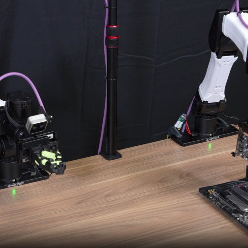
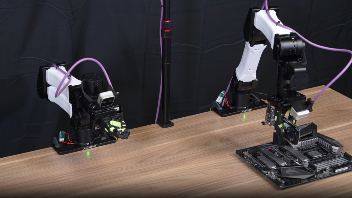
AI coding agents taught robots how to install GPUs and cut zip ties

What happens when you give AI coding agents a lab full of robotic arms, some compute resources, and a “generous token budget” for teaching the robots various tasks? The agents can apparently figure out a training regimen that teaches the robots to successfully cut zip ties and even insert GPUs into thin sockets on motherboards.

That glimpse into how AI can act in a fully autonomous way to automate robot training was made possible by a new agent harness framework—software that wraps around AI models to enable their use of various tools while also providing capabilities such as memory, context, constraint, and feedback loops. That agentic harness, called ENPIRE, was developed by robotics researchers at the Nvidia GEAR (Generalist Embodied Agent Research) lab alongside collaborators from Carnegie Mellon University in Pittsburgh and the University of California, Berkeley.

“A part of our NVIDIA GEAR lab now self-improves tirelessly overnight,” wrote Jim Fan, director of AI at NVIDIA, in a LinkedIn post. “We just read the reports in the morning.”

Read full article

Comments

© NVIDIA

  •  

Pentagon boasts of using AI to write reports mandated by Congress

The US Department of Defense has a lot of congressionally mandated homework to do every year involving hundreds of required reports on various national security topics. But Pentagon officials have been proudly describing a new shortcut—using generative AI tools to write such reports for Congress.

Pentagon Chief Technology Officer Emil Michael highlighted AI-generated reports to Congress as a key example of how the Department of Defense—stylized as the Department of War under the Trump administration—has adopted generative AI during an event hosted by the Hudson Institute think tank in Washington, DC, on June 12. The Pentagon has made AI tools, starting with Google Cloud’s Gemini for Government, widely available to members of all six military branches through the department’s bespoke GenAI.mil platform since December 2025.

“I have to report to Congress every year on this thing,” Michael said. “Let me load all the papers onto it and have it draft me a congressional report that would otherwise take 200 hours of staffing time and do it in five hours.”

Read full article

Comments

© SAUL LOEB / AFP via Getty Images

  •  
❌