❌

Normal view

NASA’s Quantum Lab Aboard Space Station Gets Chilly Upgrade
16 June 2026 at 17:50
Astronaut Jessica Meir inspects optical fibers while installing hardware updates to NASA’s Cold Atom Lab, or CAL, aboard the International Space Station on May 8, 2026. About the size of a minifridge, CAL enables researchers to explore quantum physics.
NASA

Astronauts aboard the International Space Station have switched on NASA’s newly upgraded Cold Atom Lab, a one-of-a-kind facility designed to improve how scientists explore the fundamental workings of matter and develop new quantum technologies. By leveraging the unique environment of microgravity in space, the lab can accomplish cutting-edge science impossible to do anywhere else.

Quantum science is the study of matter at the smallest scales, like atoms, electrons, and single particles of light. While it’s easy to imagine atoms as billiard balls bouncing off one another, they also exhibit wave-like behavior, can exist simultaneously in two places at once, and may even pass through one another.

About the size of a minifridge and operated from Earth, the Cold Atom Lab chills atoms to temperatures below minus 459 degrees Fahrenheit (minus 237 degrees Celsius). At this extreme cold, just above absolute zero, atoms form a large quantum object called a Bose‑Einstein condensate, or BEC, a collection of matter waves that is a fifth state of matter beyond solids, liquids, gases, and plasma. This object follows the rules of quantum mechanics despite being much larger than subatomic particles, and the microgravity of low Earth orbit helps make the waves even larger.

“At the coldest temperatures, matter behaves drastically different from anything we have experienced,” said Jason Williams, project scientist for Cold Atom Lab at NASA’s Jet Propulsion Laboratory in Southern California, which built the facility. “The wavelike nature of matter dominates, and ultracold matter can behave in ways that are not only unexpected, but that also enable extremely precise measurements of time, gravity, and motion. The lab has lots of tools — especially with this latest upgrade — to let us probe the nature of the universe.”

The project supports five international teams studying fundamental physics. It also tests the space-readiness of quantum tools that could support future Earth science and space exploration missions.

How it works

The heart of the Cold Atom Lab is a complex set of instruments called its science module. An upgraded module launched on April 11 as part of a Commercial Resupply Services mission to the space station, enabling new kinds of experiments.

For each experiment, a strip of rubidium or potassium metal is heated to as high as 750 F (400 C) — hot enough to form a gas within the facility’s vacuum chamber. Lasers tuned to specific frequencies are then fired at the gas, draining the energy from these atoms, and cooling them by slowing them down. Once this gas has completed the laser-cooling stage, a magnetic trap captures and holds the gas in place. Through a series of complex techniques, the laboratory reduces an atom cloud’s energy further, bringing it close to a standstill and maximizing its time in microgravity.

While facilities for studying ultracold gases exist on Earth, the Cold Atom Lab can study quantum gases in microgravity for longer periods of time and at even lower temperatures. Conducting these experiments in low gravity allows scientists to study larger quantum waves that also interact for longer times with gravity. To harness these benefits, the Cold Atom Lab essentially shrinks an atom physics lab, typically the size of an entire room filled with lasers and tabletop mirrors, to fit within an experiment rack aboard the space station.

“As the first project to create Bose-Einstein condensates in orbit, we’re demonstrating that we can make quantum technology work reliably in space,” said Ethan Elliott, deputy project scientist for Cold Atom Lab at JPL. “In the previous century, there was a quantum revolution that led to lasers, cellphones, and MRIs for medical imaging. We’re performing quantum 2.0 — direct manipulation of large quantum states — and we hope for similar gains in quantum tech by advancing this science in orbit.”

The latest upgrade is the fourth since the Cold Atom Lab arrived at the space station in 2018. Key improvements include a newly designed magnetic trap that changes the shape of the quantum gas clouds, allowing scientists to test different properties related to their atoms. The upgrade also features redesigned metal strips that act as sources for those gas clouds.

“It’s the closest thing we have to controlling the boundary of the quantum world,” said Kamal Oudrhiri, project manager of Cold Atom Lab at JPL, referring to those low temperatures. “This new upgrade pushes that boundary even further.”

The upgrade, Oudrhiri added, “demonstrates NASA’s ability to maintain U.S. leadership in space-based quantum technologies while maturing future quantum instruments, such as matter-wave interferometers for fundamental physics missions, positioning, navigation, timing, and gravity sensing of Earth, the Moon, and beyond.”

More about Cold Atom Lab

Managed by Caltech in Pasadena, JPL designed, built, and operates the Cold Atom Lab, which is sponsored by the Biological and Physical Sciences division of NASA’s Science Mission Directorate at the agency’s headquarters in Washington. The division pioneers scientific discovery and enables exploration by using space environments to conduct investigations that are not possible on Earth. Studying biological and physical phenomena under extreme conditions allows researchers to advance the fundamental scientific knowledge required to go farther and stay longer in space, while also benefiting life on Earth. 

To learn more about Cold Atom Lab, visit:

https://nasa.gov/cold-atom-laboratory/

Media Contact

Andrew Good
Jet Propulsion Laboratory, Pasadena, Calif.
818-393-2433
andrew.c.good@jpl.nasa.gov

2026-039

The post NASA’s Quantum Lab Aboard Space Station Gets Chilly Upgrade appeared first on NASA Science.
NASA’s Quantum Lab Aboard Space Station Gets Chilly Upgrade

16 June 2026 at 17:50
Astronaut Jessica Meir inspects optical fibers while installing hardware updates to NASA’s Cold Atom Lab, or CAL, aboard the International Space Station on May 8, 2026. About the size of a minifridge, CAL enables researchers to explore quantum physics.
NASA

Astronauts aboard the International Space Station have switched on NASA’s newly upgraded Cold Atom Lab, a one-of-a-kind facility designed to improve how scientists explore the fundamental workings of matter and develop new quantum technologies. By leveraging the unique environment of microgravity in space, the lab can accomplish cutting-edge science impossible to do anywhere else.

Quantum science is the study of matter at the smallest scales, like atoms, electrons, and single particles of light. While it’s easy to imagine atoms as billiard balls bouncing off one another, they also exhibit wave-like behavior, can exist simultaneously in two places at once, and may even pass through one another.

About the size of a minifridge and operated from Earth, the Cold Atom Lab chills atoms to temperatures below minus 459 degrees Fahrenheit (minus 237 degrees Celsius). At this extreme cold, just above absolute zero, atoms form a large quantum object called a Bose‑Einstein condensate, or BEC, a collection of matter waves that is a fifth state of matter beyond solids, liquids, gases, and plasma. This object follows the rules of quantum mechanics despite being much larger than subatomic particles, and the microgravity of low Earth orbit helps make the waves even larger.

“At the coldest temperatures, matter behaves drastically different from anything we have experienced,” said Jason Williams, project scientist for Cold Atom Lab at NASA’s Jet Propulsion Laboratory in Southern California, which built the facility. “The wavelike nature of matter dominates, and ultracold matter can behave in ways that are not only unexpected, but that also enable extremely precise measurements of time, gravity, and motion. The lab has lots of tools — especially with this latest upgrade — to let us probe the nature of the universe.”

The project supports five international teams studying fundamental physics. It also tests the space-readiness of quantum tools that could support future Earth science and space exploration missions.

How it works

The heart of the Cold Atom Lab is a complex set of instruments called its science module. An upgraded module launched on April 11 as part of a Commercial Resupply Services mission to the space station, enabling new kinds of experiments.

For each experiment, a strip of rubidium or potassium metal is heated to as high as 750 F (400 C) — hot enough to form a gas within the facility’s vacuum chamber. Lasers tuned to specific frequencies are then fired at the gas, draining the energy from these atoms, and cooling them by slowing them down. Once this gas has completed the laser-cooling stage, a magnetic trap captures and holds the gas in place. Through a series of complex techniques, the laboratory reduces an atom cloud’s energy further, bringing it close to a standstill and maximizing its time in microgravity.

While facilities for studying ultracold gases exist on Earth, the Cold Atom Lab can study quantum gases in microgravity for longer periods of time and at even lower temperatures. Conducting these experiments in low gravity allows scientists to study larger quantum waves that also interact for longer times with gravity. To harness these benefits, the Cold Atom Lab essentially shrinks an atom physics lab, typically the size of an entire room filled with lasers and tabletop mirrors, to fit within an experiment rack aboard the space station.

“As the first project to create Bose-Einstein condensates in orbit, we’re demonstrating that we can make quantum technology work reliably in space,” said Ethan Elliott, deputy project scientist for Cold Atom Lab at JPL. “In the previous century, there was a quantum revolution that led to lasers, cellphones, and MRIs for medical imaging. We’re performing quantum 2.0 — direct manipulation of large quantum states — and we hope for similar gains in quantum tech by advancing this science in orbit.”

The latest upgrade is the fourth since the Cold Atom Lab arrived at the space station in 2018. Key improvements include a newly designed magnetic trap that changes the shape of the quantum gas clouds, allowing scientists to test different properties related to their atoms. The upgrade also features redesigned metal strips that act as sources for those gas clouds.

“It’s the closest thing we have to controlling the boundary of the quantum world,” said Kamal Oudrhiri, project manager of Cold Atom Lab at JPL, referring to those low temperatures. “This new upgrade pushes that boundary even further.”

The upgrade, Oudrhiri added, “demonstrates NASA’s ability to maintain U.S. leadership in space-based quantum technologies while maturing future quantum instruments, such as matter-wave interferometers for fundamental physics missions, positioning, navigation, timing, and gravity sensing of Earth, the Moon, and beyond.”

More about Cold Atom Lab

Managed by Caltech in Pasadena, JPL designed, built, and operates the Cold Atom Lab, which is sponsored by the Biological and Physical Sciences division of NASA’s Science Mission Directorate at the agency’s headquarters in Washington. The division pioneers scientific discovery and enables exploration by using space environments to conduct investigations that are not possible on Earth. Studying biological and physical phenomena under extreme conditions allows researchers to advance the fundamental scientific knowledge required to go farther and stay longer in space, while also benefiting life on Earth. 

To learn more about Cold Atom Lab, visit:

https://nasa.gov/cold-atom-laboratory/

Media Contact

Andrew Good
Jet Propulsion Laboratory, Pasadena, Calif.
818-393-2433
andrew.c.good@jpl.nasa.gov

2026-039

Explore JPL to Take Place Oct. 10, 11

16 June 2026 at 01:34
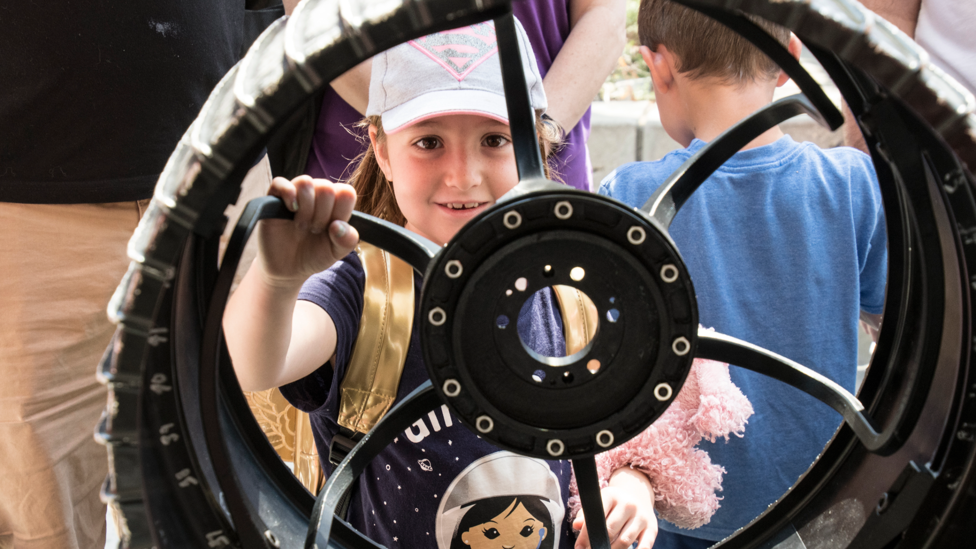
A smiling young girl looking through the spokes of a large black metal wheel.
Visitors are welcome to Explore JPL to learn more about space exploration, robotics, and technology being developed at NASA’s Jet Propulsion Laboratory. Tickets for the popular, free event become available on Aug. 29 and go fast.
NASA/JPL-Caltech

Celebrating its 90th anniversary this year, NASA’s Jet Propulsion Laboratory invites the public to its campus at the base of the San Gabriel Mountains in Southern California for an open-house event, Explore JPL. On Oct. 10 and 11, from 9:30 a.m. to 4 p.m. PDT, visitors will get the chance to visit JPL’s most iconic facilities and explore four thematic areas: Missions That Changed the World, Moon to Mars, In Flight, and Makerspace. 

Tickets are free but very limited and have gone quickly for past Explore JPL events. They will be available on the Explore JPL webpage at 9 a.m. PDT Sunday, Aug. 29, and will be distributed on a first-come, first-served basis, with a maximum of five tickets per requestor. Orders for more than five tickets may be subject to cancellation. Tickets will be provided for specific time slots and must be reserved for specific names. Attendees will not be admitted to JPL before the designated time printed on their ticket. 

A division of Caltech in Pasadena, California, JPL traces its origins to rocket-propulsion development in 1936. By 1958, the lab had built and helped launch America’s first satellite, Explorer 1. That same year, Congress established NASA, and JPL became a part of the agency. Since then, JPL has managed such historic missions as Voyager, Galileo, Cassini, the Mars Exploration Rover program, the Perseverance Mars rover, Europa Clipper, and many more.

Among other highlights, Explore JPL guests will get to: 

  • Visit JPL’s legendary Space Flight Operations Facility, a National Historic Landmark where engineers send commands and receive data from spacecraft billions of miles away. 
  • Discover the Spacecraft Assembly Facility and JPL Machine Shop, where precision spacecraft components are crafted. 
  • See the latest cutting-edge innovations in robotics research, from autonomous lunar rovers to search-and-rescue robots. 
  • Get up close with full-scale models of the Mars Perseverance rover, Voyager, and Galileo. 
  • Step inside the Microdevices Laboratory to see how miniature technologies developed there are shaping the future of space exploration and Earth science. 

To attend Explore JPL, visitors must have their tickets in hand and anyone age 18 or over must show government-issued identification. Tickets are not transferable and cannot be sold. Children under age 2 do not require a ticket, but experiences at the event are not intended for very young guests. 

Visitors may not bring these items to JPL: weapons or explosives of any kind, incendiary devices, glass containers, alcohol, cannabis or illegal drugs, pets (except certified service animals), banners or signs, flags, boom boxes, air horns, musical instruments, and professional camera equipment with detachable telephoto lenses. Use of laser pointers or whistles is not allowed. No bags, backpacks, or hard-sided coolers are permitted, either, except small purses and diaper bags. Drones are not allowed to fly over JPL under any circumstances. Skates, skateboards, scooters, Segways, and bicycles are not permitted inside the event, as the venues are crowded with pedestrians. 

Vehicles entering JPL property are subject to inspection. Parking is free. 

Follow JPL on Facebook, X, and Instagram. 

To get a virtual tour of JPL, visit:

https://www. jpl.nasa.gov/virtual-tour/

Media Contact 
JPL-media@jpl.nasa.gov

The post Explore JPL to Take Place Oct. 10, 11 appeared first on NASA Science.

Explore JPL to Take Place Oct. 10, 11

16 June 2026 at 01:34
A smiling young girl looking through the spokes of a large black metal wheel.
Visitors are welcome to Explore JPL to learn more about space exploration, robotics, and technology being developed at NASA’s Jet Propulsion Laboratory. Tickets for the popular, free event become available on Aug. 29 and go fast.
NASA/JPL-Caltech

Celebrating its 90th anniversary this year, NASA’s Jet Propulsion Laboratory invites the public to its campus at the base of the San Gabriel Mountains in Southern California for an open-house event, Explore JPL. On Oct. 10 and 11, from 9:30 a.m. to 4 p.m. PDT, visitors will get the chance to visit JPL’s most iconic facilities and explore four thematic areas: Missions That Changed the World, Moon to Mars, In Flight, and Makerspace. 

Tickets are free but very limited and have gone quickly for past Explore JPL events. They will be available on the Explore JPL webpage at 9 a.m. PDT Saturday, Aug. 29, and will be distributed on a first-come, first-served basis, with a maximum of five tickets per requestor. Orders for more than five tickets may be subject to cancellation. Tickets will be provided for specific time slots and must be reserved for specific names. Attendees will not be admitted to JPL before the designated time printed on their ticket. 

A division of Caltech in Pasadena, California, JPL traces its origins to rocket-propulsion development in 1936. By 1958, the lab had built and helped launch America’s first satellite, Explorer 1. That same year, Congress established NASA, and JPL became a part of the agency. Since then, JPL has managed such historic missions as Voyager, Galileo, Cassini, the Mars Exploration Rover program, the Perseverance Mars rover, Europa Clipper, and many more.

Among other highlights, Explore JPL guests will get to: 

  • Visit JPL’s legendary Space Flight Operations Facility, a National Historic Landmark where engineers send commands and receive data from spacecraft billions of miles away. 
  • Discover the Spacecraft Assembly Facility and JPL Machine Shop, where precision spacecraft components are crafted. 
  • See the latest cutting-edge innovations in robotics research, from autonomous lunar rovers to search-and-rescue robots. 
  • Get up close with full-scale models of the Perseverance Mars rover, Voyager, and Galileo. 
  • Step inside the Microdevices Laboratory to see how miniature technologies developed there are shaping the future of space exploration and Earth science. 

To attend Explore JPL, visitors must have their tickets in hand and anyone age 18 or over must show government-issued identification. Tickets are not transferable and cannot be sold. Children under age 2 do not require a ticket, but experiences at the event are not intended for very young guests. 

Visitors may not bring these items to JPL: weapons or explosives of any kind, incendiary devices, glass containers, alcohol, cannabis or illegal drugs, pets (except certified service animals), banners or signs, flags, boom boxes, air horns, musical instruments, and professional camera equipment with detachable telephoto lenses. Use of laser pointers or whistles is not allowed. No bags, backpacks, or hard-sided coolers are permitted, either, except small purses and diaper bags. Drones are not allowed to fly over JPL under any circumstances. Skates, skateboards, scooters, Segways, and bicycles are not permitted inside the event, as the venues are crowded with pedestrians. 

Vehicles entering JPL property are subject to inspection. Parking is free. 

Follow JPL on Facebook, X, and Instagram. 

To get a virtual tour of JPL, visit:

https://www. jpl.nasa.gov/virtual-tour/

Media Contact 
JPL-media@jpl.nasa.gov

NASA, USGS Scientists Go Rock Hounding in California’s High Desert

11 June 2026 at 16:38
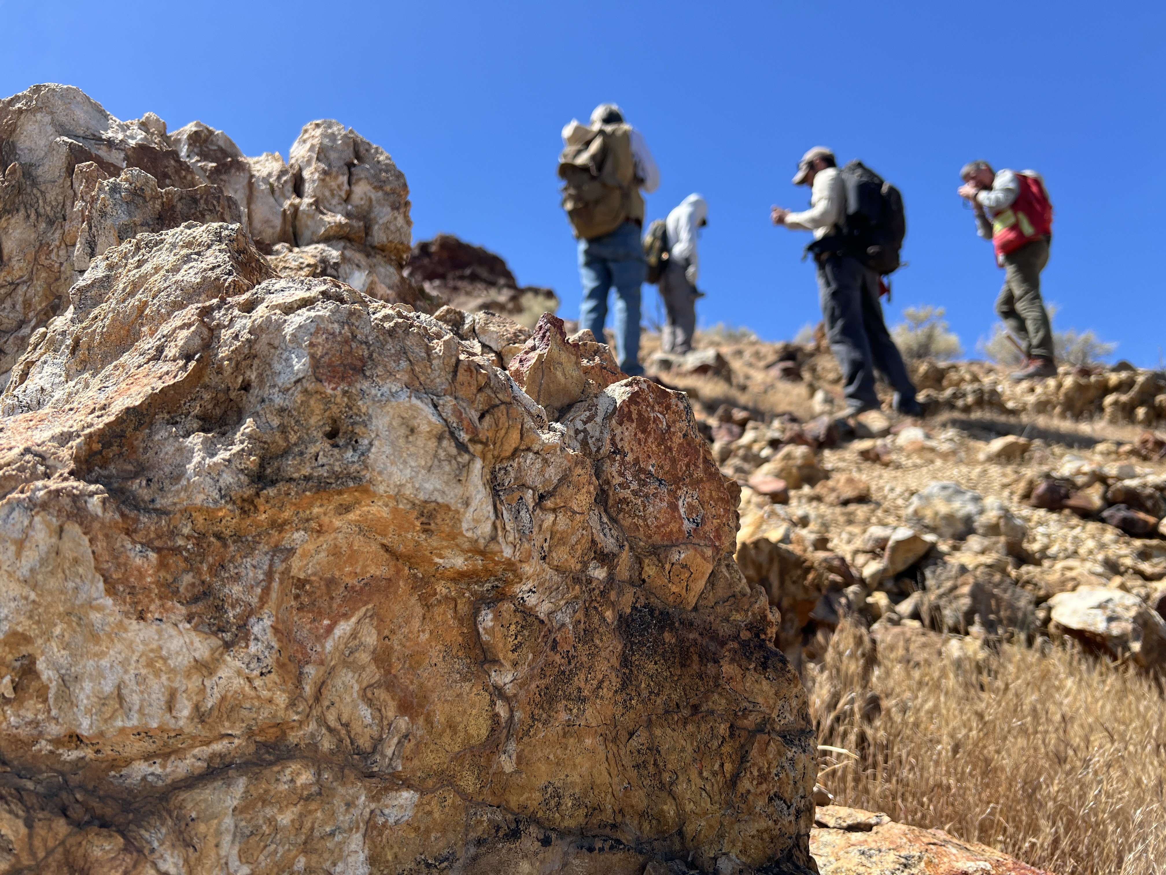
Four people with backpacks pause to examine rocks on a hillside under a clear blue sky, with a large orange-and-tan boulder in the foreground.
Geologists recently converged on a site near Barstow, California, to ground-truth a mineral discovery made on public land by a NASA JPL sensor flying aboard a plane overhead.
NASA/JPL-Caltech

Equipped with rock picks and hand lenses, a team of geoscientists deployed to the Mojave Desert recently to investigate a tantalizing “fingerprint” detected by a NASA sensor. Their target: a cache of topaz hiding in plain sight.

The geologists weren’t searching for gem-grade treasure. Rather, the presence of topaz could hint at a more valuable deposit below of something known as porphyry copper.

One of the world’s primary sources of copper, these deposits are left behind when magma and hot water from deep underground course through Earth’s crust, chemically transforming the surrounding rock. This tends to occur where one tectonic plate dives below another, known as a subduction zone, such as the North American Cordillera, which stretches from the Canadian Rockies to western Mexico.

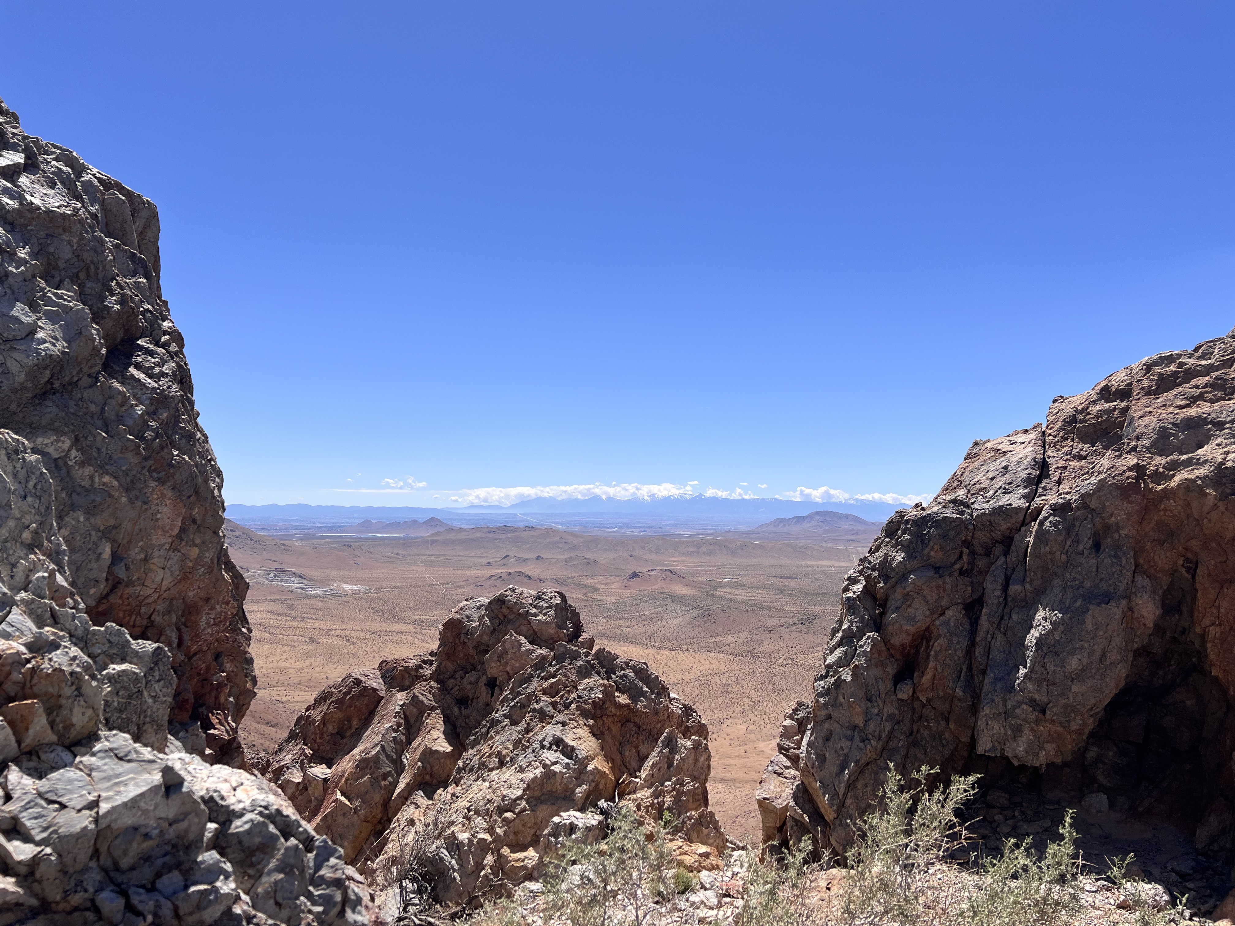
A wide-angle shot framing a vast desert plain viewed through a natural gap between jagged rock formations in the foreground. Distant snowcapped hills stretch across the far horizon beneath a thin line of cloud.
California’s high desert stretches below a bright spring sky in April 2026. NASA and USGS scientists are using airborne remote sensing to home in on potential sources of critical minerals here and across the Western U.S.
NASA/JPL-Caltech

In addition to copper — the third most used metal in the world after steel and aluminum — the deposits can hold other critical minerals like molybdenum and tellurium, which are used in everything from steelmaking to solar panels. Finding the deposits isn’t easy. Geologists look for topaz because it forms under the same volcanic conditions.

For the team in the Mojave, the goal was to collect more evidence. That would require boots on the ground and a heavy bag of samples. The scientists who converged on the site included three experts from the U.S. Geological Survey (USGS) and Robert Green of NASA’s Jet Propulsion Laboratory in Southern California.

“What we’re doing out here is geologic CSI,” said Green, referring to the investigative TV show, as he split open a weathered red rock to expose a sparkling core. “We’re looking for clues to reconstruct what happened here.”

A three-dimensional cube representing multispectral imaging data of an arid landscape. The front face shows an aerial image. The top and side panels display colored bands ranging from blue to red, illustrating spectral information for each pixel.
Three-dimensional image cubes illustrate the volume of data captured by NASA imaging spectrometers. The front face shows an aerial view of the Mojave Desert. The colorful side panels reveal what no eye or camera can detect: the spectral fingerprints of minerals present in every pixel.
NASA/JPL-Caltech

Next-generation mineral mapping

The sensor that detected the topaz deposit on public land near Barstow, California, was built at JPL. Called AVIRIS, short for Airborne Visible Infrared Imaging Spectrometer, it analyzes reflected sunlight and can be used to identify chemicals and minerals by their unique spectral fingerprint. The technology was pioneered in the early 1980s by a team that included Green, and space-hardened versions have explored the Moon, Mars, and other rocky bodies in the solar system in the decades since.

While its cousins study distant worlds aboard spacecraft, the AVIRIS line of sensors is advancing Earth science from aircraft. The latest model, AVIRIS-5, recently took to the skies for the first time as part of the NASA-USGS Geologic Earth Mapping Experiment (GEMx). The goal of GEMx is to identify sources of critical minerals across the American West, including in the waste rock of active and legacy mines. It is led by the USGS as part of its larger, nationwide initiative.

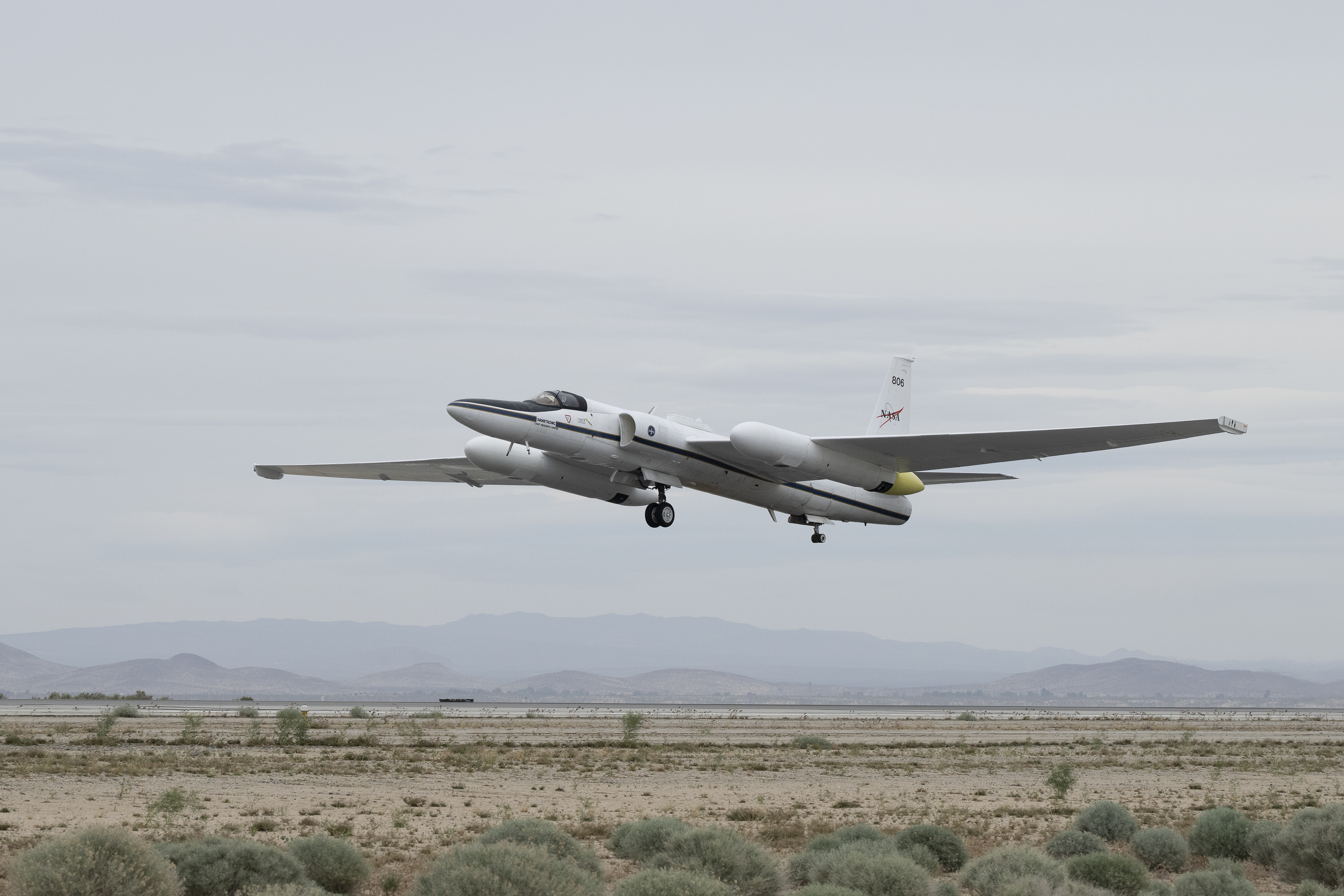
Carrying next-generation sensors, a high-altitude NASA ER-2 aircraft takes off from the agency’s Armstrong Flight Research Center in Edwards, California, on March 31, 2026, to support the GEMx mineral mapping campaign.
NASA/Carla Thomas

Since 2023, GEMx flights have covered more than 386,000 square miles (1 million square kilometers) of American soil, including most of California.

Ground-truthing the sensor data can entail hot field work, scrambling over steep crags to uncover samples for lab analysis. While testing has confirmed the topaz discovery, determining if the Mojave site overlies a porphyry copper deposit will require intensive investigation using ground-penetrating equipment. But the AVIRIS finding shows how advanced NASA airborne sensing can help lead geologists to the metaphorical needle in a haystack, even in heavily explored Southern California.

“People have been prospecting this area for generations,” said Erik Tharalson, a USGS geologist. “But there’s a lot more to discover.”

High flyer

From the beginning, the GEMx mineral mapping campaign has been enabled by one of the highest-flying aircraft in NASA’s fleet: the ER‑2. It deployed on March 31 from NASA’s Armstrong Flight Research Center in Edwards, California, to Colorado Springs Airport in Colorado.

“We deployed to Colorado Springs to maximize flight time for data collection needed in Colorado, Utah, New Mexico, Arizona, and Texas,” said John McGrath, ER‑2 project manager at NASA Armstrong.

By the conclusion of this deployment on June 5, the aircraft had completed 26 flights totaling more than 125 hours. Soaring at about 65,000 feet, the ER-2 can fly at high altitudes that allow it to collect broad‑area, high‑resolution spectral measurements in a single pass, supporting researchers studying mineral composition and surface processes.

In 2025, the aircraft flew 36 science missions, collecting more than 7 billion measurements over 200 flight hours. The data has contributed to the largest airborne surface mineralogy dataset gathered in a single NASA-USGS campaign.

The GEMx survey is led and funded by the USGS Earth Mapping Resources Initiative. Earth MRI is modernizing mapping the nation’s surface and subsurface to find new, critical, and other minerals. It is a partnership effort with 45 state geological surveys, federal agencies, private industry, tribes, universities, and others. The initiative will capitalize on both the technology developed by NASA for spectroscopic imaging, as well as the USGS expertise in analyzing the datasets, conducting field work, and deriving critical mineral information from them.

To learn more about GEMx visit:

https://science.nasa.gov/mission/gemx/

Media Contacts

Andrew Wang / Andrew Good
Jet Propulsion Laboratory, Pasadena, Calif.
626-379-6874 / 818-393-2433
andrew.wang@jpl.nasa.gov / andrew.c.good@jpl.nasa.gov

Written by Sally Younger

2026-037

The post NASA, USGS Scientists Go Rock Hounding in California’s High Desert appeared first on NASA Science.

NASA, USGS Scientists Go Rock Hounding in California’s High Desert

11 June 2026 at 16:38
Four people with backpacks pause to examine rocks on a hillside under a clear blue sky, with a large orange-and-tan boulder in the foreground.
Geologists recently converged on a site near Barstow, California, to ground-truth a mineral discovery made on public land by a NASA JPL sensor flying aboard a plane overhead.
NASA/JPL-Caltech

Equipped with rock picks and hand lenses, a team of geoscientists deployed to the Mojave Desert recently to investigate a tantalizing “fingerprint” detected by a NASA sensor. Their target: a cache of topaz hiding in plain sight.

The geologists weren’t searching for gem-grade treasure. Rather, the presence of topaz could hint at a more valuable deposit below of something known as porphyry copper.

One of the world’s primary sources of copper, these deposits are left behind when magma and hot water from deep underground course through Earth’s crust, chemically transforming the surrounding rock. This tends to occur where one tectonic plate dives below another, known as a subduction zone, such as the North American Cordillera, which stretches from the Canadian Rockies to western Mexico.

A wide-angle shot framing a vast desert plain viewed through a natural gap between jagged rock formations in the foreground. Distant snowcapped hills stretch across the far horizon beneath a thin line of cloud.
California’s high desert stretches below a bright spring sky in April 2026. NASA and USGS scientists are using airborne remote sensing to home in on potential sources of critical minerals here and across the Western U.S.
NASA/JPL-Caltech

In addition to copper — the third most used metal in the world after steel and aluminum — the deposits can hold other critical minerals like molybdenum and tellurium, which are used in everything from steelmaking to solar panels. Finding the deposits isn’t easy. Geologists look for topaz because it forms under the same volcanic conditions.

For the team in the Mojave, the goal was to collect more evidence. That would require boots on the ground and a heavy bag of samples. The scientists who converged on the site included three experts from the U.S. Geological Survey (USGS) and Robert Green of NASA’s Jet Propulsion Laboratory in Southern California.

“What we’re doing out here is geologic CSI,” said Green, referring to the investigative TV show, as he split open a weathered red rock to expose a sparkling core. “We’re looking for clues to reconstruct what happened here.”

A three-dimensional cube representing multispectral imaging data of an arid landscape. The front face shows an aerial image. The top and side panels display colored bands ranging from blue to red, illustrating spectral information for each pixel.
Three-dimensional image cubes illustrate the volume of data captured by NASA imaging spectrometers. The front face shows an aerial view of the Mojave Desert. The colorful side panels reveal what no eye or camera can detect: the spectral fingerprints of minerals present in every pixel.
NASA/JPL-Caltech

Next-generation mineral mapping

The sensor that detected the topaz deposit on public land near Barstow, California, was built at JPL. Called AVIRIS, short for Airborne Visible Infrared Imaging Spectrometer, it analyzes reflected sunlight and can be used to identify chemicals and minerals by their unique spectral fingerprint. The technology was pioneered in the early 1980s by a team that included Green, and space-hardened versions have explored the Moon, Mars, and other rocky bodies in the solar system in the decades since.

While its cousins study distant worlds aboard spacecraft, the AVIRIS line of sensors is advancing Earth science from aircraft. The latest model, AVIRIS-5, recently took to the skies for the first time as part of the NASA-USGS Geologic Earth Mapping Experiment (GEMx). The goal of GEMx is to identify sources of critical minerals across the American West, including in the waste rock of active and legacy mines. It is led by the USGS as part of its larger, nationwide initiative.

Carrying next-generation sensors, a high-altitude NASA ER-2 aircraft takes off from the agency’s Armstrong Flight Research Center in Edwards, California, on March 31, 2026, to support the GEMx mineral mapping campaign.
NASA/Carla Thomas

Since 2023, GEMx flights have covered more than 386,000 square miles (1 million square kilometers) of American soil, including most of California.

Ground-truthing the sensor data can entail hot field work, scrambling over steep crags to uncover samples for lab analysis. While testing has confirmed the topaz discovery, determining if the Mojave site overlies a porphyry copper deposit will require intensive investigation using ground-penetrating equipment. But the AVIRIS finding shows how advanced NASA airborne sensing can help lead geologists to the metaphorical needle in a haystack, even in heavily explored Southern California.

“People have been prospecting this area for generations,” said Erik Tharalson, a USGS geologist. “But there’s a lot more to discover.”

High flyer

From the beginning, the GEMx mineral mapping campaign has been enabled by one of the highest-flying aircraft in NASA’s fleet: the ER‑2. It deployed on March 31 from NASA’s Armstrong Flight Research Center in Edwards, California, to Colorado Springs Airport in Colorado.

“We deployed to Colorado Springs to maximize flight time for data collection needed in Colorado, Utah, New Mexico, Arizona, and Texas,” said John McGrath, ER‑2 project manager at NASA Armstrong.

By the conclusion of this deployment on June 5, the aircraft had completed 26 flights totaling more than 125 hours. Soaring at about 65,000 feet, the ER-2 can fly at high altitudes that allow it to collect broad‑area, high‑resolution spectral measurements in a single pass, supporting researchers studying mineral composition and surface processes.

In 2025, the aircraft flew 36 science missions, collecting more than 7 billion measurements over 200 flight hours. The data has contributed to the largest airborne surface mineralogy dataset gathered in a single NASA-USGS campaign.

The GEMx survey is led and funded by the USGS Earth Mapping Resources Initiative. Earth MRI is modernizing mapping the nation’s surface and subsurface to find new, critical, and other minerals. It is a partnership effort with 45 state geological surveys, federal agencies, private industry, tribes, universities, and others. The initiative will capitalize on both the technology developed by NASA for spectroscopic imaging, as well as the USGS expertise in analyzing the datasets, conducting field work, and deriving critical mineral information from them.

To learn more about GEMx visit:

https://science.nasa.gov/mission/gemx/

Media Contacts

Andrew Wang / Andrew Good
Jet Propulsion Laboratory, Pasadena, Calif.
626-379-6874 / 818-393-2433
andrew.wang@jpl.nasa.gov / andrew.c.good@jpl.nasa.gov

Written by Sally Younger

2026-037

NASA’s CloudCube Pioneers Miniaturized Radar to Study Clouds, Precipitation

10 June 2026 at 13:00

A compact, multifrequency radar built by a team at NASA’s Jet Propulsion Laboratory will make it easier to collect information about dynamic cloud systems. Called CloudCube, this new instrument simultaneously probes the atmosphere with three radar signals, spanning 36 to 240 GHz, for optimized sensitivity to a wide range of water droplet and ice particle sizes. 

An outdoor scientific equipment setup on a gravel surface under a bright blue sky. The main structure is a white shipping container elevated on concrete blocks, with a large, white, drum-shaped dome mounted on its roof. Attached to the front of the container is a grey metal cabinet featuring the red Jet Propulsion Laboratory (JPL) logo and a small angled panel on top. Bright green tie-down straps anchor the front equipment securely to the ground. Another container with a metal ladder is partially visible on the left.
Figure 1: A prototype of CloudCube’s G-band channel was installed at Cape Grim, Tasmania, as a guest instrument for the Department of Energy’s Cloud and Precipitation Experiment at Kennaook (CAPE-K)
Credit: Raquel Rodriguez Monje / JPL

Built with funding from NASA’s Earth Science Technology Office Instrument Incubator Program, CloudCube transmits and receives Ka-, W-, and G-band signals, making it the first compact radar system capable of simultaneously probing meteorological targets at wavelengths spanning approximately one to ten millimeters. Researchers will be able to combine information from the three signals to learn more about the initiation and evolution of precipitation, as well as cloud microphysics and radiative properties.

“We’re making a low-power, low-mass instrument to facilitate new cost-efficient missions for atmospheric observations. Building a multi-frequency radar, especially at G-band, is very novel,” said Raquel Rodriguez Monje, a systems engineer at JPL and principal investigator for CloudCube.

Each of CloudCube’s three signals observes a different element of cloud physics. Ka-band radar signals are ideal for collecting precipitation profiles; W-band radar signals are preferred for measuring cloud particles that give rise to precipitation; and G-band radar signals, which have never been collected from a space-based instrument, are ideal for measuring ice and liquid water content inside very light clouds (a paper describing this measurement can be found here).

Probing the atmosphere simultaneously with three signals allows researchers to collect data on all these cloud features at once, which is valuable for improving weather forecasts and especially climate modeling. CloudCube leverages innovations in millimeter-wave hardware to pack three radar modules–one for each signal–within a single compact system.

A highly intricate piece of custom electronic, likely radio frequency or microwave, hardware sitting on a light blue surface. The assembly is made mostly of thick gold-plated and silver metal blocks fastened together with numerous screws. It features several curved, rigid gold waveguides with flanged connections, various coaxial ports, a multi-pin D-sub connector, and a small bundle of colored electrical wires. A silver block on top is labeled with
Figure 2. A photo of the radar electronics for CloudCube’s compact G-band radar. Producing G-band radar signals requires a large amount of energy, and CloudCube is one of the first instruments to produce those signals effectively from a compact platform.
Credit: Raquel Rodriguez Monje / NASA JPL

One CloudCube innovation concerns the specialized components required to transmit G-band power from a compact, low-power instrument. The detection of cloud signals requires high transmit power, which CloudCube achieves by combining the outputs of multiple high-efficiency frequency-multiplication devices that allow the instrument to generate hundreds of milliWatts at 240 GHz. Another innovation of CloudCube is that it was designed to use as few radio frequency components as possible to reduce its mass and power consumption, which could lower the cost of future Earth-observing orbital instruments.

Flying an instrument equipped with G-band radar in space will be a new capability and will allow researchers to achieve greater spatial resolution and sensitivity in the study of cloud microphysical processes.

“Basically, we’re weighing clouds using these combinations of frequencies in a way that we couldn’t do before we had the G-band,” said Matt Lebsock, a researcher at JPL and co-investigator for CloudCube.

The instrument has been tested in the field. A ground-based prototype of CloudCube’s G-band channel operated continuously for 11 months during the Department of Energy’s Cloud and Precipitation Experiment at Kennaook (CAPE-K) campaign. CloudCube also participated in the Eastern Pacific Cloud Aerosol Precipitation Experiment, a ground campaign sponsored by the Department of Energy. A paper describing the results of that experiment can be found here.

Most recently, CloudCube successfully operated all three frequency bands from NASA’s Gulfstream III aircraft and collected its first airborne observations of snowfall as part of the North American Upstream Feature-Resolving and Tropopause Uncertainty Reconnaissance Experiment campaign—a NASA-funded campaign designed to improve forecasts of high-impact winter weather. The CloudCube team is currently calibrating and processing the data for public release.

For additional details, see the entry for this project on NASA TechPort.

Project Lead: Dr. Raquel Rodriguez Monje, NASA’s Jet Propulsion Laboratory

Sponsoring Organization: NASA’s Earth Science Technology Office Instrument Incubation Program

NASA’s CloudCube Pioneers Miniaturized Radar to Study Clouds, Precipitation

10 June 2026 at 13:00

A compact, multifrequency radar built by a team at NASA’s Jet Propulsion Laboratory will make it easier to collect information about dynamic cloud systems. Called CloudCube, this new instrument simultaneously probes the atmosphere with three radar signals, spanning 36 to 240 GHz, for optimized sensitivity to a wide range of water droplet and ice particle sizes. 

An outdoor scientific equipment setup on a gravel surface under a bright blue sky. The main structure is a white shipping container elevated on concrete blocks, with a large, white, drum-shaped dome mounted on its roof. Attached to the front of the container is a grey metal cabinet featuring the red Jet Propulsion Laboratory (JPL) logo and a small angled panel on top. Bright green tie-down straps anchor the front equipment securely to the ground. Another container with a metal ladder is partially visible on the left.
Figure 1: A prototype of CloudCube’s G-band channel was installed at Cape Grim, Tasmania, as a guest instrument for the Department of Energy’s Cloud and Precipitation Experiment at Kennaook (CAPE-K)
Credit: Raquel Rodriguez Monje / JPL

Built with funding from NASA’s Earth Science Technology Office Instrument Incubator Program, CloudCube transmits and receives Ka-, W-, and G-band signals, making it the first compact radar system capable of simultaneously probing meteorological targets at wavelengths spanning approximately one to ten millimeters. Researchers will be able to combine information from the three signals to learn more about the initiation and evolution of precipitation, as well as cloud microphysics and radiative properties.

“We’re making a low-power, low-mass instrument to facilitate new cost-efficient missions for atmospheric observations. Building a multi-frequency radar, especially at G-band, is very novel,” said Raquel Rodriguez Monje, a systems engineer at JPL and principal investigator for CloudCube.

Each of CloudCube’s three signals observes a different element of cloud physics. Ka-band radar signals are ideal for collecting precipitation profiles; W-band radar signals are preferred for measuring cloud particles that give rise to precipitation; and G-band radar signals, which have never been collected from a space-based instrument, are ideal for measuring ice and liquid water content inside very light clouds (a paper describing this measurement can be found here).

Probing the atmosphere simultaneously with three signals allows researchers to collect data on all these cloud features at once, which is valuable for improving weather forecasts and especially climate modeling. CloudCube leverages innovations in millimeter-wave hardware to pack three radar modules–one for each signal–within a single compact system.

A highly intricate piece of custom electronic, likely radio frequency or microwave, hardware sitting on a light blue surface. The assembly is made mostly of thick gold-plated and silver metal blocks fastened together with numerous screws. It features several curved, rigid gold waveguides with flanged connections, various coaxial ports, a multi-pin D-sub connector, and a small bundle of colored electrical wires. A silver block on top is labeled with "I" and "Q". A US quarter coin sits in the lower-left corner to indicate the scale of the device.
Figure 2. A photo of the radar electronics for CloudCube’s compact G-band radar. Producing G-band radar signals requires a large amount of energy, and CloudCube is one of the first instruments to produce those signals effectively from a compact platform.
Credit: Raquel Rodriguez Monje / NASA JPL

One CloudCube innovation concerns the specialized components required to transmit G-band power from a compact, low-power instrument. The detection of cloud signals requires high transmit power, which CloudCube achieves by combining the outputs of multiple high-efficiency frequency-multiplication devices that allow the instrument to generate hundreds of milliWatts at 240 GHz. Another innovation of CloudCube is that it was designed to use as few radio frequency components as possible to reduce its mass and power consumption, which could lower the cost of future Earth-observing orbital instruments.

Flying an instrument equipped with G-band radar in space will be a new capability and will allow researchers to achieve greater spatial resolution and sensitivity in the study of cloud microphysical processes.

“Basically, we’re weighing clouds using these combinations of frequencies in a way that we couldn’t do before we had the G-band,” said Matt Lebsock, a researcher at JPL and co-investigator for CloudCube.

The instrument has been tested in the field. A ground-based prototype of CloudCube’s G-band channel operated continuously for 11 months during the Department of Energy’s Cloud and Precipitation Experiment at Kennaook (CAPE-K) campaign. CloudCube also participated in the Eastern Pacific Cloud Aerosol Precipitation Experiment, a ground campaign sponsored by the Department of Energy. A paper describing the results of that experiment can be found here.

Most recently, CloudCube successfully operated all three frequency bands from NASA’s Gulfstream III aircraft and collected its first airborne observations of snowfall as part of the North American Upstream Feature-Resolving and Tropopause Uncertainty Reconnaissance Experiment campaign—a NASA-funded campaign designed to improve forecasts of high-impact winter weather. The CloudCube team is currently calibrating and processing the data for public release.

For additional details, see the entry for this project on NASA TechPort.

Project Lead: Dr. Raquel Rodriguez Monje, NASA’s Jet Propulsion Laboratory

Sponsoring Organization: NASA’s Earth Science Technology Office Instrument Incubation Program

The post NASA’s CloudCube Pioneers Miniaturized Radar to Study Clouds, Precipitation appeared first on NASA Science.

NASA's Psyche spacecraft returns unfamiliar views of a familiar world

20 May 2026 at 22:26

Not quite halfway through a six-year sojourn through the Solar System, a NASA spacecraft used a close encounter with Mars last week as a dress rehearsal for its arrival at the Solar System's largest metal asteroid in 2029.

The Psyche mission launched more than two-and-a-half years ago, in October 2023, from Kennedy Space Center, Florida, to kick off a journey of some 2.2 billion miles (3.6 billion km) to reach its unexplored namesake, the asteroid Psyche. The robotic research mission got an initial lift from a powerful SpaceX Falcon Heavy rocket. It uses plasma engines to gradually build up the impulse needed to reach its destination in the asteroid belt, between the orbits of Mars and Jupiter.

A flyby of Mars last Friday gave the spacecraft its most significant boost since launch. Navigators at NASA's Jet Propulsion Laboratory in California set up the spacecraft for a course taking it 2,864 miles (4,609 km) from the Martian surface, well above the planet's tenuous atmosphere. Psyche used Martian gravity like a slingshot to gain enough speed to reshape its orbit around the Sun, putting the probe on a path to intercept its asteroid target.

Read full article

Comments

© NASA/JPL-Caltech/ASU

❌