❌

Normal view

NASA’s CASALS Instrument Bridges Gaps in 3D Maps of Earth’s Surface

21 October 2026 at 13:17

From orbit, today’s space-based laser instruments measure Earth’s forests and terrain one narrow line at a time. Between those lines are enormous gaps that include millions of acres of land scientists never directly measure. NASA’s CASALS instrument will blend machine learning with an ultra-compact lidar instrument to adaptively ‘sweep’ large swaths of Earth’s surface. This new capability for space-based remote sensors allows CASALS to create truly three-dimensional (3D) topographical renderings. 

Video from a CASALS flight over the Great Cypress Swamp in Delaware on Nov. 12, 2024, showing tree canopy tops in green, the ground in purple, and near-ground vegetation in blue.
Credit: NASA

A team of researchers at NASA’s Goddard Space Flight Center (GSFC) has developed a new instrument designed to eliminate blind spots between lines of lidar data on the Earth’s surface. Built with support from NASA’s Earth Science Technology Office (ESTO), the Concurrent Artificially-intelligent Spectrometry Lidar System (CASALS) could help researchers map the features of Earth’s surface with unprecedented detail. Rather than mechanically steering a laser with moving mirrors, CASALS steers light using wavelength itself, generating a continuous, 3D swath of the ground below. 

John Yorks, a physical research scientist at GSFC and Principal Investigator for CASALS, explained that the instrument features a novel transmitter and optical grating system that manipulates laser pulses without heavy, failure-prone motorized mirrors. 

Instead, CASALS uses a fast-pulsing, tunable “seed” laser centered at 1040 nanometers, rapidly cycling through 256 unique wavelengths as it pulses through an optical component with a microscopic pattern of ridges called a transmission grating. 

At this point, the physics of diffraction takes over. Because light bends at slightly different angles depending on its exact wavelength, the grating naturally “steers” each of the 256 pulses into a distinct position across the flight path. 

This non-mechanical approach paints a continuous 3D swath of the ground. Not only does this eliminate the large unmapped gaps left between the isolated tracks of legacy spaceborne lidars, but stripping away moving parts drastically reduces the instrument’s size, weight, and power (SWaP) requirements. This makes it more reliable for the harsh environment of space. 

Another key innovation within CASALS is its detector array. This component features a uniquely high Quantum Efficiency (QE), a variable that describes how effectively a detector converts incoming light (photons) into an electrical signal. CASALS operates at 80% QE. This means CASALS wastes almost none of the light that makes it back to the sensor. 

With QE that high, CASALS can detect much weaker return signals, allowing it to collect useful measurements from darker surfaces or through denser vegetation. 

This technology isn’t limited to a laboratory environment. In November 2024, an airborne CASALS prototype flew aboard NASA’s B200 King Air aircraft. The instrument produced science-quality datasets on its first campaign, exceeding the team’s expectations. 

“I’m very impressed with Guang Yang, Jeffrey Chen, and all our engineers, and how well CASALS performed. This worked really well from the first time we flew it, which is pretty impressive,” said Yorks. 

Flying at an altitude of roughly five kilometers, CASALS can distinguish individual tree branches and subtle changes in ground elevation, thanks to its 22-centimeter horizontal resolution. 

“We’re able to see really fine details of vegetation structure and changes in the topography of the surface,” Yorks said. 

The team aims to fly CASALS again as part of the Airborne Surface, Cryosphere, Ecosystem, and Nearshore Topography (ASCENT) campaign, scheduled for summer 2027. 

But there’s more work to do to prepare the technology for space. The team plans to make several improvements to CASALS before creating a space-ready prototype. Specifically, they’re widening the instrument’s swath and adding onboard data processing software. 

Transitioning from a successful airborne prototype to a fully realized space mission is a challenge, but the CASALS team is up to the task. 

“The team’s really done a great job of sticking together and keeping on task and on schedule. We are being funded to optimize and improve the performance, and we’re also then looking at ways to take the technologies used in the airborne instrument and mature them and prepare them for a spaceborne version in the future,” said Yorks. 

If successful, CASALS could become the first spaceborne lidar capable of mapping Earth’s forests and terrain as continuous three-dimensional swaths rather than isolated profiles, giving scientists a dramatically more complete picture of our changing planet. 

For additional details, see the entry for this project on NASA TechPort. 

Project Lead(s): John Yorks, NASA’s Goddard Space Flight Center 

Sponsoring Organization(s): NASA’s Decadal Survey Incubation (DSI) program; NASA’s Instrument Incubation Program (IIP); NASA’s Goddard Space Flight Center; University of California, Santa Barbara; Virginia Polytechnic Institute and State University 

Share

Details

Last Updated
Oct 21, 2026
Editor
NASA Science Editorial Team
Location
Goddard Space Flight Center

NASA Watches Earth’s Weight, Finds Center of Mass

16 September 2026 at 17:08

5 min read

Preparations for Next Moonwalk Simulations Underway (and Underwater)

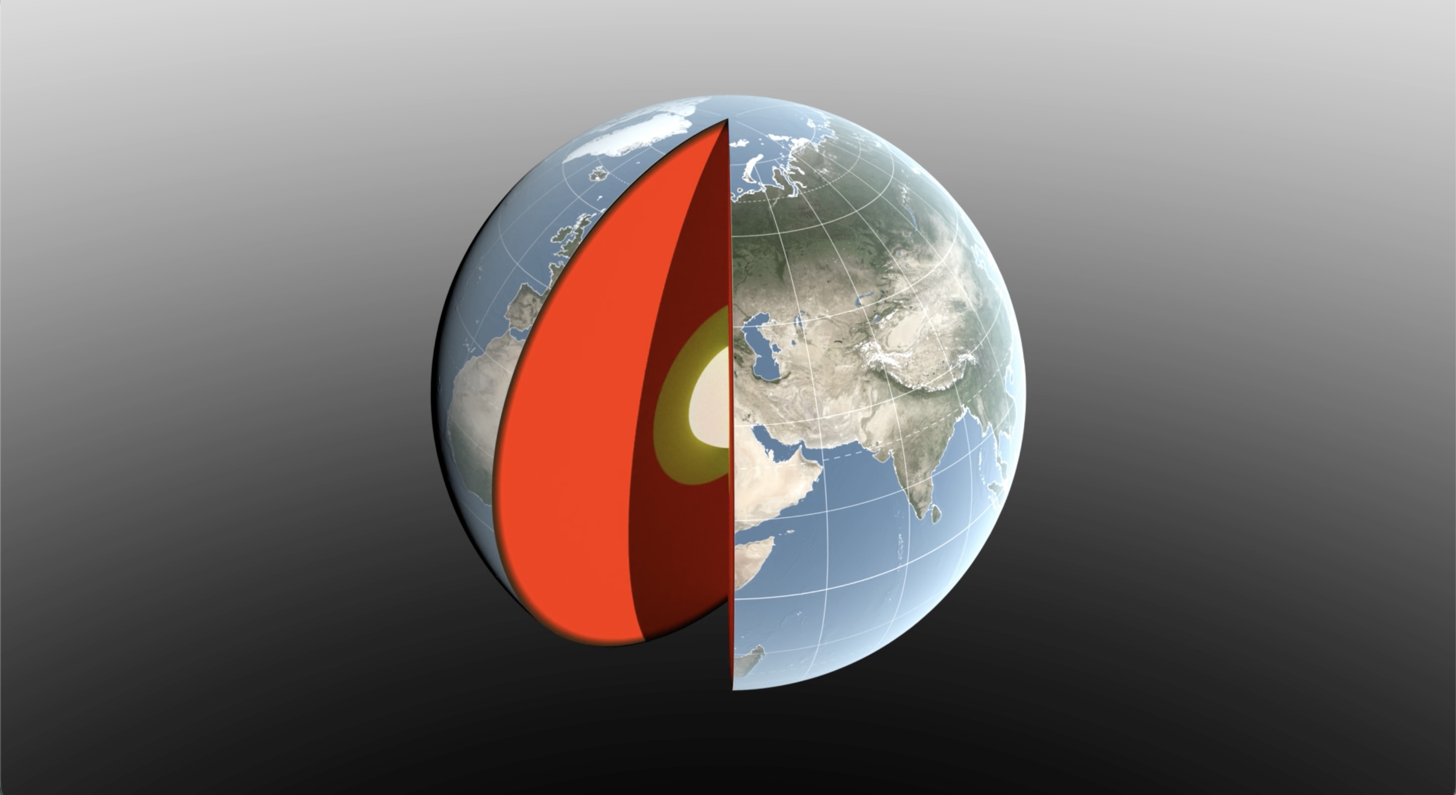
A 3D digital illustration of Earth with a slice cut away to reveal its internal layers. The exterior shows a realistic view of the globe, focusing on Europe, Asia, and Africa with visible geographic features and grid lines.
Water sloshing between the land and oceans shifts Earth’s center of mass relative to its geometric center. NASA scientists have developed a new technique using ultraprecise satellite tracking to estimate the displacement to within fractions of inches.
NASA’s Scientific Visualization Studio

Seasonal changes redistribute enough water around Earth to shift the planet’s center of mass back and forth by fractions of an inch relative to its geometric center. NASA scientists are on the case, tracking the oscillations because Earth’s center of mass is a crucial reference point for satellite navigation and elevation measurements.

A team, led by NASA’s Jet Propulsion Laboratory in Southern California, has proposed a way to calculate the seasonal swings with extreme precision. The technique and findings are detailed in a new study published in Geophysical Journal International. The authors paint a vivid picture of springtime thaws, churning oceans, and dense winter air shifting massive surface loads from season to season.

The study isn’t the first attempt to pin down Earth’s center of mass. Scientists over the decades have pioneered several space-based techniques to define and locate it. But it’s a moving goalpost. If Earth were a hard blue marble, its center of mass would simply overlap its geometric center. In reality, the planet is sloshing and sagging under the weight of water, ice, and air. Because of this, Earth’s center of mass continually swivels around its geometric center by as much as several millimeters.

NASA’s Space Geodesy Project currently uses a variety of space- and land-based techniques to track Earth’s center of mass (also called the geocenter) moving up and down and side to side. This animation traces the millimeter-scale motion from 1993 to 2017.
NASA’s Scientific Visualization Studio

How accurate are existing methods to measure the size of the swivel? The last two international estimates, made in 2017 and 2023, differ by 0.27 inches (7 millimeters), about the height of three stacked nickels. The difference is almost as large as the motion itself.

To reduce uncertainty, JPL geoscientist Donald Argus led the development of a new technique based on ultraprecise satellite tracking.

Driven by gravity, satellites naturally orbit Earth’s center of mass, as if bound by invisible tethers. Tiny changes in the distance between satellites and ground stations reflect Earth’s shifting center of mass.

Using satellites to locate Earth’s center of mass is not a new idea. In fact, dense metal satellites, launched in 1976 and 1992, are dedicated exclusively to this purpose. Resembling 900-pound (408-kilogram) disco balls, both Laser Geodynamics Satellites (LAGEOS 1 and 2) are studded with reflective prisms and tracked with laser precision via ground stations globally distributed across more than 20 countries.

However, one limitation of satellite laser ranging is the uneven distribution of ground stations around Earth. The new technique improves accuracy in two ways: It adds GPS tracking into the mix along with orbital data from several satellites in low Earth orbit to provide a diverse array of targets. And it considers how the weight of water and ice deforms Earth’s crust, taking ground stations along for the ride.

The technique was developed by Argus along with researchers from JPL’s satellite orbit determination team, the University of Nevada, University of Montana, and the Helmholtz Centre for Geosciences in Germany.

“We’re now estimating the size of the movement of Earth’s mass center back and forth each year to be about half of what we believed it to be eight years ago,” said Argus. “Our findings suggest that the mass of Earth’s water and air moving between the hemisphere is smaller than previously thought.”

Felix Landerer, one of the study’s coauthors at JPL, noted that “while these movements might appear tiny, our modern world relies on extremely accurate positioning measurements. By unraveling and understanding the mechanisms that change reference systems, we can build better reference systems that ultimately benefit mapping and navigation — from global shipping logistics to precision agriculture.”

What they found

The study authors tracked Earth’s center of mass oscillating seasonally and attributed the cause to three categories: oceans, atmosphere, and continental water (made up of land ice, snow, lake and river water, soil moisture, and groundwater).

They found that snow accumulation in North America and Eurasia reaches a maximum in March and shifts Earth’s center of mass about 3 millimeters toward the North Pole. A month later, in April, rainwater in the Amazon River basin peaks at 2,400 gigatons, swinging Earth’s center of mass 2.2 millimeters toward South America. Monsoon water in southeast Asia attains a maximum of 600 gigatons six months later in November, adding slightly to the annual oscillation.

Between August and October, the oceans swell with meltwater and rain, and Earth’s center of mass shifts toward the South Pacific Ocean. The Pacific Ocean is so large that mass changes there overshadow the loss or gain in other oceans, though seasonal dynamics in the Mediterranean, Red, North, Baltic, and Barents seas all help shift Earth’s center of mass in their own small way.

The researchers used a model developed by the European Centre for Medium-Range Weather Forecasts to estimate how atmospheric changes affect Earth’s center of mass throughout the seasons. They found that cold, dense, winter air helps tip the scales over Arabia, Asia, and northern Africa around Dec. 21 each year, and over South America and South Africa around June 21.

The mass calculations in the study are consistent with observations made by the Gravity Recovery and Climate Experiment Follow-On (GRACE-FO) mission. Launched in 2018, the mission is made up of twin satellites that map monthly fluctuations in Earth’s gravitational pull due primarily to the mass movement of water above and below ground. The two satellites fly in precise formation, and when the lead satellite passes over a dense body, like a swollen river basin, the extra gravitational tug changes the distance between its twin by a small but measurable amount.

The GRACE-FO mission is a joint partnership between NASA and the German Research Centre for Geosciences (GFZ). The next-generation GRACE-Continuity (GRACE-C) mission is targeting a launch in late 2028 to extend the nearly 25-year GRACE-series data record.

-end-

Written by Sally Younger

2026-061

❌