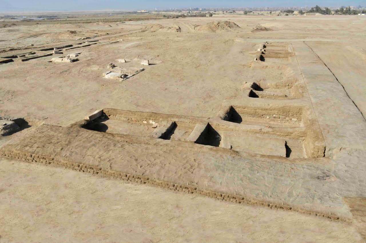
Archaeologists in Egypt have discovered an ancient tomb belonging to the "keeper of the secrets of royal decrees," they announced following an excavation at Saqqara.
The decorated burial belongs to an official named Sekhentio-Ptah, who lived during the Old Kingdom (2649 to 2150 B.C.), a period that's famous for the building of the pyramids, including those at Giza.
While the title "keeper of the secrets of royal decrees" may sound mysterious, it was likely a more bureaucratic position, said Ann Macy Roth, a clinical professor of Egyptology at New York University who was not involved with the excavation.
It "probably merely means that as someone in charge of royal documents and the people who write them, he has access to confidential information," Roth told Live Science in an email. "It's a common title among royal scribes."
The official Sekhentio-Ptah had a number of other titles, according to his tomb, including "Overseer of all the King's Works" and "Overseer of Royal Documents," representatives of Egypt's Ministry of Tourism and Antiquities wrote in a translated statement.
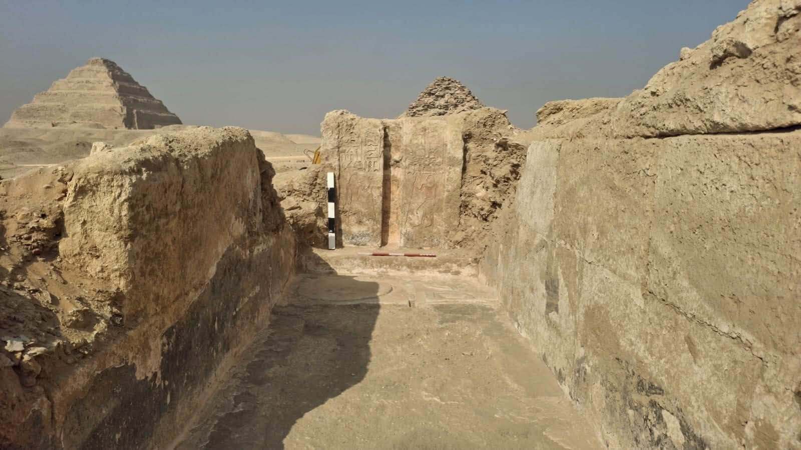
Within the tomb, archaeologists found an offering table, a purification basin and two false doors. The false door is a symbolic door, commonly found in ancient Egyptian tombs, that was believed to allow the soul to exit and enter the tomb at will. The design of the false doors places them in the late fifth or early sixth dynasty, around 4,350 years ago, Roth said.
Part of the newfound tomb, which dates to well over 4,000 years ago. (Image credit: Photo courtesy of the Egyptian Ministry of Tourism and Antiquities )
More than 100 shabtis (also spelled ushabtis) were found in the tomb. Ancient Egyptians believed these figurines would act as servants for the deceased in the afterlife. The team also discovered a wooden statue of a falcon (possibly related to the falcon-headed god Horus) and the remains of cartonnage, a plastered material used on mummies. The mummy of Sekhentio-Ptah was not identified.
Looking at the photos and information the ministry released, Roth said it's likely this tomb was reused for later burials — something that was commonly done in ancient Egypt. She said the shabtis found in the tomb likely belong to later burials and the cartonnage is likely from mummies that were buried in the tomb at a later date.
The team discovered the tomb in the Bubasteion (also spelled Bubasteum) area of Saqqara, a place that was commonly used forcat burials in later times such as the late period (circa 664 to 332 B.C). The site was associated with Bastet, a cat-shaped goddess associated with fertility and protection. However, the statement didn't mention any cat burials found in this particular tomb.
Live Science reached out to the excavation team but did not hear back by the time of publication.
See how much you know about mummies with our mummy quiz.
The Romans are well known for their aqueducts, which brought water to their cities and settlements.
These aqueducts sometimes ran for very long distances. For instance, the aqueduct of Valens, which brought water to the city of Constantinople (modern-day Istanbul), was 250 miles (400 kilometers) long, according to a statement from Johannes Gutenberg University Mainz.
The aqueducts also lasted a long time; their remains are some of the most prominent Roman architectural finds visible today. All of this demonstrates the Romans' engineering prowess. So how did the Romans build such large and long-lasting aqueducts?
First, the Romans would select a source of water for the aqueduct, with springs being a popular choice. The aqueducts had to be designed so water would flow toward the city or settlement. The successful building of the aqueducts "was accomplished by an ever slight incline downwards from the spring to its end source," such as Rome, Ann Olga Koloski-Ostrow, a classics professor and chair emerita at Brandeis University in Massachusetts, told Live Science in an email.
Roman surveyors had to design a route carefully. "To choose a route with the necessary gradient, Roman surveyors would have either used the libra or the dioptra,"Joseph Lewis, an archaeologist at the University of Cambridge, told Live Science in an email.
The dioptra was shaped like a disc with a sighting bar in the middle. It could be suspended from a stand, and the surveyor could look through the sighting bar at rods in the ground to help determine their elevations. "Surveyors would sight through the sighting bar toward surveying staves to measure differences to elevation," Lewis said.
The exact design of the libra is unclear, but we know that it had a plumb bob that was suspended in the air and the surveyor could compare it to rods in the ground to help determine differences in ground height. "Surveyors would set the libra up along proposed routes for the aqueduct and look forward and backward against calibrated staves," Lewis explained, noting that this allowed them to determine differences in ground height.
Building a long-lasting aqueduct
The Romans used a form of concrete that tended to last much longer than modern-day concrete. Roman concrete used pozzolan, an ashy substance, that was combined with lime and water to form a durable concrete that hardened when exposed to water.
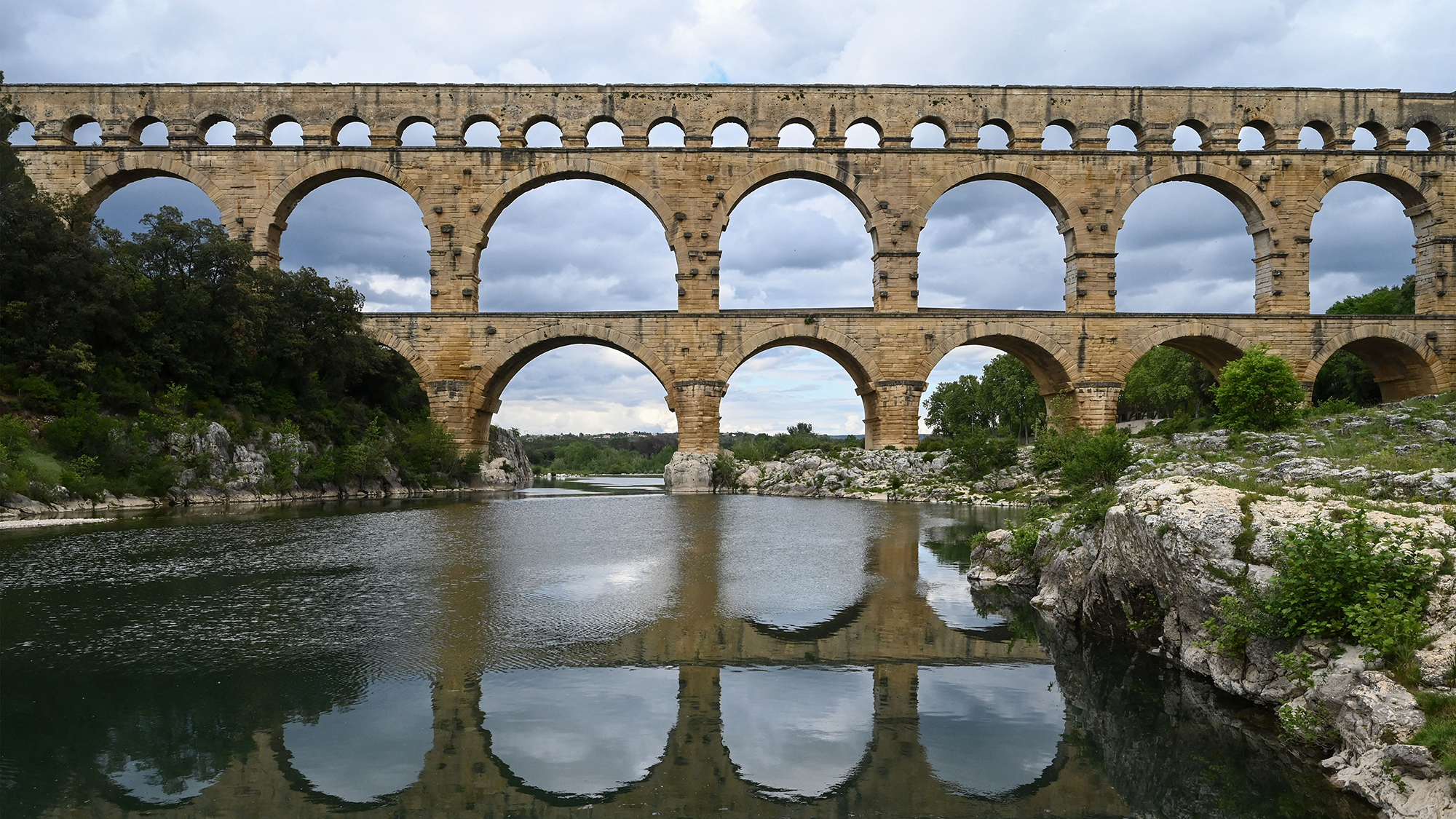
A Roman aqueduct crossing a river at Pont du Gard in France. (Image credit: PASCAL GUYOT via Getty Images)
"Roman concrete certainly played an important role, especially in bridges, arcades, and other structural elements," Giovanni De Feo, a professor of industrial engineering at the University of Salerno in Italy, said in an email.
But this wasn't the only factor that allowed Roman aqueducts to last such a long time.
"I believe their remarkable preservation results from a combination of factors," De Feo said. For example, the Romans were careful to select routes that followed stable geological formations.
Regular maintenance that, in many cases, continued into the Middle Ages also helped Roman aqueducts survive the test of time, De Feo noted. This means that they tried to avoid volcanoes and other landscapes that were unstable.
Aqueducts did not always run aboveground; sometimes, they had lengthy underground portions in areas where the landscapes made it difficult to place it aboveground. Some "aqueducts had hardly any stretches above ground outside the city, while others ran on arches for a considerable distance," Gerda de Kleijn, a researcher at Radboud University in the Netherlands, wrote in her book "The Water Supply of Ancient Rome" (J.C. Gieben, 2001).
As the water neared the city, it would sometimes go into pools that helped remove dirt and other visible pollutants. "Water would pool into the basin, sediment would sink to the bottom, then the water would continue from there on its course to the distribution tank," Harry Evans, a professor emeritus of classics at Fordham University, said in an email.
The number of workers required to build an aqueduct depended on its size and timeline for completion. The Hadrianic aqueduct at Athens, which runs for about 12.4 miles (20 km), could have been completed in 15 years by a team of around 500 workers, researchers estimated in a 2022 paper.
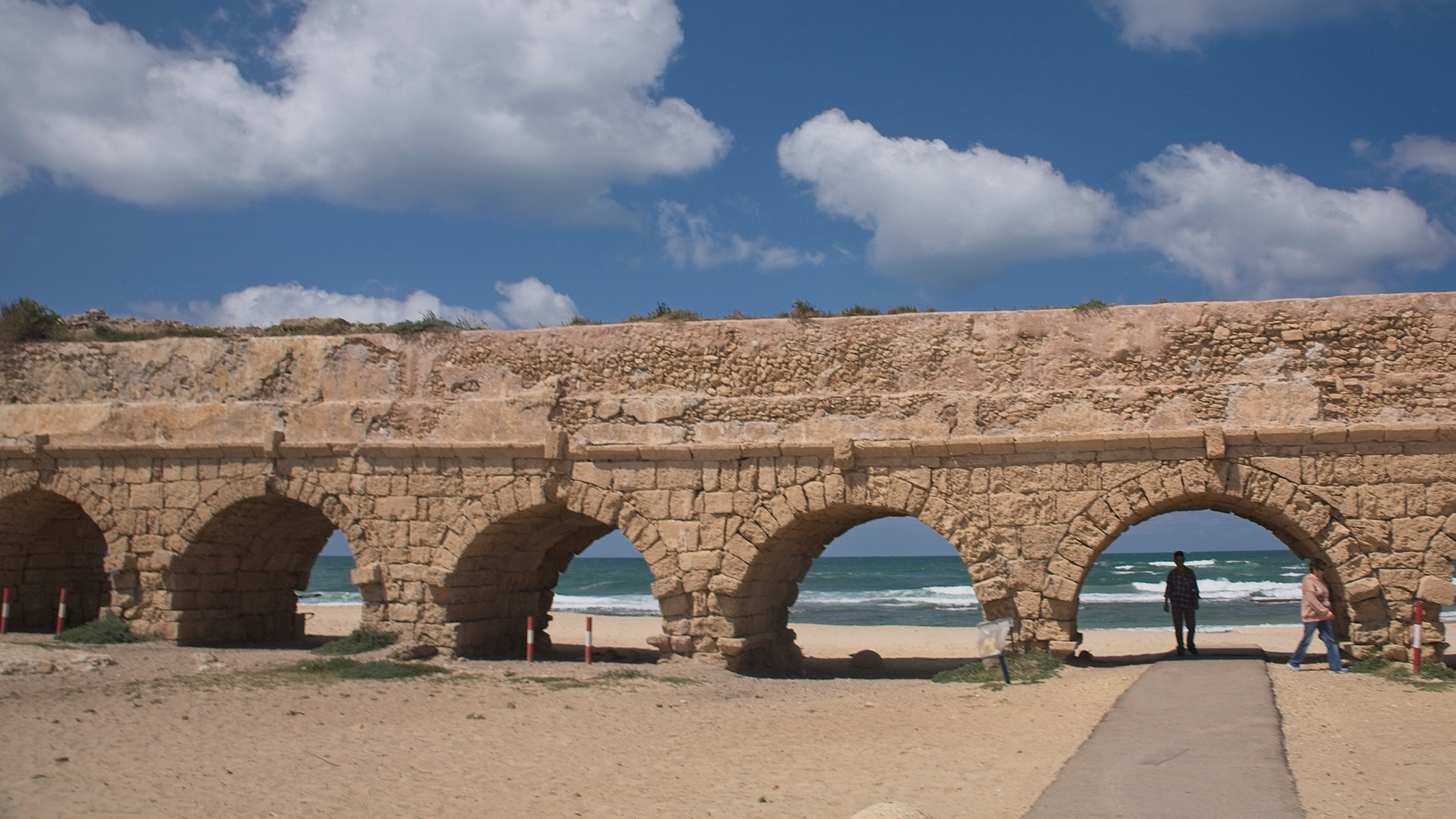
Part of a Roman aqueduct in Caesarea, on the Mediterranean coast. (Image credit: Richard Nowitz Photography via Getty Images)
After an aqueduct was built, regular maintenance kept it in good shape.Cees Passchier, head of tectonophysics at Johannes Gutenberg University Mainz in Germany, has studied a Roman aqueduct at Divona in France. In a 2023 study, Passchier and colleagues found that carbonate would have built up on the aqueduct over time. Maintenance workers "partly scraped away" the carbonate before replastering the aqueduct, Passchier told Live Science in an email. At some other aqueducts, they wouldn't bother scraping but would "simply plaster over the carbonate without ever cleaning anything," he said.
A sizable number of workers would have been needed to keep aqueducts functional, but it varied based on the aqueduct's size. For "a small place like Divona, a workforce of a dozen people would probably have been enough," Passchier said. "We know that in Rome, there was a staff of a few hundred people to keep the aqueducts working."
Even after the Roman Empire collapsed, many of its aqueducts survived, as some were used and maintained into the Middle Ages and even into modern times. One of the aqueducts, the Aqua Virgo, built in 19 B.C., is still bringing water to Rome today.
From Augustus to Nero, see how much you know about ancient Rome's famous leaders with our Roman emperor quiz!
A 3,200-year-old Egyptian inscription found near an ancient military road may indicate the location of a long-lost city, archaeologists have announced.
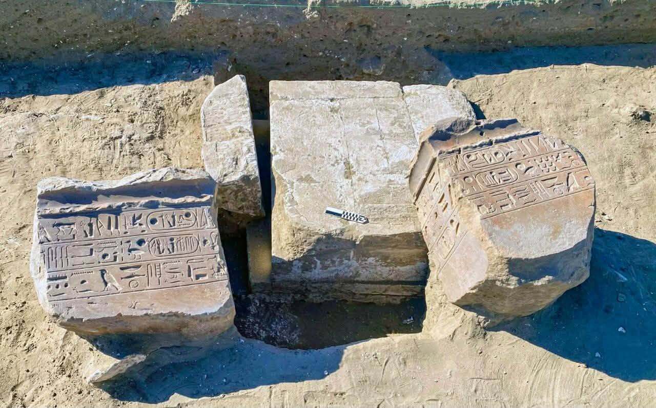
Found at the site of Tell Abu Seifi (also spelled Seify), the inscription mentions Ramesses II, who reigned from about 1279 to 1213 B.C. It says that Horus, a falcon-headed ancient Egyptian god associated with the sky and war, is the "Lord of the City of Mesn," representatives of the Egyptian Ministry of Tourism and Antiquities said in a translatedstatement.
The team also found the remains of a temple dedicated to Horus at the archaeological site, they said in the statement. Unfortunately, "the temple was almost completely destroyed," making it difficult to get much information from it, Hesham Hussein, the director general of Delta and Sinai Archaeology at Egypt's Ministry of Tourism and Antiquities and a leader of the research team, told Live Science in an email.
Tell Abu Seifi is located by the Suez Canal, near the north Sinai Desert and the eastern Nile Delta. The presence of both the inscription that mentions Mesn and a temple of Horus at the site means there is a strong possibility that Tell Abu Seifi is, in fact, Mesn (also spelled Mesen), according to the statement. However, Hussein cautioned that more research is needed for archaeologists to be certain.
The ministry’s statement called Mesn a "lost city," and it is difficult to determine precisely when the city was founded or how large it was. "Because its archaeological identification has remained uncertain, we cannot currently provide a reliable estimate of its total extent or population," Hussein said.
If Tell Abu Seifi is Mesn, it seems to have existed for a long time. A bronze seal that was previously found at Tell Abu Seifi and dates to the Ptolemaic period (circa 304 to 30 B.C.) also has an inscription that says, "Horus, Lord of Mesen," Hussein noted, and coffins dating to the Ptolemaic period previously found at the site have similar inscriptions.
Horus also seems to have been extremely important to the people of Mesn. "The title "Horus, Lord of Mesen" directly connects the deity with the place, and the archaeological evidence from Tell Abu Seify supports the importance of this cult," Hussein said.
A view of more of the inscriptions, which were written in the name of Ramesses II. (Image credit: Photo courtesy of the Egyptian Ministry of Tourism and Antiquities)
Way of Horus
Tell Abu Seifi is located near what the ancient Egyptians called the "Way of Horus" (or "Ways of Horus"), a road that connected the eastern Nile Delta with the southern Levant and was dotted with fortresses.
Peter Brand, a professor of history at the University of Memphis in Tennessee who was not involved in the excavation, said the evidence indicates that Tell Abu Seifi, which is near the modern-day city of Qantara, is Mesn. "Several fortifications were built along the 'Ways of Horus' and Mesen, near modern Qantara, was likely one of the 'jumping off' points for Egyptian armies departing for Canaan, Lebanon, and Syria," he told Live Science in an email.
A road leading out of Africa and into the Middle East was key, as the Egyptians went on several military campaigns to expand their empire around that time.
"The Egyptian empire dominated this part of the Middle East," Brand said. "Ramesses II's father had built a series of the forts along the Ways and Ramesses himself marched his armies across Sinai during his military campaign." This included his famous Battle of Kadesh, in what is now Syria, against the Hittite Empire, a kingdom based in Anatolia (modern-day Turkey).
The site's temple also hints at its importance.
Part of the site, which may actually be part of Mesn, a long-lost city from ancient Egypt. (Image credit: Photo courtesy of the Egyptian Ministry of Tourism and Antiquities)
The "temple of the god Horus of Mesen was the most important religious center in the area," Brand said. He noted that the newfound inscription mentions "how Ramesses II restored a statue of Horus of Mesen." Remarkably, the pedestal of a statue just like this was previously found at the site.
These two clues indicate that Tell Abu Seifi is Mesn, Brand said.
Waiting for more evidence
Other scholars were not ready to identify Tell Abu Seifi as Mesn. James Hoffmeier, an archaeologist and professor at Trinity International University who has conducted extensive work in the region, said that while the case is strong, he wants to see more evidence, such as ceramics from the site, to be sure.
One problem is that similar inscriptions mentioning Mesn have been found at other sites in the region, raising the question of whether those sites could be Mesn, Gregory Mumford, an anthropology professor at the University of Alabama at Birmingham who was not involved in the excavations, told Live Science in an email. These sites include a fortress at Kom el-Qolzoum on the Suez and a fort at Tjaru in the northwest Sinai Desert. Mumford proposed that Mesn could be a broad area that encompasses multiple sites in the region.
Other scholars also said more information on the discoveries was needed.
Oren Siegel, an Egyptology professor at the University of Toronto who was not involved in the excavation, said this is a "really exciting find" but he wants to wait for more information before commenting in detail.Shirly Ben Dor Evian, an Egyptology professor at the University of Haifa in Israel who wasn't involved in the excavation, also said more information, particularly on the hieroglyphic inscriptions, was needed.
Research into the site is ongoing. Hussein noted that, interestingly, historical records show there was a second settlement named Mesn located in southern Egypt.
Are you a fan of mummies and hieroglyphs? Find out with our ancient Egypt quiz!

 Login