Normal view

Oxygen Loss in Inland Freshwater Ecosystems

3 June 2026 at 21:37

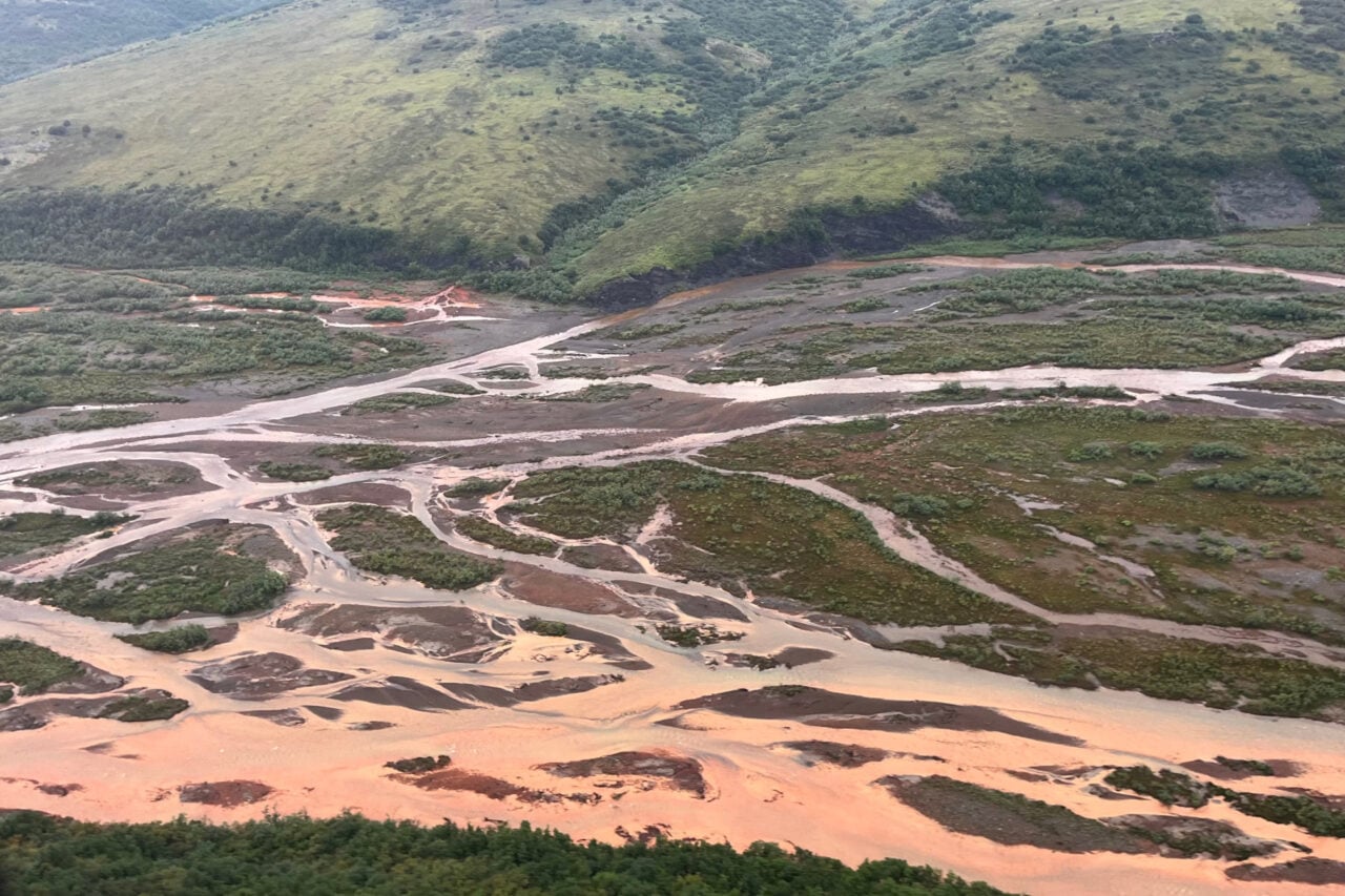
Inland freshwater ecosystems—comprising rivers, lakes, and reservoirs—are critical reservoirs of biodiversity and essential sources of freshwater resources for human use. However, these ecosystems are facing an alarming threat from deoxygenation, a process characterized by declining levels of dissolved oxygen (DO) in surface and subsurface waters. Dissolved oxygen serves as a fundamental driver of aquatic life, facilitating aerobic respiration for myriad organisms and sustaining complex biogeochemical cycling. The rapid depletion of DO in freshwater systems threatens not only the ecological health of these habitats but also the socioeconomic stability of communities that depend on them for drinking water, fisheries, and recreation.

Recent studies reveal a stark global trend: surface water dissolved oxygen in inland freshwater bodies is declining at unprecedented rates. Over the last two decades, lakes have recorded an average DO decrease of approximately 0.034 mg per liter per decade during summer months, while rivers have exhibited a more pronounced year-round decline of 0.043 mg per liter per decade dating back to the early 1980s. These patterns are not uniform, with spatial variability linked to geographic and climatic heterogeneity. Notably, the most dramatic decreases have occurred in Asian lakes, where DO has dropped by 0.043 mg per liter per decade, and in the Amazon River Basin, where declines reach as much as 0.2 mg per liter per decade, a figure that signals profound disruption in one of the planet’s most vital freshwater systems.

The drivers behind this widespread deoxygenation are multifaceted, intricately interwoven with both natural processes and human influences. Climate warming emerges as a dominant force amplifying oxygen depletion through several mechanisms. Elevated temperatures exacerbate thermal stratification in lakes and reservoirs, prolonging the summer layering of water masses which prevents oxygen exchange between surface and bottom layers. Moreover, oxygen’s solubility in water inherently decreases as temperature rises, compounding DO shortages. Higher temperatures also stimulate microbial metabolism, escalating the respiration rates that consume available oxygen. In sum, climatic warming both directly and indirectly escalates the vulnerability of freshwater systems to hypoxia and anoxia.

Human activities intensify these natural stressors by accelerating nutrient inputs, primarily nitrogen and phosphorus, through agricultural runoff, sewage discharge, and industrial effluents. This nutrient enrichment leads to eutrophication—a process marked by excessive algal growth and subsequent decay, further depleting oxygen levels once the organic matter decomposes. Extreme rainfall events, which are increasing in frequency and intensity due to climate change, exacerbate this situation by facilitating nutrient transport and promoting the development of hypoxic zones. Globally, this complex interplay of anthropogenic nutrient loading and climate-induced changes is reshaping hydrological and biogeochemical cycles with alarming consequences.

The process of deoxygenation initiates a cascade of biogeochemical feedbacks that accelerate ecosystem deterioration. Oxygen-depleted conditions foster the proliferation of anaerobic microbial communities, altering the cycling of key elements such as nitrogen, sulfur, and carbon. For instance, in low-oxygen environments, increased denitrification and sulfate reduction processes release potent greenhouse gases like nitrous oxide and hydrogen sulfide, contributing to climate warming and further degrading water quality. These feedback loops not only diminish biodiversity through selective pressures on aerobic organisms but also impede ecosystem resilience by modifying essential nutrient fluxes.

Biological communities within freshwater habitats are profoundly restructured as DO levels decline. Aerobic species—ranging from fish and macroinvertebrates to key microbial taxa—often face physiological stress or mortality due to hypoxic conditions, leading to losses in biodiversity and shifts toward more tolerant but less ecologically functional assemblages. These shifts undermine the ecological integrity of freshwater systems, compromising ecosystem functions such as nutrient cycling, primary production, and organic matter decomposition. Consequently, trophic interactions become altered, disrupting food web dynamics and potentially promoting harmful algal blooms and invasive species that further degrade water quality.

In parallel, the socioeconomic dimensions of freshwater deoxygenation are vast and insidious. Diminished oxygen concentrations impair fishery productivity, reducing catch volumes and the livelihoods of millions dependent on inland fisheries worldwide. Deoxygenated waters often exhibit poorer recreational quality due to eutrophication-driven algal blooms and unpleasant odors, impacting tourism and associated economic benefits. Moreover, the quality of drinking water sourced from lakes and rivers can be severely compromised by hypoxia-induced processes, including the release of harmful contaminants and changes in microbial populations. These factors collectively jeopardize public health, food security, and economic stability.

Despite the gravity of freshwater deoxygenation, monitoring efforts remain insufficiently coordinated and under-resourced. Establishing comprehensive, real-time dissolved oxygen monitoring networks is critical for detecting early-stage deoxygenation events and informing rapid management responses. Coupled with these networks, the development of integrated predictive models that incorporate climatic, hydrological, and biogeochemical drivers can improve forecasting accuracy and guide adaptive management strategies. These models must consider complex feedback mechanisms and potential nonlinear responses to environmental changes to ensure reliability.

Mitigation requires a multifaceted approach emphasizing nutrient management through reduction of agricultural runoff, wastewater treatment improvements, and watershed restoration. Restoration efforts that reestablish hydrological connectivity and promote aquatic vegetation can enhance oxygen replenishment and buffer against extreme events. Ecological restoration not only targets oxygen replenishment but also fosters biodiversity recovery and resilience building. Coordinated governance frameworks integrating local stakeholder engagement, scientific expertise, and policy enforceability are vital to ensuring the sustainability of mitigation initiatives.

Furthermore, adaptation strategies must anticipate the compounding threats posed by future climate warming and land-use changes. Increasing community awareness and embedding scientific findings into policy decisions foster better resilience and stewardship at the local to global scales. Collaborative interdisciplinary research—and transboundary cooperation, especially in large, shared freshwater basins—is pivotal for confronting the complexities of freshwater deoxygenation.

In conclusion, the widespread deoxygenation of surface waters in inland freshwater systems represents a critical environmental challenge with far-reaching ecological and socioeconomic impacts. The synergistic effects of climate warming and human activities have set in motion a trajectory of oxygen loss that threatens the viability of aquatic ecosystems globally. Addressing this challenge mandates innovative science-policy interfaces, enhanced monitoring infrastructures, proactive nutrient and watershed management, and inclusive governance models. Only through integrated and adaptive strategies can the integrity and functionality of our planet’s freshwater ecosystems be safeguarded for future generations.


Subject of Research: Deoxygenation trends, drivers, and impacts in inland freshwater ecosystems

Article Title: Deoxygenation in inland freshwater systems

Article References:
Shi, K., Iestyn Woolway, R., Guan, Q. et al. Deoxygenation in inland freshwater systems. Nat Rev Earth Environ (2026). https://doi.org/10.1038/s43017-026-00795-x

Image Credits: AI Generated

Fast Quake Magnitude Estimation Using Borehole Strains

3 June 2026 at 13:19

In an era where every second counts in mitigating the impact of natural disasters, the rapid and accurate classification of earthquake magnitudes remains one of the foremost challenges in seismology. Traditional seismic methods, while robust, often face latency issues and inconsistencies, particularly when discerning the early signatures of major tremors. A compelling breakthrough, recently reported by Sawi et al. in Nature Communications, amplifies the potential of borehole strainmeters combined with cutting-edge Distributed Acoustic Sensing (DAS) technology to revolutionize how seismic events are detected and classified. Their pioneering study introduces an innovative approach that leverages P-wave strain measurements for immediate magnitude classification—ushering in a new frontier for earthquake early warning systems worldwide.

The crux of this advancement lies in harnessing the initial P-wave signals generated during an earthquake. Unlike the more destructive S-waves and surface waves, P-waves travel fastest through the Earth, arriving at sensors before significant damage has begun. Historically, magnitude estimation has relied heavily on shaking intensity and frequency content derived from secondary waves, which inherently introduces delay. However, Sawi and colleagues’ methodology centers on directly capturing dynamic strain responses from these early-arriving P-waves using borehole strainmeters embedded deep within the Earth’s crust. This means instead of measuring ground displacement or velocity, the technology quantifies the tiny volumetric changes the rock undergoes as seismic waves propagate.

Distributed Acoustic Sensing, an innovative fiber optic-based technology, is key to this paradigm shift. By transforming conventional fiber optic cables into dense arrays of seismic sensors, DAS offers unprecedented spatial resolution over vast distances. Coupled with borehole strainmeters, this system captures the subtle nuances of strain fields with exquisite sensitivity and near real-time responsiveness. The integration of these technologies permits the extraction of detailed strain waveforms that directly correlate to the earthquake’s rupture process and consequently its magnitude. Unlike typical seismic networks where sensor spacing can be sparse or irregular, DAS fiber arrays enable a highly granular seismic picture that was previously unattainable.

One of the most groundbreaking findings by the researchers revolves around their ability to swiftly classify earthquake magnitudes through machine-learning algorithms trained on P-wave strain data. By analyzing strain amplitude patterns from numerous earthquakes spanning a range of magnitudes, the team demonstrated that early P-wave strain characteristics reliably predict the event size, often within seconds of wave arrival. This approach circumvents the long-standing challenge of magnitude saturation, where traditional scales underestimate the size of large events due to reliance on ground motion amplitudes alone. The implication for earthquake early warning systems is immense: not only can alerts be dispatched faster, but their accuracy in estimating potential damage zones is significantly enhanced.

Such a method holds profound implications for regions susceptible to seismic hazards. Early warning systems equipped with this technology could facilitate rapid decision-making processes for emergency responders, infrastructure protection, and public safety communications. For dense urban environments, even a few seconds of advanced notice can mean the difference between chaos and controlled evacuation. Importantly, the fusion of borehole strainmeter data with distributed optical sensing allows for scalable deployment—fiber optic networks, already widespread in urban and industrial settings, can potentially be adapted for seismic monitoring with minimal additional infrastructure.

The technical underpinnings of the study delve into the signal processing algorithms crafted to isolate P-wave strain signals amid background noise and competing seismic phases. The authors meticulously outline how waveform preprocessing, including filtering and windowing techniques, enables robust feature extraction essential for training predictive models. Deep learning frameworks were customized to discern subtle distinctions in strain signal envelopes and temporal evolution, correlating them with magnitude scaling laws. The fidelity of these models was validated against historical earthquakes, ensuring both sensitivity to small events and robustness against false positives.

Beyond immediate practical applications, this research enriches our fundamental understanding of earthquake mechanics. The direct measurement of strain within the Earth’s interior sheds light on rupture initiation processes, energy release rates, and fault slip characteristics. These insights could feed back into seismic hazard models, refining both spatial and temporal forecasts of earthquake likelihood. Moreover, the ability to continuously monitor strain variations in real time may open new avenues for detecting precursory phenomena, potentially inching us closer to the elusive goal of earthquake prediction.

It is noteworthy that the deployment of borehole strainmeters—though highly sensitive—has traditionally been limited due to installation complexity and cost. The incorporation of Distributed Acoustic Sensing mitigates these limitations by repurposing existing fiber optic cables for dense seismic arrays, reducing the need for extensive sensor networks and allowing for widespread coverage, especially in remote or offshore areas. The synergy between these two techniques exemplifies how combining conventional geophysical instrumentation with innovative sensing technologies can yield transformative results.

Moreover, the study addresses the issue of data integration from heterogeneous sensor networks. By harmonizing strainmeter outputs with DAS data streams, the researchers established a comprehensive multisensor approach that balances temporal precision with spatial detail. This multiscale monitoring capability ensures that early strain signals are neither lost in noise nor isolated from broader seismic context. The multilayered data fusion strategy amplifies the reliability of magnitude assessments, making it feasible to implement on global earthquake monitoring platforms.

Sawi et al.’s research also explores how their methodology interfaces with existing seismic infrastructure. The advent of real-time cloud computing and edge processing enables the rapid handling of the massive data volumes inherent to DAS systems. Coupled with decentralized algorithms capable of operating on site, the system circumvents traditional bottlenecks in data transmission and processing latency. This architecture ensures that magnitude classification data can feed directly into early warning dissemination channels, promptly activating mitigation protocols.

Additionally, the implications for future earthquake research are far-reaching. Deploying DAS-enhanced borehole strainmeters along major fault zones offers an unprecedented window into the spatial complexity of seismic rupture propagation. Continuous, dense strain measurements could elucidate phenomena such as foreshock sequences, slow slip events, and aftershock distributions with an accuracy unmatched by conventional seismic networks. As data accumulates, machine learning models will further improve their predictive capabilities, potentially guiding dynamic response strategies and urban planning.

The technological innovation showcased in this study exemplifies the convergence of material science, optical engineering, geophysics, and data science. The delicate task of deploying strainmeters in boreholes with minimal disturbance to surrounding rock layers demands meticulous engineering, while the adaptation of telecommunication fiber optics as seismic sensors highlights interdisciplinary ingenuity. This cross-pollination of fields paves the way for future innovations beyond earthquake science, such as monitoring volcanic activity, landslides, or even anthropogenic subsurface processes like hydraulic fracturing.

From a societal standpoint, this accelerated approach to earthquake magnitude classification represents a monumental leap toward resilience against seismic disasters. Early warnings with higher fidelity empower communities to safeguard lives and infrastructure more effectively. The method’s scalability and adaptability make it relevant for diverse geographical settings, from sprawling metropolitan areas to vulnerable rural regions. As climate change and urbanization increase the stakes of natural hazards, such advanced monitoring and alert systems will become indispensable.

In closing, the work by Sawi and colleagues elegantly demonstrates how modern technological tools can be integrated with classical geophysical principles to address one of humanity’s most enduring challenges: understanding and responding to Earth’s seismic fury with speed and precision. By directly capturing P-wave strain fields deep within the Earth and processing them with sophisticated computational techniques, the study charts a new course for earthquake early warning science. This breakthrough not only enhances our ability to measure and classify earthquakes in real time but also sets the stage for a future where seismic risks are managed with unprecedented agility and insight.

Their findings, meticulous methodology, and visionary application illuminate the path forward for both researchers and policymakers. As these technologies mature and deployment scales up, we may well witness a paradigm shift in our global capability to anticipate earthquakes—not just as unforeseen disasters, but as phenomena we can understand and respond to with unparalleled clarity and rapidity. The fusion of borehole strainmeter sensitivity with the extensive reach of Distributed Acoustic Sensing thus stands as a beacon of hope in the perpetual quest to mitigate the forces of nature.


Subject of Research: Rapid earthquake magnitude classification through P-wave strain measurement using borehole strainmeters and Distributed Acoustic Sensing.

Article Title: Rapid earthquake magnitude classification via P-wave strains from borehole strainmeters and Distributed Acoustic Sensing.

Article References:
Sawi, T.M., McGuire, J.J., Barbour, A.J. et al. Rapid earthquake magnitude classification via P-wave strains from borehole strainmeters and Distributed Acoustic Sensing. Nat Commun 17, 4776 (2026). https://doi.org/10.1038/s41467-026-72223-z

Image Credits: AI Generated

DOI: https://doi.org/10.1038/s41467-026-72223-z

Fan-Shaped East Antarctic Basin Formed by Rotation

3 June 2026 at 12:38

A groundbreaking tectonic model has emerged from the depths of East Antarctica’s frozen landscape, revealing a colossal rotational extension process that shaped a striking handheld-fan-shaped structural feature beneath the ice. This vast subglacial basin province, meticulously reconstructed by geoscientists, offers compelling evidence of continental-scale deformation that redefined East Antarctica’s crustal architecture. The implications of this discovery reverberate beyond geological curiosity, stirring fresh insights into the ancient tectonic forces that sculpted one of the planet’s most enigmatic continents and linking these subterranean transformations to the dynamics of Gondwana’s fragmentation.

At the heart of this tectonic revelation lies a single, continent-wide mechanism dominated by rotational extension—an earth-shaping process that not only dramatically reworked pre-existing structures but also set in motion subsequent geological phenomena of monumental scale. This model suggests that the rotational extension instigated a complex reconfiguration of East Antarctic lithosphere, fundamentally influencing the geological evolution of critical mountain ranges, including the Gamburtsev and Transantarctic Mountains. The resulting deformation and segmentation within these ranges underpin the formation of conjugate continental margins, which form a semi-circular pattern between Antarctica and Australia, illuminating previously obscure steps in the precursory tectonic stages leading up to the ultimate breakup of Gondwana.

One of the most intriguing aspects of this tectonic scenario concerns the spatial coincidence between the fan-shaped province’s pivot point and the Euler poles inferred for the extension between East and West Antarctica after approximately 34 million years ago. Although there remains uncertainty surrounding the precise location of these rotational poles, the close alignment raises provocative questions about the stability of deformation centers over geological time scales. This alignment further suggests a potential causal link bridging intraplate deformation mechanisms with the broader plate tectonic motions that characterized the region during late Cenozoic rifting and continental evolution.

Remarkably, this fan-like rotational deformation appears confined exclusively to the Antarctic lithosphere. Detailed analyses fail to identify any continuation of these features into the adjacent Australian continent, signaling a previously unrecognized intraplate deformation zone within East Antarctica. This discovery holds profound implications for reconciling longstanding inconsistencies in tectonic reconstructions, particularly in refining the fit between the Australian and Antarctic continental margins. Identifying this localized deformation zone may illuminate why some plate reconstructions have documented unusually broad crustal overlaps and difficult-to-explain mismatches across conjugate basement terranes and major fault systems.

Beyond its tectonic significance, this rotational extension model profoundly informs our understanding of the East Antarctic Ice Sheet’s origins and dynamic behaviour. Initiated approximately 34 million years ago, the ice sheet’s evolution intersects the geological fabric sculpted by the extensional forces operating beneath it. The subglacial basins forming the handheld-fan-like structure influence not only the basal topography but also the dynamic feedback mechanisms governing ice sheet retreat and advance. Due to ongoing subsidence and cooling of the crust following extension, many of these basin floors lie near or below modern mean sea level, engendering conditions that likely amplify the ice sheet’s sensitivity and vulnerability to climatic perturbations.

Topographically, the segmentation of major mountain ranges in East Antarctica via a network of east-west oriented circular shear belts has played a pivotal role in directing glacial pathways. Shear zones along these belts create structural weaknesses exploited by massive outlet glaciers such as Byrd, Beardmore, Nimrod, David, Priestley, and Tucker. These glaciers have incised profound troughs into the mountains, driving further isostatic uplift of the peaks and perpetuating a cycle of tectonic and glacial interaction. This dynamic interplay exemplifies how ancient tectonic architecture continues to govern present-day cryospheric and geomorphological processes in Antarctica’s interior.

Similarly, the prominent fan-shaped boundary system oriented roughly north-south within the East Antarctic subglacial basin province appears intimately linked to the positions of some of the continent’s most significant outlet glaciers on its coastal margins. Totten, Vanderford, Denman, Frost, and Amery glaciers align closely with major basin boundaries, suggesting that structural geology fundamentally controls glacial drainage patterns. This tectonic-ice sheet interface underscores the critical role geological processes dating back more than 150 million years play in determining the contemporary ice sheet’s behaviour and its response to environmental change.

From a broader geodynamic perspective, the existence of this rotational extension province challenges conventional interpretations of East Antarctica’s lithospheric rigidity. Instead of behaving as a monolithic block, the continent’s eastern sector underwent profound internal distortion and segmentation, contesting previous models that invoked more homogeneous deformation. This nuanced understanding demands re-evaluation of geodynamic models that couple onshore structural features with offshore fracture zone studies, highlighting the complementary roles of both deep and shallow earth processes in continent-scale reorganization.

Moreover, the timeframe of deformation pinned to the EAFBP coincides intriguingly with marked geological shifts at the Paleogene-Neogene boundary. This temporal intersection accentuates the role of tectonics in modulating the environmental context for large-scale ice sheet nucleation and persistence. The established relationship provides a unique opportunity to integrate tectonic forcing into climate and cryosphere models, potentially refining predictions of ice sheet behaviour within a warming world.

Delineating the rotational extension process also sheds light on the segmentation observed within the Transantarctic Mountains and the West Antarctic Rift System. These structural discontinuities reveal how the continent’s lithosphere accommodated strain over millions of years, via curved shear belts and fault zones demarcating discrete tectonic blocks. Such segmentation arguably fostered localized uplift and subsidence patterns, influencing sediment deposition regimes and geomorphological evolution throughout the continent’s interior.

Perhaps most strikingly, this in-depth investigation emphasizes the enduring influence of early Mesozoic tectonics on shaping Antarctica’s geological framework, long after the initial stages of Gondwana’s breakup. By identifying a singular large-scale rotational extension event as a formative agent, this model unites seemingly disparate observations—from subglacial basin geometry to mountain range uplift—into a cohesive tectonic narrative. This unified perspective provides a valuable blueprint for reinterpreting the continent’s evolutionary trajectory and contextualizing its role within global plate tectonics.

The pioneering interdisciplinary approach harnessed to unravel this subglacial province integrates geophysical imaging, structural geology, and tectonic reconstruction techniques. Detailed gravity anomaly mapping and seismic reflection profiles provide unprecedented subsurface illumination, enabling researchers to differentiate subtle deformation patterns beneath kilometers of ice. The resulting dataset affords unparalleled clarity into the three-dimensional architecture of East Antarctica’s crust, setting a benchmark for future Antarctic geoscience research.

In conclusion, this discovery of a fan-shaped rotational extension province unveils an overlooked GPS of tectonic activity underpinning the East Antarctic lithosphere. It highlights the dynamic and evolving nature of continental interiors, traditionally considered tectonically inert. As our understanding deepens, so too does the appreciation for how ancient geological forces continue to wield influence over ice dynamics, mountain formation, and continental fragmentation—processes that shape Earth both past and present.

The identification of this rotational extension province opens new avenues for refining plate reconstructions involving Antarctica and Australia. It simultaneously challenges simplifications inherent in previous models, advocating for nuanced treatments of intraplate deformation zones. This progression promises enhanced geological models capable of incorporating the intricate interplay of forces molding Earth’s least accessible continental frontier.

Ultimately, these insights carry profound ramifications for predicting Antarctica’s future amid climate change. Given the pivotal role tectonic features play in modulating ice sheet sensitivity and stability, understanding their genesis and evolution becomes crucial for anticipating responses to accelerating global warming. This research thus exemplifies the vital synergy between geological sciences and cryospheric studies essential for informed stewardship of polar environments.


Subject of Research: The formation and tectonic evolution of a fan-shaped subglacial basin province in East Antarctica driven by rotational extension.

Article Title: A fan-shaped subglacial basin province in East Antarctica formed by rotational extension.

Article References:
Armadillo, E., Rizzello, D., Balbi, P. et al. A fan-shaped subglacial basin province in East Antarctica formed by rotational extension. Nat. Geosci. (2026). https://doi.org/10.1038/s41561-026-01991-6

Image Credits: AI Generated

DOI: https://doi.org/10.1038/s41561-026-01991-6

Keywords: East Antarctica, rotational extension, subglacial basins, tectonic deformation, Gondwana breakup, ice sheet dynamics, Transantarctic Mountains, Gamburtsev Mountains, intraplate deformation, East Antarctic Ice Sheet, plate reconstructions, lithospheric segmentation, continental rifting, conjugate margins

Global Rivers Show Increased Flashiness With Climate Change

3 June 2026 at 07:06

A groundbreaking new study has revealed an alarming intensification in the flashiness of river hydrographs worldwide, marking a significant shift in the behavior of earth’s freshwater systems under the influence of climate change. Published in Communications Earth & Environment, this research highlights not only the widespread nature of these changes but also their profound implications for water resource management, ecosystem stability, and hazard mitigation in coming decades. The findings serve as a stark reminder that climate dynamics are increasingly rewriting the hydrological patterns that humanity and nature rely on.

River hydrograph flashiness refers to the rapidity and magnitude of fluctuations in river discharge over short time scales. Traditionally, rivers exhibit relatively smooth changes in flow according to seasonal precipitation patterns and snowmelt. However, flashiness represents a scenario in which river discharge exhibits abrupt, intense peaks and troughs, shifting the timing and intensity of water availability. Such variability challenges downstream water infrastructure, destabilizes aquatic habitats, and exacerbates flood risks—a phenomenon that has now been identified as becoming pervasive on a global scale.

This comprehensive investigation leveraged a vast array of hydrological data spanning decades, integrating river gauge readings from thousands of sites across diverse climatic regions. By applying advanced statistical analyses to quantify flashiness indices, the researchers identified trends that point unmistakably towards enhanced flow variability coinciding with rising global temperatures and altered precipitation regimes. Importantly, the study confirms that this is not a localized problem: from arctic tundras to tropical basins, rivers are exhibiting increasingly erratic discharge patterns.

Climate change alters key drivers of hydrological cycles, including temperature, precipitation intensity, and snowpack dynamics. These changes translate into modified runoff regimes, as rainfall patterns become more intermittent yet intense, and melting glaciers contribute to erratic seasonal flows. The cumulative effect is a reshaping of river hydrographs towards heightened extremities — sudden spikes associated with storms followed by rapid declines, rather than prolonged periods of steady flow. This increased hydrograph flashiness signals a fundamental shift in river system behavior, complicating predictability and management efforts.

One of the critical implications of heightened river flashiness is its impact on flood frequency and magnitude. Sudden surges in river discharge, often triggered by extreme precipitation events, increase the likelihood of flash floods, which can destroy infrastructure, disrupt communities, and lead to loss of life. Simultaneously, rapid declines in flow during dry periods compromise water availability for agriculture, drinking, and industrial uses. This dual stress challenges traditional water management paradigms that rely on historical flow predictability, necessitating a reevaluation of policies and engineering designs.

Beyond human concerns, riverine ecosystems face significant threats due to changing flow variability. Many aquatic species have evolved life cycles synchronized with predictable flow patterns. The abrupt fluctuations associated with increased flashiness can disorient migratory fish, disrupt spawning, and degrade habitat quality by altering sediment transport and nutrient distribution. Moreover, riparian vegetation subjected to irregular inundation regimes may experience increased stress or mortality, destabilizing the entire river corridor ecology.

The study’s findings underscore the importance of integrating hydrograph flashiness metrics into climate impact assessments and water resource planning. Traditional hydrological models, which often emphasize mean flow or total annual runoff, may underestimate risks posed by extreme variability. Updating predictive frameworks to incorporate flashiness will improve hazard forecasting, guide infrastructure resilience measures, and support adaptive management strategies that can cope with more volatile hydrological realities.

Researchers employed novel remote sensing technologies alongside ground-based river gauges to capture high-resolution temporal data, enabling more precise detection of flashiness trends than previously possible. Coupled with machine learning algorithms for pattern recognition, these methodologies allowed for robust global comparisons, illustrating that intensified hydrograph flashiness is a systemic consequence of anthropogenic climate change rather than isolated anomalies attributable to local land use or hydrological modifications.

The study also explored regional disparities in flashiness intensification. For example, mountainous basins influenced by glacial retreat exhibit pronounced seasonal variability, while tropical monsoon regions encounter intensified storm-driven discharge peaks. Arid and semi-arid zones, already vulnerable due to scarce water resources, face exacerbated risks from flashiness that may jeopardize water security further. Such regional nuances highlight the necessity for tailored adaptation approaches reflecting localized hydrological contexts.

Mitigation strategies proposed in response to these findings focus on enhancing river basin resilience through integrated water resource management. This involves optimizing reservoir operation schedules to buffer against sudden inflows, restoring wetlands that naturally attenuate flood peaks, and adopting green infrastructure solutions to promote groundwater recharge during erratic precipitation. Coordinated international efforts will be vital for transboundary rivers that traverse multiple national jurisdictions.

Public awareness and policy engagement are equally crucial in addressing the challenges posed by intensifying river flashiness. Governments and stakeholders must be informed about these emerging risks to prioritize investments in infrastructure upgrade, early warning systems, and community preparedness. Enhanced educational outreach can galvanize support for sustainable land use practices that reduce runoff velocity and inert urban flooding dynamics, thereby mitigating some of the human-induced exacerbation of flashiness.

Furthermore, ongoing monitoring and research are essential to refine understanding as climate change continues to evolve. The dynamic nature of hydrographic responses calls for continuous data acquisition to detect emerging patterns, evaluate intervention efficacy, and update predictive models accordingly. International collaborations and open data sharing will accelerate knowledge dissemination and foster innovative solutions to cope with these new hydrological realities.

In conclusion, the widespread intensification of global river hydrograph flashiness reflects a profound hydrological transformation prompted by climate change. This phenomenon introduces heightened uncertainties and risks that permeate ecological integrity, human livelihoods, and infrastructure stability. Recognizing and responding to these shifts with informed scientific insights, adaptive management, and proactive policy measures is imperative to safeguard water resources and ecosystem services in an increasingly unpredictable world. The research stands as both a warning and a call to action for the global community to address the cascading consequences of a warming planet on its vital freshwater systems.

Subject of Research: Global intensification of river hydrograph flashiness under climate change and its hydrological, ecological, and societal impacts.

Article Title: Widespread intensification of global river hydrograph flashiness under climate change.

Article References:

Zhu, S., Li, Z., Yan, S. et al. Widespread intensification of global river hydrograph flashiness under climate change.
Commun Earth Environ (2026). https://doi.org/10.1038/s43247-026-03681-y

Image Credits: AI Generated

DOI: 10.1038/s43247-026-03681-y

Keywords: river hydrograph flashiness, climate change, extreme hydrological events, flood risk, water resource management, hydrology, ecosystem impacts, global warming

❌