Why it's incredible: The park hosts prehistoric-fossil-bearing rock formations and overlies one of the world's biggest aquifers.
Nestled within Brazil's Cerrado tropical savanna — the second-largest biome in South America, after the Amazon rainforest — Uberaba Geopark is a time capsule from the Late Cretaceous period (100.5 million to 66 million years ago).
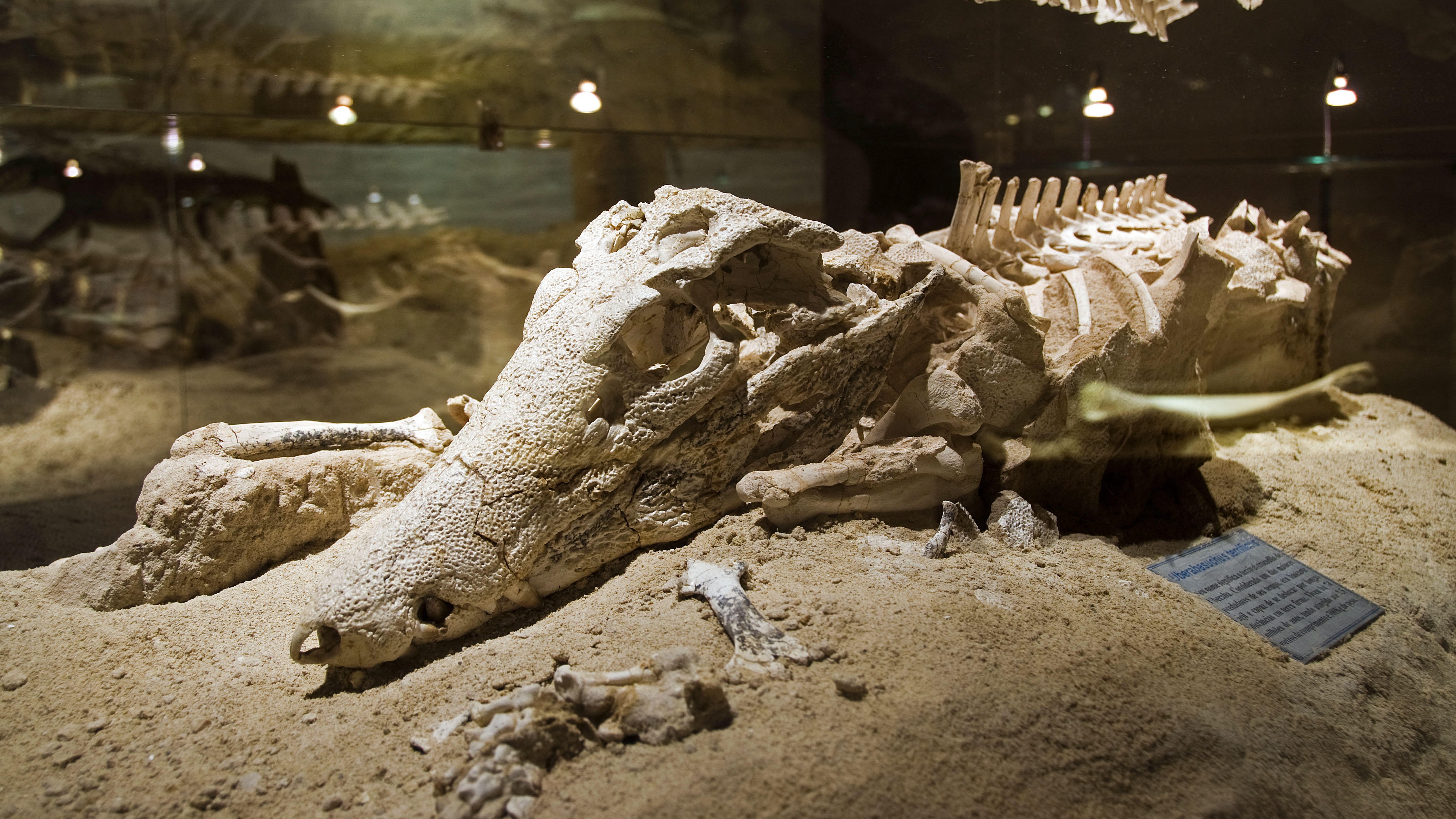
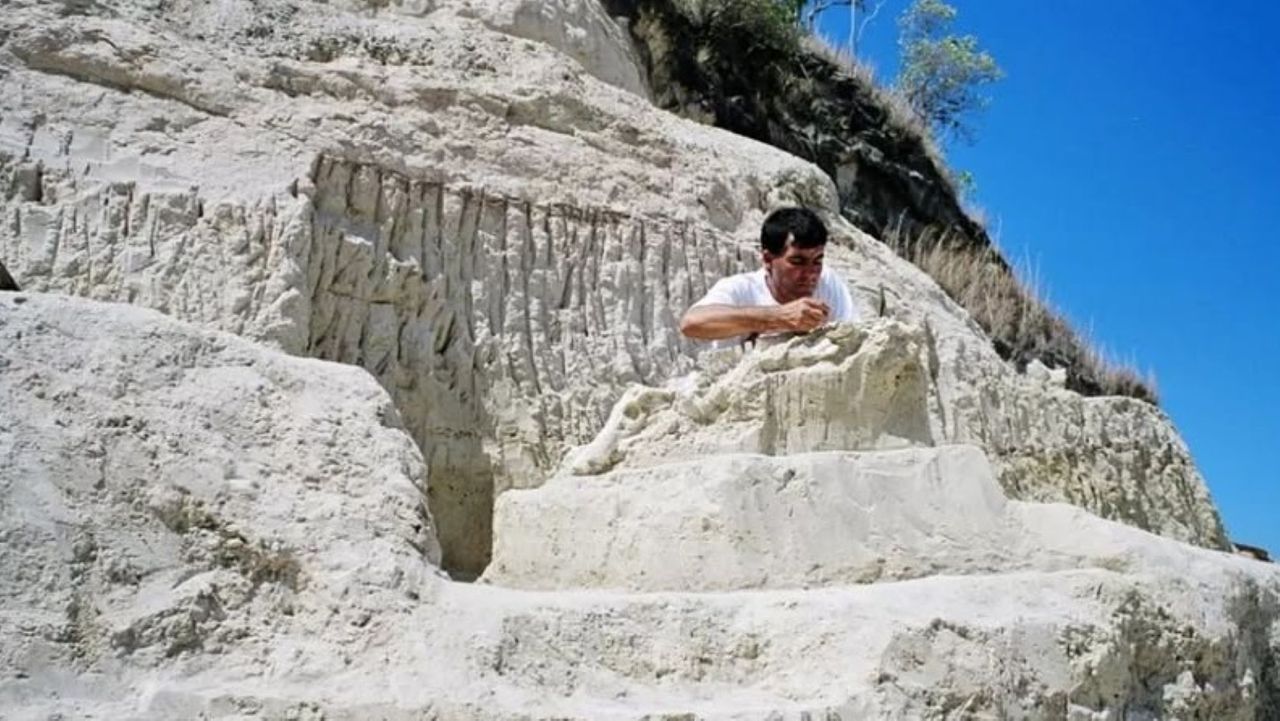
The geopark boasts abundant, well-preserved fossils from the last chapters of the nonavian-dinosaur era, according to UNESCO, earning it the nickname the "Land of the Giants," or "Terra dos Gigantes" in Portuguese. Paleontologists have discovered more than 10,000 fossils belonging to dinosaurs, prehistoric crocodyliforms (a group encompassing living crocodiles, alligators, caimans and gharials, as well as their extinct relatives), turtles and other ancient creatures within the park's boundaries.
One of the best-known discoveries is the fossil of Uberabatitan ribeiroi, a titanosaur measuring 89 feet (27 meters) long and 33 feet (10 m) tall, according to UNESCO.
The finds were clustered in impressive geological features, including the Serra da Galga formation and Serra Geral mountain range. These structures formed from ancient basalt flows, which came from giant volcanic eruptions that predate the breakup of the Gondwana supercontinent 180 million years ago.
The park has the ideal conditions to preserve fossils because it alternated between shallow lagoons and river systems when the dinosaurs roamed the region, meaning the animals' remainswere conserved in mudwhen they died.
Uberaba Geopark preserved extinct crocodile relatives among other fossils. (Image credit: Pulsar Imagens via Alamy)
The Cerrado savanna, which houses the entire park, is a critical-yet-underprotected carbon sink that hosts more than 12,000 plant species and diverse animal life.
The "Land of the Giants" was added to UNESCO's list of geoparks in 2024 in recognition of the region's geological and natural heritage.
What is now the Uberaba Geopark was the birthplace of Brazil's modern livestock market, which is one of the biggest in the world. Farmers in the 19th century introduced zebu (Bos indicus) cattle from India because they are better suited to the climate in Brazil and require less food than common domesticated cattle (Bos taurus). Zebu cattle also produce lower greenhouse gas emissions than common domesticated cattle do, according to UNESCO.
Uberaba Geopark is open to visitors. There are several museums and trails to explore, including one that leads to the Vale Encantado, or "Enchanted Valley," which contains forests, waterfalls and prehistoric rock formations, according to the BBC.
Discover more incredible places, where we highlight the fantastic history and science behind some of the most dramatic landscapes on Earth.
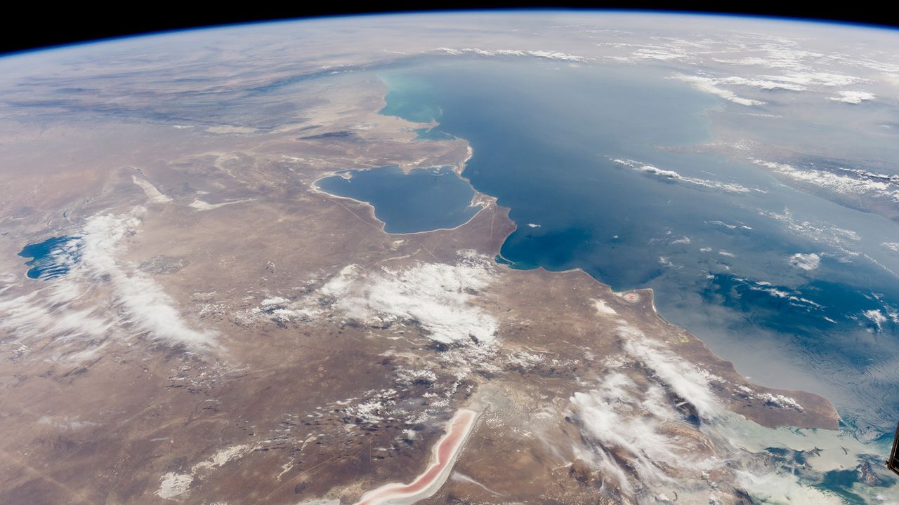
The Caspian Sea, the world's largest inland body of water, is in major trouble. Since the mid-1990s, this saline lake, located between Europe and Asia, has lost an area nearly the size of Sicily. But until now, it wasn't clear why.
Researchers finally provided answers in a study published June 5 in the journal Earth's Future. Using ground- and satellite-based observations, they connected falling water levels to a drastic drop in river inputs from Iran, Turkmenistan, Azerbaijan, Kazakhstan and Russia, all of which border the Caspian Sea.
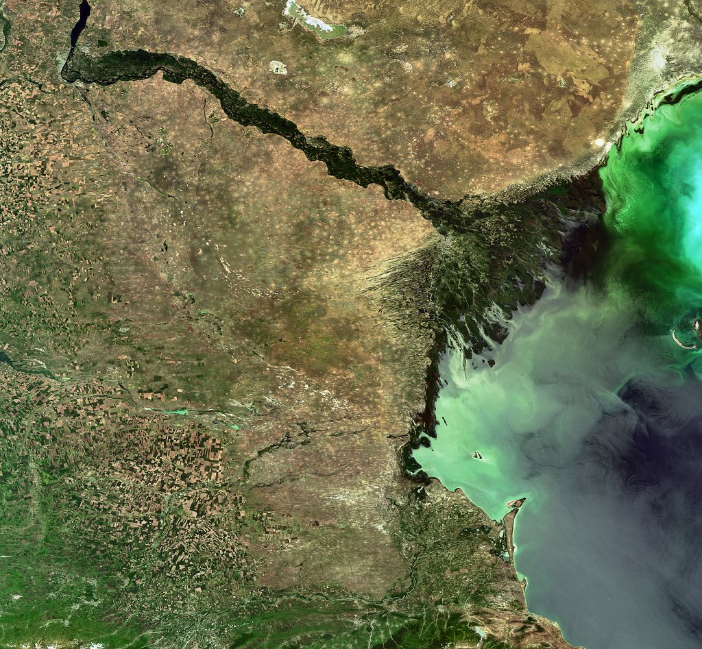
The team particularly highlighted losses from Russia's Volga River, the longest river in Europe, which supplies roughly 80% of the Caspian's inflow.
To find out why the Volga is discharging less water into the Caspian Sea now than it did 30 years ago, we spoke with Amir AghaKouchak, a co-author of the study and professor of civil and environmental engineering at the University of California, Irvine.
AghaKouchak, who directs UC Irvine's Center for Hydrometeorology and Remote Sensing, explained why river inputs have dropped and how decades of water withdrawals have put the Caspian Sea on a path to collapse. He also touched on a solution to this crisis — and revealed why Russia's hunger for ammunition to attack Ukraine is making it harder to save the Caspian Sea.
Sascha Pare: Falling water levels in the Caspian Sea have been attributed to natural variability, and more recently, there's been a focus on climate change and increased evaporation due to rising temperatures. But what did the results of your study show?
Amir AghaKouchak: People quickly jump to conclusions about climate change. Of course, that is important, but it cannot explain the change that we have observed. Over the last 30 years, water levels in the Caspian Sea have shrunk by around 2 meters [6.5 feet] or so. Just to put things in perspective, this translates to about 24,000 square kilometers [9,300 square miles] of sea area loss — about 5%. When we look at drivers, we notice that rainfall hasn't changed significantly over the lake and upstream, so the decline cannot be explained simply by changes in rain.
Evaporation has increased, so it explains maybe about one-third of the change. There is less water in the lake, and that indicates there's probably some water lost along the way. We don't have a lot of human-related data — for example, water withdrawal for irrigation or groundwater wells. That area is very difficult; the countries are not open to sharing data. A lot of our results are based on looking at proxies. Our interpretation is that temperature caused about 30% of the change and the rest is probably because of human activities.
SP: Which human activities does your research suggest are responsible for the Caspian Sea's decline?
AA: Several of the countries on the Caspian Sea have built large dams — Russia, for example. They are all desperate for hydropower. All of the countries around the lake [have also built infrastructure to supply agriculture], and one reason is that they want to create jobs and improve the local economy. Water demand is increasing in all those countries around the Caspian Sea. It's not surprising to see lakes drying or groundwater levels falling.
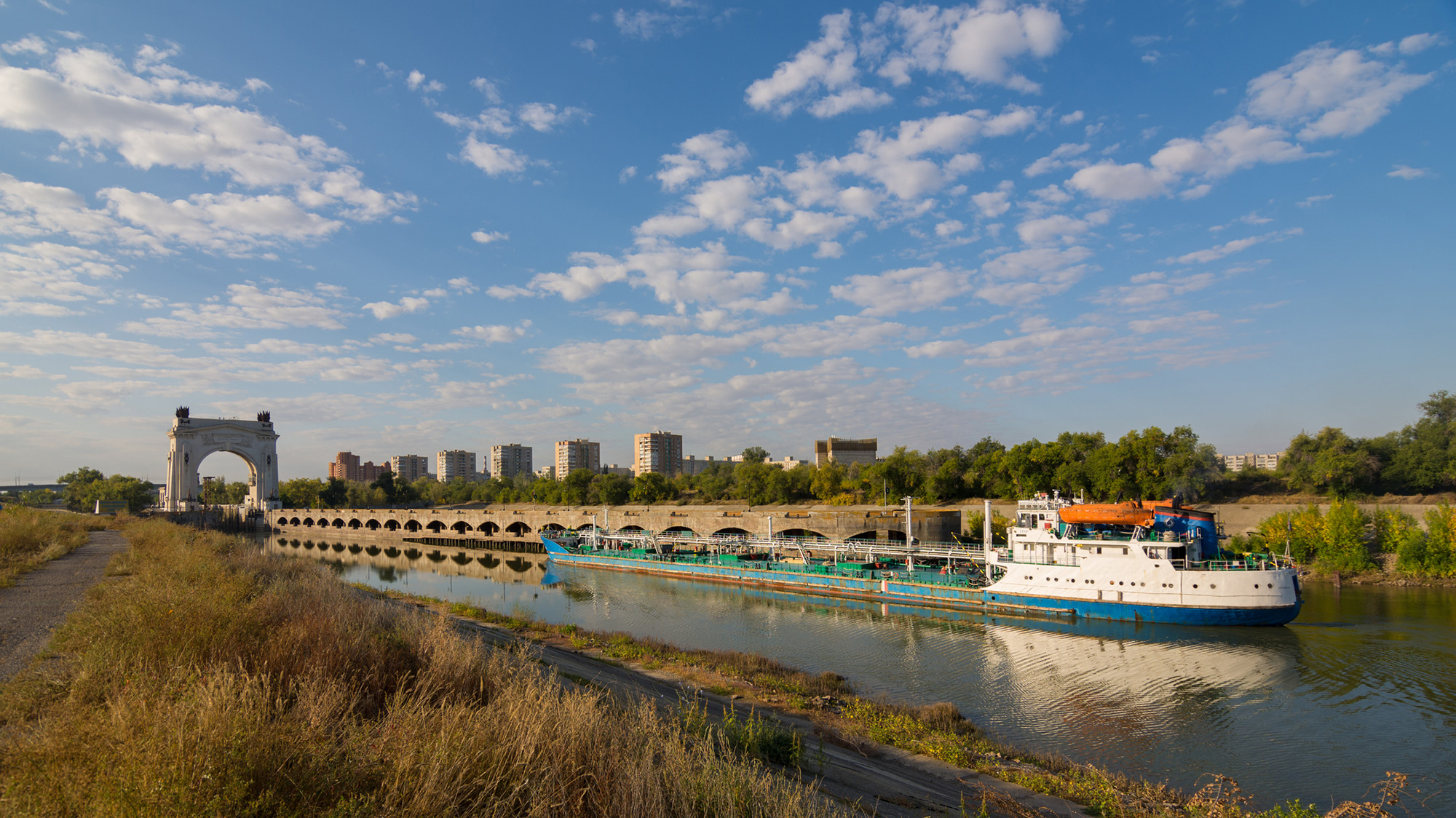
It's hard to find data about how much water countries are using; they keep data very private, especially places like Russia. We don't have detailed information, but the Volga-Don Canal in Russia is one of the projects that is contributing to this crisis. [Editor's note: The Volga-Don Canal is a ship canal that connects the Volga and Don rivers at their closest points.]
Opened in 1952, the Volga-Don Canal connects the Volga, which flows into the Caspian Sea, and the Don, which empties into the Sea of Azov (a northern extension of the Black Sea). (Image credit: Gaika102 via Getty Images)
But we cannot blame this whole thing on that. We have to be careful with our language; we can't say one project is responsible. Most likely, this is the collective impact of many different small withdrawals from here and there, overall contributing to a significant decline in the Volga River outflow into the lake. In the paper, we have different rivers, but the Volga dominates because it's the largest river. The Volga has a higher impact than all the other rivers combined. There are lots of demands along that river basin.
SP: Did you expect human activities to play such a big role, or were you surprised?
AA: We did not have any expectations at the beginning. In fact, when we started this project, I reached out to a lot of colleagues from neighboring countries around the Caspian Sea. We didn't want to do it on our own, sitting in California, looking at another area of the world, without having local people involved. If you look at the co-authors, you see people from Azerbaijan, Iran, Kazakhstan — so, we have local experts. We thought this was really important to have those perspectives. I didn't want to reflect the opinions of only one research group. What we have here is the collective opinion of people who have not met in person; we only exchanged emails to look at the results, and then we came up with those conclusions.
We do have a Russian involved, but not from an official Russian institution. I thought this was really important, because there's more back-and-forth [with a large group of people]. If two people have to convince themselves of an idea, it's much easier than with 20. Also, we brought in people from other countries who had projects in the area; for example, there is one group from Finland and another group from Germany. We tried to come up with something that this large group of people could agree on. It was not easy, but it worked out.
The Volga River supplies roughly 80% of the Caspian Sea's inflow, but huge water demands have decreased its flow. (Image credit: ESA, CC BY-SA 3.0 IGO )
SP: What is the worst-case future scenario for the Caspian Sea if shoreline countries fail to decrease their water demands?
AA: My concern is that, in the same general area, we have the Aral Sea, which is now about 5% to 10% of what it used to be, and Lake Urmia, in northwest Iran, that has also shrunk really fast and is now very small, with low levels of ecological activity. So we have two smaller lakes in a very similar climate that, from an ecological perspective, are dead. Because we have seen those degrade, we have to consider that this is the worst-case scenario for the Caspian Sea, too.
The Caspian Sea is much, much bigger. I hope it doesn't happen, but it's on the same path. Again, it's much larger, so it would probably take 100 years [to shrink as much as the Aral Sea and Lake Urmia], even with the current trend. But because we have seen those lakes shrink really fast, it deserves attention. Due to the size of this lake, the potential impacts will be huge. Even if 20% of the Caspian Sea dries out, the consequences will be very significant. It would be a disaster.
SP: You mentioned that drying lakes can become ecologically "dead." What other impacts could the Caspian Sea's falling water levels have on the surrounding landscape and people?
AA: The lake's retreat will expose the lake bed, and because it's saline, you have all kinds of minerals that will be exposed. With the next strong wind, they will go into the air. The health impacts include respiratory diseases, and even eye diseases, that are linked to salt minerals in the atmosphere. Those are the immediate consequences. Additionally, those minerals can travel long distances. In general, salt deposition on agricultural land reduces productivity. It takes a while, but if those lands are exposed for a long time, this will have an impact on the agricultural sector in those areas, which means potential food security issues. We don't exactly know what those materials are on the lake bed, so it's hard to know precisely what the consequences will be.
There is also serious shipping happening in this region. Right now, most of the shrinking is happening in the Caspian Sea's northern part, which is shallower [than the rest of the lake]. The drop in water levels is about 2 meters, and you can imagine that if you have a port and water levels drop more, you won't be able to operate. You'll need to extend your shipping routes southward; you'll need to invest and spend a lot of money to use other ports and docking sites. We have evidence of that around the Aral Sea and also Lake Urmia. There used to be these docking sites and ports, but those are now far away from the water.
SP: What must bordering countries do to save the Caspian Sea and prevent these negative effects?
AA: Demand management is absolutely critical. Demand management doesn't get a lot of attention, because unlike big projects that make the news, management means you have to cut things and do things that people don't notice. Some people argue that politicians don't show a lot of interest in demand management, but it's something that we have control over. The technological opportunities are there.
But when you look at that area, there is a big war — so probably it's not the priority to invest in management. There are a lot of things that we don't talk about in the paper that are relevant. I recently learned through discussions with people from the region — this is something that came to us from co-authors and collaborators — that many countries in that area grow cotton, which uses a lot of water. It has a lot of applications, but apparently, one of them is military. Cotton is used to produce ammunition. Russia needs a lot of ammunition, so not only are they growing it themselves, but they also bought neighboring reserves from Uzbekistan and Kazakhstan. So now, even those countries have an incentive to grow more cotton. This is driving more irrigation, more groundwater extraction, more surface water depletion, and probably more impacts on the Caspian Sea.
This interview has been condensed and edited lightly for clarity.
Scientists have confirmed that a flowering plant native to the mountains in southwest China is carnivorous, supporting a prediction made by Charles Darwin more than 150 years ago.
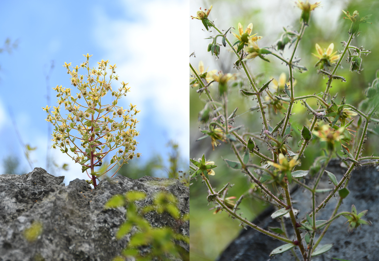
The species, Saxifraga candelabrum, grows at elevations above 8,200 feet (2,500 meters) in the Hengduan Mountains, which connect the southeast portions of the Tibetan Plateau to the Yunnan-Guizhou Plateau.
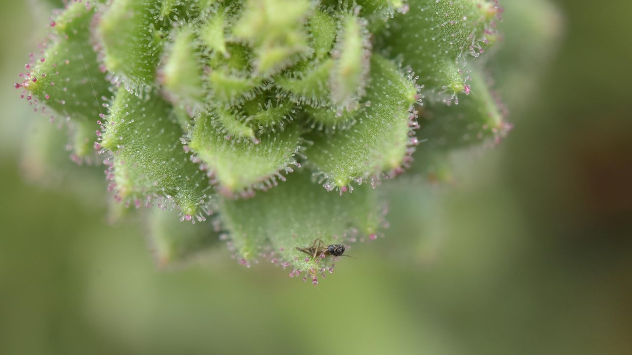
The plant has stems and branches covered in sticky hairs that can trap small insects, predominantly nonbiting midges. However, scientists were unsure if these insects were being ingested by the plant. In a new study, researchers showed that S. candelabrum can digest and absorb nutrients from insects after capturing them, proving that the plant is carnivorous. The scientists published their findings Tuesday (Aug. 4) in the journal Nature Communications.
This is the first demonstrated case of carnivory in the saxifrage plant group, said study co-author Douglas Soltis, a distinguished professor of biology at the Florida Museum of Natural History.
Other carnivorous plants typically grow in moist, boggy soils, but S. candelabrum is found in dry alpine areas, Soltis told Live Science in an email. "These are all nitrate poor soils — that's why this carnivorous habit has evolved a number of times" to supplement the plants in vital nutrients, he said.
In 1875, Darwin theorized that two species closely related to S. candelabrum that also have sticky hairs — S. rotundifolia and S. umbrosa — may be carnivorous, based on their ability to catch insects. But the 19th-century naturalist couldn't show that the plants digested their prey or reused the nutrients in insect tissues — two conditions that are key to confirming carnivory in plants. Without these conditions, a species is considered simply "protocarnivorous," meaning it catches and kills insects or other small animals but doesn't digest or absorb them, according to the study.
"Although untested at the time, Darwin’s hypothesis provided an important inspiration for our study," study co-author Hang Sun, a researcher in the Chinese Academy of Sciences' Kunming Institute of Botany, told Live Science in an email.
The researchers conducted field observations and herbarium surveys of S. candelabrum, which revealed that mature plants with more numerous and longer branches had an average of 71 trapped insects on them. In the herbarium surveys, the team found that 43 out of 45 specimens had caught insects, suggesting that insect-trapping is a widespread phenomenon in this species.
Next, the study's authors showed that S. candelabrum possesses phosphatase, a digestive enzyme commonly found in carnivorous plants. They did this by labeling the phosphatase enzymes with fluorescent molecules to visualize them under a specialized microscope, a technique known as fluorescence tagging.
S. candelabrum secretes a viscous substance that coats its hairs, meaning insects get stuck on the stem and branches if they fly too close. (Image credit: Xin-Jian Zhang)
To determine if S. candelabrum digests and absorbs nutrients from insects, the researchers labeled fruit flies with a stable form of nitrogen before feeding them to the plants. This led to a marked rise in stable nitrogen in S. candelabrum and in a different, known carnivorous species, which the team used as a control group. By contrast, a non-carnivorous plant that formed a second control group did not show an increase in stable nitrogen, indicating that S. candelabrum is carnivorous.
Finally, the researchers performed a genetic analysis, which revealed that S. candelabrum has genes in common with known carnivorous plants that are linked to prey attraction, digestion and nutrient absorption. Together, the results showed that S. candelabrum evolved carnivorous traits to cope with its nutrient-poor environment, adapting its hairs — which were initially used for herbivore defense — into insect traps, according to the study.
Larger insects, which S. candelabrum requires for pollination, rarely get stuck to the hairs, the researchers noted in the study, suggesting that the species has perfectly balanced its needs through evolution.
Other Saxifraga species and plants belonging to the same lineage could turn out to be carnivorous, too.
"Many members of the Saxifragaceae, which includes genera other than Saxifraga, have sticky glandular hairs and are often covered with insects," Soltis said. "I would not be surprised if other members of the family are also carnivorous — as Darwin predicted."
The study broadens the scope of carnivorous plant research, Sun said. "Carnivory may therefore be far more widespread among flowering plants than previously recognized," he said.
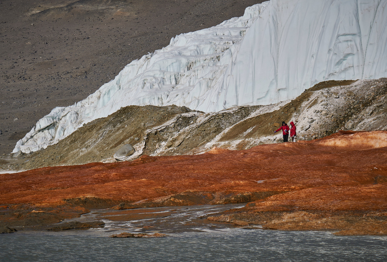
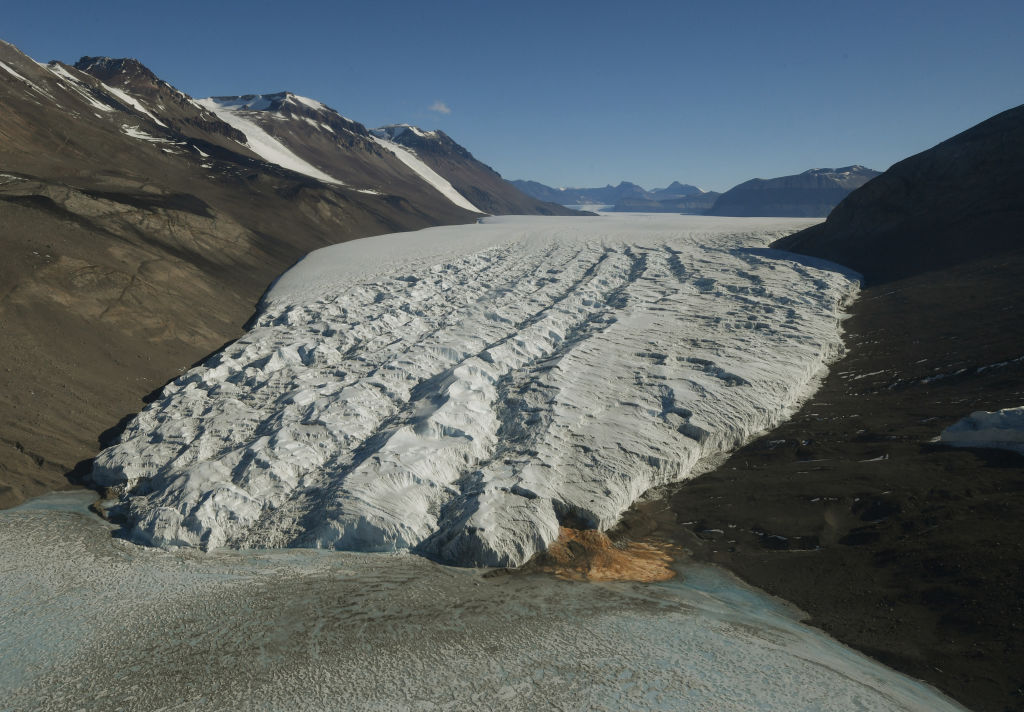
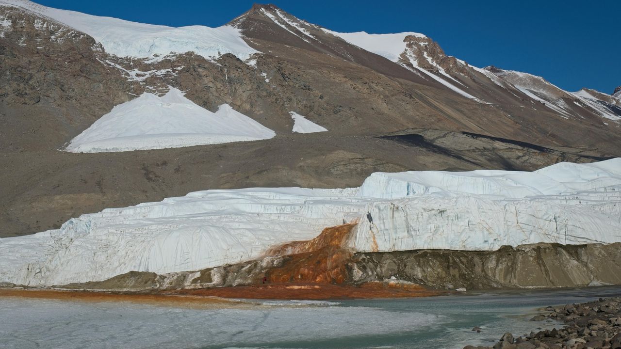
At the end of a glacier deep in East Antarctica's Taylor Valley, there is a haunting waterfall that oozes red brine like a bleeding wound in the ice. Scientists explained the brine's gory hue several years ago, finding that it is exceptionally rich in iron. And now, they may have identified the salty water's origin.
Microbes in the crimson waterfall, called Blood Falls, suggest the brine is composed of ancient seawater that was trapped in a pool beneath the glacier when ocean levels fell and the glacier advanced. However, it's unclear exactly when that happened, researchers noted. Previous studies had already proposed a seawater origin for the brine, based on various chemical signatures and bacteria detected in the liquid, but the new results add molecular and genetic evidence to the mix of clues.
"Findings in this study reveal a dominance of marine eukaryotic lineages in the Blood Falls area" compared with the broader region, known as the McMurdo Dry Valleys, the authors wrote in the study, published Monday (Aug. 3) in the journal Nature Geoscience. "This marine signal is less prominent but still detectable in the prokaryotic structure," the researchers added.
Eukaryotes' cells contain a membrane-bound nucleus and other closed internal compartments. Prokaryotes, by contrast, are single-celled organisms whose DNA floats around freely in the cell, unbounded by a membrane.
To characterize the types of microorganisms present within Blood Falls, the researchers used a suite of genetic techniques to analyze 167 samples of water, sediment and air from around the falls and the broader McMurdo Dry Valleys.
Some researchers argue that Blood Falls' water does not originate from seawater, and suggest the marine bacteria and chemical signatures that point to seawater may have instead reached the falls from the ocean via intense winds, which are common in the McMurdo Dry Valleys. By analyzing samples from various sites in the Dry Valleys, the team behind the new study compared microorganisms from the wider region with those at Blood Falls to determine if Blood Falls has a distinct microbial assemblage potentially left over from ancient conditions.
The researchers found that the crimson brine and associated red-tinted sediments at Blood Falls shared a higher proportion of eukaryotes with nearby oceanic samples than other sites in the Dry Valleys did. Whereas Blood Falls had a little over 9% of its eukaryotes in common with the ocean, the Dry Valleys showed only about 1% similarity, according to the study. The remaining eukaryotes and most of the prokaryotes identified in the paper had freshwater and terrestrial origins.
Researchers tried to determine if microbes at Blood Falls are distinct community from the surrounding region's assemblages. (Image credit: Bryan Minnea)
The results also showed that the air near Blood Falls contained only a tiny proportion of marine microorganisms, suggesting that present-day winds can't fully explain the microbial composition of Blood Falls, the researchers wrote.
The most likely origin for the brine that feeds Blood Falls is ancient seawater that was trapped when sea levels dropped and the Taylor Glacier advanced, the study found. (Image credit: MARK RALSTON/POOL/AFP via Getty Images)
Therefore, an ancient seawater origin is the most likely explanation for the microorganisms found at Blood Falls today, the team concluded. Winds may have played a role in shaping the community in the past, but now, their influence is probably insignificant, the team added.
The brine that feeds Blood Falls may have become entrapped more than 1 million years ago, during a warm period with higher sea levels and less ice cover than there is now, previous estimates suggested. However, further work, including more comprehensive genetic profiling and mapping of microorganisms, is needed to pinpoint when Taylor Valley's glacier grew to cover the brine, the researchers wrote.
Antarctica quiz: Test your knowledge on Earth's frozen continent

 Login