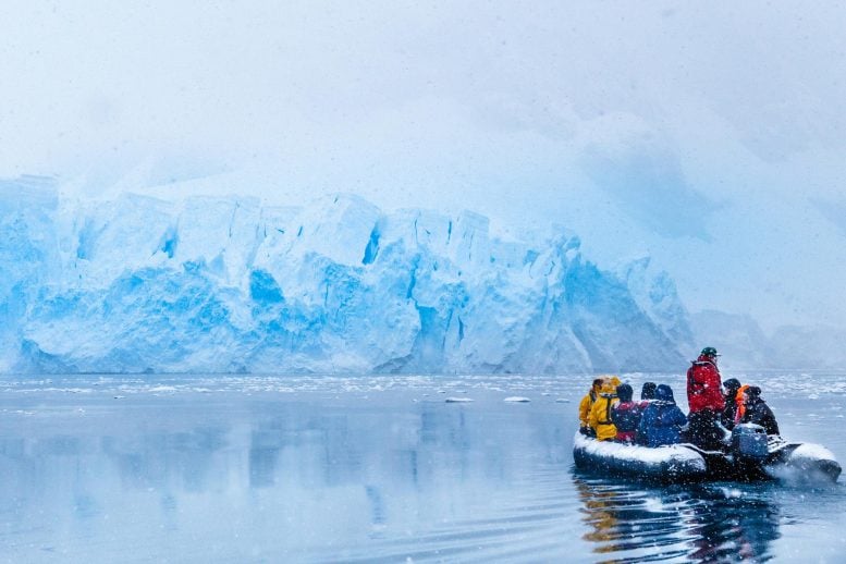
Antarctic guides walked away from their dream jobs after tourism’s environmental damage became impossible to ignore. “You’d see massive glacier calvings, and you’d just want to cry. But all the guests would be cheering. And you’d be like … ‘Can you not put two and two together?’” Those are the words of a former Antarctic [...]
A new study is challenging one of the most persistent assumptions in space manufacturing: that building advanced composite structures beyond Earth is simply a matter of moving terrestrial production methods into orbit. Research published in npj Advanced Manufacturing examines how two defining features of the space environment—reduced gravity and reduced atmospheric pressure—can alter the manufacture of carbon-fiber-reinforced structures, materials widely regarded as essential for future spacecraft, habitats and large orbital infrastructure.
Carbon-fiber-reinforced polymers, commonly known as CFRPs, combine strong, lightweight carbon fibers with a polymer resin that binds the fibers into a rigid composite. Their exceptional strength-to-weight ratio makes them attractive for launch vehicles and spacecraft, where every kilogram matters. Yet manufacturing these materials is a delicate process. Fibers must be positioned accurately, resin must penetrate the reinforcement evenly, and gases or trapped voids must be removed before the material cures. On Earth, gravity and atmospheric pressure quietly assist—or complicate—each of these steps.
In space, those familiar forces change dramatically. Reduced gravity can alter how liquid resin flows through a carbon-fiber structure, while low pressure can encourage dissolved gases and volatile compounds to expand or escape. Together, these effects may influence impregnation, consolidation, curing and the final mechanical performance of a composite part. The new work by R. Strecker, T. Rieger, A. Tabelander and colleagues focuses on understanding these interactions before manufacturers attempt to produce increasingly complex structures in orbit.
The central issue is void formation. A composite that appears solid can contain microscopic pockets of air or vapor between its fibers. These voids interrupt the transfer of stress through the material and can reduce strength, stiffness and fatigue resistance. During conventional manufacturing on Earth, pressure is often applied to compress the layers and drive out unwanted gases while resin fills the spaces between fibers. In a reduced-gravity environment, however, buoyancy-driven movement is weakened, and the pathways through which bubbles travel may change. A bubble that would rise and escape during terrestrial processing could remain trapped inside the structure.
Pressure reduction introduces another layer of complexity. Lower ambient pressure can help remove volatile substances and trapped gases, but it can also cause dissolved gases in the resin to expand. If the resin is not sufficiently mobile, expanding bubbles may become locked in place as the material cures. The balance between degassing and bubble growth therefore becomes a critical manufacturing parameter. The study’s importance lies in treating pressure and gravity not as isolated variables, but as environmental conditions that can interact throughout the production cycle.
Resin flow is equally important. Carbon-fiber reinforcements are made from tightly packed filaments, creating narrow channels through which resin must travel. On Earth, gravity can influence resin distribution, especially in vertically oriented or large components. In reduced gravity, capillary forces and surface tension become relatively more significant. These forces can help draw resin into small spaces, but they may also create uneven wetting patterns depending on the fiber architecture, resin viscosity and processing orientation. Such changes could affect whether a component cures uniformly from its surface to its interior.
The findings carry implications far beyond laboratory samples. Future space manufacturers may seek to fabricate beams, pressure-vessel elements, antenna supports, solar-array components and repair patches directly in orbit. Producing these parts where they are needed could reduce the need to launch bulky finished structures from Earth. It could also enable designs too large to fit inside a rocket fairing, including trusses and habitation modules assembled gradually in space. But the economic and engineering promise of this approach depends on reliable quality control. A component that looks flawless may still fail if its internal fiber alignment, resin distribution or void content is inconsistent.
The research also highlights why manufacturing hardware designed for Earth cannot automatically be considered space-ready. Pumps, heaters, vacuum systems, molds and curing chambers must all operate under conditions in which heat transfer, fluid movement and gas removal behave differently. Temperature control is particularly important because resin viscosity changes strongly with temperature. A resin that flows readily during terrestrial processing might move more slowly or unevenly in orbit, while excessive heating could accelerate curing before impregnation is complete. Space-based production systems will therefore need carefully coordinated control of pressure, temperature, resin chemistry and processing time.
For engineers, the study provides a foundation for developing manufacturing protocols tailored to reduced-gravity environments. Instead of copying Earth-based workflows, future systems may need staged pressure changes, specialized fiber preforms, modified resin formulations or active bubble-management techniques. Sensors could monitor pressure, temperature and resin flow in real time, allowing automated systems to detect defects before a part is finished. Non-destructive inspection, including imaging and ultrasonic testing, will also be essential for verifying the integrity of components that cannot easily be returned to Earth for analysis.
The broader message is that space manufacturing is not merely an extension of industrial production—it is a new manufacturing regime governed by different physics. Understanding how gravity and pressure reshape the behavior of fluids, gases and composite materials could determine whether orbital fabrication remains a promising experiment or becomes a practical industrial capability. By examining the production of carbon-fiber-reinforced structures under space-relevant conditions, Strecker, Rieger, Tabelander and their colleagues are helping identify the hidden variables that will decide how safely and efficiently humanity can build beyond Earth.
Subject of Research: Effects of reduced gravity and reduced atmospheric pressure on the in-space manufacturing of carbon-fiber-reinforced structures
Article Title: Effects of reduced gravity and reduced atmospheric pressure on in-space manufacturing of carbon-fiber-reinforced structures
Article References: Strecker, R., Rieger, T., Tabelander, A. et al. Effects of reduced gravity and reduced atmospheric pressure on in-space manufacturing of carbon-fiber-reinforced structures. npj Adv. Manuf.3, 26 (2026). https://doi.org/10.1038/s44334-026-00104-w
The Dallas Business Journal reported Monday that the U.S. multinational paper goods company Kimberly-Clark announced "that its researchers identified and advanced patented technology transforming fibers from hesperaloe, a low-water-use plant with pointy leaves that thrives in the southwest region of the country, into material for paper towels." Discovering an alternative to conventional wood fiber "could reshape how the company, and the industry at large, manufactures products," according to article.
And the move comes "amid growing pressure on manufacturers regarding their reliance on wood fibre from freshly felled trees," reports The Telegraph. "Campaigners claim that more than one million trees are cut down every day..."
Unlike trees, hesperaloe can be grown on dry, low-quality farmland unsuitable for most food crops and harvested much more quickly. Kimberly-Clark said it had tested more than 70 potential materials before settling on hesperaloe. Earlier candidates included wheat straw, corn waste, seaweed, algae and chicken feathers. The US consumer goods giant will now develop the fibre at a pilot factory in Yuma, Arizona, working with local growers to determine whether the crop can be cultivated for commercial use in its tissue products. "This represents an exciting moonshot for Kimberly-Clark and the culmination of more than two decades of materials and plant science expertise," said Craig Slavtcheff, who is helping develop the new toilet paper.
However, the company said products made from hesperaloe remained years away from supermarket shelves, with further research needed before the fibre could be produced at the scale required for global manufacturing. The US-based company has invested about $250m (£190m) in the project and filed more than 30 patents linked to the technology.
Yams and sweet potatoes are often confused, and the names are sometimes used interchangeably in the U.S. However, they're two different crops. So what sets them apart?
The differences lie mainly in these vegetables' classifications, plant growth, and nutritional profiles, experts told Live Science.
Despite both growing underground and appearing somewhat similar, "Botanically, sweet potatoes and yams are not closely related, as they belong to different plant families," said Phillip Wadl, a research geneticist at the U.S. Vegetable Laboratory in Charleston, South Carolina. Sweet potatoes (Ipomoea batatas) are in the morning glory family (Convolvulaceae). Yams (Dioscorea), by contrast, belong to the Dioscoreaceae family, and there are 11 yam species cultivated for food and income, Wadl told Live Science in an email.
Yams and sweet potatoes also belong to different plant groups, or "cotyledon types," said Jeffrey Cole Denis Gregorie, a sweet potato specialist at the Sweet Potato Research Station in Chase, Louisiana. Yams are monocots, plants whose embryo has only one cotyledon, or seed leaf, like grasses and lilies. Sweet potatoes are dicots, plants with two embryonic seed leaves, which include many fruits and vegetables, such as grapes, squash, strawberries and tomatoes.
In addition, yams and sweet potatoes store food in different parts of the plant. "Sweet potatoes form storage roots which are enlarged parts of the root system," Wadl explained, "whereas yams form tubers, which are enlarged underground stems for nutrient storage."
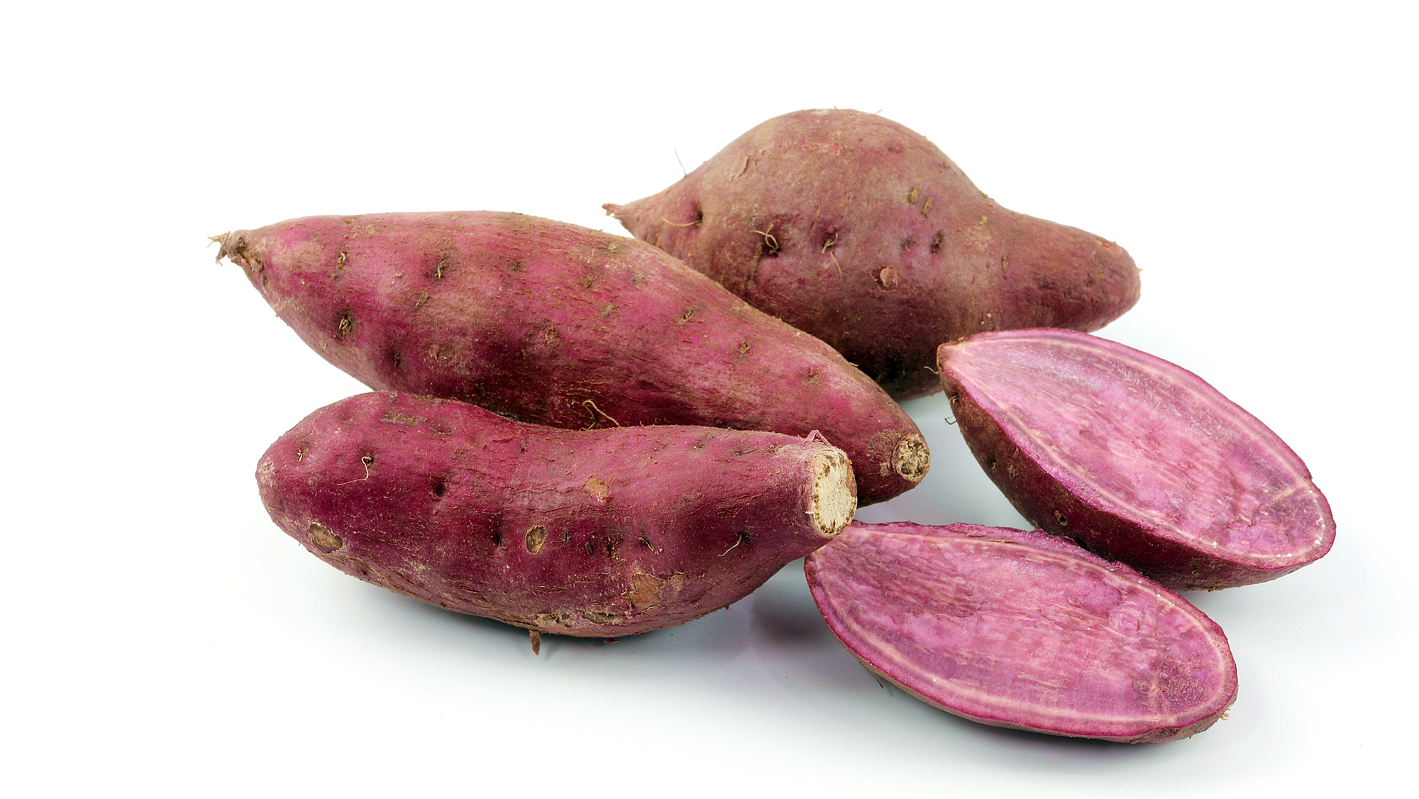
The "garnet yam" is actually a sweet potato. (Image credit: Sarawuth123 via Getty Images)
A single sweet potato plant typically produces about four to 10 sweet potatoes, while a yam plant yields about one to five yams. Sweet potatoes generally take about three to five months to mature, compared with about six months to a full year for yams, according to Craig Yencho, a professor of horticultural science and a sweet potato and potato researcher with North Carolina State University.
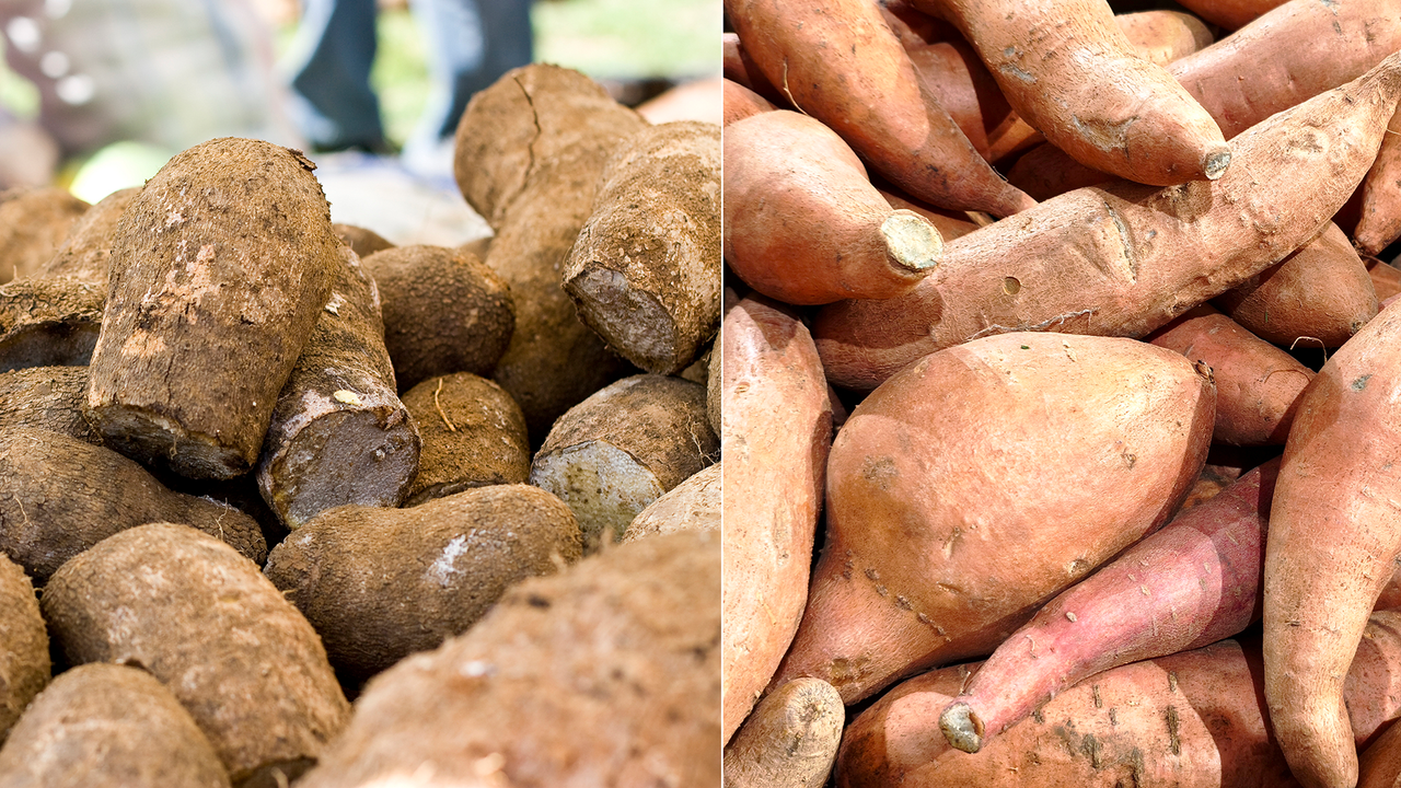
Visually, sweet potatoes and yams are easy to tell apart when you know what to look for. Sweet potatoes tend to be shorter and blockier, with tapered ends. Yams are usually long and cylindrical, sometimes with "toes," or branching shapes.
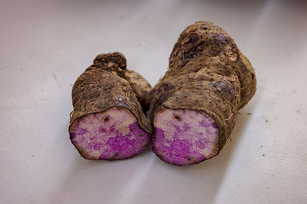
Sweet potatoes come in various flesh colors, including orange — the most common color in the U.S. — as well as yellow, purple and white. Their skin is typically thin and smooth, whereas "yams often have a rough, bark-like skin and their flesh can be white, purple or reddish," Wadl said. One well-known purple yam, known as ube (Dioscorea alata), is a popular ingredient in treats such as ice cream, cookies and pound cake.
Sweet potatoes and yams also have noticeable differences in their culinary and nutritional profiles, Wadl said. "Sweet potatoes are generally sweeter and have a moist, creamy texture when cooked, although dry types are available," he explained. "Yams, on the other hand, tend to be starchier, drier, and have a more earthy, sometimes less sweet, flavor compared to sweet potatoes. Their texture can be more like a regular potato."
Nutritionally, the two crops are quite different, too. Sweet potatoes, particularly the orange-fleshed varieties, are an excellent source of beta-carotene (a precursor to vitamin A), vitamin C, dietary fiber, potassium and some B vitamins. "While nutritious, [yams] typically contain less beta-carotene than orange sweet potatoes," Wadl noted. Instead, yams are a good source of potassium, vitamin C, manganese and dietary fiber.
Sweet potatoes are generally considered safe to eat both raw and cooked, Wadl said. By contrast, many wild varieties of true yams, especially those not cultivated for commercial consumption, contain compounds like dioscorine that could make them toxic to humans if eaten raw. "These must be thoroughly cooked to remove the toxins and make them safe for consumption," Wadl said.
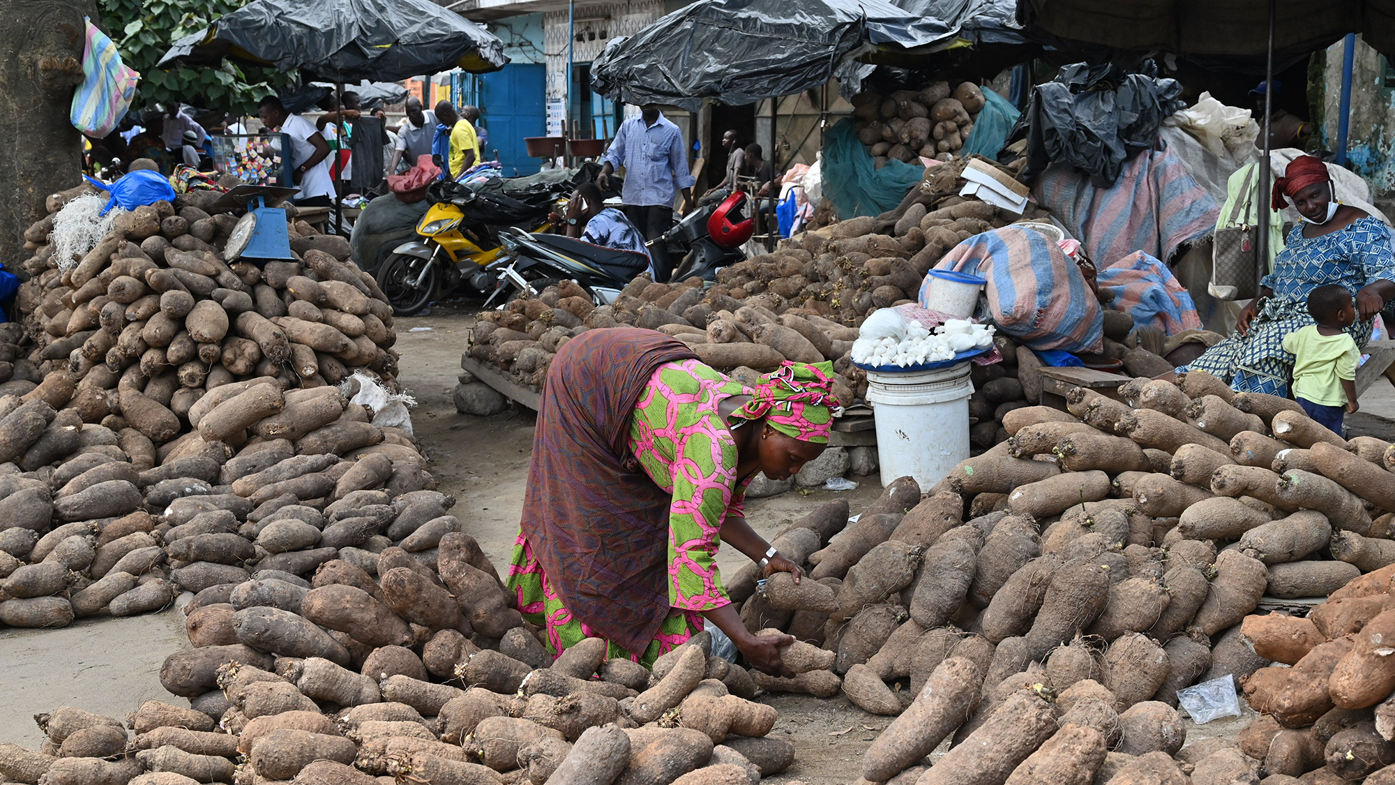
A woman sells yams in the market in Abobo in the Ivory Coast on April 22, 2020. (Image credit: ISSOUF SANOGO via Getty Images)
Thanksgiving confusion around yams and sweet potatoes
If yams and sweet potatoes are so different, why do so many Americans call sweet potatoes "yams"?
Part of the answer lies in history. The yam was a key provision on voyages of enslaved people from West Africa to the Americas, "used to feed captives a familiar food," said Judith Carney, a professor of geography at UCLA. "In mainland plantation societies of North America where the African yam could not be grown, the sweet potato served as a substitute dietary staple." Because the two crops shared some characteristics, "the word 'yam' came to refer vernacularly to both tubers in mainland America, as we see in the U.S. today," Carney told Live Science in an email.
A purple yam, known as ube, from the Philippines. (Image credit: Ezra Acayan / Stringer via Getty Images)
The U.S. sweet potato industry also leaned into the confusion, adopting the term "yam" for marketing reasons, Gregorie told Live Science in an email. "In the United States, many orange-fleshed, moist varieties of sweet potatoes are often mislabeled as "yams" to distinguish them from the drier, white-fleshed sweet potato varieties," Wadl explained.
As a result, the "yams" at most U.S. supermarkets are probably sweet potatoes. "Garnet yams" and "jewel yams" aren't actually yams, despite those labels; instead, they're softer, sweeter varieties of sweet potatoes, according to the University of California, Davis.
Although genuine yams are sold in many international markets in the U.S, "if you're buying a "yam" in a typical U.S. supermarket, you're almost certainly purchasing a sweet potato," Wadl said.
Researchers used quartz from fossilized wood to trace how Europe developed. A polished piece of fossilized wood may look like little more than a decorative stone, yet the quartz inside it can preserve the history of an entire region for hundreds of millions of years. Geologist Dr. Steffen Trümper of the University of Münster and [...]
An international research team has uncovered how LUCA, the last common ancestor of all life on Earth, split into the first two branches of organisms—bacteria and archaea—allowinglife to thrive innew conditions and spread to other biomes.
Scientists from the Institute of Molecular Evolution at Heinrich Heine University Düsseldorf (HHU) led the research, revealing their findings in a recent paper published in Science Advances, investigating these early cells’ metabolisms.
The team discovered that the chemical reactions and energy sources behind these two types of cells told unique stories of separate evolutions, in new work that sheds light on the primordial processes that gave rise to some of Earth’s first free-living cells.
Life on Earth Begins
Roughly four billion years ago, life on Earth emerged as the first cells formed, most likely at hydrothermal vents, before evolving to explore new biomes.
“We would see two very different kinds of cells emerging, pioneer bacteria and pioneer archaea, making their first attempts at life outside the confines of a hydrothermal vent,” said lead author Natalia Mrnjavac, a biologist at the University of Düsseldorf.
The new study investigated protein structures, chemical reactions, and genomes involved in the evolution of these early free-living cells.
“These comparisons are giving us unprecedented insights into the phase of evolution when metabolism catalysed by enzymes was arising from spontaneous reactions catalysed by metals in the Earth’s crust,” said senior author William Martin, a Düsseldorf biologist.
Metabolism and Evolution
Among the new work’s major findings is a consideration of the entire set of 420 chemical reactions involved in metabolism that produce amino acids, RNA bases, and vitamins from the raw materials of hydrogen, ammonia, and carbon dioxide.
These reactions are preserved for modern researchers inside the genetic code, allowing the team to make a surprising discovery: about half of LUCA’s reactions were catalyzed by environmental metals instead of enzymes produced by the organism itself.
“Metals that naturally occur in hydrothermal vents can replace a surprisingly large number of enzymes in metabolism,” said co-author Harun Tüysüz, an inorganic chemist from the Max-Planck-Institut für Kohlenforschung and the IMDEA Materials Institute in Madrid.
In this study, the team reconstructed catalysis evolution from metal-only to a metal-enzyme hybrid present in LUCA, and finally to the divergence of the bacterial and archaeal lineages. This evolution helped life move on from the hydrothermal vents inhabited by the first cells by replacing the inorganic catalysts provided by that environment with new enzymes.
“We can see cases where the ancestors of bacteria and archaea independently evolved structurally distinct enzymes to catalyse the same essential metabolic reaction,” Mrnjavac explained, adding that “such parallel inventions could have paved the way to the independent emergence of free-living bacteria and archaea.”
The Energy for Life on Earth
A primary question involves what supplied the energy driving metabolic reactions in early life on Earth. A compound named ATP is the primary metabolic driver in most organisms today, but it comes from enzymes and is not present in hydrothermal vents. The researchers identified a new energy source in palladium, a natural catalyst used by chemists and also plentiful in hydrothermal vents.
“When we react phosphite, a form of phosphorus that naturally occurs in hydrothermal vents, with organic compounds, we get metabolic phosphorylation reactions overnight in water. Phosphite and palladium replace ATP and enzymes; it’s amazing, and it makes early evolution a lot easier to grasp,” Schlikker said.
Understanding the interconnection between so many reactions presents a significant mathematical challenge. For this reason, the team included not just biologists, but network scientists tasked with ordering the reactions by their complexity, which the researchers hoped would indicate the sequence in which they evolved. Using a machine learning algorithm, the team discovered that a clear order did appear to exist.
“The new data leave only one conclusion,” Martin concluded. “The bacteria and archaeal lineages made the transition to the free-living state independently. Only free-living cells are alive.”
“Let’s call it by name,” Martin added. “We are looking at one origin of the genetic code, but two origins of life.”
Ryan Whalen covers science and technology for The Debrief. He holds an MA in History and a Master of Library and Information Science with a certificate in Data Science. He can be contacted at ryan@thedebrief.org.
Why it's incredible: The park hosts prehistoric-fossil-bearing rock formations and overlies one of the world's biggest aquifers.
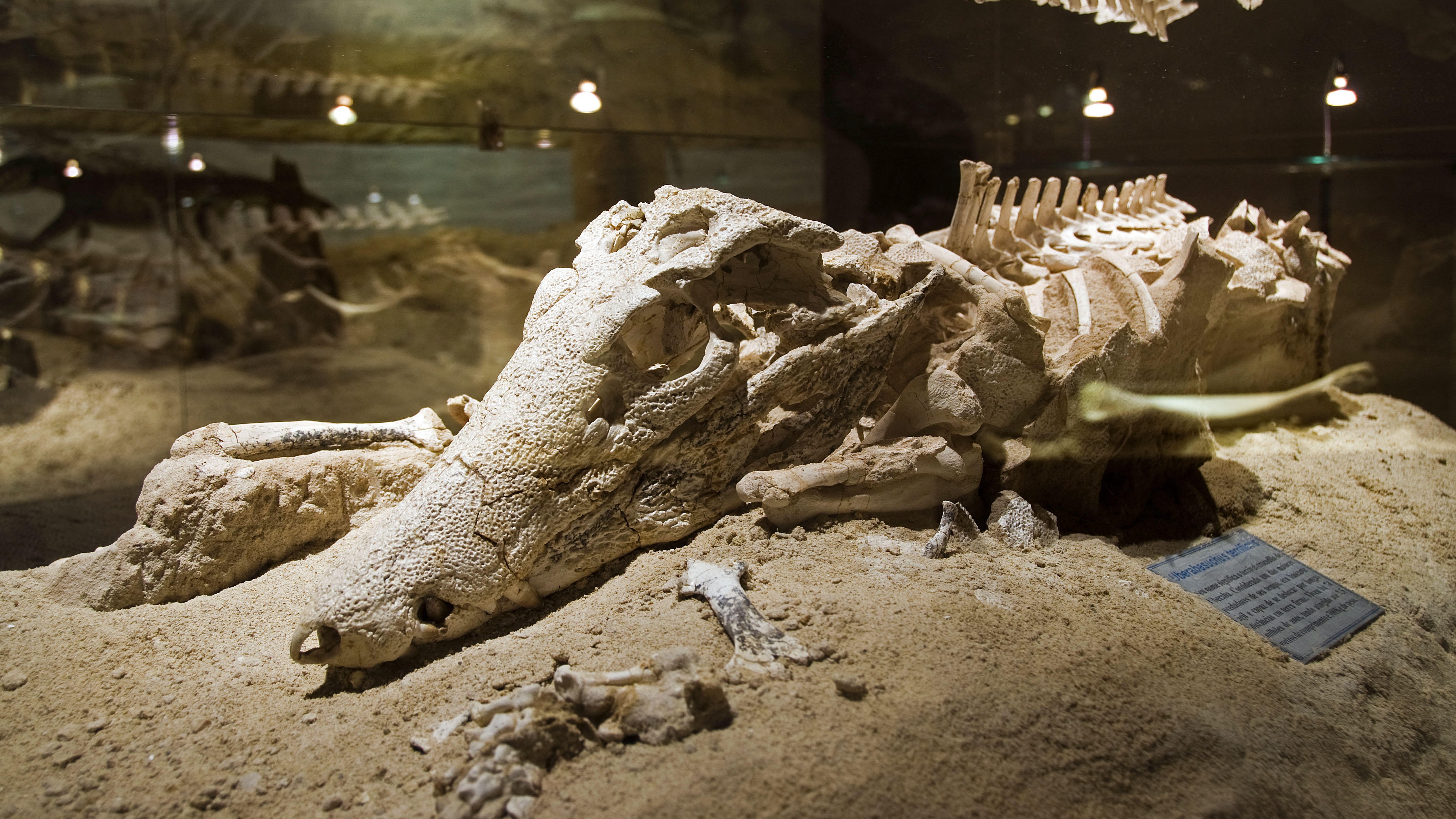
Nestled within Brazil's Cerrado tropical savanna — the second-largest biome in South America, after the Amazon rainforest — Uberaba Geopark is a time capsule from the Late Cretaceous period (100.5 million to 66 million years ago).
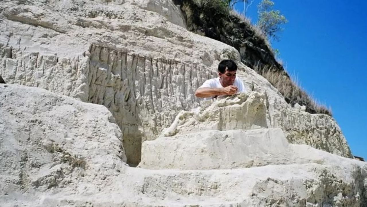
The geopark boasts abundant, well-preserved fossils from the last chapters of the nonavian-dinosaur era, according to UNESCO, earning it the nickname the "Land of the Giants," or "Terra dos Gigantes" in Portuguese. Paleontologists have discovered more than 10,000 fossils belonging to dinosaurs, prehistoric crocodyliforms (a group encompassing living crocodiles, alligators, caimans and gharials, as well as their extinct relatives), turtles and other ancient creatures within the park's boundaries.
One of the best-known discoveries is the fossil of Uberabatitan ribeiroi, a titanosaur measuring 89 feet (27 meters) long and 33 feet (10 m) tall, according to UNESCO.
The finds were clustered in impressive geological features, including the Serra da Galga formation and Serra Geral mountain range. These structures formed from ancient basalt flows, which came from giant volcanic eruptions that predate the breakup of the Gondwana supercontinent 180 million years ago.
The park has the ideal conditions to preserve fossils because it alternated between shallow lagoons and river systems when the dinosaurs roamed the region, meaning the animals' remainswere conserved in mudwhen they died.
Uberaba Geopark preserved extinct crocodile relatives among other fossils. (Image credit: Pulsar Imagens via Alamy)
The Cerrado savanna, which houses the entire park, is a critical-yet-underprotected carbon sink that hosts more than 12,000 plant species and diverse animal life.
The "Land of the Giants" was added to UNESCO's list of geoparks in 2024 in recognition of the region's geological and natural heritage.
What is now the Uberaba Geopark was the birthplace of Brazil's modern livestock market, which is one of the biggest in the world. Farmers in the 19th century introduced zebu (Bos indicus) cattle from India because they are better suited to the climate in Brazil and require less food than common domesticated cattle (Bos taurus). Zebu cattle also produce lower greenhouse gas emissions than common domesticated cattle do, according to UNESCO.
Uberaba Geopark is open to visitors. There are several museums and trails to explore, including one that leads to the Vale Encantado, or "Enchanted Valley," which contains forests, waterfalls and prehistoric rock formations, according to the BBC.
Discover more incredible places, where we highlight the fantastic history and science behind some of the most dramatic landscapes on Earth.
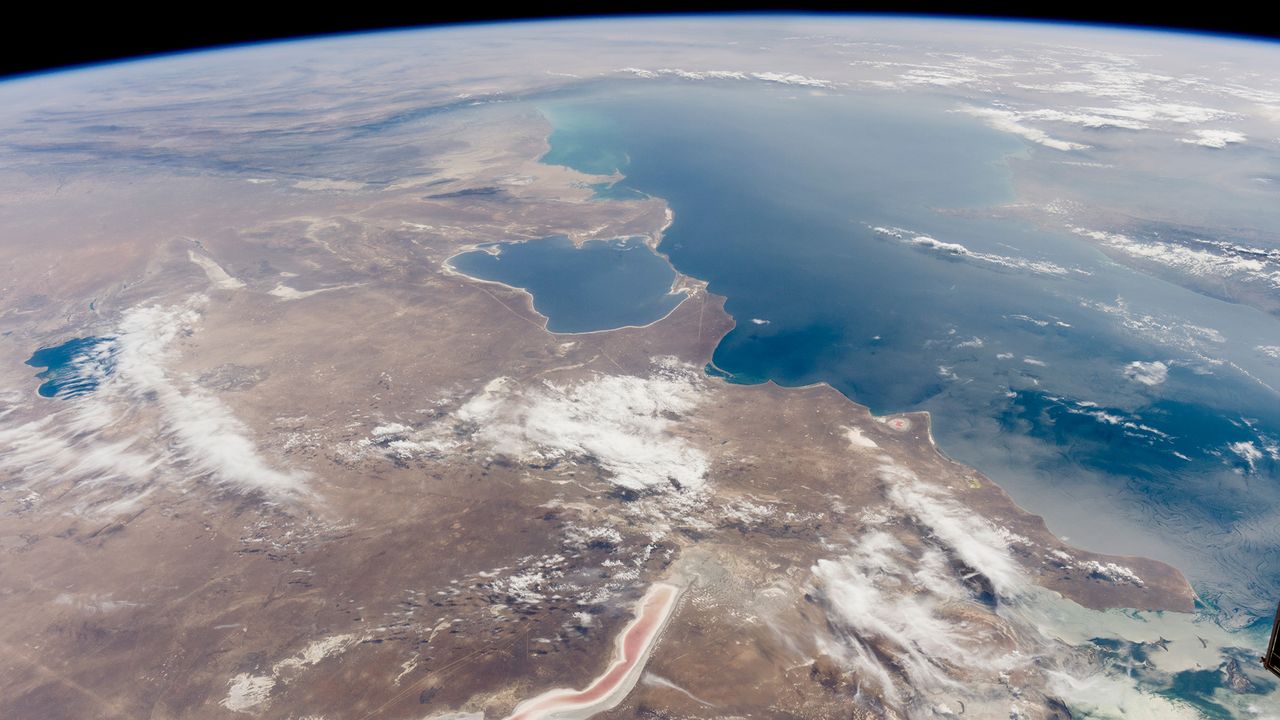
The Caspian Sea, the world's largest inland body of water, is in major trouble. Since the mid-1990s, this saline lake, located between Europe and Asia, has lost an area nearly the size of Sicily. But until now, it wasn't clear why.
Researchers finally provided answers in a study published June 5 in the journal Earth's Future. Using ground- and satellite-based observations, they connected falling water levels to a drastic drop in river inputs from Iran, Turkmenistan, Azerbaijan, Kazakhstan and Russia, all of which border the Caspian Sea.
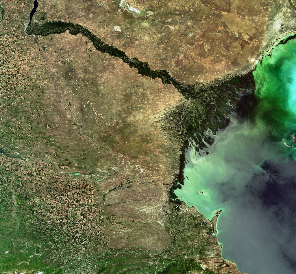
The team particularly highlighted losses from Russia's Volga River, the longest river in Europe, which supplies roughly 80% of the Caspian's inflow.
To find out why the Volga is discharging less water into the Caspian Sea now than it did 30 years ago, we spoke with Amir AghaKouchak, a co-author of the study and professor of civil and environmental engineering at the University of California, Irvine.
AghaKouchak, who directs UC Irvine's Center for Hydrometeorology and Remote Sensing, explained why river inputs have dropped and how decades of water withdrawals have put the Caspian Sea on a path to collapse. He also touched on a solution to this crisis — and revealed why Russia's hunger for ammunition to attack Ukraine is making it harder to save the Caspian Sea.
Sascha Pare: Falling water levels in the Caspian Sea have been attributed to natural variability, and more recently, there's been a focus on climate change and increased evaporation due to rising temperatures. But what did the results of your study show?
Amir AghaKouchak: People quickly jump to conclusions about climate change. Of course, that is important, but it cannot explain the change that we have observed. Over the last 30 years, water levels in the Caspian Sea have shrunk by around 2 meters [6.5 feet] or so. Just to put things in perspective, this translates to about 24,000 square kilometers [9,300 square miles] of sea area loss — about 5%. When we look at drivers, we notice that rainfall hasn't changed significantly over the lake and upstream, so the decline cannot be explained simply by changes in rain.
Evaporation has increased, so it explains maybe about one-third of the change. There is less water in the lake, and that indicates there's probably some water lost along the way. We don't have a lot of human-related data — for example, water withdrawal for irrigation or groundwater wells. That area is very difficult; the countries are not open to sharing data. A lot of our results are based on looking at proxies. Our interpretation is that temperature caused about 30% of the change and the rest is probably because of human activities.
SP: Which human activities does your research suggest are responsible for the Caspian Sea's decline?
AA: Several of the countries on the Caspian Sea have built large dams — Russia, for example. They are all desperate for hydropower. All of the countries around the lake [have also built infrastructure to supply agriculture], and one reason is that they want to create jobs and improve the local economy. Water demand is increasing in all those countries around the Caspian Sea. It's not surprising to see lakes drying or groundwater levels falling.
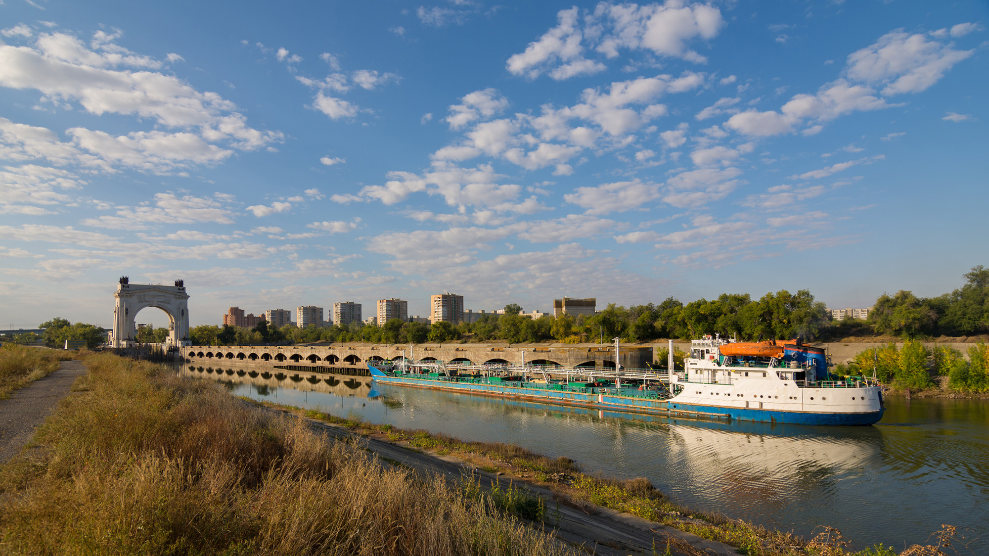
It's hard to find data about how much water countries are using; they keep data very private, especially places like Russia. We don't have detailed information, but the Volga-Don Canal in Russia is one of the projects that is contributing to this crisis. [Editor's note: The Volga-Don Canal is a ship canal that connects the Volga and Don rivers at their closest points.]
Opened in 1952, the Volga-Don Canal connects the Volga, which flows into the Caspian Sea, and the Don, which empties into the Sea of Azov (a northern extension of the Black Sea). (Image credit: Gaika102 via Getty Images)
But we cannot blame this whole thing on that. We have to be careful with our language; we can't say one project is responsible. Most likely, this is the collective impact of many different small withdrawals from here and there, overall contributing to a significant decline in the Volga River outflow into the lake. In the paper, we have different rivers, but the Volga dominates because it's the largest river. The Volga has a higher impact than all the other rivers combined. There are lots of demands along that river basin.
SP: Did you expect human activities to play such a big role, or were you surprised?
AA: We did not have any expectations at the beginning. In fact, when we started this project, I reached out to a lot of colleagues from neighboring countries around the Caspian Sea. We didn't want to do it on our own, sitting in California, looking at another area of the world, without having local people involved. If you look at the co-authors, you see people from Azerbaijan, Iran, Kazakhstan — so, we have local experts. We thought this was really important to have those perspectives. I didn't want to reflect the opinions of only one research group. What we have here is the collective opinion of people who have not met in person; we only exchanged emails to look at the results, and then we came up with those conclusions.
We do have a Russian involved, but not from an official Russian institution. I thought this was really important, because there's more back-and-forth [with a large group of people]. If two people have to convince themselves of an idea, it's much easier than with 20. Also, we brought in people from other countries who had projects in the area; for example, there is one group from Finland and another group from Germany. We tried to come up with something that this large group of people could agree on. It was not easy, but it worked out.
The Volga River supplies roughly 80% of the Caspian Sea's inflow, but huge water demands have decreased its flow. (Image credit: ESA, CC BY-SA 3.0 IGO )
SP: What is the worst-case future scenario for the Caspian Sea if shoreline countries fail to decrease their water demands?
AA: My concern is that, in the same general area, we have the Aral Sea, which is now about 5% to 10% of what it used to be, and Lake Urmia, in northwest Iran, that has also shrunk really fast and is now very small, with low levels of ecological activity. So we have two smaller lakes in a very similar climate that, from an ecological perspective, are dead. Because we have seen those degrade, we have to consider that this is the worst-case scenario for the Caspian Sea, too.
The Caspian Sea is much, much bigger. I hope it doesn't happen, but it's on the same path. Again, it's much larger, so it would probably take 100 years [to shrink as much as the Aral Sea and Lake Urmia], even with the current trend. But because we have seen those lakes shrink really fast, it deserves attention. Due to the size of this lake, the potential impacts will be huge. Even if 20% of the Caspian Sea dries out, the consequences will be very significant. It would be a disaster.
SP: You mentioned that drying lakes can become ecologically "dead." What other impacts could the Caspian Sea's falling water levels have on the surrounding landscape and people?
AA: The lake's retreat will expose the lake bed, and because it's saline, you have all kinds of minerals that will be exposed. With the next strong wind, they will go into the air. The health impacts include respiratory diseases, and even eye diseases, that are linked to salt minerals in the atmosphere. Those are the immediate consequences. Additionally, those minerals can travel long distances. In general, salt deposition on agricultural land reduces productivity. It takes a while, but if those lands are exposed for a long time, this will have an impact on the agricultural sector in those areas, which means potential food security issues. We don't exactly know what those materials are on the lake bed, so it's hard to know precisely what the consequences will be.
There is also serious shipping happening in this region. Right now, most of the shrinking is happening in the Caspian Sea's northern part, which is shallower [than the rest of the lake]. The drop in water levels is about 2 meters, and you can imagine that if you have a port and water levels drop more, you won't be able to operate. You'll need to extend your shipping routes southward; you'll need to invest and spend a lot of money to use other ports and docking sites. We have evidence of that around the Aral Sea and also Lake Urmia. There used to be these docking sites and ports, but those are now far away from the water.
SP: What must bordering countries do to save the Caspian Sea and prevent these negative effects?
AA: Demand management is absolutely critical. Demand management doesn't get a lot of attention, because unlike big projects that make the news, management means you have to cut things and do things that people don't notice. Some people argue that politicians don't show a lot of interest in demand management, but it's something that we have control over. The technological opportunities are there.
But when you look at that area, there is a big war — so probably it's not the priority to invest in management. There are a lot of things that we don't talk about in the paper that are relevant. I recently learned through discussions with people from the region — this is something that came to us from co-authors and collaborators — that many countries in that area grow cotton, which uses a lot of water. It has a lot of applications, but apparently, one of them is military. Cotton is used to produce ammunition. Russia needs a lot of ammunition, so not only are they growing it themselves, but they also bought neighboring reserves from Uzbekistan and Kazakhstan. So now, even those countries have an incentive to grow more cotton. This is driving more irrigation, more groundwater extraction, more surface water depletion, and probably more impacts on the Caspian Sea.
This interview has been condensed and edited lightly for clarity.
Each year, tons of soil, silt and rocks flow into reservoirs in the U.S. and get stuck there, creating a "ticking time bomb" that threatens lives and livelihoods. According to a new study, around a fifth of the world's reservoirs are currently at high risk of filling with sediment, and by 2060, half could be inoperable as a result.
The sediment takes up space meant for water, putting additional pressure on structures that were not built to contain large quantities of sand and sludge. As the reservoir fills with the material instead of water, sediment-filled reservoirs pose a serious threat to water security and the safety of people living near or downstream of them — and as the climate changes, scientists expect the problem to worsen.
"We are losing storage space in our reservoirs faster from sediment accumulation than we gain space from new dam construction," Amy East, a geologist at the U.S. Geological Survey, told Live Science.
What is dam sedimentation?
Dam sedimentation is not a uniquely U.S. problem. Rain pulls sediment down slopes into waterways. Normally, this sediment would travel through the river system, shaping the water flow, creating habitats, and fortifying coastal wetlands and estuaries against erosion. In many parts of the world, this sediment is also a vital natural fertilizer for crops. But after a river is dammed, this sediment can collect in the reservoir.
A 2023 study published in the journal Science found that sediment buildup was the greatest threat to global water storage in existing reservoirs — even more than drought.
New research, which includes smaller reservoirs, has offered a more nuanced and concerning picture. In the study, published June 5 in the journal Nature Sustainability, researchers assessed the state of reservoir sedimentation globally. They looked at more than 550,000 reservoirs, most of which spanned less than 0.4 square miles (1 square kilometre). They found that almost 1 in 5 of reservoirs globally are at high risk of filling up with sediment.
The researchers found that sedimentation is eating into global reservoir storage capacity at about 7.3% every decade. There are 16 global hotspots that are at high risk of reservoir sedimentation, threatening water supplies to more than 2 billion people and impacting more than a quarter of global irrigated land. One of these hotspots includes the western U.S.
The authors found that sedimentation risk was especially pronounced in regions with dense small-reservoir networks supporting key crop systems.
"Without intervention, we project that, by 2060, more than half of all reservoirs could become functionally inoperable," the authors wrote. This includes more than half of all small reservoirs and more than a third of large reservoirs globally.
Where is it a problem in the U.S.?
North America has the second largest number of reservoirs, after Asia, according to the global survey. And at 7.8%, its sedimentation rate is higher than the global average, ranking it third after Oceania (9.9%) and South America (8.1%),
The U.S. is home to many small dams, said Matthias Kondolf, a geomorphologist at the University of California, Berkeley who wasn't involved in the study. "All the focus tends to be on the big dams, and these many, many small ones have been neglected," he told Live Science.
From the 1940s to 1970s, there was a big push by the U.S. government to build "farm ponds," he said. In western Oklahoma, for example, "all these dams are now filling up with sediment, and there's nothing in place to assess the safety of these features, which have now become threats."
Reservoirs in some regions are more at risk than others. The western U.S. is a natural hotspot because it has a steeper topography, meaning more sediment naturally ends up in watersheds, East, who wasn't involved in the new research, said.
And in areas where human activities like farming or logging disrupt the landscape, rainfall is likely to drag even more sediment into reservoirs, East said. "Those types of land use can create sediment-producing hotspots almost anywhere."
In California, for example, more than half of small reservoirs in maize-growing areas are filling up with sediment at a rate of more than 10% a year, which threatens local maize production.
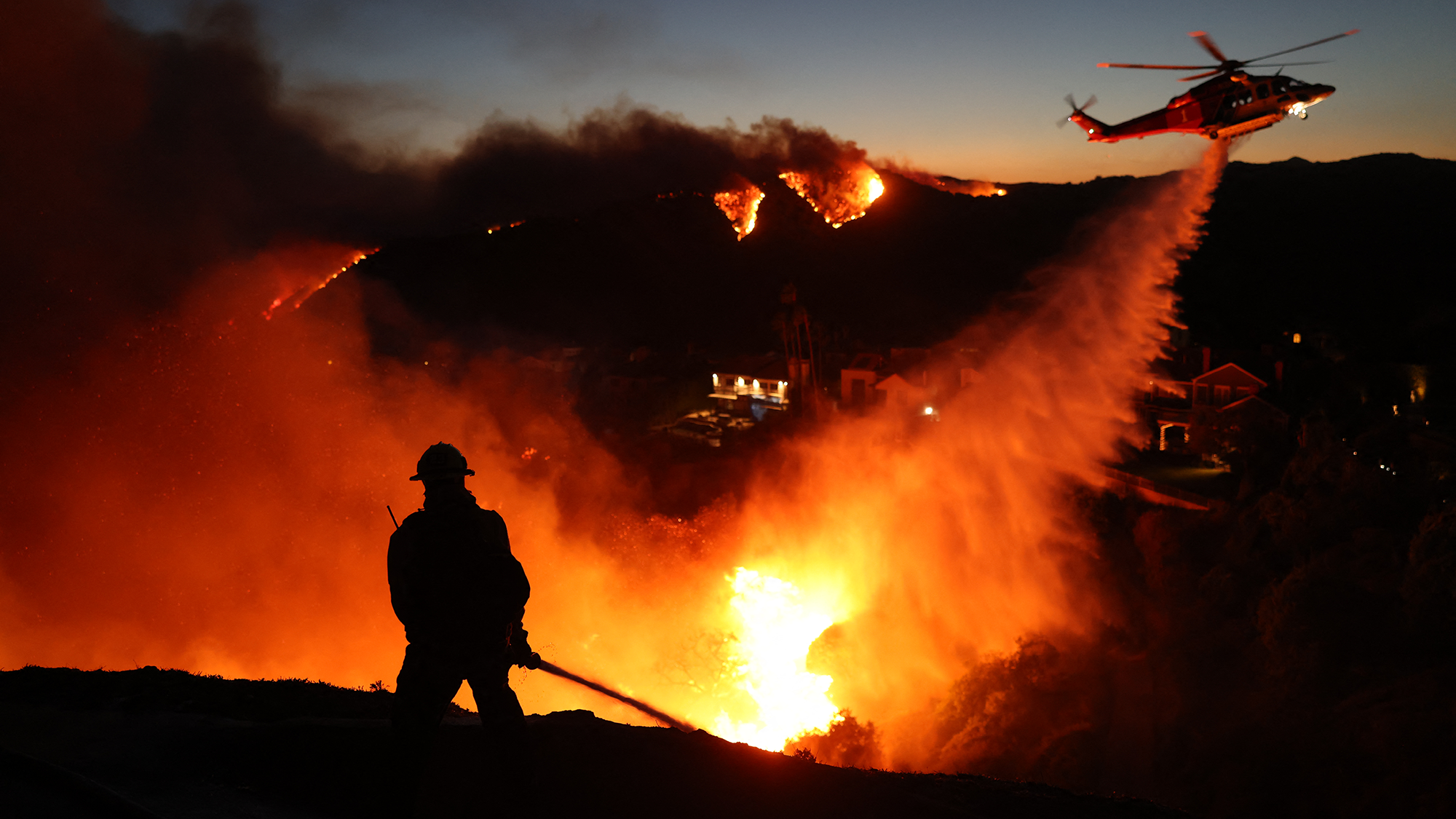
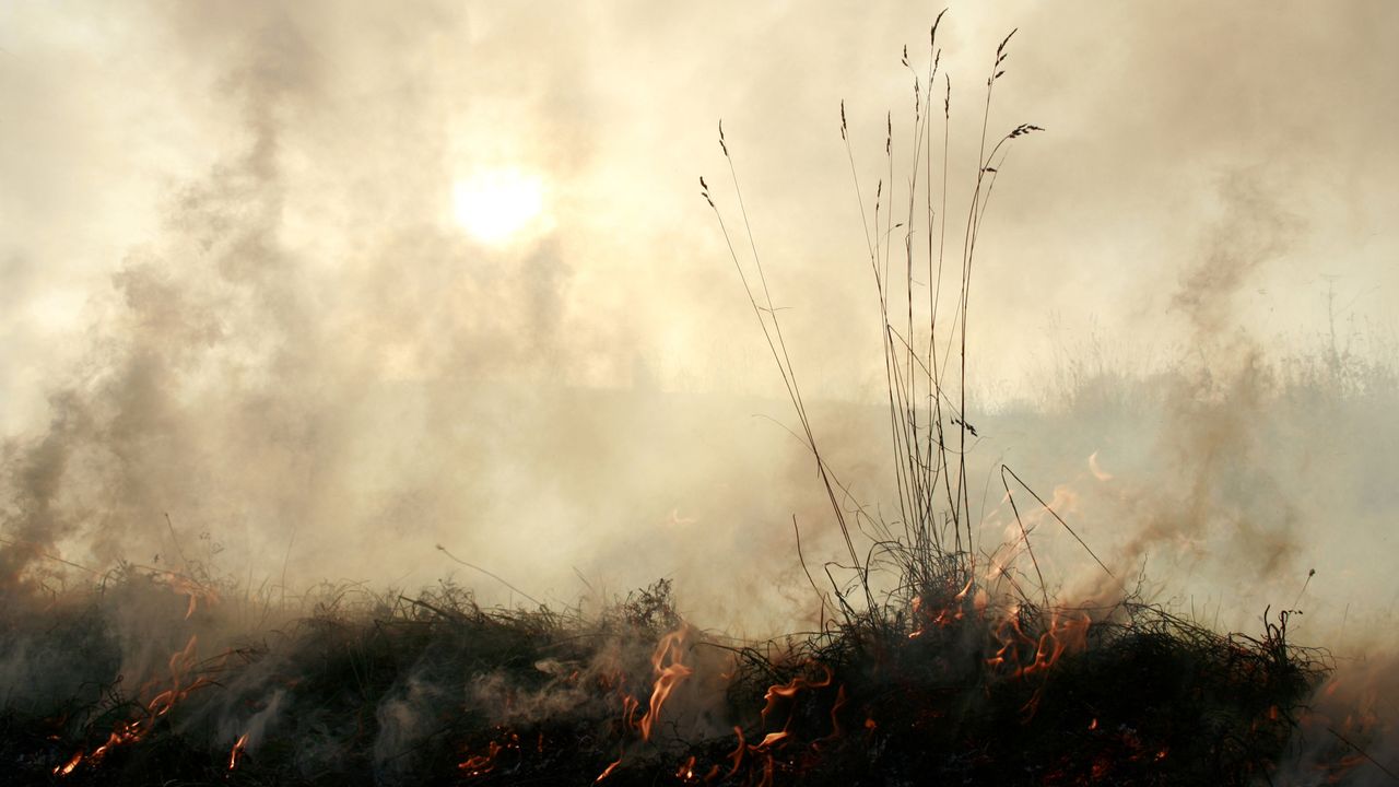
Wildfires also increase the amount of sediment flowing into rivers. (Image credit: DAVID SWANSON via Getty Images)
The threat to water security will be particularly acute in places struggling with wildfires, such as the western U.S. After fires, rain washes the debris and sediment into watersheds. A 2024 study in California found that most of this post-fire sediment erosion occurred upstream of reservoirs, rather than in places where sediment would move downstream directly to the ocean.
The dam-sedimentation situation is likely to get worse as the climate changes, researchers said. As the climate changes, there will be more extreme weather events, such as droughts and wildfires, adding more sediment to watersheds. Dams are designed to cope with the pressure of water, not sediment which exerts more force on dam walls. Moreover, in seismically active areas, the sediment vibrates at a different frequency than the concrete of the dam, which creates further impact against the structure. Additionally, the dams are just getting older.
"What do we do 50 or 100 years from now when we have all these reservoirs across the landscape filled with sediment, sitting there as ticking time bombs?" Kondolf said.
What can be done about it?
For a reservoir to be sustainable long-term, the amount of sediment entering it and leaving it should be the same.
"A big part of preventing reservoir sedimentation problems is upstream soil conservation in the watershed," East said. Interventions include ensuring that land use, such as agriculture or timber harvesting, follow best practice to reduce the amount of sediment washing off the landscapes.
If sediment is already in the dam, it can be difficult to manage and expensive to remediate, Kondolf said. Some dams, such as Fall Creek Dam in Oregon, have mechanisms that enable engineers to release sediment. But in the past, reservoirs were not designed to manage sediment and little thought was given to how to decommission them.
"This is one of those issues that falls in the cracks between different agencies and responsibilities," Kondolf said. Some larger facilities fall under the remit of the federal government. Other dams fall under state governments. California, for example, recently launched a state-sponsored program to future-proof the state's dams.
But smaller dams often get overlooked, Kondolf said.
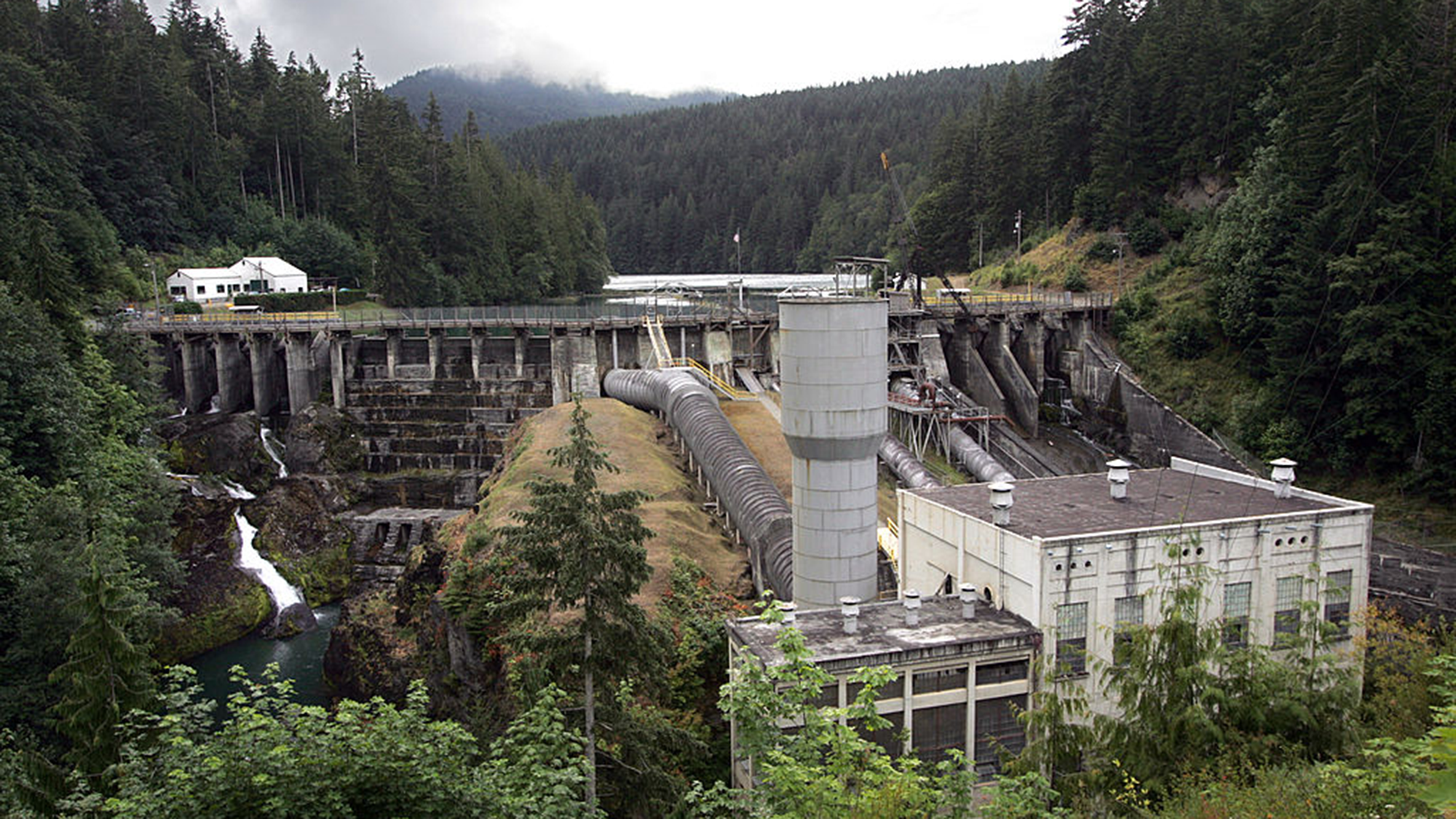
The Elwha Dam in Washington state which was removed around a decade ago. (Image credit: Tacoma News Tribune via Getty Images)
For smaller dams with a relatively small amount of sediment, "you just blow up the dam and let the sediment work its way downstream", Kondolf said.
There are other technological solutions, but they are expensive, such as retrofitting dams to enable them to pass sediment; creating a bypass to route sediment-heavy water around the dam; and mechanical dredging.
"The economics of managing reservoir sediment long-term were not generally incorporated into dam design and planning in the last century when many western-U.S. water projects began," East said. This has "pushed the cost burden on future generations."
But the reality is that reservoirs around the country are filling with sediment. It is reducing their ability to store water and potentially endangering the communities living downstream of them — and unless addressed, the problem will only get worse.
Scientists have confirmed that a flowering plant native to the mountains in southwest China is carnivorous, supporting a prediction made by Charles Darwin more than 150 years ago.
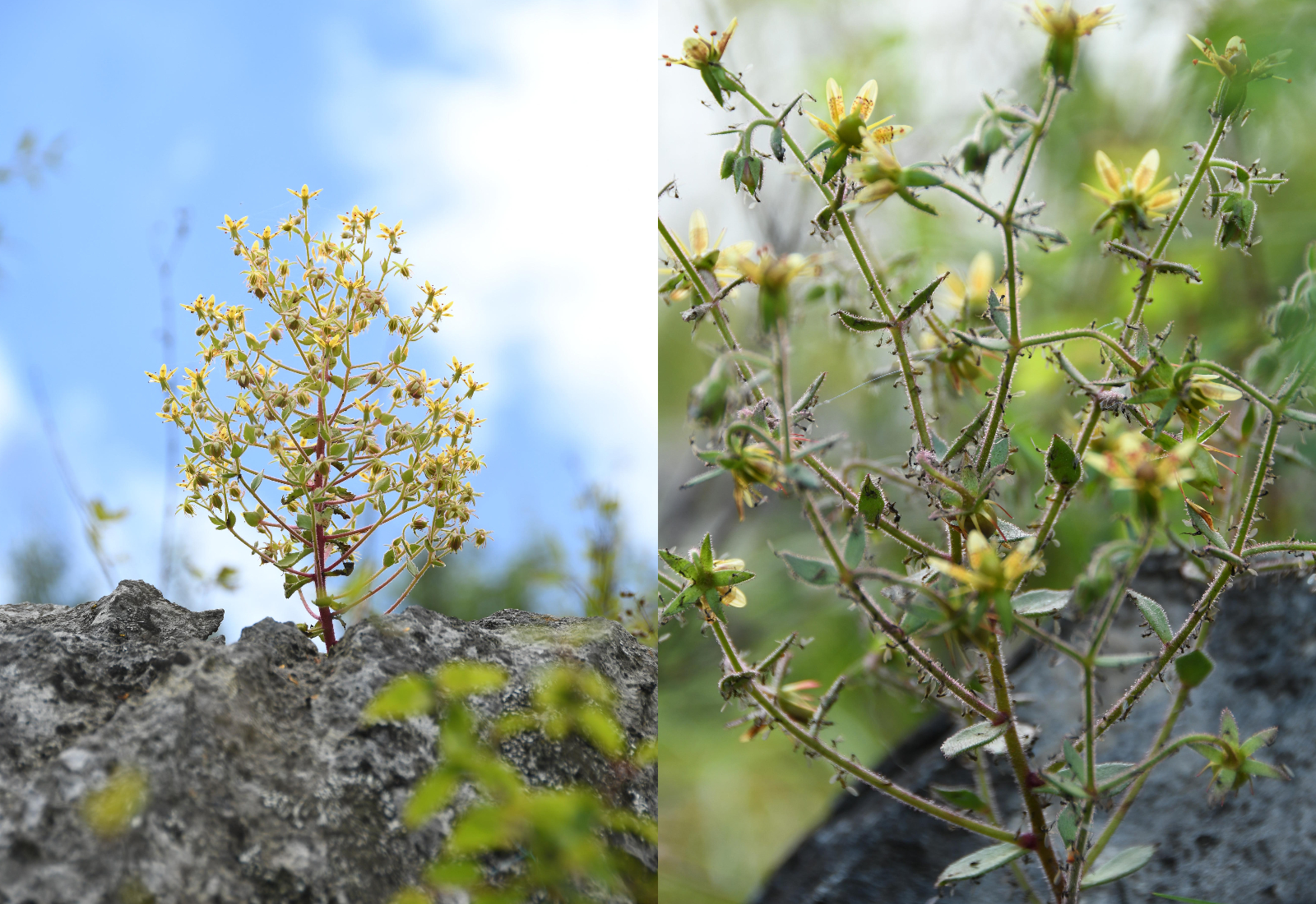
The species, Saxifraga candelabrum, grows at elevations above 8,200 feet (2,500 meters) in the Hengduan Mountains, which connect the southeast portions of the Tibetan Plateau to the Yunnan-Guizhou Plateau.
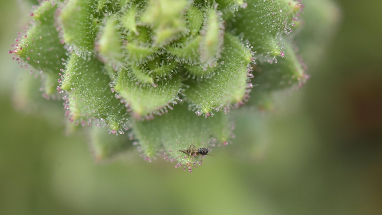
The plant has stems and branches covered in sticky hairs that can trap small insects, predominantly nonbiting midges. However, scientists were unsure if these insects were being ingested by the plant. In a new study, researchers showed that S. candelabrum can digest and absorb nutrients from insects after capturing them, proving that the plant is carnivorous. The scientists published their findings Tuesday (Aug. 4) in the journal Nature Communications.
This is the first demonstrated case of carnivory in the saxifrage plant group, said study co-author Douglas Soltis, a distinguished professor of biology at the Florida Museum of Natural History.
Other carnivorous plants typically grow in moist, boggy soils, but S. candelabrum is found in dry alpine areas, Soltis told Live Science in an email. "These are all nitrate poor soils — that's why this carnivorous habit has evolved a number of times" to supplement the plants in vital nutrients, he said.
In 1875, Darwin theorized that two species closely related to S. candelabrum that also have sticky hairs — S. rotundifolia and S. umbrosa — may be carnivorous, based on their ability to catch insects. But the 19th-century naturalist couldn't show that the plants digested their prey or reused the nutrients in insect tissues — two conditions that are key to confirming carnivory in plants. Without these conditions, a species is considered simply "protocarnivorous," meaning it catches and kills insects or other small animals but doesn't digest or absorb them, according to the study.
"Although untested at the time, Darwin’s hypothesis provided an important inspiration for our study," study co-author Hang Sun, a researcher in the Chinese Academy of Sciences' Kunming Institute of Botany, told Live Science in an email.
The researchers conducted field observations and herbarium surveys of S. candelabrum, which revealed that mature plants with more numerous and longer branches had an average of 71 trapped insects on them. In the herbarium surveys, the team found that 43 out of 45 specimens had caught insects, suggesting that insect-trapping is a widespread phenomenon in this species.
Next, the study's authors showed that S. candelabrum possesses phosphatase, a digestive enzyme commonly found in carnivorous plants. They did this by labeling the phosphatase enzymes with fluorescent molecules to visualize them under a specialized microscope, a technique known as fluorescence tagging.
S. candelabrum secretes a viscous substance that coats its hairs, meaning insects get stuck on the stem and branches if they fly too close. (Image credit: Xin-Jian Zhang)
To determine if S. candelabrum digests and absorbs nutrients from insects, the researchers labeled fruit flies with a stable form of nitrogen before feeding them to the plants. This led to a marked rise in stable nitrogen in S. candelabrum and in a different, known carnivorous species, which the team used as a control group. By contrast, a non-carnivorous plant that formed a second control group did not show an increase in stable nitrogen, indicating that S. candelabrum is carnivorous.
Finally, the researchers performed a genetic analysis, which revealed that S. candelabrum has genes in common with known carnivorous plants that are linked to prey attraction, digestion and nutrient absorption. Together, the results showed that S. candelabrum evolved carnivorous traits to cope with its nutrient-poor environment, adapting its hairs — which were initially used for herbivore defense — into insect traps, according to the study.
Larger insects, which S. candelabrum requires for pollination, rarely get stuck to the hairs, the researchers noted in the study, suggesting that the species has perfectly balanced its needs through evolution.
Other Saxifraga species and plants belonging to the same lineage could turn out to be carnivorous, too.
"Many members of the Saxifragaceae, which includes genera other than Saxifraga, have sticky glandular hairs and are often covered with insects," Soltis said. "I would not be surprised if other members of the family are also carnivorous — as Darwin predicted."
The study broadens the scope of carnivorous plant research, Sun said. "Carnivory may therefore be far more widespread among flowering plants than previously recognized," he said.
Forecasters are warning that the ongoing El Niño is likely to become supercharged in the coming months and inject potentially unprecedented heat into our already warming world.
El Niño is the warm phase of a multiyear natural climate pattern, but models suggest this year's cycle will be exceptionally intense. Super El Niño conditions could contribute to temperature extremes until next year, but scientists are warning that it may also pose longer-term threats.
Jong-Seong Kug, a professor in the Department of Earth and Environmental Sciences at Seoul National University in South Korea, uses observational data and artificial intelligence to model El Niño events.
Kug has found that super El Niño events can drive sudden, dramatic and even irreversible climate regime shifts. Live Science spoke with Kug to learn more about climate regime shifts and the long-term threats posed by this year's ongoing El Niño.
Patrick Pester: Last year, you published a study that found super El Niño events significantly increase the likelihood of potentially irreversible climate regime shifts. With a super El Niño now looking very likely, how concerned should we be?
Jong-Seong Kug: We should be concerned but not alarmist, because our study does not suggest that every super El Niño inevitably causes a climate regime shift. Rather, a super El Niño can push an already-stressed climate ecosystem across a critical threshold. If a system is near a critical threshold, then strong forcing can induce irreversible change.
Current forecasts indicate a very strong El Niño is increasingly likely later this year. We need to watch vulnerable regions closely, particularly those that are already experiencing severe warming, drying, ecosystem degradation or ocean stress.
PP: What kind of climate regime shift do you fear most?
J-S K: I am particularly concerned about the persistent shift in major ecosystems, such as the Amazon rainforest moving toward a much drier and degraded state. You know, a long time ago the Amazon was a savannah area, so we are now approaching this kind of tipping point. Also, in the Amazon, this drying can weaken [or] even reverse the forest's role as a carbon sink.
The Amazon is a carbon sink, but imagine it becomes drier and drier, and there's some die-back of the forest. Now, [carbon] sink becomes source. This could amplify global warming long after an El Niño event.
PP: Is there anything we can do to mitigate the threat of extreme climate and weather events in the coming months?
J-S K: We cannot stop El Niño. But we can greatly reduce its human impact or ecosystem impact. Governments should use precision forecasts to strengthen our heat health plan, water and food management and flood and wildfire preparedness. In the long term, a rapid reduction in greenhouse gas emissions remains essential because every additional degree of warming increases this possibility that an extreme natural event will trigger lasting damage.
PP: Do you think a reduction in greenhouse gas emissions is likely, given where we are now?
J-S K: I don't think so. It's very difficult.
PP: So, where does that leave us?
J-S K: I don't know. There are some additional techniques we may use at a critical point. Have you heard about climate engineering? Like stratospheric aerosol injection [reflecting solar radiation back into space]. If we cannot do anything, then we have to choose that kind of technology. I don't want this kind of situation, but maybe in the near future we have to decide.
There are two kinds of climate engineering. One is carbon mitigation, just direct air capture [taking carbon out of the atmosphere]. That is a safe way. The other is solar energy management. We can deflect more solar energy from the surface.
So, the easiest way is just to inject an aerosol into the stratosphere; then this aerosol reflects solar radiation, and then global temperatures will decrease. It's like a volcano: After a big eruption of a volcano, the global mean temperature drops by about 0.6 degrees [Celsius, or 1 degree Fahrenheit] because there is volcano aerosol [in the atmosphere]. Instead of volcano aerosol, artificially we can inject aerosol into the stratosphere. Then global temperature can easily decrease.
But there are many side effects. Some we already know, but some we don't know. Like climate inequality. If we artificially decrease temperatures, then some countries will have a drought or a flood. And then how will we compensate?
Obviously, if you want some kind of climate mitigation, we need a kind of consensus across the countries.
PP: Is there anything else you'd like to add that we haven't covered?
J-S K: This year, super El Niño is developing in an already exceptionally warm climate. We are already seeing widespread heat waves this year, so we cannot attribute every individual event to this El Niño. But El Niño will intensify toward the end of this year, so it is likely to further increase the risk of extreme events in many regions, so we need to prepare.
Editor's note: This interview has been edited and condensed for clarity.
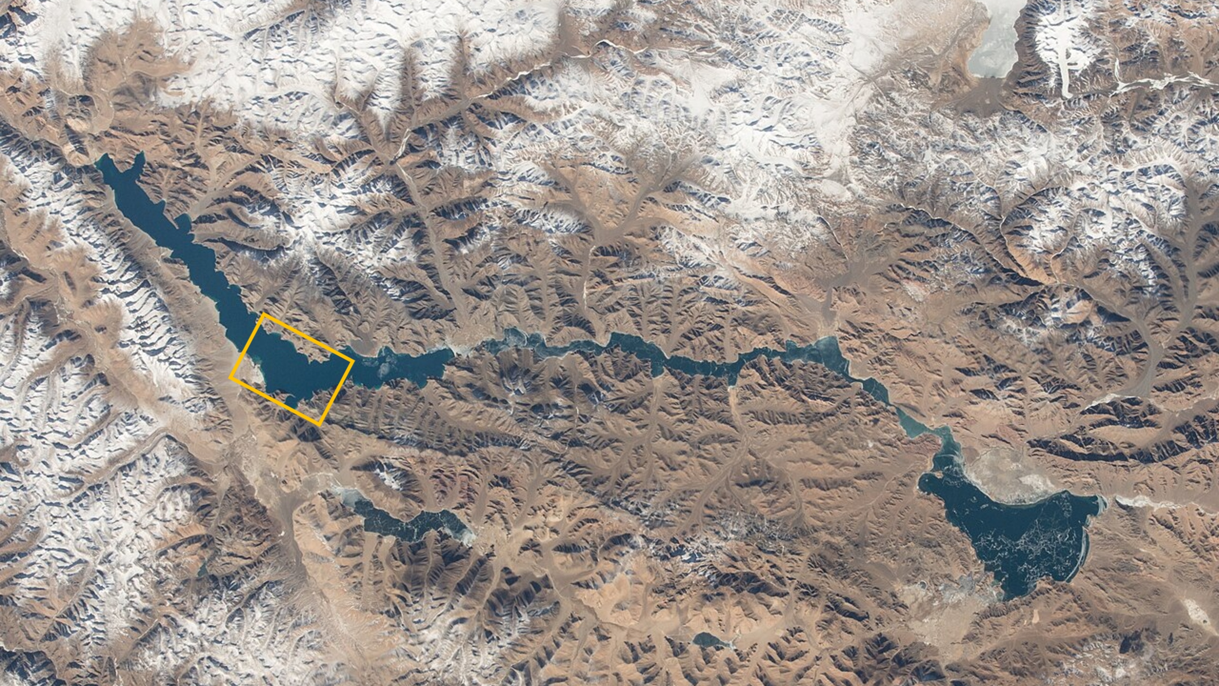
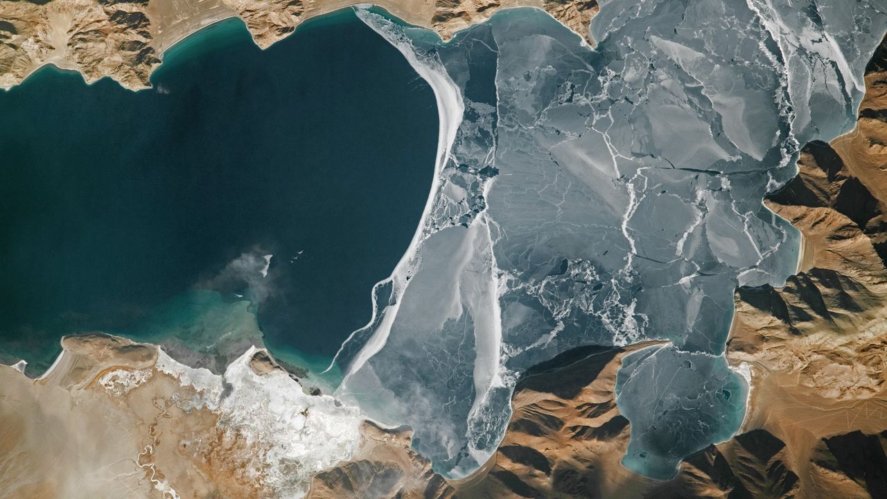
What's in the photo? Lake ice fracturing along a disputed border between China and India
Who took the photo? An unnamed astronaut on board the International Space Station
When was it taken? Jan. 25, 2024
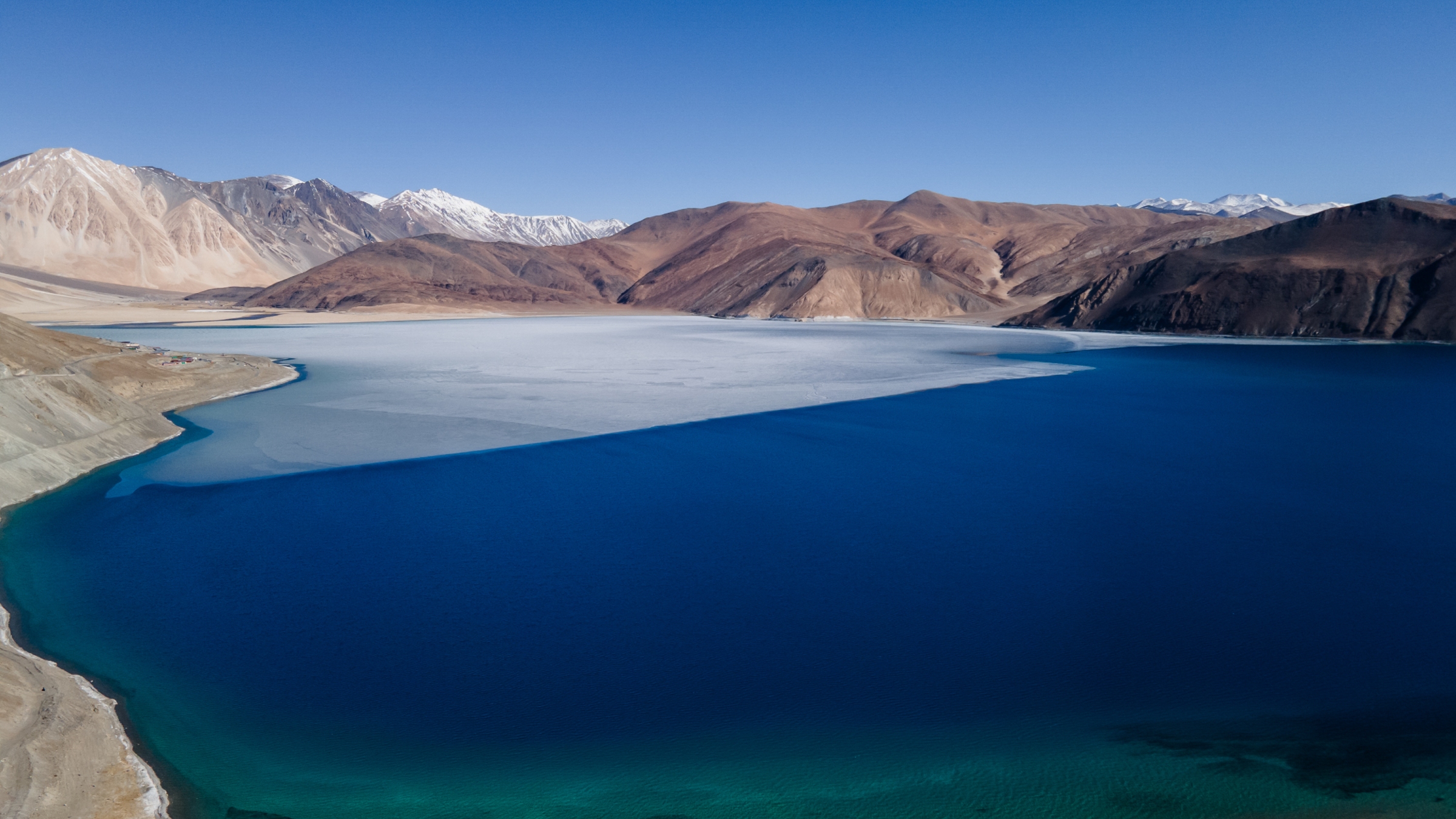
This eye-catching astronaut photo shows the fractured surface of the world's highest frozen lake lurking in the lofty climbs of the Tibetan Plateau. The smooth, white line where the ice meets the water closely follows a disputed border between China and India.
The elevated lake, known as Pangong Lake or Pangong Tso, sits at an altitude of 13,862 feet (4,225 meters), according to NASA's Earth Observatory. It is long and thin, stretching 83 miles (134 kilometers) across Ladakh, part of the Kashmir region administered by India; and Tibet, an autonomous region of China.
This photo shows a roughly 9.5-mile-long (15 km) section of the river, located around a third of the way along its length from west to east. This is also where the most widely accepted border between Ladakh (on the left of the photo) and Tibet (right side of the photo) lies. However, the exact position of the divide, commonly known as the Line of Actual Control, is poorly defined and has shifted in recent decades, according to The New York Times.
Pangong Lake is endorheic, meaning it has no outflow, and the only way water can escape is via evaporation. As a result, the lake's waters have built up an unusually high concentration of salt over thousands of years. This would usually prevent it from freezing. However, the temperature in the region can drop to minus 13 degrees Fahrenheit (minus 25 degrees Celsius), according to a local travel site, which is cold enough for the salty water to freeze over.
It is unclear why the lake's ice is fracturing in the photo. Normally, the entire body of water is completely frozen in January, when this photo was taken in 2024.
Pangong Lake largely freezes over between December and February, despite its high salinity. This image was captured in April 2025 and shows winter ice melting in another section of the lake. (Image credit: Matt Hunt/Anadolu via Getty Images)
Although Pangong Lake has no major outflow, it is connected to several inflowing rivers, including one on the bottom left of this image. The river's delta has largely frozen over (visible as the large, white patch on land), but you can still see a small plume of water entering the river.
On the opposite bank of the delta, there is a beach littered with several striations parallel to the water. These are ancient shorelines left over from when the lake had a higher water level, according to the Earth Observatory.
Pangong Lake was likely once part of the Indus River, which stretches nearly 2,000 miles (3,200 km) across South and Central Asia. However, it was likely cut off from the waterway millions of years ago as the Indian and Eurasian tectonic plates collided and the Tibetan Plateau and Himalayas formed.
Disputed border
The Line of Actual Control was first established in 1959 but was largely set in its current position in 1962 after the Sino-Indian War. Although the countries have technically been at peace ever since, frequent and occasionally deadly skirmishes have broken out along the border, including on the shores of Pangong Lake, according to the BBC.
Pangong Lake stretches 83 miles (134 km) across Ladakh and Tibet. An orange box highlights the rough location of the close-up astronaut photo featured above. (Image credit: NASA)
Nonetheless, the lake frequently draws tourists from both China and India, particularly bird-watchers, who travel there to see the large groups of bar-headed geese (Anser indicus) and Brahminy ducks (Tadorna ferruginea, also called ruddy shelducks) that breed there, according to the Earth Observatory.
On the Ladakh side of Pangong Lake, extreme-sports enthusiasts run long distances across the lake's ice. In February 2023, dozens of runners gathered there to participate in the highest-altitude frozen lake half-marathon ever recorded, according to Guinness World Records.
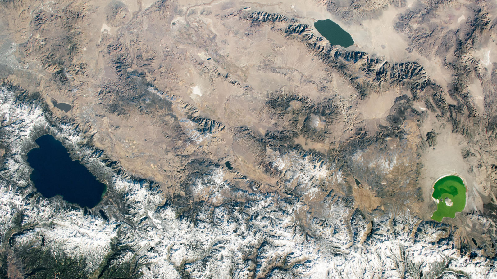
A 2020 astronaut photo shows three uniquely colored lakes — Tahoe, Walker and Mono — straddling contrasting biomes on either side of the California-Nevada border.
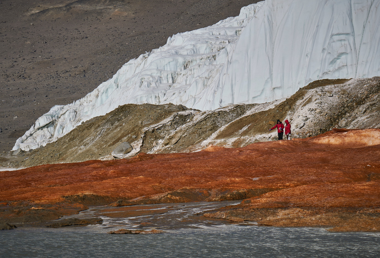
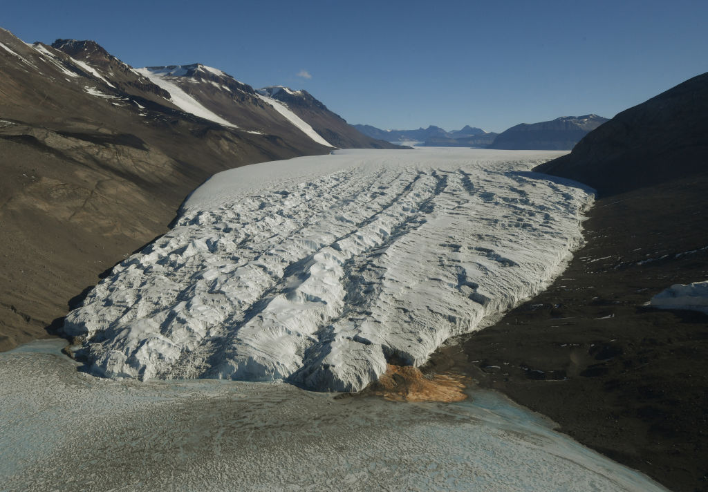
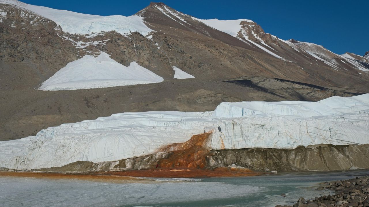
At the end of a glacier deep in East Antarctica's Taylor Valley, there is a haunting waterfall that oozes red brine like a bleeding wound in the ice. Scientists explained the brine's gory hue several years ago, finding that it is exceptionally rich in iron. And now, they may have identified the salty water's origin.
Microbes in the crimson waterfall, called Blood Falls, suggest the brine is composed of ancient seawater that was trapped in a pool beneath the glacier when ocean levels fell and the glacier advanced. However, it's unclear exactly when that happened, researchers noted. Previous studies had already proposed a seawater origin for the brine, based on various chemical signatures and bacteria detected in the liquid, but the new results add molecular and genetic evidence to the mix of clues.
"Findings in this study reveal a dominance of marine eukaryotic lineages in the Blood Falls area" compared with the broader region, known as the McMurdo Dry Valleys, the authors wrote in the study, published Monday (Aug. 3) in the journal Nature Geoscience. "This marine signal is less prominent but still detectable in the prokaryotic structure," the researchers added.
Eukaryotes' cells contain a membrane-bound nucleus and other closed internal compartments. Prokaryotes, by contrast, are single-celled organisms whose DNA floats around freely in the cell, unbounded by a membrane.
To characterize the types of microorganisms present within Blood Falls, the researchers used a suite of genetic techniques to analyze 167 samples of water, sediment and air from around the falls and the broader McMurdo Dry Valleys.
Some researchers argue that Blood Falls' water does not originate from seawater, and suggest the marine bacteria and chemical signatures that point to seawater may have instead reached the falls from the ocean via intense winds, which are common in the McMurdo Dry Valleys. By analyzing samples from various sites in the Dry Valleys, the team behind the new study compared microorganisms from the wider region with those at Blood Falls to determine if Blood Falls has a distinct microbial assemblage potentially left over from ancient conditions.
The researchers found that the crimson brine and associated red-tinted sediments at Blood Falls shared a higher proportion of eukaryotes with nearby oceanic samples than other sites in the Dry Valleys did. Whereas Blood Falls had a little over 9% of its eukaryotes in common with the ocean, the Dry Valleys showed only about 1% similarity, according to the study. The remaining eukaryotes and most of the prokaryotes identified in the paper had freshwater and terrestrial origins.
Researchers tried to determine if microbes at Blood Falls are distinct community from the surrounding region's assemblages. (Image credit: Bryan Minnea)
The results also showed that the air near Blood Falls contained only a tiny proportion of marine microorganisms, suggesting that present-day winds can't fully explain the microbial composition of Blood Falls, the researchers wrote.
The most likely origin for the brine that feeds Blood Falls is ancient seawater that was trapped when sea levels dropped and the Taylor Glacier advanced, the study found. (Image credit: MARK RALSTON/POOL/AFP via Getty Images)
Therefore, an ancient seawater origin is the most likely explanation for the microorganisms found at Blood Falls today, the team concluded. Winds may have played a role in shaping the community in the past, but now, their influence is probably insignificant, the team added.
The brine that feeds Blood Falls may have become entrapped more than 1 million years ago, during a warm period with higher sea levels and less ice cover than there is now, previous estimates suggested. However, further work, including more comprehensive genetic profiling and mapping of microorganisms, is needed to pinpoint when Taylor Valley's glacier grew to cover the brine, the researchers wrote.
Antarctica quiz: Test your knowledge on Earth's frozen continent
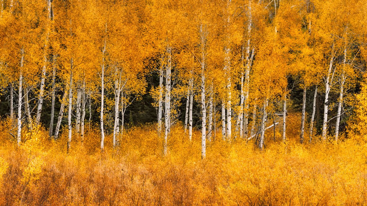
Aspen trees could provide a natural buffer against wildfires, as new research shows that areas of forest where these trees dominate burn less intensely than those made of conifers.
The findings suggest that planting more of the right kinds of trees, such as trembling aspen (Populus tremuloides, also known as quaking aspen), could be an effective strategy for protecting communities as devastating wildfires become more common and intense in a warming world, researchers reported June 15 in the journal Forest Ecology and Management.
Individual aspen trees burn easily because of their thin bark, but large "stands" — contiguous communities of trees that are uniform in species, age and structure — of them are more resistant to fire than stands of conifers and can act like a firebreak.
The reasons for aspen stands' resilience are not certain. However, researchers think it likely stems from a combination of factors, including the high moisture content in the aspens' leaves and the undergrowth, the trees' lack of highly flammable resin, and the leaves' height, which makes it harder for fire to spread to the canopy and leap from tree to tree.
Flavie Pelletier, who conducted the research as part of her doctorate at McGill University in Montreal, wanted to see whether aspen stands have been able to maintain their fire-resistant properties as climate change makes fire seasons more intense and destructive.
She combined new maps of dominant tree species in forests across Canada with satellite maps of wildfires from three recent years, including 2023, which was the country's most destructive wildfire season ever recorded. She noted which tree species tended to be inside the fire zone and which were more common at the edges. She found that aspen trees were more than twice as common at the perimeters of fires than inside them, while conifers like spruce and pine were equally present in both locations.
Having more aspen trees in a particular area also decreased the amount of forest that burned each day during a fire, so it also appears to help slow the spread of the fire. Notably, the trees still resisted fire spread even in the spring, before their leaves had fully sprouted.
"This is proof that aspen has an impact on fire perimeter formation and can slow fire progression," she told Live Science.
Anthony Taylor, a forest management specialist at the University of New Brunswick, said the study, with its use of large datasets on real fires, does a good job of analyzing and quantifying a phenomenon that Indigenous peoples and foresters have understood for a long time.
"The idea that deciduous trees burn less has been known for millennia, but knowing something through experience is different than testing it," he told Live Science.
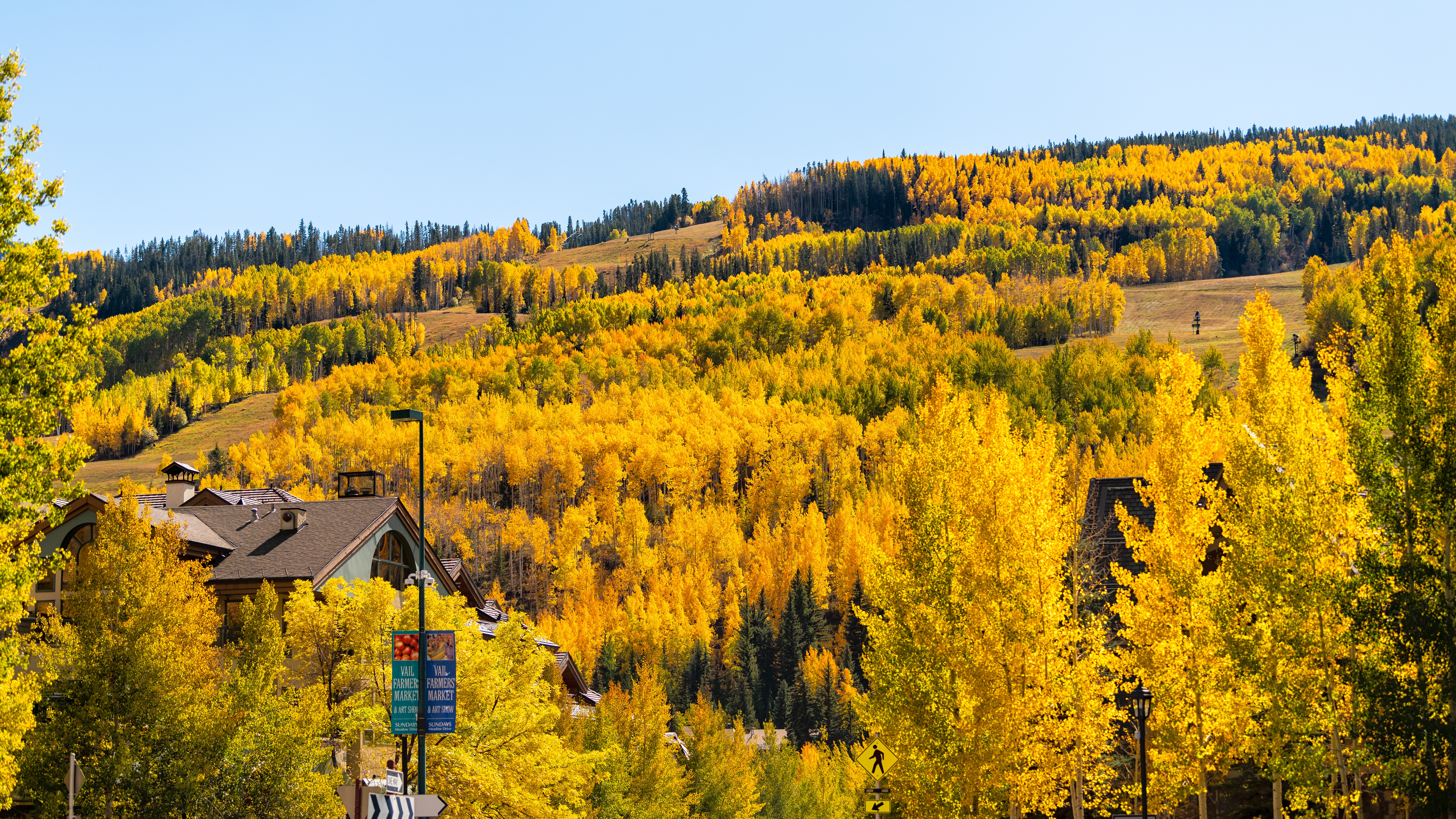
Aspen trees in Vail Colorado. (Image credit: Getty Images)
Changing practices
The research supports the idea that planting aspen or other deciduous trees around vulnerable communities can help protect them from fires. Taylor said this buffer strategy is being considered or implemented in many areas.
A single line of trees will not do the trick. The stands must be deep enough to stop the flames from blowing over the top — probably 300 to 1,000 feet (100 to 300 meters), Taylor said.
Aspens can also play a role in fire control at larger scales. Pelletier first became interested in this topic when she learned that forestry companies often spray the forests they manage with the herbicide glyphosate to kill deciduous trees like aspen so they can grow monocultures of more economically valuable conifers, leaving those forests at much higher risk of fires. She hopes her work will help convince the companies and regulators to change their practices.
"There needs to be less of a war on aspen in commercial forests," she said. In the long term, it would actually benefit the companies, because it would reduce the risk of losing large numbers of trees to fire, even if it slightly reduces the value of the forest in the short term.
Taylor agrees that in places like New Brunswick, a province with a large forestry sector, officials should be promoting more mixed and hardwood forests, and less of the softwood monocultures that the forestry industry relies on.
"That would go a long way to making our landscape more resilient to wildfire," he said. "And that's what would have been here anyway, before we started converting the forests to a more industrial forest."

 Login

 Antarctic guides walked away from their dream jobs after tourism’s environmental damage became impossible to ignore. “You’d see massive glacier calvings, and you’d just want to cry. But all the guests would be cheering. And you’d be like … ‘Can you not put two and two together?’” Those are the words of a former Antarctic [...]