❌

Reading view

'They would come in with a chord change': Composer Jim Nollman has collaborated with turkeys, kangaroo rats and whales. Now he's dropping 'Orcas' Greatest Hits.'

Throughout his career as a composer, Jim Nollman has worked with unorthodox partners to create music. Instead of collaborating solely with human musicians, the artist has expanded his cast to include animal bandmates, and they've been making melodies together for more than 50 years.

Nollman's new album, "Orcas' Greatest Hits," will be released Aug. 14 by the music label Smithsonian Folkways Recordings. As the title suggests, the album is a collection of songs centered around orca (Orcinus orca) vocalizations.

Nollman now lives in Friday Harbor, Washington, but he recorded these sounds off the coast of British Columbia between 1985 and 2002, using underwater microphones called hydrophones. The vocalizations weren't random calls that Nollman overheard; rather, he prompted the orcas to "sing" by broadcasting his and fellow musicians' music into the water via underwater speakers. The artists kept the volume at a reasonable level to protect the orcas and performed after dark to avoid motorboat sounds.

However, orcas weren't Nollman's first animal bandmates. Fresh out of Tufts University in the 1970s, he made music with various animals, including turkeys, wolves and dolphins. To learn more, we spoke with Nollman about his career, including several years he spent consulting with the U.S. Navy, and the extraordinary interactions he's had with whales and other creatures.

Sascha Pare: How did you first start making music with animals?

Jim Nollman: In my latter year at university, I got involved in the theater, doing all the music for all their plays. I soon got into John Cage [an American composer known for his innovative approaches to sound] β€ͺ—‬ first in Boston, and then in the San Francisco Bay Area when I moved there. I got to know some of the avant-garde music people, especially in Berkeley, because there was a big movement there [centered around California's KPFA Radio].

I'd been in Mexico, playing flute, and the turkeys next door would always gobble on a certain high note and at a certain volume. I said [to an editor at KPFA], "Why don't you send me to a turkey farm? I'd like to do a Thanksgiving Day piece." He gave me a sound man and a Nagra tape recorder. I remember vividly, because having a Nagra after just getting out of college was a big deal for me. I was into technology. [Editor's note: Nagra is a Swiss brand of portable audio recorders.]

The turkey farm had 300 turkeys, and I immediately learned from the owner that it's really only the males that gobble. He kept the males and the females separate, so he put me into the fenced-in area where the males were. I started singing, and I could control them. The turkeys closest to me would start, and the gobble would go out to the edge of the 300 birds. And then it would come back, and then they would all stop. I was singing "Froggie Went A-Courtin'," which is an old American folk song [originally from Scotland] about animals. I sang 30 or 40 verses of this song and controlled the turkeys.
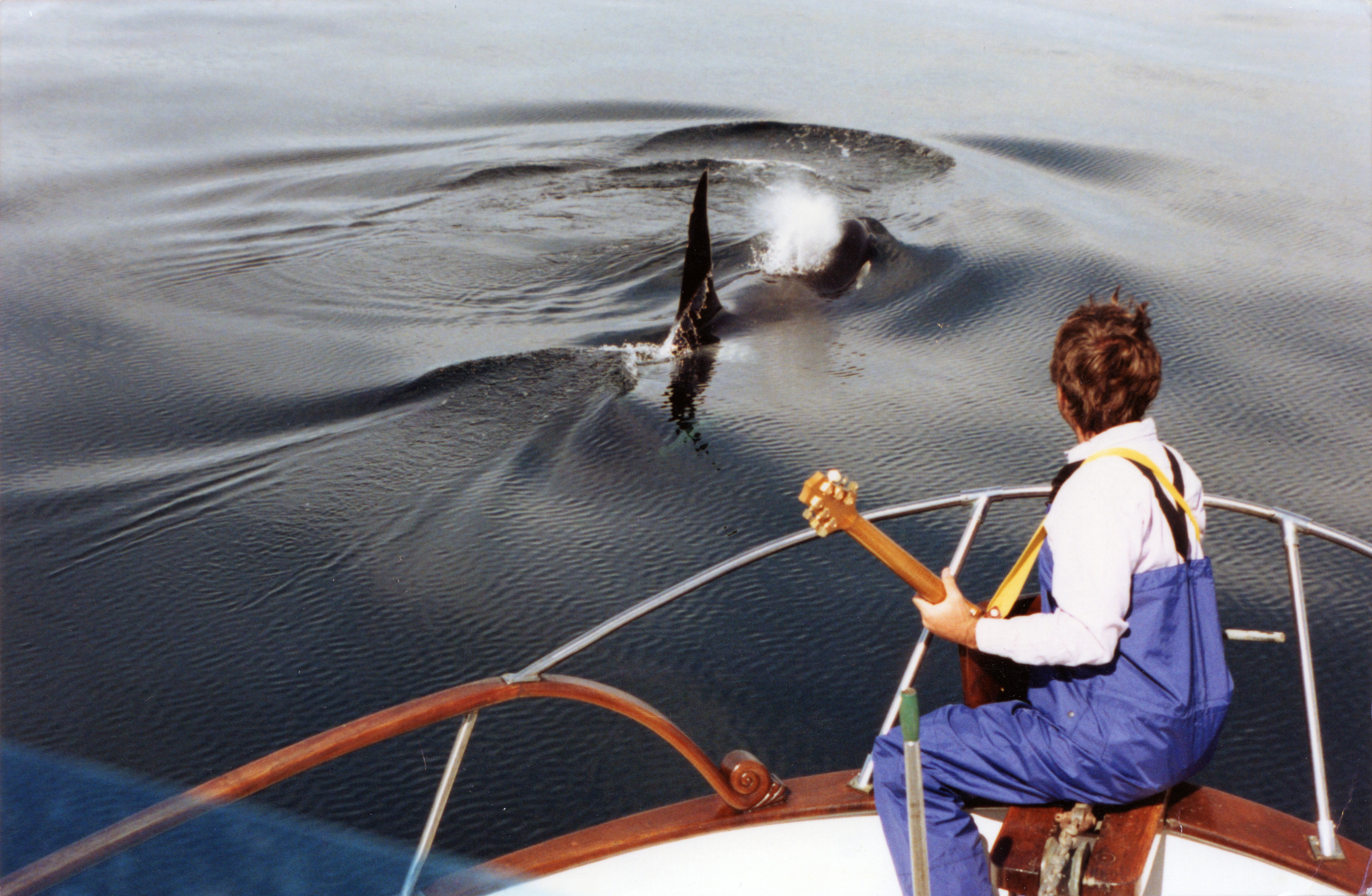
Jim Nollman playing guitar with orcas from the bow of a boat.

Jim Nollman's new album, "Orcas' Greatest Hits," will be released Aug. 14. (Image credit: Jim O'Donnell)

I was around 24 years old, and I had a hit. I knew I wanted to be a musician, but I had some major flaws to be a performer, because I didn't like being the center of attention. I'm kind of an introvert. That's a loser if you're trying to be a singer-songwriter. I loved writing tunes and playing them, but not in front of a big audience. This [recording tunes in nature with animals] was a way to get into music.

After the turkeys, I wondered if I should try making music with animals again. I tried it with kangaroo rats [Dipodomys deserti], which build these burrows like Trinidad steel drums. Kangaroo rats only come out at night, and they thump to each other in their burrow systems, which are tuned β€” it seemed to me, anyway, that each place in the burrow had a different tone β€” and they communicate with one another.

Then, I went to a wolf preserve. I realized that the wolves did two or three howl sessions in the morning around dawn and two or three at night. The wolves wouldn't play with me if I was out of their key. If I played a flat note, they would stop and basically tell me, "We don't mind if you're playing in our pack, but you've got to do it right." That was a big lesson for me, and that's how I got into it.

SP: Your new album features orcas. Did you always have a sweet spot for orcas, or is there another animal you preferred working with?

JN: No, I don't have a sweet spot for orcas. I recorded orcas for 15 years, and I had lots of recordings, most of which I never really listened to, because I didn't know what to do with them. At some point, I decided that "I can't do anything more with the orcas, and I don't like going to whale conferences and being this authority," because it wasn't about that for me.

[After years of recording orcas], I started going to the Arctic β€ͺ—‬ because I wanted to go to the Arctic and because beluga whales [Delphinapterus leucas] were there, and they seemed like the opposites of orcas. The orcas were very much in tight families traveling together and making very simple calls that had deep meaning. To have their echolocation against a speaker at midnight could be like being in a war zone. It was so loud; we had speakers blow out sometimes.

The beluga whales were the antithesis of that. It seemed like they all were talking at the same time, and they all seemed to know what everybody else was saying. This is my speculation. They used sound as their family anchor, and I had no idea if they all understood each other talking. But it was very much more animated than what the orcas were doing. I would say 50% of the orca calls were just two notes; they were D to C, and back to D. And they would do that all day long, some of them. Beluga whales sometimes sounded like belly laughs. They made the weirdest sounds, and I loved it.

I went everywhere in the Arctic. I started out in the first year going to Nome [Alaska] in the Bering Strait, and then I went east to the Mackenzie River delta in northern Canada on the Beaufort Sea. Then, I went to Baffin Island in the Canadian High Arctic. In every place I went, limited beluga populations were crashing. At some point, I realized this was a complete loser. I pretty much gave it up until I met some people from Finland who said, "You should try it in Russia." The Soviet Union had recently crashed, and they were opening up all the places where they had their gulags [forced labor camps] and their nuclear fleet. The Solovetsky Islands were loaded with beluga whales that hadn't seen people in 70 years. I went there, and I had a great time with the beluga whales.

The wolves wouldn't play with me if I was out of their key.

Jim Nollman, musical composer and sound artist

SP: What is your favorite memory of working with orcas or beluga whales?

JN: Six or eight years ago, somebody brought me and a bunch of other artists up to Hudson Bay [in Canada], basically to emulate what I'd done for so many years [artistic residencies to experiment with whale sounds]. I was the mentor for everybody. I liked that role. We were confronted with beluga whales, and I said, "I don't really want to play the guitar or the mandolin with the beluga whales, because I've tried that all over the Arctic and I've never had much success. I'm going to put my head in the water and blow bubbles."

The beluga whale came up, and it wrapped its mouth around my face. It did the same thing to the woman who was blowing bubbles on the other side of the kayak we were on. That was maybe the most fun thing I ever did with cetaceans. I wasn't worried at all. I've had the same thing happen with giraffes. I was in Texas at this game farm, and this giraffe came and licked my whole face with its giant tongue. It was really quite wonderful.

SP: The oldest recordings in the new album are 40 years old, and you said you hadn't listened to all of them before making the album. What was it like hearing them after all these years?

JN: I had 65 hours of tapes, and I listened to them over three or four months. Ninety percent of it was rubbish; it was just repetitive, and the whales would get into their D-to-C-to-D call routine. I wanted something where there was a groove, or some kind of magic going on that was inexplicable.

I started choosing some sequences. I thought it was only a certain level of connection that we'd created, but a couple of the things that I listened to when I was in that process blew me away. The one where I was playing James Brown riffs into the water β€ͺ—‬ that was very strong for me. I'd never heard that before. I was discovering new stuff by giving it a close listen.

There's one where I was being filmed by National Geographic, and it was just me and a guy on a big boat cruising the waters. I started playing a country blues bottleneck on the guitar. [Editor's note: A bottleneck in country blues is a guitar-playing technique where a hard object is placed on a finger and glided along the strings.] The whales only did this a couple of times, but they would come in with a chord change. Say I'm playing in a key of D; they would come up and play the G in perfect time. I was impressed by that.

SP: Did you ever play the recordings of you and the orcas back to the orcas?

JN: No, because the recording can't answer the whales. I was trying to make a telephone connection, so it has to be two things talking to each other. To play a recording would be like me saying, "Let's stop this interview now, and I'm going to put on something of me giving an interview to somebody I spoke to yesterday." You wouldn't like that, and I don't think the whales would have liked that either if I did it to them. It had to be direct. I had many people who were very ardent or passionate about singing or reciting poetry β€” one guy wanted to sing Jewish death prayers to the whales. But the whales didn't come.
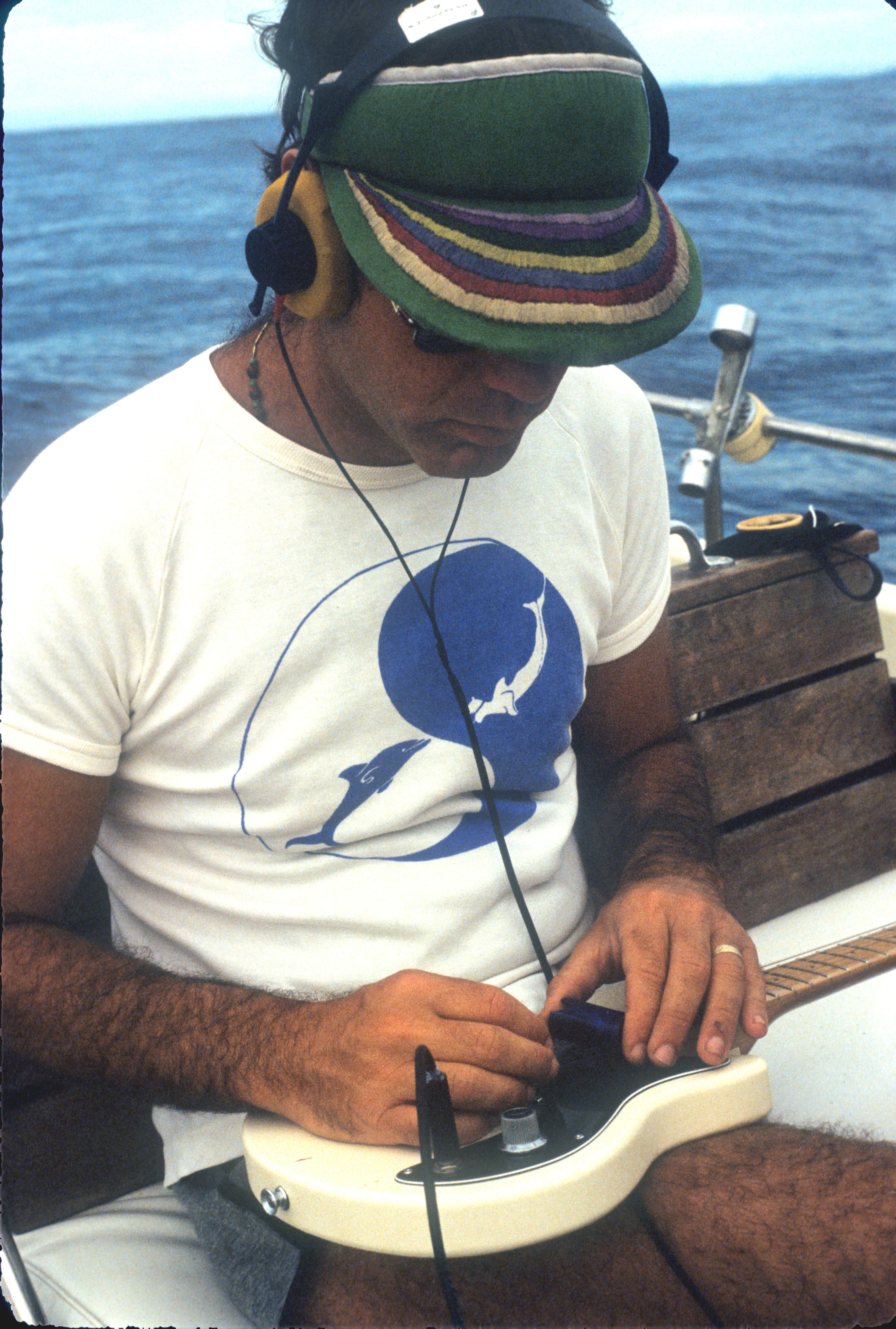
A man playing a guitar with headphones in, on a boat in on the ocean.

Nollman recorded orcas off the coast of British Columbia between 1985 and 2002. (Image credit: Jim Nollman)

SP: Is part of why you've been so successful at making music with animals that they particularly like you?

JN: Some animals like me. I definitely got through to the orcas. I could tell that, because I had an interim of eight years between doing it with the big communities [of artists] and going out alone with the orcas. They were the same orcas, and they definitely knew who I was the first time I put sound in the water again. That's when that country blues episode happened. We were all much more relaxed with each other. The second time was great. It was also a tragedy, because the whales had lost their residence to the loss of salmon [in the northeast Pacific Ocean], and they were way out of their range.

SP: Your work with orcas and other whales landed you a job with the U.S. Navy in 2011. How did that happen, and what was your role?

JN: I was doing underwater concerts in the 1990s. I was invited to Kodiak Island, which is a large island off the coast of southern Alaska. They wanted me to do an underwater concert. At the time of this festival, in which I was performing, the U.S. Navy was sending ballistic missiles from Southern California to the waters off Kodiak Island for testing. This was destroying the halibut [Hippoglossus stenolepis] fishery on Kodiak Island, because the fishermen couldn't go into this area, suddenly.

The Navy sent a guy who was part of this ballistic missile thing but also had a PR background. He said, "Can I speak before your concert?" I said, "You can speak about whatever you want, but you've got to get in the water. That's the payment you have to give me: Get in the water and hear all this music that I've created."

He was blown away. I had a fan. He took me out for dinner and asked me if I had any ideas about solving this great scandal that was enveloping the Navy at the time, which was the killing of mostly beaked whales during mid-frequency sonar exercises, mostly in the Bahamas, in this hole in the ocean that's there. Nobody had a solution, so he wanted me to be on the team. I said, "Sure, I'll be on the team." It was like somebody asking me to play for the New York Yankees or something β€” completely odd, but I thought, "OK, I'll try that."

He called me back two years later, saying, "We have our money, and we want you to come to the Groton submarine base [in Connecticut], where we'll have our first meeting with submarine captains, Ph.D. sonar engineers and a few whale biologists." That went on for seven years. I took the job seriously. I told them that I thought we could solve it in five minutes. I said, "All you need to do is take care. If you see whales in the vicinity, don't exercise on that day." This sounds so totally obvious, but the fact was that he [the PR man] was contending with a Navy establishment that believed that the Navy could do anything to save the American people from being bombed or wrecked. They didn't see whales as anything but collateral damage.

SP: Do you have a favorite song on the new album?

JN: I like "The Three Jimmies." I never knew that James Brown's guitar player was named Jimmy Nolen β€” I mean, that's really outrageous. So, it's the three Jimmies, right? I really like the music, and I like the piano player [Jonathan Churcher], who plays one note every three or four bars. The response of the whales is also brilliant, I think. There's one part where the whale starts to echolocate, which is the way they see the world; it's their perceptional tool. The whale starts clicking in time with the beat that I'm playing on the guitar. That only happened once in 65 hours of recordings, and I thought that was pretty unusual.

SP: What's next for you after "Orcas' Greatest Hits"?

JN: I'm composing new music, and I'm hoping I'm at least breaking even [with the new album] so that they [Smithsonian Folkways Recordings] can do the next one, which is called the "Cowbird Variations." The cowbirds are basically the bottom voice, maybe the part that's played by bass in pop music. Everything else is other birds and insects called treehoppers. It has this very primitive sound to it.

I love doing this music with cowbirds, because cowbirds have a horrible reputation. They lay their eggs in other birds' nests, and when the eggs hatch, the baby cowbirds knock all the birds in the nest out and kill them. Then, the parents β€” juncos, where I live β€” end up raising the cowbirds. These birds have a terrible reputation, but they make one of the strangest sounds in nature β€” so that's why I chose them.

This interview has been condensed and edited lightly for clarity.
  •  

Uberaba Geopark: A time capsule from the Late Cretaceous period nestled in Brazil's tropical savanna

QUICK FACTS

Name: Uberaba Geopark (also known as "Terra dos Gigantes," or "Land of the Giants")

Location: Minas Gerais, Brazil

Coordinates: -19.71, -47.96

Why it's incredible: The park hosts prehistoric-fossil-bearing rock formations and overlies one of the world's biggest aquifers.

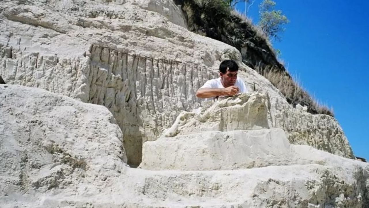
Nestled within Brazil's Cerrado tropical savanna β€” the second-largest biome in South America, after the Amazon rainforest β€” Uberaba Geopark is a time capsule from the Late Cretaceous period (100.5 million to 66 million years ago).

The geopark boasts abundant, well-preserved fossils from the last chapters of the nonavian-dinosaur era, according to UNESCO, earning it the nickname the "Land of the Giants," or "Terra dos Gigantes" in Portuguese. Paleontologists have discovered more than 10,000 fossils belonging to dinosaurs, prehistoric crocodyliforms (a group encompassing living crocodiles, alligators, caimans and gharials, as well as their extinct relatives), turtles and other ancient creatures within the park's boundaries.

One of the best-known discoveries is the fossil of Uberabatitan ribeiroi, a titanosaur measuring 89 feet (27 meters) long and 33 feet (10 m) tall, according to UNESCO.

The finds were clustered in impressive geological features, including the Serra da Galga formation and Serra Geral mountain range. These structures formed from ancient basalt flows, which came from giant volcanic eruptions that predate the breakup of the Gondwana supercontinent 180 million years ago.

The park has the ideal conditions to preserve fossils because it alternated between shallow lagoons and river systems when the dinosaurs roamed the region, meaning the animals' remains were conserved in mud when they died.

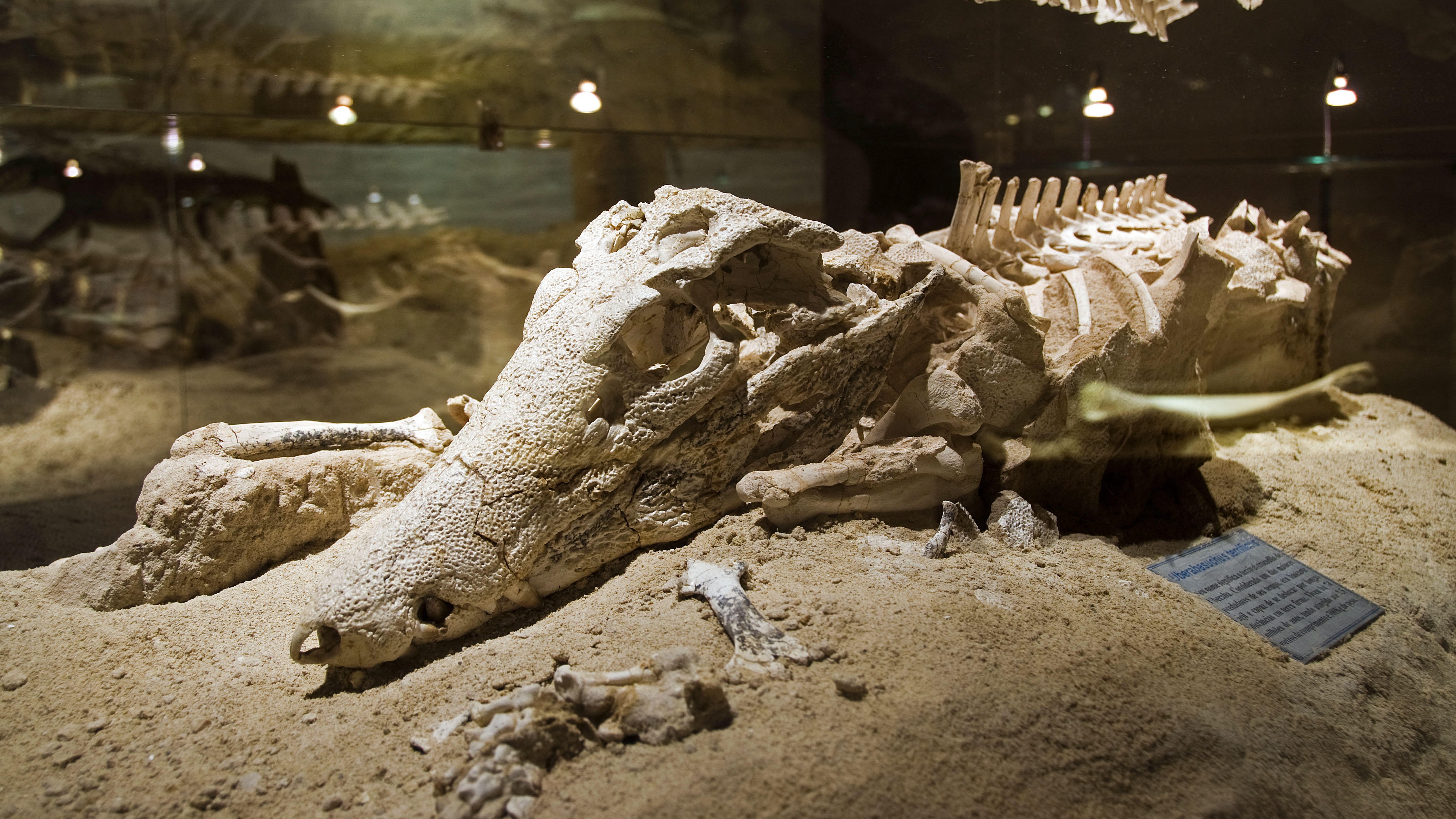
Fossil of an ancient crocodylimorph from Brazil.

Uberaba Geopark preserved extinct crocodile relatives among other fossils. (Image credit: Pulsar Imagens via Alamy)

Serra da Galga and Serra Geral also overlie one of the world's largest freshwater reservoirs, the Guarani aquifer, which supplies drinking water for more than 100 cities in Brazil, Argentina, Paraguay and Uruguay.

The Cerrado savanna, which houses the entire park, is a critical-yet-underprotected carbon sink that hosts more than 12,000 plant species and diverse animal life.

The "Land of the Giants" was added to UNESCO's list of geoparks in 2024 in recognition of the region's geological and natural heritage.

What is now the Uberaba Geopark was the birthplace of Brazil's modern livestock market, which is one of the biggest in the world. Farmers in the 19th century introduced zebu (Bos indicus) cattle from India because they are better suited to the climate in Brazil and require less food than common domesticated cattle (Bos taurus). Zebu cattle also produce lower greenhouse gas emissions than common domesticated cattle do, according to UNESCO.

Uberaba Geopark is open to visitors. There are several museums and trails to explore, including one that leads to the Vale Encantado, or "Enchanted Valley," which contains forests, waterfalls and prehistoric rock formations, according to the BBC.

Discover more incredible places, where we highlight the fantastic history and science behind some of the most dramatic landscapes on Earth.

  •  

'It would be a disaster': Ammunition for war and surging water withdrawals are putting the Caspian Sea β€ͺon the brink of collapse

The Caspian Sea, the world's largest inland body of water, is in major trouble. Since the mid-1990s, this saline lake, located between Europe and Asia, has lost an area nearly the size of Sicily. But until now, it wasn't clear why.

Researchers finally provided answers in a study published June 5 in the journal Earth's Future. Using ground- and satellite-based observations, they connected falling water levels to a drastic drop in river inputs from Iran, Turkmenistan, Azerbaijan, Kazakhstan and Russia, all of which border the Caspian Sea.

The team particularly highlighted losses from Russia's Volga River, the longest river in Europe, which supplies roughly 80% of the Caspian's inflow.

To find out why the Volga is discharging less water into the Caspian Sea now than it did 30 years ago, we spoke with Amir AghaKouchak, a co-author of the study and professor of civil and environmental engineering at the University of California, Irvine.

AghaKouchak, who directs UC Irvine's Center for Hydrometeorology and Remote Sensing, explained why river inputs have dropped and how decades of water withdrawals have put the Caspian Sea on a path to collapse. He also touched on a solution to this crisis β€” and revealed why Russia's hunger for ammunition to attack Ukraine is making it harder to save the Caspian Sea.

Sascha Pare: Falling water levels in the Caspian Sea have been attributed to natural variability, and more recently, there's been a focus on climate change and increased evaporation due to rising temperatures. But what did the results of your study show?

Amir AghaKouchak: People quickly jump to conclusions about climate change. Of course, that is important, but it cannot explain the change that we have observed. Over the last 30 years, water levels in the Caspian Sea have shrunk by around 2 meters [6.5 feet] or so. Just to put things in perspective, this translates to about 24,000 square kilometers [9,300 square miles] of sea area loss β€” about 5%. When we look at drivers, we notice that rainfall hasn't changed significantly over the lake and upstream, so the decline cannot be explained simply by changes in rain.

Evaporation has increased, so it explains maybe about one-third of the change. There is less water in the lake, and that indicates there's probably some water lost along the way. We don't have a lot of human-related data β€ͺ—‬ for example, water withdrawal for irrigation or groundwater wells. That area is very difficult; the countries are not open to sharing data. A lot of our results are based on looking at proxies. Our interpretation is that temperature caused about 30% of the change and the rest is probably because of human activities.

SP: Which human activities does your research suggest are responsible for the Caspian Sea's decline?

AA: Several of the countries on the Caspian Sea have built large dams β€” Russia, for example. They are all desperate for hydropower. All of the countries around the lake [have also built infrastructure to supply agriculture], and one reason is that they want to create jobs and improve the local economy. Water demand is increasing in all those countries around the Caspian Sea. It's not surprising to see lakes drying or groundwater levels falling.

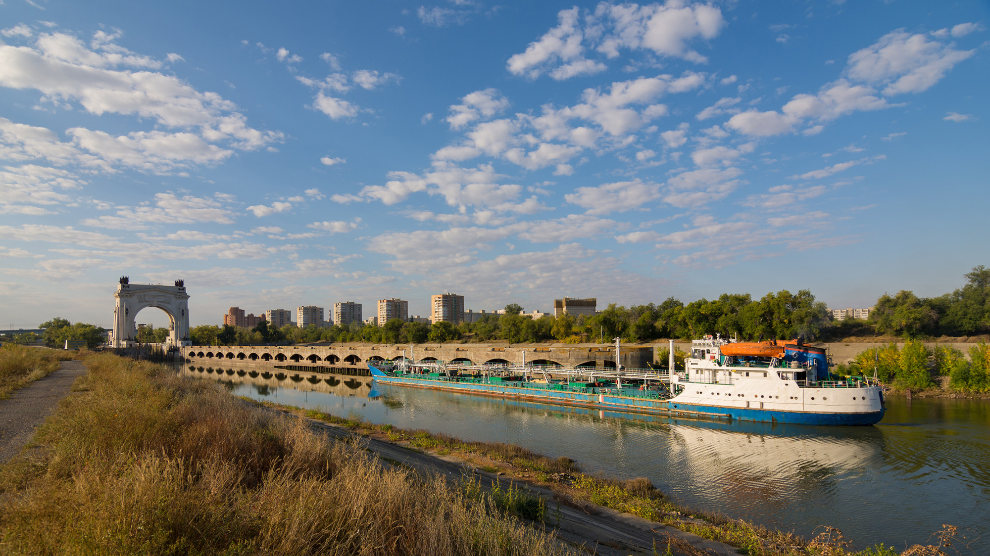
It's hard to find data about how much water countries are using; they keep data very private, especially places like Russia. We don't have detailed information, but the Volga-Don Canal in Russia is one of the projects that is contributing to this crisis. [Editor's note: The Volga-Don Canal is a ship canal that connects the Volga and Don rivers at their closest points.]

A view of a boat sailing down a waterway with grassy reeds on either side.

Opened in 1952, the Volga-Don Canal connects the Volga, which flows into the Caspian Sea, and the Don, which empties into the Sea of Azov (a northern extension of the Black Sea). (Image credit: Gaika102 via Getty Images)

But we cannot blame this whole thing on that. We have to be careful with our language; we can't say one project is responsible. Most likely, this is the collective impact of many different small withdrawals from here and there, overall contributing to a significant decline in the Volga River outflow into the lake. In the paper, we have different rivers, but the Volga dominates because it's the largest river. The Volga has a higher impact than all the other rivers combined. There are lots of demands along that river basin.

SP: Did you expect human activities to play such a big role, or were you surprised?

AA: We did not have any expectations at the beginning. In fact, when we started this project, I reached out to a lot of colleagues from neighboring countries around the Caspian Sea. We didn't want to do it on our own, sitting in California, looking at another area of the world, without having local people involved. If you look at the co-authors, you see people from Azerbaijan, Iran, Kazakhstan β€” so, we have local experts. We thought this was really important to have those perspectives. I didn't want to reflect the opinions of only one research group. What we have here is the collective opinion of people who have not met in person; we only exchanged emails to look at the results, and then we came up with those conclusions.

We do have a Russian involved, but not from an official Russian institution. I thought this was really important, because there's more back-and-forth [with a large group of people]. If two people have to convince themselves of an idea, it's much easier than with 20. Also, we brought in people from other countries who had projects in the area; for example, there is one group from Finland and another group from Germany. We tried to come up with something that this large group of people could agree on. It was not easy, but it worked out.

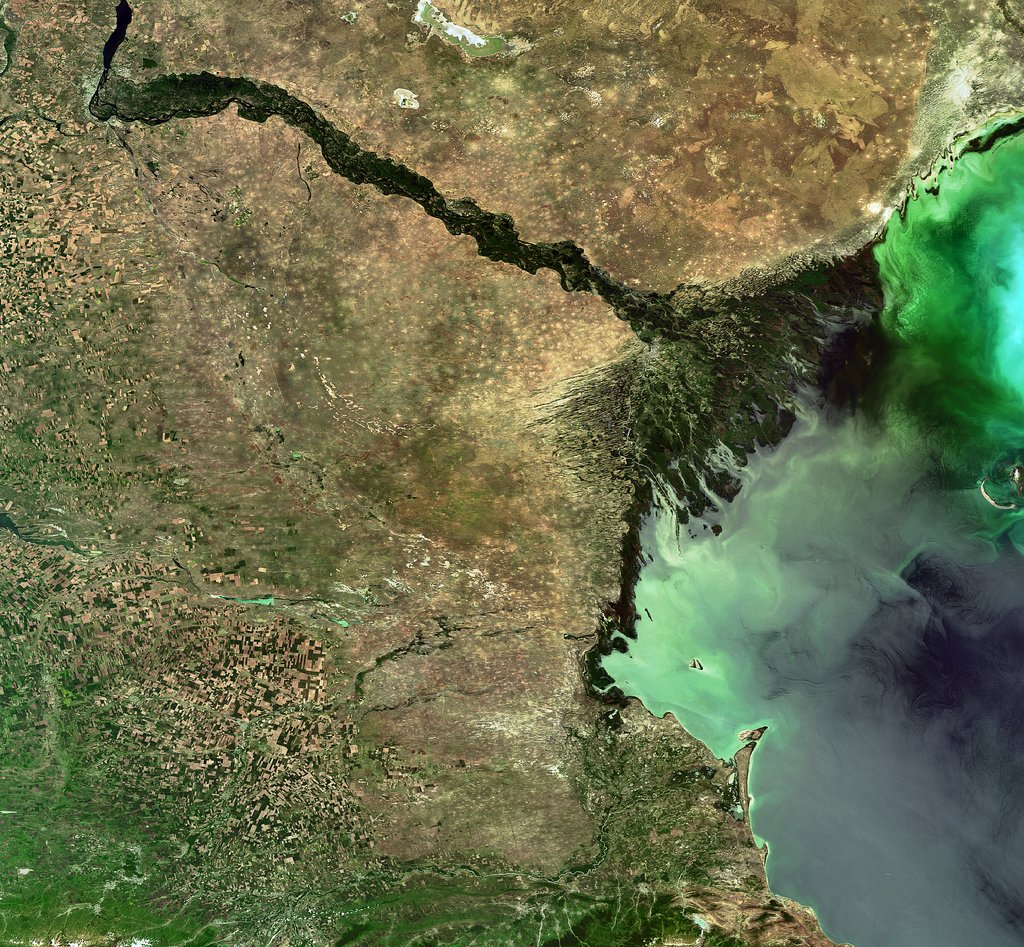
A view of a green river delta from space.

The Volga River supplies roughly 80% of the Caspian Sea's inflow, but huge water demands have decreased its flow. (Image credit: ESA, CC BY-SA 3.0 IGOΒ )

SP: What is the worst-case future scenario for the Caspian Sea if shoreline countries fail to decrease their water demands?

AA: My concern is that, in the same general area, we have the Aral Sea, which is now about 5% to 10% of what it used to be, and Lake Urmia, in northwest Iran, that has also shrunk really fast and is now very small, with low levels of ecological activity. So we have two smaller lakes in a very similar climate that, from an ecological perspective, are dead. Because we have seen those degrade, we have to consider that this is the worst-case scenario for the Caspian Sea, too.

The Caspian Sea is much, much bigger. I hope it doesn't happen, but it's on the same path. Again, it's much larger, so it would probably take 100 years [to shrink as much as the Aral Sea and Lake Urmia], even with the current trend. But because we have seen those lakes shrink really fast, it deserves attention. Due to the size of this lake, the potential impacts will be huge. Even if 20% of the Caspian Sea dries out, the consequences will be very significant. It would be a disaster.

SP: You mentioned that drying lakes can become ecologically "dead." What other impacts could the Caspian Sea's falling water levels have on the surrounding landscape and people?

AA: The lake's retreat will expose the lake bed, and because it's saline, you have all kinds of minerals that will be exposed. With the next strong wind, they will go into the air. The health impacts include respiratory diseases, and even eye diseases, that are linked to salt minerals in the atmosphere. Those are the immediate consequences. Additionally, those minerals can travel long distances. In general, salt deposition on agricultural land reduces productivity. It takes a while, but if those lands are exposed for a long time, this will have an impact on the agricultural sector in those areas, which means potential food security issues. We don't exactly know what those materials are on the lake bed, so it's hard to know precisely what the consequences will be.

There is also serious shipping happening in this region. Right now, most of the shrinking is happening in the Caspian Sea's northern part, which is shallower [than the rest of the lake]. The drop in water levels is about 2 meters, and you can imagine that if you have a port and water levels drop more, you won't be able to operate. You'll need to extend your shipping routes southward; you'll need to invest and spend a lot of money to use other ports and docking sites. We have evidence of that around the Aral Sea and also Lake Urmia. There used to be these docking sites and ports, but those are now far away from the water.

SP: What must bordering countries do to save the Caspian Sea and prevent these negative effects?

AA: Demand management is absolutely critical. Demand management doesn't get a lot of attention, because unlike big projects that make the news, management means you have to cut things and do things that people don't notice. Some people argue that politicians don't show a lot of interest in demand management, but it's something that we have control over. The technological opportunities are there.

But when you look at that area, there is a big war β€ͺ—‬ so probably it's not the priority to invest in management. There are a lot of things that we don't talk about in the paper that are relevant. I recently learned through discussions with people from the region β€” this is something that came to us from co-authors and collaborators β€” that many countries in that area grow cotton, which uses a lot of water. It has a lot of applications, but apparently, one of them is military. Cotton is used to produce ammunition. Russia needs a lot of ammunition, so not only are they growing it themselves, but they also bought neighboring reserves from Uzbekistan and Kazakhstan. So now, even those countries have an incentive to grow more cotton. This is driving more irrigation, more groundwater extraction, more surface water depletion, and probably more impacts on the Caspian Sea.

This interview has been condensed and edited lightly for clarity.
  •  

'Darwin’s hypothesis provided an important inspiration': Scientists bolster 150-year-old Darwinian theory with a carnivorous plant in China

Scientists have confirmed that a flowering plant native to the mountains in southwest China is carnivorous, supporting a prediction made by Charles Darwin more than 150 years ago.

The species, Saxifraga candelabrum, grows at elevations above 8,200 feet (2,500 meters) in the Hengduan Mountains, which connect the southeast portions of the Tibetan Plateau to the Yunnan-Guizhou Plateau.

The plant has stems and branches covered in sticky hairs that can trap small insects, predominantly nonbiting midges. However, scientists were unsure if these insects were being ingested by the plant. In a new study, researchers showed that S. candelabrum can digest and absorb nutrients from insects after capturing them, proving that the plant is carnivorous. The scientists published their findings Tuesday (Aug. 4) in the journal Nature Communications.

This is the first demonstrated case of carnivory in the saxifrage plant group, said study co-author Douglas Soltis, a distinguished professor of biology at the Florida Museum of Natural History.

Other carnivorous plants typically grow in moist, boggy soils, but S. candelabrum is found in dry alpine areas, Soltis told Live Science in an email. "These are all nitrate poor soils β€” that's why this carnivorous habit has evolved a number of times" to supplement the plants in vital nutrients, he said.

In 1875, Darwin theorized that two species closely related to S. candelabrum that also have sticky hairs β€” S. rotundifolia and S. umbrosa β€” may be carnivorous, based on their ability to catch insects. But the 19th-century naturalist couldn't show that the plants digested their prey or reused the nutrients in insect tissues β€” two conditions that are key to confirming carnivory in plants. Without these conditions, a species is considered simply "protocarnivorous," meaning it catches and kills insects or other small animals but doesn't digest or absorb them, according to the study.

"Although untested at the time, Darwin’s hypothesis provided an important inspiration for our study," study co-author Hang Sun, a researcher in the Chinese Academy of Sciences' Kunming Institute of Botany, told Live Science in an email.

The researchers conducted field observations and herbarium surveys of S. candelabrum, which revealed that mature plants with more numerous and longer branches had an average of 71 trapped insects on them. In the herbarium surveys, the team found that 43 out of 45 specimens had caught insects, suggesting that insect-trapping is a widespread phenomenon in this species.

Next, the study's authors showed that S. candelabrum possesses phosphatase, a digestive enzyme commonly found in carnivorous plants. They did this by labeling the phosphatase enzymes with fluorescent molecules to visualize them under a specialized microscope, a technique known as fluorescence tagging.

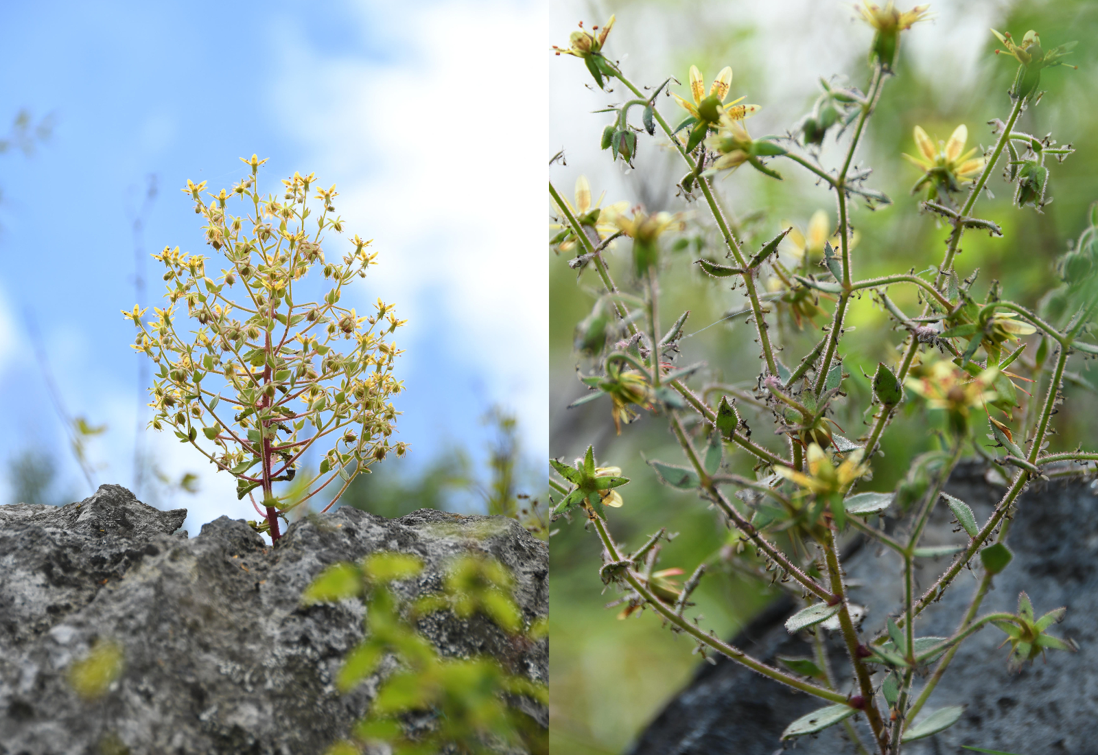
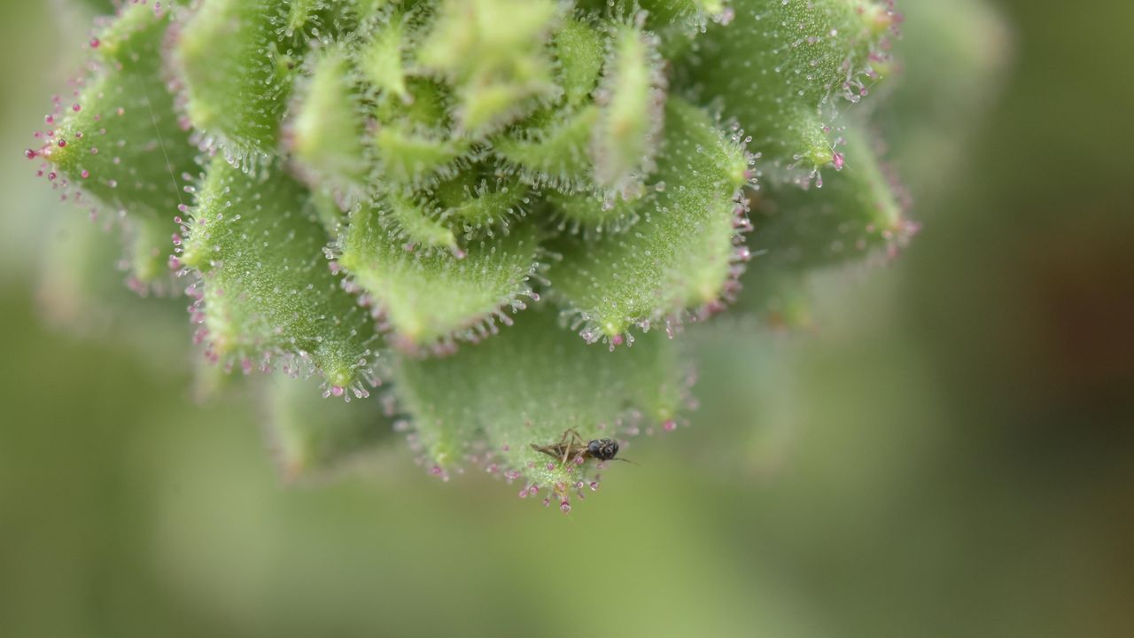
Two pictures of a carnivorous flowering plant in China with insects stuck on its branches and stem.

S. candelabrum secretes a viscous substance that coats its hairs, meaning insects get stuck on the stem and branches if they fly too close. (Image credit: Xin-Jian Zhang)

To determine if S. candelabrum digests and absorbs nutrients from insects, the researchers labeled fruit flies with a stable form of nitrogen before feeding them to the plants. This led to a marked rise in stable nitrogen in S. candelabrum and in a different, known carnivorous species, which the team used as a control group. By contrast, a non-carnivorous plant that formed a second control group did not show an increase in stable nitrogen, indicating that S. candelabrum is carnivorous.

Finally, the researchers performed a genetic analysis, which revealed that S. candelabrum has genes in common with known carnivorous plants that are linked to prey attraction, digestion and nutrient absorption. Together, the results showed that S. candelabrum evolved carnivorous traits to cope with its nutrient-poor environment, adapting its hairs β€” which were initially used for herbivore defense β€” into insect traps, according to the study.

Larger insects, which S. candelabrum requires for pollination, rarely get stuck to the hairs, the researchers noted in the study, suggesting that the species has perfectly balanced its needs through evolution.

Other Saxifraga species and plants belonging to the same lineage could turn out to be carnivorous, too.

"Many members of the Saxifragaceae, which includes genera other than Saxifraga, have sticky glandular hairs and are often covered with insects," Soltis said. "I would not be surprised if other members of the family are also carnivorous β€” as Darwin predicted."

The study broadens the scope of carnivorous plant research, Sun said. "Carnivory may therefore be far more widespread among flowering plants than previously recognized," he said.

Charles Darwin quiz: Test your knowledge on the 'father of evolution'

  •  

Microbial DNA hidden under Antarctica offers new clues about how the continent’s mysterious Blood Falls came to be

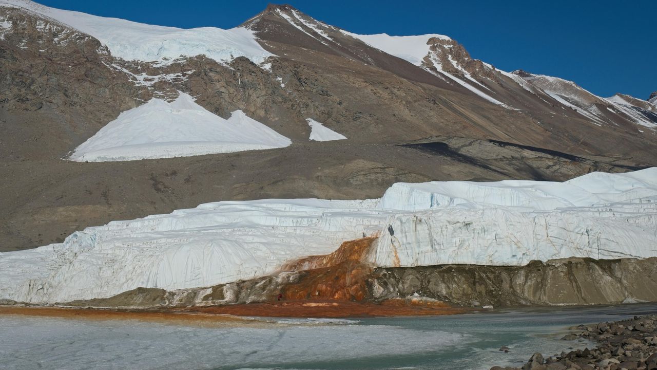
At the end of a glacier deep in East Antarctica's Taylor Valley, there is a haunting waterfall that oozes red brine like a bleeding wound in the ice. Scientists explained the brine's gory hue several years ago, finding that it is exceptionally rich in iron. And now, they may have identified the salty water's origin.

Microbes in the crimson waterfall, called Blood Falls, suggest the brine is composed of ancient seawater that was trapped in a pool beneath the glacier when ocean levels fell and the glacier advanced. However, it's unclear exactly when that happened, researchers noted. Previous studies had already proposed a seawater origin for the brine, based on various chemical signatures and bacteria detected in the liquid, but the new results add molecular and genetic evidence to the mix of clues.

"Findings in this study reveal a dominance of marine eukaryotic lineages in the Blood Falls area" compared with the broader region, known as the McMurdo Dry Valleys, the authors wrote in the study, published Monday (Aug. 3) in the journal Nature Geoscience. "This marine signal is less prominent but still detectable in the prokaryotic structure," the researchers added.

Eukaryotes' cells contain a membrane-bound nucleus and other closed internal compartments. Prokaryotes, by contrast, are single-celled organisms whose DNA floats around freely in the cell, unbounded by a membrane.

To characterize the types of microorganisms present within Blood Falls, the researchers used a suite of genetic techniques to analyze 167 samples of water, sediment and air from around the falls and the broader McMurdo Dry Valleys.

Some researchers argue that Blood Falls' water does not originate from seawater, and suggest the marine bacteria and chemical signatures that point to seawater may have instead reached the falls from the ocean via intense winds, which are common in the McMurdo Dry Valleys. By analyzing samples from various sites in the Dry Valleys, the team behind the new study compared microorganisms from the wider region with those at Blood Falls to determine if Blood Falls has a distinct microbial assemblage potentially left over from ancient conditions.

The researchers found that the crimson brine and associated red-tinted sediments at Blood Falls shared a higher proportion of eukaryotes with nearby oceanic samples than other sites in the Dry Valleys did. Whereas Blood Falls had a little over 9% of its eukaryotes in common with the ocean, the Dry Valleys showed only about 1% similarity, according to the study. The remaining eukaryotes and most of the prokaryotes identified in the paper had freshwater and terrestrial origins.

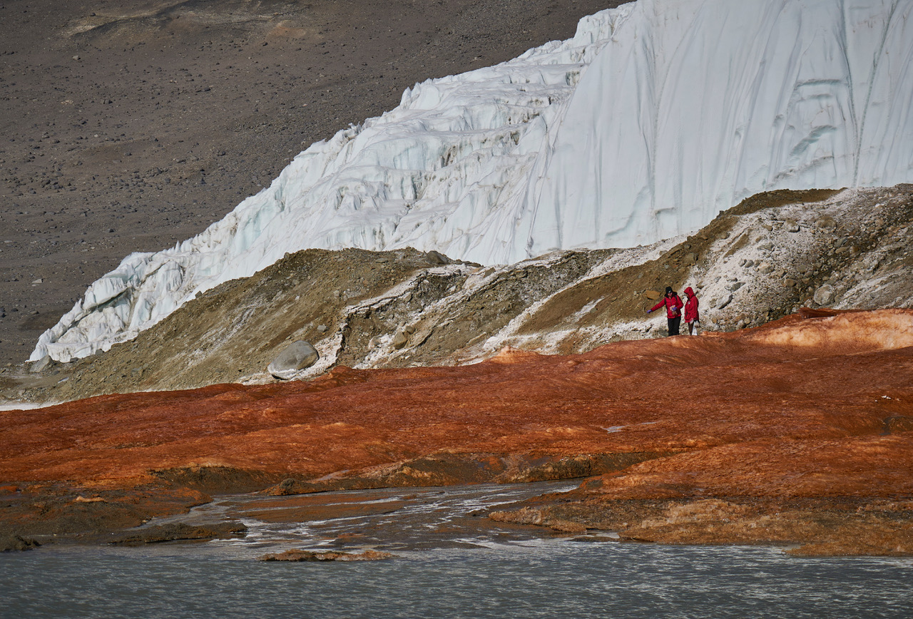
Two researchers stand on red-stained sediments near Blood Falls in Antarctica.

Researchers tried to determine if microbes at Blood Falls are distinct community from the surrounding region's assemblages. (Image credit: Bryan Minnea)

The results also showed that the air near Blood Falls contained only a tiny proportion of marine microorganisms, suggesting that present-day winds can't fully explain the microbial composition of Blood Falls, the researchers wrote.

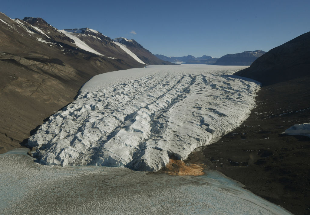
Aerial view of Taylor Glacier and Blood Falls in Antarctica.

The most likely origin for the brine that feeds Blood Falls is ancient seawater that was trapped when sea levels dropped and the Taylor Glacier advanced, the study found. (Image credit: MARK RALSTON/POOL/AFP via Getty Images)

Therefore, an ancient seawater origin is the most likely explanation for the microorganisms found at Blood Falls today, the team concluded. Winds may have played a role in shaping the community in the past, but now, their influence is probably insignificant, the team added.

The brine that feeds Blood Falls may have become entrapped more than 1 million years ago, during a warm period with higher sea levels and less ice cover than there is now, previous estimates suggested. However, further work, including more comprehensive genetic profiling and mapping of microorganisms, is needed to pinpoint when Taylor Valley's glacier grew to cover the brine, the researchers wrote.

Antarctica quiz: Test your knowledge on Earth's frozen continent

  •  

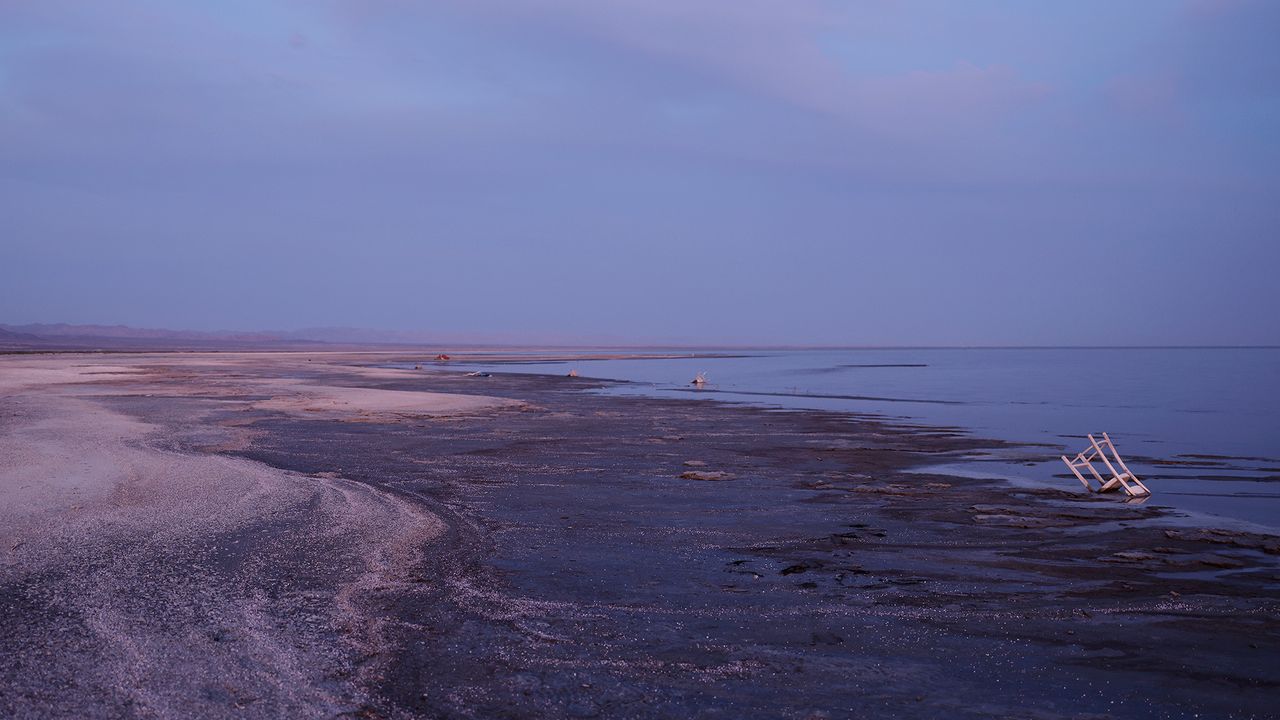
'It's a really poor quality of life': Once a 'miracle in the desert,' California's Salton Sea now spreads toxic dust on vulnerable communities

Fifty years after Southern California's Salton Sea formed due to an engineering mishap in 1905, the giant salt lake became a booming vacation destination. Nicknamed the "miracle in the desert," the lake offered watersports and boating, while its shores were lined with yacht clubs, vacation homes, shops and nightclubs.

However, by the 1970s, the Salton Sea had begun shrinking due to high evaporation rates and flow reductions in the Colorado River, which had fed the lake. The lake's retreat exposed muddy sediments imbued with pesticides and other agricultural chemicals from large cotton, alfalfa and vegetable farms in the Imperial and Coachella valleys.

Today, the Salton Sea is a ghost of its former self, but the lake looms larger in the lives of local residents than ever before. Its shrinking shoreline releases toxic particles so tiny that they can penetrate deep into human lungs and enter the bloodstream. Exposure to these particles can raise the risk of a range of respiratory and cardiovascular conditions, including asthma, impaired lung function and heart attacks.

The communities most affected by this pollution are low-income, racial and ethnic minorities that, for socioeconomic reasons, cannot move away or adequately protect themselves.

A study published July 1 in the journal BMC Environmental Science reveals just how bad living conditions are for some communities near the Salton Sea. The authors examined air quality and respiratory health in Latinx and Indigenous Mexican families in the Eastern Coachella Valley, finding that families must change their daily routines to protect themselves from harmful dust events.

To find out more, we spoke with study co-author Ann Cheney, a professor of social medicine, population and public health at the University of California, Riverside School of Medicine. Cheney, who oversees a free clinic for underserved minority communities in the Eastern Coachella Valley, described the daily struggles of families living near the Salton Sea and some of the measures that are needed to improve their quality of life.

Sascha Pare: The Salton Sea has shrunk by 65 square miles (168 square kilometers) and dropped by 14.6 feet (4.5 meters) over the past few decades. Why is that, and how does it affect local residents?

Ann Cheney: The Salton Sea occupies an ancient lake bed that, over the millennia, has been filled, and then dried up again. In the early 1900s, because of an engineering mistake, part of that lake bed filled, and it created the Salton Sea. [Editor's note: The sea formed when Colorado River floodwater breached an irrigation canal that was under construction in the Imperial Valley.]

Then, over decades, there were changes in the composition of the sea because the main source of water was agricultural runoff. The sea is located in the inland southern Californian desert region. In the 1940s and 1950s, there was a boom in agribusiness. This remade the landscape, and all of those chemicals and pesticides from the agricultural land seeped into the lake bed.

With [water management] decision-making around the Colorado River waters, that then meant that another source of water, which had been the Colorado River, ceased to enter into the Salton Sea. 2018 was the last time that water from the Colorado River touched the Salton Sea.

An aerial view of a town near a seaside.

Once a booming vacation destination, the Salton Sea is now the site of an environmental disaster that affects neighboring communities. (Image credit: Mario Tama via Getty Images)

Because there is the primary source of agricultural runoff going into the sea and no new fresh water coming in β€” and with climate change [boosting evaporation] β€” it's created this environment in which you have a drying sea. Over decades, there have been chemicals and heavy metals seeping into the playa [dry lake bed], and now it's exposed. It's the desert, so there's a lot of dust storms, and the winds take the exposed playa and bring it into the air, which is then breathed by the local residents.

For me, what's most concerning is that the local residents who are most affected by the poor air quality are Latinx and Indigenous Mexicans, many of whom are undocumented and have very little political voice.

SP: You asked caregivers of children with asthma and other respiratory conditions to document their experiences of living near the Salton Sea. What did those submissions reveal?

AC: When I first started doing this work, I thought about it as solely the Salton Sea [affecting people]. But it's the environment in which the Salton Sea is one contributor to poor air quality [that impacts local residents].

The caregivers perceive the Salton Sea as being a contributor to the poor respiratory health of their children. But also, this area has many disenfranchised communities that are interspersed on tribal lands, and there are different rules on these tribal lands. There is a lot of dumping and a lot of burning of trash. What we heard from caregivers is that it's not just the exposure to the toxic dust, but also the fires [that are causing issues].

A view of a dust-covered doormat

A photograph submitted by one of the caregivers shows a door mat covered in dust outside their front door. (Image credit: Trinidad et al (2026). CC BY 4.0)

In that article that we published [July 1 in BMC Environmental Science], there was an incident in which there was a fire β€” I think it was related to tire burning β€” in very close proximity to one of the apartments that one of the caregivers and her family were living in. These things happen commonly. So, from the perspective of the caregivers, there are multiple different factors that contribute to their children's poor respiratory health.

SP: Can you take me through a day in the life of one of these caregivers, based on the evidence you gathered?

AC: It could be a beautiful day. The caregiver walks outside. It's sunny; everything's beautiful. In my opinion, this environment is very beautiful. Maybe, later on in the day, there is a pickup of wind, and there's dust. Let's say the caregiver is a mother with a child who has asthma who's at school. The children are outside on the playground. Her child is going to be highly affected by the dust that's being picked up by the wind. What's going to happen is, the school will bring the child inside, and if the child doesn't have too severe of a respiratory distress, the child could stay at school. Otherwise, the caregiver will get called and have to come to school and pick up their child.

Most folks in that region are farm laborers. They're not owners of farms; they are the ones who are working the land for the owners. Many individuals who are living in very impoverished conditions β€” for instance, the PurΓ©pecha community, which is the Indigenous community we worked with that's from MichoacΓ‘n in Mexico β€” are pickers. They are in the lowest-social-ranking jobs within farm labor, and, in part, that's because they may be monolingual PurΓ©pecha. That means they don't speak Spanish or English, and that limits the type of employment they can have.

In a situation where you have this very precarious employment, if your child needs to be taken out of school and you are the caregiver, then you risk losing your job. That's the type of dynamic that's at play among many of the families that we work with.

SP: What are the long-term consequences of living day after day in these conditions?

AC: It's a really poor quality of life for children, especially. There's a picture that a caregiver took of her child that I think exemplifies so well the experience of children and their quality of life. The child is just lying on the floor in their home. The photo illustrates the child's lethargy and the boredom and the fact that caregivers often choose to have their children stay inside, because they can better control the indoor air quality. They can't necessarily control what's going to happen outside, but they can control indoor air quality.

The problem is, if the family doesn't have the resources to have an air filter to clean and purify the air, for instance, then what we've noticed in our research is that there can still be very poor indoor air quality, particularly when there's more extreme weather events like fires or dust storms.

With the research, I anticipated very poor quality of life for children. But what I understood less was that it also means poor quality of life for their families, and particularly for mothers, who are often the primary caregivers. It really affects their mental health and well-being.

SP: Currently, are there any measures in place to protect these families?

AC: There has been Assembly Bill 617, which was a measure to engage members of the communities that are most affected by the Salton Sea environment in a process of mitigating the effects of the sea. From that, there have been a lot of community meetings. Years ago, I started to participate as one of the advisory board members. It became a bit frustrating β€” and I think this illustrates the history of frustration in this region β€” because government entities come in with resources and money. But it's very top-down, and often the community gets upset and frustrated because they don't see these agencies making changes in the community. There's a lot of talk and very little action.

There are also monies that have been dedicated to Salton Sea restoration, and there's been an ongoing conversation about a 10-year plan to mitigate the effects of the drying of the sea. But the focus has been primarily on wildlife, not human health. Only more recently have there been conversations about human health and the public health implications.

A close up of a series of inhalers and pill bottles.

One of the caregivers in the study submitted this image of the medication their child needs to take daily. (Image credit: Trinidad et al (2026). CC BY 4.0)

For individuals who have a specific diagnosis of asthma, they may qualify for retrofitting. That means they will receive money through their health insurance to be able to invest in improving their home. That might mean taking out carpet [which can capture dust], or maybe fortifying windows or doors β€ͺ—‬ things like that. But it's a really small amount of money. It can help to a certain degree, but I think in this community, in particular, they may not always know how to navigate the healthcare system to get access to that type of resource. In addition, the most vulnerable people in this community don't have access to health insurance.

SP: What more could be done to improve people's quality of life in this community?

AC: We installed air-quality monitors in people's homes, and we spent a lot of time collaborating with communities in this region. Some live in apartment complexes; some live in single-family homes. But the majority live in mobile home parks, in which they're living in very old, dilapidated trailers. The land is dirt. It's an area that is very impoverished.

So, when I think about these communities, in particular, they can't protect themselves from the external environment. In terms of policies, [I wonder] how we can put money toward building housing that is not trailers and can really protect people from the dust. Right now, the wind is bringing dust into the homes. We need to find ways to actually keep the homes sealed.

A view of a dusty road.

This image submitted by one of the caregivers shows a blurred highway during a dust storm. (Image credit: Trinidad et al. BMC Environmental Science, 2026. CC BY 4.0)

SP: The Salton Sea is a hotspot for lithium, and although there are currently no active lithium mines in the region, policymakers and private companies are investigating the sea's potential to host one. How might lithium mining affect the families you worked with?

AC: That conversation's been going on for several years now. At the moment, it's not as much a community concern, because there's been very little movement [to open mines]. There was a lot of action and movement about three or four years ago. But it's been a few years since they've been testing the prototype, and it doesn't seem like it's gone to scale, where they would have been able to commercialize it.

Initially, the community was quite upset, because it's just another example of the lands being exploited and other people benefiting. Typically, the beneficiaries are individuals who are not originally from the community and who have professional degrees. They get the resources, and they get to make decisions about the resources. Then, the conversation was, "Well, but if we have this type of business coming in, then it can create jobs." But we know that it creates jobs for individuals who have professional degrees, or they'll have to get some type of training; they're not jobs for farmworkers or individuals who are undocumented.

It takes a lot of water to do lithium mining, so that also has implications for the continuation of the shrinking of the Salton Sea.

SP: Other lakes around the U.S., including Utah's Great Salt Lake, are shrinking and exposing toxic sediments that are then blown into residential areas. Do those drying lakes have similar effects on local communities?

AC: There is a film director [Abby Ellis from around the Great Salt Lake] who, I think two years ago, came to the Eastern Coachella Valley and met with myself and my team members. She said, "I want to get a sense of what's going on here, because this is essentially where we are going to be 10 or 15 years from now."

I had the opportunity to very briefly chat with her, but also view the trailer for her documentary. One of the distinctions between the communities surrounding the Great Salt Lake and the Salton Sea is the color of the skin of those living around these bodies of water. In Utah, it seems to be more so individuals who maybe are middle class, or have a certain access to resources β€” people who can have a political voice and organize and say, "We don't want this to happen." It will be interesting to see if there can be more change in communities where there are more affluent people living near these bodies of water.

This interview has been condensed and edited lightly for clarity.
  •  

Greenland meltwater will drive a 'strong weakening, but not a shutdown' of key Atlantic currents, study finds

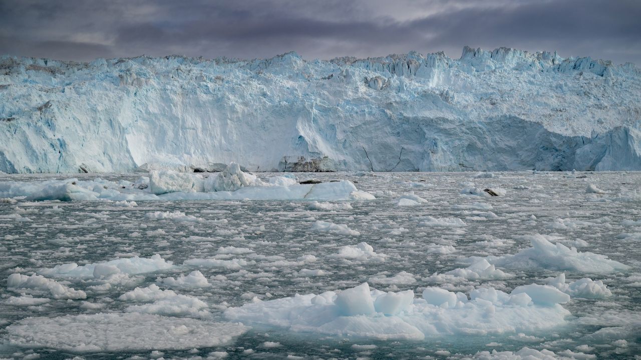
Runoff from Greenland's rapidly melting ice sheet could severely disrupt currents in the Atlantic Ocean that regulate the global climate, researchers say. But the fresh water won't trigger the complete and irreversible collapse of the circulation that some research predicts, a new study suggests.

By 2100, Greenland meltwater could cause a reduction in the strength of the Atlantic Meridional Overturning Circulation (AMOC) equivalent to an additional 10% to 20% on top of the weakening that many scientists already expect for this huge system of currents, researchers found.

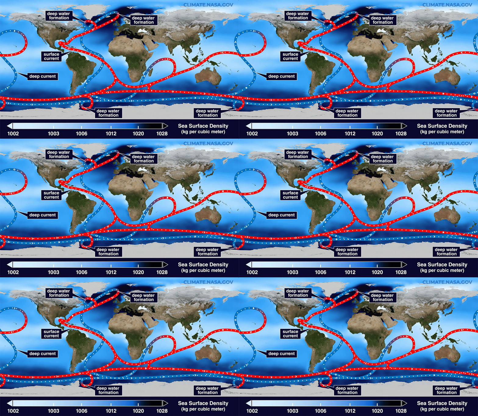
Previous research suggests the AMOC, which moves heat from the tropics to the Northern Hemisphere and cold water back south toward Antarctica, is at its weakest in more than 1,000 years due to Arctic ice melt and soaring ocean temperatures. Models indicate that the circulation will continue to weaken for decades to come, potentially unleashing freezing weather in Northwest Europe, additional sea-level rise along the U.S. East Coast and droughts around the equator.

Animation showing surface and bottom currents across the world's oceans.

The AMOC loops around the Atlantic Ocean, bringing warm waters north along the ocean's surface and cold waters south along the ocean floor. (Image credit: NASA/Goddard Space Flight Center Scientific Visualization Studio)

The new study revealed that by 2300, Greenland's ice sheet could cause a whopping 40% of AMOC weakening on top of the declines projected by some climate models if we continue to cook the planet. The results highlight the effects on the AMOC of a growing freshwater pulse from Greenland that most climate models currently don't take into account, the authors said.

"By the year 2100, yes, we have something, but the greatest fraction is what we add later," study co-author Jost von Hardenberg, a professor in the Department of Environment, Land and Infrastructure Engineering at the Polytechnic University of Turin in Italy, told Live Science.

Meltwater from the Arctic and Greenland slows the AMOC by preventing the formation of deep currents in the North Atlantic that drive the circulation south toward Antarctica. Deep currents form when masses of cold, salty water sink to the seabed, but inputs of fresh water and rising water temperatures are blocking this step by diluting and warming surface waters.

While Arctic meltwater is commonly integrated into climate simulations, researchers have been slower to include runoff from the Greenland ice sheet in models, partly because this runoff may not be as disruptive as Arctic meltwater on shorter timescales, von Hardenberg said.

"In order to represent correctly the Greenland melt, you need a specific, dynamic model for the Greenland ice sheet. It's nice to have, but it requires a lot of resources to develop," von Hardenberg said

The Community Ice Sheet Model version 2 (CESM2) is one of the few available simulations of the Greenland ice sheet. For the study, von Hardenberg and his colleagues used a global climate model called EC-Earth3, which does not include the Greenland ice sheet. The team added the ice sheet from CESM2 to explore how it might affect the AMOC over the next few centuries. Adding the ice sheet separately enabled them to compare AMOC weakening with and without Greenland, clearly revealing the impact of the ice sheet on the AMOC's strength.

The results, published June 19 in the journal Science Advances, suggest the Greenland ice sheet will have a big influence on Atlantic ocean currents, especially after 2100.

"Greenland starts really melting strongly only after that date," von Hardenberg said. "If you go farther in our simulation β€” we go up to the year 2300 β€” that is also when this meltwater really becomes extremely strong."

Yet unlike other studies that show the AMOC collapsing irreversibly under climate change, in this model, the circulation recovered once the team switched off the meltwater or dialed down greenhouse gas emissions. Both the simulations that didn't include the Greenland ice sheet and those that did had similar results, recovering partially when the meltwater was turned off and fully when greenhouse gas emissions were stopped.

The recovery in the model suggests that the AMOC is more stable than previously thought and doesn't suddenly flip from an active state into a collapsed one, von Hardenberg said. "It's consistent with a strong weakening, but not a shutdown," he said.

Overall, the findings show that it is important to include the Greenland ice sheet in climate models β€” something von Hardenberg and his colleagues are planning to do in the next version of the EC-Earth3 model.

"It's really something which is worthwhile doing to better constrain the uncertainty of these future simulations," von Hardenberg said. "If we have a larger set of models which include this component, we will be in a better position to try to answer the question, 'How much do we expect AMOC to decrease in different scenarios?'"

Other experts agreed that integrating the Greenland ice sheet in climate models will increase the accuracy of AMOC predictions.

"What makes the study particularly interesting is that it directly tests a process that has often been highlighted as an important source of uncertainty in future AMOC projections," said Jonathan Baker, a senior climate scientist at the Met Office in the U.K. who was not involved in the study.

The results are consistent with previous research showing that Greenland meltwater causes additional AMOC weakening, but whether the system could collapse is still uncertain, given that the team used only one model, Baker told Live Science in an email. "Repeating these experiments across a wider range of models will be important to assess how robust the findings are," he said.

Nicholas Foukal, an assistant professor at the University of Georgia's Skidaway Institute of Oceanography who was not involved in the study, said he doesn't think the use of a single model limits the analysis.

"I think this result is robust and I am glad to see the authors come to this conclusion in such a high-resolution and realistic coupled climate model," Foukal told Live Science in an email. "This finding also agrees with other modeling results that require immense amounts of fresh water, much more fresh water than is available on Greenland, to cause irreversible change in the AMOC."

However, a third expert said the model used in the study is unrealistic, because its parameters make the AMOC more resilient than those of other models. Therefore, the study should be replicated in other models to draw unbiased conclusions.

"While the experiment reported is interesting, its outcomes are neither surprising nor should be interpreted as exemplary for the whole model ensemble," Sybren Drijfhout, a professor of physical oceanography at the University of Southampton in the U.K., told Live Science in an email.

Researchers should investigate the impact of the Greenland ice sheet on the AMOC further, von Hardenberg said. "It would be interesting in the future to check it [the AMOC's recovery with Greenland meltwater] with other models, but of course it's encouraging to see it in one case," he added.

  •  

Heaven Lake: China's deepest lake sits atop a colossal volcano and belongs mostly to North Korea

QUICK FACTS

Name: Tianchi Lake, or Heaven Lake

Location: China-North Korea border

Coordinates: 42.0091, 128.0593

Why it's incredible: It is the deepest lake in China and sits at the top of a giant volcano.

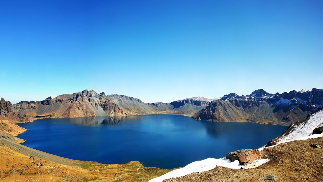
Heaven Lake is a crater lake at the top of Mount Changbaishan (also called Changbai Mountain) β€” a colossal, dormant volcano on the border between China and North Korea that formed through successive eruptions over the past 2.6 million years.

Known in China as Tianchi, the lake is the highest and largest crater lake in Northeast Asia, according to UNESCO. It is also the deepest lake in China, according to a study published in March. The lake sits at an elevation of around 7,200 feet (2,200 meters), covers roughly 3.6 square miles (9.2 square kilometers), and has a maximum depth of 1,224 feet (373 m), according to the study.

Heaven Lake is surrounded by 16 peaks that belong to Mount Changbaishan. The lake fills a caldera created by past eruptions, the biggest of which was the "millennium eruption" that took place in A.D. 946 and remains one of the largest eruptions in modern history.

Water started to pool on Mount Changbaishan's summit after the prehistoric Tianwenfeng eruption, which scientists dated to between 70,000 and 40,000 years ago. Heaven Lake has periodically emptied and refilled since then due to precipitation, snowmelt, and an active geothermal system beneath the volcano that forces water up through fault lines.

Although hundreds of reports in the early 2000s claimed there was a creature with a head shaped like that of a horse living in the water, scientists have repeatedly said they are skeptical that any large creature could survive in Heaven Lake.

Mount Changbaishan is one of the best-preserved stratovolcanoes from the past several million years, according to UNESCO. Stratovolcanoes, also known as composite volcanoes, are volcanic mountains built from alternating layers of solidified lava, volcanic ash and rocky debris. Mount Changbaishan is an "open-air classroom for volcanism" because it recorded the different stages of multiple eruptions in astounding detail.

In North Korea, Mount Changbaishan is known as Mount Paektu or Paeku Mountain, meaning "white-topped mountain." The volcano's Chinese name means "forever white mountain."

China, North Korea and South Korea have clashed over the volcano in the past, as the mountain holds cultural and geopolitical significance for the three countries. Two border treaties between China and North Korea in 1962 and 1964 divided the volcano and Heaven Lake roughly down the middle, with North Korea securing 54.5% of the lake.

In the 2000s, China moved to develop the region around the volcano, opening the Mount Changbai Airport and the Mount Changbai Eastern Railroad to connect the region with the rest of the country.

A geological park surrounding the Chinese site of the volcano was officially designated a UNESCO Global Geopark in 2024.

Discover more incredible places, where we highlight the fantastic history and science behind some of the most dramatic landscapes on Earth.

  •  

Scientists are deep-freezing koala eggs and sperm to protect the species from extinction

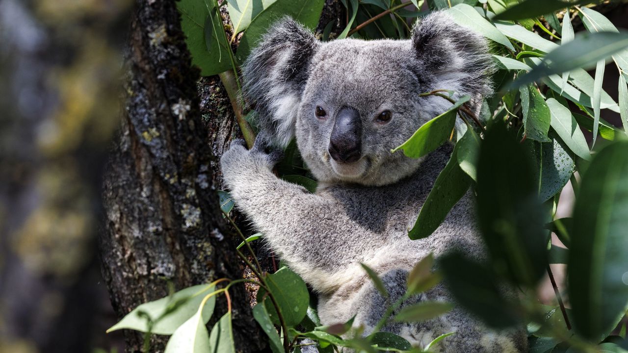
Scientists in Australia are deep-freezing koala eggs and sperm as a "genetic backup" to save the wild population from future extinction.

The backup could be used to create healthy koala embryos through artificial insemination and in vitro fertilization (IVF), the researchers said in a statement. When koalas (Phascolarctos cinereus) die, unique traits and diverse genes that may help them adapt to changing environments are lost, but the new project offers a way to store this valuable material, the team said.

"Losing genetic diversity can weaken future generations and decreases the ability of the species to adapt to challenges," Andres Gambini, a reproductive biologist at the University of Queensland who is involved in the project, said in the statement. "This project will create a safe and systematic way to rescue and preserve koala spermatozoa and eggs to support future conservation programs."

Australia is facing a paradox with its koalas. In some regions of Queensland and New South Wales, koala populations have crashed by as much as 80% since the late 1990s due to deforestation, bushfires, drought and disease. This prompted the Australian government to change koalas' conservation status in their eastern range from "vulnerable" to "endangered" in 2022.

Meanwhile, in parts of southern Australia, koalas are overabundant. However, the places where koalas are currently thriving may not be able to support a booming population much longer, because the animals are overbrowsing and killing the trees they need to survive, recent research suggests.

To protect against koalas' decline, the scientists will freeze koala reproductive cells in liquid nitrogen (LN2), which has a boiling point of minus 321 degrees Fahrenheit (minus 196 degrees Celsius). This method would enable the team to cryopreserve the cells for several decades until they are needed, said Vincent Lynch, an evolutionary developmental biologist and associate professor of biological sciences at the University at Buffalo in New York.

Every year, many koalas are admitted to wildlife hospitals because of illness or injury and sadly, not all of them survive.

Andres Gambini, reproductive biologist at the University of Queensland

"I've successfully woken cells up that were frozen in LN2 a couple of decades ago," Lynch, who is not involved in the koala project, told Live Science in an email.

The sperm and eggs will be supplied by wildlife hospitals that will harvest sex cells from dead koalas or koalas that can no longer breed due to disease or trauma, according to the statement.

"Every year, many koalas are admitted to wildlife hospitals because of illness or injury and sadly, not all of them survive," Gambini said.

The researchers will then test the cells for Chlamydia pecorum, a highly contagious and deadly form of chlamydia. In koalas, this infection causes painful urinary tract infections, gastrointestinal issues, and conjunctivitis, which can lead to blindness. It can also cause infertility in females. C. pecorum is one of the main contributors to koalas' decline in recent years, with infertility driving a sharp reduction in the number of koala joeys being born. In the worst-affected populations, situated mostly in Queensland and New South Wales, almost 90% of koalas are infected with chlamydia.

If the reproductive cells contain C. pecorum, "we have the technology now to remove the infection from the samples," Steve Johnston, an associate professor of animal reproduction and captive husbandry at the University of Queensland who works on the koala project, said in the statement.

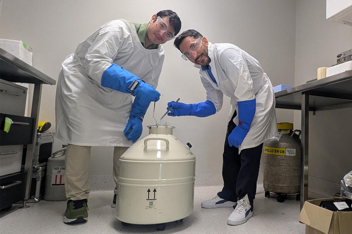
Two scientists posing with a liquid nitrogen storage cannister in a laboratory.

Andres Gambini and doctoral student Patricio Dandy Palacios, who participated in the project, want to preserve koala sex cells in liquid nitrogen. (Image credit: The University of Queensland)

In 1998, Johnston was part of a research team at the University of Queensland that created the world's first koala joey born through artificial insemination. The new project also builds on a 2025 study, led by Gambini, that produced the first-ever IVF kangaroo embryos. (These did not result in live births; at the time, the scientists said that would take another decade.)

It's unclear how many sperm and egg cells the researchers plan on freezing, and it's hard to say how many cells they would need to ensure the survival of healthy koala populations, as the number of cells required is probably increasing with time, Lynch said. As koala populations shrink, genetic material is being lost at an accelerating pace, so the team will have to get more samples as time goes on to obtain the same amount of diversity.

The project does not replace more traditional conservation approaches β€” such as habitat protection, disease management and population monitoring β€” but researchers cannot afford to wait until populations are smaller and genetic diversity is harder to recover, Gambini said.

Although conservationists are concerned about the fast rate of koalas' decline, "there is a chance" that scientists can save the species through cryopreservation, Lynch said.

"I support multipronged approaches like this," he said. "By preserving the environment with traditional conservation we allow re-introductions because the species have somewhere to live."

  •  

Scientists build tiny 'diving suit' for cockroaches, turning them into search-and-rescue cyborgs

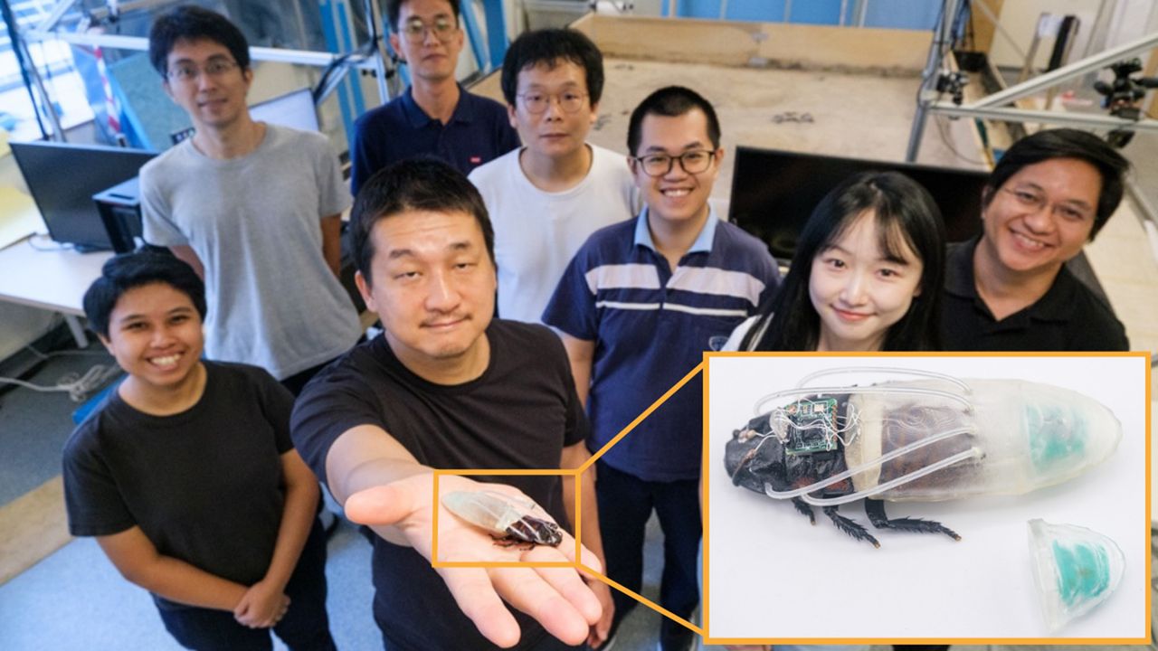
Engineers have designed a waterproof "diving suit" for cyborg cockroaches that enables the hybrid insects to survive and roam underwater for up to three hours. This function expands the capabilities of cyborg insects and could one day be deployed in disaster zones, according to the team.

A built-in oxygen generator and silicone tubes deliver the gas directly to a cockroach's breathing holes, known as spiracles. The design is adapted for use in low-oxygen conditions as well as submerged environments, the researchers said in a new study published June 29 in the journal Nature Communications.

"Our approach combines a soft waterproof shell with a simple yet reliable chemical oxygen generator," study co-author Shinjiro Umezu, a professor in the School of Creative Science and Engineering at Waseda University in Japan, said in a statement. "This allows the insect to retain its natural mobility while being protected from an environment that it cannot normally survive in."

Cyborg insects are living insects that have been fitted with electronic controllers that guide their movements. Researchers have previously used them in search-and-rescue operations to access and investigate hard-to-reach areas; for example, they were used in rescue efforts after the devastating magnitude 7.7 earthquake in Myanmar in March 2025 that killed at least 3,700 people and injured 4,800 more. The advantage of cyborg insects over tiny robots is that the former employ insects' muscles to move, whereas the latter rely on high-power batteries that consume energy and can run out of steam.

The cyborg insects deployed in Myanmar were developed in the laboratory of Hirotaka Sato, senior author of the new study and a professor in the School of Mechanical and Aerospace Engineering at Singapore's Nanyang Technological University.

Sato has spent more than a decade pioneering cyborg insect technology. He and colleagues hope the new diving suit will extend cyborg insects' operational range to include flooded and partially submerged areas in disaster zones.

The suit consists of a flexible shell, four silicone tubes that attach to the spiracles and a transparent, 3D-printed oxygen tank. To make the tank produce oxygen, the researchers sprinkled manganese dioxide onto a highly absorbent sponge inside the tank. They then injected a small amount of diluted hydrogen peroxide, which breaks down slowly in the presence of manganese dioxide to produce oxygen. Finally, the team sealed the tank with ultraviolet adhesive to prevent leaks.

"The key engineering challenge was to build a system that was small, light and flexible enough for the insect to wear, while still producing enough oxygen for long-duration underwater movement," Umezu said.

The silicone tubes send oxygen straight into the thoracic spiracles, while the abdominal spiracles, which are lower down the insects' bodies, take in the oxygen contained in the suit.

"Our new insect diving suit works like the oxygen tank used by human divers," Sato said in the statement. The silicone tubes can be attached and removed without pain or harm to the insect, the researchers added.

The researchers tested the suit on a cyborg Madagascar hissing cockroach (Gromphadorhina portentosa), which they placed in a water tank and later sent into a plastic tube that simulated submerged and low-oxygen environments.

The suit enabled the cockroaches to roam underwater for up to three hours, raising the prospect that cyborg insects, including locusts and beetles, could one day be used to inspect flooded pipes, drains, tunnels and other hard-to-access places.

Next steps include improving the diving suit to potentially include sensors and a navigation system; and testing the design in simulated disaster environments, according to the statement.

  •  

First experiment to thicken Arctic ice with seawater shows promise β€” but there's a big catch

A simple method to thicken Arctic sea ice has shown promising results in its very first field experiment, performed in Cambridge Bay, Nunavut, Canada.

Researchers are considering several controversial geoengineering techniques to slow the catastrophic melt of Arctic sea ice, including stratospheric aerosol injection, which involves shooting tiny sulfur particles into the sky to blot out the sun. But in a new study, scientists evaluated the merits of a much safer and more straightforward approach: pumping seawater onto existing sea ice in winter and letting it freeze into a reinforcing layer.

Known as sea ice thickening, this method has been used by Nordic and Arctic communities for decades, and ice hockey rinks employ a similar technique to keep their ice sturdy, two of the study's authors told Live Science in an email.

"Practical applications [that already exist] include building ice roads and creating platforms for offshore oil exploration," said Edward Blanchard-Wrigglesworth, a research associate professor in the University of Washington's Department of Atmospheric Sciences, and Andrea Ceccolini, an honorary professor at University College London and the CEO of the startup Real Ice, which studies artificial sea ice thickening methods and receives funding from the U.K. government.

Modeling work hints that sea ice thickening could become a climate adaptation tool for Arctic communities by limiting coastal erosion near towns, facilitating travel and supporting animal migrations and hunting.

Now, researchers have assessed the method's efficacy in the field for the first time. Their results, published May 22 in the journal Earth's Future, indicate that both the thickness and brightness of sea ice can be enhanced significantly on small scales β€” making the ice more reflective, and therefore more resilient to melting.

In the experiment, the team set up eight test areas and three control sites in Cambridge Bay during the winter of 2024 to 2025. Using submersible pumps that each consume less power than a toaster, they flooded the test areas either once or twice with up to 8 inches (20 centimeters) of seawater, while the control sites were never flooded. In spring, one control site was used for a melt pond drainage experiment, which involved drilling small holes in the ice to remove meltwater and expose the brighter ice underneath.

Overall, the test areas grew up to 12.6 inches (32 cm) thicker than the control sites by the end of winter, which is roughly equivalent to the ice thinning that has happened in the Arctic over the past 50 years, according to the study. Test areas that were flooded twice showed greater thickening than those flooded once. And in the melt period from late May to September, sea ice in the test areas appeared brighter and had slower melt rates, remaining thicker than the ice in the control sites. The melt pond drainage experiment also resulted in brighter sea ice than the other control sites.

When water is pumped onto sea ice, it saturates the snow that sits on top of the ice. "The snow-water mixture freezes into a new layer of ice, while the reduction in snow insulation allows colder atmospheric temperatures to accelerate natural ice growth from below," Blanchard-Wrigglesworth and Ceccolini explained.

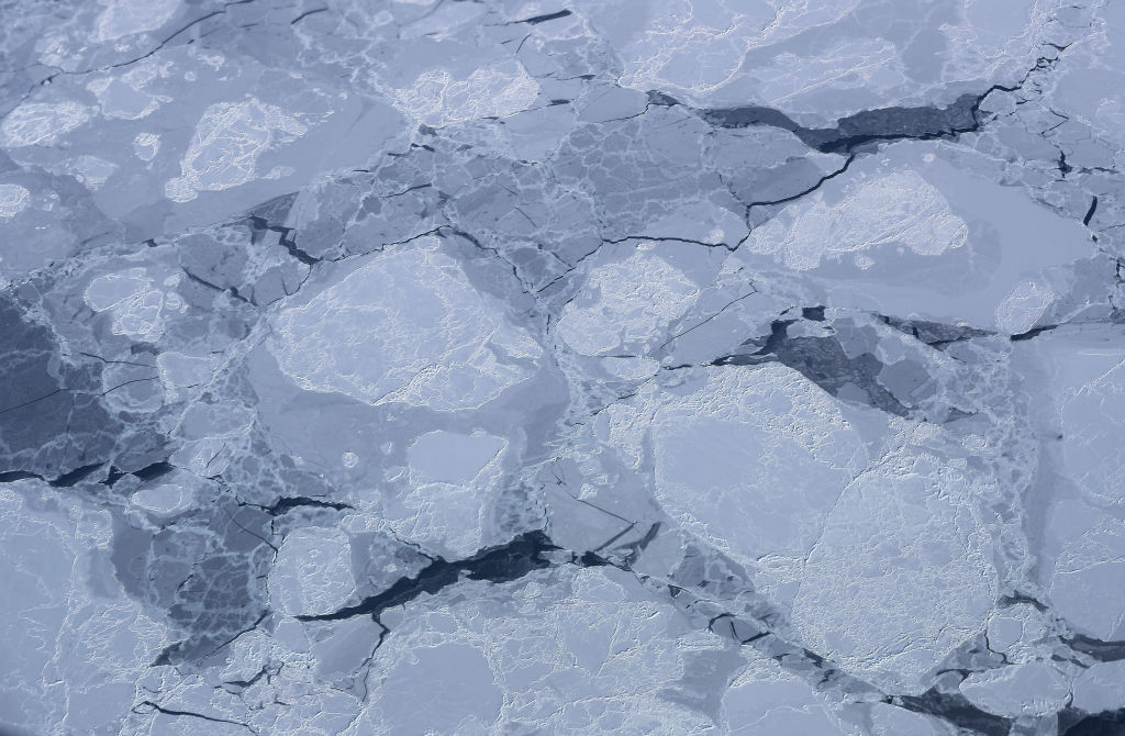
Sea ice seen from a NASA aircraft.

Sea ice thickening could boost the amount of sunlight that is reflected back to space in the Arctic, thus cooling the region. (Image credit: Mario Tama/Getty Images)

Thicker sea ice is usually brighter than thin sea ice, which boosts the amount of sunlight that is reflected back into space. "The broader implication is that these effects could enhance the Arctic's reflectivity through both increased surface brightness and longer-lasting sea ice," the researchers said. "If similar results could eventually be achieved at larger scales, increased Arctic albedo could contribute to regional cooling, with potential knock-on benefits such as slowing permafrost thaw and reducing ice loss from Greenland."

However, there is still a big question mark over how scalable and economically viable sea ice thickening is, given that it requires people and machines working in the field. According to a 2016 study, 10 million wind-powered pumps would be needed to cover just 10% of the Arctic Ocean, and 100 million to cover the entire Arctic. "It is reasonable to ask whether such an endeavor is financially feasible or even logistically possible," the authors of that study wrote.

Yearly sea ice extent in the Arctic has shrunk by 20% since 1979, and this loss is accelerating with global warming. Therefore, if we want Arctic sea ice thickening to work at a large scale, "the pumps must be deployed almost immediately, while there is still a sufficient area of sea ice over which to flood," researchers wrote in a 2021 study.

The ecological and social impacts of Arctic sea ice thickening are not well understood, and further research will delay deployment, meaning it might be too late to roll out sea ice thickening by the time scientists have the data they need to ensure its safety and feasibility.

For these reasons and others, including governance issues and high maintenance needs, "sea-ice thickening is simply not feasible for use at a scale and at a rate that would be meaningful for sea ice protection," researchers wrote in a review published last year.

Deployment on anything but local scales would be challenging, Blanchard-Wrigglesworth and Ceccolini agreed. Nevertheless, the researchers said their most recent winter trials, which have yet to be published, showed encouraging results. In those trials, the sea ice in test areas grew 20 inches (50 cm) thicker than in control sites, The Guardian reported.

"We expect to have a clearer picture once the current melt season is complete," the researchers told Live Science. "In parallel, we are developing underwater robotic technology that could support autonomous deployments. Earlier this year, we conducted the first Arctic field tests of a prototype re-icing drone in Finland."

The drone is currently being refined in collaboration with the BioRobotics Institute in Pisa, Italy, according to The Guardian.

  •  

'Unequivocal evidence' of Earth's oldest impact crater turns out to be off by half a billion years

Earth's oldest known impact crater formed when a meteorite slammed into what is now Australia about 3 billion years ago β€ͺ—‬ 470 million years later than scientists previously claimed, a new study suggests.

The impact crater, known as the North Pole Dome crater, is located in Western Australia's Pilbara region, which is home to some of the planet's oldest rocks. It remains a record-breaking structure, beating the world's next-oldest known meteorite impact crater β€” the Yarrabubba impact structure, also in Western Australia β€” by roughly 800 million years.

"While the site had previously been identified as an ancient impact structure, its exact age remained uncertain," study first author Chris Kirkland, a professor in the School of Earth and Planetary Sciences at Curtin University in Australia, said in a statement. "The impact left a 'mineral clock' behind. By dating minerals that were remade or newly grown in the damaged rocks, we can now pin down when this extraordinary event happened."

In a study published last year, Kirkland and his colleagues said they had "unequivocal evidence" that the North Pole Dome crater was 3.47 billion years old, based on an analysis of cone-shaped chunks of rock known as "shatter cones" that form when the shock waves from a meteorite impact propagate downward.

However, a study published four months later in the journal Science Advances called the other team's results "inaccurate," arguing that the impact occurred no earlier than 2.7 billion years ago.

For the new study, Kirkland and his colleagues used advanced mineral dating techniques to estimate the ages of zircon, apatite, calcite and muscovite in shatter cones from the North Pole Dome crater. The researchers analyzed two samples of shatter-cone-bearing rocks, as well as a shocked quartz vein β€” a sheet-like deposit that typically forms when superhot, mineral-rich water circulates in the cracks between shocked rocks.

Three images of rocks in the North Pole Dome area and a scan of the mineral zircon.

Researchers analyzed zircon and other minerals in North Pole Dome rocks. (Image credit: Curtin University)

"The key evidence comes from zircon, a tiny but extraordinarily resilient mineral that can keep geological time for billions of years," Kirkland said. "Some zircons at North Pole Dome have unusual branching, skeletal shapes. We interpret these as impact-modified crystals, formed when older zircon was disrupted, partly recrystallised, and in places regrown during the intense heating caused by the impact."

The age recorded in zircon was the same as that locked inside apatite minerals, giving the researchers confidence that the impact occurred a little more than 3 billion years ago. The younger shatter cones in the Science Advances study may have formed subsequently due to tectonic and thermal activity, the team wrote in the new paper, which was published Tuesday (June 23) in the journal Geology.

"Ancient impact craters are incredibly difficult to date because over billions of years, rocks are altered by heat, pressure and fluids, which can obscure or reset the original impact signals," Kirkland said. "The new age places the North Pole Dome structure as Earth's oldest known impact crater and the only recognised example from the Archean eon [4 billion to 2.5 billion years ago], a time when the planet's earliest continents were forming."

Planet Earth quiz: What do you know about our planet's most amazing features?

  •  

Watch bison herd defend a newborn calf from wolf attack in a primeval Polish forest

A camera trap in an ancient Polish forest has captured extremely rare and unexpected footage of wolves attacking a bison herd made up of adults, youngsters and a newborn calf, a new study shows.

The event took place on Sept. 15, 2025. Five wolves (Canis lupus) enter the camera frame, closely followed by three bison cows and the newborn calf. In the footage, the cows chase after the wolves, leaving the calf alone and exposed. The wolves then surround the calf, bite its neck and try to drag it away, but two cows come to its rescue. The wolves return and seize the calf a second time in the background of the video β€” however, this time the entire bison herd comes to its defense to end the attack.

The clip is from the Bialowieza Primeval Forest, the oldest and best-preserved temperate lowland forest in Europe, which hosts the world's biggest population of European bison (Bison bonasus). The forest covers 350,600 acres (141,900 hectares) on the border between Poland and Belarus. There are more than 870 bison on the Polish side, according to the new study, while the Belarussian side has roughly 730 bison.

Also known as "the king of the forest," the European bison is typically considered a non-prey species, meaning it has no predators except humans. But the footage calls this into question.

Still images from a video of wolves attacking a bison herd in Poland.

These still images from the video show (a) the wolves grabbing the newborn calf for the first time; (b) the wolves seizing the newborn calf for the second time; and (c) the bison herd forming a protective circle around the newborn calf after both attacks. (Image credit: Wijnands & Borowik, 2026. (CC BY 4.0). Mammal Research Institute, Polish Academy of Sciences.)

"To our knowledge, we present the first video-recorded evidence of wolves attacking a European bison herd in the BiaΕ‚owieΕΌa Primaeval Forest," researchers wrote in the study, published May 29 in the journal Ecology and Evolution. "Although the video did not capture a direct kill, it suggests that other attacks on European bison could potentially be successful."

Historical documents show that wolf attacks on European bison used to be more common, with about 8 kills recorded annually in the Bialowieza Primeval Forest between 1840 and 1849. The forest was a popular hunting ground for monarchs from the 14th century onward, explaining why such detailed records exist.

European bison went extinct in the wild in 1919, but they were reintroduced in the Bialowieza Primeval Forest in 1952. The first confirmed bison kill since then dates to the mid 1990s, and after that, it seems as though wolves stuck to a diet of roe deer (Capreolus capreolus), red deer (Cervus elaphus) and wild boar (Sus scrofa), likely because these are much easier prey than bison, the researchers wrote in the study.

But now, "our observation demonstrated that the European bison is in fact a potential prey for wolves," they wrote. "This raises questions about why predation attempts are so rare, whether the bison can still be described as a non-prey species, and what this could mean for conservation and management of the species."

An intriguing trend in the Bialowieza Primeval Forest is that wolf packs are growing in size, possibly thanks to a late 1980s hunting ban. This shift could increase wolf predation on bison in the future, because bigger packs can handle bigger prey.

"If predation on European bison, specifically young animals, occurs more frequently than previously assumed, wolves could play a small but potentially important role in the natural regulation of bison numbers," the researchers wrote in the study. "In turn, such regulation could possibly lead to mitigation of human-bison conflicts."

  •  

'Is it really necessary to generate another image?': UN scientist explains how everyday people can limit AI's environmental impact

Energy used to power artificial intelligence (AI) could jump to 3% of global electricity demand by 2030, guzzling as much water as the 1.3 billion people in sub-Saharan Africa consume in one year to meet their domestic water needs.

Those are the conclusions of a recent United Nations report that estimated the land use, water consumption and greenhouse gas emissions associated with AI's breakneck expansion. If the data centers that underpin AI formed a country, they would rank 11th in the world for energy use due to their high infrastructure and electricity needs to train ever more complicated models and satisfy users, the report found.

By 2030, data centers could rise to sixth in the world for energy consumption, which would have a land footprint the size of Connecticut and release emissions comparable to those of the U.K. in 2025, depending on how much renewable energy is in the mix.

The findings highlight how much additional pressure AI and the infrastructure that supports it could put on the environment and the climate within the next few years. But why does AI have such a huge footprint, who is benefiting or being left out from the opportunities linked to AI's growth, and what can be done to limit the damage?

To find out more, we spoke with Kaveh Madani, lead investigator for the U.N. report; director of the United Nations University Institute for Water, Environment and Health; and the recipient of this year's Stockholm Water Prize.

Sascha Pare: What would you say is the main takeaway from the report?

Kaveh Madani: The main takeaway of this report is that although in the general discourse AI is perceived as something virtual, or digital, or up in the clouds, there is [a] massive physicality to AI and the supply chains and infrastructure that back it up. And that's one thing that this report has tried to do: to remind people that behind every prompt, every use, every interaction, there is some level of impact on the environment. This is because from the top of the supply chain, where the extraction of critical minerals happens, to the point of manufacturing the hardware, the construction of the data centers, then the operation of data centers, and then dealing with the e-waste, there are major environmental impacts. If we take all of those into account, then we realize that what's digital is not necessarily free of impact. There is always some footprint associated with it, and we have to remember that.

SP: Why does AI have such massive land and water footprints, specifically?

KM: The report outlines the carbon, water and land footprints of AI's energy use. All along the supply chain, from the extraction of critical minerals to the point of disposing and dealing with the electronic waste, we have actions and interventions that require water, require land, and are associated with carbon emissions. So, if you think about, for example, the extraction of critical minerals, we know that during the process, a lot of water is being used and a lot of water is being polluted and poisoned. We published a report in April about the water injustice implications of the critical minerals, showing exactly what is happening where we have the extraction of critical minerals.

You have to decide if you want to continue using your water for agriculture or if you want to put it into data centers.

Kaveh Madani

But let's not forget that the [new] report is focused on AI's energy use, and then tries to argue that the energy production process itself requires also a lot of water and land. If you are using hydropower to provide energy to your data center, you're using a lot of land and a lot of water. This applies to all sorts of energy sources, regardless of being clean or not, or if you consider them renewable or not β€” they all require water and land. On top of this, of course, you need to build data centers on land, but also you need water for cooling. That's why, throughout the supply chain, throughout the life cycle of AI, we have a lot of water and land use, in addition to carbon emissions.

SP: The report is packed with jaw-dropping statistics about how big AI's environmental footprint could get by 2030. But how significant are the impacts?

KM: First of all, it is very hard to estimate exactly how much energy AI is currently using, but we know that roughly 20% of the current load of data centers can be attributed to AI. We are expecting that to be 40% within a few years. And by then, the data centers that back AI's operations are expected to have an energy demand that is about 3% of the total energy demand of the world. This is equivalent to being the sixth-most-energy-intensive country in the world. The water demand of that is also huge; the water footprint associated with that is enough to satisfy the domestic water needs of 1.3 billion people in sub-Saharan Africa.

SP: Can the environment and communities cope with the projected levels of energy and water consumption needed for AI?

KM: There would be places in the world where big decisions must be made, meaning that you have to decide if you want to continue using your water for agriculture or if you want to put it into data centers. Those would be decisions for the communities β€” and if the communities are not involved, then the most vulnerable, the poor, will be dealing with the consequences.

Aerial view of a huge Microsoft Azure data center in Aldie, Virginia. There is a lake next to the data center.

A Microsoft Azure data center in Aldie, Virginia. (Image credit: Lexi Critchett/Bloomberg via Getty Images)

At the same time, we know that the world's electricity consumption keeps increasing. That's a major problem, because although we are trying to add more and more renewables to the energy supply systems, the renewables cannot keep up with the increasing electricity demand. This means that not only can we not retire the old systems, but we might also need to use more fossil energy to satisfy this growing demand. And of course, that means more pressure on the fragile environment.

We know some of the data centers are being placed in locations that are already dry or suffering from what we refer to as "water bankruptcy," based on the report we published in January. These are major issues. More pressure on the environment [puts] more pressure on humans, and this recipe means [we could have] a kind of reinforcing degradation loop that would jeopardize both nature and human society.

SP: Who is benefiting the most from AI's expansion, and who is being excluded?

KM: AI expansion is benefiting humanity as a whole. It has changed our lifestyle; it has provided a lot of opportunities and improvements. But at the same time, it has some consequences. The issue that we see right now is that the richer communities and countries of the world are the ones that are benefiting from it the most, and within those communities and countries, it's the rich who are also profiting more from the expansion. If you look at the investment landscape of AI, you can see that there is a lot of push from a number of strong players and private investors. And they don't bear the costs when it comes to pollution, water bankruptcy, land degradation and so on.

If you think about the emissions, they are contributing to global warming, and everybody would suffer from it. Even the countries that don't have AI infrastructure are affected: If you think about where the critical minerals come from, you see a lot of poor communities, poor countries and poor regions in Africa, South America, parts of Asia, where people don't have basic infrastructure β€” they don't even have clean drinking water and energy infrastructure. They don't benefit from this expansion and the profits and utilities it provides. It's the most vulnerable communities and the poor economies that are going to suffer the consequences, while the other ones will benefit more.

SP: How did you estimate AI's growth by 2030, and how likely is it that your numbers will come true, given the fears that AI is a bubble that's about to catastrophically burst?

KM: We were looking at the data centers, and we still think that our projections are conservative. There is a lot of push from the private sector to further growth. Countries are also seeing investment in AI and data centers as an investment in security, sovereignty and other matters, so there's also a competition there. Some of the investments β€” some of the decisions about expanding AI β€” are not necessarily based on comprehensive assessments. Investments remain a bid to stay in the race, and that means more and more push. So we think that what we have projected is probably very conservative.

SP: China is scaling up its energy capacity together with data center buildout, and it is putting data centers in the ocean to try to solve the hardware cooling issue. What do you make of this strategy, and should other countries learn from it?

Underwater data center under construction in a Chinese shipyard.

Chinese companies are testing underwater data centers to solve cooling demands. Here, we see a data center under construction at a shipyard in Nantong, in China's eastern Jingsu province. (Image credit: CN-STR / AFP via Getty Images)

KM: China's more centralized decision-making system provides advantages, but I think we need to be careful about generalizing the information of one or two projects highlighted by the media to the overall strategy.

We know that China has been expanding its renewable energy production capacity, and that's definitely a good thing. We have to make sure that the additional load of AI would not mean more fossil energy and would not compromise the decarbonization process. But at the same time, we should note that just scaling up renewables is not sufficient if you're thinking about decarbonization. We need a massive addition of renewables if we're going to reverse climate change, and we are not seeing strong enough signs of that around the world. So that's something that we have to be worried about.

That has been the challenge created for the world because of the expansion of AI. When it comes to putting things under the ocean, I think we do not yet have enough information and enough experience to judge if those things come with less environmental impact. What we hide would not be impact-free; there are also other impacts to worry about.

SP: What are some other solutions to the pressures AI is putting on the environment and people? How should we approach the rapid expansion to ensure it is fair?

KM: We offer a framework based on a number of principles about making the AI governance system more fair and transparent and sustainable. So, those are the principles suggested, and they bring responsibility to all stakeholders, including the developers and service providers β€” those who provide the technology and have responsibilities of ensuring that their systems are more transparent and efficient.

Then, we have the governments that have the responsibility of ensuring that information becomes available, that footprints are properly monitored and disclosed and regulated. They can use a range of incentives, mechanisms or penalties to ensure that footprints are reduced across the supply chain β€” and I insist on that β€” from the mines to the landfill. So, that can be done; pollution taxes can be charged and so on. [Governments should ensure] that those who have to deal with the consequences also benefit from the profits and the opportunities that data centers bring to their communities. Decisions must be made based on resource availability and the environmental consequences taken into account.

Users also can do a better job of making smarter choices by using AI more responsibly and only when it's absolutely necessary. When using AI, choose the right models, and be mindful of what is happening behind the scenes. Is it really necessary to generate another image? Is it really necessary to generate a video? Is it necessary to use the model in the "thinking mode"? Together, all the stakeholders can make a difference, and users can also call for more transparency and force governments to take action to force the service providers to provide more information and be more transparent.

Editor's note: This interview has been condensed and lightly edited for clarity.

  •  

Atlantic 'cold blob' is responsible for shifts in the Indian summer monsoon that threaten over 1 billion people

A giant blob of abnormally cold water in the North Atlantic Ocean is shifting the Indian summer monsoon, threatening the livelihoods of more than 1 billion people, new research suggests.

The link between these two systems highlights a previously unrecognized connection that could inform weather forecasts in South Asia and shed light on climatic events elsewhere, scientists say.

The Indian summer monsoon is a rainfall pattern that lasts from June to September and is driven by temperature differences between the warm northern Indian Ocean and cooler seawater below the equator. Historically, the monsoon triggered heavy rainfall along the west coast of India and a huge region of northern India called the Indo-Gangetic Plain. But since 1999, this pattern has changed dramatically, the researchers reported in a new study.

Northwest India now receives about 25% more rain during the monsoon season than it did before 1999, while the Indo-Gangetic Plain gets roughly 4% less, the team found. This is disastrous for farmers, in particular, because their soils and crops are adapted to the old rainfall pattern, said study first author Mahendra Nimmakanti, a climate scientist at the Indian Institute of Science's Centre for Atmospheric and Oceanic Sciences.

"India is largely dependent on agriculture," Nimmakanti told Live Science in a joint interview with study co-author Matthew Huber, a professor in the Department of Earth, Atmospheric, and Planetary Sciences at Purdue University in Indiana. Higher-than-normal precipitation in northwest India is causing flash floods and crop losses, because agriculture in this region is adapted to dry conditions. Meanwhile, the Indo-Gangetic Plain has seen periods of drought that also caused crop declines and impacted farmers' livelihoods, Nimmakanti said.

Previous studies have linked shifts in the Indian summer monsoon to changes in the Atlantic Meridional Overturning Circulation (AMOC), a giant web of ocean currents in the Atlantic that regulates the global climate and carries heat to the Northern Hemisphere. Data suggests the AMOC is slowing due to climate change and releasing less heat in the North Atlantic Ocean than it did before. This may be causing a southward shift of the Intertropical Convergence Zone, a band of low-pressure atmospheric conditions around the equator that drives tropical monsoons, including the Indian summer monsoon.

But these studies didn't specify how the Indian monsoon might shift or explain the underlying mechanism in detail, Nimmakanti said. "They generally explain that if there is a weakening of AMOC, that suppresses the Indian summer monsoon," he said.

One part of the problem is that current climate models do not show the changes in the Indian monsoon that have happened in real life, possibly because they also don't fully capture shifts in North Atlantic sea surface temperatures. This is especially true for a region southeast of Greenland known as the "cold blob," where the water was colder between 1901 and 2021 than it was in the late 1800s, even as the ocean around it heated up.

The cold blob suggests the AMOC is weakening because it points to a reduction in the amount of heat reaching the North Atlantic.

To pinpoint how and why the Indian monsoon has changed, the researchers fed precipitation data, sea surface temperature records and other real-life observations into dozens of climate models. This reproduced the shifts observed over the past 27 years. However, the results only implied a correlation between shifts in the North Atlantic and changes in the monsoon, not that the former directly caused the latter.

People wade through floodwater after heavy monsoon rains in Karachi, Pakistan.

Northwest India now gets 25% more rain during the monsoon season than it did before 1999, and this shift has also increased flooding risk in Pakistan. (Image credit: Sabir Mazhar/Anadolu via Getty Images)

To figure out if North Atlantic sea surface temperatures caused the Indian monsoon to behave strangely, the team added and removed the cold blob in a simulation. The results showed that the cold blob has shifted the Indian monsoon by creating a strong temperature gradient over the North Atlantic, which, in turn, affects jet stream winds and pressure systems in the atmosphere above Eurasia.

Specifically, the jet stream above the North Atlantic has intensified, and a "blocking" system over the Ural Mountains in western Russia has strengthened, Huber said. As a result, weather systems in India have changed, sucking moist air toward the country's northwest and away from other regions.

"It's a shifting of the high- and low-pressure systems," Huber said. "Realizing that these two systems were directly linked through this wave train coming off the North Atlantic, that was novel."

More than 1 billion people in India and other parts of South Asia depend on the monsoon for food security and economic stability. The new results, published April 27 in the journal AGU Advances, could help forecasters predict extreme rainfall and drought events in India and neighboring countries like Pakistan during the monsoon season.
Some researchers think the Indian monsoon is a key tipping point within the global climate, and the findings suggest the system crossed a threshold in 1999. Since then, the cold blob has caused a "persistent jet stream reorganization," leading to abrupt shifts in the monsoon, according to the study.
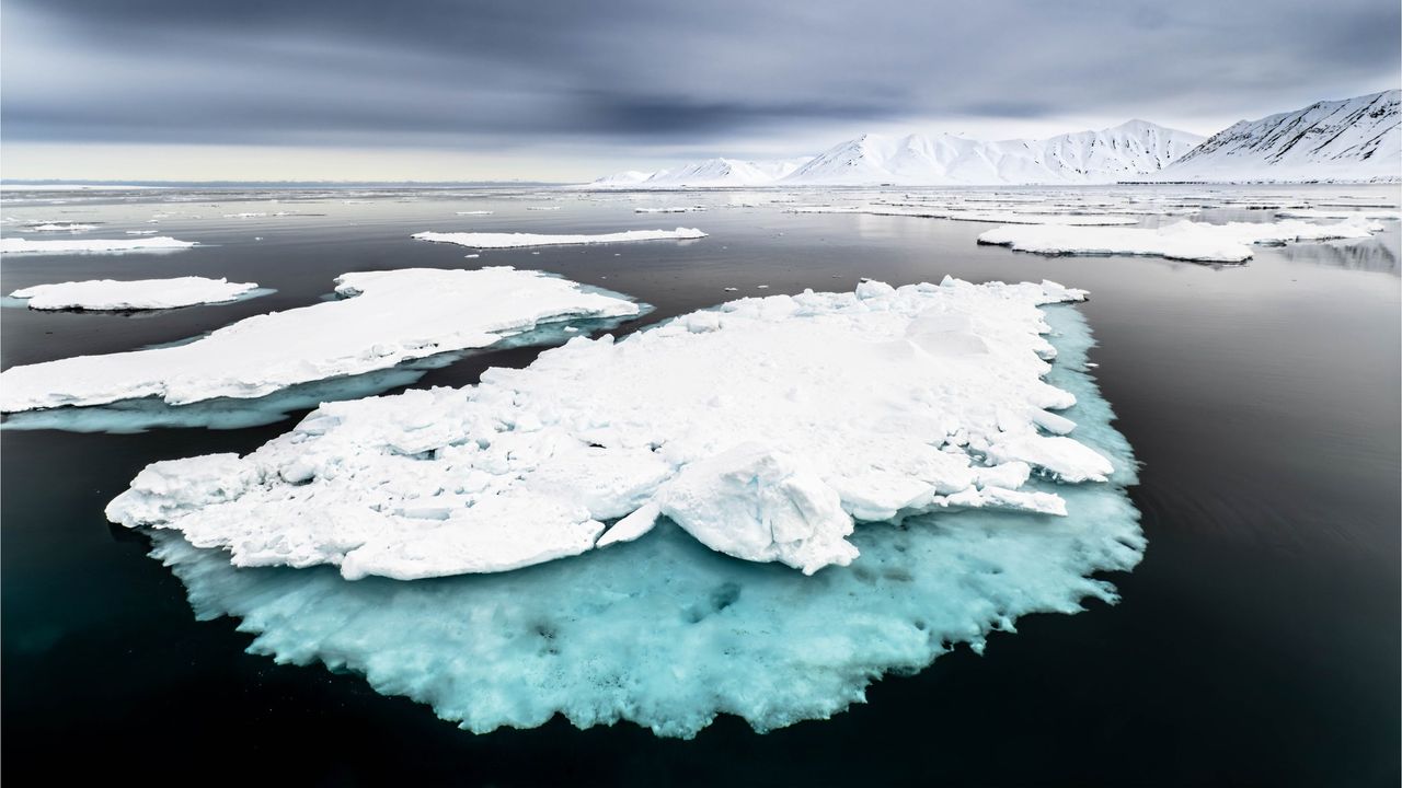
It's unclear how the Indian monsoon will evolve under intensifying climate change, because climate models produce different predictions of what will happen in the North Atlantic, and other drivers may come into play as the world changes, Huber said.
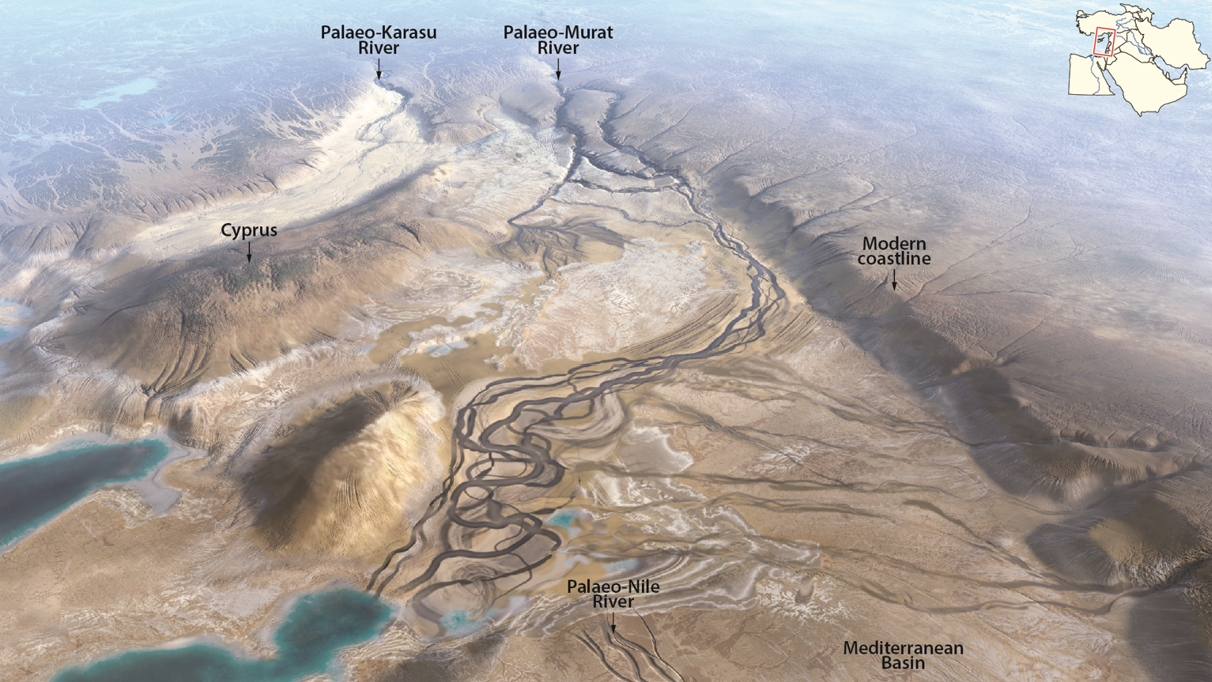
"What we do now know is that this is one of the key building blocks of formulating a theory for what will happen in the future," he said.

  •  

'The system is critically stressed': San Andreas and San Jacinto faults scarily close to major earthquake, study finds

The San Andreas and San Jacinto fault systems are at their highest levels of tectonic stress in 1,000 years, raising the threat of a major, imminent earthquake that could devastate Southern California, a new study finds.

The faults could rupture separately or together, thanks to an "earthquake gate" between them at Cajon Pass, where the San Jacinto fault splits from the main trace of the San Andreas fault. Researchers discovered that Cajon Pass can prevent or facilitate earthquakes moving between the faults, depending on how similar their stress levels are at the time of rupture.

And right now, the San Andreas and San Jacinto faults appear to have comparable, extremely elevated stress levels, potentially spelling trouble for Los Angeles, San Bernardino, Riverside and the Coachella Valley, the team warned.

Map of Southern California showing the San Andreas and San Jacinto fault systems. The faults connect at Cajon Pass and run parallel to each other.

Cajon Pass, where the San Andreas and San Jacinto faults connect, is an "earthquake gate" that can facilitate the spread of ruptures. (Image credit: Burkhard et al., 2026. JCR Solid Earth. (CC BY 4.0))

"Our results show that stress levels on multiple fault segments are now at or above the highest values seen in the past millennium and that the region may be capable of a large through-going rupture involving both fault systems," study first author Liliane Burkhard, a planetary geologist at the University of Bern in Switzerland and at the University of Hawaii at Manoa, said in a statement.

The San Andreas and San Jacinto faults have caused 36 earthquakes with magnitudes of 6.4 or above in the past 1,000 years. Southern California's last "big one" was a magnitude 7.9 event in 1857, when a 205-mile (330 kilometers) segment of the San Andreas fault slipped horizontally between Parkfield and Cajon Pass. That rupture did not propagate through Cajon Pass, but a similar megaquake in 1812 did, suggesting this could happen again in what is now a much more built-up and densely populated environment, according to the study.

Almost 170 years have passed since the 1857 megaquake, raising fears that another huge earthquake could be due to hit soon.

To estimate this risk, Burkhard and her colleagues built a model replicating the last 1,000 years of major earthquake activity along the southern San Andreas and San Jacinto fault systems.

The researchers used observations such as tree-ring records and age data from sediments that have been displaced to reconstruct Southern California's earthquake history. They fed this information into the model, which simulated the accumulation, release and propagation of tectonic stress in the San Andreas and San Jacinto faults.

The results, published June 3 in the Journal of Geophysical Research: Solid Earth, suggest the San Andreas and San Jacinto faults are primed for an Earth-shattering rupture, which may involve the earthquake gate at Cajon Pass opening to unleash more destruction than a single-fault event would on its own.

If a rupture were to occur along the two branches of the San Andreas fault that connect at Cajon Pass, it would be a joint rupture, according to the study. If both branches of the San Andreas fault and the San Jacinto fault were involved, this would constitute a tripartite rupture.

The chance of each event happening and the timing of a potential rupture are unknown, but understanding how much stress is building up inside the system could help planners and policymakers prepare for whatever comes next, Burkhard said.

"What we can say is that the system is critically stressed, and that physics-based models like this one give us a clearer picture of the range of scenarios we should be prepared for," she said. "That information matters for hazard assessment, infrastructure planning, and emergency preparedness."

The researchers say their model could apply to other fault junctions and be used as a tool for hazard assessment globally. "We are using rigorous, quantitative science to better understand the risk facing millions of people," Burkhard said.

  •  
❌