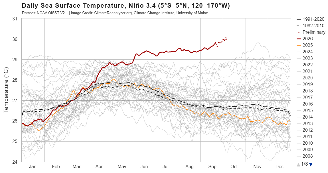
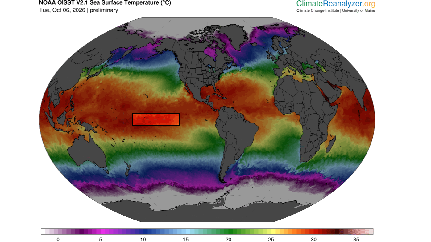
The sea surface temperature in a key section of the central equatorial Pacific Ocean has now surpassed all previous temperatures on record for this region, exceeding 86 degrees Fahrenheit (30 degrees Celsius) for the first time, according to preliminary data released Monday (Oct. 5).
Specifically, these temperatures occurred in the Niño 3.4 region, located between 5 degrees north and 5 degrees south latitude, and 120 degrees west and 170 degrees west longitude. Researchers use this region to monitor the progression of El Niño, the warm phase of a multiyear natural climate pattern that's currently in full swing and steadily intensifying. But how significant is this new record, and could it be a harbinger of increasingly extreme El Niño events in the future?
At this time of the year, sea surface temperatures above 86 F are common in the western Pacific warm pool, a mass of water located northeast of Australia. But the Niño 3.4 region is nowhere near the warm pool and usually has much cooler temperatures. This latest data indicates "an exceptionally warm state for this part of the tropical Pacific," said Jin-Yi Yu, a professor of Earth system science at the University of California, Irvine.
"If the reported daily El Niño 3.4 temperature above 30°C is verified in the observational dataset, it would be an extraordinary record," Yu told Live Science in an email.
Other experts agreed. A Niño 3.4 sea surface temperature above 86 F is a "very significant" new record, Timothy Osborn, a professor of climate science and the director of the Climatic Research Unit at the University of East Anglia in the U.K., told Live Science in an email. Mat Collins, a professor of climate systems and the head of mathematics and statistics at the University of Exeter in the U.K., also called the temperature "very significant" in an email to Live Science.
But it's important to note that absolute temperature is not the standard way of measuring the strength of El Niño, Osborn said. Researchers usually assess El Niño intensity by comparing sea surface temperatures in the Niño 3.4 region with the average conditions there or with sea surface temperatures across the rest of the tropics, with the latter method removing a skew in the data caused by the climate-change-induced heating of oceans globally.
"On those measures, the current event is already close to being the strongest [El Niño] on record and will likely soon exceed previous records given that the event is forecast to strengthen further," Osborn said. "For some measures, it is already record-breaking for the time of year."
"Super" El Niño
El Niño events happen when warm water in the western tropical Pacific Ocean migrates eastward along the equator, toward South America. This boosts global temperatures, triggering heavy rainfall and floods in regions like East Africa, southern China, the southern U.S. and the Pacific coast of equatorial South America, while places such as Indonesia, the Philippines, southern Africa and northern South America experience drought.
"El Nino impacts are greatest across the tropics and in the lands around the Pacific Ocean," Osborn said. "An El Nino with record strength is very significant because it greatly disrupts the atmospheric circulation which controls the weather patterns including patterns of rainfall."
As of Oct. 6, the temperature anomaly in the Niño 3.4 region is 6 F (3.34 C) above average and rising. A typical El Niño increases Niño 3.4 temperatures by a maximum of 1.8 to 3.6 F (1 to 2 C) above average, so the current condition is "exceptionally large," Yu said. "This indicates that a very strong, or what is sometimes called a 'super,' El Niño is developing."
Sea surface temperatures in the Niño 3,4 region exceeded 86 degrees F (30 C) on Oct. 5. (Image credit: ClimateReanalyzer.org (CC BY 4.0))
This year's El Niño is being amplified by human-driven global warming, which has increased background ocean temperatures. As a result, it's likely that sea surface temperatures in the Niño 3.4 region will keep rising over the coming weeks and peak in November or December, before declining again in 2027, Collins said.
While it's likely that future El Niños will be more extreme than past ones, on average, not every El Niño will be record-breaking and as dramatic as the one unfolding now, because these events tend to be very variable, Collins said.
As climate change intensifies, the big worry is that certain regions will be primed for extreme conditions even before an El Niño strikes, Osborn said. For example, regions that are getting drier due to global warming could see catastrophic droughts if they overlap with areas that experience dryness during El Niño events. Likewise, places that are getting wetter could see worse deluges of rain and flooding if they coincide with areas with higher precipitation during El Niños. But that doesn't necessarily mean extreme El Niños are the new normal, he said.
Instead, the location and duration of El Niño events may be transforming, Yu suggested. "In research by my group and collaborators, we have documented changes not only in El Niño intensity, but also in where the warming occurs and how long events persist," he said.
Yu and his colleagues helped to introduce the idea that we are seeing the emergence of two distinct types of El Niño: the eastern Pacific El Niño and the central Pacific El Niño. "Many El Niño events in the earlier observational record were dominated by warming in the eastern tropical Pacific, whereas Central Pacific El Niño events became much more prominent in recent decades," he explained, adding that El Niños have also been lasting longer.
Global warming may be creating a new kind of El Niño by strengthening atmosphere-ocean interactions in the subtropical Pacific, Yu said. If these interactions combine with processes in the equatorial Pacific, where eastern Pacific El Niños emerge, they might trigger unusually strong events with extreme heating in the central Pacific.
"That provides a physical reason to take the possibility of more frequent extreme El Niño events in a warmer climate seriously," Yu said. "But I would distinguish that from saying that every El Niño will become progressively stronger."
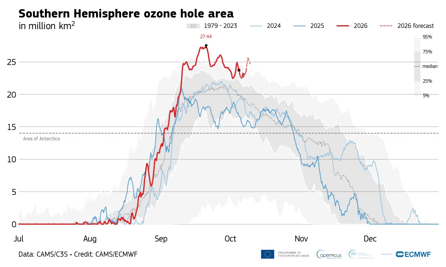
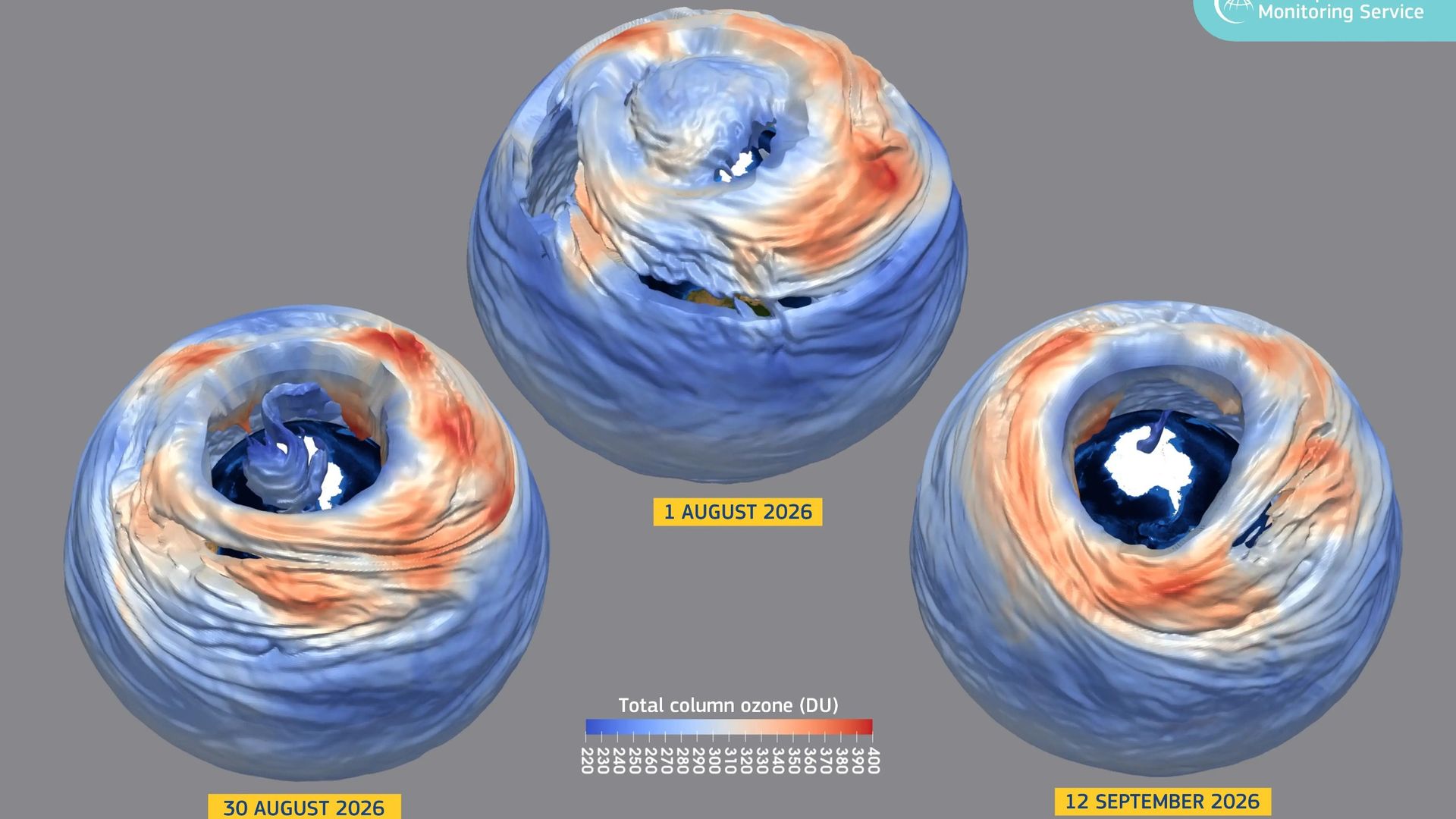
On Sept. 20, the Antarctic ozone hole peaked at 10.6 million square miles (27.4 million square kilometers), the second-largest size ever observed for this time of the year.
The last time the ozone hole was this big was in October 2015, when it reached a whopping 10.8 million square miles (27.9 million square km), records from the Copernicus Atmosphere Monitoring Service show. So why is the hole in the ozone layer — the shield that protects life on Earth from harmful ultraviolet solar radiation — so big this year, despite other clues telling scientists that it is recovering as expected from the damage human-made chemicals did in the 20th century?
The ozone hole's extent is due to extremely low temperatures in the stratosphere, but it's also possible that we could be seeing a new long-term trend of large, persistent holes, experts told Live Science.
"This year's ozone hole shouldn't be a cause for alarm," Hannah Kessenich, a postdoctoral physicist at the University of Otago in New Zealand who predicted the 2026 ozone hole's extent using satellite data and a computer model, told Live Science in an email. "However, there are still many unanswered questions. It's something we need to keep a close eye on."
Accurate predictions
The latest figures from the Copernicus Atmosphere Monitoring Service indicate that the size of Antarctica's ozone hole has dropped to around 8.9 million square miles (23 million square km) since Sept. 20, making it unlikely that this year will break the 2015 record. However, scientists think the hole will remain large and fluctuate over the next few weeks, Kessenich said.
Antarctica's 2026 ozone hole peaked Sept. 20 and has been shrinking since. (Image credit: Copernicus Atmosphere Monitoring Service)
Antarctica's ozone hole expands every year during the Southern Hemisphere's winter and spring. It typically reaches its maximum size between mid-September and early October, when temperatures are still freezing in the stratosphere and sunlight illuminates the frozen continent for the first time after months of darkness. The hole then shrinks again until late January as surrounding ozone-rich air mixes into the depleted region.
Antarctica's ozone hole was caused by emissions of ozone-destroying chlorofluorocarbons (CFCs) between the 1930s and late 1980s. These chemicals increased concentrations of chlorine in the stratosphere, thereby promoting a reaction that depletes the ozone layer. While countries signed the Montreal Protocol to phase out CFC use beginning in 1989, major CFCs have atmospheric lifetimes of 50 to 100 years, so the hole's recovery could take six decades, researchers estimate.
The ozone layer is particularly vulnerable above Antarctica due to the frigid conditions in the polar stratosphere. Temperatures below minus 108 degrees Fahrenheit (minus 78 degrees Celsius) trigger the formation of high-altitude clouds, whose icy surfaces turn inactive chlorine into its ozone-destroying form in the presence of sunlight. These conditions don't exist to the same extent in the Arctic, because warmer air from the midlatitudes mixes more readily with cold Arctic air than with Antarctic air, thereby blocking the formation of high-altitude clouds.
Changes in the polar vortex
This year's large ozone hole is caused by a very strong polar vortex, a wall of wind that encircles Antarctica and the Southern Ocean in the winter, trapping cold air above the continent. The polar vortex created colder-than-usual conditions in the stratosphere over Antarctica, accelerating the growth of the ozone hole.
We have to look at the longer term trends, and those metrics continue to tell us that the ozone hole is slowly recovering as expected.
Susan Solomon, professor of chemistry and environmental studies at MIT
Researchers haven't detected an increase in reactive chlorine, but the colder polar vortex has triggered more ozone depletion than usual, said Susan Solomon, a professor of chemistry and environmental studies at MIT who pioneered the study of Antarctica's ozone hole in the 1980s.
This size of this year's ozone hole is most likely a product of natural variability in atmospheric dynamics, Kessenich said.
"We expect ups and downs in the size of the hole from year to year," Solomon told Live Science in an email. "A year or a few years of bigger or smaller holes doesn't tell us anything about ozone loss or recovery; it is just variability. We have to look at the longer term trends, and those metrics continue to tell us that the ozone hole is slowly recovering as expected."
It's also reassuring that the ozone hole, while large, isn't as "thin" as in years past. The hole's extent is calculated based on the area above the continent with ozone values below 220 Dobson units, a measure of how many ozone molecules occur in a vertical column through Earth's atmosphere. Although the area of this year's ozone hole is huge, ozone values haven't dropped as low as in previous big-ozone-hole years, suggesting that there is less ozone "missing" from the hole compared with those years, Kessenich and her colleagues wrote in The Conversation.
But there's also the possibility that we've shifted to a new long-term trend of big ozone holes persisting until late spring, Kessenich said. Changes in global atmospheric dynamics unrelated to CFCs could be making longer-lived holes more likely, she and her colleagues wrote in the article.
There is also some evidence that climate change will strengthen the Antarctic polar vortex over time, which could lead to colder temperatures in the stratosphere and greater ozone losses in the spring, Kessenich said. If this year's polar vortex stays robust, the ozone hole could remain large well into November, she noted.
"It's too soon to tell what has been driving dynamical variability in recent years, but more research is needed," she added.
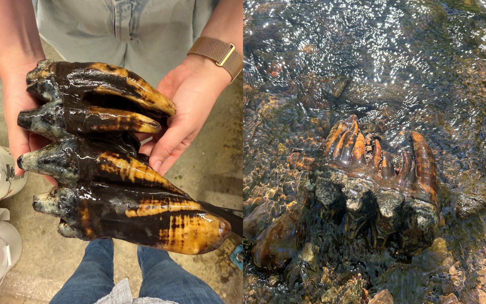
An exceptionally well-preserved fossilized molar belonging to an adult Pacific mastodon has surfaced in a nature preserve near San Francisco.
Upon first glance, the ancient tooth looked like an "oddly shaped rock" to geologists who were conducting fieldwork in the area, according to a statement from the Midpeninsula Regional Open Space (Midpen), which runs the preserve. But the find was quickly unmasked as a valuable fossil from the last ice age and was sent to scientists at Stanford University for carbon dating.
"The tooth itself is in immaculate condition," Wayne Thompson, a paleontologist and the CEO of Pacific Paleontology, a consulting firm that carried out a preliminary analysis, said in the statement. "It's the most complete mastodon molar from our area, and the most spectacular mastodon molar that I've ever seen. I had chills and shivers up and down my spine."
Brigid Lynch, a geomorphologist with the California-based hydrology consulting firm Balance Hydrologics, found the molar this summer while surveying a creek bed. "As a geologist, I've gone out and seen stuff in the field, but definitely nothing as exciting as this," Lynch said in the statement.
Lynch's team was working on a habitat enhancement project to support the threatened California red-legged frog (Rana draytonii) inside the preserve, which is located on the San Francisco Peninsula in San Mateo County. The fossil was a complete surprise and dates to at least 10,000 years ago, when the Pacific mastodon (Mammut pacificus) is thought to have gone extinct.
Mastodons are extinct, elephant-like creatures that lived during the last ice age. (Image credit: Midpen (left); Balance Hydrologics (right))
The Pacific mastodon was first recognized as a species in 2019. It was closely related to the American mastodon (Mammut americanum). Both elephant-like creatures lived in North America during the Pleistocene epoch (2.6 million to 11,700 years ago), but the Pacific mastodon inhabited regions farther west than its cousin, roaming parts of present-day Mexico, California, Oregon and the northern Rocky Mountains of the western U.S., according to the statement.
Pacific and American mastodon fossils reveal slight differences between the species, including a narrower third molar, thicker hind-leg bones and occasionally absent lower-jaw tusks in the Pacific mastodon, according to the Royal Alberta Museum.
The newfound tooth is "another puzzle in the Ice Age saga that we can put into place," Thompson said. To get a precise date for the fossil, Midpen donated it to Stanford University's Doerr School of Sustainability in July, the Los Angeles Times reported.
Researchers will produce a 3D copy of the molar that Midpen plans to use for public outreach and education, according to the statement.
Weakening Atlantic Ocean currents could cripple agriculture in some of the world's major breadbaskets, threatening global food security and raising the price of basic commodities, new research finds.
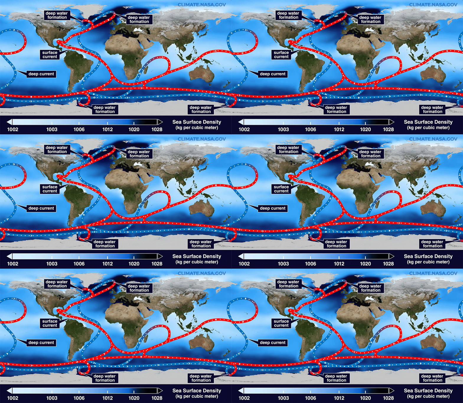
The study, which hasn't been peer-reviewed yet, investigated how a roughly 60% decline in the Atlantic Meridional Overturning Circulation (AMOC) would impact global food production. The AMOC is a system of ocean currents that regulates the global climate and brings heat from the tropics to the Northern Hemisphere.
In the new study, researchers used a computer model to simulate the AMOC's future decline. They modeled 100 years of change, assuming 3.6 degrees Fahrenheit (2 degrees Celsius) of warming above preindustrial levels. The team forced an AMOC slowdown over the first 50 years in one simulation but didn't modify the circulation in a second experiment, which enabled them to compare the world with and without an AMOC failure.
The model's outcomes mirrored the results of previous studies, showing broad cooling in the Northern Hemisphere and a southward shift of the belt of clouds and rain that encircles the globe near the equator. As in past studies, these effects were irreversible on human timescales, said study co-author Michael Hinge, a senior economist at the nonprofit Alliance to Feed the Earth in Disasters (ALLFED).
"Once the damage is inflicted, it stays there," Hinge told Live Science, adding that in the 50 years after the peak rate of AMOC slowdown in the model, the circulation weakened by an extra 20%. The study was posted on ALLFED's website July 7.
An agricultural "shock"
Hinge and his colleagues ran three models to look at the most common varieties of wheat, maize and rice, layering these models on top of the AMOC simulations. They found that global yields for these crops decreased by 5.3% by the 50-year mark, once the AMOC had weakened substantially.
"Lots of these effects manifest earlier, so it's a moving target," Hinge said.
He added that the results were based on a single warming scenario that was run once and used monthly rather than daily data, so they should be interpreted as a proof of concept. "We've set up a pipeline that is ready to take pretty much any AMOC scenario that can generate high-resolution climate data and see what it implies for crops," Hinge said.
While there was a 5.3% decrease overall, that global metric concealed huge differences between regions. For example, countries like Germany and Ukraine lost up to 19% of their cereal yields due to sudden, sharp cooling, while Canada showed a 12% decline in production for the same reason.
"Scandinavia, the United Kingdom and Canada are particularly exposed," Hinge said, "but there are many other [vulnerable] locations, some of which may be surprising even to the people who are living there."
For instance, the model produced a "very nasty brown splodge" of reduced precipitation over India, Pakistan and big parts of China, he said. Iran, Sudan and Eritrea, which are already water-stressed countries, also exhibited severe declines in rainfall, indicating that a portion of the agriculture there may not survive an AMOC collapse.
The 5.3% result also hides variability among years, Hinge said, because it's an average. So there may be years when global cereal losses reach 10% or more, which would bump up food prices, in part because countries might stockpile crops instead of trading them.
Global response
The regional effects of an AMOC slowdown would interact with climate change, triggering unpredictable outcomes. In particular, maladaptation — taking actions that end up backfiring — is a worry, Hinge said.
"You're preparing and setting up for much hotter temperatures or trying to develop areas for these temperatures and the trends you're seeing, and suddenly you see something different," he said. "That may cause an even larger compounding effect [on agriculture]."
The findings build on prior research led by Paul Ritchie, a climate scientist at the University of Exeter in the U.K., whose team explored the effects of an AMOC collapse on agriculture in Great Britain. That study, published in 2020, had similar limitations as the new one, so it's best to interpret both papers as a suggestion of what might happen rather than a precise forecast, Ritchie told Live Science in an email.
"I think the new study is valuable in showing the potential scale and geographic distribution of the initial agricultural shock," said Ritchie, who was not involved in the latest work. "What that would ultimately mean for food production and food security is more uncertain, because there are many possible responses by farmers, markets and governments." For that reason, the regional predictions may be more informative than the 5.3% global average, he said.
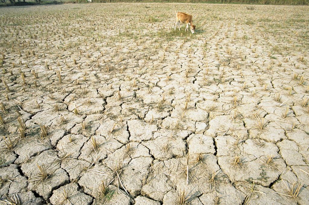
An AMOC collapse could reduce rainfall over the Indian subcontinent, crippling agriculture in this region. (Image credit: Bhaswaran Bhattacharya/IndiaPictures/Universal Images Group via Getty Images)
Average food prices worldwide could rise by 17% to 40% if the AMOC weakens to the extent it did in the model, the study predicts. The level of increase depends on how countries respond to the shock and their degree of preparedness, as well as on whether agriculture can be sustainably expanded in places like the African Sahel (the semi-arid zone directly south of the Sahara Desert) and Brazil, the analysis suggests.
The U.S. would not be spared from this price jump, and the model indicated that the country could see crop losses of about 3% for domestic wheat and corn. This loss would likely impact other foods that rely on cereal inputs, like meat, Hinge said. "The variety of foods available in the stores may well diminish for periods," he added.
An AMOC collapse would fundamentally deepen the need for countries to trade with each other, because some regions — such as the Indian subcontinent, China, Iran, Russia, Ukraine and Canada — could endure this giant shift only if they imported more food, Hinge said.
"Should countries turn inwards and start to restrict exports in an effort to ensure access for their own citizens first, or deal with the uncertainty, or offset concerns, then this will massively magnify the effects of AMOC," he said.
If governments behave as they have during past shocks, such as the 2008 financial crisis and the COVID-19 pandemic, they may restrict trade and start stockpiling food if and when the effects of AMOC weakening begin to show, Hinge predicted. The researchers hope their work and future modeling can help people understand the need to take swift, effective action if a collapse were to occur, he said.
Currently, "if that warning light starts flashing, we're not sure what to do with it," Hinge said. "There are no easy answers here; an AMOC [collapse] would be deeply catastrophic."
Abnormally high temperatures on the Tibetan Plateau triggered two catastrophic rainfall events halfway around the world in California and nearby states in early 2017 and 2023, a new study reports.
This is the first time that researchers have identified this link, known as a climate teleconnection. The results could improve forecasts of extreme weather in the western U.S., which, in turn, could improve warnings for coastal communities and potentially save lives as well as billions of dollars in property damage, the study's authors say.
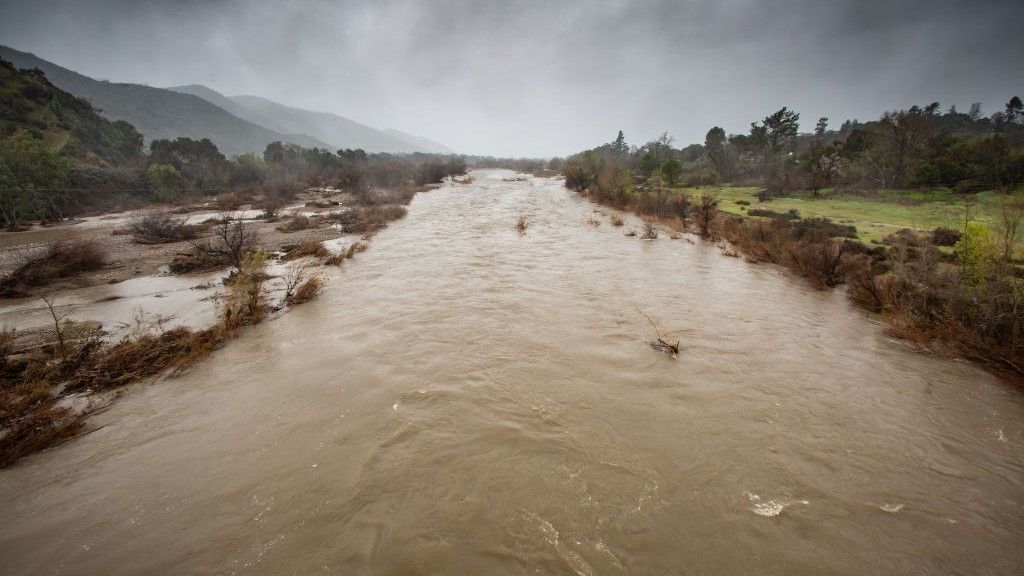
In December 2016 and February 2023, the Tibetan Plateau was warmer than usual for these times of the year. Roughly one month after each of these hotspots appeared, parts of California, Nevada, Oregon, Utah and Arizona received record-breaking precipitation, causing a total of around $6.6 billion in damage, according to the study, and killing at least nine people.
State-of-the-art forecast systems, which rely heavily on ocean conditions like El Niño, failed to predict this extreme rainfall, said study first author Yongkang Xue, a distinguished professor of atmospheric and oceanic sciences at UCLA. The record precipitation occurred during La Niña years, which are typically associated with dry conditions in California and neighboring regions, further complicating the picture.
"This study provides the first evidence from observational data analysis and model simulations that abnormally high early-winter temperatures on the Tibetan Plateau led to stronger atmospheric rivers along the U.S. Pacific Coast, driving heavy regional precipitation," Xue told Live Science in an email.
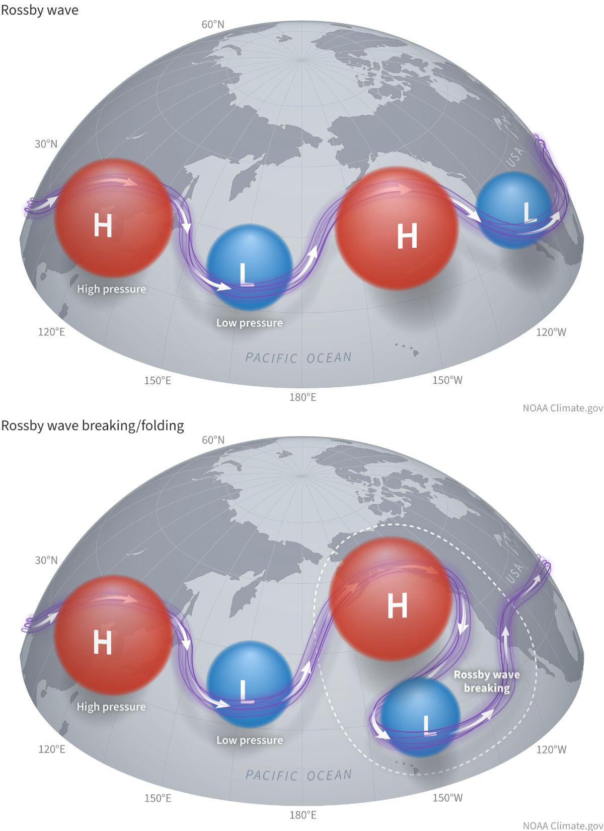
Atmospheric rivers are narrow, elongated corridors of intense water vapor transport. They are key drivers of precipitation and floods in the western U.S., and in this case, they interacted with giant waves in Earth's atmosphere, called Rossby waves, to produce devastating rainfall in the winters of 2017 and 2023.
As temperatures increased over the Tibetan Plateau in late 2016 and early 2023, a strong gradient formed with the regions north and south of the plateau. This generated an atmospheric disturbance that propagated eastward along the jet stream via Rossby waves, triggering what is known as a Rossby wave train between the Tibetan Plateau and the Rocky Mountains, Xue said.
Rossby waves are waves in Earth's atmosphere that wrap around high- and low-pressure systems. When there is an atmospheric disturbance, it can propagate in what is known as a Rossby wave train. (Image credit: NOAA Climate)
A Rossby wave train is a series of waves traveling in the same direction and at regular intervals around alternating high- and low-pressure systems. As the wave trains initiated over the Tibetan Plateau reached the northeastern Pacific Ocean, they suddenly broke, and this supercharged the weather above California and adjacent states, Xue explained.
"Over the eastern Pacific, the wave breaks — much like a towering ocean wave crashing near the shore," he said. "This wave-breaking mechanism reduces static stability and significantly intensifies atmospheric rivers, ultimately driving extraordinary, heavy precipitation along the West Coast."
The findings, published Wednesday (Sept. 9) in the journal Science Advances, are based on complex modeling and analyses of precipitation and surface temperature data, among other observations. The results are part of a new body of research examining the influence of land temperatures on weather patterns, and this is the first study of a winter season, Xue said.
The analysis is a "very specific and impactful case study," said Matthew Huber, a professor in the Department of Earth, Atmospheric, and Planetary Sciences at Purdue University in Indiana, who was not involved in the research. The results build on the well-established idea that extra heat on a mountaintop affects Rossby waves almost as if the mountain had suddenly grown, Huber told Live Science in an email.
Large mountains and plateaus generate waves in the jet stream that are thousands of miles long — "so long that we also call them planetary waves," Huber said. An increase or drop in temperature so high up above sea level adds or subtracts from the atmospheric disturbance that already exists due to the elevation.
"You can imagine the waves in the jet are kind of like a motorcycle rider going off a jump," Huber said. "How far and how high they jump depends on how fast they are going and how big a ramp they are going over."
The models replicated the extreme weather with surprising accuracy, raising hopes that the Tibetan Plateau could be integrated into early warning systems for the western U.S., Xue said. "As similar, though less severe, events become more [frequent] and extreme weather escalates globally, understanding this teleconnection allows forecasting agencies to better warn coastal communities of impending extreme conditions," he said.
Huber agreed that the results could help to better prepare for weather hazards. "This study shows that accurate predictions of weather events in the U.S. West are very sensitive to tiny changes very far 'upstream' and these upstream features are identifiable and traceable," he said.
Two distinct climate regimes that could trigger runaway methane emissions are emerging in Siberia due to Arctic warming, new research suggests.
While western Siberia is becoming wetter in response to rising heat and moisture transported from the North Atlantic Ocean, eastern Siberia is getting drier and more prone to wildfires, a study published Aug. 6 in the journal Science finds. The Yenisei River (also spelled Yenisey) in central Russia delineates the separate environmental states — referred to as regimes because they describe specific types of climates — on each side of the basin, the study authors said.
Between 2010 and 2023, methane emissions from Siberia rose by 5% per year, with western Siberia releasing methane mainly via microbial activity in thawing soils and eastern Siberia discharging the powerful greenhouse gas through biomass burning, the results showed.
"Given the observed increases in permafrost thaw, wetland activity, and wildfire occurrence, an increase in methane emissions was expected," study co-author Paul Palmer, a professor in the School of Geosciences at the University of Edinburgh, told Live Science in an email. "What is surprising is how large and sustained the increase appears to be."
Annual methane emissions grew by about 13.2 million tons (12 million metric tons) over the study period, almost mirroring the rate of increase in methane emissions from wetlands worldwide. Although Siberia currently makes up only about 5% of global methane emissions, the region is becoming one of the fastest-growing natural methane sources on the planet, Palmer said.
In their study, Palmer and his colleagues integrated satellite observations with near-surface measurements to map methane emissions from Siberia over time. Instead of adding up individual methane sources on the ground, the researchers used a modeling method known as a methane flux inversion system, which helped them limit the uncertainty in their estimates to roughly 10%.
Siberia is vast, remote, sparsely instrumented and currently inaccessible for many scientists due to the Russia-Ukraine war, making it hard to monitor methane consistently by any means other than satellites. Although satellites rely on sunlight, of which Siberia gets very little in the winter, most methane emissions are thought to occur in the spring and summer, when Siberia gets more sunlight, Palmer said.
The results of the study show that Arctic warming amplifies methane emissions via distinct pathways in western and eastern Siberia because the regions are influenced by different climate patterns. The researchers also used climate models to predict future methane emissions from Siberia and found that additional warming could unleash millions of tons of greenhouse gases stored in forests and permafrost, which would further accelerate the warming trend.
In western Siberia, methane is released mainly from permafrost, or ground that has stayed frozen for at least two consecutive years. Siberia holds 46% of the Northern Hemisphere's permafrost, and this icy sediment traps vast amounts of carbon that have accumulated for thousands of years, Palmer said.
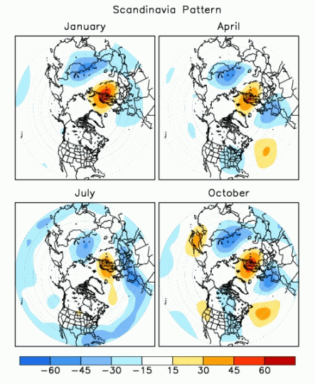
Western Siberia is influenced by the Scandinavian pattern of atmospheric circulation, a climate connection that consists of a main circulation center over Scandinavia and opposing weaker centers over Western Europe and eastern Russia. Global warming makes the Scandinavian pattern transport more warmth and moisture to western Siberia from the North Atlantic. Together with soaring temperatures in western Siberia itself, this triggers extensive permafrost thaw and unlocks carbon that microbes can convert into methane.
The Scandinavian pattern of atmospheric circulation (seen here in the positive phase) consists of different pressure systems above Scandinavia, Western Europe and eastern Russia/western Mongolia. (Image credit: NOAA)
Conversely, eastern Siberia is influenced by a climate pattern known as the Arctic Oscillation, which causes atmospheric air pressure to "seesaw" between the Arctic and the Northern Hemisphere's middle latitudes. Climate change affects the Arctic Oscillation, leading to persistent high-pressure systems that intensify heat waves, reduce cloud cover and promote wildfires in eastern Siberia, Palmer said.
The climate models showed that methane emissions will increase with temperature rise and that the increase could become steeper the hotter the world gets, triggering a feedback loop.
"Eastern Siberia appears to be the main driver of the projected increase because it is warming faster than western Siberia and has seen a sharp rise in extreme wildfires," Palmer said. "Whether that trend continues will depend on how much vegetation remains available to burn, but there is also evidence that fires may be accelerating permafrost thaw and the release of methane from previously frozen ground."
However, the rise in methane emissions reported in the study is small relative to global and projected future emissions, especially if wildfires are already destabilizing eastern Siberia's permafrost, Palmer said.
"Siberia's vast permafrost carbon store is a sleeping giant," he said. "Continued warming risks waking up a much larger source of greenhouse gases."
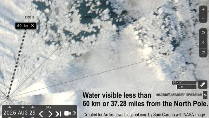
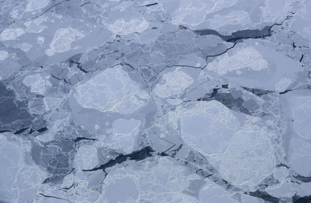
Large patches of open water were visible just 37 miles (60 kilometers) from the North Pole on Aug. 29, a NASA satellite image shows. Although this doesn't necessarily mean that Arctic ice is worse off this year than the past few years, the image reveals how severely climate change is affecting the region, experts say.
The image is from the NASA Worldview satellite photo browsing tool and was shared last week on the blog Arctic News. The patches are "quite striking," but it's not the first time that water has encroached upon Arctic ice in this way, said Julienne Stroeve, a professor of polar observation and modeling at University College London.
"We can see open water at times at the North Pole but I don't think it's ever been this extensive," Stroeve told Live Science in an email. For instance, the central Arctic Ocean and regions north of 80 degrees north latitude, an imaginary line that crosses Canada's Ellesmere Island and Spitsbergen in Norway, were highly fragmented in early September 2016.
The time of year is one reason water is now visible in this region, said Zachary Labe, a climate scientist at Climate Central, a nonprofit news organization that analyzes and reports on the climate. "By the end of summer, the sea ice generally becomes more fragmented, with areas of open water appearing more widespread between pieces of sea ice," Labe told Live Science in an email.
This means that local weather conditions and ocean currents can create large gaps between ice floes, Labe said. For example, strong winds can push ice fragments together or pull them apart, leading areas of water to widen or close within hours or days.
"Individual satellite images from around the North Pole in just the last two weeks show dramatic changes in the amount and location of visible open water," he noted.
The current extent of Arctic sea ice isn't particularly low when compared with record-setting years, but that's now very changeable due to the diffuseness of the ice, Stroeve said. "Winds could change and compress the ice into a more compact ice cover leading to sudden drops in total extent," she said.
There is no specific distance from the North Pole at which open water should normally stop, because Arctic conditions can vary substantially from year to year, Labe said. However, the summer ice has become thinner and more fragile in recent years, so open water is consistently reaching closer to the North Pole than it did before.
"To me, this image doesn't necessarily show that conditions are dramatically worse this year compared to other recent years," Labe said. "Instead, it represents a worrying snapshot of a very different Arctic Ocean than only a few decades ago and one that is quickly changing over time."
The Arctic is warming nearly four times faster than the global average. Some of the northernmost regions that have historically boasted expansive, thick and persistent ice at the end of summer now have young, brittle ice floes instead, Labe said.
"The broader implications of more open water across the Arctic Ocean are wide-ranging, from changes in local weather and ocean conditions to impacts on marine ecosystems and greater coastal risks like erosion and flooding for Arctic communities," he said.
Scientists expect that sea ice will start to refreeze by mid- to late September, closing at least some of the gaps.
Scientists have identified an ancient volcano on England's east coast that is so eroded, it took researchers three decades to piece together its enormous size and explosive past. What remains of the caldera system is located beneath the English counties of Norfolk and Lincolnshire.
However, while the volcano undoubtedly produced at least one huge-scale eruption, some experts don't think there is enough evidence for the structure to be called a supervolcano.
"It obviously must have been a very large eruption, but it would be very difficult to calculate the volume of the eruption given the poor preservation of the deposits," said Michael Poland, a research geophysicist with the Cascades Volcano Observatory and the scientist-in-charge of the Yellowstone Volcano Observatory. "This is part of the reason I really hate the term 'supervolcano,'" Poland, who was not involved in the discovery, told Live Science in an email.
In a recent analysis, published April 29 in the Geological Society of America Bulletin, scientists examined zircon crystals that were taken 80 years ago from boreholes 40 miles (65 kilometers) apart in Norfolk and Lincolnshire. Zircon crystals are smaller than the diameter of a human hair and form within molten magma underground before a volcano erupts. They contain uranium that decays into lead isotopes at a known rate, enabling researchers to precisely date eruptions.
The results showed an age match between the zircon crystals from Norfolk and Lincolnshire and counterparts taken from the Kinnekulle tephra, a thick layer of volcanic ash covering Scandinavia and the Baltic region. This suggests the ash plume from the volcano in what is now eastern England blew across the Tornquist Sea, a body of water that existed during the Ordovician period (488.3 million to 443.7 million years ago), and settled on what is now Scandinavia.
Researchers already knew that the Kinnekulle tephra was formed during a massive volcanic eruption. But the recent analysis shows for the first time how far the ash traveled and, therefore, how big the eruption really was.
The eruption would have also produced huge pyroclastic flows, or avalanches of rocky debris, ash and hot gas that race down the sides of some erupting volcanoes, said Peter Rowley, a volcanologist and senior lecturer at the University of Bristol in the U.K. who was not involved in the analysis. "The last eruption of this kind of scale was the Oranui event at Taupō in New Zealand, over 26,000 years ago," he told Live Science in an email.
However, while the explosion would have been impressive and equivalent to the force of thousands of atomic bombs, experts said the definition of a supervolcano is vague and there are better ways to describe what happened.
"The scientific definition of a supervolcano varies a little; it’s a term we tend not to use as volcanologists much," Rowley said. "In this case we would describe it as an ultraplinian eruption."
Ultraplinian eruptions are the most violent type of volcanic explosions, ejecting more than 240 cubic miles (1,000 cubic kilometers) of material. It's difficult to say exactly what the eruption that formed the Kinnekulle tephra would have looked like, but it likely lasted days to weeks and formed ash clouds taller than 25 miles (40 km) that reached into the stratosphere.
Geologists tend to reject the term supervolcano because it is imprecise, instead preferring to describe eruptions by the volume of material they eject.
Stephen Self, a physical volcanologist at the University of California, Berkeley, agreed that the term supervolcano can be too vague. "Supervolcano has become a kind-of buzz-word," he told Live Science in an email. "It's the deposits of the eruptions that are recognized, not the volcano."
Very little of the material ejected in England's ultraplinian eruption remains today, because most of it was eroded or buried. "The geological record is far from complete so it can be very difficult to say much about these eruption volumes with very old volcanoes," Rowley said.
The analysis also found evidence for an earlier eruption of the volcano that occurred 453.7 million years ago. However, there is no trace of these eruptions at the surface today; the boreholes are located in some of England's flattest landscapes, study first author Tim Pharaoh, a geophysicist with the British Geological Survey, said in a statement in August.
It's not surprising to find traces of big, ancient volcanoes in England. The recently identified volcano is part of a wider volcanic system that was active 450 million years ago and includes Eryri National Park in Wales and the Lake District in northwestern England, Rowley said.
"It's best not to imagine whole preserved volcanoes, but rather that we have deposits from their eruptions, or rocks which formed in the magma reservoirs beneath the original volcano," Rowley said. "These are often deformed and altered by tectonic events meaning that it takes some careful geological investigation to interpret the true picture."
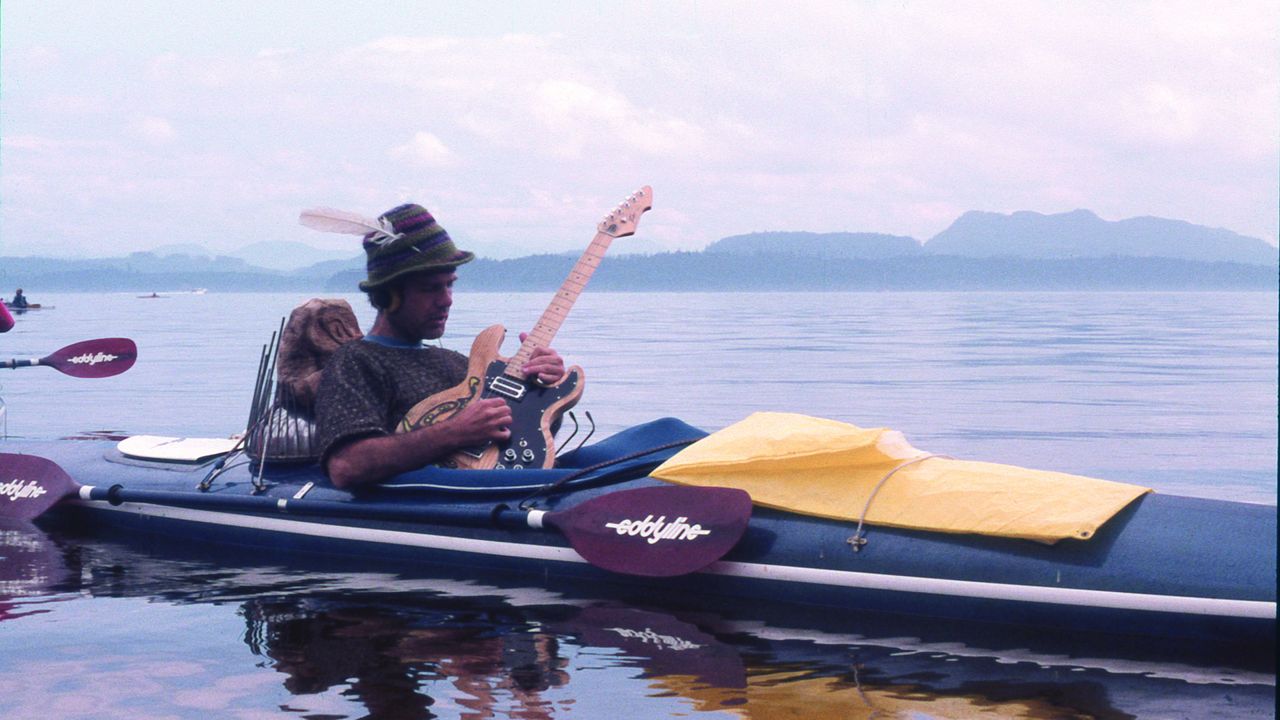
Throughout his career as a composer, Jim Nollman has worked with unorthodox partners to create music. Instead of collaborating solely with human musicians, the artist has expanded his cast to include animal bandmates, and they've been making melodies together for more than 50 years.
Nollman's new album, "Orcas' Greatest Hits," will be released Aug. 14 by the music label Smithsonian Folkways Recordings. As the title suggests, the album is a collection of songs centered around orca (Orcinus orca) vocalizations.
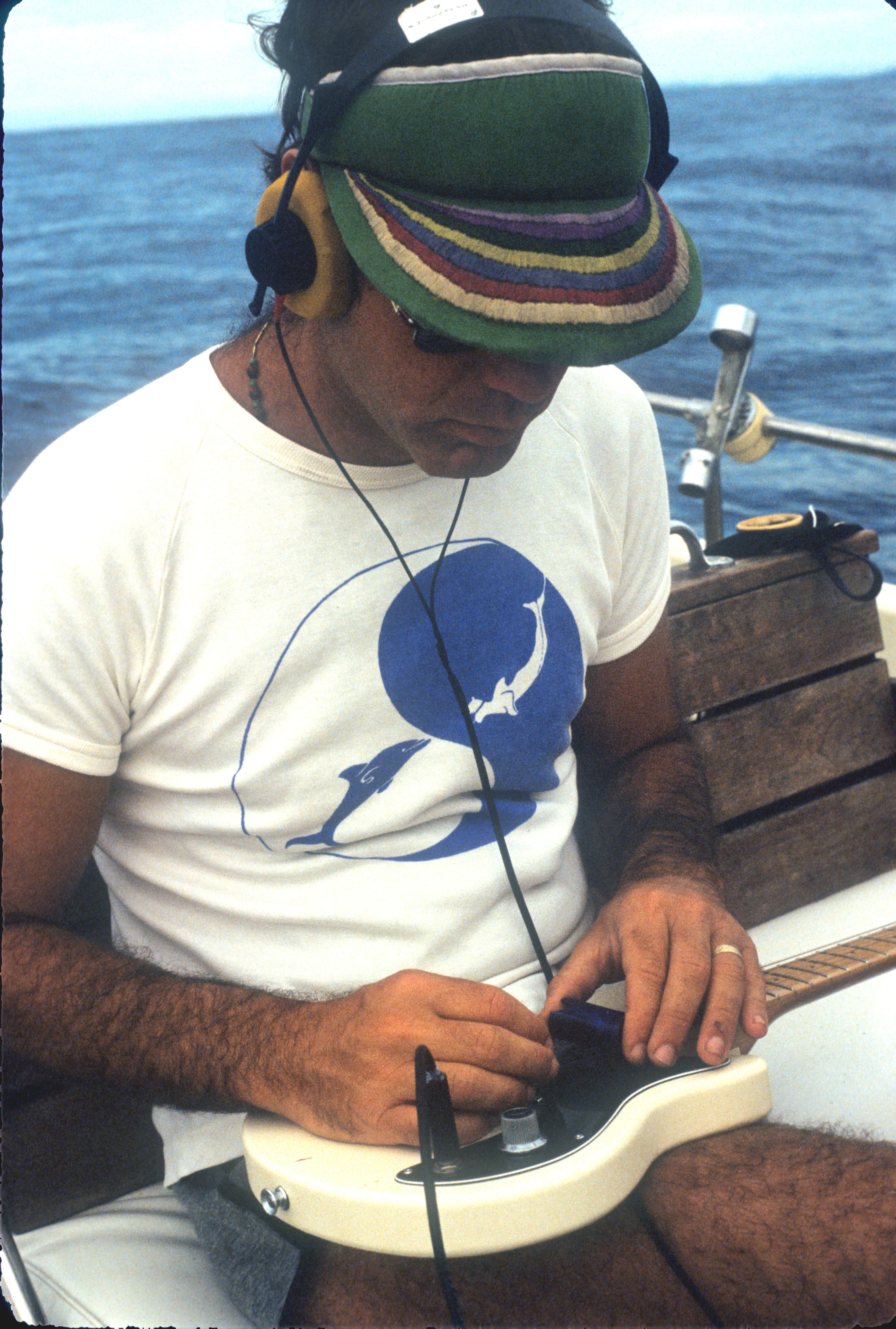
Nollman now lives in Friday Harbor, Washington, but he recorded these sounds off the coast of British Columbia between 1985 and 2002, using underwater microphones called hydrophones. The vocalizations weren't random calls that Nollman overheard; rather, he prompted the orcas to "sing" by broadcasting his and fellow musicians' music into the water via underwater speakers. The artists kept the volume at a reasonable level to protect the orcas and performed after dark to avoid motorboat sounds.
However, orcas weren't Nollman's first animal bandmates. Fresh out of Tufts University in the 1970s, he made music with various animals, including turkeys, wolves and dolphins. To learn more, we spoke with Nollman about his career, including several years he spent consulting with the U.S. Navy, and the extraordinary interactions he's had with whales and other creatures.
Sascha Pare: How did you first start making music with animals?
Jim Nollman: In my latter year at university, I got involved in the theater, doing all the music for all their plays. I soon got into John Cage [an American composer known for his innovative approaches to sound] — first in Boston, and then in the San Francisco Bay Area when I moved there. I got to know some of the avant-garde music people, especially in Berkeley, because there was a big movement there [centered around California's KPFA Radio].
I'd been in Mexico, playing flute, and the turkeys next door would always gobble on a certain high note and at a certain volume. I said [to an editor at KPFA], "Why don't you send me to a turkey farm? I'd like to do a Thanksgiving Day piece." He gave me a sound man and a Nagra tape recorder. I remember vividly, because having a Nagra after just getting out of college was a big deal for me. I was into technology. [Editor's note: Nagra is a Swiss brand of portable audio recorders.]
The turkey farm had 300 turkeys, and I immediately learned from the owner that it's really only the males that gobble. He kept the males and the females separate, so he put me into the fenced-in area where the males were. I started singing, and I could control them. The turkeys closest to me would start, and the gobble would go out to the edge of the 300 birds. And then it would come back, and then they would all stop. I was singing "Froggie Went A-Courtin'," which is an old American folk song [originally from Scotland] about animals. I sang 30 or 40 verses of this song and controlled the turkeys.
Jim Nollman's new album, "Orcas' Greatest Hits," will be released Aug. 14. (Image credit: Jim O'Donnell)
I was around 24 years old, and I had a hit. I knew I wanted to be a musician, but I had some major flaws to be a performer, because I didn't like being the center of attention. I'm kind of an introvert. That's a loser if you're trying to be a singer-songwriter. I loved writing tunes and playing them, but not in front of a big audience. This [recording tunes in nature with animals] was a way to get into music.
After the turkeys, I wondered if I should try making music with animals again. I tried it with kangaroo rats [Dipodomys deserti], which build these burrows like Trinidad steel drums. Kangaroo rats only come out at night, and they thump to each other in their burrow systems, which are tuned — it seemed to me, anyway, that each place in the burrow had a different tone — and they communicate with one another.
Then, I went to a wolf preserve. I realized that the wolves did two or three howl sessions in the morning around dawn and two or three at night. The wolves wouldn't play with me if I was out of their key. If I played a flat note, they would stop and basically tell me, "We don't mind if you're playing in our pack, but you've got to do it right." That was a big lesson for me, and that's how I got into it.
SP: Your new album features orcas. Did you always have a sweet spot for orcas, or is there another animal you preferred working with?
JN: No, I don't have a sweet spot for orcas. I recorded orcas for 15 years, and I had lots of recordings, most of which I never really listened to, because I didn't know what to do with them. At some point, I decided that "I can't do anything more with the orcas, and I don't like going to whale conferences and being this authority," because it wasn't about that for me.
[After years of recording orcas], I started going to the Arctic — because I wanted to go to the Arctic and because beluga whales [Delphinapterus leucas] were there, and they seemed like the opposites of orcas. The orcas were very much in tight families traveling together and making very simple calls that had deep meaning. To have their echolocation against a speaker at midnight could be like being in a war zone. It was so loud; we had speakers blow out sometimes.
The beluga whales were the antithesis of that. It seemed like they all were talking at the same time, and they all seemed to know what everybody else was saying. This is my speculation. They used sound as their family anchor, and I had no idea if they all understood each other talking. But it was very much more animated than what the orcas were doing. I would say 50% of the orca calls were just two notes; they were D to C, and back to D. And they would do that all day long, some of them. Beluga whales sometimes sounded like belly laughs. They made the weirdest sounds, and I loved it.
I went everywhere in the Arctic. I started out in the first year going to Nome [Alaska] in the Bering Strait, and then I went east to the Mackenzie River delta in northern Canada on the Beaufort Sea. Then, I went to Baffin Island in the Canadian High Arctic. In every place I went, limited beluga populations were crashing. At some point, I realized this was a complete loser. I pretty much gave it up until I met some people from Finland who said, "You should try it in Russia." The Soviet Union had recently crashed, and they were opening up all the places where they had their gulags [forced labor camps] and their nuclear fleet. The Solovetsky Islands were loaded with beluga whales that hadn't seen people in 70 years. I went there, and I had a great time with the beluga whales.
The wolves wouldn't play with me if I was out of their key.
Jim Nollman, musical composer and sound artist
SP: What is your favorite memory of working with orcas or beluga whales?
JN: Six or eight years ago, somebody brought me and a bunch of other artists up to Hudson Bay [in Canada], basically to emulate what I'd done for so many years [artistic residencies to experiment with whale sounds]. I was the mentor for everybody. I liked that role. We were confronted with beluga whales, and I said, "I don't really want to play the guitar or the mandolin with the beluga whales, because I've tried that all over the Arctic and I've never had much success. I'm going to put my head in the water and blow bubbles."
The beluga whale came up, and it wrapped its mouth around my face. It did the same thing to the woman who was blowing bubbles on the other side of the kayak we were on. That was maybe the most fun thing I ever did with cetaceans. I wasn't worried at all. I've had the same thing happen with giraffes. I was in Texas at this game farm, and this giraffe came and licked my whole face with its giant tongue. It was really quite wonderful.
SP: The oldest recordings in the new album are 40 years old, and you said you hadn't listened to all of them before making the album. What was it like hearing them after all these years?
JN: I had 65 hours of tapes, and I listened to them over three or four months. Ninety percent of it was rubbish; it was just repetitive, and the whales would get into their D-to-C-to-D call routine. I wanted something where there was a groove, or some kind of magic going on that was inexplicable.
I started choosing some sequences. I thought it was only a certain level of connection that we'd created, but a couple of the things that I listened to when I was in that process blew me away. The one where I was playing James Brown riffs into the water — that was very strong for me. I'd never heard that before. I was discovering new stuff by giving it a close listen.
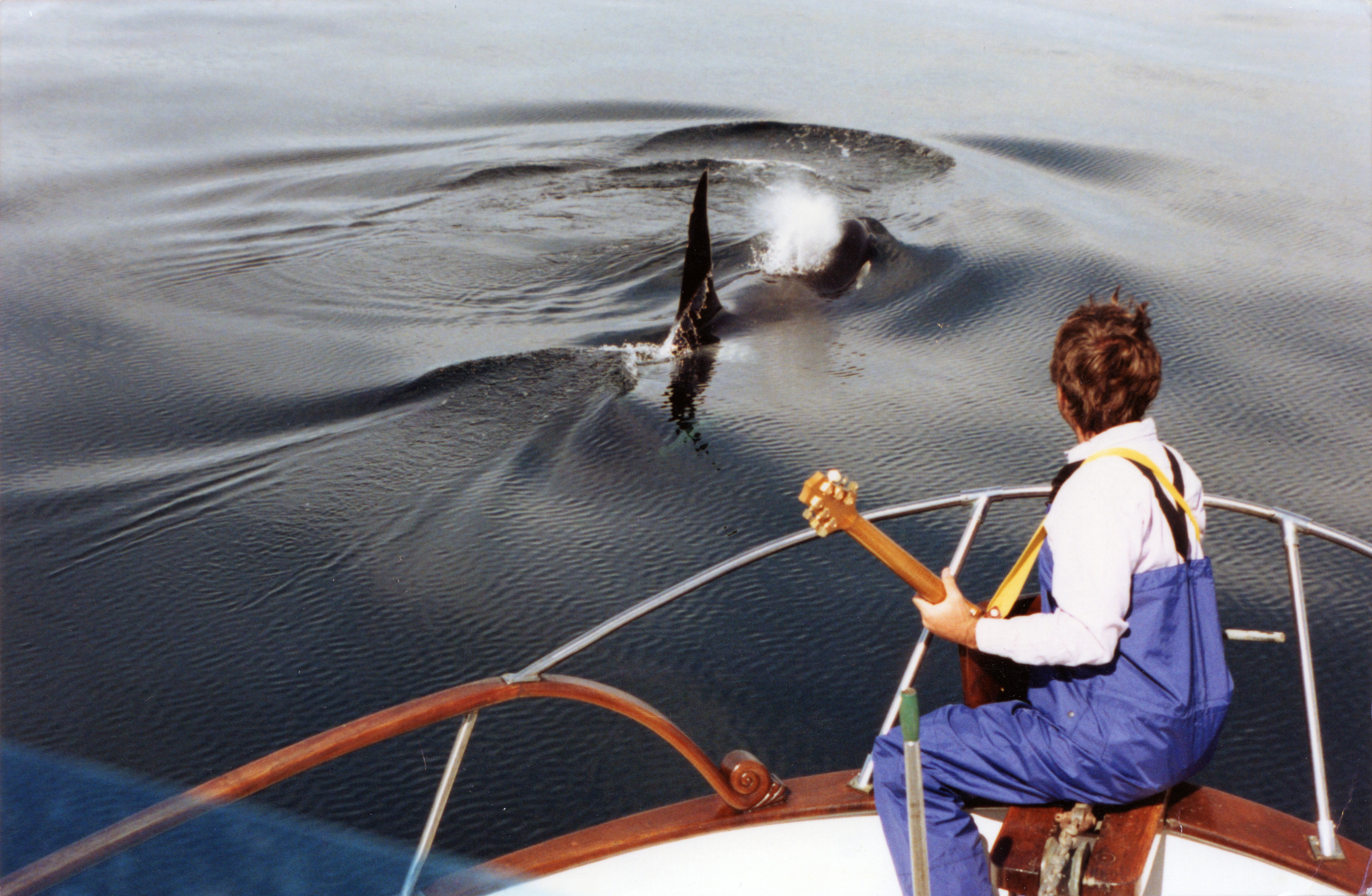
There's one where I was being filmed by National Geographic, and it was just me and a guy on a big boat cruising the waters. I started playing a country blues bottleneck on the guitar. [Editor's note: A bottleneck in country blues is a guitar-playing technique where a hard object is placed on a finger and glided along the strings.] The whales only did this a couple of times, but they would come in with a chord change. Say I'm playing in a key of D; they would come up and play the G in perfect time. I was impressed by that.
SP: Did you ever play the recordings of you and the orcas back to the orcas?
JN: No, because the recording can't answer the whales. I was trying to make a telephone connection, so it has to be two things talking to each other. To play a recording would be like me saying, "Let's stop this interview now, and I'm going to put on something of me giving an interview to somebody I spoke to yesterday." You wouldn't like that, and I don't think the whales would have liked that either if I did it to them. It had to be direct. I had many people who were very ardent or passionate about singing or reciting poetry — one guy wanted to sing Jewish death prayers to the whales. But the whales didn't come.
Nollman recorded orcas off the coast of British Columbia between 1985 and 2002. (Image credit: Jim Nollman)
SP: Is part of why you've been so successful at making music with animals that they particularly like you?
JN: Some animals like me. I definitely got through to the orcas. I could tell that, because I had an interim of eight years between doing it with the big communities [of artists] and going out alone with the orcas. They were the same orcas, and they definitely knew who I was the first time I put sound in the water again. That's when that country blues episode happened. We were all much more relaxed with each other. The second time was great. It was also a tragedy, because the whales had lost their residence to the loss of salmon [in the northeast Pacific Ocean], and they were way out of their range.
SP: Your work with orcas and other whales landed you a job with the U.S. Navy in 2011. How did that happen, and what was your role?
JN: I was doing underwater concerts in the 1990s. I was invited to Kodiak Island, which is a large island off the coast of southern Alaska. They wanted me to do an underwater concert. At the time of this festival, in which I was performing, the U.S. Navy was sending ballistic missiles from Southern California to the waters off Kodiak Island for testing. This was destroying the halibut [Hippoglossus stenolepis] fishery on Kodiak Island, because the fishermen couldn't go into this area, suddenly.
The Navy sent a guy who was part of this ballistic missile thing but also had a PR background. He said, "Can I speak before your concert?" I said, "You can speak about whatever you want, but you've got to get in the water. That's the payment you have to give me: Get in the water and hear all this music that I've created."
He was blown away. I had a fan. He took me out for dinner and asked me if I had any ideas about solving this great scandal that was enveloping the Navy at the time, which was the killing of mostly beaked whales during mid-frequency sonar exercises, mostly in the Bahamas, in this hole in the ocean that's there. Nobody had a solution, so he wanted me to be on the team. I said, "Sure, I'll be on the team." It was like somebody asking me to play for the New York Yankees or something — completely odd, but I thought, "OK, I'll try that."
He called me back two years later, saying, "We have our money, and we want you to come to the Groton submarine base [in Connecticut], where we'll have our first meeting with submarine captains, Ph.D. sonar engineers and a few whale biologists." That went on for seven years. I took the job seriously. I told them that I thought we could solve it in five minutes. I said, "All you need to do is take care. If you see whales in the vicinity, don't exercise on that day." This sounds so totally obvious, but the fact was that he [the PR man] was contending with a Navy establishment that believed that the Navy could do anything to save the American people from being bombed or wrecked. They didn't see whales as anything but collateral damage.
SP: Do you have a favorite song on the new album?
JN: I like "The Three Jimmies." I never knew that James Brown's guitar player was named Jimmy Nolen — I mean, that's really outrageous. So, it's the three Jimmies, right? I really like the music, and I like the piano player [Jonathan Churcher], who plays one note every three or four bars. The response of the whales is also brilliant, I think. There's one part where the whale starts to echolocate, which is the way they see the world; it's their perceptional tool. The whale starts clicking in time with the beat that I'm playing on the guitar. That only happened once in 65 hours of recordings, and I thought that was pretty unusual.
SP: What's next for you after "Orcas' Greatest Hits"?
JN: I'm composing new music, and I'm hoping I'm at least breaking even [with the new album] so that they [Smithsonian Folkways Recordings] can do the next one, which is called the "Cowbird Variations." The cowbirds are basically the bottom voice, maybe the part that's played by bass in pop music. Everything else is other birds and insects called treehoppers. It has this very primitive sound to it.
I love doing this music with cowbirds, because cowbirds have a horrible reputation. They lay their eggs in other birds' nests, and when the eggs hatch, the baby cowbirds knock all the birds in the nest out and kill them. Then, the parents — juncos, where I live — end up raising the cowbirds. These birds have a terrible reputation, but they make one of the strangest sounds in nature — so that's why I chose them.
This interview has been condensed and edited lightly for clarity.
Why it's incredible: The park hosts prehistoric-fossil-bearing rock formations and overlies one of the world's biggest aquifers.
Nestled within Brazil's Cerrado tropical savanna — the second-largest biome in South America, after the Amazon rainforest — Uberaba Geopark is a time capsule from the Late Cretaceous period (100.5 million to 66 million years ago).
The geopark boasts abundant, well-preserved fossils from the last chapters of the nonavian-dinosaur era, according to UNESCO, earning it the nickname the "Land of the Giants," or "Terra dos Gigantes" in Portuguese. Paleontologists have discovered more than 10,000 fossils belonging to dinosaurs, prehistoric crocodyliforms (a group encompassing living crocodiles, alligators, caimans and gharials, as well as their extinct relatives), turtles and other ancient creatures within the park's boundaries.
One of the best-known discoveries is the fossil of Uberabatitan ribeiroi, a titanosaur measuring 89 feet (27 meters) long and 33 feet (10 m) tall, according to UNESCO.
The finds were clustered in impressive geological features, including the Serra da Galga formation and Serra Geral mountain range. These structures formed from ancient basalt flows, which came from giant volcanic eruptions that predate the breakup of the Gondwana supercontinent 180 million years ago.
The park has the ideal conditions to preserve fossils because it alternated between shallow lagoons and river systems when the dinosaurs roamed the region, meaning the animals' remainswere conserved in mudwhen they died.
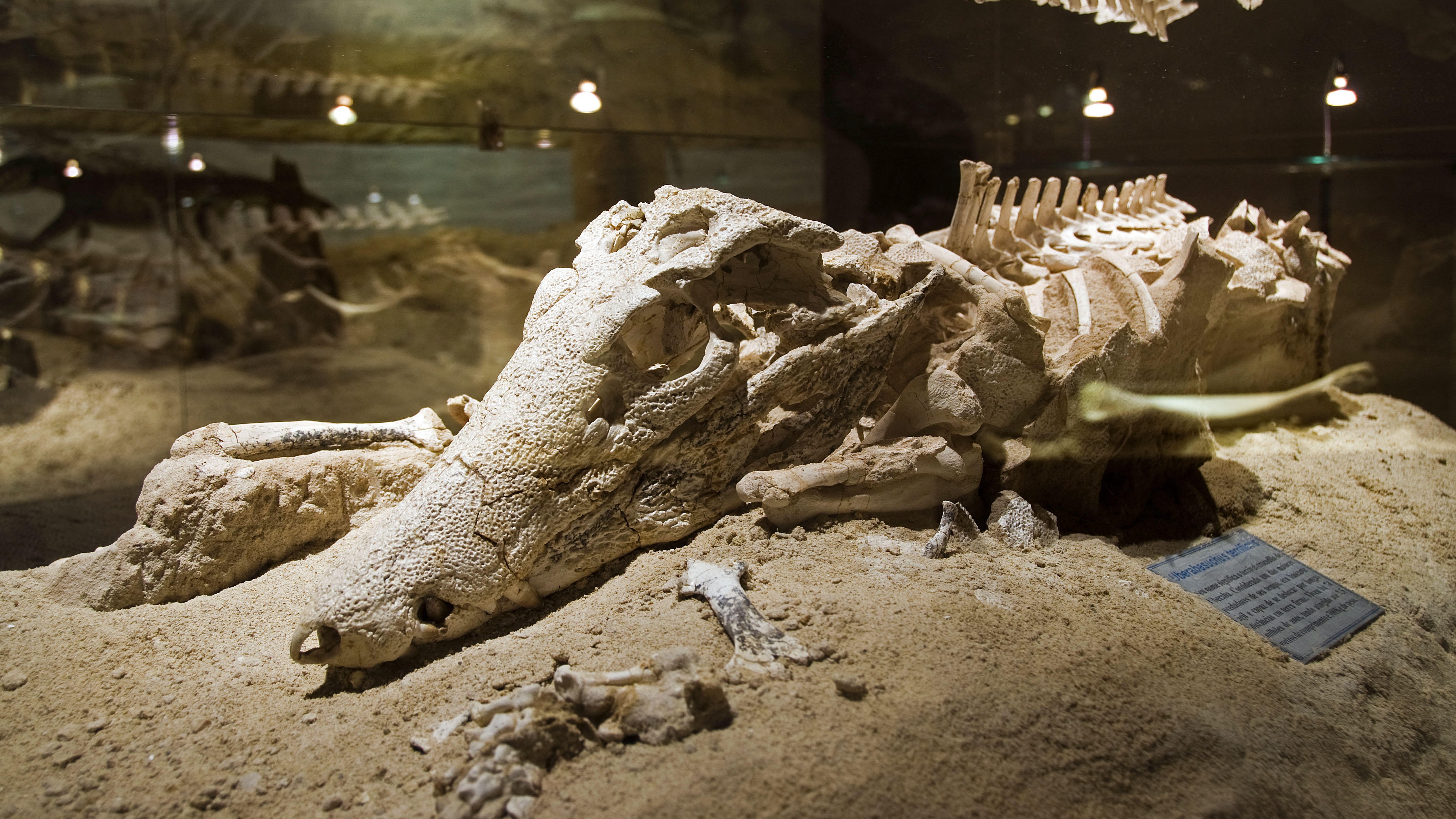
Uberaba Geopark preserved extinct crocodile relatives among other fossils. (Image credit: Pulsar Imagens via Alamy)
The Cerrado savanna, which houses the entire park, is a critical-yet-underprotected carbon sink that hosts more than 12,000 plant species and diverse animal life.
The "Land of the Giants" was added to UNESCO's list of geoparks in 2024 in recognition of the region's geological and natural heritage.
What is now the Uberaba Geopark was the birthplace of Brazil's modern livestock market, which is one of the biggest in the world. Farmers in the 19th century introduced zebu (Bos indicus) cattle from India because they are better suited to the climate in Brazil and require less food than common domesticated cattle (Bos taurus). Zebu cattle also produce lower greenhouse gas emissions than common domesticated cattle do, according to UNESCO.
Uberaba Geopark is open to visitors. There are several museums and trails to explore, including one that leads to the Vale Encantado, or "Enchanted Valley," which contains forests, waterfalls and prehistoric rock formations, according to the BBC.
Discover more incredible places, where we highlight the fantastic history and science behind some of the most dramatic landscapes on Earth.
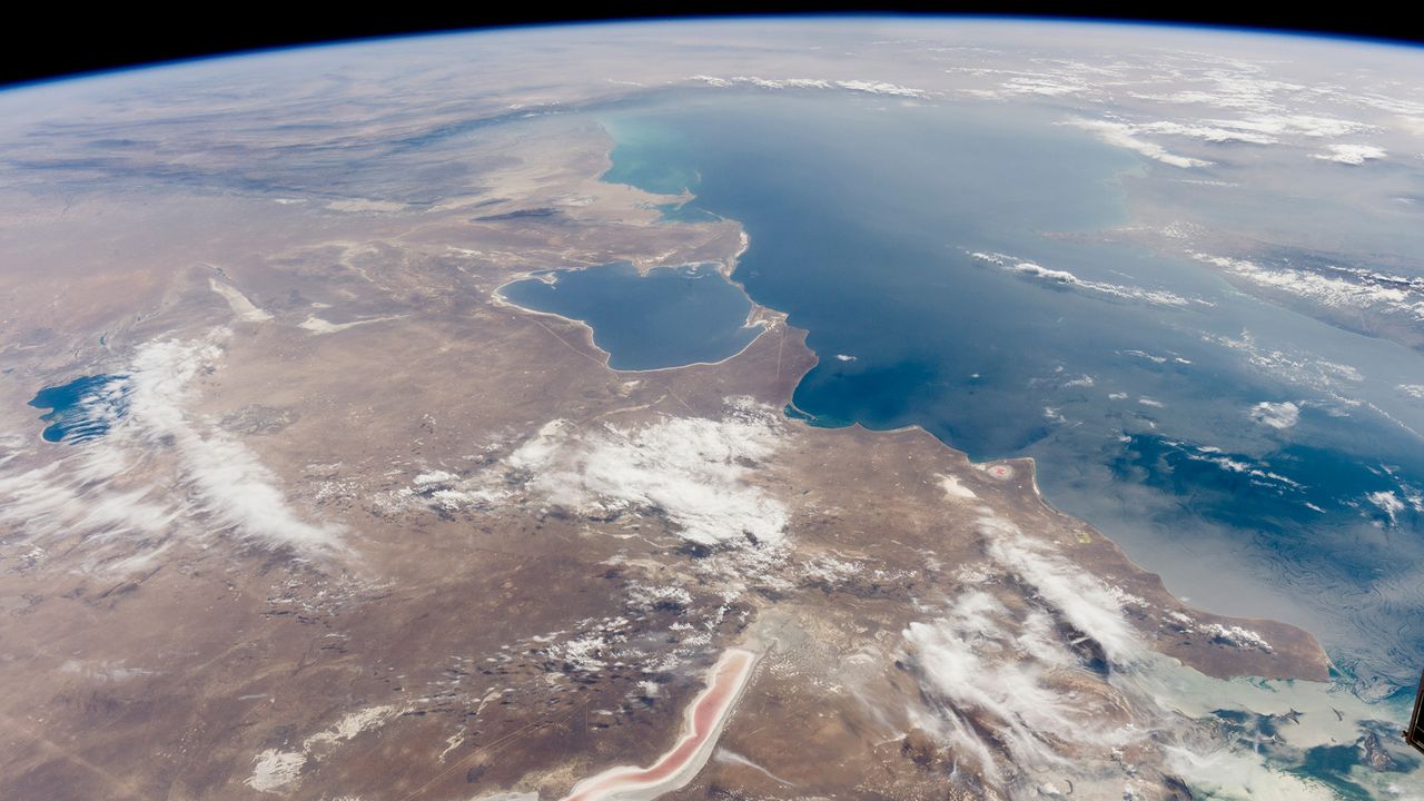
The Caspian Sea, the world's largest inland body of water, is in major trouble. Since the mid-1990s, this saline lake, located between Europe and Asia, has lost an area nearly the size of Sicily. But until now, it wasn't clear why.
Researchers finally provided answers in a study published June 5 in the journal Earth's Future. Using ground- and satellite-based observations, they connected falling water levels to a drastic drop in river inputs from Iran, Turkmenistan, Azerbaijan, Kazakhstan and Russia, all of which border the Caspian Sea.
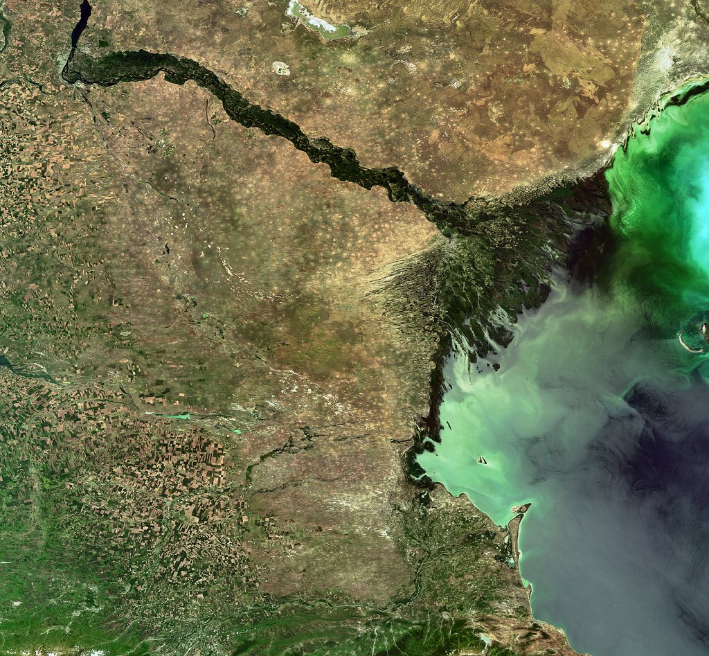
The team particularly highlighted losses from Russia's Volga River, the longest river in Europe, which supplies roughly 80% of the Caspian's inflow.
To find out why the Volga is discharging less water into the Caspian Sea now than it did 30 years ago, we spoke with Amir AghaKouchak, a co-author of the study and professor of civil and environmental engineering at the University of California, Irvine.
AghaKouchak, who directs UC Irvine's Center for Hydrometeorology and Remote Sensing, explained why river inputs have dropped and how decades of water withdrawals have put the Caspian Sea on a path to collapse. He also touched on a solution to this crisis — and revealed why Russia's hunger for ammunition to attack Ukraine is making it harder to save the Caspian Sea.
Sascha Pare: Falling water levels in the Caspian Sea have been attributed to natural variability, and more recently, there's been a focus on climate change and increased evaporation due to rising temperatures. But what did the results of your study show?
Amir AghaKouchak: People quickly jump to conclusions about climate change. Of course, that is important, but it cannot explain the change that we have observed. Over the last 30 years, water levels in the Caspian Sea have shrunk by around 2 meters [6.5 feet] or so. Just to put things in perspective, this translates to about 24,000 square kilometers [9,300 square miles] of sea area loss — about 5%. When we look at drivers, we notice that rainfall hasn't changed significantly over the lake and upstream, so the decline cannot be explained simply by changes in rain.
Evaporation has increased, so it explains maybe about one-third of the change. There is less water in the lake, and that indicates there's probably some water lost along the way. We don't have a lot of human-related data — for example, water withdrawal for irrigation or groundwater wells. That area is very difficult; the countries are not open to sharing data. A lot of our results are based on looking at proxies. Our interpretation is that temperature caused about 30% of the change and the rest is probably because of human activities.
SP: Which human activities does your research suggest are responsible for the Caspian Sea's decline?
AA: Several of the countries on the Caspian Sea have built large dams — Russia, for example. They are all desperate for hydropower. All of the countries around the lake [have also built infrastructure to supply agriculture], and one reason is that they want to create jobs and improve the local economy. Water demand is increasing in all those countries around the Caspian Sea. It's not surprising to see lakes drying or groundwater levels falling.
It's hard to find data about how much water countries are using; they keep data very private, especially places like Russia. We don't have detailed information, but the Volga-Don Canal in Russia is one of the projects that is contributing to this crisis. [Editor's note: The Volga-Don Canal is a ship canal that connects the Volga and Don rivers at their closest points.]
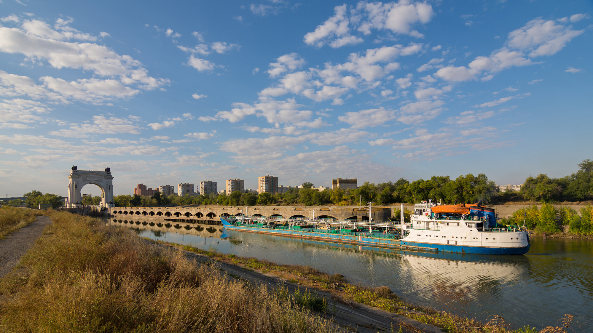
Opened in 1952, the Volga-Don Canal connects the Volga, which flows into the Caspian Sea, and the Don, which empties into the Sea of Azov (a northern extension of the Black Sea). (Image credit: Gaika102 via Getty Images)
But we cannot blame this whole thing on that. We have to be careful with our language; we can't say one project is responsible. Most likely, this is the collective impact of many different small withdrawals from here and there, overall contributing to a significant decline in the Volga River outflow into the lake. In the paper, we have different rivers, but the Volga dominates because it's the largest river. The Volga has a higher impact than all the other rivers combined. There are lots of demands along that river basin.
SP: Did you expect human activities to play such a big role, or were you surprised?
AA: We did not have any expectations at the beginning. In fact, when we started this project, I reached out to a lot of colleagues from neighboring countries around the Caspian Sea. We didn't want to do it on our own, sitting in California, looking at another area of the world, without having local people involved. If you look at the co-authors, you see people from Azerbaijan, Iran, Kazakhstan — so, we have local experts. We thought this was really important to have those perspectives. I didn't want to reflect the opinions of only one research group. What we have here is the collective opinion of people who have not met in person; we only exchanged emails to look at the results, and then we came up with those conclusions.
We do have a Russian involved, but not from an official Russian institution. I thought this was really important, because there's more back-and-forth [with a large group of people]. If two people have to convince themselves of an idea, it's much easier than with 20. Also, we brought in people from other countries who had projects in the area; for example, there is one group from Finland and another group from Germany. We tried to come up with something that this large group of people could agree on. It was not easy, but it worked out.
The Volga River supplies roughly 80% of the Caspian Sea's inflow, but huge water demands have decreased its flow. (Image credit: ESA, CC BY-SA 3.0 IGO )
SP: What is the worst-case future scenario for the Caspian Sea if shoreline countries fail to decrease their water demands?
AA: My concern is that, in the same general area, we have the Aral Sea, which is now about 5% to 10% of what it used to be, and Lake Urmia, in northwest Iran, that has also shrunk really fast and is now very small, with low levels of ecological activity. So we have two smaller lakes in a very similar climate that, from an ecological perspective, are dead. Because we have seen those degrade, we have to consider that this is the worst-case scenario for the Caspian Sea, too.
The Caspian Sea is much, much bigger. I hope it doesn't happen, but it's on the same path. Again, it's much larger, so it would probably take 100 years [to shrink as much as the Aral Sea and Lake Urmia], even with the current trend. But because we have seen those lakes shrink really fast, it deserves attention. Due to the size of this lake, the potential impacts will be huge. Even if 20% of the Caspian Sea dries out, the consequences will be very significant. It would be a disaster.
SP: You mentioned that drying lakes can become ecologically "dead." What other impacts could the Caspian Sea's falling water levels have on the surrounding landscape and people?
AA: The lake's retreat will expose the lake bed, and because it's saline, you have all kinds of minerals that will be exposed. With the next strong wind, they will go into the air. The health impacts include respiratory diseases, and even eye diseases, that are linked to salt minerals in the atmosphere. Those are the immediate consequences. Additionally, those minerals can travel long distances. In general, salt deposition on agricultural land reduces productivity. It takes a while, but if those lands are exposed for a long time, this will have an impact on the agricultural sector in those areas, which means potential food security issues. We don't exactly know what those materials are on the lake bed, so it's hard to know precisely what the consequences will be.
There is also serious shipping happening in this region. Right now, most of the shrinking is happening in the Caspian Sea's northern part, which is shallower [than the rest of the lake]. The drop in water levels is about 2 meters, and you can imagine that if you have a port and water levels drop more, you won't be able to operate. You'll need to extend your shipping routes southward; you'll need to invest and spend a lot of money to use other ports and docking sites. We have evidence of that around the Aral Sea and also Lake Urmia. There used to be these docking sites and ports, but those are now far away from the water.
SP: What must bordering countries do to save the Caspian Sea and prevent these negative effects?
AA: Demand management is absolutely critical. Demand management doesn't get a lot of attention, because unlike big projects that make the news, management means you have to cut things and do things that people don't notice. Some people argue that politicians don't show a lot of interest in demand management, but it's something that we have control over. The technological opportunities are there.
But when you look at that area, there is a big war — so probably it's not the priority to invest in management. There are a lot of things that we don't talk about in the paper that are relevant. I recently learned through discussions with people from the region — this is something that came to us from co-authors and collaborators — that many countries in that area grow cotton, which uses a lot of water. It has a lot of applications, but apparently, one of them is military. Cotton is used to produce ammunition. Russia needs a lot of ammunition, so not only are they growing it themselves, but they also bought neighboring reserves from Uzbekistan and Kazakhstan. So now, even those countries have an incentive to grow more cotton. This is driving more irrigation, more groundwater extraction, more surface water depletion, and probably more impacts on the Caspian Sea.
This interview has been condensed and edited lightly for clarity.
Scientists have confirmed that a flowering plant native to the mountains in southwest China is carnivorous, supporting a prediction made by Charles Darwin more than 150 years ago.
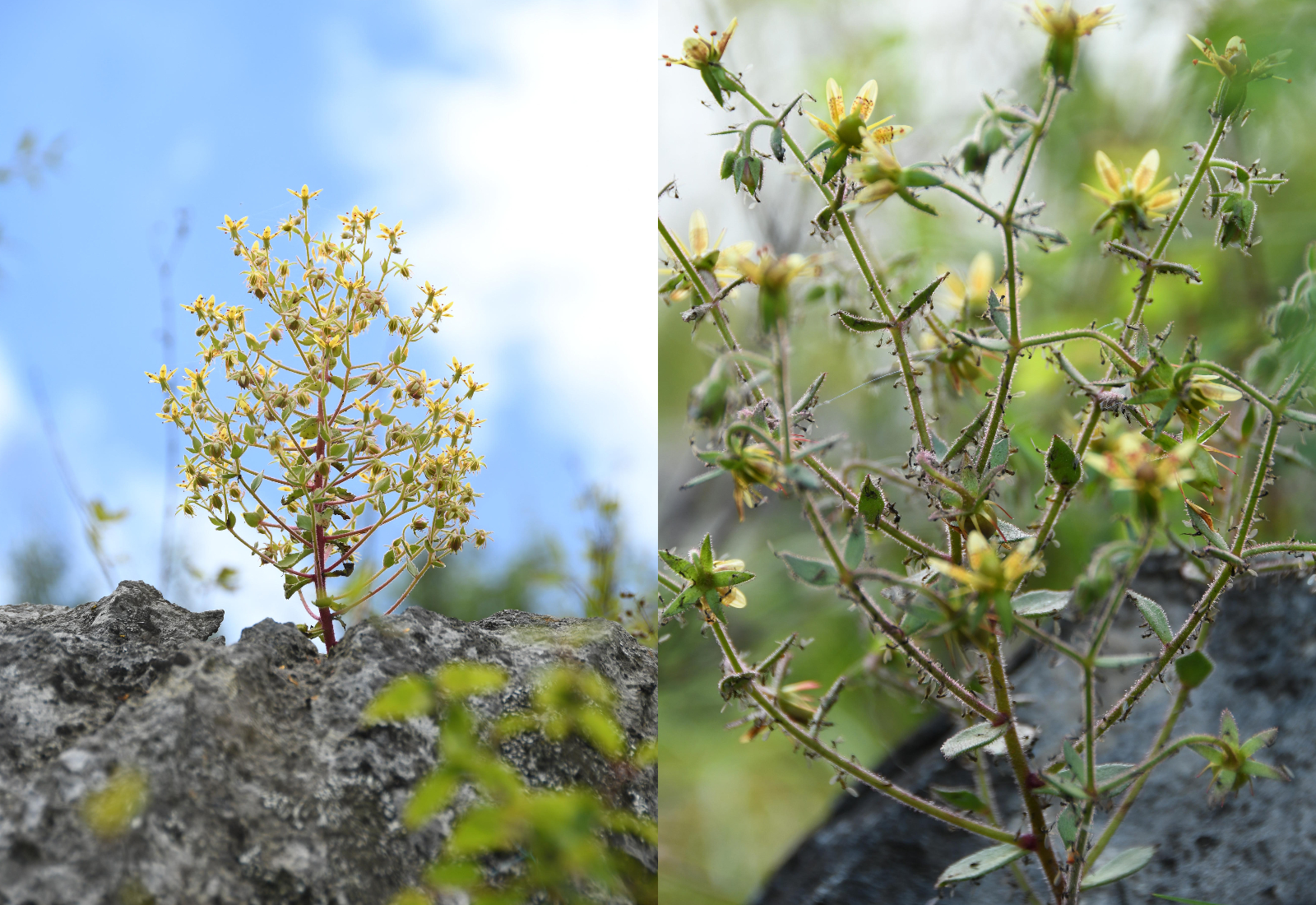
The species, Saxifraga candelabrum, grows at elevations above 8,200 feet (2,500 meters) in the Hengduan Mountains, which connect the southeast portions of the Tibetan Plateau to the Yunnan-Guizhou Plateau.
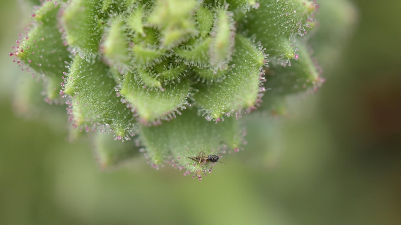
The plant has stems and branches covered in sticky hairs that can trap small insects, predominantly nonbiting midges. However, scientists were unsure if these insects were being ingested by the plant. In a new study, researchers showed that S. candelabrum can digest and absorb nutrients from insects after capturing them, proving that the plant is carnivorous. The scientists published their findings Tuesday (Aug. 4) in the journal Nature Communications.
This is the first demonstrated case of carnivory in the saxifrage plant group, said study co-author Douglas Soltis, a distinguished professor of biology at the Florida Museum of Natural History.
Other carnivorous plants typically grow in moist, boggy soils, but S. candelabrum is found in dry alpine areas, Soltis told Live Science in an email. "These are all nitrate poor soils — that's why this carnivorous habit has evolved a number of times" to supplement the plants in vital nutrients, he said.
In 1875, Darwin theorized that two species closely related to S. candelabrum that also have sticky hairs — S. rotundifolia and S. umbrosa — may be carnivorous, based on their ability to catch insects. But the 19th-century naturalist couldn't show that the plants digested their prey or reused the nutrients in insect tissues — two conditions that are key to confirming carnivory in plants. Without these conditions, a species is considered simply "protocarnivorous," meaning it catches and kills insects or other small animals but doesn't digest or absorb them, according to the study.
"Although untested at the time, Darwin’s hypothesis provided an important inspiration for our study," study co-author Hang Sun, a researcher in the Chinese Academy of Sciences' Kunming Institute of Botany, told Live Science in an email.
The researchers conducted field observations and herbarium surveys of S. candelabrum, which revealed that mature plants with more numerous and longer branches had an average of 71 trapped insects on them. In the herbarium surveys, the team found that 43 out of 45 specimens had caught insects, suggesting that insect-trapping is a widespread phenomenon in this species.
Next, the study's authors showed that S. candelabrum possesses phosphatase, a digestive enzyme commonly found in carnivorous plants. They did this by labeling the phosphatase enzymes with fluorescent molecules to visualize them under a specialized microscope, a technique known as fluorescence tagging.
S. candelabrum secretes a viscous substance that coats its hairs, meaning insects get stuck on the stem and branches if they fly too close. (Image credit: Xin-Jian Zhang)
To determine if S. candelabrum digests and absorbs nutrients from insects, the researchers labeled fruit flies with a stable form of nitrogen before feeding them to the plants. This led to a marked rise in stable nitrogen in S. candelabrum and in a different, known carnivorous species, which the team used as a control group. By contrast, a non-carnivorous plant that formed a second control group did not show an increase in stable nitrogen, indicating that S. candelabrum is carnivorous.
Finally, the researchers performed a genetic analysis, which revealed that S. candelabrum has genes in common with known carnivorous plants that are linked to prey attraction, digestion and nutrient absorption. Together, the results showed that S. candelabrum evolved carnivorous traits to cope with its nutrient-poor environment, adapting its hairs — which were initially used for herbivore defense — into insect traps, according to the study.
Larger insects, which S. candelabrum requires for pollination, rarely get stuck to the hairs, the researchers noted in the study, suggesting that the species has perfectly balanced its needs through evolution.
Other Saxifraga species and plants belonging to the same lineage could turn out to be carnivorous, too.
"Many members of the Saxifragaceae, which includes genera other than Saxifraga, have sticky glandular hairs and are often covered with insects," Soltis said. "I would not be surprised if other members of the family are also carnivorous — as Darwin predicted."
The study broadens the scope of carnivorous plant research, Sun said. "Carnivory may therefore be far more widespread among flowering plants than previously recognized," he said.
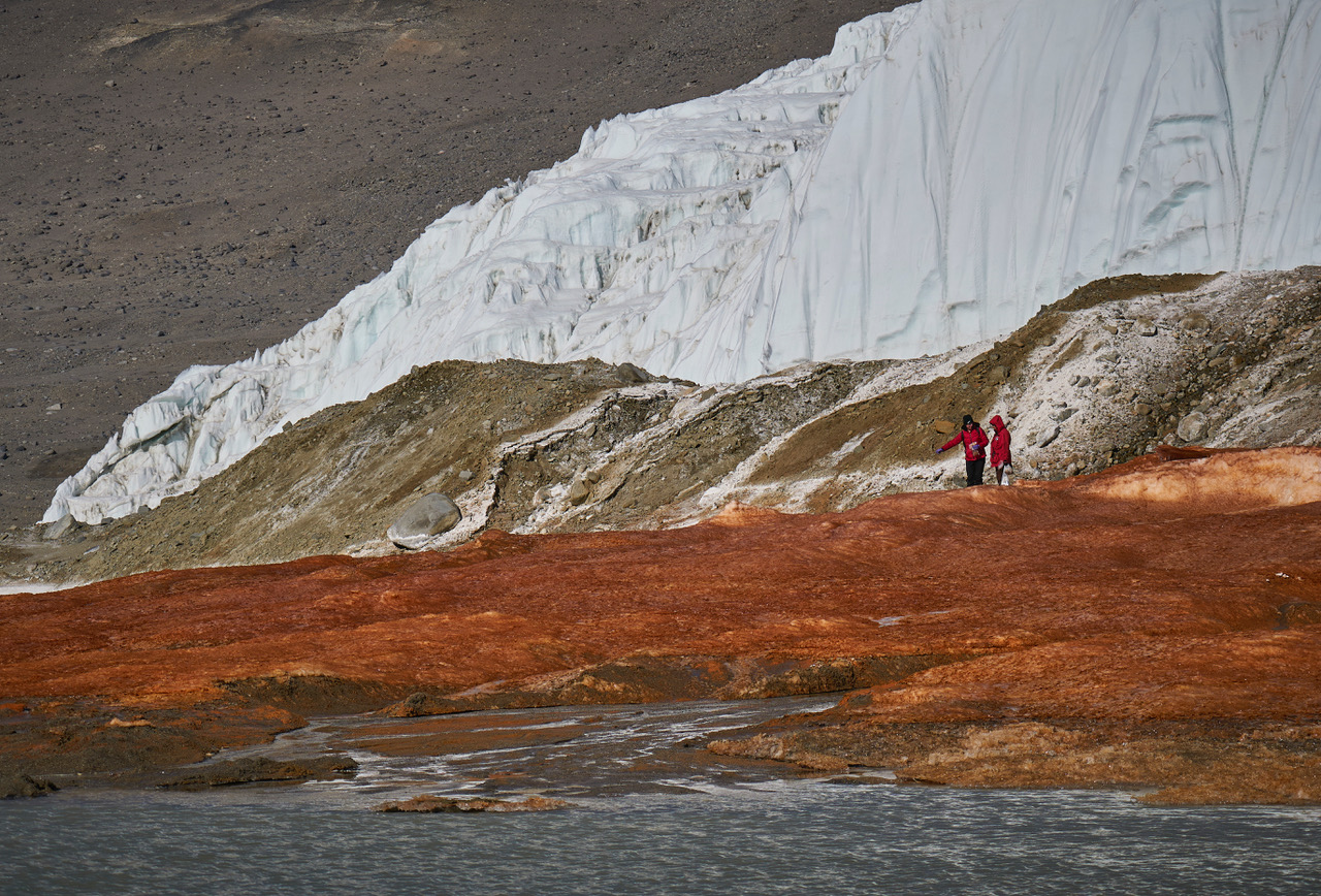
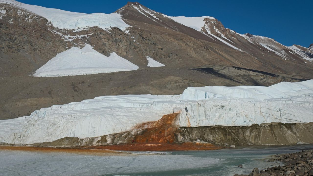
At the end of a glacier deep in East Antarctica's Taylor Valley, there is a haunting waterfall that oozes red brine like a bleeding wound in the ice. Scientists explained the brine's gory hue several years ago, finding that it is exceptionally rich in iron. And now, they may have identified the salty water's origin.
Microbes in the crimson waterfall, called Blood Falls, suggest the brine is composed of ancient seawater that was trapped in a pool beneath the glacier when ocean levels fell and the glacier advanced. However, it's unclear exactly when that happened, researchers noted. Previous studies had already proposed a seawater origin for the brine, based on various chemical signatures and bacteria detected in the liquid, but the new results add molecular and genetic evidence to the mix of clues.
"Findings in this study reveal a dominance of marine eukaryotic lineages in the Blood Falls area" compared with the broader region, known as the McMurdo Dry Valleys, the authors wrote in the study, published Monday (Aug. 3) in the journal Nature Geoscience. "This marine signal is less prominent but still detectable in the prokaryotic structure," the researchers added.
Eukaryotes' cells contain a membrane-bound nucleus and other closed internal compartments. Prokaryotes, by contrast, are single-celled organisms whose DNA floats around freely in the cell, unbounded by a membrane.
To characterize the types of microorganisms present within Blood Falls, the researchers used a suite of genetic techniques to analyze 167 samples of water, sediment and air from around the falls and the broader McMurdo Dry Valleys.
Some researchers argue that Blood Falls' water does not originate from seawater, and suggest the marine bacteria and chemical signatures that point to seawater may have instead reached the falls from the ocean via intense winds, which are common in the McMurdo Dry Valleys. By analyzing samples from various sites in the Dry Valleys, the team behind the new study compared microorganisms from the wider region with those at Blood Falls to determine if Blood Falls has a distinct microbial assemblage potentially left over from ancient conditions.
The researchers found that the crimson brine and associated red-tinted sediments at Blood Falls shared a higher proportion of eukaryotes with nearby oceanic samples than other sites in the Dry Valleys did. Whereas Blood Falls had a little over 9% of its eukaryotes in common with the ocean, the Dry Valleys showed only about 1% similarity, according to the study. The remaining eukaryotes and most of the prokaryotes identified in the paper had freshwater and terrestrial origins.
Researchers tried to determine if microbes at Blood Falls are distinct community from the surrounding region's assemblages. (Image credit: Bryan Minnea)
The results also showed that the air near Blood Falls contained only a tiny proportion of marine microorganisms, suggesting that present-day winds can't fully explain the microbial composition of Blood Falls, the researchers wrote.
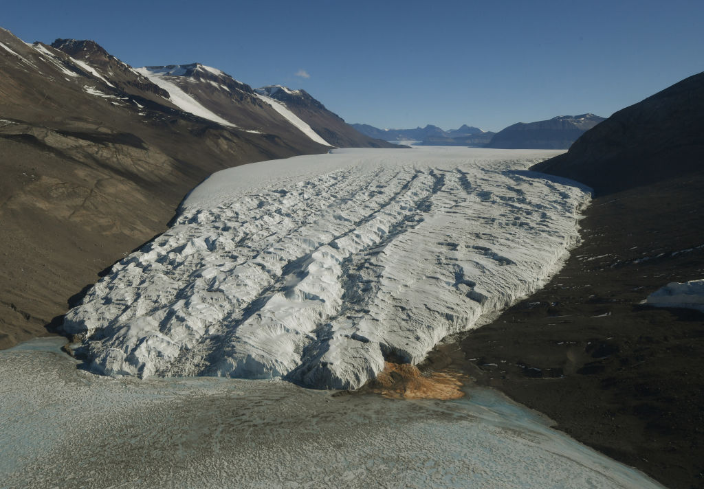
The most likely origin for the brine that feeds Blood Falls is ancient seawater that was trapped when sea levels dropped and the Taylor Glacier advanced, the study found. (Image credit: MARK RALSTON/POOL/AFP via Getty Images)
Therefore, an ancient seawater origin is the most likely explanation for the microorganisms found at Blood Falls today, the team concluded. Winds may have played a role in shaping the community in the past, but now, their influence is probably insignificant, the team added.
The brine that feeds Blood Falls may have become entrapped more than 1 million years ago, during a warm period with higher sea levels and less ice cover than there is now, previous estimates suggested. However, further work, including more comprehensive genetic profiling and mapping of microorganisms, is needed to pinpoint when Taylor Valley's glacier grew to cover the brine, the researchers wrote.
Antarctica quiz: Test your knowledge on Earth's frozen continent
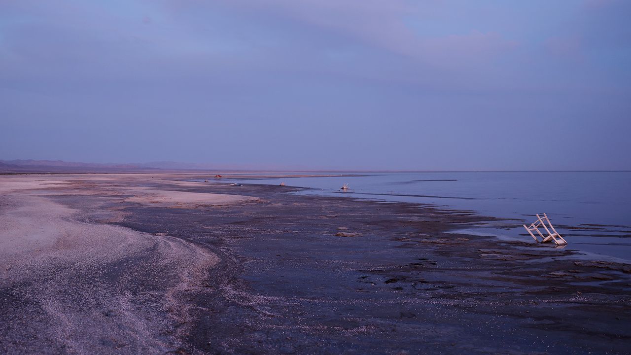
Fifty years after Southern California's Salton Sea formed due to an engineering mishap in 1905, the giant salt lake became a booming vacation destination. Nicknamed the "miracle in the desert," the lake offered watersports and boating, while its shores were lined with yacht clubs, vacation homes, shops and nightclubs.
However, by the 1970s, the Salton Sea had begun shrinking due to high evaporation rates and flow reductions in the Colorado River, which had fed the lake. The lake's retreat exposed muddy sediments imbued with pesticides and other agricultural chemicals from large cotton, alfalfa and vegetable farms in the Imperial and Coachella valleys.
Today, the Salton Sea is a ghost of its former self, but the lake looms larger in the lives of local residents than ever before. Its shrinking shoreline releases toxic particles so tiny that they can penetrate deep into human lungs and enter the bloodstream. Exposure to these particles can raise the risk of a range of respiratory and cardiovascular conditions, including asthma, impaired lung function and heart attacks.
The communities most affected by this pollution are low-income, racial and ethnic minorities that, for socioeconomic reasons, cannot move away or adequately protect themselves.
A study published July 1 in the journal BMC Environmental Science reveals just how bad living conditions are for some communities near the Salton Sea. The authors examined air quality and respiratory health in Latinx and Indigenous Mexican families in the Eastern Coachella Valley, finding that families must change their daily routines to protect themselves from harmful dust events.
To find out more, we spoke with study co-author Ann Cheney, a professor of social medicine, population and public health at the University of California, Riverside School of Medicine. Cheney, who oversees a free clinic for underserved minority communities in the Eastern Coachella Valley, described the daily struggles of families living near the Salton Sea and some of the measures that are needed to improve their quality of life.
Sascha Pare: The Salton Sea has shrunk by 65 square miles (168 square kilometers) and dropped by 14.6 feet (4.5 meters) over the past few decades. Why is that, and how does it affect local residents?
Ann Cheney: The Salton Sea occupies an ancient lake bed that, over the millennia, has been filled, and then dried up again. In the early 1900s, because of an engineering mistake, part of that lake bed filled, and it created the Salton Sea. [Editor's note: The sea formed when Colorado River floodwater breached an irrigation canal that was under construction in the Imperial Valley.]
Then, over decades, there were changes in the composition of the sea because the main source of water was agricultural runoff. The sea is located in the inland southern Californian desert region. In the 1940s and 1950s, there was a boom in agribusiness. This remade the landscape, and all of those chemicals and pesticides from the agricultural land seeped into the lake bed.
With [water management] decision-making around the Colorado River waters, that then meant that another source of water, which had been the Colorado River, ceased to enter into the Salton Sea. 2018 was the last time that water from the Colorado River touched the Salton Sea.
Once a booming vacation destination, the Salton Sea is now the site of an environmental disaster that affects neighboring communities. (Image credit: Mario Tama via Getty Images)
Because there is the primary source of agricultural runoff going into the sea and no new fresh water coming in — and with climate change [boosting evaporation] — it's created this environment in which you have a drying sea. Over decades, there have been chemicals and heavy metals seeping into the playa [dry lake bed], and now it's exposed. It's the desert, so there's a lot of dust storms, and the winds take the exposed playa and bring it into the air, which is then breathed by the local residents.
For me, what's most concerning is that the local residents who are most affected by the poor air quality are Latinx and Indigenous Mexicans, many of whom are undocumented and have very little political voice.
SP: You asked caregivers of children with asthma and other respiratory conditions to document their experiences of living near the Salton Sea. What did those submissions reveal?
AC: When I first started doing this work, I thought about it as solely the Salton Sea [affecting people]. But it's the environment in which the Salton Sea is one contributor to poor air quality [that impacts local residents].
The caregivers perceive the Salton Sea as being a contributor to the poor respiratory health of their children. But also, this area has many disenfranchised communities that are interspersed on tribal lands, and there are different rules on these tribal lands. There is a lot of dumping and a lot of burning of trash. What we heard from caregivers is that it's not just the exposure to the toxic dust, but also the fires [that are causing issues].
A photograph submitted by one of the caregivers shows a door mat covered in dust outside their front door. (Image credit: Trinidad et al (2026). CC BY 4.0)
In that article that we published [July 1 in BMC Environmental Science], there was an incident in which there was a fire — I think it was related to tire burning — in very close proximity to one of the apartments that one of the caregivers and her family were living in. These things happen commonly. So, from the perspective of the caregivers, there are multiple different factors that contribute to their children's poor respiratory health.
SP: Can you take me through a day in the life of one of these caregivers, based on the evidence you gathered?
AC: It could be a beautiful day. The caregiver walks outside. It's sunny; everything's beautiful. In my opinion, this environment is very beautiful. Maybe, later on in the day, there is a pickup of wind, and there's dust. Let's say the caregiver is a mother with a child who has asthma who's at school. The children are outside on the playground. Her child is going to be highly affected by the dust that's being picked up by the wind. What's going to happen is, the school will bring the child inside, and if the child doesn't have too severe of a respiratory distress, the child could stay at school. Otherwise, the caregiver will get called and have to come to school and pick up their child.
Most folks in that region are farm laborers. They're not owners of farms; they are the ones who are working the land for the owners. Many individuals who are living in very impoverished conditions — for instance, the Purépecha community, which is the Indigenous community we worked with that's from Michoacán in Mexico — are pickers. They are in the lowest-social-ranking jobs within farm labor, and, in part, that's because they may be monolingual Purépecha. That means they don't speak Spanish or English, and that limits the type of employment they can have.
In a situation where you have this very precarious employment, if your child needs to be taken out of school and you are the caregiver, then you risk losing your job. That's the type of dynamic that's at play among many of the families that we work with.
SP: What are the long-term consequences of living day after day in these conditions?
AC: It's a really poor quality of life for children, especially. There's a picture that a caregiver took of her child that I think exemplifies so well the experience of children and their quality of life. The child is just lying on the floor in their home. The photo illustrates the child's lethargy and the boredom and the fact that caregivers often choose to have their children stay inside, because they can better control the indoor air quality. They can't necessarily control what's going to happen outside, but they can control indoor air quality.
The problem is, if the family doesn't have the resources to have an air filter to clean and purify the air, for instance, then what we've noticed in our research is that there can still be very poor indoor air quality, particularly when there's more extreme weather events like fires or dust storms.
With the research, I anticipated very poor quality of life for children. But what I understood less was that it also means poor quality of life for their families, and particularly for mothers, who are often the primary caregivers. It really affects their mental health and well-being.
SP: Currently, are there any measures in place to protect these families?
AC: There has been Assembly Bill 617, which was a measure to engage members of the communities that are most affected by the Salton Sea environment in a process of mitigating the effects of the sea. From that, there have been a lot of community meetings. Years ago, I started to participate as one of the advisory board members. It became a bit frustrating — and I think this illustrates the history of frustration in this region — because government entities come in with resources and money. But it's very top-down, and often the community gets upset and frustrated because they don't see these agencies making changes in the community. There's a lot of talk and very little action.
There are also monies that have been dedicated to Salton Sea restoration, and there's been an ongoing conversation about a 10-year plan to mitigate the effects of the drying of the sea. But the focus has been primarily on wildlife, not human health. Only more recently have there been conversations about human health and the public health implications.
One of the caregivers in the study submitted this image of the medication their child needs to take daily. (Image credit: Trinidad et al (2026). CC BY 4.0)
For individuals who have a specific diagnosis of asthma, they may qualify for retrofitting. That means they will receive money through their health insurance to be able to invest in improving their home. That might mean taking out carpet [which can capture dust], or maybe fortifying windows or doors — things like that. But it's a really small amount of money. It can help to a certain degree, but I think in this community, in particular, they may not always know how to navigate the healthcare system to get access to that type of resource. In addition, the most vulnerable people in this community don't have access to health insurance.
SP: What more could be done to improve people's quality of life in this community?
AC: We installed air-quality monitors in people's homes, and we spent a lot of time collaborating with communities in this region. Some live in apartment complexes; some live in single-family homes. But the majority live in mobile home parks, in which they're living in very old, dilapidated trailers. The land is dirt. It's an area that is very impoverished.
So, when I think about these communities, in particular, they can't protect themselves from the external environment. In terms of policies, [I wonder] how we can put money toward building housing that is not trailers and can really protect people from the dust. Right now, the wind is bringing dust into the homes. We need to find ways to actually keep the homes sealed.
This image submitted by one of the caregivers shows a blurred highway during a dust storm. (Image credit: Trinidad et al. BMC Environmental Science, 2026. CC BY 4.0)
SP: The Salton Sea is a hotspot for lithium, and although there are currently no active lithium mines in the region, policymakers and private companies are investigating the sea's potential to host one. How might lithium mining affect the families you worked with?
AC: That conversation's been going on for several years now. At the moment, it's not as much a community concern, because there's been very little movement [to open mines]. There was a lot of action and movement about three or four years ago. But it's been a few years since they've been testing the prototype, and it doesn't seem like it's gone to scale, where they would have been able to commercialize it.
Initially, the community was quite upset, because it's just another example of the lands being exploited and other people benefiting. Typically, the beneficiaries are individuals who are not originally from the community and who have professional degrees. They get the resources, and they get to make decisions about the resources. Then, the conversation was, "Well, but if we have this type of business coming in, then it can create jobs." But we know that it creates jobs for individuals who have professional degrees, or they'll have to get some type of training; they're not jobs for farmworkers or individuals who are undocumented.
SP: Other lakes around the U.S., including Utah's Great Salt Lake, are shrinking and exposing toxic sediments that are then blown into residential areas. Do those drying lakes have similar effects on local communities?
AC: There is a film director [Abby Ellis from around the Great Salt Lake] who, I think two years ago, came to the Eastern Coachella Valley and met with myself and my team members. She said, "I want to get a sense of what's going on here, because this is essentially where we are going to be 10 or 15 years from now."
I had the opportunity to very briefly chat with her, but also view the trailer for her documentary. One of the distinctions between the communities surrounding the Great Salt Lake and the Salton Sea is the color of the skin of those living around these bodies of water. In Utah, it seems to be more so individuals who maybe are middle class, or have a certain access to resources — people who can have a political voice and organize and say, "We don't want this to happen." It will be interesting to see if there can be more change in communities where there are more affluent people living near these bodies of water.
This interview has been condensed and edited lightly for clarity.
Runoff from Greenland's rapidly melting ice sheet could severely disrupt currents in the Atlantic Ocean that regulate the global climate, researchers say. But the fresh water won't trigger the complete and irreversible collapse of the circulation that some research predicts, a new study suggests.
By 2100, Greenland meltwater could cause a reduction in the strength of the Atlantic Meridional Overturning Circulation (AMOC) equivalent to an additional 10% to 20% on top of the weakening that many scientists already expect for this huge system of currents, researchers found.
Previous research suggests the AMOC, which moves heat from the tropics to the Northern Hemisphere and cold water back south toward Antarctica, is at its weakest in more than 1,000 years due to Arctic ice melt and soaring ocean temperatures. Models indicate that the circulation will continue to weaken for decades to come, potentially unleashing freezing weather in Northwest Europe, additional sea-level rise along the U.S. East Coast and droughts around the equator.
The AMOC loops around the Atlantic Ocean, bringing warm waters north along the ocean's surface and cold waters south along the ocean floor. (Image credit: NASA/Goddard Space Flight Center Scientific Visualization Studio)
The new study revealed that by 2300, Greenland's ice sheet could cause a whopping 40% of AMOC weakening on top of the declines projected by some climate models if we continue to cook the planet. The results highlight the effects on the AMOC of a growing freshwater pulse from Greenland that most climate models currently don't take into account, the authors said.
"By the year 2100, yes, we have something, but the greatest fraction is what we add later," study co-author Jost von Hardenberg, a professor in the Department of Environment, Land and Infrastructure Engineering at the Polytechnic University of Turin in Italy, told Live Science.
Meltwater from the Arctic and Greenland slows the AMOC by preventing the formation of deep currents in the North Atlantic that drive the circulation south toward Antarctica. Deep currents form when masses of cold, salty water sink to the seabed, but inputs of fresh water and rising water temperatures are blocking this step by diluting and warming surface waters.
While Arctic meltwater is commonly integrated into climate simulations, researchers have been slower to include runoff from the Greenland ice sheet in models, partly because this runoff may not be as disruptive as Arctic meltwater on shorter timescales, von Hardenberg said.
"In order to represent correctly the Greenland melt, you need a specific, dynamic model for the Greenland ice sheet. It's nice to have, but it requires a lot of resources to develop," von Hardenberg said
The Community Ice Sheet Model version 2 (CESM2) is one of the few available simulations of the Greenland ice sheet. For the study, von Hardenberg and his colleagues used a global climate model called EC-Earth3, which does not include the Greenland ice sheet. The team added the ice sheet from CESM2 to explore how it might affect the AMOC over the next few centuries. Adding the ice sheet separately enabled them to compare AMOC weakening with and without Greenland, clearly revealing the impact of the ice sheet on the AMOC's strength.
The results, published June 19 in the journal Science Advances, suggest the Greenland ice sheet will have a big influence on Atlantic ocean currents, especially after 2100.
"Greenland starts really melting strongly only after that date," von Hardenberg said. "If you go farther in our simulation — we go up to the year 2300 — that is also when this meltwater really becomes extremely strong."
Yet unlike other studies that show the AMOC collapsing irreversibly under climate change, in this model, the circulation recovered once the team switched off the meltwater or dialed down greenhouse gas emissions. Both the simulations that didn't include the Greenland ice sheet and those that did had similar results, recovering partially when the meltwater was turned off and fully when greenhouse gas emissions were stopped.
The recovery in the model suggests that the AMOC is more stable than previously thought and doesn't suddenly flip from an active state into a collapsed one, von Hardenberg said. "It's consistent with a strong weakening, but not a shutdown," he said.
Overall, the findings show that it is important to include the Greenland ice sheet in climate models — something von Hardenberg and his colleagues are planning to do in the next version of the EC-Earth3 model.
"It's really something which is worthwhile doing to better constrain the uncertainty of these future simulations," von Hardenberg said. "If we have a larger set of models which include this component, we will be in a better position to try to answer the question, 'How much do we expect AMOC to decrease in different scenarios?'"
Other experts agreed that integrating the Greenland ice sheet in climate models will increase the accuracy of AMOC predictions.
"What makes the study particularly interesting is that it directly tests a process that has often been highlighted as an important source of uncertainty in future AMOC projections," said Jonathan Baker, a senior climate scientist at the Met Office in the U.K. who was not involved in the study.
The results are consistent with previous research showing that Greenland meltwater causes additional AMOC weakening, but whether the system could collapse is still uncertain, given that the team used only one model, Baker told Live Science in an email. "Repeating these experiments across a wider range of models will be important to assess how robust the findings are," he said.
Nicholas Foukal, an assistant professor at the University of Georgia's Skidaway Institute of Oceanography who was not involved in the study, said he doesn't think the use of a single model limits the analysis.
"I think this result is robust and I am glad to see the authors come to this conclusion in such a high-resolution and realistic coupled climate model," Foukal told Live Science in an email. "This finding also agrees with other modeling results that require immense amounts of fresh water, much more fresh water than is available on Greenland, to cause irreversible change in the AMOC."
However, a third expert said the model used in the study is unrealistic, because its parameters make the AMOC more resilient than those of other models. Therefore, the study should be replicated in other models to draw unbiased conclusions.
"While the experiment reported is interesting, its outcomes are neither surprising nor should be interpreted as exemplary for the whole model ensemble," Sybren Drijfhout, a professor of physical oceanography at the University of Southampton in the U.K., told Live Science in an email.
Researchers should investigate the impact of the Greenland ice sheet on the AMOC further, von Hardenberg said. "It would be interesting in the future to check it [the AMOC's recovery with Greenland meltwater] with other models, but of course it's encouraging to see it in one case," he added.
Why it's incredible: It is the deepest lake in China and sits at the top of a giant volcano.
Heaven Lake is a crater lake at the top of Mount Changbaishan (also called Changbai Mountain) — a colossal, dormant volcano on the border between China and North Korea that formed through successive eruptions over the past 2.6 million years.
Known in China as Tianchi, the lake is the highest and largest crater lake in Northeast Asia, according to UNESCO. It is also the deepest lake in China, according to a study published in March. The lake sits at an elevation of around 7,200 feet (2,200 meters), covers roughly 3.6 square miles (9.2 square kilometers), and has a maximum depth of 1,224 feet (373 m), according to the study.
Heaven Lake is surrounded by 16 peaks that belong to Mount Changbaishan. The lake fills a caldera created by past eruptions, the biggest of which was the "millennium eruption" that took place in A.D. 946 and remains one of the largest eruptions in modern history.
Water started to pool on Mount Changbaishan's summit after the prehistoric Tianwenfeng eruption, which scientists dated to between 70,000 and 40,000 years ago. Heaven Lake has periodically emptied and refilled since then due to precipitation, snowmelt, and an active geothermal system beneath the volcano that forces water up through fault lines.
Although hundreds of reports in the early 2000s claimed there was a creature with a head shaped like that of a horse living in the water, scientists have repeatedly said they are skeptical that any large creature could survive in Heaven Lake.
Mount Changbaishan is one of the best-preserved stratovolcanoes from the past several million years, according to UNESCO. Stratovolcanoes, also known as composite volcanoes, are volcanic mountains built from alternating layers of solidified lava, volcanic ash and rocky debris. Mount Changbaishan is an "open-air classroom for volcanism" because it recorded the different stages of multiple eruptions in astounding detail.
In North Korea, Mount Changbaishan is known as Mount Paektu or Paeku Mountain, meaning "white-topped mountain." The volcano's Chinese name means "forever white mountain."
China, North Korea and South Korea have clashed over the volcano in the past, as the mountain holds cultural and geopolitical significance for the three countries. Two border treaties between China and North Korea in 1962 and 1964 divided the volcano and Heaven Lake roughly down the middle, with North Korea securing 54.5% of the lake.
In the 2000s, China moved to develop the region around the volcano, opening the Mount Changbai Airport and the Mount Changbai Eastern Railroad to connect the region with the rest of the country.
A geological park surrounding the Chinese site of the volcano was officially designated a UNESCO Global Geopark in 2024.
Discover more incredible places, where we highlight the fantastic history and science behind some of the most dramatic landscapes on Earth.
Scientists in Australia are deep-freezing koala eggs and sperm as a "genetic backup" to save the wild population from future extinction.
The backup could be used to create healthy koala embryos through artificial insemination and in vitro fertilization (IVF), the researchers said in a statement. When koalas (Phascolarctos cinereus) die, unique traits and diverse genes that may help them adapt to changing environments are lost, but the new project offers a way to store this valuable material, the team said.
"Losing genetic diversity can weaken future generations and decreases the ability of the species to adapt to challenges," Andres Gambini, a reproductive biologist at the University of Queensland who is involved in the project, said in the statement. "This project will create a safe and systematic way to rescue and preserve koala spermatozoa and eggs to support future conservation programs."
Australia is facing a paradox with its koalas. In some regions of Queensland and New South Wales, koala populations have crashed by as much as 80% since the late 1990s due to deforestation, bushfires, drought and disease. This prompted the Australian government to change koalas' conservation status in their eastern range from "vulnerable" to "endangered" in 2022.
Meanwhile, in parts of southern Australia, koalas are overabundant. However, the places where koalas are currently thriving may not be able to support a booming population much longer, because the animals are overbrowsing and killing the trees they need to survive, recent research suggests.
To protect against koalas' decline, the scientists will freeze koala reproductive cells in liquid nitrogen (LN2), which has a boiling point of minus 321 degrees Fahrenheit (minus 196 degrees Celsius). This method would enable the team to cryopreserve the cells for several decades until they are needed, said Vincent Lynch, an evolutionary developmental biologist and associate professor of biological sciences at the University at Buffalo in New York.
Every year, many koalas are admitted to wildlife hospitals because of illness or injury and sadly, not all of them survive.
Andres Gambini, reproductive biologist at the University of Queensland
"I've successfully woken cells up that were frozen in LN2 a couple of decades ago," Lynch, who is not involved in the koala project, told Live Science in an email.
The sperm and eggs will be supplied by wildlife hospitals that will harvest sex cells from dead koalas or koalas that can no longer breed due to disease or trauma, according to the statement.
"Every year, many koalas are admitted to wildlife hospitals because of illness or injury and sadly, not all of them survive," Gambini said.
The researchers will then test the cells for Chlamydia pecorum, a highly contagious and deadly form of chlamydia. In koalas, this infection causes painful urinary tract infections, gastrointestinal issues, and conjunctivitis, which can lead to blindness. It can also cause infertility in females. C. pecorum is one of the main contributors to koalas' decline in recent years, with infertility driving a sharp reduction in the number of koala joeys being born. In the worst-affected populations, situated mostly in Queensland and New South Wales, almost 90% of koalas are infected with chlamydia.
If the reproductive cells contain C. pecorum, "we have the technology now to remove the infection from the samples," Steve Johnston, an associate professor of animal reproduction and captive husbandry at the University of Queensland who works on the koala project, said in the statement.
Andres Gambini and doctoral student Patricio Dandy Palacios, who participated in the project, want to preserve koala sex cells in liquid nitrogen. (Image credit: The University of Queensland)
In 1998, Johnston was part of a research team at the University of Queensland that created the world's first koala joey born through artificial insemination. The new project also builds on a 2025 study, led by Gambini, that produced the first-ever IVF kangaroo embryos. (These did not result in live births; at the time, the scientists said that would take another decade.)
It's unclear how many sperm and egg cells the researchers plan on freezing, and it's hard to say how many cells they would need to ensure the survival of healthy koala populations, as the number of cells required is probably increasing with time, Lynch said. As koala populations shrink, genetic material is being lost at an accelerating pace, so the team will have to get more samples as time goes on to obtain the same amount of diversity.
The project does not replace more traditional conservation approaches — such as habitat protection, disease management and population monitoring — but researchers cannot afford to wait until populations are smaller and genetic diversity is harder to recover, Gambini said.
Although conservationists are concerned about the fast rate of koalas' decline, "there is a chance" that scientists can save the species through cryopreservation, Lynch said.
"I support multipronged approaches like this," he said. "By preserving the environment with traditional conservation we allow re-introductions because the species have somewhere to live."
Engineers have designed a waterproof "diving suit" for cyborg cockroaches that enables the hybrid insects to survive and roam underwater for up to three hours. This function expands the capabilities of cyborg insects and could one day be deployed in disaster zones, according to the team.
A built-in oxygen generator and silicone tubes deliver the gas directly to a cockroach's breathing holes, known as spiracles. The design is adapted for use in low-oxygen conditions as well as submerged environments, the researchers said in a new study published June 29 in the journal Nature Communications.
"Our approach combines a soft waterproof shell with a simple yet reliable chemical oxygen generator," study co-author Shinjiro Umezu, a professor in the School of Creative Science and Engineering at Waseda University in Japan, said in a statement. "This allows the insect to retain its natural mobility while being protected from an environment that it cannot normally survive in."
Cyborg insects are living insects that have been fitted with electronic controllers that guide their movements. Researchers have previously used them in search-and-rescue operations to access and investigate hard-to-reach areas; for example, they were used in rescue efforts after the devastating magnitude 7.7 earthquake in Myanmar in March 2025 that killed at least 3,700 people and injured 4,800 more. The advantage of cyborg insects over tiny robots is that the former employ insects' muscles to move, whereas the latter rely on high-power batteries that consume energy and can run out of steam.
The cyborg insects deployed in Myanmar were developed in the laboratory of Hirotaka Sato, senior author of the new study and a professor in the School of Mechanical and Aerospace Engineering at Singapore's Nanyang Technological University.
Sato has spent more than a decade pioneering cyborg insect technology. He and colleagues hope the new diving suit will extend cyborg insects' operational range to include flooded and partially submerged areas in disaster zones.
The suit consists of a flexible shell, four silicone tubes that attach to the spiracles and a transparent, 3D-printed oxygen tank. To make the tank produce oxygen, the researchers sprinkled manganese dioxide onto a highly absorbent sponge inside the tank. They then injected a small amount of diluted hydrogen peroxide, which breaks down slowly in the presence of manganese dioxide to produce oxygen. Finally, the team sealed the tank with ultraviolet adhesive to prevent leaks.
"The key engineering challenge was to build a system that was small, light and flexible enough for the insect to wear, while still producing enough oxygen for long-duration underwater movement," Umezu said.
The silicone tubes send oxygen straight into the thoracic spiracles, while the abdominal spiracles, which are lower down the insects' bodies, take in the oxygen contained in the suit.
"Our new insect diving suit works like the oxygen tank used by human divers," Sato said in the statement. The silicone tubes can be attached and removed without pain or harm to the insect, the researchers added.
The researchers tested the suit on a cyborg Madagascar hissing cockroach (Gromphadorhina portentosa), which they placed in a water tank and later sent into a plastic tube that simulated submerged and low-oxygen environments.
The suit enabled the cockroaches to roam underwater for up to three hours, raising the prospect that cyborg insects, including locusts and beetles, could one day be used to inspect flooded pipes, drains, tunnels and other hard-to-access places.
Next steps include improving the diving suit to potentially include sensors and a navigation system; and testing the design in simulated disaster environments, according to the statement.
A simple method to thicken Arctic sea ice has shown promising results in its very first field experiment, performed in Cambridge Bay, Nunavut, Canada.
Researchers are considering several controversial geoengineering techniques to slow the catastrophic melt of Arctic sea ice, including stratospheric aerosol injection, which involves shooting tiny sulfur particles into the sky to blot out the sun. But in a new study, scientists evaluated the merits of a much safer and more straightforward approach: pumping seawater onto existing sea ice in winter and letting it freeze into a reinforcing layer.
Known as sea ice thickening, this method has been used by Nordic and Arctic communities for decades, and ice hockey rinks employ a similar technique to keep their ice sturdy, two of the study's authors told Live Science in an email.
"Practical applications [that already exist] include building ice roads and creating platforms for offshore oil exploration," said Edward Blanchard-Wrigglesworth, a research associate professor in the University of Washington's Department of Atmospheric Sciences, and Andrea Ceccolini, an honorary professor at University College London and the CEO of the startup Real Ice, which studies artificial sea ice thickening methods and receives funding from the U.K. government.
Modeling work hints that sea ice thickening could become a climate adaptation tool for Arctic communities by limiting coastal erosion near towns, facilitating travel and supporting animal migrations and hunting.
Now, researchers have assessed the method's efficacy in the field for the first time. Their results, published May 22 in the journal Earth's Future, indicate that both the thickness and brightness of sea ice can be enhanced significantly on small scales — making the ice more reflective, and therefore more resilient to melting.
In the experiment, the team set up eight test areas and three control sites in Cambridge Bay during the winter of 2024 to 2025. Using submersible pumps that each consume less power than a toaster, they flooded the test areas either once or twice with up to 8 inches (20 centimeters) of seawater, while the control sites were never flooded. In spring, one control site was used for a melt pond drainage experiment, which involved drilling small holes in the ice to remove meltwater and expose the brighter ice underneath.
Overall, the test areas grew up to 12.6 inches (32 cm) thicker than the control sites by the end of winter, which is roughly equivalent to the ice thinning that has happened in the Arctic over the past 50 years, according to the study. Test areas that were flooded twice showed greater thickening than those flooded once. And in the melt period from late May to September, sea ice in the test areas appeared brighter and had slower melt rates, remaining thicker than the ice in the control sites. The melt pond drainage experiment also resulted in brighter sea ice than the other control sites.
When water is pumped onto sea ice, it saturates the snow that sits on top of the ice. "The snow-water mixture freezes into a new layer of ice, while the reduction in snow insulation allows colder atmospheric temperatures to accelerate natural ice growth from below," Blanchard-Wrigglesworth and Ceccolini explained.
Sea ice thickening could boost the amount of sunlight that is reflected back to space in the Arctic, thus cooling the region. (Image credit: Mario Tama/Getty Images)
Thicker sea ice is usually brighter than thin sea ice, which boosts the amount of sunlight that is reflected back into space. "The broader implication is that these effects could enhance the Arctic's reflectivity through both increased surface brightness and longer-lasting sea ice," the researchers said. "If similar results could eventually be achieved at larger scales, increased Arctic albedo could contribute to regional cooling, with potential knock-on benefits such as slowing permafrost thaw and reducing ice loss from Greenland."
However, there is still a big question mark over how scalable and economically viable sea ice thickening is, given that it requires people and machines working in the field. According to a 2016 study, 10 million wind-powered pumps would be needed to cover just 10% of the Arctic Ocean, and 100 million to cover the entire Arctic. "It is reasonable to ask whether such an endeavor is financially feasible or even logistically possible," the authors of that study wrote.
Yearly sea ice extent in the Arctic has shrunk by 20% since 1979, and this loss is accelerating with global warming. Therefore, if we want Arctic sea ice thickening to work at a large scale, "the pumps must be deployed almost immediately, while there is still a sufficient area of sea ice over which to flood," researchers wrote in a 2021 study.
The ecological and social impacts of Arctic sea ice thickening are not well understood, and further research will delay deployment, meaning it might be too late to roll out sea ice thickening by the time scientists have the data they need to ensure its safety and feasibility.
For these reasons and others, including governance issues and high maintenance needs, "sea-ice thickening is simply not feasible for use at a scale and at a rate that would be meaningful for sea ice protection," researchers wrote in a review published last year.
Deployment on anything but local scales would be challenging, Blanchard-Wrigglesworth and Ceccolini agreed. Nevertheless, the researchers said their most recent winter trials, which have yet to be published, showed encouraging results. In those trials, the sea ice in test areas grew 20 inches (50 cm) thicker than in control sites, The Guardian reported.
"We expect to have a clearer picture once the current melt season is complete," the researchers told Live Science. "In parallel, we are developing underwater robotic technology that could support autonomous deployments. Earlier this year, we conducted the first Arctic field tests of a prototype re-icing drone in Finland."
The drone is currently being refined in collaboration with the BioRobotics Institute in Pisa, Italy, according to The Guardian.
Earth's oldest known impact crater formed when a meteorite slammed into what is now Australia about 3 billion years ago — 470 million years later than scientists previously claimed, a new study suggests.
The impact crater, known as the North Pole Dome crater, is located in Western Australia's Pilbara region, which is home to some of the planet's oldest rocks. It remains a record-breaking structure, beating the world's next-oldest known meteorite impact crater — the Yarrabubba impact structure, also in Western Australia — by roughly 800 million years.
"While the site had previously been identified as an ancient impact structure, its exact age remained uncertain," study first author Chris Kirkland, a professor in the School of Earth and Planetary Sciences at Curtin University in Australia, said in a statement. "The impact left a 'mineral clock' behind. By dating minerals that were remade or newly grown in the damaged rocks, we can now pin down when this extraordinary event happened."
For the new study, Kirkland and his colleagues used advanced mineral dating techniques to estimate the ages of zircon, apatite, calcite and muscovite in shatter cones from the North Pole Dome crater. The researchers analyzed two samples of shatter-cone-bearing rocks, as well as a shocked quartz vein — a sheet-like deposit that typically forms when superhot, mineral-rich water circulates in the cracks between shocked rocks.
Researchers analyzed zircon and other minerals in North Pole Dome rocks. (Image credit: Curtin University)
"The key evidence comes from zircon, a tiny but extraordinarily resilient mineral that can keep geological time for billions of years," Kirkland said. "Some zircons at North Pole Dome have unusual branching, skeletal shapes. We interpret these as impact-modified crystals, formed when older zircon was disrupted, partly recrystallised, and in places regrown during the intense heating caused by the impact."
The age recorded in zircon was the same as that locked inside apatite minerals, giving the researchers confidence that the impact occurred a little more than 3 billion years ago. The younger shatter cones in the Science Advances study may have formed subsequently due to tectonic and thermal activity, the team wrote in the new paper, which was published Tuesday (June 23) in the journal Geology.
"Ancient impact craters are incredibly difficult to date because over billions of years, rocks are altered by heat, pressure and fluids, which can obscure or reset the original impact signals," Kirkland said. "The new age places the North Pole Dome structure as Earth's oldest known impact crater and the only recognised example from the Archean eon [4 billion to 2.5 billion years ago], a time when the planet's earliest continents were forming."
Planet Earth quiz: What do you know about our planet's most amazing features?

 Login