
❌

Reading view

Is modern farming sustainable?

Since the 1850s, plowing and clear-cutting in modern agriculture have increased how fast soil erodes in the Upper Mississippi River Valley. Across the globe, farming strips soil up to 100 times faster than natural processes. It also removes farmable land and clogs waterways, threatening long-term environmental sustainability. However, scientists in the past have struggled to separate the effects of land-use changes from the transition out of the last ice age over the past 20,000 years. 

To determine whether current farming practices are sustainable, researchers from Minnesota recently measured the speed at which soil eroded during the ice age transition and compared it with modern agricultural erosion. They focused on the Trout Creek tributary of the Mississippi River. This tributary has 2 step-like formations, or terraces, on its bank that represent past floodplains before the river eroded to its current level. 

The oldest, upper terrace is about 14 meters (50 feet) above the lower terrace, which is about 8 meters (26 feet) above the modern floodplain. Scientists studying nearby areas have suggested that the terraces contain sediment from the last ice age, 20,000 years ago, referred to as the Last Glacial Maximum, to today. 

In the upper terrace, the researchers pushed an empty cylinder into the ground, like a straw into a layer cake, to collect a cylindrical sample of sediments about 4 centimeters (1.5 inches) wide and 6 meters (20 feet) deep, called a sediment core. They collected slices of this core from 2 meters (6 feet) and 6 meters (20 feet) to find the terrace’s age. 

Some grains in the sediment trap electrons while buried and release them when exposed to light. So the team shone light on the sediment slices to stimulate these electrons and measure the intensity of light emitted, known as their optically stimulated luminescence. Brighter light emissions indicate the sediment is older and was buried for a longer period of time. Using this method, they confirmed that the deep sediment slice was 22,000 years old, and the shallow sediment slice was 20,000 years old, dating the terrace back to the Last Glacial Maximum.

Next, the team drilled into the upper terrace with an auger to collect 25-centimeter (10-inch) wide plastic tubes of sediment. They pulled 4 samples from 0 to 2 meters (0 to 6 feet), and 1 sample from 6 meters (20 feet) deep. They explained that minerals in the sediment called quartz produce the radioactive form of the element beryllium, known as 10Be, when exposed to the Sun, so low 10Be means the sediment was buried quickly and had little sun exposure. The team measured the concentration of 10Be in each sediment sample and used an online calculator to estimate how quickly it eroded. The researchers calculated that during the Last Glacial Maximum, 0.073 millimeters (0.003 inches) of surface sediment were removed per year.

The researchers collected similar samples from the lower terrace and used optically stimulated luminescence to determine that it was between 22,000 and 14,000 years old. This terrace was the floodplain during the transition out of the Last Glacial Maximum, or deglacial period, where temperatures warmed and permafrost retreated. They measured the concentration of 10Be in samples from this terrace and determined that 0.049 millimeters (0.002 inches) of surface sediment were removed per year. 

Finally, the researchers measured 10Be in a sediment sample from the modern floodplain, deposited between 14,00 years ago and today. They found that the sediment had eroded 0.053 millimeters (0.002 inches) per year during that interval, at a rate slower than it had during the glacial period, but similar to the deglacial period. 

The researchers compared their findings to the average soil loss caused by modern agriculture, as reported by 4 previous scientists studying the area. They saw that modern farming removes an average of 0.60 millimeters (0.02 inches) of soil per year, which is 8 to 12 times greater than all the natural erosion rates they calculated. 

They concluded that the recent spike in soil loss from agriculture greatly exceeds that caused by the largest natural climate transition in recent Earth history. Human-driven erosion shows an upward “hockey stick” trend like the one seen in global temperatures, suggesting that similar trends could exist throughout Earth systems. The team concluded that modern agricultural practices aren’t currently sustainable. While measures like native plant reintroduction can help curb this trend, more research is required to determine how best to limit long-term erosion.

The post Is modern farming sustainable? appeared first on Sciworthy.
  •  

Can melting ice increase glacial hazards?

Globally, about 1 billion people live near glaciers and depend on glacial water. As temperatures continue to climb due to global warming, glaciers can become unstable and hazardous to nearby communities. These communities risk exposure to a series of linked processes, like ice collapse, flooding, and landslides, which could have life-threatening consequences. Scientists call these events catastrophic glacier hazard chains, or CGHC. So, a team of scientists in China sought to understand the driving forces behind these dangerous phenomena. 

The team focused on a CGHC event that occurred in 2018 at the Sedongpu Glacier, located in the Eastern Himalayas. During this event, the glacier obstructed the flow of 30 million square meters (more than 300 million square feet) of the Yarlung Tsanpo River, one of the main rivers within the region. 

To reconstruct the event, the team observed satellite images of the Sedongpu glacier over time, using a process called remote sensing. They used the images to calculate ice volumes, glacier velocities, and glacier movement between 1961 and 2018, to determine the glacier’s long-term physical properties and how they changed over time. They found that from 1968 to 2013, the Sedongpu Glacier shrank, or retreated, by over 6 football fields. It also lost ice and water volume and increased its velocity.

The scientists also measured earthquake waves on the Earth’s surface, or seismicity, to characterize any downslope rock or debris movements caused by the glacial retreat. They measured seismicity across 11 different seismic stations within 580 kilometers (about 350 miles) of the glacier. Then, they used this data to identify 2 distinct phases of the CGHC event on Sedongpu Glacier: the ice-rock avalanche and the debris flow.

When the ice-rock avalanche occurred, the team detected noticeable increases in seismicity, suggesting it lasted over 30 seconds. During those 30 seconds, over 8 million cubic meters (more than 280 million cubic feet) of ice fell onto the main glacier. The team recorded even more increases in seismicity during the debris flow, which lasted nearly 5 minutes. The debris from the avalanche hit the main valley glacier at nearly 300 kilometers (200 miles) per hour.

The researchers combined these data to describe how the 2018 CGHC event unfolded. First, the backward movement and shrinkage of the glacier produced an unstable sheet of ice hanging over a cliff face. The steep slope and large cracks in the ice caused an ice-rock avalanche. Debris from the avalanche then accumulated on the main glacier, causing it to move faster. As the main valley glacier moved downslope, it picked up even more debris from the bottom and sides of the glacial valley. The melting ice also increased the glacier’s velocity, and its movement eventually transitioned into a debris flow, which obstructed the Yarlung Tsangpo River. 

In total, the CGHC event in the Sedongpu Glacier travelled over 10 kilometers (6 miles) and moved down in elevation for over 3 kilometers (about 2 miles) at a velocity of about 100 kilometers (about 70 miles) per hour. The glacier accumulated enough debris and ice to fill thousands of Olympic-sized swimming pools. Imagine what this could do to a nearby village!

It’s difficult for scientists to estimate when CGHC events will occur, but this team proposed several factors that could help predict them. These factors included the size of the ice-rock avalanche and the glacier velocity, as well as the occurrence of earthquakes, temperature changes, and the melting of the glacier’s underside. They stated that these factors can combine to create a domino effect that drives the CGHC process. They recommended consistent glacial monitoring as temperatures continue to climb, in the Himalayas and globally. 

The team concluded that understanding CGHC events can help scientists mitigate glacial hazards and keep people safe, especially in mountainous areas such as the Eastern Himalayas. They stated that their findings illustrate the dangerous processes behind glacial melting, but further research is needed to accurately assess those processes and ensure nearby communities remain safe.

The post Can melting ice increase glacial hazards? appeared first on Sciworthy.

  •  

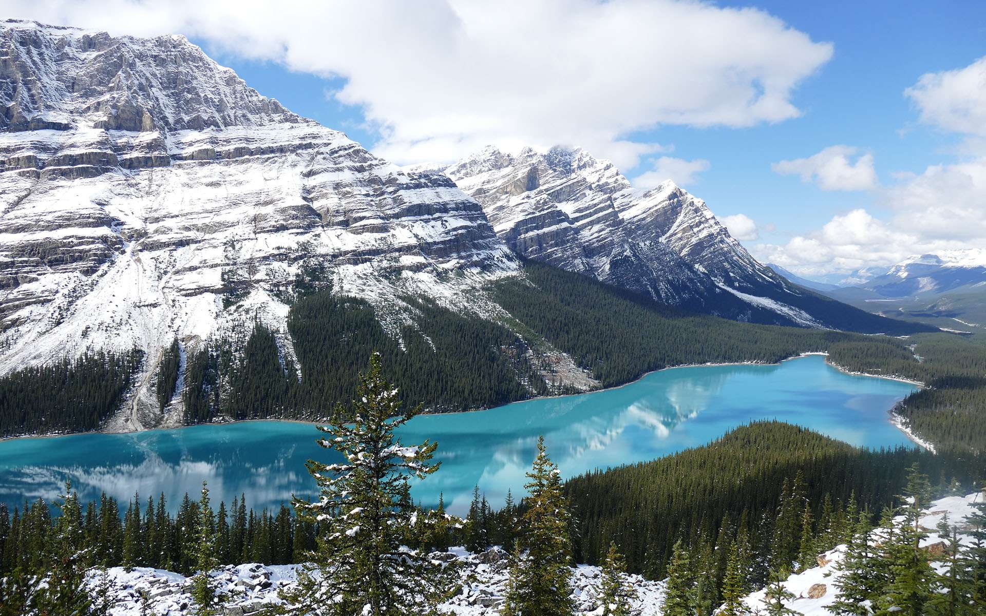
Spectaculaire, ce joyau des Rocheuses défie les couleurs que l'on croit possibles dans la nature

Canada : L’eau du lac Peyto s’étire en une étendue turquoise, éclatante comme un joyau niché au creux des Rocheuses. Tout autour, les forêts sombres montent la garde, dressant leur ombre sur les rives tandis que les glaciers lointains déposent sur la surface leurs éclats de lumière cristalline....

  •  

When glaciers retreat, microbes take over

As our world is rapidly reshaped by climate change, glaciers have retreated and revealed new swaths of bare land. Throughout the coming decades to centuries, this rocky ground will become dappled with lichens and scrub, eventually giving rise to newborn forests in a process known as ecological succession. 

Ecologists have mapped out the stages of ecological succession for plant communities, observing which species are the first to colonize land and how these pioneer species promote secondary growth. Yet before any plants sink their roots into the soil, it is populated by thriving communities of single-celled microbes that prepare it for further habitation. Scientists study how these microbial communities arise to understand how healthy ecosystems develop.

Newly exposed land is nutrient-poor and subject to large temperature fluctuations, so the first species to settle there must overcome these challenges. Pioneer plant species are often habitat generalists, meaning they can thrive under a variety of environmental conditions. However, all plants convert water and sunlight into carbon and energy. Microbes can use many different energy sources, and often contain genes for multiple metabolisms in their genomes. Therefore, researchers wondered whether pioneer microbes could also be defined by their metabolic flexibility. 

A team of scientists based at Monash University in Australia tested this hypothesis by studying land left in the wake of 2 retreating glaciers: one on an island off the coast of Antarctica and one in the Swiss Alps. The researchers sampled soils along a path from the tip of the glacier outward, which had been exposed to the air for different amounts of time. By comparing the microbial communities within these soils, the researchers could track the different stages of ecological succession after glacial retreat.

The researchers extracted DNA from the soils and analyzed it using 2 sequencing methods. First, they sequenced a gene called 16S rRNA, which is like a microbial fingerprint for the different species present. They used this method to understand the diversity of these communities and track their species overlap, helping them to identify habitat generalists that thrived under different soil conditions. 

To understand the metabolic flexibility of these microbes, the researchers used a second method, known as metagenomics, which sequences all of the DNA in a sample rather than just a single gene. They used these data to reconstruct the entire genomes of microbes present in the soils, providing information on what kinds of metabolic activities they were capable of. The team also measured chemicals like ammonium and sulfide in the soils, as well as atmospheric gases like methane and carbon monoxide, to assess how the microbes used these compounds for growth.

The researchers found microbes inhabiting even the youngest soils, demonstrating the speed at which life takes hold in new environments. The abundance of microbes increased by approximately 8-fold in older soils, alongside a similar rise in species diversity, indicating that complex communities persisted over time. They also found the metabolic capabilities of microbes inhabiting Antarctic and Swiss glacial soils to be remarkably similar, suggesting common selective pressures drove the establishment of these new ecosystems.

They were surprised to discover that the most abundant microbes in younger soils were habitat specialists that were rare in older soils. These pioneer microbes, while still metabolically flexible, had adapted to utilize meager energy sources like atmospheric trace gases, including hydrogen, methane, and carbon monoxide. Many of these microbes could also derive energy from chemicals that dissolved out of rocks, like inorganic sulfur compounds. The researchers proposed that pioneer microbes could quickly take advantage of newly opened ecological niches, like soils exposed during a glacier’s retreat, because of their efficiency at using scant resources. 

They found that habitat generalists, on the other hand, tended to dominate older soils.  This result suggested that the habitat specialists were eventually outcompeted by the slow and steady growth of the habitat generalists in a real-life turtle-and-hare race.

The team concluded that using multiple growth strategies helps microbes adapt to new environments. However, they acknowledged that ecological succession could occur differently in other landscapes, such as in the aftermath of volcanic eruptions, meteorite impacts, or forest fires. They suggested that future researchers work to uncover how microbial communities lay the groundwork across these diverse ecosystems. 

The post When glaciers retreat, microbes take over appeared first on Sciworthy.

  •  
❌