❌

Reading view

A Pompeii-Like Eruption Buried This Landscape 22 Million Years Ago—Scientists Just Discovered What Lies Beneath

The Americas experienced their own Vesuvius-style volcanic eruption 21.9 million years ago, devastating a portion of Chile worse than Pompeii.

A new study in Science Advances highlights the work of University College London Earth Sciences researchers analyzing a mountain of ancient volcanic rock covering an area six times the size of the Chilean capital, Santiago. 

The Lauca Caldera erupted to cover the area in molten ignimbrite rock up to a kilometer deep. That ancient volcanic hellscape buried the region’s terrain but, ironically, preserved it from typical erosion, providing important clues for modern climate researchers.

Modeling Volcanic Activity

“This landscape was buried by a giant volcanic eruption – a little like Pompeii, but on a vastly larger scale,” said lead author Dr Byron Adams, based at UCL Earth Sciences. “Instead of covering a town, hot mixtures of volcanic ash, rock fragments, and gas swept across an entire landscape, engulfing the terrain beneath them.”

Using detailed computer models, the UCL Earth Sciences team produced hundreds of possible landscapes to explore what the region may have once looked like. Detailed data on how rivers cut through landscapes to form mountain ranges informed predictions of what lies beneath the massive ignimbrite deposits. The researchers concluded that a low-relief landscape, such as foothills, most likely existed there at the time.

“Pompeii shows how volcanic eruptions can freeze a moment in human history. This study shows that much larger eruptions can also freeze moments in Earth history, burying whole landscapes beneath volcanic deposits and preserving clues to how mountains were being built before the eruption,” Adams said.

“We cannot dig down to see the buried landscape, but we can use the shape of the volcanic blanket and what we know about how rivers shape mountains to infer what is hidden beneath it.”

The Volcanic Andes

The findings indicate that this portion of the Andes, the world’s longest continental mountain range, rose very slowly, by only about an inch per century. At a faster rate, the landscape beneath the volcanic deposits would not fit the researchers’ models, and the slopes would have been much steeper.

The work provides new evidence in a longstanding debate among geologists over whether the Andes rose rapidly in the last few million years or developed more gradually over a much longer period. Earlier mineral analyses of the Andean range produced similar estimates based on records of temperature changes preserved in the rocks as they cooled while moving toward the planet’s surface.

“This approach gives us a new way to look back at Earth’s history. Current methods to estimate the speed at which mountains build look at chemical ‘clocks’ in the rock, but these are limited to specific moments in time. Our method can estimate rock uplift over a much longer period,” Dr. Adams said. “In this case, we estimate it would have taken millions of years to produce the subdued landscape we infer prior to the eruption.”

Other mountain ranges around the world, such as the Himalayas, can move even faster, rising several millimeters or even centimeters each year.

Climate Implications

While the team’s work covers only the middle of the Andes’ history, it still provides interesting support for the slow-movement hypothesis. For years, researchers have worked to understand how the Andes developed, as they strongly influence global and regional climate. 

By better understanding the Andes, climatologists have a more complete data set to piece together the complex problem of global climate change.

“What’s particularly exciting about this study is that it gives us a new way of piecing together that history, concluded co-author Dr Frances Cooper, also based at UCL Earth Sciences. “The same approach could be applied to volcanic deposits elsewhere in the world, helping us reconstruct landscapes buried for millions of years.”

The paper, “Landscapes Buried Beneath Large-Volume Ignimbrites Reveal Preeruptive Uplift Rates,” appeared in Science Advances on September 11, 2026.

Ryan Whalen covers science and technology for The Debrief. He holds an MA in History and a Master of Library and Information Science with a certificate in Data Science. He can be contacted at ryan@thedebrief.org, and follow him on Twitter @mdntwvlf.
  •  

Mountains Can Influence Where Magma Breaks Through the Ground, Iceland Study Finds

Volcanoes • Iceland • Fissure Eruptions • New Research Why does a long underground crack filled with magma erupt violently in one place — yet fail to reach the surface just a few kilometres away? New research from Iceland’s giant Laki and Eldgjá fissure eruptions suggests that part of the answer may be sitting directly […]

The post Mountains Can Influence Where Magma Breaks Through the Ground, Iceland Study Finds appeared first on Strange Sounds.

  •  

Juno’s Microwave Vision Peers beneath Surface of Jupiter’s Volcanic Moon Io

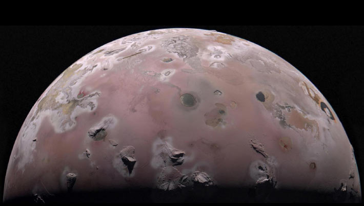
The north polar region of Io was captured by NASA’s Juno spacecraft on December 30, 2023. Image credit: NASA / JPL-Caltech / SwRI / MSSS / Gerald Eichstädt.

New data from NASA’s Juno spacecraft show temperatures spike more than 20 degrees Celsius just a few meters under Io’s surface, providing the first look at what’s happening below the crust of the Solar System’s most volcanic world.

The post Juno’s Microwave Vision Peers beneath Surface of Jupiter’s Volcanic Moon Io appeared first on Sci.News: Breaking Science News.

  •  

A new method to detect volcanic eruptions

Many volcano scientists spend their time monitoring volcanoes to predict if, or when, they’ll next erupt. The challenge for these scientists is to forecast the exact probability of an eruption and the moment it will occur. 

To address this problem, a team of researchers developed an early-detection system to determine when to issue alerts about volcanic eruptions. Their motivation was that previous alert systems weren’t accurate enough because they couldn’t detect underground volcanic processes that occur right before an eruption. 

From 2014 to 2023, the researchers conducted a series of tests to accurately detect temporary, low-frequency vibrations using an instrument called a seismometer. The researchers focused on these transient signals because they come from earthquakes and other ground phenomena, which scientists often rely on to predict volcanic eruptions. These phenomena include ground tilting caused by fracturing from the movement of magma and volcanic gases. The scientists named these signals the “Jerk” signals because they occur due to sudden movements. 

The team set up their experiment at Piton de la Fournaise, a volcano at La Réunion Island off the east coast of Madagascar. They discovered the Jerk signals by detecting and analyzing mysterious short-term signals from existing and experimental seismic data. During real-time experiments, they detected signals 8 kilometers (about 5 miles) from the volcano at the Rivière de l’Est seismic station. These signals resulted from changes in ground elevation as magma moved, and they preceded eruptions by minutes and sometimes hours. 

The researchers measured the Jerk signals in units of newton-meters per second, which conveys how fast physical changes occurred in or around the volcano. In addition to real-time experiments, the team checked the Jerk signals’ accuracy by analyzing the station’s past data to determine when these signals would have occurred before an eruption.

To avoid false alarms during their experiments, the researchers needed to distinguish between the signal amplitudes of ocean tides and the transient Jerk signals. So, they used computational software to predict the signals from ocean tides. This was necessary because the instruments that record ground phenomena are also sensitive to tidal movements.  

The Jerk system sent its first automatic alarm in June 2014, 1 hour before the first volcanic tremor, signalling that magma was at the Earth’s surface. The team recorded the last signal in their study on July 2, 2023, 40 minutes before the eruption, at a slow 1.5 newton-meters per second. From 2014 to 2023, other Jerk detections occurred between a few minutes and up to 8 hours before an eruption.

To further assess the strength of the Jerk signals, the team examined previous eruption records at Piton de la Fournaise. They found that for the 24 eruptions between 1998 and 2010, a Jerk alarm would have gone off 83% of the time. Of the 48 eruptions that occurred between 1998 and 2023, including the eruptions during their real-time tests, about 42 Jerk alarms would have occurred. However, they found that the Jerk signals were more accurate during their real-time analysis than they would have been for the eruptions 20 years earlier. 

Although the researchers successfully detected pre-eruption signals, they noted that the Jerk alarms occasionally arrived too late due to the data processing time, which takes at least 10 to 15 minutes. They reported 2 late alarms: one on June 11, 2019, and the other on February 10, 2020. Therefore, after 10 years of tracking the Jerk signals, the team evaluated their success rates at 22 successful alarms out of 24 eruptions, for a 92% positive rate. 

Before using the Jerk signals, many volcanologists struggled to predict the exact moment a volcano erupts. The team concluded that, in addition to the usual methods for detecting pre-eruption earthquakes, observatory scientists could now use Jerk signals to confidently notify authorities in advance of volcanic eruptions, so they can alert people living near volcanoes worldwide. 

The post A new method to detect volcanic eruptions appeared first on Sciworthy.

  •  

Fungi Bloomed Twice around End-Cretaceous Mass Extinction

The end-Cretaceous mass extinction was marked by both the Chicxulub asteroid impact and the ongoing eruptions of the Deccan Traps volcanoes.

By studying fungal microfossils in 66-million-year-old rock samples from the Denver Basin in Colorado, Johns Hopkins University microbiologists have confirmed that the dinosaur-killing asteroid impact triggered a worldwide fungal takeover, and uncovered a second, previously unknown ecological crisis just before it.

The post Fungi Bloomed Twice around End-Cretaceous Mass Extinction appeared first on Sci.News: Breaking Science News.

  •  
❌