❌

Reading view

Rapid Wildfire Structure Risk Assessment Helps Fire-Adapted Communities

Wildfire scientists have unveiled a new rapid risk-assessment tool that shows substantial wildfire danger to homes and buildings in three major Arctic communities, revealing that between 14% and 26% of structures in Anchorage, Fairbanks, and Whitehorse face high or very high risk from approaching flames. The study, led by Jennifer I. Schmidt of the University of Alaska Anchorage together with Robert H. Ziel, Monika P. Calef, Anna Varvak, and Julio C. Postigo, was published in the International Journal of Disaster Risk Science. Rather than relying on complex fire-behavior simulations that demand specialist analysts and expensive software, the approach combines datasets that most local governments already possess: building footprints, zoning maps, and readily available vegetation layers. The result is an updatable, affordable portrait of which buildings face the greatest threat and where mitigation dollars can do the most good.

The urgency behind the work is hard to overstate. Wildfire costs and damages in the United States alone are now estimated at between USD 394 billion and 893 billion annually, and the 2019 to 2020 Australian fire disasters cost nearly USD 100 billion. The Arctic, often imagined as too cold and wet to burn, is not immune: since 1980, wildfires have cost Alaska between USD 2 billion and 5 billion, with projections suggesting costs could rise 68% by the end of the century. Canadian suppression expenses are expected to climb by 60 to 110% relative to the 1980 to 2009 baseline. Meanwhile, structure loss from wildfire has doubled over the past two decades in the western United States, and western Canada has suffered major structure-loss events in four of the last eight fire seasons. Nearly half the global population now lives within the wildland-urban interface, the zone where people and forests meet or intermingle, making tools that translate fire science into actionable local maps increasingly vital.

The researchers’ central premise is conceptually simple but technically consequential: for a structure to be at high risk, a flammable hazard must exist nearby, within roughly 500 meters, and the surrounding landscape must exhibit high wildfire exposure. The method begins with a flammability hazard layer at 30-meter resolution, built from a modified version of NASA’s ABoVE Landcover dataset in which generic evergreen classes were refined to reflect locally flammable species such as black spruce, white spruce, lodgepole pine, and subalpine fir, each assigned hazard ratings from 0 to 100. Critically, the team treated structures themselves as fuel. Each building contributes three fuel units to the surrounding flammability score, a value chosen after systematic testing of one through ten fuel units; three proved optimal, nudging densely built environments up a hazard category without causing wholesale reclassification. Structure density was computed at 90-meter resolution, multiplied by three, and added to the vegetation-based hazard to produce an enhanced flammability hazard layer.

Wildfire exposure, the second pillar of the assessment, captures the potential for hazard to travel. It is calculated as the average flammability hazard within a 100-meter or 500-meter radius, representing the likelihood that fire can reach and burn a given location even if the local fuels themselves are sparse. Exposure values, also ranging from 0 to 100, are classified into five tiers from very low to extreme, and concentrated pockets of flammable vegetation drive scores upward. The third ingredient is structure vulnerability, produced by multiplying the enhanced flammability hazard by a structure importance factor derived from zoning data: residential buildings and critical infrastructure such as hospitals, schools, and nursing homes receive the highest weight, followed by commercial and other structures. Where zoning was unavailable, as on military installations like Joint Base Elmendorf-Richardson in Anchorage and Fort Wainwright and Eielson Air Force Base in Fairbanks, the team collaborated with base personnel or interpreted aerial imagery to classify neighborhoods. The final risk score synthesizes hazard, exposure, and vulnerability into six categories, from extremely low to very high.

The results paint a nuanced picture of Arctic fire danger. Fairbanks showed the greatest proportion of structures in the top two risk categories at 26%, followed by Whitehorse at 22% and Anchorage at 14%. Anchorage, paradoxically, had the highest share of buildings in the top vulnerability tiers, 42%, yet the lowest risk, a consequence of its large urban footprint where dense housing raises vulnerability but fragmented, less-flammable vegetation and abundant developed ground suppress exposure. Fairbanks and Whitehorse, with structures woven into spruce- and pine-dominated boreal landscapes, showed closer alignment between vulnerability and risk. Anchorage was also the only study area where more than 1% of cells jumped two or more flammability categories when buildings were counted as fuel, at 7%, reflecting its 27% share of structure area containing seven or more buildings per cell. The analysis also confirmed the primacy of exposure: when a structure’s wildfire exposure was extreme, at least 87% of such buildings landed in the highest risk category across all three communities.

A key innovation lies in how the team redrew the wildland-urban interface itself. Traditional WUI maps distinguish urban, interface, and intermix zones; the researchers added a fourth category, the transmission zone, marking areas roughly 2.4 kilometers beyond the WUI boundary where fire could move into a community and where fuel breaks might be sited. Within the 500-meter buffer around structures, urban areas were defined by exposure values of 20 or less, interface zones by 21 to 60, and intermix by values above 60, cross-referenced with Alaska and Yukon wildfire management designations that prioritize suppression from critical down to unplanned or wilderness levels. Fairbanks claimed the largest overall WUI footprint, and the transmission zone proved the largest category in every study area, spanning 23,347 square kilometers around Anchorage, 6,180 square kilometers around Fairbanks, and 665 square kilometers around Whitehorse. Across all sites, most structures fell within interface zones, 52 to 61%, followed by intermix at 20 to 35%. Thousands of buildings sit in the high-risk interface and intermix zones where mitigation should concentrate: 15,537 structures in Anchorage, 16,212 in Fairbanks, and 3,734 in Whitehorse.

The method faced its most demanding test against a real disaster. On 17 August 2019, during southcentral Alaska’s hottest and driest summer on record, the likely human-caused McKinley wildfire was driven by high winds across 13.3 square kilometers in three days, destroying 52 residential structures, 84 outbuildings, and three commercial buildings, affecting 1,028 properties and forcing roughly 350 to 400 people to evacuate. By comparing pre-fire aerial imagery from 2017 with post-fire imagery from 2020 at 0.3-meter resolution and linking vanished buildings to the Matanuska-Susitna Borough structure database, the team identified exactly which structures burned. The verdict was statistically compelling: burned structures had significantly higher wildfire exposure than those that survived, and the proportion of burned structures with exposure values above 60 was significantly larger than among unburned ones. Structure risk scores above 60 were also significantly associated with burning. Notably, the test held even under conditions so extreme that normally resistant, low-flammability fuels were igniting.

The study’s design was shaped by sustained community engagement. Through workshops in 2019, 2021, and 2023, along with 15 to 20 meetings organized by Anchorage community councils and landowner associations and public events ranging from wildfire awareness days to Arbor Day, residents and agency staff reshaped everything from color schemes to model parameters. One consequential example: Anchorage residents and fire managers insisted that the maps reflect the spruce beetle outbreak first detected in 2016 and peaking around 2020, which killed and removed many spruce trees. The team responded with rules derived from aerial detection surveys, reclassifying white spruce cells in areas of beetle intensity of 11% or greater to mixed forest, and shifting mixed forest cells to open shrub, while a succession model updated vegetation on areas burned within the last 30 years. This iterative dialogue ensured outputs that both wildfire practitioners and the general public can interpret, a prerequisite the authors see as central to building fire-adapted communities.

The practical implications for planning are direct. Because mitigation funding is often tied to officially designated WUI areas, the ability to rapidly recalculate boundaries from updated building layers expands funding opportunities and keeps pace with community growth. The framework also points to different interventions in different zones: structures in intermix areas, surrounded by vegetation, benefit most from fuel treatments, while those in interface zones, where flammable vegetation is scarcer, are better served by home hardening measures such as fire-resistant roofs, siding, decks, screens, and unburnable buffers. Given that wildfire activity tends to occur where exposure exceeds 60, the authors recommend concentrating resources on the top two risk categories. Where national products like wildfirerisk.org rely on generalized fuel layers that can overestimate unburnable area in WUI zones and are updated too slowly for annually burning landscapes, this approach trades complexity for transparency, using local data that governments already collect. The underlying wildfire exposure toolbox is publicly available on GitHub, and the team argues that empowered residents, equipped with accurate, current, neighborhood-scale information, are crucial to reducing wildfire risk, particularly where communities may prefer action without government intervention.

Subject of Research: Rapid assessment of wildfire risk to structures and wildland-urban interface delineation in Arctic communities using local vegetation, building footprint, and zoning data.

Article Title: Fueling Fire-Adapted Communities Through a Rapid Wildfire Structure Risk Assessment

Article References: Schmidt, J. I., Ziel, R. H., Calef, M. P., Varvak, A., & Postigo, J. C. (2026). Fueling Fire-Adapted Communities Through a Rapid Wildfire Structure Risk Assessment. International Journal of Disaster Risk Science, 17(2), 351-362. https://doi.org/10.1007/s13753-026-00716-y

Image Credits: AI Generated

DOI: 10.1007/s13753-026-00716-y

Keywords: Arctic, Wildfire, Risk assessment, Wildland-urban interface, WUI, Mitigation planning, Structures, Fire-adapted communities, Wildfire exposure, Flammability hazard, Alaska, Yukon

  •  

‘It’s smoke and mirrors’: hope turns to fear in Scottish village chosen for AI datacentre

Suspicions grow in Lanarkshire that local people have been misled on supposed benefits of the huge development

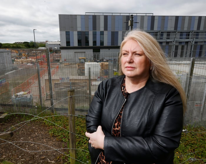
The promise was that a Scottish community would be transformed by massive investment and empowered to chase “the jobs of the future”. Instead, local people in Lanarkshire fear they may have to sell their properties and lose green belt land because of the errors of a badly planned AI datacentre complex, even as those jobs and investments never arrive.

Late last year, representatives of Oakes Energy Services began to knock on doors in Newarthill, a village east of Glasgow. In letters reviewed by the Guardian, they invited residents to individual meetings. They told them about plans for a solar farm, say local people, and made offers: free solar panels, tree planting, or even cash for their properties.

Continue reading...

© Photograph: Murdo MacLeod/The Guardian

© Photograph: Murdo MacLeod/The Guardian

© Photograph: Murdo MacLeod/The Guardian

  •  

Sleep, Stress, Distress Vary with Displacement Duration

In a groundbreaking study recently published in Scientific Reports, researchers have unveiled the intricate relationship between sleep disturbances, stress levels, and psychological distress among internally displaced persons (IDPs), demonstrating that the duration of displacement plays a pivotal role in shaping these outcomes. As millions worldwide are forced to flee their homes due to conflict, natural disasters, or political upheaval, understanding the complex interplay of mental health factors in this vulnerable population has become a pressing scientific and humanitarian imperative. This new research sheds light on how the protracted nature of displacement can exacerbate or modulate psychological conditions, potentially informing targeted interventions and policy decisions to support these populations more effectively.

Internally displaced persons represent one of the most precarious demographic groups in terms of mental health. Unlike refugees who cross international borders, IDPs remain within their own country, often caught in regions of continued conflict or instability. This paradoxical existence subjects them to an array of chronic stressors: insecure living conditions, loss of community and social support, uncertainty about the future, and the daily struggle for basic necessities. The study by Basishvili, Eliozishvili, Lortkipanidze, and colleagues delves deeply into how these chronic stressors produce different psychological trajectories depending on the length of displacement.

At the core of the research lies the investigation into sleep as both a symptom and a mediator of distress. Sleep disturbances are frequently reported among displaced populations, yet the nuances of how sleep quality changes over time during displacement have been poorly understood. Employing comprehensive psychometric evaluations and sleep quality assessments, the research team conducted a longitudinal study encompassing multiple cohorts of IDPs displaced for varying lengths of time, spanning from several months to multiple years.

The findings reveal a non-linear dynamic: individuals recently displaced exhibited acute sleep disturbances strongly correlated with heightened stress hormone levels and immediate psychological distress. This phase, typified by hyperarousal and vigilance, aligns with the body’s acute stress response, where cortisol and other neurochemical mediators disrupt normal sleep architecture. Paradoxically, those displaced for extended periods demonstrated a paradoxical pattern of gradual diminution in objective stress markers, yet enduring subjective reports of poor sleep and depressive symptoms. This suggests an adaptive but potentially maladaptive physiological adjustment where initial hypervigilance gives way to chronic sleep abnormalities linked with prolonged psychological wear and tear.

Advanced polysomnography and actigraphy data indicate that sleep fragmentation and reduced slow-wave sleep are especially pronounced among long-term displaced persons. Slow-wave sleep, crucial for emotional regulation and memory consolidation, is markedly impaired, offering a potential mechanistic explanation for sustained psychological distress. These alterations exacerbate levels of anxiety, depressive symptomatology, and cognitive deficits, which in turn can worsen social withdrawal and reduce resilience, forming a vicious cycle difficult to break without intervention.

Neuroendocrine assays conducted as part of the study underscore the role of the hypothalamic-pituitary-adrenal (HPA) axis dysregulation as a critical biological underpinning. Elevated cortisol levels were consistently found with short-term displacement, whereas flatter diurnal cortisol slopes characterized those with prolonged displacement, indicating chronic stress dysregulation. These hormonal patterns mirror findings from PTSD and chronic depression literature, supporting the notion that displacement-induced stress elicits a spectrum of overlapping pathophysiological processes.

The researchers also investigated psychosocial moderators such as social support networks, access to healthcare resources, and coping strategies. Notably, individuals with stronger communal ties and better access to counseling services exhibited more stable sleep profiles and reduced psychological distress, regardless of displacement duration. These findings underscore the importance of integrative mental health services and community rebuilding as necessary components to ameliorate the scourge of displacement-induced morbidity.

This complex interplay between biological, psychological, and social factors implies that mental health interventions for IDPs cannot be monolithic. Recent arrivals require acute crisis interventions focusing on immediate stress reduction, sleep restoration, and trauma counseling. Meanwhile, long-term displaced individuals may benefit more from chronic disease management approaches emphasizing resilience building, sleep hygiene education, and pharmacological or behavioral therapies targeting sleep fragmentation and depressive symptoms.

The implications extend beyond clinical practice into public health and policy realms. By quantitatively establishing the bidirectional links between sleep disruptions and stress pathology modulated by displacement duration, the study advocates for time-sensitive resource allocation. Humanitarian agencies and government authorities can leverage these insights to design tiered mental health responses calibrated to the displacement timeline, enhancing efficiency, and outcomes.

Furthermore, the advancement of biomarker-driven diagnostics in this context offers a promising avenue to identify individuals at greatest risk of long-term psychological sequelae. Personalized intervention strategies guided by biological data such as cortisol rhythms and sleep metrics could revolutionize care for displaced populations, where resources are often limited and needs are immense.

The pervasive nature of displacement globally makes this research critically relevant in the current socio-political climate, where conflicts and climate-driven migration show little sign of abating. Integrating these scientific insights into coordinated international action can mitigate the profound mental health toll borne by internally displaced individuals, transforming a global crisis into an opportunity for innovation in humanitarian mental health care.

In sum, the study by Basishvili and colleagues offers a nuanced, detailed exploration of how the length of displacement modulates the interdependent phenomena of sleep disturbances, stress responses, and psychological distress in IDPs. This knowledge not only expands the theoretical understanding of trauma and adaptation but also provides tangible pathways to improve mental health outcomes through temporally tailored interventions. The future of displacement medicine will likely hinge on such integrative, multidisciplinary efforts that unify biology, psychology, and social policy within a coherent framework of care.

This pioneering research continues to underscore the vital importance of sleep health as a cornerstone of psychological resilience, especially under the extraordinary stress conditions faced by displaced populations. As global displacement trends rise, harnessing these insights to catalyze innovative, evidence-based interventions will be paramount in alleviating human suffering and fostering recovery amidst upheaval.

The authors conclude their work with a call to action, emphasizing the need for heightened international collaboration to translate these findings into scalable mental health programs. Such initiatives must prioritize accessible diagnostic tools, culturally sensitive therapeutic approaches, and sustainable community support systems aligned to the evolving phases of displacement. Effectively addressing the mental health crisis within IDP communities represents both a formidable challenge and a profound human opportunity in the coming decades.


Subject of Research: The study investigates the complex interactions between sleep patterns, stress physiology, and psychological distress among internally displaced persons, focusing particularly on how these factors are influenced by the duration of displacement.

Article Title: Relationship between sleep, stress and psychological distress in internally displaced persons depends on the length of displacement.

Article References:

Basishvili, T., Eliozishvili, M., Lortkipanidze, N. et al. Relationship between sleep, stress and psychological distress in internally displaced persons depends on the length of displacement.
Sci Rep (2026). https://doi.org/10.1038/s41598-026-57241-7

Image Credits: AI Generated

  •  

Ancient Microbes in Greenland’s Rubbish Heaps Reveal Insights into Old Farms, Seal Hunts, and Toilets

Greenland, with its vast icy expanses and challenging environment, harbors a rich tapestry of human history etched into its landscape over millennia. The island’s archaeological record tells tales of successive human inhabitations that have left behind more than just stories and artefacts; it preserves complex biological legacies embedded within ancient refuse deposits known as middens. These middens, essentially ancient domestic rubbish heaps composed of animal bones, excrement, mollusk shells, and various artefacts, offer not only archaeologists but also microbiologists a unique window into the past. Their frozen state in Arctic permafrost has allowed microbial communities trapped over thousands of years to persist, raising compelling questions about the nature and dynamics of these ancient microbial populations.

The study of microbial life within these middens is far more than a niche query; it intersects with pressing concerns about human health, ecosystem integrity, and the potentially resurging threats posed by ancient pathogens. As the Arctic warms at an alarming rate—currently estimated to be three to four times faster than the global average—the thawing permafrost raises fears that dormant microbes, including pathogens from bygone eras, might be released back into the environment. The microbial fingerprints preserved in these deposits chronicle past human and animal interactions, environmental conditions, and disease ecology, providing invaluable data to reconstruct historical microbiomes and understand their evolution through millennia.

In groundbreaking research reported recently in Frontiers in Microbiology, scientists led by Dr. Frank Møller Aarestrup of the Technical University of Denmark embarked on an ambitious project to characterize the microbial composition of Greenland’s archaeological middens. Their experimental approach involved rigorous sampling of frozen middens from multiple chronological layers spanning approximately 4,500 years of human history—from the earliest Paleo-Inuit cultures to medieval Norse settlers and early Danish colonists. Employing advanced DNA sequencing techniques and bioinformatics, the team reconstructed diverse and complex bacterial communities present in these ancient deposits and compared them with microbes from surrounding pristine permafrost soils, unperturbed by human activity.

One of the striking revelations from this study was the extraordinary microbial richness residing within the middens. From as few as nine to as many as 202 bacterial species per midden, the researchers identified an aggregate of 1,207 distinct bacterial species across all samples. Intriguingly, many species could not be identified beyond broad taxonomic categories, underscoring the vast unknown microbial diversity in Arctic archaeological contexts and the general paucity of data on cold-environment microbiomes. This discovery shines a light on the hidden microbial world preserved under layers of ice and soil, aspects that have remained largely unexplored until now.

The middens invariably featured richer bacterial communities than adjacent soils, affirming their role as biological archives chronicling the legacy of human presence and activity. Among the deposits, middens linked to the Paleo-Inuit exhibited bacterial compositions closely resembling natural soil communities, suggesting a fading microbial imprint over thousands of years. Conversely, Norse and colonial middens revealed bacterial assemblages heavily influenced by human-related waste, livestock farming, and domestic activities, evidencing the intimate connection between past humans, their animals, and local microbes.

Practically, these midden microbiomes hosted a variety of bacteria associated with human and animal hosts. Notably, the researchers detected species such as Clostridium massilliamazoniense, innocuous but indicative of human fecal matter presence, alongside more pathogenic taxa like Clostridium baratii, which can lead to botulism, and Paeniclostridium sordellii, linked to severe human illnesses including toxic shock syndrome and gas gangrene. Such findings highlight how midden microbial communities serve as time capsules, preserving signatures of diseases that may have affected historic populations, which hold relevance to the emerging field of paleomicrobiology.

Furthermore, the microbial composition differed markedly depending on the nature of the organic waste constituting each midden. Middens from Greenland’s early colonial era, particularly those in Nuuk containing decomposing seal skins, harbored Clostridium perfringens, a bacterium notorious for causing food poisoning. Meanwhile, middens filled with animal carcasses were dominated by gut bacteria such as Romboutsia species and Paraclostridium sordellii. Early Norse deposits, rich in decomposing bones, exhibited an abundance of unknown species within the Proteobacteria and Clostridiaceae groups. This substrate-specific microbial differentiation provides new perspectives on historic dietary patterns, hunting practices, and animal domestication in Greenland.

An essential aspect of the team’s work was the investigation of antimicrobial resistance (AMR) genes within these ancient bacterial genomes. The researchers uncovered a diverse array of resistance genes, demonstrating that ancient permafrost soils and middens contained bacteria equipped with antimicrobial defense mechanisms. The persistence of these genes in both ancient and modern soil layers indicates the long-term stability and environmental retention of genetic elements conferring antibiotic resistance, a critical insight into the evolutionary history of AMR and its environmental reservoirs. Despite this, spatial analyses suggested that upon thawing, microbes from the middens do not tend to disperse widely, limiting the risk of pathogen spread under current conditions.

Importantly, the authors emphasized that the immediate threat to public health from ancient pathogens emerging from Greenland’s thawing middens is currently low. Dr. Saria Otani, co-author and associate professor, noted that the microbiome released from melting permafrost appears to be rapidly outcompeted or replaced by contemporary environmental microbes, reducing opportunities for ancient pathogens to proliferate. Nonetheless, this dynamic balance could shift with accelerating climate warming, necessitating vigilant monitoring.

To that end, the researchers advocate for the incorporation of microbiome characterization into routine archaeological protocols during future excavations at permafrost sites. The spatially and temporally resolved microbial data obtained could serve as early warning markers for pathogen emergence and inform conservation strategies during the rapidly unfolding Arctic environmental transition. This interdisciplinary study brilliantly exemplifies how combining microbiology, archaeology, and environmental science can unlock secrets buried in ice and soil, informing both our understanding of the past and preparations for an uncertain microbial future.

This pioneering research hence sets a precedent for microbiome-informed archaeology, where the “dustbins of history” are not merely relics of human culture but bearers of ancient microbial life, antimicrobial resistance, and metabolic potential. By resolving these ancient microbial ecosystems, scientists are better positioned to trace human-animal-environment interactions across centuries and to anticipate the potential consequences of microbial releases driven by climate change.

As global temperatures continue their inexorable rise, the Arctic remains a hotspot for uncovering hidden biogeochemical dynamics playing out beneath melting permafrost. Greenland’s middens now stand as invaluable archives that illuminate the intertwined narratives of human migration, settlement, livestock domestication, and the microbial world shaped by these processes. The revelations from these frozen repositories reinforce a broader vision of archaeology enriched by microbial ecology, where ancient microbial communities provide vital clues for understanding human history, health, and environmental change on a planetary scale.


Subject of Research: Not applicable

Article Title: Microbial composition of archaeological middens: Tracing Human Footprints Through Centuries in Greenland’s Ancient Settlements

News Publication Date: 17-Jun-2026

Web References:
Frontiers in Microbiology Article

Image Credits: Louise Hindborg Mortensen

Keywords: Archaeology, Animal domestication, Anthropology, Archaeological sites, Prehistory, Microbial ecology, Infectious diseases, Gastrointestinal disorders, Health and medicine, Human biology, Public health, Land use, Iron Age

  •  

Ancient Maya knowledge helps Guatemalan farmers cut agrochemical use

In the mountain villages of Guatemala’s Western Highlands, farmers are combining ancient Maya knowledge with modern sustainable farming techniques to protect their crops from pests and disease. Smallholders are creating homemade biopesticides using plants with strong smells and flavors to deter pests on their family plots. This is helping to cut back on the use of increasingly expensive agrochemicals, many of which have been labeled as dangerous to human health and linked to soil degradation. About 60 Guatemalan communities in the Western Highland departments of Sololá and Huehuetenango, as well as Chiquimula in the east, are working to revive these traditional techniques with support from the international development organization World Neighbors. Their focus is to restore and strengthen traditional knowledge, combining it with agroecological practices that help families produce surplus food they can sell to boost household incomes. “Traditional farming techniques are becoming popular because they are simple practices to apply, use local resources, and have proven to be effective,” Dayani Roche, a program associate at World Neighbors, told Mongabay via email. Rather than a single ancient recipe, farmers are using “a living combination of ancestral knowledge, local experimentation and more recent agroecological practices,” he said, which are “safer for families, soil, water and biodiversity than many chemical alternatives.” The Maya civilization, which once stretched across modern-day Central America, had a rich history of farming dating back to 2000 B.C.E. Its most celebrated agriculture system is the milpa, a form of intercropping that involves a mix of maize, beans and…This article was originally published on Mongabay

  •  

Taiwan’s tallest tree found with help of citizen science

Deep in Taiwan’s misty mountains, researchers have confirmed the tallest tree in the country: a thousand-year-old fir tree higher than a 20-story building, which they’ve named “the heaven sword of the Da’an River.” Climbers scaled the tree and dropped a measuring tape from the top to the forest floor during the Lunar New Year holiday in January 2023. The tree measured 84.1-meters (276-feet). The findings have been published in Frontiers in Forests and Global Change. A team of ecologists, geologists, remote-sensing specialists, professional climbers and Indigenous people that calls itself the “Taiwan tree seekers” began the search in 2014. “The common characteristics [of the team] are probably that we are all tree lovers and like adventures,” Rebecca Chia-Chun Hsu, lead author from Division of Forest Ecology, Institute of Taiwan Forestry Research, told CNN. ‘The Heaven Sword’, Taiwan’s tallest tree, measures 84.1 meters. Photo courtesy of Steven Pearce. Taiwan is one of the few places on Earth where trees can grow this tall. The island sits where the tropics meet the subtropics, and its mountains host several giant conifer species. The species behind the new record, Taiwania cryptomerioides, is known to the Indigenous Rukai people as “the tree that hits the moon.” Although nearly 60% of Taiwan is covered in forest, loggers cleared much of the island’s old-growth forest between 1912 and 1991. However, its steep slopes were too dangerous to reach, and pockets of ancient forest survived. Still, finding the tallest tree amid the rugged terrain was a task. Taiwan…This article was originally published on Mongabay

  •  

Northern Thai residents march for action on polluted rivers. ‘This is an emergency’

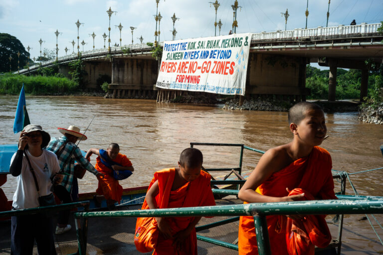
BANGKOK — More than 600 residents of Chiang Mai and Chiang Rai provinces embarked May 31 on a roughly 68-kilometer, six-day ‘peace walk’ to demand the Thai government take action on the river pollution crisis that has seen Thai rivers polluted with heavy metals. The ensemble of affected residents, civil society groups, monks and students marched from Tha Ton subdistrict in Chiang Mai to the city of Chiang Rai in northern Thailand, reaching their destination on June 5, World Environment Day. For more than a year, Thailand’s Pollution Control Department has reported dangerous levels of arsenic, mercury, cadmium and other heavy metals in rivers across northern Thailand, with mining operations across eastern Myanmar suspected to be responsible for the pollution. “We are walking because our rivers are slowly dying,” Pianporn Deetes, executive director of the Rivers and Rights Foundation, which helped to organize the peace walk, told Mongabay by phone. “Toxic contamination from unregulated mining upstream is already affecting water, fish, food, livelihoods, and public health. We do not want to wait until more people become sick. This is an emergency.” Pianporn said the walk (42 miles) was about taking collective action to share information, document impacts and build public pressure in a bid to force the government to address the issue, which Pianporn said has, so far, been lacking. “Monitoring has improved, but action has not matched the scale of the crisis,” she said. “We need urgent diplomatic engagement with neighboring countries, stronger health monitoring, transparency, and action to…This article was originally published on Mongabay

  •  

In Peru and Brazil, extractivism threatens Indigenous people in isolation: Report

Indigenous Peoples in Voluntary Isolation and Initial Contact (PIACI) in the Yavarí-Tapiche Territorial Corridor, one of the largest contiguous, intact forests in the Amazon and home to the world’s highest concentrations of PIACI, are under threat by extractive and large-scale industrial activities, which pose an existential threat to its inhabitants and the ecosystems they depend on. This is according to a new report co-authored by Earth Insight, the Regional Organization of Indigenous Peoples of the East (ORPIO), the Coordination of the Indigenous Organizations of the Brazilian Amazon (COIAB) and the Interethnic Association for the Development of the Peruvian Rainforest (AIDESEP). The report finds that oil and gas blocks overlap with 10% of the 16-million-hectare (39.5-million-acre) corridor, including almost 1.7 million hectares (4.2 million acres) of intact tropical moist forest, 907,000 hectares (2.2 million acres) of Key Biodiversity Areas and 713,000 hectares (1.8 million acres) of protected areas. “Pressure from hydrocarbons is increasing on the Peruvian side of the Yavarí Tapiche corridor,” Edith Espejo, senior program manager at Earth Insight and author of the report, told Mongabay over WhatsApp messages. “Our report serves as a warning for the irreversible harm that could take place if these oil blocks move into this corridor. Mining concessions within and on the peripheries of the corridor also pose a threat of encroachment and contamination of waterways.” A critical corridor for ecosystems and Indigenous communities The Yavarí-Tapiche Corridor covers Brazil’s western border states of Amazonas and Acre and Peru’s Loreto and Ucayali departments in the Amazon…This article was originally published on Mongabay

  •  

Rights groups renew call to free jailed Cambodian environmental activists

BANGKOK — Seven hundred days after activists from the environmental group Mother Nature Cambodia were imprisoned on charges widely regarded as retaliatory for their activism, 73 international and Cambodian civil society organizations have renewed calls for their unconditional release. After a trial lasting just over a month, 10 activists from Mother Nature Cambodia were sentenced on July 2, 2024, to between six and eight years in prison. Only five of the defendants attended the hearings, which saw Long Kuntha, 28, Ly Chandaravuth, 26, Phuon Keoraksmey, 25, and Thun Ratha, 34, each sentenced to six years behind bars for plotting against the government; fellow activist Yim Leanghy, 36, received an eight-year sentence for both plotting against the government and insulting the king. The five activists who did not attend the trial were sentenced in absentia. The appeals hearing for all 10 convicted activists was slated to take place on June 2, but has been postponed indefinitely by the Phnom Penh Court of Appeals. “The MNC5 are incarcerated in prisons in overcrowded and harsh living conditions, separated from each other and spread out all across Cambodia, hundreds of kilometers away from their families and legal counsel,” wrote the 73 NGOs in an open letter addressed to Prime Minister Hun Manet. “The … NGOs who have signed this letter sincerely request you take immediate action to ensure the unjust convictions of these five activists are reversed either prior to or at their upcoming appeals court hearing in Phnom Penh, and that their freedom…This article was originally published on Mongabay

  •  
❌