NASA’s Physics of the Cosmos Program, in collaboration with the Physics of the Cosmos Program Analysis Group Executive Committee, is pleased to announce the Third Early Career Workshop. Participants will benefit from engaging interactive sessions covering essential topics including grant opportunities, navigating data archives, and effective strategies for career advancement.
22-24 September 2026 1:00pm-4:00pm ET / 10:00am-1:00pm PT
Community
Physics of the Cosmos
Type
Workshop
Physics of the Cosmos
Inspiring the Next Generation of Astrophysicists
The workshop will be held on September 22 – 24, 2026, from 1:00PM to 4:00PM Eastern Time and will be fully virtual.
This workshop aims to provide early career scientists with valuable insights into the groundbreaking research conducted within the Physics of the Cosmos Program, demonstrate essential tools and resources available to them, and address their questions and concerns.
Physics of the Cosmos Third Early Career Workshop Poster
This third workshop will discuss three topics—Science, Missions, and Career Development— and will also showcase the importance of collaborations.
This workshop is tailored for graduate students, postdoctoral researchers, and early-career scientists looking to enhance their professional trajectory in astrophysics.
Workshop Schedule
The workshop will include a tutorial on the NASA Astrophysics Data System (ADS) Science Explorer (SciX), talks on upcoming missions including the Compton Spectrometer and Imager (COSI) and the Ultraviolet Explorer (UVEX), updates on NASA programs for students and postdocs, a CV writing mini-workshop, presentations by your fellow early career researchers on exciting science and technology development projects, and much more!
The full program will be coming soon.
Downloads
Physics of the Cosmos Third Early Career Workshop Poster
Curiosity Blog, Sols 4968-4974: Rock Climbing Towards the Discontinuity
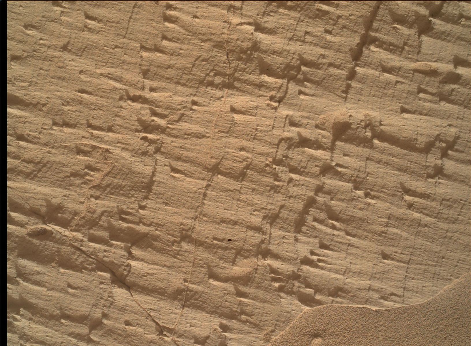
NASA’s Mars rover Curiosity acquired this image, a frame of the “Longquimay” mosaic showing fine-scale sedimentary textures in a bedrock block near the supersurface, using its Mars Hand Lens Imager (MAHLI), located on the turret at the end of the rover’s robotic arm. Curiosity acquired the image on Aug. 1, 2026 — Sol 4972, or Martian day 4,972 of the Mars Science Laboratory mission — at 23:35:43 UTC.
NASA/JPL-Caltech/MSSS
Written by Lucy Lim, Planetary Scientist at NASA’s Goddard Space Flight Center
Earth planning date: Friday, July 31, 2026
As mentioned in the previous blog, Curiosity has been exploring a large-scale feature in Gale’s sedimentary record suspected to be an “erosional supersurface.” The “supersurface” represents a period in time when a net depositional environment changed to a net erosional one before returning to a depositional regime, thus producing a discontinuity in the rock record. The erosion can involve wind, water, or both. Sometimes there are clues about these environmental changes in the layers below and above the supersurface. So far we’ve been seeing some patterns that look like aeolian features and also some “lens” deposits that sometimes appear consistent with fluvial origins. We need higher-resolution imaging of these features.
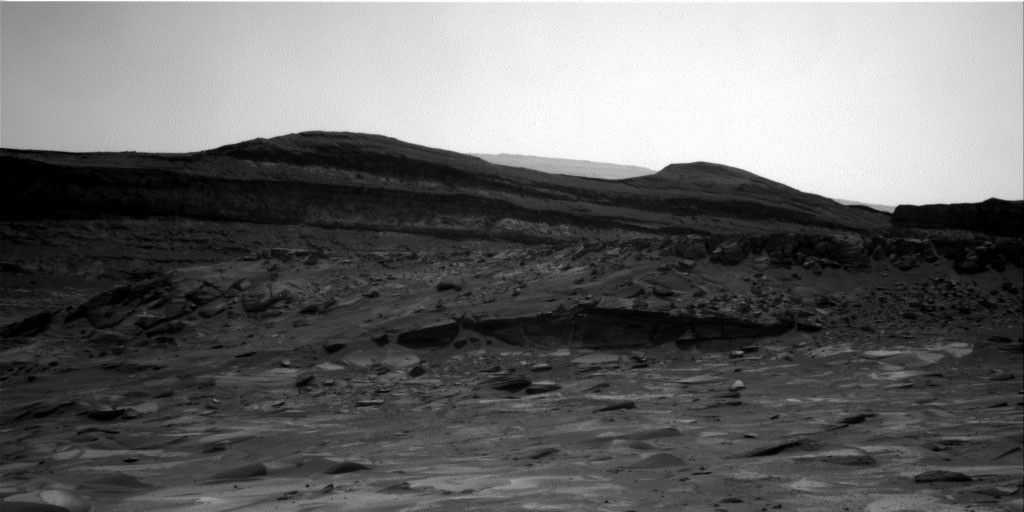
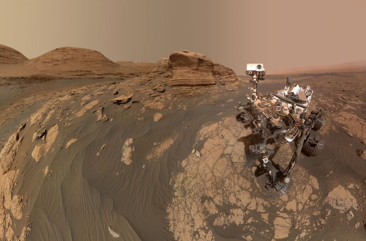
This week Curiosity came within detailed imaging range of a section of the “Cerro Paine Grande” vertical exposure just below the candidate supersurface before climbing on top of it. Mastcam was the star of the show on both planning days this week, capturing large stereo mosaics of the vertical face of the outcrop and a 360-degree panorama after the rover climbed on top of it.
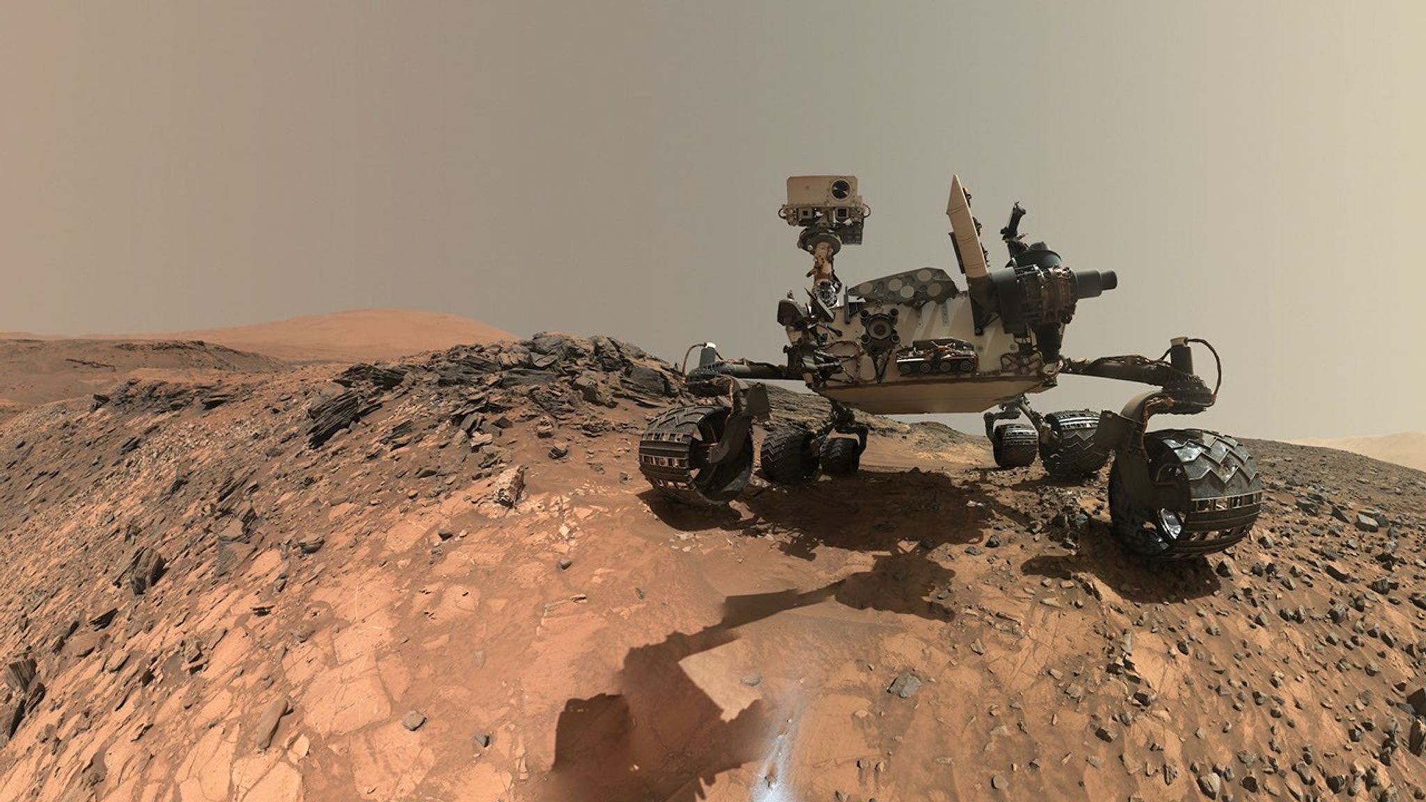
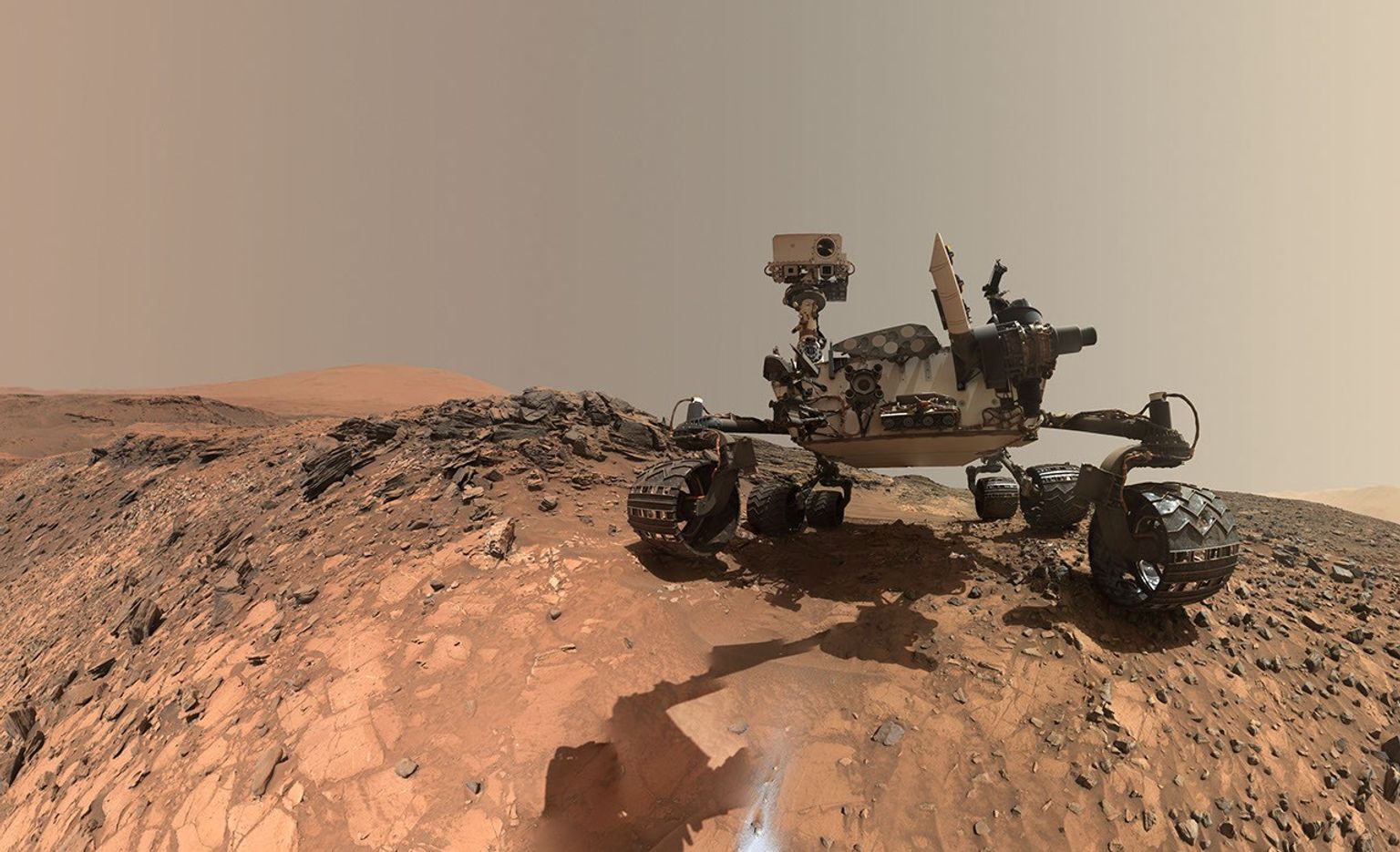
NASA’s Mars rover Curiosity acquired this image, showing the rover arm in action in the “Longquimay” workspace at the top of a steep climb. Curiosity captured the image using its Right Navigation Camera on Aug. 2, 2026 — Sol 4972, or Martian day 4,972 of the Mars Science Laboratory mission — at 00:49:52 UTC.
NASA/JPL-Caltech
Roving to the top took full advantage of Curiosity’s climbing capabilities, leaving the rover at an approximate 24-degree tilt in its final parking spot. The rover planners managed to reach the right posture for contact science at the same time — quite a feat, and one that approached the mission’s contact science tilt record of 27 degrees!
Meanwhile, MAHLI and our geochemical instruments provided detailed characterization of the rock layers beneath the discontinuity. I was the Geology and Mineralogy Theme Lead for the Sol 4968 (Monday) planning cycle, during which “Puyehue” in the light-toned bedrock block of the workspace was co-targeted with APXS, MAHLI, and ChemCam LIBS. The other two targeted LIBS observations in the plan went to a similar-looking nearby bedrock block (“Lago Palena”) and an intriguing layered block off to the side of the workspace (“Piedras Juntas”). Another APXS measurement went to a sand target, “Cormudesi,” which will help us assess the consistency of sand compositions along the rover’s traverse.
In the Sol 4972 workspace atop the slope, the bedrock was sharply divided between a smooth bedding-parallel surface on the local top of the outcrop and the darker-toned, rougher, angled exposure of the same rocks. The light-toned top surface was measured by MAHLI, APXS, and the LIBS at target “Sierra de Sangre,” whereas the darker-toned laminated face was targeted by APXS and MAHLI at “Laguna del Laja.” The fine-scale sedimentary structures in the textured material were also documented by a MAHLI mosaic (“Longquimay”) supported by Mastcam M100 imaging.
Rounding out the week’s science observations were several long-distance ChemCam RMI mosaics on more distant targets such as sedimentary structures above the rover’s current stratigraphic position, and finally our regular cadence measurements of the modern Martian environment, including atmospheric opacity and a ChemCam passive-sky survey to monitor abundances of minor atmospheric gases.
Discover the cosmos! Each day a different image or photograph of our fascinating universe is featured, along with a brief explanation written by a professional astronomer.
Six Moons of Saturn
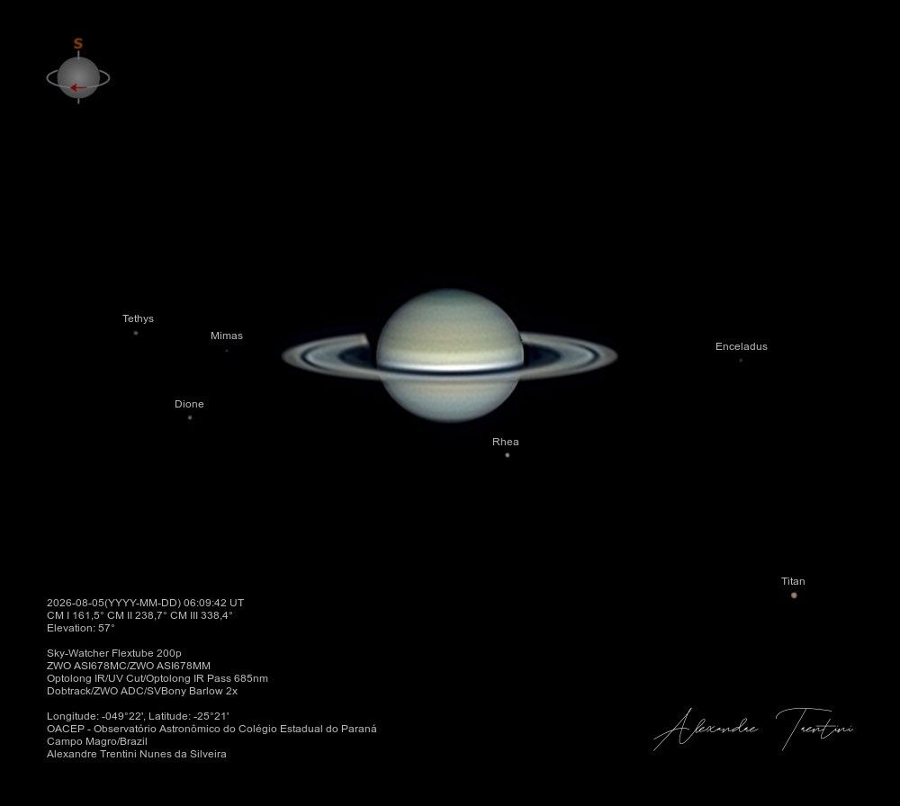
Explanation:How many moons does Saturn have? While the total will likely continue to grow, as of June 2026 the ringed gas giant had 293 confirmed moons. That’s easily more than any other planet of the Solar System, including ruling gas giant Jupiter with a mere 115 confirmed moons. Most of Saturn’s known moons are small, irregular satellites. Many are only few kilometers to a fraction of a kilometer across and grouped in tilted outer orbits. Six of its largest satellites can be seen here, though, in this sharp telescopic Saturnian family portrait taken on August 5. Larger than Earth’s Moon and even slightly larger than inner planet Mercury, Titan, with a diameter of 5,150 kilometers, is at lower right. You can also spot icy major moons Mimas, Tethys, Enceladus, Dione, and Rhea in the frame. Saturn’s first known natural satellite, Titan was discovered in 1655 by Dutch astronomer Christiaan Huygens. During the space age Voyager and Cassini discoveries have added to the swelling ranks of Saturnian moons.
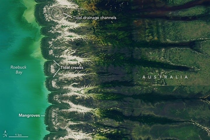
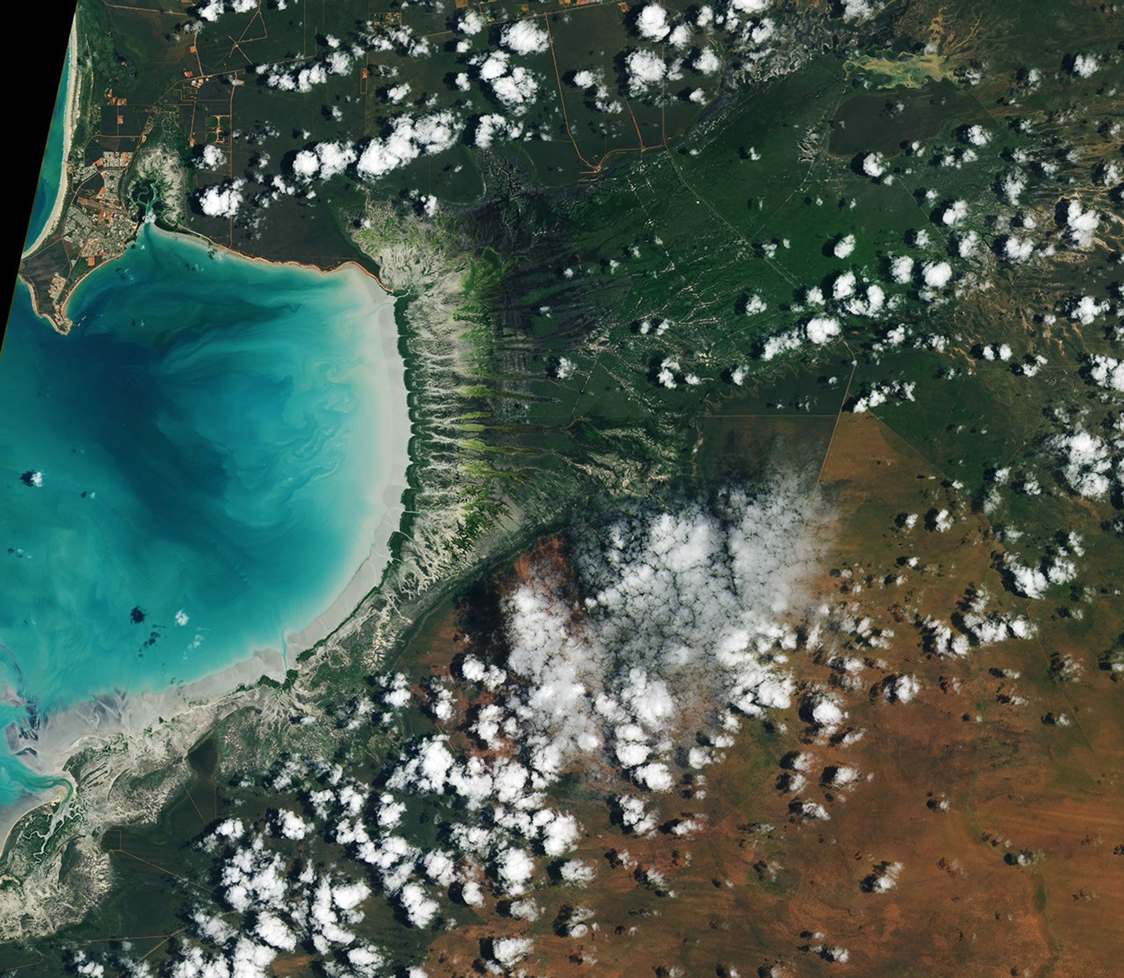
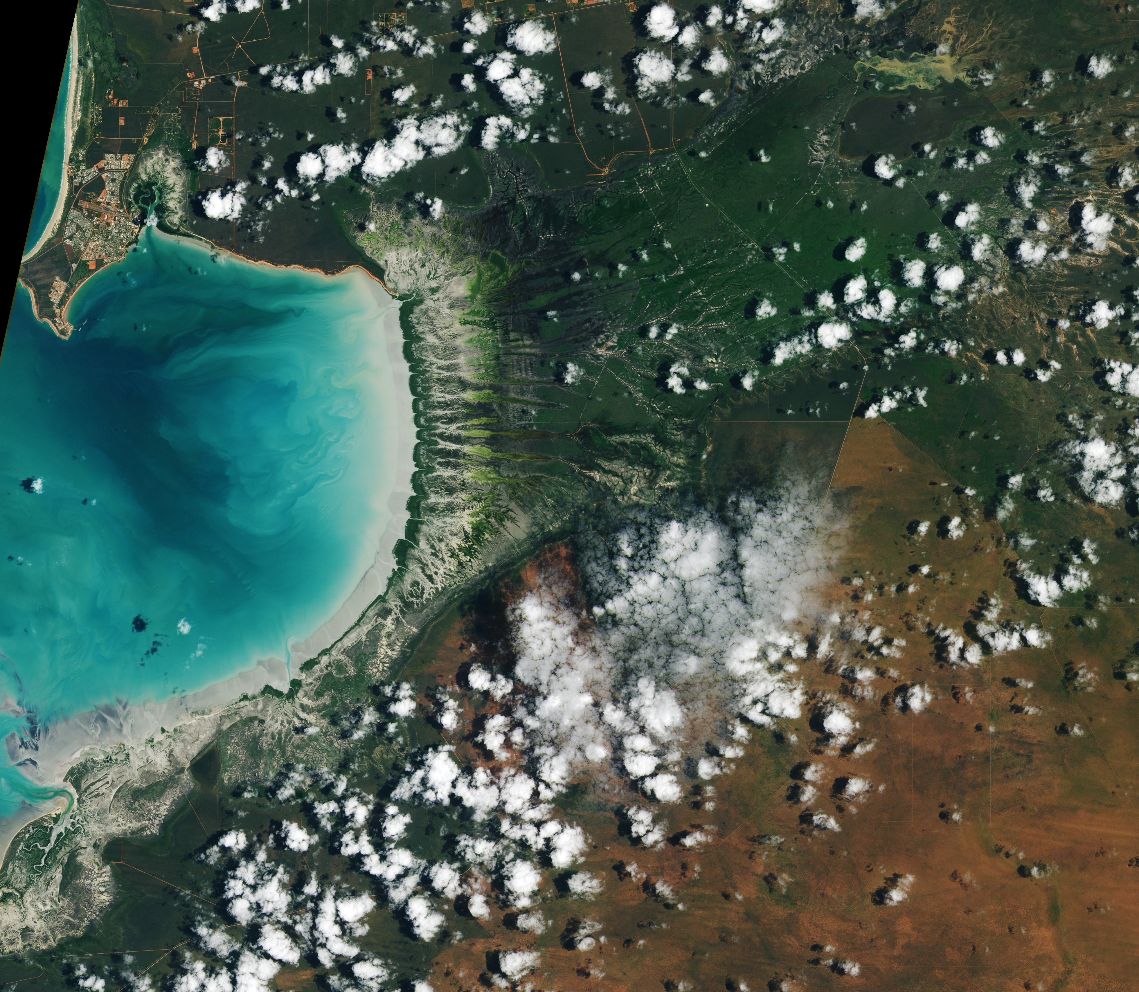
Water covers intertidal mudflats around Roebuck Bay in Western Australia, as seen in this image captured by the OLI (Operational Land Imager) on Landsat 8 on March 18, 2026.
NASA Earth Observatory / Lauren Dauphin
Editor’s Note: Today’s story is the answer to the August Puzzler.
Tides are among the clearest signs of the Moon’s pull on Earth. Just 239,000 miles (385,000 kilometers) away, the Moon’s gravity pulls on Earth’s oceans and solid crust, subtly distorting them into a more oblong shape with bulges roughly extending toward and away from the Moon.
High tides happen throughout Earth’s oceans, but in some places they leave an unusually strong fingerprint on the landscape. Among those places is Roebuck Bay, a crescent-shaped feature in the Kimberley region of Western Australia.
Roebuck Bay’s tidal range can reach a remarkable 9 meters (30 feet). Rising and falling tides repeatedly inundate and expose expansive mudflats, flood broad mangrove forests and salt marshes, and feed branching networks of tidal drainage channels. Many parts of Australia have tidal ranges of 2 meters or less. But the large range at Roebuck Bay is mostly a consequence of northwestern Australia’s unusually wide, shallow continental shelf, which helps amplify tides as they approach the coast.
The image at the top of the page shows the bay on March 18, 2026, when water levels were high. Green mangrove forests grow thickly along the shoreline and line the mouths of a network of evenly spaced, linear tidal creeks. These mangrove forests are dynamic. Analysis of decades of Landsat observations shows them expanding westward by nearly 2 meters per year as sediment from the waterways to the east accumulates in the sheltered bay.
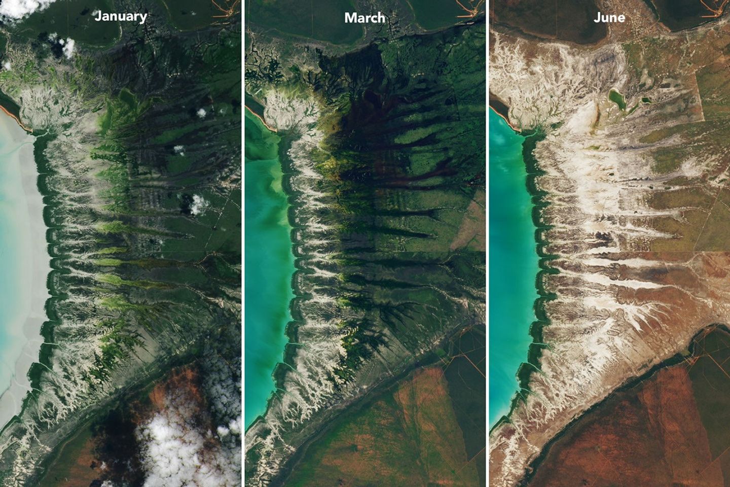
Farther inland, branching networks of tidal drainage channels connect with the tidal creeks, giving the bay its feathered appearance. These channels, partially obscured by thick vegetation in March, were more visible earlier and later in the year, when vegetation was thinner.
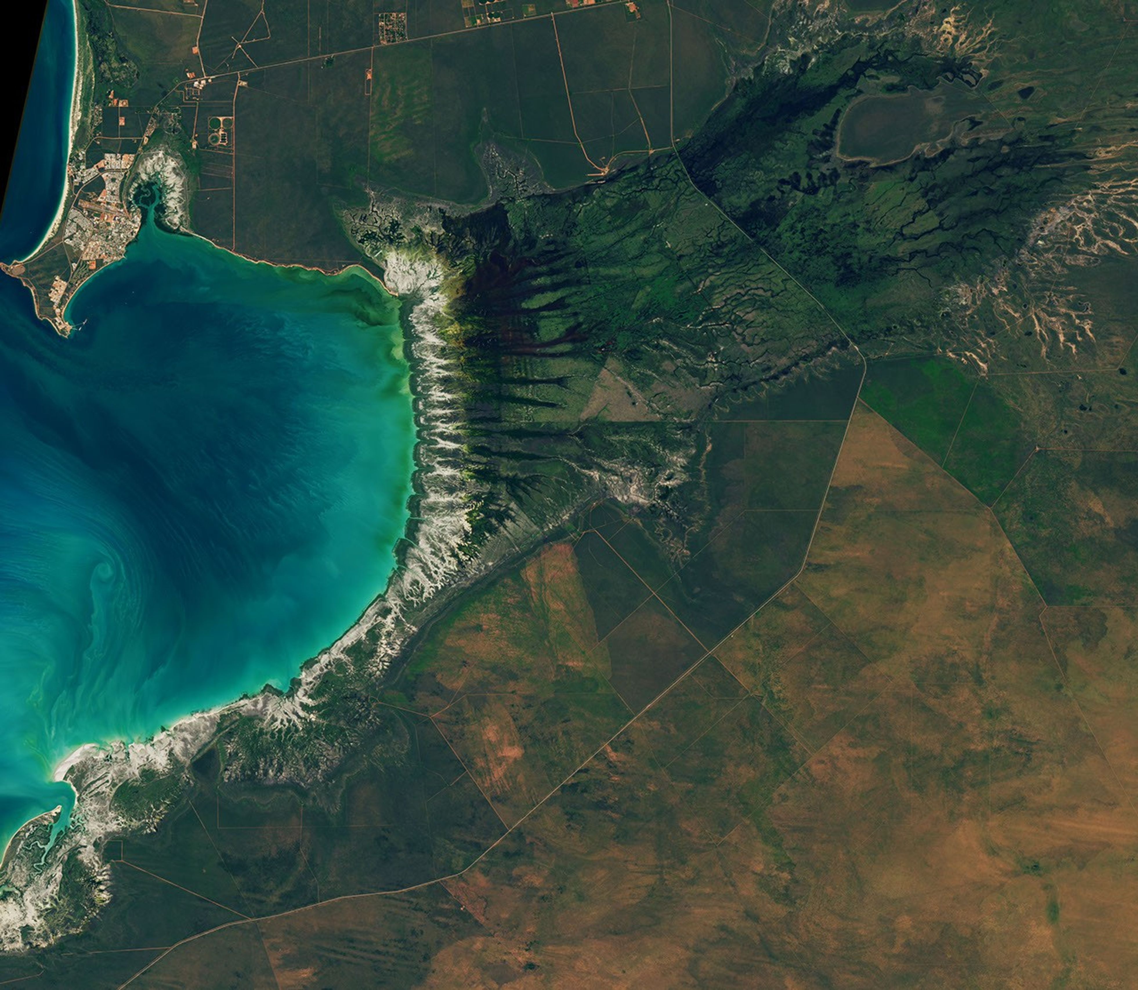
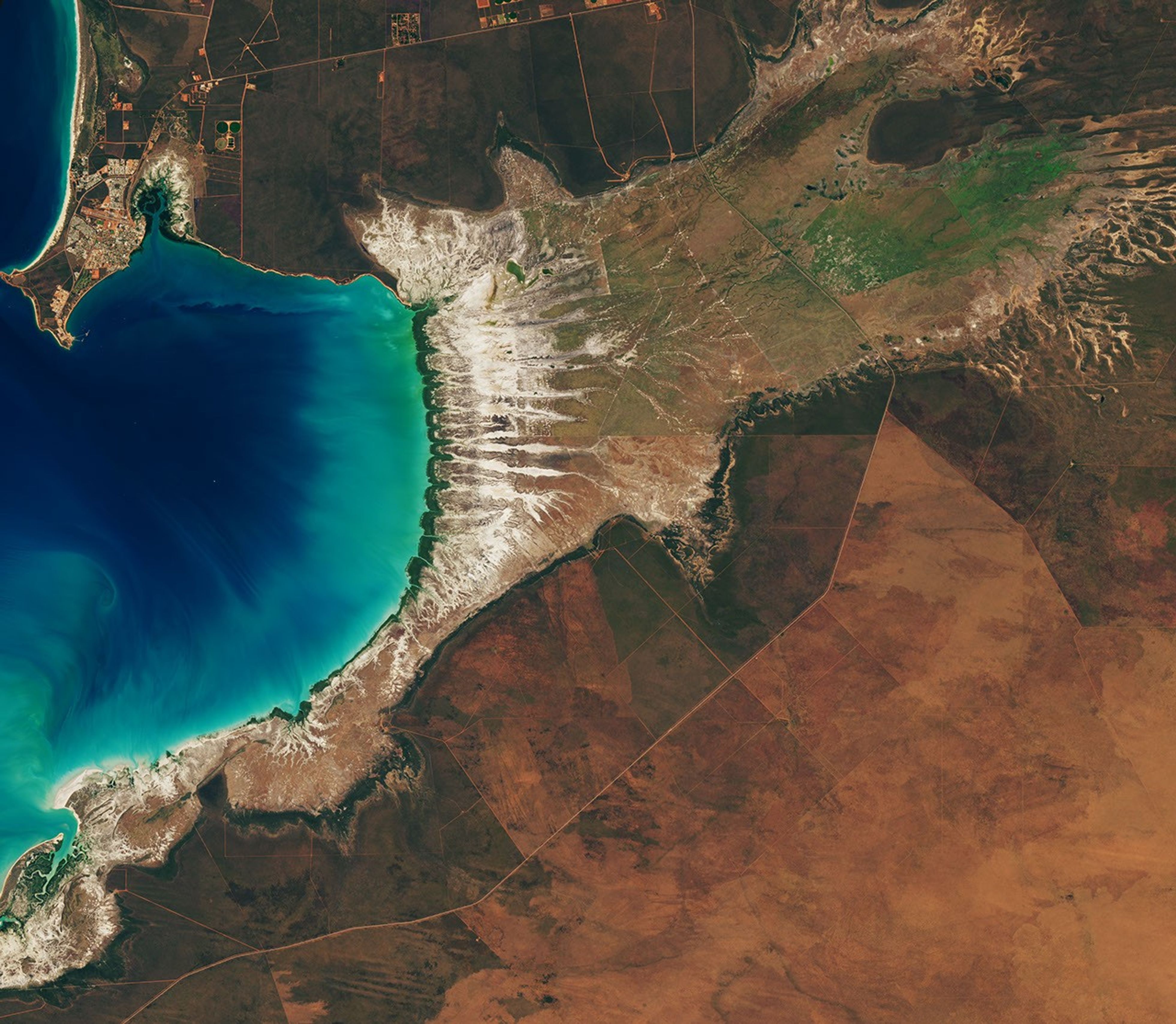
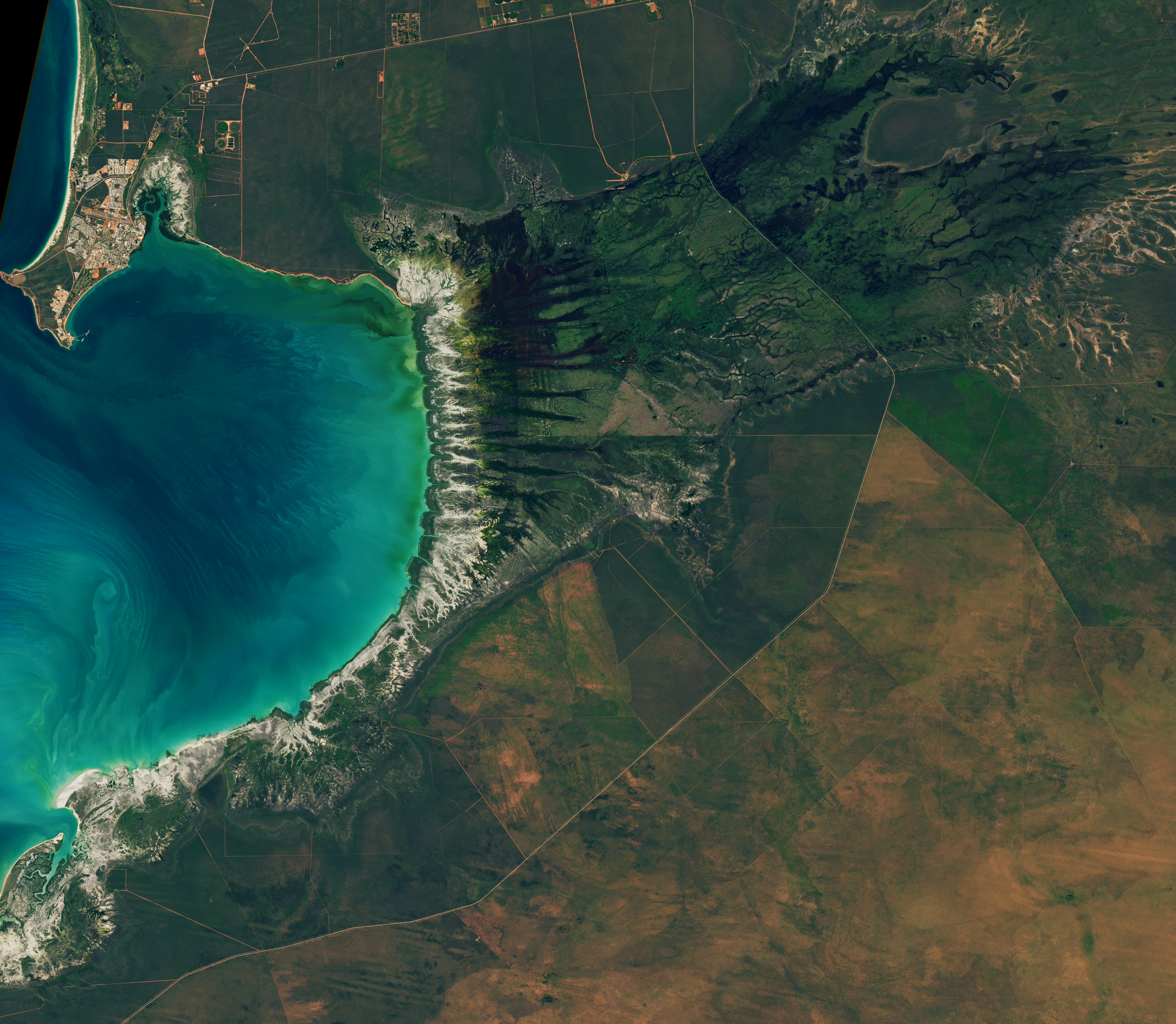
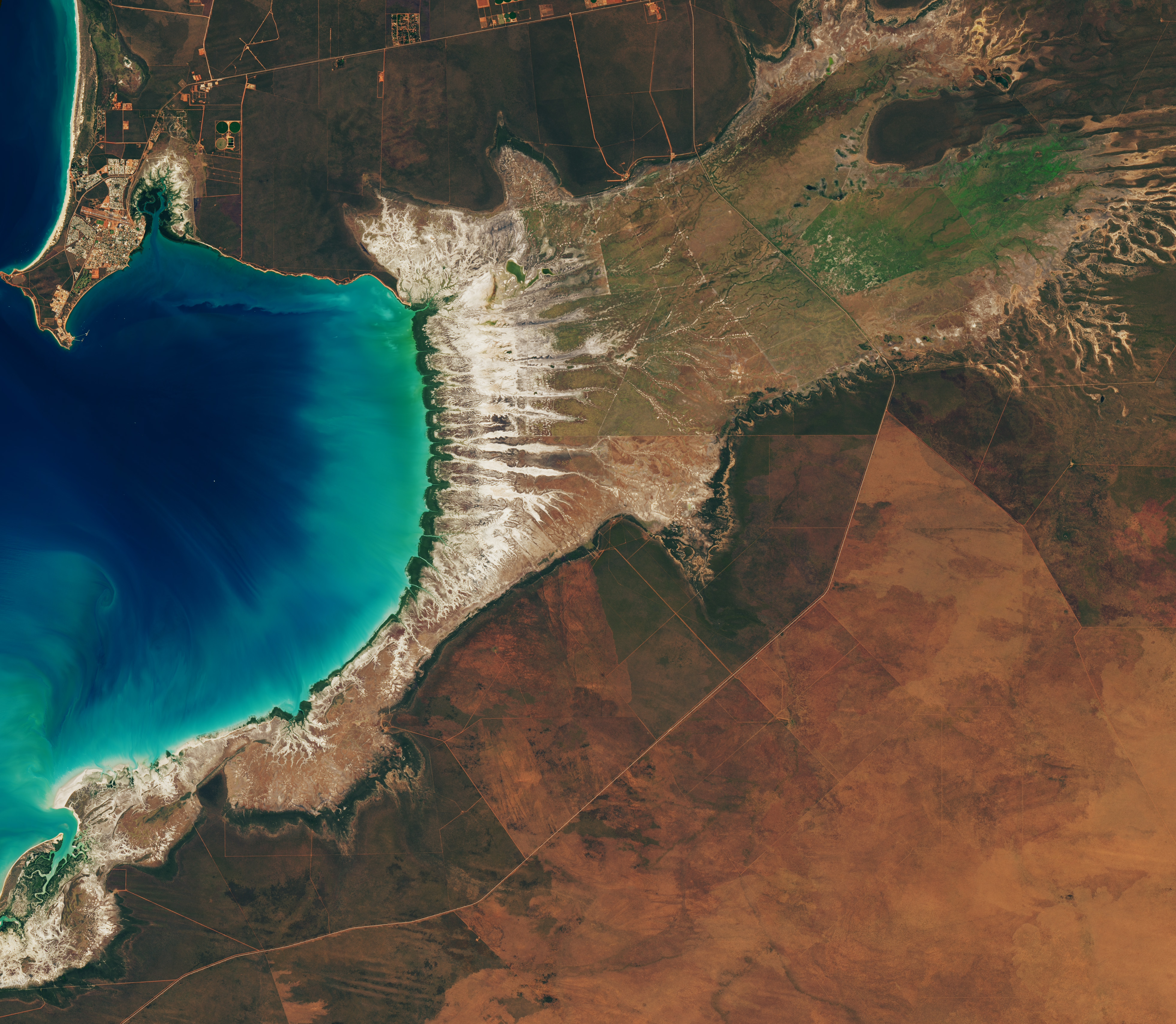
Around Roebuck Bay, inland vegetation greens after monsoon rains, peaking in March, and turns brown and dry by June. The Landsat 8 and 9 satellites captured these images throughout 2026.
NASA Earth Observatory / Lauren Dauphin
Monsoonal rains, typically falling between December and March, transform the landscape around the bay into lush grasslands and seasonal wetlands. As the rains fade in May and June and the dry season takes hold, these ephemeral grasses and sedge ecosystems die back, turning the landscape shades of gold and brown. The consistent spacing of the tidal creeks is likely not a tidal effect; it appears to be influenced by the regular spacing of linear dunes in the broader region, as seen in the plains to the east.
The bay’s dramatic tidal and seasonal changes are striking from above, and they also support a bounty of life on the ground. The mangroves serve as nurseries for crustaceans and fish, and the mudflats teem with dozens of types of invertebrates, including snails, worms, crabs, clams, and cockles. Shells and snails can reach an abundance of 2,500 per square meter, according to the Australian government.
This bounty of marine life is a major draw for birds. The bay, one of the most important sites for migratory birds in Australia and a key stop on the East Asian-Australasian Flyway, regularly hosts hundreds of thousands of birds, including plovers, godwits, and knots.
NASA Earth Observatory images by Lauren Dauphin, using Landsat data from the U.S. Geological Survey.Story by Adam Voiland.
Downloads
January 29, 2026
JPEG (3.65 MB)
March 18, 2026
JPEG (3.41 MB)
June 20, 2026
JPEG (3.61 MB)
References & Resources
Birdlife International (2026) Roebuck Bay. Accessed August 10, 2026.
Brockmann Consult (2025) Roebuck Bay. Accessed August 10, 2026.
The National Aeronautics and Space Administration is America’s civil space program and the global leader in space exploration. The agency has a diverse workforce of just under 18,000 civil servants, and works with many more U.S. contractors, academia, and international and commercial partners to explore, discover, and expand knowledge for the benefit of humanity.
Capabilities
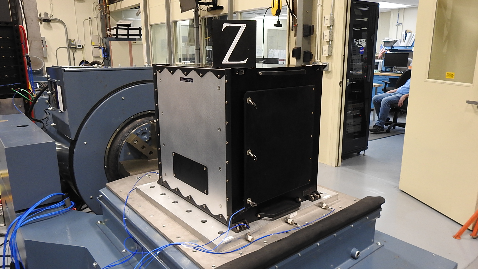
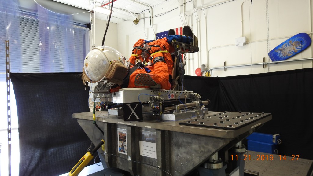
Unholtz-Dickie Model 2XSAI240-T5500-3-43 Electrodynamic Shaker System
Continuous rating 55,000 lbf peak, 143g max free table acceleration, 90 inches/sec maximum velocity, 3 in peak-to-peak stroke, 6’x6’ hydrostatic slip table with 6,000,000 in-lbs. of pitch moment, 36”x72” Guided expander head
Unholtz-Dickie Model 2XSAI240-T-1000-32LH/ST Electrodynamic Shaker System
Continuous rating 22,000 lbf, peak, 200g max free table acceleration, 70 inches/sec maximum velocity, 2 in peak-to-peak stroke, 48”x48” slip table with 140,000 in-lbs. of pitch moment, 48”x48” expander head
Unholtz-Dickie Model T208IAR Electrodynamic Shaker System
Generated shock force rating 10,000 lbf, 2750g max free table acceleration, 140 inches/sec maximum velocity, 0.9 in peak-to-peak shaker stroke, SRS Shock 3000g to 10 kHz
Correlated Solutions VIC-3D Digital Image Correlation Measurement System
Two IDTMotionPROY4S2 High Speed Cameras with synchronized LED lighting
Seven HD SDI Spy Cameras
Sixteen APEX Controller channels sampled up to 72kHz 12,288 Hz
Thirty-two addtional channels NI cDAQ-9137 sampled up to 100kHz
Polytec OFV-505 Single Point Sensor Head Laser Vibrometer with OFV-2500-2 Vibrometer Controller outputting velocity and displacement
The National Aeronautics and Space Administration is America’s civil space program and the global leader in space exploration. The agency has a diverse workforce of just under 18,000 civil servants, and works with many more U.S. contractors, academia, and international and commercial partners to explore, discover, and expand knowledge for the benefit of humanity.
Overview
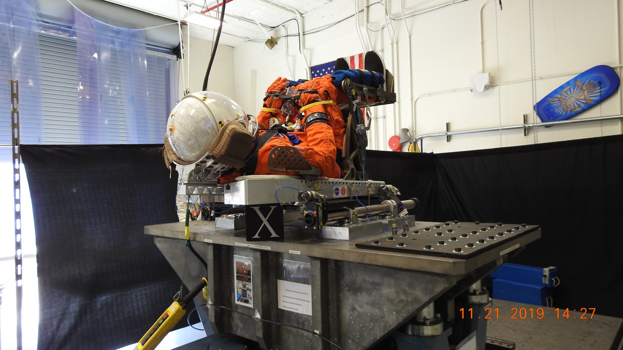
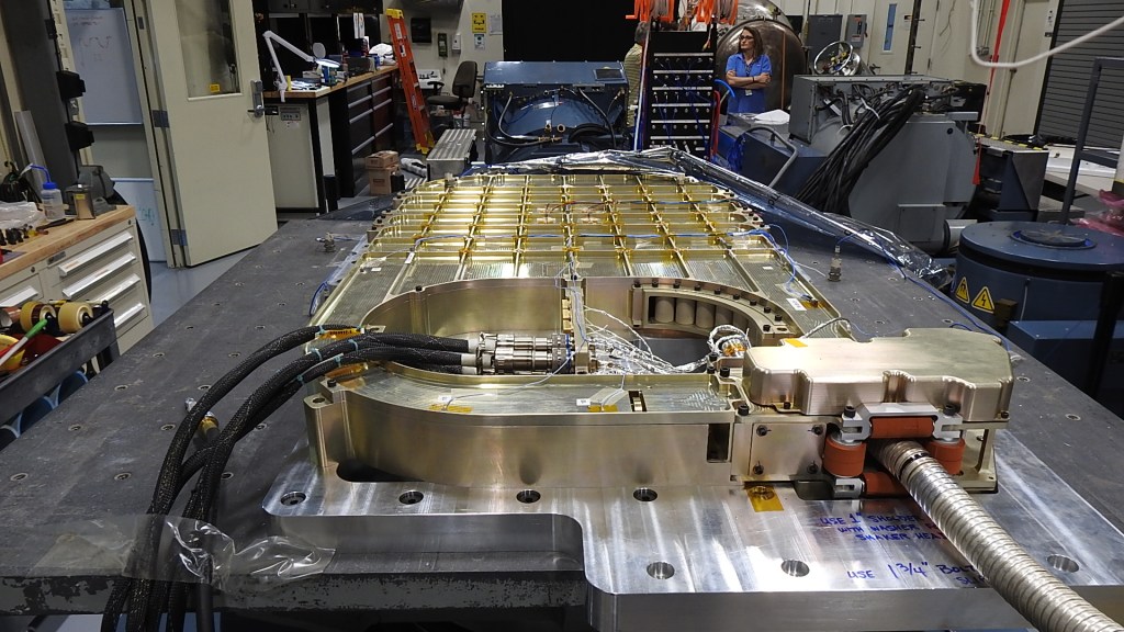
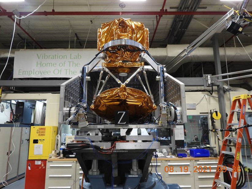
The Vibration Test Laboratory (VTL) provides testing of articles that includes sinusoidal, random, shock, classic (half sine, saw tooth, etc.) shock response spectrum (SRS), imported pulse, superimposed – random on random and sine on random, gunfire and sine burst. The lab provides closed loop vibration test systems typically consisting of electrodynamic shakers, instrumentation, signal conditioning, a controller and amplifier. Video documentation, high speed data and synchronized multiplexed test records provided. Provides acceptance and qualification testing of GSE, flight hardware, small satellites, experiments, cargo, and ISS spares and upgrades. Work is performed in support of multi-program launch vehicle and payload processing operational activities, CxP design/fabrication activities and external customer support. Testing also includes R&D experiments supporting analytical model correlation and engineering evaluation using Correlated Solutions VIC-3D Digital Image Correlation Measurement System and High Speed Data Aquisition Systems. Recent laboratory upgrades include capabilities for extreme launch environments (55,000 lbf with 3” pk-pk) and simulated pyro shock (3750g SRS to 10kHz).
The Vibration Test Laboratory (VTL) provides testing of articles that includes sinusoidal, random, shock, classic (half sine, saw tooth, etc.) shock response spectrum (SRS), imported pulse, superimposed – random on random and sine on random, gunfire and sine burst.
Announcement of Opportunity Astrophysics Explorers Program 2026 Small Explorer (SMEX) Amended Text Released
10 August 2026
The National Aeronautics and Space Administration (NASA) Science Mission Directorate (SMD) announces the release of Amendment #1 to the Announcement of Opportunity (AO) to solicit Principal Investigator (PI)-led space science investigations for the Small Explorer (SMEX) opportunity under the Astrophysics Explorers Program on the NASA Solicitation and Proposal Integrated Review and Evaluation System (NSPIRES). To find the full amended AO text and a copy of Amendment #1 visit https://nspires.nasaprs.com/, and select “Solicitations” at the top of the page, and on the next page in the search box, input the number “NNH26ZDA011O” or use the direct short URL https://go.nasa.gov/APSMEX26. In the event of any lapse in NASA operations, please visit NSPIRES for further information.
Changes within the AO text are noted by using bold for new text and strikethrough for deleted text. The proposal due date, September 9, 2026, remains unchanged. For a summary of the changes made to the AO, locate the Amendment #1 document on the right side of the AO landing page on NSPIRES. Additionally, the official Question and Answers (Q&A) document has been updated on the Science Office for Mission Assessments (SOMA) web site at https://explorers.larc.nasa.gov/APSMEX26/SMEX.
All new questions or comments about the Astrophysics SMEX 2026 AO shall be addressed via email to Dan Moses, APSMEX26 Lead Program Scientist, dan.moses@nasa.gov; Hannah Jang-Condell, APSMEX26 Deputy Program Scientist, hannah.jang-condell@nasa.gov; and Omar Torres, Lead Acquisition Manager for the 2026 Astrophysics SMEX AO, SOMA omar.torres@nasa.gov using subject line “APSMEX26” to be properly routed. The Q&A period for the SMEX 2026 AO ends 14 days before the proposal due date.
Any costs incurred in preparing a submission in response to this notice or the full APSMEX26 AO are solely the responsibility of the submitter.
NASA Science
NSPIRES
NASA Solicitation and Proposal Integrated Review and Evaluation System
Miscellaneous- sound pressure level, vibration pickup sensitivity, gas detection
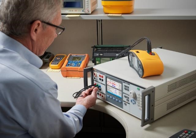
NIST-traceable standards for dimensional, pressure, mass, temperature, and electrical disciplines
Direct Current- Josephson Voltage Standard, Voltage Divider, Fluke 752A, American Reliance PLA 4K-400-360, Standard Resistor/Precision Multimeter, Standard Resistor and DCC Bridge
Alternating Current-Fluke 792A AC/DC Transfer Standard, Fluke A55 Thermal Converters, Fluke A40B Shunts, Pacific Power Source 140AMX, Phase Meter, Phase Generator, Capacitance Bridge, Standard Inductors, Cesium & GPS Receiver w/ Time Interval Analyzer, Reference Magnets
RF and Microwave- Thermistor Mount, Power Sensor, Coaxial WGBC Piston Attenuator, Attenuation Measurement Receiver, Agilent N5230A/N4690B Type N, Agilent E5071C/85092C Type N, Entegra 1240,Agilent N5531S Measuring Receiver
Photometric, Radiometric, Fiber Optic- Standard Lamp (Illuminant ‘A’), Standard Photometer & Lamp, Standard Detectors and Directional Transmitting Standard, Standard Lamps and Monochromator, Fiber Optic Power Meter, Fiber Optic Spectrum Analyzer
Video- Video Amplitude Calibrator, Video Waveform Monitor Thermodynamics- Comparison bath & Standard Platinum Resistance Thermometer, Two-Pressure Dew Point Standard, Black Body Source, Laminar Mass Flow Standard, Sonic Mass Flow Standard, Liquid Flow Prover
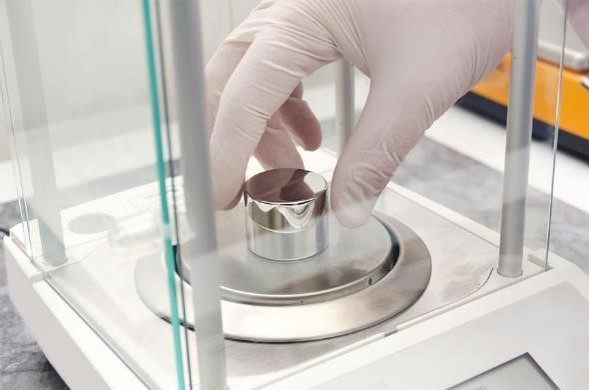
Mass, Force, Torque- Reference Masses, Balance, Comparator, Class F Weights, Comparison to Reference Load Cells (Tension and Compression),Torque Testing Machine, Torque Moment Arm & Weights, Tachometer Calibrator
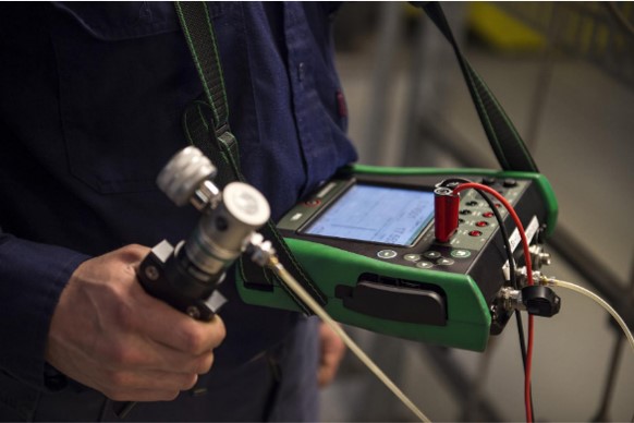
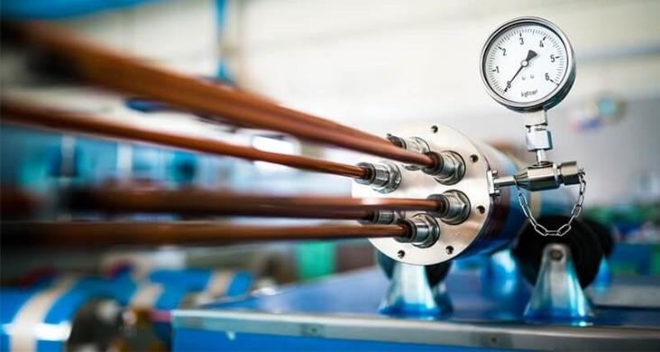
ANSI/NCSL Z540.1 and Z540.3 compliant calibration of analytical, chemical, gas, and particle counter equipment, torque and gas flow, load cells, pressure transducers, gages, humidity and temperature, and electrical measuring and test equipment.
Discover the cosmos! Each day a different image or photograph of our fascinating universe is featured, along with a brief explanation written by a professional astronomer.
Discover the cosmos! Each day a different image or photograph of our fascinating universe is featured, along with a brief explanation written by a professional astronomer.
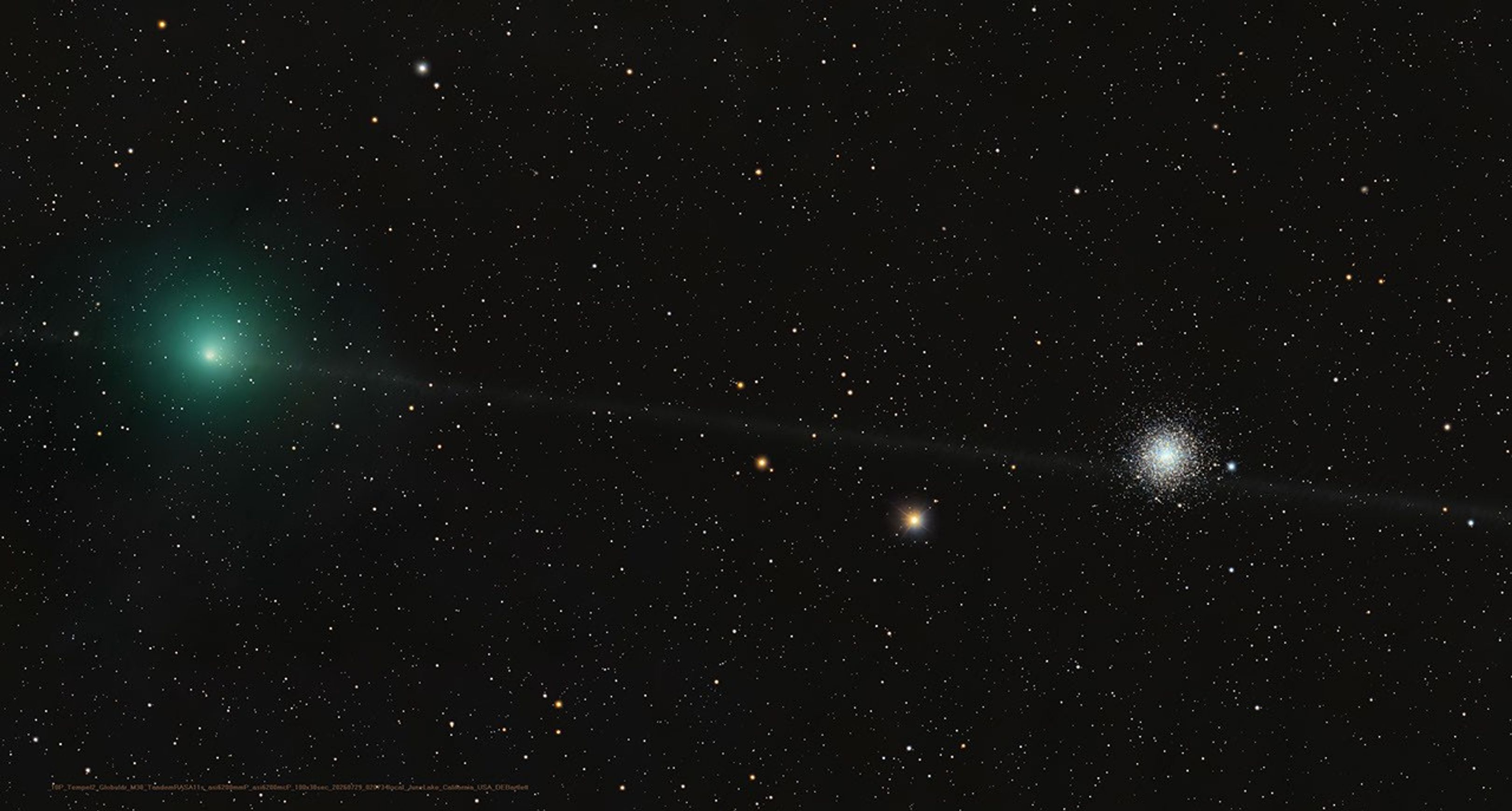
A Messier Moment for Tempel 2
Explanation: Which of these is not a comet? You guessed it – the one on the right is a globular star cluster. The diffuse greenish coma of periodic comet 10P/Tempel 2 is at left in the frame. In fact the globular star cluster is Messier 30, also known as M30, or the 30th entry in astronomer Charles Messier’s catalog of things which are not comets. The well-known 18th century astronomer kept a list of objects he observed, now his famous Messier Catalogue of Nebulae and Star Clusters, which did not move from night to night against the background stars and so were not the comets he was hunting for. So the famous comet hunter would get the correct answer too, even though his telescope would show both 10P/Tempel 2 and distant star cluster as similar looking faint and fuzzy objects in his field of view. Recorded on July 29, this modern telescopic image captures periodic comet Tempel 2 as it briefly swept close on the sky to M30. While the periodic comet’s faint, narrow, orbital dust trail seems to pierce the globular star cluster, Tempel 2 was a mere 3.5 light-minutes away. Messier 30 is some 28,000 light-years distant.
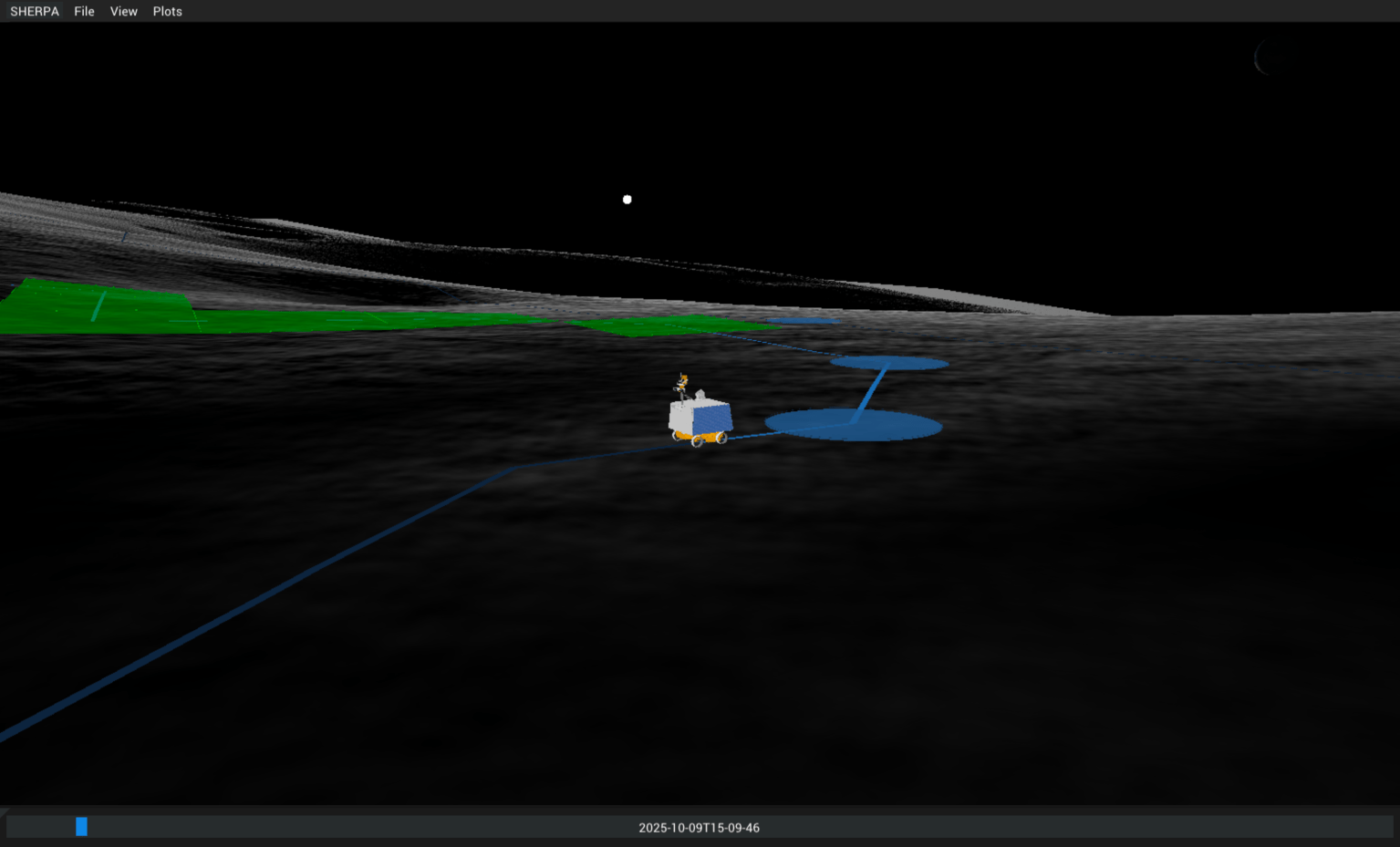
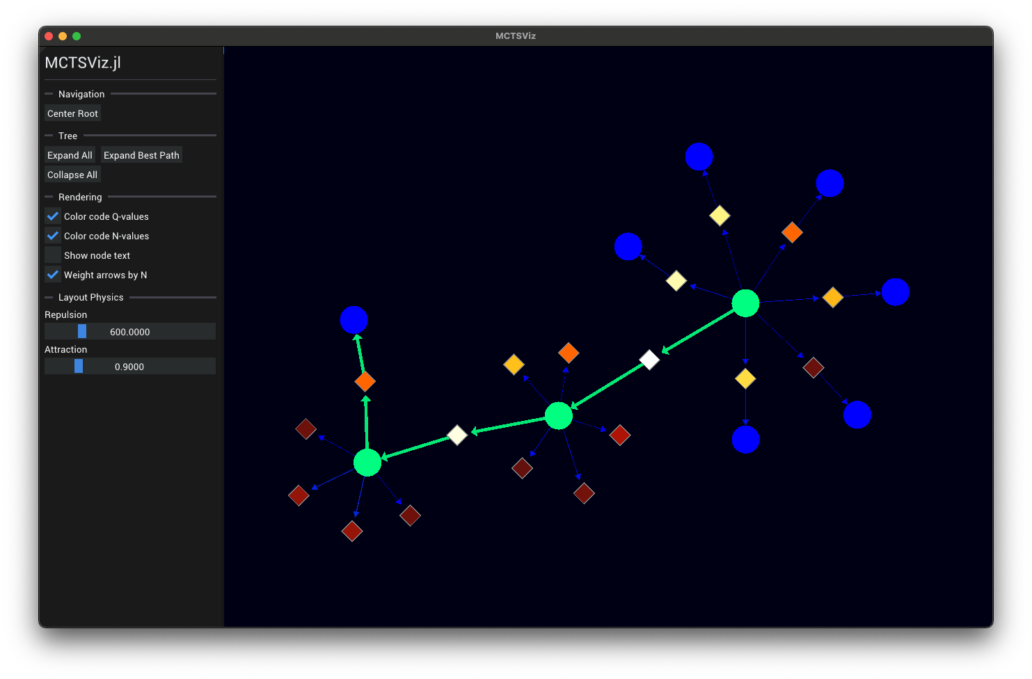
Strategic planning and simulation tool used for many lunar rover projects such as VIPER, Artemis Pressurized Rover, and CT-4. Utilizes AI methods for decision making under uncertainty such as Markov decision processes (MDPs) and partially observable Markov decision processes (POMDPs) for automated optimal mission planning.
State of the art map computation for off-world missions
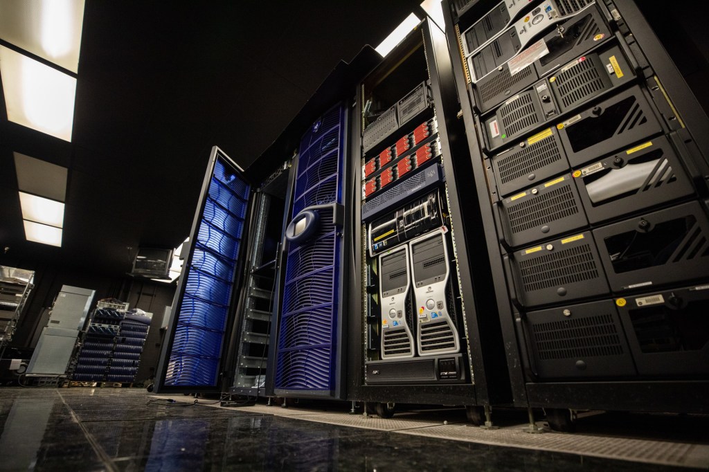
Running on the NASA Ames supercomputer, Hyperion is used for multiple missions to simulate conditions off-world. For VIPER, Artemis, and Moon Base missions, Hyperion is used to compute lighting conditions ahead of time in different operating regions near the lunar south pole for use in mission planning software such as SHERPA.
Pushing the state of the art of AI, MDPs, and POMDPs for missions which must make autonomous real-time decisions far from home.
In development for highly autonomous missions including deep space missions, SHERPA-RPA is used to construct extensively tested and validated decision making policies ahead of time that will be autonomously executed onboard. This enables new types of missions which do not need to rely on extensive human operator support.
Library for developing desktop GUIs in Julia with real-time 2D and 3D graphics.
Originally built for the SHERPA GUI, Mirage.jl powers all of ADMG’s graphical tools. From inspecting in the internals of MDPs and POMDPs, to visualizing rover missions on the lunar south pole, Mirage.jl seamlessly integrates into the Julia language ecosystem and enables developer friendly 2D and 3D real-time rendering.
Edward Balaban Zachary Booth Evan Astle Grace Kim Michelle Ho Kirthika Ashokkumar
Alumni
Tomer Arnon Somrita Banerjee Saylor Brisson Thomas Cannon Wyatt Cannon Jennifer Chang Sophia Eichholz Sarah Feng Alex Gao Miguel Garcia Leyton Ho Chandler Kilpatrick Logan Kilpatrick Robert Moss Molly O’Connor Joshua Ott Nobel Truong Hailey Warner
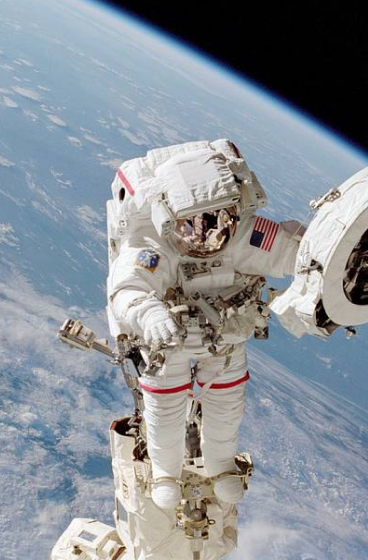
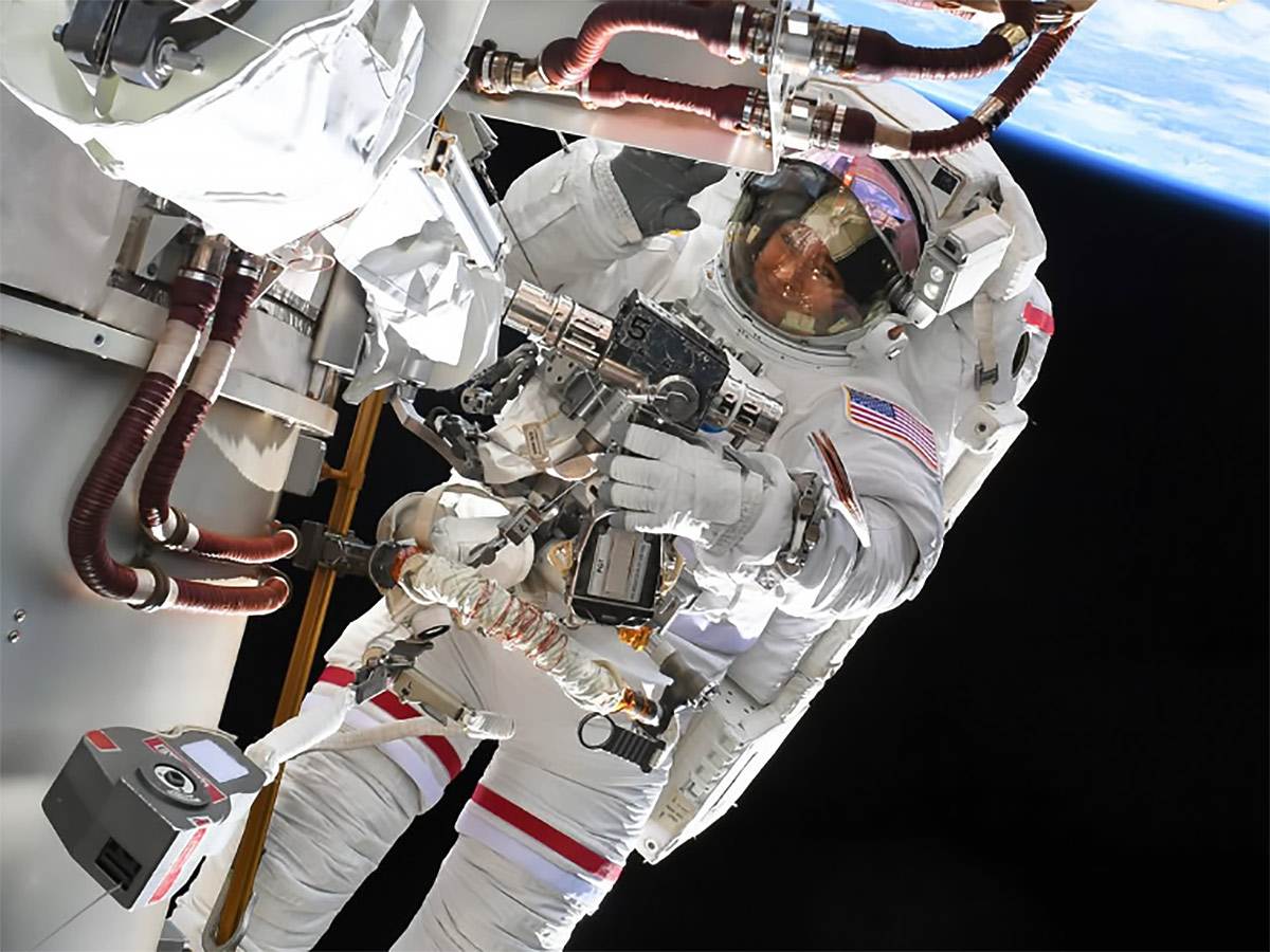
NASA astronaut Jessica Meir shared a pictured of herself during a spacewalk on her Instagram page taken by NASA astronaut Anil Menon.
Instagram/@Astro_Jessica
On Aug. 6, NASA astronauts Jessica Meir and Anil Menon concluded a 6-hour, 27-minute spacewalk outside the International Space Station. Meir and Menon successfully completed their primary objective of preparing the 3B power channel for the future installation of a roll out solar array. Toward the end of the spacewalk, a carbon dioxide sensor on Menon’s spacesuit indicated an unexpected data reading. Menon reported no other issues during the spacewalk.
Although the sensor returned to normal readings following removal of the suit, engineers on the ground will continue to evaluate over the coming days whether to change suits for the next spacewalk. As a result, NASA will move the next spacewalk to replace a Space-to-Ground antenna on the space station to Tuesday, Aug. 18. As of now, the third planned spacewalk this month remains scheduled on Tuesday, Aug. 25. The agency will provide additional spacewalk details early next week.
On Friday, NASA astronaut Jack Hathaway of studied Canadarm2 robotic arm operations planned to support the next spacewalk. NASA will soon name the spacewalkers who will replace a space-to-ground antenna to maintain high-speed data and communication transmissions between Mission Control Center and the space station.
ESA (European Space Agency) astronaut Sophie Adenot was back on exercise research working out with new and advanced gear to inform countermeasures that may improve muscle and bone health in microgravity. She first wore the EasyMotion-2 suit that sent electrical impulses and triggered muscle contractions to supplement her workout session on the advanced resistive exercise device in the Tranquility module. Afterward, she moved into the Columbus laboratory module and performed rope pull exercises on the European Enhanced Exploration Exercise Device (E4D). Researchers are evaluating the E4D’s effectiveness for use on missions to the Moon, Mars, and beyond.
Numerous science investigations and lab maintenance tasks also kept the three Expedition 75 cosmonauts busy at the end of the week. Roscosmos flight engineer Andrey Fedyaev started his shift measuring his blood pressure while wearing a series of cuffs on his arm, wrist, and fingers for a circulation system study. He wrapped up his day inspecting and cleaning smoke detectors in the Rassvet module. Flight engineer Pyotr Dubrov set up an automated Earth photography session to capture European and Asian landmarks then tested artificial intelligence tools to improve crew operations. Flight engineer Anna Kikina worked in the Zarya module photographing areas to identify optimal stowage locations and locate hardware.

 Login