❌

Normal view

Arctic warming fuels 2 distinct climate regimes in Siberia that could wake up a methane 'sleeping giant'

Two distinct climate regimes that could trigger runaway methane emissions are emerging in Siberia due to Arctic warming, new research suggests.

While western Siberia is becoming wetter in response to rising heat and moisture transported from the North Atlantic Ocean, eastern Siberia is getting drier and more prone to wildfires, a study published Aug. 6 in the journal Science finds. The Yenisei River (also spelled Yenisey) in central Russia delineates the separate environmental states β€” referred to as regimes because they describe specific types of climates β€” on each side of the basin, the study authors said.

Between 2010 and 2023, methane emissions from Siberia rose by 5% per year, with western Siberia releasing methane mainly via microbial activity in thawing soils and eastern Siberia discharging the powerful greenhouse gas through biomass burning, the results showed.

"Given the observed increases in permafrost thaw, wetland activity, and wildfire occurrence, an increase in methane emissions was expected," study co-author Paul Palmer, a professor in the School of Geosciences at the University of Edinburgh, told Live Science in an email. "What is surprising is how large and sustained the increase appears to be."

Annual methane emissions grew by about 13.2 million tons (12 million metric tons) over the study period, almost mirroring the rate of increase in methane emissions from wetlands worldwide. Although Siberia currently makes up only about 5% of global methane emissions, the region is becoming one of the fastest-growing natural methane sources on the planet, Palmer said.

In their study, Palmer and his colleagues integrated satellite observations with near-surface measurements to map methane emissions from Siberia over time. Instead of adding up individual methane sources on the ground, the researchers used a modeling method known as a methane flux inversion system, which helped them limit the uncertainty in their estimates to roughly 10%.

Siberia is vast, remote, sparsely instrumented and currently inaccessible for many scientists due to the Russia-Ukraine war, making it hard to monitor methane consistently by any means other than satellites. Although satellites rely on sunlight, of which Siberia gets very little in the winter, most methane emissions are thought to occur in the spring and summer, when Siberia gets more sunlight, Palmer said.

The results of the study show that Arctic warming amplifies methane emissions via distinct pathways in western and eastern Siberia because the regions are influenced by different climate patterns. The researchers also used climate models to predict future methane emissions from Siberia and found that additional warming could unleash millions of tons of greenhouse gases stored in forests and permafrost, which would further accelerate the warming trend.

In western Siberia, methane is released mainly from permafrost, or ground that has stayed frozen for at least two consecutive years. Siberia holds 46% of the Northern Hemisphere's permafrost, and this icy sediment traps vast amounts of carbon that have accumulated for thousands of years, Palmer said.

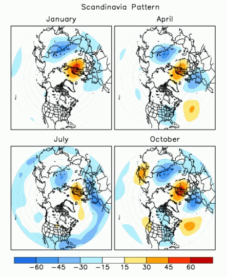
Western Siberia is influenced by the Scandinavian pattern of atmospheric circulation, a climate connection that consists of a main circulation center over Scandinavia and opposing weaker centers over Western Europe and eastern Russia. Global warming makes the Scandinavian pattern transport more warmth and moisture to western Siberia from the North Atlantic. Together with soaring temperatures in western Siberia itself, this triggers extensive permafrost thaw and unlocks carbon that microbes can convert into methane.

Maps showing a climate pattern known as the Scandinavian pattern of atmospheric circulation.

The Scandinavian pattern of atmospheric circulation (seen here in the positive phase) consists of different pressure systems above Scandinavia, Western Europe and eastern Russia/western Mongolia. (Image credit: NOAA)

Conversely, eastern Siberia is influenced by a climate pattern known as the Arctic Oscillation, which causes atmospheric air pressure to "seesaw" between the Arctic and the Northern Hemisphere's middle latitudes. Climate change affects the Arctic Oscillation, leading to persistent high-pressure systems that intensify heat waves, reduce cloud cover and promote wildfires in eastern Siberia, Palmer said.

The climate models showed that methane emissions will increase with temperature rise and that the increase could become steeper the hotter the world gets, triggering a feedback loop.

"Eastern Siberia appears to be the main driver of the projected increase because it is warming faster than western Siberia and has seen a sharp rise in extreme wildfires," Palmer said. "Whether that trend continues will depend on how much vegetation remains available to burn, but there is also evidence that fires may be accelerating permafrost thaw and the release of methane from previously frozen ground."

However, the rise in methane emissions reported in the study is small relative to global and projected future emissions, especially if wildfires are already destabilizing eastern Siberia's permafrost, Palmer said.

"Siberia's vast permafrost carbon store is a sleeping giant," he said. "Continued warming risks waking up a much larger source of greenhouse gases."

'A worrying snapshot': Satellite image shows large patches of open water less than 40 miles from the North Pole

Large patches of open water were visible just 37 miles (60 kilometers) from the North Pole on Aug. 29, a NASA satellite image shows. Although this doesn't necessarily mean that Arctic ice is worse off this year than the past few years, the image reveals how severely climate change is affecting the region, experts say.

The image is from the NASA Worldview satellite photo browsing tool and was shared last week on the blog Arctic News. The patches are "quite striking," but it's not the first time that water has encroached upon Arctic ice in this way, said Julienne Stroeve, a professor of polar observation and modeling at University College London.

"We can see open water at times at the North Pole but I don't think it's ever been this extensive," Stroeve told Live Science in an email. For instance, the central Arctic Ocean and regions north of 80 degrees north latitude, an imaginary line that crosses Canada's Ellesmere Island and Spitsbergen in Norway, were highly fragmented in early September 2016.

The time of year is one reason water is now visible in this region, said Zachary Labe, a climate scientist at Climate Central, a nonprofit news organization that analyzes and reports on the climate. "By the end of summer, the sea ice generally becomes more fragmented, with areas of open water appearing more widespread between pieces of sea ice," Labe told Live Science in an email.

This means that local weather conditions and ocean currents can create large gaps between ice floes, Labe said. For example, strong winds can push ice fragments together or pull them apart, leading areas of water to widen or close within hours or days.

"Individual satellite images from around the North Pole in just the last two weeks show dramatic changes in the amount and location of visible open water," he noted.

The current extent of Arctic sea ice isn't particularly low when compared with record-setting years, but that's now very changeable due to the diffuseness of the ice, Stroeve said. "Winds could change and compress the ice into a more compact ice cover leading to sudden drops in total extent," she said.

There is no specific distance from the North Pole at which open water should normally stop, because Arctic conditions can vary substantially from year to year, Labe said. However, the summer ice has become thinner and more fragile in recent years, so open water is consistently reaching closer to the North Pole than it did before.

"To me, this image doesn't necessarily show that conditions are dramatically worse this year compared to other recent years," Labe said. "Instead, it represents a worrying snapshot of a very different Arctic Ocean than only a few decades ago and one that is quickly changing over time."

The Arctic is warming nearly four times faster than the global average. Some of the northernmost regions that have historically boasted expansive, thick and persistent ice at the end of summer now have young, brittle ice floes instead, Labe said.

"The broader implications of more open water across the Arctic Ocean are wide-ranging, from changes in local weather and ocean conditions to impacts on marine ecosystems and greater coastal risks like erosion and flooding for Arctic communities," he said.

Scientists expect that sea ice will start to refreeze by mid- to late September, closing at least some of the gaps.

An ancient 'supervolcano' has been found hiding beneath eastern England. But experts say there's not enough evidence to call it that.

Scientists have identified an ancient volcano on England's east coast that is so eroded, it took researchers three decades to piece together its enormous size and explosive past. What remains of the caldera system is located beneath the English counties of Norfolk and Lincolnshire.

However, while the volcano undoubtedly produced at least one huge-scale eruption, some experts don't think there is enough evidence for the structure to be called a supervolcano.

"It obviously must have been a very large eruption, but it would be very difficult to calculate the volume of the eruption given the poor preservation of the deposits," said Michael Poland, a research geophysicist with the Cascades Volcano Observatory and the scientist-in-charge of the Yellowstone Volcano Observatory. "This is part of the reason I really hate the term 'supervolcano,'" Poland, who was not involved in the discovery, told Live Science in an email.

In a recent analysis, published April 29 in the Geological Society of America Bulletin, scientists examined zircon crystals that were taken 80 years ago from boreholes 40 miles (65 kilometers) apart in Norfolk and Lincolnshire. Zircon crystals are smaller than the diameter of a human hair and form within molten magma underground before a volcano erupts. They contain uranium that decays into lead isotopes at a known rate, enabling researchers to precisely date eruptions.

The results showed an age match between the zircon crystals from Norfolk and Lincolnshire and counterparts taken from the Kinnekulle tephra, a thick layer of volcanic ash covering Scandinavia and the Baltic region. This suggests the ash plume from the volcano in what is now eastern England blew across the Tornquist Sea, a body of water that existed during the Ordovician period (488.3 million to 443.7 million years ago), and settled on what is now Scandinavia.

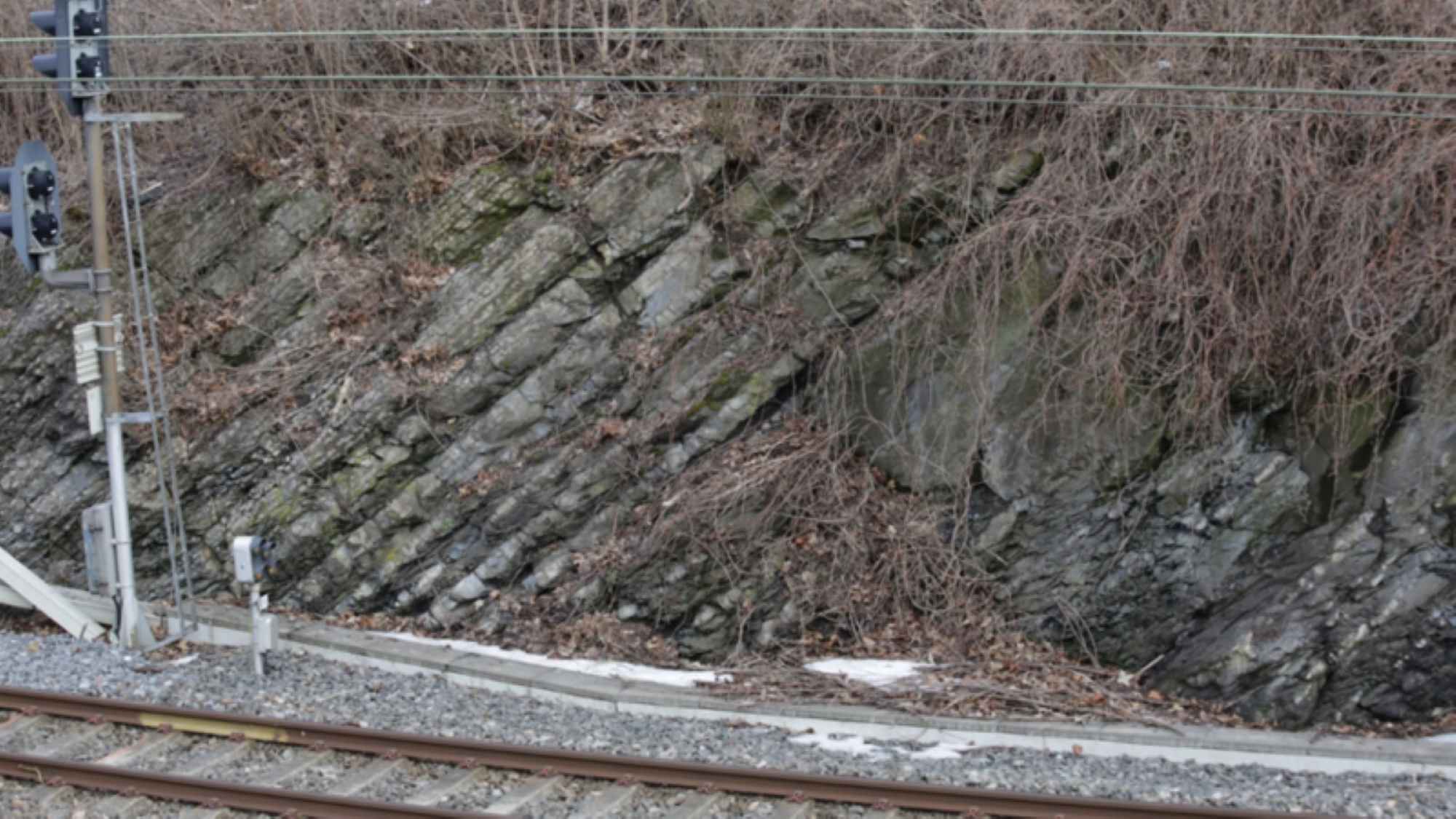
Evidence of the ancient volcanic ash near train tracks in Norway.

The Kinnekulle tephra is visible next to train track north of Oslo in Norway. Dipping strata of the Arnestad Formation (Late Ordovician) contain thin beds of gray-green altered volcanic ash. (Image credit: Β© Tim Pharaoh)

Researchers already knew that the Kinnekulle tephra was formed during a massive volcanic eruption. But the recent analysis shows for the first time how far the ash traveled and, therefore, how big the eruption really was.

The eruption would have also produced huge pyroclastic flows, or avalanches of rocky debris, ash and hot gas that race down the sides of some erupting volcanoes, said Peter Rowley, a volcanologist and senior lecturer at the University of Bristol in the U.K. who was not involved in the analysis. "The last eruption of this kind of scale was the Oranui event at Taupō in New Zealand, over 26,000 years ago," he told Live Science in an email.

However, while the explosion would have been impressive and equivalent to the force of thousands of atomic bombs, experts said the definition of a supervolcano is vague and there are better ways to describe what happened.

"The scientific definition of a supervolcano varies a little; it’s a term we tend not to use as volcanologists much," Rowley said. "In this case we would describe it as an ultraplinian eruption."

Ultraplinian eruptions are the most violent type of volcanic explosions, ejecting more than 240 cubic miles (1,000 cubic kilometers) of material. It's difficult to say exactly what the eruption that formed the Kinnekulle tephra would have looked like, but it likely lasted days to weeks and formed ash clouds taller than 25 miles (40 km) that reached into the stratosphere.

Geologists tend to reject the term supervolcano because it is imprecise, instead preferring to describe eruptions by the volume of material they eject.

Stephen Self, a physical volcanologist at the University of California, Berkeley, agreed that the term supervolcano can be too vague. "Supervolcano has become a kind-of buzz-word," he told Live Science in an email. "It's the deposits of the eruptions that are recognized, not the volcano."

Very little of the material ejected in England's ultraplinian eruption remains today, because most of it was eroded or buried. "The geological record is far from complete so it can be very difficult to say much about these eruption volumes with very old volcanoes," Rowley said.

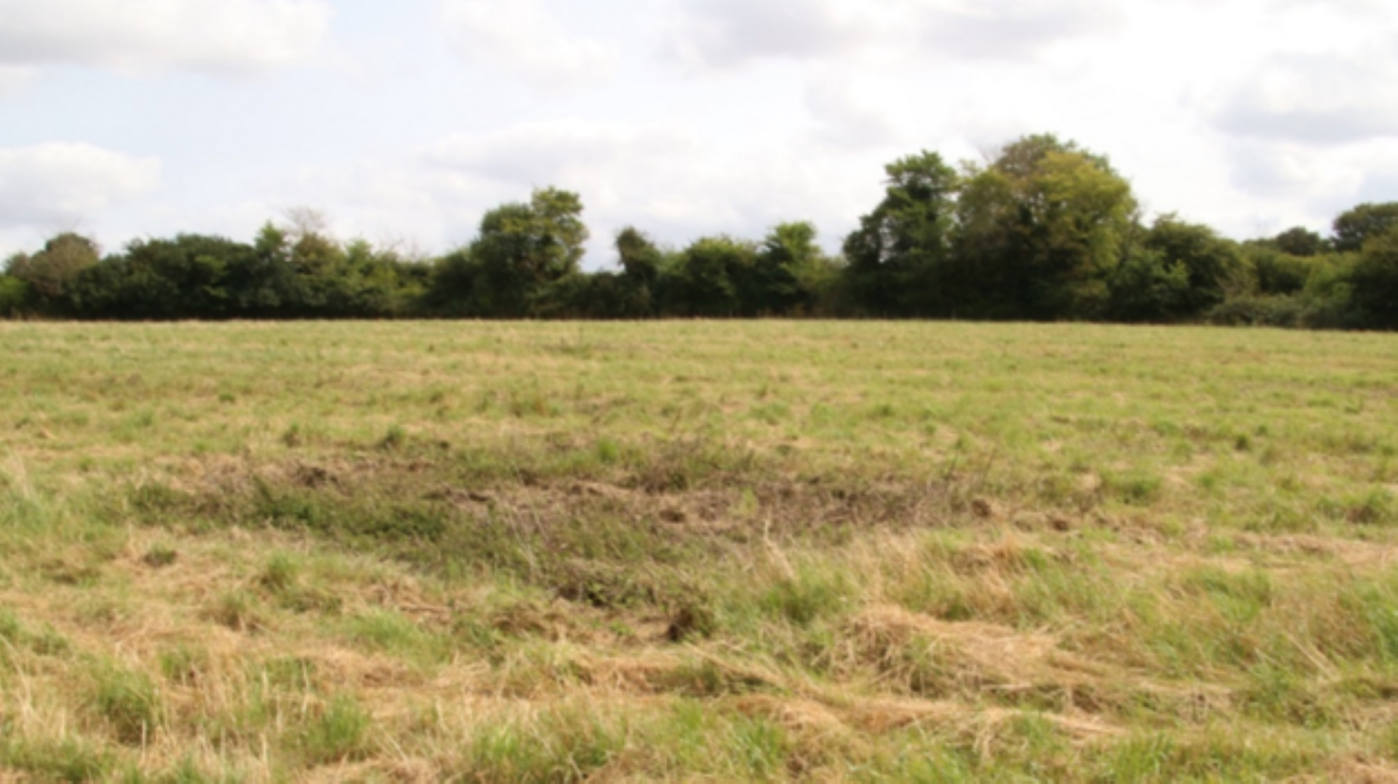
A field in England where scientists drilled boreholes into an ancient volcano.

The location of one of the borehole samples studied, at North Creake in Norfolk. (Image credit: Β© Tim Pharaoh)

Similarly, the Kinnekulle tephra has been degraded over time, Poland said.

The analysis also found evidence for an earlier eruption of the volcano that occurred 453.7 million years ago. However, there is no trace of these eruptions at the surface today; the boreholes are located in some of England's flattest landscapes, study first author Tim Pharaoh, a geophysicist with the British Geological Survey, said in a statement in August.

It's not surprising to find traces of big, ancient volcanoes in England. The recently identified volcano is part of a wider volcanic system that was active 450 million years ago and includes Eryri National Park in Wales and the Lake District in northwestern England, Rowley said.

"It's best not to imagine whole preserved volcanoes, but rather that we have deposits from their eruptions, or rocks which formed in the magma reservoirs beneath the original volcano," Rowley said. "These are often deformed and altered by tectonic events meaning that it takes some careful geological investigation to interpret the true picture."

❌