❌

Normal view

Crew Works Microbiology, Advanced Tech and Congratulates New Artemis III Crew
9 June 2026 at 20:57
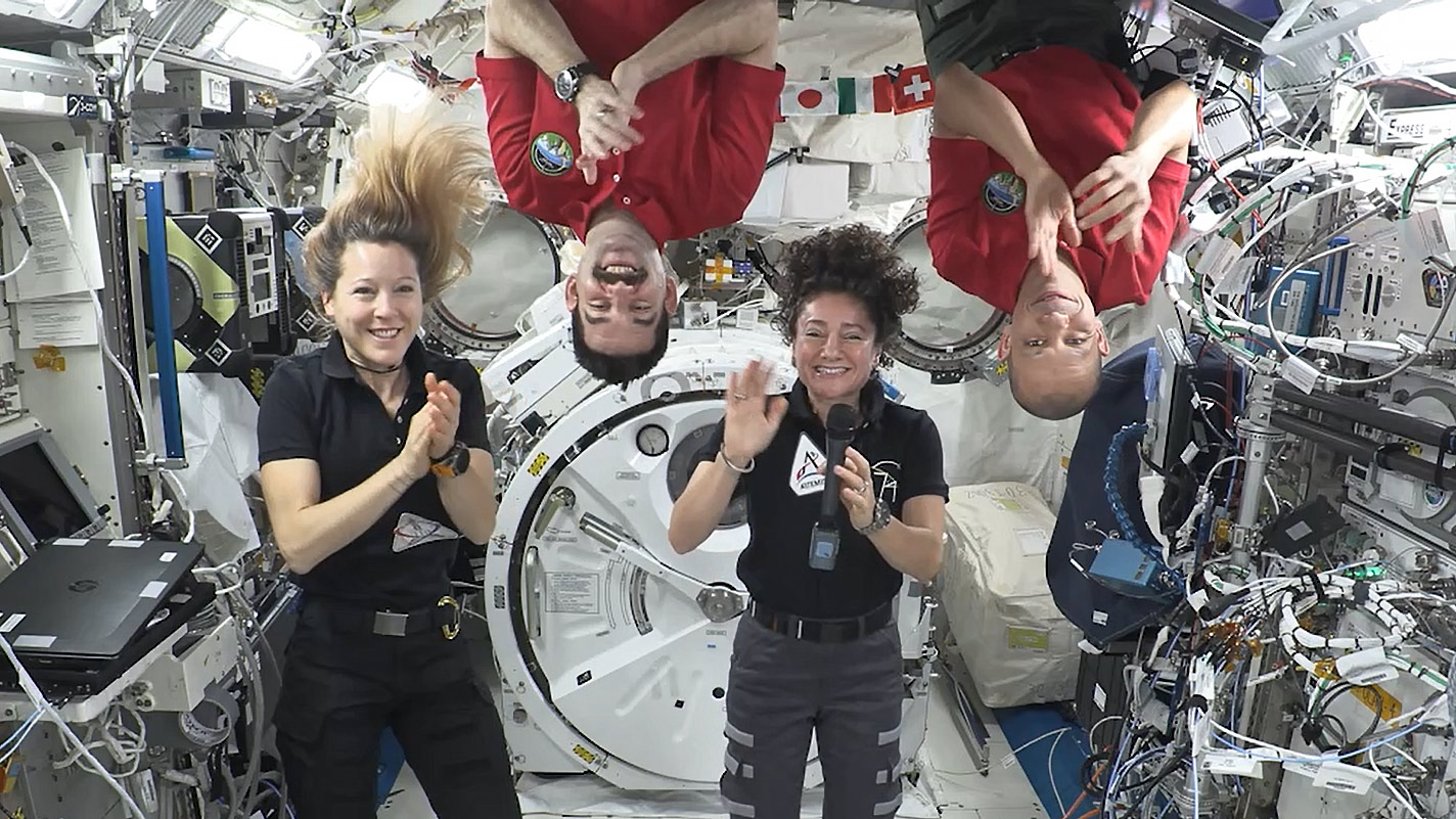
Expedition 74 crew members (from left) Sophie Adenot, Jack Hathaway, Jessica Meir, and Chris Williams congratulate the Artemis III crew in a recorded video message.
NASA

Microbiology and human research were the main scientific focus aboard the International Space Station on Tuesday to protect health on and off the Earth. The Expedition 74 crew members also worked on advanced research hardware and sent down a congratulatory message to the Artemis III crew, who were named during an announcement from the Johnson Space Center in Houston.

Some common bacteria have shown an increased resistance to antibiotics in the space environment potentially affecting an astronaut’s ability to fight an infection. Flight engineers Jack Hathway of NASA and Sophie Adenot of ESA (European Space Agency) explored the antibiotic-resistant organisms inside the Kibo laboratory module’s Life Science Glovebox and the Harmony module’s maintenance work area by processing the microbial samples and preparing them for DNA extraction and analysis. Doctors will use the data to understand how microbes adapt to microgravity possibly informing countermeasures to reduce the risk to astronaut health and protect patients on Earth.

NASA flight engineers Jessica Meir and Chris Williams partnered together loading a CubeSat-packed small satellite orbital deployer into Kibo’s airlock that will soon be placed into the vacuum of space. The Japanese robotic arm will grapple the deployer and point it away from the orbital outpost where it will safely deploy the shoebox-sized satellites into Earth orbit. A series of tiny satellites will be released for public and private research, including the Hokushin-1 CubeSat that will test space technologies such as radio frequency, propulsion, and solar arrays.

Roscosmos cosmonauts Sergey Kud-Sverchkov and Andrey Fedyaev worked on a pair of different investigations on Tuesday to continuously monitor how weightlessness affects the human body. Kud-Sverchkov, the orbital outpost’s commander, strapped an acoustic sensor around his neck that recorded his rapid exhalation to learn how living in space affects the respiratory system. Fedyaev wore a set of cuffs attached to his arms, wrist, and fingers measuring his blood pressure for a microgravity cardiac experiment. Roscosmos flight engineer Sergei Mikaev was back on artificial intelligence research studying new tools to boost crew efficiency and communications aboard a spacecraft.

Four of the station’s astronauts also sent down a message congratulating the four new Artemis III crew members commander Randy Bresnik of NASA, pilot Luca Parmitano of ESA, and NASA mission specialists Frank Rubio and Andre Douglas. The four flight engineers each spoke a few inspiring words with Meir stating, “Congratulations, Artemis III and godspeed on the journey ahead.” Watch the crew message on @Space_Station X.

Learn more about station activities by following the space station blog, @space_stationon X, as well as the ISS Facebook and ISS Instagram accounts.

Get the latest from NASA delivered every week. Subscribe here.

The post Crew Works Microbiology, Advanced Tech and Congratulates New Artemis III Crew appeared first on NASA Science.

San Francisco’s Metropolitan Mosaic

9 June 2026 at 05:00
A top-down photo of San Francisco shows dense gray urban infrastructure interspersed with green parks. Waves and ships are visible in the surrounding blue-green water.
May 27, 2026

A period of unsettled weather brought scattered showers and thunderstorms to California’s Bay Area on May 27, 2026. That afternoon, a break in the clouds left downtown San Francisco and nearby communities beneath mostly cloud-free skies, allowing an astronaut aboard the International Space Station to take this photograph.

The image captures two of the region’s iconic bridges. The Golden Gate Bridge connects the northern San Francisco Peninsula with Marin County to the north, while the San Francisco-Oakland Bay Bridge spans the bay toward Oakland to the east.  

Near the center of the image, Golden Gate Park stands out as a long, rectangular strip of green amid the dense urban landscape. Spanning more than 1,000 acres (400 hectares), the park encompasses meadows, gardens, wooded areas, and lakes. Additional green space toward the north around the Golden Gate Bridge is part of a national recreation area. 

The nadir (downward-looking) perspective also provides a clear view of the patchwork of street grids, which were laid out over San Francisco’s hilly terrain as the city grew in successive stages. In the heart of the downtown area, Market Street runs southwest to northeast and serves as a prominent divider between two distinct grid orientations: one aligned with the bay and the other aligned with the street.  

Along the northeastern and eastern waterfront, various structures extend into the bay. Toward the north, these include a historic wharf, seawalls, and piers—most built in the early 1900s, though some date back into the 1800s. The adjacent waters support heavy maritime traffic, including cargo and container ships, cruise vessels, and regional ferries.

Breaking waves are visible along the western coast, including at Ocean Beach, the 3.5-mile stretch of sandy shore adjacent to Golden Gate Park. On May 27, the National Weather Service warned of hazardous conditions at the region’s beaches due to strong northerly winds. Long-period swells from the northwest contributed to the increased risk of rip currents as well as sneaker waves in the days after this image was acquired.

Astronaut photograph ISS074-E-619284 was acquired on May 27, 2026, with a Nikon Z9 digital camera using a focal length of 800 millimeters. It is provided by the ISS Crew Earth Observations Facility and the Earth Science and Remote Sensing Unit at NASA Johnson Space Center. The image was taken by a member of the Expedition 74 crew. The image has been cropped and enhanced to improve contrast, and lens artifacts have been removed. The International Space Station Program supports the laboratory as part of the ISS National Lab to help astronauts take pictures of Earth that will be of the greatest value to scientists and the public, and to make those images freely available on the Internet. Additional images taken by astronauts and cosmonauts can be viewed at the NASA/JSC Gateway to Astronaut Photography of Earth. Story by Kathryn Hansen.

Downloads

A top-down photo of San Francisco shows dense gray urban infrastructure interspersed with green parks. Waves and ships are visible in the surrounding blue-green water.

May 27, 2026

JPEG (12.13 MB)

References & Resources

You may also be interested in:

Stay up-to-date with the latest content from NASA as we explore the universe and discover more about our home planet.

Belts of Green in the Washington Suburbs
3 min read

Along the northeast side of the Capital Beltway in Maryland, green spaces weave through the developed landscape.

Article
Contours of the James Bay Lowlands
3 min read

After the Laurentide Ice Sheet retreated from present-day Hudson Bay, rebounding land has revealed striking nearshore topography.

Article
Great Balls of Fire
4 min read

An astronaut on the International Space Station was surprised to photograph a shower of light streaking through the darkness while…

Article

The post San Francisco’s Metropolitan Mosaic appeared first on NASA Science.

San Francisco’s Metropolitan Mosaic

9 June 2026 at 05:00
A top-down photo of San Francisco shows dense gray urban infrastructure interspersed with green parks. Waves and ships are visible in the surrounding blue-green water.
May 27, 2026

A period of unsettled weather brought scattered showers and thunderstorms to California’s Bay Area on May 27, 2026. That afternoon, a break in the clouds left downtown San Francisco and nearby communities beneath mostly cloud-free skies, allowing an astronaut aboard the International Space Station to take this photograph.

The image captures two of the region’s iconic bridges. The Golden Gate Bridge connects the northern San Francisco Peninsula with Marin County to the north, while the San Francisco-Oakland Bay Bridge spans the bay toward Oakland to the east.  

Near the center of the image, Golden Gate Park stands out as a long, rectangular strip of green amid the dense urban landscape. Spanning more than 1,000 acres (400 hectares), the park encompasses meadows, gardens, wooded areas, and lakes. Additional green space toward the north around the Golden Gate Bridge is part of a national recreation area. 

The nadir (downward-looking) perspective also provides a clear view of the patchwork of street grids, which were laid out over San Francisco’s hilly terrain as the city grew in successive stages. In the heart of the downtown area, Market Street runs southwest to northeast and serves as a prominent divider between two distinct grid orientations: one aligned with the bay and the other aligned with the street.  

Along the northeastern and eastern waterfront, various structures extend into the bay. Toward the north, these include a historic wharf, seawalls, and piers—most built in the early 1900s, though some date back into the 1800s. The adjacent waters support heavy maritime traffic, including cargo and container ships, cruise vessels, and regional ferries.

Breaking waves are visible along the western coast, including at Ocean Beach, the 3.5-mile stretch of sandy shore adjacent to Golden Gate Park. On May 27, the National Weather Service warned of hazardous conditions at the region’s beaches due to strong northerly winds. Long-period swells from the northwest contributed to the increased risk of rip currents as well as sneaker waves in the days after this image was acquired.

Astronaut photograph ISS074-E-619284 was acquired on May 27, 2026, with a Nikon Z9 digital camera using a focal length of 800 millimeters. It is provided by the ISS Crew Earth Observations Facility and the Earth Science and Remote Sensing Unit at NASA Johnson Space Center. The image was taken by a member of the Expedition 74 crew. The image has been cropped and enhanced to improve contrast, and lens artifacts have been removed. The International Space Station Program supports the laboratory as part of the ISS National Lab to help astronauts take pictures of Earth that will be of the greatest value to scientists and the public, and to make those images freely available on the Internet. Additional images taken by astronauts and cosmonauts can be viewed at the NASA/JSC Gateway to Astronaut Photography of Earth. Story by Kathryn Hansen.

Downloads

A top-down photo of San Francisco shows dense gray urban infrastructure interspersed with green parks. Waves and ships are visible in the surrounding blue-green water.

May 27, 2026

JPEG (12.13 MB)

References & Resources

You may also be interested in:

Stay up-to-date with the latest content from NASA as we explore the universe and discover more about our home planet.

Belts of Green in the Washington Suburbs

3 min read

Along the northeast side of the Capital Beltway in Maryland, green spaces weave through the developed landscape.

Article

Contours of the James Bay Lowlands

3 min read

After the Laurentide Ice Sheet retreated from present-day Hudson Bay, rebounding land has revealed striking nearshore topography.

Article

Great Balls of Fire

4 min read

An astronaut on the International Space Station was surprised to photograph a shower of light streaking through the darkness while…

Article
❌