
❌

Normal view

Jim Irons, Former Landsat Project Scientist, Wins Pecora Award
10 June 2026 at 15:00
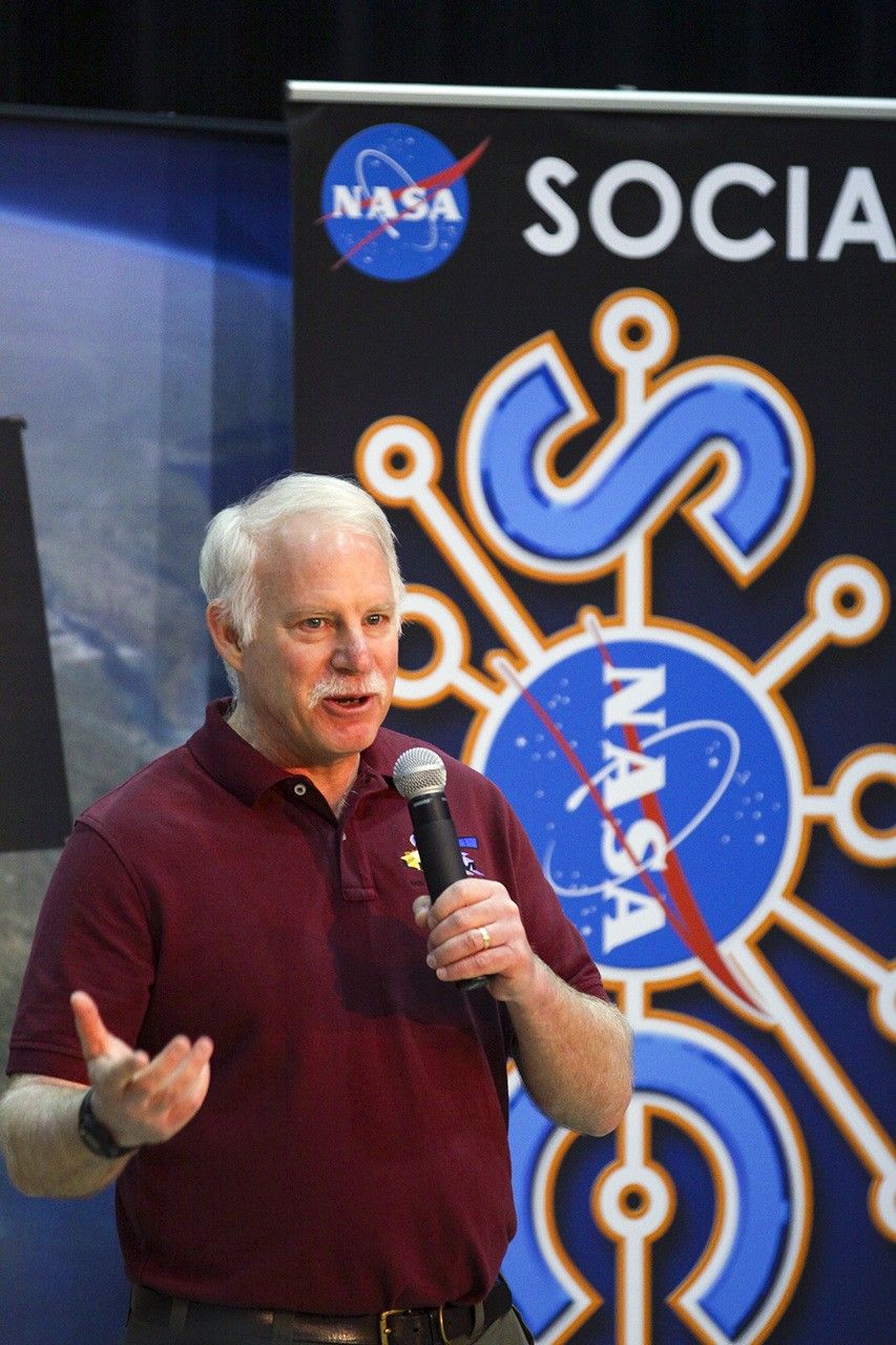
Jim Irons speaking into a microphone with some colorful banners behind him.
Now an emeritus scientist at NASA Goddard Space Flight Center, Dr. Jim Irons is the former Landsat 8 Project and GSFC Earth Science Division Director.

Last month, Landsat’s very own Jim Irons won the prestigious William T. Pecora Award. 

Irons, now an emeritus scientist at NASA Goddard Space Flight Center, played an integral role in shaping the Landsat program into what it is today. He served as deputy project scientist for Landsat 7 before taking over as project scientist for Landsat 8. From the earliest days of Landsat 8—then called the Landsat Data Continuity Mission (LDCM)—all the way through launch and operation, Irons worked across the agency and with colleagues at the USGS to ensure that Landsat continued providing critical data to researchers around the world. He championed rigorous calibration standards and fought to keep the thermal band on Landsat 8. Now, with projects like OpenET relying on evapotranspiration data derived from Landsat thermal imagery, the strength of his vision has only become more apparent. 

Irons also served as the director of NASA Goddard’s Earth Science Division during the turbulent early days of the COVID-19 pandemic. Contending with global disruption, he prioritized making sure that everyone had the support that they needed to continue doing great work. As a leader and a scientist, Irons left a legacy of collaboration and innovation that lives on today. 

We checked in with Irons about his role in Landsat’s history, what it takes to be a good leader, and winning the Pecora award:

NASA missions are so collaborative. Are there mentors, colleagues, or teams that you would want to share this recognition with or give special mention to?

One reason I feel so honored is that prior recipients have been my supervisors, mentors, role models, and colleagues whose work I admired and who inspired me. There’s a long list of people who have been recipients, and I am very honored to be added to that list.

There are also many people who have not yet been recognized who are very deserving. I’ve written letters of support for others, and I hope I’m called on again because there are more people who deserve recognition than there are awards to give out. 

One of the things highlighted in the Pecora Award announcement was your commitment to the long-term continuous data record of Landsat. Looking at the Landsat program, why is this continuity so critical for Earth science today?

Data continuity is the backbone of the Landsat program. We are looking for change over time. When we talk about climate change and the impact of humans on the land surface, those changes are multi-decadal. We wouldn’t be able to understand, characterize, and monitor those changes without a continuous data record.

And it’s really important that the data record is well-calibrated. When we see changes between data from one Landsat sensor relative to another, we need to be confident that it’s a change occurring on the Earth, not a change in the performance of the sensors.

That’s another major contribution cited in your award: how much you pushed for rigorous data calibration and quality assurance. How did you establish those processes, and how did that make Landsat the gold standard of satellite data?

Early in my career, I got in trouble over calibration. NASA was flying an airborne sensor called the Thematic Mapper Simulator, intended to anticipate the capabilities of Landsat 4 and 5. But the operators kept changing the radiometric gain in-flight to maximize the dynamic range. I told NASA Headquarters that we couldn’t compare that data to the actual Thematic Mappers if they kept changing the gain—it wasn’t the same radiometry! The HQ manager got really upset, but I weathered the storm and stuck to my guns.

Later, when Landsat 4 and 5 were returned to the U.S. government from private operation, there had been no real calibration since launch. I advocated for a ground system component at USGS EROS to perform calibration. I didn’t build it, but I did advocate for USGS to hire a brilliant guy named Jim Storey, who developed the software for the precise geolocation of pixels in the data.

When I became Landsat 8 Project Scientist, we needed a pre-launch calibration lead. I advocated for Brian Markham. Brian just did a remarkable job ensuring the calibration of the Operational Land Imager (OLI) and its cross-calibration with previous instruments. He was modest, humble, and built a highly effective team across private industry and agencies.

Another important part of your legacy was the effort to ensure that thermal-infrared measurements continued onto Landsat 8. Why was retaining those measurements so important?

Back when USGS charged for data, the use of thermal data was minimal. Some well-respected papers even claimed it wouldn’t be possible to use thermal data to estimate evapotranspiration rates. Based on that, the Director of Earth Sciences at NASA HQ was convinced that the thermal capability wasn’t providing a return on investment.

But while this debate was ongoing, people began developing methodologies for estimating evapotranspiration and water consumption using thermal data—prominently Martha Anderson at the USDA, and researchers at the University of Idaho. It became crucial for monitoring agricultural water use in the West, and was even used in adjudicating water rights. It was also useful for cloud detection and fire monitoring.

I felt strongly that dropping the thermal capability was inconsistent with our directive to continue the Landsat data record. However, due to time pressures and budget constraints, the decision was initially made to fly Landsat 8 without a thermal instrument. But then, when our schedule was pushed back by an independent review board, a window opened up. Center Director Ed Weiler, who had moved to HQ, supported putting a thermal sensor on the payload. Kathy Richardson and engineer Fernando Pellerano were assigned to build it on an incredibly tight schedule, and they did an unbelievable job.

Now, deriving evapotranspiration rates for water consumption is considered essential. Ironically, for Landsat 9, NASA HQ even briefly considered launching a satellite with only a thermal sensor!

You were the Project Scientist from the earliest days of the Landsat Data Continuity Mission (LDCM) all the way through the Landsat 8 launch and beyond. What was the biggest challenge you faced during its development?

There were a lot of problems. Laughs. Because of the Land Remote Sensing Policy Act of 1992, the government was exploring commercial data buys for the follow-on mission. NASA spent five painful years attempting to implement LDCM as a commercial data buy. Only one company ultimately responded to the RFP, and it wasn’t a good deal for NASA, so it was rejected.

Then we were directed to put the Landsat sensor on an NPOESS platform (combining civilian and military weather satellite requirements). That platform wasn’t technically suitable, and the program ultimately fell apart.

Finally, the Office of Science and Technology Policy directed us to launch a free-flyer. Bill Ochs took over as project manager, and he deserves so much credit for the success of Landsat 8. He essentially rescued the project and put it on a path to success.

Reflecting on the partnership between USGS and NASA, how did you help build that, and what makes long-term interagency collaboration possible?

Darrell Williams and I worked very hard to establish a good relationship between NASA Goddard and USGS EROS. I took many trips to Sioux Falls. With Landsat 7, the EROS Center Director at the time, Don Lauer, brought in new people with great experience, like Jim Storey, Doug Daniels, and Jim Nelson. They developed the geometric rectification software for Landsat 7, and by the time we worked on Landsat 8, they had the right people in place to develop the whole data processing system. And we all got along really well with them. We still keep in touch with a number of them and consider them friends. 

With Landsat 10 on the horizon, are there emerging applications or discoveries you’re excited about?

Yes. A major emerging capability is using Landsat data in concert with other systems, like ESA’s Sentinel-2, or with LIDAR and radar for 3D forest mapping. The community has asked for more frequent observations, especially more frequent thermal observations to measure water consumption more precisely without extrapolating over long gaps during the growing season.

There’s also great interest in using Landsat for water quality assessment, combining it with the PACE mission to monitor coastal and inland water quality. And tracking glacial velocities, glacial retreat, and even population displacement in conflict regions are all expanding areas. Landsat is truly foundational.

What was your biggest takeaway about leadership from your role as Director for the Earth Science Division at Goddard?

I was asked to step up after my predecessor, Piers Sellers—who was an absolute superstar—passed away. My main goal was simply to create an environment where the highly diverse researchers within the division could be successful. I wanted to minimize bureaucratic hindrances so they could focus on their work.

What I learned is that there is a limit to authority. Dictating doesn’t work. You have to lead, engage people, bring them into discussions, and get their buy-in. I used to joke that the job was like working with 1,400 valedictorians! It’s a high-achieving, dedicated group. My challenge was sometimes just reminding them to respect the work of the person down the hall, because people can get so fiercely focused on their own research.

My primary goal during my tenure was to provide stability, especially since it spanned what was then the longest government shutdown in history, followed by the COVID-19 pandemic. I was incredibly impressed by how productive the division remained through a complete disruption in how they worked.

What is the most important piece of advice you would give to young scientists?

Persistence. Persistence in pursuing your interests is critical. The only reason Landsat 8 was a success was that we persisted through several failed attempts to reformulate the program, schedule challenges, and budget uncertainties.

Funding and mission success aren’t entitlements based on your name or reputation. You have to work hard, keep putting forward proposals, do good work, and persist through rejections. If you really believe in what you’re doing, Goddard is a great place to work. You can get a lot done. But it takes persistence.

This interview was condensed and lightly edited for clarity.

Explore More

Jim Irons, Former Landsat Project Scientist, Wins Pecora Award

9 min read

Landsat’s Jim Irons won the prestigious William T. Pecora Award. Irons, now an emeritus scientist at NASA Goddard Space Flight Center,…

Jun 10, 2026
Article

Digging Back in Time in the UAE

5 min read

Once below a shallow sea, Jabal al Fāyah now stands above the desert in the United Arab Emirates as a…

Jun 8, 2026
Article

Fire’s Footprint on Santa Rosa Island

3 min read

A wildland fire charred grassland, coastal sage scrub, and chaparral across one-third of the island, the second largest of the…

Jun 2, 2026
Article

Jim Irons, Former Landsat Project Scientist, Wins Pecora Award

10 June 2026 at 15:00
Jim Irons speaking into a microphone with some colorful banners behind him.
Now an emeritus scientist at NASA Goddard Space Flight Center, Dr. Jim Irons is the former Landsat 8 Project and GSFC Earth Science Division Director.

Last month, Landsat’s very own Jim Irons won the prestigious William T. Pecora Award. 

Irons, now an emeritus scientist at NASA Goddard Space Flight Center, played an integral role in shaping the Landsat program into what it is today. He served as deputy project scientist for Landsat 7 before taking over as project scientist for Landsat 8. From the earliest days of Landsat 8—then called the Landsat Data Continuity Mission (LDCM)—all the way through launch and operation, Irons worked across the agency and with colleagues at the USGS to ensure that Landsat continued providing critical data to researchers around the world. He championed rigorous calibration standards and fought to keep the thermal band on Landsat 8. Now, with projects like OpenET relying on evapotranspiration data derived from Landsat thermal imagery, the strength of his vision has only become more apparent. 

Irons also served as the director of NASA Goddard’s Earth Science Division during the turbulent early days of the COVID-19 pandemic. Contending with global disruption, he prioritized making sure that everyone had the support that they needed to continue doing great work. As a leader and a scientist, Irons left a legacy of collaboration and innovation that lives on today. 

We checked in with Irons about his role in Landsat’s history, what it takes to be a good leader, and winning the Pecora award:

NASA missions are so collaborative. Are there mentors, colleagues, or teams that you would want to share this recognition with or give special mention to?

One reason I feel so honored is that prior recipients have been my supervisors, mentors, role models, and colleagues whose work I admired and who inspired me. There’s a long list of people who have been recipients, and I am very honored to be added to that list.

There are also many people who have not yet been recognized who are very deserving. I’ve written letters of support for others, and I hope I’m called on again because there are more people who deserve recognition than there are awards to give out. 

One of the things highlighted in the Pecora Award announcement was your commitment to the long-term continuous data record of Landsat. Looking at the Landsat program, why is this continuity so critical for Earth science today?

Data continuity is the backbone of the Landsat program. We are looking for change over time. When we talk about climate change and the impact of humans on the land surface, those changes are multi-decadal. We wouldn’t be able to understand, characterize, and monitor those changes without a continuous data record.

And it’s really important that the data record is well-calibrated. When we see changes between data from one Landsat sensor relative to another, we need to be confident that it’s a change occurring on the Earth, not a change in the performance of the sensors.

That’s another major contribution cited in your award: how much you pushed for rigorous data calibration and quality assurance. How did you establish those processes, and how did that make Landsat the gold standard of satellite data?

Early in my career, I got in trouble over calibration. NASA was flying an airborne sensor called the Thematic Mapper Simulator, intended to anticipate the capabilities of Landsat 4 and 5. But the operators kept changing the radiometric gain in-flight to maximize the dynamic range. I told NASA Headquarters that we couldn’t compare that data to the actual Thematic Mappers if they kept changing the gain—it wasn’t the same radiometry! The HQ manager got really upset, but I weathered the storm and stuck to my guns.

Later, when Landsat 4 and 5 were returned to the U.S. government from private operation, there had been no real calibration since launch. I advocated for a ground system component at USGS EROS to perform calibration. I didn’t build it, but I did advocate for USGS to hire a brilliant guy named Jim Storey, who developed the software for the precise geolocation of pixels in the data.

When I became Landsat 8 Project Scientist, we needed a pre-launch calibration lead. I advocated for Brian Markham. Brian just did a remarkable job ensuring the calibration of the Operational Land Imager (OLI) and its cross-calibration with previous instruments. He was modest, humble, and built a highly effective team across private industry and agencies.

Another important part of your legacy was the effort to ensure that thermal-infrared measurements continued onto Landsat 8. Why was retaining those measurements so important?

Back when USGS charged for data, the use of thermal data was minimal. Some well-respected papers even claimed it wouldn’t be possible to use thermal data to estimate evapotranspiration rates. Based on that, the Director of Earth Sciences at NASA HQ was convinced that the thermal capability wasn’t providing a return on investment.

But while this debate was ongoing, people began developing methodologies for estimating evapotranspiration and water consumption using thermal data—prominently Martha Anderson at the USDA, and researchers at the University of Idaho. It became crucial for monitoring agricultural water use in the West, and was even used in adjudicating water rights. It was also useful for cloud detection and fire monitoring.

I felt strongly that dropping the thermal capability was inconsistent with our directive to continue the Landsat data record. However, due to time pressures and budget constraints, the decision was initially made to fly Landsat 8 without a thermal instrument. But then, when our schedule was pushed back by an independent review board, a window opened up. Center Director Ed Weiler, who had moved to HQ, supported putting a thermal sensor on the payload. Kathy Richardson and engineer Fernando Pellerano were assigned to build it on an incredibly tight schedule, and they did an unbelievable job.

Now, deriving evapotranspiration rates for water consumption is considered essential. Ironically, for Landsat 9, NASA HQ even briefly considered launching a satellite with only a thermal sensor!

You were the Project Scientist from the earliest days of the Landsat Data Continuity Mission (LDCM) all the way through the Landsat 8 launch and beyond. What was the biggest challenge you faced during its development?

There were a lot of problems. Laughs. Because of the Land Remote Sensing Policy Act of 1992, the government was exploring commercial data buys for the follow-on mission. NASA spent five painful years attempting to implement LDCM as a commercial data buy. Only one company ultimately responded to the RFP, and it wasn’t a good deal for NASA, so it was rejected.

Then we were directed to put the Landsat sensor on an NPOESS platform (combining civilian and military weather satellite requirements). That platform wasn’t technically suitable, and the program ultimately fell apart.

Finally, the Office of Science and Technology Policy directed us to launch a free-flyer. Bill Ochs took over as project manager, and he deserves so much credit for the success of Landsat 8. He essentially rescued the project and put it on a path to success.

Reflecting on the partnership between USGS and NASA, how did you help build that, and what makes long-term interagency collaboration possible?

Darrell Williams and I worked very hard to establish a good relationship between NASA Goddard and USGS EROS. I took many trips to Sioux Falls. With Landsat 7, the EROS Center Director at the time, Don Lauer, brought in new people with great experience, like Jim Storey, Doug Daniels, and Jim Nelson. They developed the geometric rectification software for Landsat 7, and by the time we worked on Landsat 8, they had the right people in place to develop the whole data processing system. And we all got along really well with them. We still keep in touch with a number of them and consider them friends. 

With Landsat 10 on the horizon, are there emerging applications or discoveries you’re excited about?

Yes. A major emerging capability is using Landsat data in concert with other systems, like ESA’s Sentinel-2, or with LIDAR and radar for 3D forest mapping. The community has asked for more frequent observations, especially more frequent thermal observations to measure water consumption more precisely without extrapolating over long gaps during the growing season.

There’s also great interest in using Landsat for water quality assessment, combining it with the PACE mission to monitor coastal and inland water quality. And tracking glacial velocities, glacial retreat, and even population displacement in conflict regions are all expanding areas. Landsat is truly foundational.

What was your biggest takeaway about leadership from your role as Director for the Earth Science Division at Goddard?

I was asked to step up after my predecessor, Piers Sellers—who was an absolute superstar—passed away. My main goal was simply to create an environment where the highly diverse researchers within the division could be successful. I wanted to minimize bureaucratic hindrances so they could focus on their work.

What I learned is that there is a limit to authority. Dictating doesn’t work. You have to lead, engage people, bring them into discussions, and get their buy-in. I used to joke that the job was like working with 1,400 valedictorians! It’s a high-achieving, dedicated group. My challenge was sometimes just reminding them to respect the work of the person down the hall, because people can get so fiercely focused on their own research.

My primary goal during my tenure was to provide stability, especially since it spanned what was then the longest government shutdown in history, followed by the COVID-19 pandemic. I was incredibly impressed by how productive the division remained through a complete disruption in how they worked.

What is the most important piece of advice you would give to young scientists?

Persistence. Persistence in pursuing your interests is critical. The only reason Landsat 8 was a success was that we persisted through several failed attempts to reformulate the program, schedule challenges, and budget uncertainties.

Funding and mission success aren’t entitlements based on your name or reputation. You have to work hard, keep putting forward proposals, do good work, and persist through rejections. If you really believe in what you’re doing, Goddard is a great place to work. You can get a lot done. But it takes persistence.

This interview was condensed and lightly edited for clarity.

Explore More

Jim Irons, Former Landsat Project Scientist, Wins Pecora Award
9 min read

Landsat’s Jim Irons won the prestigious William T. Pecora Award. Irons, now an emeritus scientist at NASA Goddard Space Flight Center,…

Jun 10, 2026
Article
Digging Back in Time in the UAE
5 min read

Once below a shallow sea, Jabal al Fāyah now stands above the desert in the United Arab Emirates as a…

Jun 8, 2026
Article
Fire’s Footprint on Santa Rosa Island
3 min read

A wildland fire charred grassland, coastal sage scrub, and chaparral across one-third of the island, the second largest of the…

Jun 2, 2026
Article

The post Jim Irons, Former Landsat Project Scientist, Wins Pecora Award appeared first on NASA Science.

Decades of NASA Satellite Data Reveals the Elusive, Enigmatic ‘Urban Pulse” of Six Major Cities

9 June 2026 at 13:02


A multi-institutional team of researchers led by University of Connecticut Professor Zhe Zhu has developed a method for measuring the dynamic, real-time activity of urban environments from space, which they are calling an “Urban Pulse.”

The research team behind the novel urban activity metric said that monitoring a city’s Urban Pulse could help mitigate uncontrolled urban sprawl or decay and enable environmentalists and urban planners to intervene before disasters become unavoidable.

Measuring an Urban Pulse Could Reveal Neighborhoods ‘Not Doing Well”

Although environmentalists and urban planners have a wide range of tools to measure the activities within a city, Zhu notes that scientists have spent decades merely capturing the “outcome of urbanization,” such as a finished road or a newly completed home. However, the researcher and lead author of a study detailing the Urban Pulse methodology added that, even with all the current tools, “you don’t really see the dynamics within an urban area.”

According to a statement detailing the new approach, a city’s pulse is determined by all construction activity within it. Along with new construction, the metric includes repairs, infrastructure improvements, or expansion into previously undeveloped green spaces. When used correctly, the researchers said that it can help determine “if and where their city is not doing well.”

“This would allow (authorities) to be proactive rather than conducting a metaphorical autopsy after the decay of an area is evident,” the team explained.

Bridging the Gap Between Abstract Urban Theories and Measurable, Real-World Data

To test their approach, the team evaluated the Urban Pulse of six cities: Seattle, Shenzhen, Lagos, Mumbai, Dubai, and Mexico City. This involved a deep examination of what the team termed “decades of dense time-series data” collected by NASA’s Harmonized Landsat and Sentinel-2 (HLS)  satellites for physical transformations in an urban environment, such as new construction, measurable infrastructure improvements, and demolition.

Instead of analyzing each city’s changes manually, the team evaluated the above changes on what they called “the neighborhood level” using a deep-learning and time-series-analysis approach called CAPES, developed by former UConn postdoctoral researcher Ji Won Suh. The team said that, by observing these “high-frequency rhythms of development” from a broad ‘outer space’ perspective, their approach “bridges the gap between abstract urban theories and measurable, real-world data.”

Urban Pulse
This figure visualizes Dubai’s rapid expansion as a glowing “urban pulse.” Mapping monthly construction data from the city’s top 65 most active locations, the ridge plot reveals how distinct neighborhoods grow through spiky, cyclical, and asynchronous bursts. Rather than a steady wave, urbanization unfolds as dynamic, localized heartbeats, exposing the complex rhythms driving a modern metropolis. Image Credit: Zhe Zhu/GERS Lab.

After examining CAPES’ results, the team found several key markers within the Urban Pulse. For example, the view from space revealed that growth within cities is not smooth and steady. Instead, Zhu and colleagues said that development happens in “abrupt, intense, and episodic bursts of construction.”

CAPES also revealed that the rhythms of an urban environment are cyclical. For example, while a city may show relatively steady growth on a broader level, individual neighborhoods go through “dramatic boom-and-rest cycles” of expansion and dormancy that don’t appear to follow predictable annual seasons.

The third pattern revealed by measuring the six cities’ Urban Pulse from space was that cities are “asynchronous,” meaning a single city does not ‘beat’ in unison. The team noted that neighborhoods “pulse at completely different times.” When it functions properly, this “uncoordinated rhythm” helps prevent the city’s infrastructure and labor markets from “overheating.”

Unlike previous methods for tracking a city’s evolution, the team noted that their Urban Pulse approach can help researchers “visualize a city’s reaction to global shocks.” For example, the team said that their analysis captured “the exact moment the COVID-19 pandemic triggered a widespread, synchronized ‘cardiac arrest’ in urban development worldwide.”

However, their new tool also revealed what the researchers termed “profound inequalities” in how individual cities recovered from the dramatic halt to urban growth. For example, the team said that the Urban Pulse of Shenzhen revealed synchronized ‘dips’ in activity, followed almost immediately by “rapid, policy-driven rebounds.” However, the same Orban Pulse analysis showed that the reactions in Mumbai and Mexico City were much more “muted.”

“It’s like in human beings,” Zhu explained. “When you get a disease, it’s not going to show up exactly the same in different people.”

A ‘Very Impactful Tool’ for Navigating Cities

Although the Urban Pulse metric offers a tantalizing tool for academics, the team noted real-world benefits for global policymakers, urban planners, and environmentalists, adding that “it serves as an early warning system.”

“By monitoring the rhythm, rate, and amplitude of neighborhood pulses, governments can identify early signs of urban decay or unsustainable sprawl and intervene before crises become entrenched,” they explained.

The team also suggested that making Urban Pulse data publicly available could “revolutionize how everyday people interact with their cities.” For example, an urban family considering a move to a new city or a new part of their current city could track a target neighborhood’s pulse to spot early warning signs of decay or early indicators of positive-trending growth. The same data could help business owners plan new locations or expanded service routes, depending on the business profile and the local Urban Pulse trends.

“This is going to be a very impactful tool influencing not only top-down policy decisions from governments but also bottom-up decisions from everyday people navigating their cities,” Zhu explained.

In a recent study, “The Urban Pulse: Diagnosing the urbanization process as spiky, cyclical, and asynchronous” was published in the Proceedings of the National Academy of Sciences.

Christopher Plain is a Science Fiction and Fantasy novelist and Head Science Writer at The Debrief. Follow and connect with him on X, learn about his books at plainfiction.com, or email him directly at christopher@thedebrief.org.

❌