❌

Normal view

Catchment Lithology Shapes Antarctic Peninsula Carbon Balance

16 June 2026 at 22:34

In a groundbreaking study set to reshape our understanding of polar carbon dynamics, researchers have uncovered that the lithology of catchment areas along the Antarctic Peninsula plays a pivotal role in regulating the net carbon balance of these fragile ecosystems. This revelation not only challenges previous assumptions regarding carbon sequestration in polar regions but also highlights the complex interplay between geology and climate change in one of the planet’s most sensitive areas.

For decades, scientists have grappled with accurately quantifying carbon fluxes in polar environments due to the extreme conditions and limited accessibility. The Antarctic Peninsula, stretching northwards from the main Antarctic continent, represents a unique geophysical interface where ice, rock, and ocean converge. Prior research predominantly focused on biological and climatic factors controlling carbon balance but seldom accounted for the geochemical contributions borne from the underlying lithology. This new research sets a transformative precedent by rigorously dissecting how rock types influence carbon absorption and release processes, thereby painting a more nuanced picture of the peninsula’s carbon budget.

The study relied heavily on state-of-the-art field measurements coupled with advanced geochemical modeling to parse out the contributions of catchment lithology—essentially the rock makeup and mineral composition of drainage basins—to net carbon balance. Geological substrates act not only as passive backdrops but as active participants in biogeochemical cycles. Chemical weathering of silicate and carbonate minerals can sequester atmospheric carbon dioxide, while other rock forms may facilitate carbon release via mineral dissolution or hydrological transport mechanisms. The research team meticulously sampled various catchment zones along the peninsula, integrating data from frozen soils, sediment runoff, and meltwater streams to decode these lithological influences.

One of the most striking findings from the investigation was the spatial variability of carbon fluxes directly correlated with geological heterogeneity. Catchments dominated by silicate-rich bedrock exhibited higher carbon sequestration capabilities through rock weathering processes compared to those underlain by carbonate lithologies, which tend to release carbon dioxide during dissolution. This variability suggests that predictions of polar carbon dynamics need to incorporate detailed geological maps and lithological classifications for greater precision. Such insights could significantly improve climate models that currently struggle with polar region parameterization.

Moreover, the researchers illuminated the role of mineral weathering as a long-term sink for atmospheric CO2, contrasting the widely documented biological sinks such as phytoplankton blooms and moss growth. In particular, the slow yet persistent process of silicate mineral weathering draws down carbon dioxide, converting it into bicarbonate ions that are flushed into the ocean. This naturally occurring geological carbon pump could be particularly impactful in the Antarctic Peninsula where rapid glacial retreat exposes fresh silicate rock surfaces, enhancing weathering rates. These observations offer compelling evidence that geological processes may buffer climate change effects, at least regionally, by locking away carbon in mineral forms.

Intriguingly, temporal data spanning multiple melt seasons revealed that net carbon balance is highly sensitive to seasonal variations in temperature and hydrology, which themselves are modulated by lithological factors. For example, catchments composed of permeable volcanic rocks exhibited more pronounced meltwater infiltration, accelerating mineral weathering and carbon sequestration during warm months. Conversely, less permeable sedimentary formations tended to trap water and organic carbon within soils, affecting the timing and magnitude of CO2 fluxes to the atmosphere. This complex feedback between lithology, hydrology, and climate underscores the necessity of interdisciplinary approaches when assessing polar carbon systems.

The implications of these findings reverberate far beyond academic curiosity. As the Antarctic Peninsula experiences some of the fastest warming rates on Earth, understanding the controls on carbon balance is critical for forecasting future climate trajectories. If lithological variability leads to differential carbon sequestration zones, then localized geological disruptions caused by melting glaciers or human activity could substantially alter regional carbon budgets. This knowledge is paramount for policymakers designing effective climate mitigation strategies, particularly in sensitive high-latitude environments where carbon feedbacks may accelerate global warming.

In addition to geochemical and climatological impacts, the study also highlights the potential for emerging technologies such as remote sensing and machine learning to map lithological controls at unprecedented resolution. By integrating satellite imagery with field data, researchers can create predictive models that swiftly identify carbon hotspots and areas vulnerable to carbon loss. This approach holds promise not only for Antarctic research but for global efforts to monitor and manage terrestrial carbon stocks in the face of escalating environmental change.

Furthermore, the interdisciplinary team behind this research underscores the importance of collaboration across geology, ecology, and atmospheric science disciplines. Only through such synergies can the subtle yet powerful effects of geological substrates on biogeochemical cycles be fully appreciated. This holistic perspective marks a paradigm shift in polar science, encouraging future studies to transcend traditional boundaries between earth sciences and climate research.

The work also invites a reevaluation of how catchment-scale processes are incorporated into Earth system models. Historically, these models have neglected fine-scale lithological heterogeneities, instead favoring generalized assumptions about soil and sediment carbon storage. The evidence provided by this study advocates for embedding lithological parameters into model architectures, enabling more accurate simulations of polar carbon dynamics under variable climatic scenarios. Such advancements are vital for anticipating tipping points in Antarctic ecosystems where abrupt changes could trigger widespread carbon release.

As global attention intensifies on polar regions as bellwethers of climate change, the intricate connection between rocks beneath our feet and atmospheric carbon cycles comes sharply into focus. The Antarctic Peninsula serves as a natural laboratory, revealing that the geology beneath evolving ice landscapes is not merely inert background but an active, dynamic component influencing the Earth’s carbon footprint. These insights champion a new era where geosciences play a central role in unraveling planetary carbon mysteries and inform global climate stewardship.

To realize the full potential of these findings, continuous monitoring and expanded field campaigns will be indispensable. The study sets a benchmark for future Antarctic research by demonstrating how integrative methodologies can decode complex environmental phenomena. With accelerating climate pressures threatening polar ecosystems, unraveling the lithological control on carbon balance becomes not just an academic endeavor but an urgent imperative for humanity’s environmental resilience.

In conclusion, this landmark research elegantly reveals how the mineral composition and geological characteristics of Antarctic catchments exert profound control over carbon exchanges between land, atmosphere, and ocean. By amalgamating detailed geochemical analyses with ecological and climatic data, the study enriches our comprehension of polar carbon cycling and offers tangible pathways to improve global climate models. As the Antarctic Peninsula continues to reshape itself under warming skies, understanding the lithological underpinnings of its carbon dynamics will be essential for predicting its role in the Earth’s future climate narrative.


Subject of Research: Geology and carbon cycling in the Antarctic Peninsula catchments

Article Title: Catchment lithology controls net carbon balance along the Antarctic Peninsula

Article References:
He, S., Zhang, X., Hu, H. et al. Catchment lithology controls net carbon balance along the Antarctic Peninsula. Nat Commun (2026). https://doi.org/10.1038/s41467-026-74667-9

Image Credits: AI Generated

Widespread Glacier Algal Blooms Grow Across Greenland Ice

16 June 2026 at 16:51

The Greenland Ice Sheet, one of the planet’s largest reservoirs of freshwater, has become the focal point of groundbreaking research revealing a hitherto underestimated phenomenon: pervasive and expanding glacier algal blooms. Recent advanced modeling conducted by scientists Williamson and Tedstone has shed new light on the spatial extent and environmental implications of these microscopic organisms thriving on the ice. This emerging evidence disrupts prior assumptions about glacier ecosystems and poses significant concerns regarding future ice sheet dynamics amid climate warming.

Glacier algae, photosynthetic microorganisms adapted to extreme cold, dark, and nutrient-poor environments, have traditionally been considered minor ecological players in polar regions. However, their capacity to proliferate in biofilms across the ice surface influences the ice’s physical properties profoundly. The team utilized sophisticated climate-ice modeling tools coupling biological growth parameters to simulate algal bloom dynamics across Greenland’s vast ice sheet. This holistic approach enabled quantification of bloom distribution and intensity under current and projected climatic scenarios, opening avenues to assess feedback mechanisms in cryosphere systems.

The researchers addressed key variables including temperature fluctuations, solar radiation, meltwater availability, and nutrient influx that regulate glacier algal growth. By integrating these parameters, their model replicated repeated satellite observations indicating that algal blooms have become ubiquitous rather than occasional phenomena on the ice sheet’s surface. Importantly, this newfound ubiquity corresponds with notable increases in the ice’s albedo reduction, a process by which the darkened ice absorbs significantly more solar energy, accelerating melting rates substantially.

One of the critical breakthroughs of the study is the identification of a positive feedback loop involving glacier algae expansion and ice melt intensification. As temperatures rise, the expanded meltwater ponds create optimal microhabitats, facilitating rapid algal growth. This dark biomass, in turn, reduces reflectance, trapping more heat and thus promoting further meltwater generation—a cascading effect that amplifies ice mass loss. The implications for sea-level rise are profound since even marginal increases in melt rates compound over the Greenland Ice Sheet’s immense area.

The modeling framework also underscores the spatial variability of algal bloom intensity. Coastal fringes and lower elevation zones experience the highest biomass accumulation due to warmer temperatures and longer melt seasons. Conversely, high-altitude sites see more sporadic blooms, limited by colder conditions and shorter windows of liquid water presence. However, the projection models suggest an altitudinal upward expansion of these biological communities as climate warming persists, potentially transforming previously cryotoxic zones into hospitable environments for microbial colonization.

Further analysis revealed complex interactions between algal species composition and their pigmentation, which influence their light-absorption properties. Some glacier algae produce dark pigments like purpurogallin, a bioactive compound that enhances solar radiation absorption, contributing disproportionately to albedo reduction relative to their biomass. This biochemical adaptation illustrates the tightly coupled biological-physical dynamics on ice surfaces and the potential for microbe-driven modulation of glacier energy balance.

The study also incorporates insights from remote sensing technologies, including multispectral satellite instruments capable of detecting subtle color changes on the Greenland Ice Sheet indicative of blooming events. These observational datasets, validated against in-situ measurements, provided empirical support for the model’s predictive accuracy. Such integration of fieldwork and computational modeling represents a cutting-edge methodology in cryoecology, enabling researchers to quantify glacier surface biological phenomena at unprecedented spatial and temporal resolutions.

Climate models incorporating these glacier algal dynamics expose an alarming acceleration in the Greenland Ice Sheet’s mass loss trajectory. Inclusion of biological factors leads to revised melt projections that surpass prior estimates relying solely on physical ice melt processes. This insight challenges the traditional paradigms of cryosphere modeling and calls for a multidisciplinary approach that fully integrates biogeochemical and microbial influences into climate impact assessments.

From an ecological perspective, expanding glacier algal blooms signify a broader shift in polar microbial ecosystems in response to anthropogenic climate change. These vibrant microbial mats not only modify the physical environment but also participate actively in the cycling of nutrients and carbon on the ice surface, potentially altering biogeochemical fluxes at regional and global scales. The expansion of such biota may herald a new era of glacier ecology, where microbial life increasingly shapes cryospheric processes.

The researchers caution that while current models provide a vital baseline, uncertainties remain regarding the precise sensitivity of glacier algae to evolving environmental parameters such as nutrient availability from atmospheric deposition and meltwater chemistry alterations. Future investigations will need to incorporate microbial genomic and metabolic studies to refine growth kinetics and adaptive resilience under multifactorial stress conditions driven by climate variability.

The potential ramifications of glacier algal blooms extend beyond Greenland. Similar processes may be occurring or will develop in ice masses worldwide, including mountain glaciers and Antarctic ice shelves. This raises critical questions about representativeness and transferability of observational and modeling findings across different cryoenvironments. Continued interdisciplinary research is essential to globally map biological-cryosphere interactions and predict their contributions to ice sheet stability and sea-level rise.

Ultimately, the work by Williamson and Tedstone adds a vital piece to the puzzle of how biological life interacts with Earth’s changing cryosphere. Their modeling of ubiquitous and expanding glacier algal blooms challenges us to reconsider ice sheets not merely as inert reservoirs of frozen water, but as dynamic ecosystems intricately entwined with climate processes. As climate warming intensifies, these microscopic organisms emerge as influential agents capable of reshaping the trajectories of some of the planet’s most critical and vulnerable landscapes.

Their findings call for immediate attention from climate scientists, ecologists, and policymakers alike, highlighting the need to integrate biological feedbacks into predictive models and mitigation strategies. Understanding and managing the consequences of expanding glacier algal blooms may prove crucial for preserving polar environments and moderating global sea-level rise in the coming decades.

In essence, Greenland’s ice sheet is not just melting — it is biologically darkening and transforming in ways that complicate our understanding of climate change impacts. The intersection of microbial ecology and glaciology unveiled by this study signals a paradigm shift that underscores the intricate complexity of Earth’s systems and the unforeseen drivers accelerating environmental change.

Subject of Research: Glacier algal blooms on the Greenland Ice Sheet and their impacts on ice melt and albedo reduction.

Article Title: Ubiquitous and expanding glacier algal blooms modelled around the Greenland Ice Sheet.

Article References:
Williamson, C.J., Tedstone, A.J. Ubiquitous and expanding glacier algal blooms modelled around the Greenland Ice Sheet. Commun Earth Environ (2026). https://doi.org/10.1038/s43247-026-03758-8

Image Credits: AI Generated

Rising Aircraft Emissions Threaten Air Quality, Health

16 June 2026 at 16:35

As the world continues to witness unprecedented growth in air travel, a groundbreaking study published in Communications Earth & Environment reveals alarming insights into the global repercussions of accelerating aircraft emissions on air quality and human health. This landmark research meticulously quantifies how expanding aviation activities contribute to deteriorating atmospheric conditions and exacerbate public health crises worldwide, underscoring an urgent need for global policy interventions and technological innovation.

The aviation sector, responsible for a substantial portion of anthropogenic greenhouse gas and pollutant outputs, has long been scrutinized for its environmental footprint. Yet, the intricate dynamics linking aircraft emissions to widespread air quality degradation and subsequent health implications have remained largely underexplored until now. Quadros, Nelen, Snellen, and colleagues harnessed sophisticated atmospheric modeling techniques combined with epidemiological data to elucidate these complex pathways with unprecedented precision.

Aircraft engines emit a cocktail of pollutants, including nitrogen oxides (NOx), particulate matter (PM), volatile organic compounds (VOCs), and carbon dioxide (CO2). These emissions initiate a cascade of atmospheric chemical reactions, creating secondary pollutants such as ozone and fine particulate matter, which profoundly impair air quality. The study’s simulation results reveal that aircraft emissions alone contribute significantly to elevated ground-level ozone concentrations, particularly in densely populated and heavily trafficked air corridors.

One of the study’s pivotal findings focuses on the spatial distribution of pollution burdens. Regions adjacent to major airports and common flight routes exhibit air quality dips notably beyond local vehicular and industrial contributions. The researchers found that the transboundary nature of aircraft emissions facilitates the transport of chemically reactive species across continents, linking aviation activities not only to local but also to regional and global air pollution episodes.

In terms of human health, the implications are disturbing. The researchers applied integrated exposure-response functions to estimate the morbidity and mortality attributable to aviation-induced pollution. Their assessments suggest a substantial increase in respiratory ailments, cardiovascular diseases, and premature deaths attributable to aircraft emissions. Particularly vulnerable populations, such as urban dwellers, children, elderly individuals, and those with preexisting conditions, face disproportionate risks.

Moreover, the study highlights the synergistic effects of aircraft emissions with other urban pollutants, exacerbating harmful synergistic interactions that amplify health risks. For instance, the NOx and VOCs emitted interact under sunlight to generate ozone, a potent respiratory irritant, and exacerbate asthma symptoms. The authors stress the importance of recognizing these nonlinear effects for robust public health policy formulation.

Climate feedback mechanisms linked to aviation emissions emerge as a critical concern in the report. The authors delineate how nitrogen oxides released at high altitudes not only affect surface-level ozone but also perturb the radiative balance of the atmosphere. This creates complex feedback loops that potentially accelerate climate warming, indicating that the environmental cost of aviation extends beyond conventional pollutants to include broader climatic impacts.

Technology advances and mitigation strategies receive thorough evaluation in the study. The authors discuss current emission reduction technologies such as lean-burn engines, sustainable aviation fuels (SAFs), and operational measures like optimized flight paths and altitude adjustments. Despite their promise, the research cautions that without comprehensive adoption and scaling, these technologies alone may fall short of offsetting the forecasted growth in emissions.

The aviation sector is projected to expand considerably over the coming decades, driven by economic growth and increasing globalization. The study’s projections indicate that without stringent regulatory frameworks and aggressive emission reduction commitments, the global burden of aviation-induced air pollution and related health impacts will escalate dramatically, particularly in emerging economies with rapidly growing air traffic.

Policy recommendations form a cornerstone of the researchers’ conclusions. They advocate for coordinated international efforts to tighten emission standards, mandate SAF usage, and invest in next-generation propulsion technologies such as electric and hydrogen-powered aircraft. Furthermore, integrating aviation sector goals into broader air quality management and climate policies is deemed essential to maximize health and environmental benefits.

In addition to technological and regulatory measures, the report emphasizes the role of real-time monitoring networks and data-sharing frameworks. Enhanced surveillance of aircraft emissions and their atmospheric transformations can enable dynamic policy responses, better inform public health advisories, and foster transparency and accountability among stakeholders ranging from airlines to regulators.

The health economics dimension discussed in the study reveals enormous societal costs tied to aviation-related air pollution. Hospitalizations, lost productivity, and long-term healthcare expenditures attributed to pollution-induced diseases impose substantial financial burdens on governments and communities alike, reinforcing the public health imperative for aggressive mitigation.

Further research priorities identified in the report call for improved characterization of ultrafine particles emitted by aircraft engines, nuanced understanding of population exposure patterns near airports, and exploration of co-benefits arising from simultaneous air quality and climate interventions. Interdisciplinary collaboration combining atmospheric science, epidemiology, engineering, and policy studies is championed as the pathway to innovative solutions.

In light of this new research, the aviation industry stands at a crossroads. Balancing the undeniable economic and social advantages of air travel with its adverse environmental and health externalities necessitates transformative thinking and collaborative global action. The study’s revelations provide an indispensable scientific foundation for stakeholders to forge a sustainable aviation future.

This comprehensive investigation serves as a clarion call for urgent recognition of the aviation sector’s hidden consequences, urging policymakers, industry players, and the public to engage in proactive, science-informed strategies that safeguard air quality and human health on a planetary scale.

Subject of Research:
The study focuses on evaluating the global impact of increasing aircraft emissions on air quality and related human health outcomes, analyzing both direct and indirect effects through sophisticated atmospheric and epidemiological modeling.

Article Title:
Global air quality and human health impacts of growing aircraft emissions

Article References:
Quadros, F.D.A., Nelen, R., Snellen, M. et al. Global air quality and human health impacts of growing aircraft emissions. Commun Earth Environ (2026). https://doi.org/10.1038/s43247-026-03732-4

Image Credits: AI Generated

DOI: 10.1038/s43247-026-03732-4

Keywords:
Aircraft emissions, air quality, human health, nitrogen oxides, particulate matter, ozone formation, aviation pollution, atmospheric modeling, public health impact, sustainable aviation fuels

Irreversible Climate Shifts Triggered by Temperature Overshoot

16 June 2026 at 16:18

In a groundbreaking study published in Communications Earth & Environment, researchers Michael Dickau, Kirsten Zickfeld, and Henry D. Matthews unveil a sobering new framework for understanding the permanence of climate change. Their work introduces the concept of “degree-years of temperature overshoot” as a critical metric that quantifies how temporary excursions beyond safe temperature thresholds can lead to irreversible environmental transformations. This innovative approach adds a crucial dimension to climate science, emphasizing not just peak temperature increases but the duration and cumulative intensity of warming above critical limits.

Traditional climate models have largely focused on absolute temperature increases as the key indicator of climate risk, emphasizing targets such as the 1.5°C or 2°C limits set by the Paris Agreement. However, the new research underscores that even transient overshoots—periods during which global mean surface temperature temporarily exceeds these thresholds—have the potential to trigger lasting and perhaps unstoppable changes in Earth’s systems. The authors coin the term “degree-years” to capture both the magnitude and the persistence of such overshoots, integrating these factors into a unified metric that reflects cumulative thermal stress on the planet.

This degree-years concept operates by calculating the product of how many degrees the global temperature exceeds a set threshold and the length of time this exceedance lasts. For instance, a half-degree overshoot lasting two years would equate to one degree-year; similarly, a one-degree overshoot lasting one year also amounts to one degree-year. Crucially, the study demonstrates that certain climate impacts can become irreversible once the cumulative degree-years surpass specific tipping points, regardless of whether global temperature subsequently declines.

Using an ensemble of Earth system models, the research team investigates multiple climate feedback mechanisms and tipping elements, such as the melting of polar ice sheets, disruption of ocean circulation patterns, and shifts in tropical rainforests. Their simulations reveal that the risk of crossing dangerous thresholds escalates significantly with increasing degree-years of overshoot. For example, temporary overshoot scenarios that peak above 2°C but rapidly return below this limit still lead to substantial and irreversible sea level rise due to sustained polar ice melt dynamics set in motion during the overshoot period.

One of the key insights emerging from this work challenges the assumption that episodes of elevated temperature can be fully “undone” by later cooling. The degree-years metric quantifies the residual “memory” of warming embedded in earth system components, which continue to evolve even after global temperatures stabilize. The long timescales involved in ice sheet dynamics and biosphere feedbacks mean that rapid temperature corrections may not reverse damage already set in progress during the overshoot phase. Hence, avoiding overshoot altogether, or limiting both its magnitude and duration, becomes paramount to mitigating irreversible harm.

The study’s implications are profound for policy and climate mitigation strategies. Current targets geared towards limiting peak warming are important but may be insufficient if the duration of overshoot is not carefully managed. This necessitates a reconsideration of emissions trajectories, emphasizing pathways that avoid substantial periods above critical temperature thresholds. It also highlights the urgency of carbon dioxide removal and other negative emissions technologies as tools to swiftly bring temperatures down post-overshoot, should such scenarios unfold.

Further complicating the global puzzle, the authors note that regional climate impacts tied to degree-years of overshoot may be even more severe and less reversible. Areas dependent on stable ice coverage, predictable monsoon patterns, or intact rainforest ecosystems are particularly vulnerable to the cumulative stress captured by the degree-years framework. These localized consequences exacerbate socioeconomic and ecological vulnerabilities, raising challenging questions about adaptation and resilience under future climate regimes.

The robustness of the degree-years concept is fortified by the multi-model approach, harnessing the strengths of different Earth system models to explore uncertainties and variability in tipping thresholds. Although individual models exhibit different sensitivities, the overarching finding that overshoot duration compounds irreversible impacts holds consistently across simulations. This consensus underscores the importance of integrating degree-years into future climate risk assessments and international negotiations.

Another notable aspect of this research is its capacity to reconcile temporal aspects of climate response with policy-relevant decision-making. Climate policies often operate on decadal or shorter timescales, yet many earth system processes unfold over centuries to millennia. Degree-years offers a bridge, linking short-term temperature excursions to long-term, irreversible environmental change, thereby sharpening the scientific basis for precautionary action.

In terms of public communication, the concept of degree-years could serve as a powerful narrative tool. It translates complex climate dynamics into an intuitive measure that captures cumulative exposure to harmful warming. This allows scientists, policymakers, and the public to grasp why even brief exceedances of temperature targets cannot be dismissed as temporary or harmless, engendering a sense of urgency and shared responsibility to prevent such scenarios.

Moreover, the study opens exciting avenues for further research. Quantifying degree-year thresholds specific to different types of tipping points—such as permafrost thaw, coral reef die-offs, or monsoon shifts—can refine risk predictions and tailor mitigation efforts. Understanding interactions between multiple tipping elements under varying degree-year exposures may reveal potential cascade effects, heightening the stakes of temperature overshoot.

From a geoengineering perspective, the findings also raise caution. Proposed interventions aimed at artificially reducing global temperatures after an overshoot event must be evaluated in the context of irreversible processes already triggered. If irreversible changes are initiated early in the overshoot phase, cooling alone may not restore pre-overshoot conditions, limiting the efficacy of such strategies.

Importantly, this study enhances our conceptual toolkit for addressing the climate crisis. Instead of focusing solely on static temperature targets, it shifts the lens to dynamic exposure metrics that capture the integrative nature of climate impacts. This could inspire novel frameworks for carbon budgeting, climate risk governance, and adaptation planning that better reflect the temporal dimension of warming.

As the world grapples with the twin challenges of rapid decarbonization and social transformation, the message is clear: the pathways we choose today will dictate not just the future peak temperatures but whether we cross invisible but consequential temporal boundaries that lock in irreversible change. The degree-years of temperature overshoot is a clarion call to steer humanity away from transient excesses and towards a sustainable, stable climate future.

In sum, Dickau, Zickfeld, and Matthews have presented a visionary and urgently needed perspective on climate change risks. Their pioneering work demystifies the irreversibility of certain climate impacts by framing it within the cumulative thermal stress of overshoot duration and intensity. This holistic approach complements existing metrics and offers a powerful new paradigm for safeguarding the planet’s habitability in an era of uncertainty.


Subject of Research: Irreversible climate changes linked to cumulative temperature overshoot measured as degree-years.

Article Title: Irreversible climate changes driven by degree-years of temperature overshoot.

Article References:
Dickau, M., Zickfeld, K. & Matthews, H.D. Irreversible climate changes driven by degree-years of temperature overshoot. Commun Earth Environ (2026). https://doi.org/10.1038/s43247-026-03761-z

Image Credits: AI Generated

Boosted Marine Burial of Land Carbon During PETM

16 June 2026 at 13:56

A groundbreaking new study has unveiled compelling evidence of enhanced marine burial of terrestrial organic carbon during one of Earth’s most dramatic climate events: the Palaeocene–Eocene Thermal Maximum (PETM). Spanning roughly 55 million years ago, the PETM represents a window into rapid global warming, often considered a natural analogue to modern anthropogenic climate change. This research harnesses innovative biomarker proxies paired with sophisticated mixing models and climate simulations to unravel the complex pathways of carbon cycling between land and ocean during this pivotal interval.

At the heart of this investigation lie branched glycerol dialkyl glycerol tetraethers (brGDGTs) and long-chain n-alkanes, molecular fossils derived from bacterial and terrestrial plant sources, respectively. These biomarkers serve as unique fingerprints that allow scientists to distinguish inputs of organic carbon originating from soils and vascular plants, versus that synthesized or deposited within marine systems. By compiling and analyzing brGDGT and n-alkane data from multiple PETM-aged sediment cores spread across geographically diverse sites—from the High Arctic to the Tasman Sea—the researchers bridged geographic and depositional contexts to create a comprehensive view of carbon sourcing.

The methodology builds on carefully extracted lipid fractions separated via microwave-assisted and accelerated solvent extractions, followed by advanced chromatographic and mass spectrometric techniques. Gas chromatography tandem mass spectrometry (GC-MS/MS) was leveraged for hydrocarbon analyses such as n-alkanes, while high-performance liquid chromatography mass spectrometry (HPLC-MS) targeted polar fractions containing brGDGTs. These high-resolution extraction and detection methods ensured robust molecular quantification critical for downstream proxy calculations.

Several key indices were calculated to differentiate terrestrial versus marine organic carbon sources. The branched-to-isoprenoid tetraether (BIT) index quantitatively captures the balance between soil-derived branched GDGTs and marine archaeal crenarchaeol, with soil endmember values derived from an extensive modern peat and soil database, and marine endmember values from distal ocean sediments. Complementarily, the terrestrial-to-aquatic ratio (TAR), based on the abundance of long-chain versus short-chain n-alkanes, serves as a proxy for vascular plant contributions. These indicators were integrated into a rigorous three-endmember mixing model, facilitating the quantification of soil, plant, and marine fractions in PETM sedimentary organic carbon.

A significant innovation in the study is how the mixing model accounts for conservative tracers insensitive to certain endmembers, enabling refined calculations even when biomarkers partially constrain source inputs. This non-negative least squares approach, solved within a Monte Carlo framework incorporating endmember uncertainty and allowing for minor contributions from uncharacterized sources, generates statistically robust source apportionment. The approach was validated against modern Gulf of Mexico sediments, demonstrating high fidelity in reconstructing known terrestrial versus marine carbon contributions.

Quantifying historical carbon mass accumulation rates (MARs) involved integrating fractionated organic carbon proportions with independently derived sedimentation rates and bulk densities from multiple PETM sedimentary records. Standardizing dry bulk density assumptions based on typical detrital and clay mineral densities ensured consistency across sites. This multi-site MAR assessment revealed nuanced shifts in terrestrial carbon burial efficiency during the PETM, reflecting changes in sediment supply, organic carbon preservation, and coastal-marine interactions under extreme warming conditions.

Climate modeling experiments provided the contextual framework for interpreting these geochemical findings. Utilizing the DeepMIP ensemble within the Paleoclimate Modelling Intercomparison Project (PMIP4) and the Coupled Model Intercomparison Project Phase 6 (CMIP6), simulations were executed with varying atmospheric CO₂ concentrations, ranging from pre-industrial levels to multiples up to sixfold. Normalized mean annual precipitation fields extracted from multi-model means enabled the assessment of hydrologic impacts of elevated greenhouse gas forcing on terrestrial and marine carbon dynamics.

Further nuance is provided by the Hadley Centre’s coupled atmosphere-land model configuration incorporating the MOSES2.1 land surface scheme and TRIFFID dynamic vegetation and carbon cycle model. Spanning two key atmospheric CO₂ scenarios bracketing the PETM transition, this framework allowed estimation of changes in vegetation distribution, soil carbon stocks, and ecosystem productivity under palaeoclimate boundary conditions. These models affirm the plausibility of enhanced terrestrial organic carbon export and subsequent marine burial under PETM warming, as observed in empirical sediment biomarker records.

The sophisticated integration of geochemical proxies, sedimentological data, and model simulations collectively advances our understanding of carbon cycling feedbacks during hyperthermal intervals. Accelerated burial of terrestrial organic carbon in marine sediments would have acted as an important carbon sink mechanism, potentially modulating atmospheric CO₂ levels and climate evolution through the PETM. This insight bridges a critical knowledge gap regarding organic carbon fluxes from continents to oceans during rapid warming events in Earth’s deep past.

Moreover, the study’s methodological framework—combining conservative tracer endmember mixing with uncertainty quantification—represents a transferable approach applicable to other geological intervals characterized by coupled climate-carbon perturbations. It highlights the vital role of molecular-level biomarker analyses in reconstructing paleoecosystem structure and sedimentary carbon sources, deepening our ability to predict carbon cycle sensitivity to future climatic changes.

These findings challenge simplistic interpretations of terrestrial carbon loss during warming, revealing instead that significant portions were transferred and buried in marine environments, emphasizing complex cross-system connectivity. This underlines the importance of integrated biogeochemical and climate modeling perspectives to reconstruct feedbacks governing Earth system resilience and tipping points.

Crucially, the validation of biomarker endmembers via modern analogs—such as the Mississippi–Atchafalaya River system—strengthens confidence in the approach’s accuracy and relevance. By demonstrating model outputs consistent with contemporary river-coastal sediment organic carbon distributions, the study underscores the robustness of proxy-based quantitative source apportionment.

This multidisciplinary effort pushes the frontier in paleoenvironmental science, with implications extending from fundamental deep-time carbon cycle reconstructions to informing projections of future organic carbon dynamics under anthropogenic climate forcing. It exemplifies how state-of-the-art analytical chemistry, sedimentology, and Earth system modeling converge to unravel complex Earth processes critical to understanding planetary climate stability.

Further research building on these results might explore finer temporal resolution biomarker studies, integration with isotopic measurements, and expanded geographic coverage to refine the spatial heterogeneity of organic carbon sources and burial efficiencies. Additionally, investigating mechanisms underpinning organic matter preservation in marine sediments under elevated temperatures could illuminate pathways controlling long-term carbon sequestration.

In conclusion, this seminal work presents unprecedented insights into the enhanced burial of terrestrial organic carbon in marine settings during the PETM, a period typified by rapid, profound climate change. Through an elegant fusion of biomarker geochemistry and climate simulation, it opens new vistas in deciphering Earth’s carbon cycle responses and offers a potent analog to contemporary global warming scenarios.


Subject of Research: Enhanced marine burial of terrestrial organic carbon during the Palaeocene–Eocene Thermal Maximum

Article Title: Enhanced marine burial of terrestrial organic carbon through the Palaeocene–Eocene Thermal Maximum

Article References:
Inglis, G.N., Hemingway, J.D., Stockey, R.G. et al. Enhanced marine burial of terrestrial organic carbon through the Palaeocene–Eocene Thermal Maximum. Nat. Geosci. (2026). https://doi.org/10.1038/s41561-026-02012-2

Image Credits: AI Generated

DOI: https://doi.org/10.1038/s41561-026-02012-2

Vigorous Mantle Convection Sparked Cretaceous Pacific Igneous Provinces

16 June 2026 at 13:24

In a groundbreaking study poised to reshape our understanding of Earth’s deep interior dynamics, researchers have unveiled a comprehensive model elucidating the genesis of the extensive large igneous provinces (LIPs) in the Pacific Ocean during the Early Cretaceous period. These massive volcanic events, which left a profound imprint on the planet’s geological record, had long been attributed to various causes including isolated mantle plumes, tectonic slab return flows, or complex plume–ridge interactions. This latest research integrates geophysical modeling with paleogeographic data to reveal a multifaceted interplay between mantle convection processes, subducting tectonic plates, and migrating mid-ocean ridges that collectively controlled the timing, location, and intensity of LIP formation.

The Pacific Ocean’s Early Cretaceous LIPs, encompassing some of the largest volcanic eruptions in Earth’s recent history, had puzzled researchers due to their sporadic yet intense episodes of basaltic outpourings. Historically, hypotheses have swung between attributing these vast eruptions to the arrival of deep superplumes—a concept suggesting stable, buoyant columns of hot mantle material rising from the core-mantle boundary—to mechanisms involving return flows of cold slabs being subducted beneath the Pacific basin. Adding complexity, the interaction between these mantle upwellings with tectonic spreading ridges has also been proposed as a trigger for massive melt generation. Yet, until now, a unified mechanistic explanation that could integrate these disparate phenomena remained elusive.

The pivotal insight of the new study comes from advanced mantle flow simulations constrained by precise paleogeographic reconstructions of Early Cretaceous plate configurations. By projecting plate motions and subduction geometries back in time, the researchers were able to create dynamic models of mantle convection patterns beneath the Pacific basin. These simulations revealed a stable pattern of thermally buoyant mantle upwellings, or plumes, persisting between approximately 165 million and 80 million years ago. Intriguingly, these upwellings were not isolated features but were rooted above enduring lower mantle thermal anomalies, suggesting the importance of inherited mantle structure in shaping convective behavior.

A particularly striking finding emerged around 130 to 125 million years ago, when the intensity of mantle upwelling reached its zenith. This peak activity appears fundamentally linked to an increase in slab flux beneath the Pacific realm, where enhanced subduction rates delivered cold tectonic plates deeply into the mantle, inducing a return flow that effectively strengthened the buoyant upwellings. This coupling indicates that rather than being independent processes, subduction dynamics and preexisting mantle heterogeneities synergistically elevate mantle temperatures and buoyancy, fostering conditions ripe for extensive melting and volcanic activity.

The study highlights the critical role of mantle-ridge interaction in modulating LIP genesis. Around 145 to 120 million years ago, migrating spreading ridges—regions where tectonic plates diverge, allowing mantle material to rise and solidify as new crust—passed over these vigorous upwellings. The models suggest that when spreading ridges intersected with zones of intense heat advection from the underlying mantle plumes, the accompanying thermal anomaly slowed ridge propagation. This transient deceleration enhanced the efficiency of mantle melting, channeling voluminous magma to Earth’s surface and triggering the prolific LIP eruptions witnessed in the geological record.

However, subsequent to this period of intense volcanic activity, the simulations indicate a pronounced decline in LIP eruption frequency and magnitude. This downturn corresponds to a combination of factors: a weakening of mantle upwelling intensity as slab flux diminishes, and the accelerated migration of spreading ridges away from the central Pacific mantle plumes. Such dynamic decoupling reduces the capacity for significant mantle melting beneath the ridges, thereby suppressing the generation of large-scale igneous provinces.

The revelations of this study carry profound implications for our grasp of Earth’s mantle convection and its surface expressions. The joint control of radial heat advection by slab flux and inherited lower-mantle structures innovatively bridges the gap between mantle plume theory and plate tectonic processes. It underscores the necessity of considering the deep Earth’s thermal architecture not as static but as an evolving, inherited template that interacts intricately with episodic tectonic phenomena to produce massive surface volcanism.

Moreover, the research offers a nuanced perspective on the temporal and spatial variability of LIP occurrences. The inferred stability of the central Pacific mantle upwellings over tens of millions of years challenges the traditional view that mantle plumes are transient or short-lived. Instead, the presence of deep-rooted thermal anomalies suggests longevity that serves as a backdrop for dynamic tectonic events, providing fertile mantle heat reservoirs that can be tapped repeatedly under favorable conditions.

The evidence for spreading ridges acting as crucial melting amplifiers rather than mere passive features reshapes existing paradigms around mid-ocean ridge evolution. The transient slowing of ridge migration due to underlying thermal anomalies offers a novel mechanism explaining how mantle melting can be efficiently modulated over geological timescales. This insight emphasizes the interconnectedness of deep mantle processes and plate boundary dynamics, illuminating a feedback system where surface plate motions influence, and are influenced by, mantle convection.

Such a feedback mechanism further accounts for the spatial clustering and episodic nature of LIP eruptions in the Pacific basin. As spreading ridges move relative to mantle plumes, the precise location and intensity of melting episodes shift, giving rise to spatially focused volcanic provinces at certain intervals. This dynamic explains observed geological distributions that earlier models struggled to fully capture, providing a cohesive narrative linking mantle physics, tectonic processes, and surface volcanism.

In addition to unraveling long-standing geological puzzles, this study also enhances predictive frameworks that may be vital for understanding the Earth’s future geodynamic behavior. The coupling between slab dynamics, mantle structure, and ridge migration suggests that monitoring contemporary subduction zones and spreading ridges could illuminate potential sites of enhanced mantle melting, which could, in extreme cases, relate to future volcanic hazards or crustal growth episodes.

The sophisticated modeling approaches employed further demonstrate the power of integrating multi-disciplinary datasets in geosciences. The confluence of plate reconstructions, mantle convection simulations, and thermal structure analyses exemplifies a holistic methodology transcending traditional disciplinary boundaries. This approach not only advances fundamental scientific knowledge but also opens avenues for exploration into Earth’s deep processes that underpin surface phenomena critical to the planet’s evolution.

While the findings present a compelling mechanism for Early Cretaceous LIP activity in the Pacific, the study also raises exciting questions about the potential for analogous mantle-plume and ridge interactions in other oceanic basins and geological epochs. Could similar dynamics explain volcanic provinces elsewhere, or are these processes unique to the Pacific’s mantle and tectonic configuration during that period? Future research targeted at extending these models globally and temporally promises to deepen our understanding of Earth’s geodynamic engine.

In conclusion, the fusion of mantle convection modeling with tectonic and paleogeographic data in this research provides a transformative lens on one of Earth’s most dramatic volcanic phenomena. The identification of vigorous mantle convection driven by tiered slab flux and legacy mantle structures, alongside nuanced ridge-upwelling interactions, charts a paradigm shift in interpreting large igneous province formation. These revelations not only solve longstanding enigmas of the Cretaceous Pacific LIPs but also refine the broader framework within which mantle dynamics and surface tectonics coalesce to sculpt our planet’s geological evolution.

As our planet continues to evolve, studies like this reaffirm the deep interconnectivity of processes spanning from Earth’s core to its crust, reminding us of the subtly intertwined forces shaping the planet on scales across both space and time. Through sophisticated simulations and integrative science, the tantalizing mysteries of Earth’s volcanic past inch closer to clarity, offering unprecedented glimpses into the fiery heart of our dynamic planet.


Subject of Research: Mantle convection dynamics and formation of large igneous provinces during the Early Cretaceous period in the Pacific Ocean.

Article Title: Vigorous mantle convection triggered the Cretaceous Pacific large igneous provinces.

Article References:
Deng, D., Li, S., Cao, X. et al. Vigorous mantle convection triggered the Cretaceous Pacific large igneous provinces. Nat. Geosci. (2026). https://doi.org/10.1038/s41561-026-02016-y

Image Credits: AI Generated

DOI: https://doi.org/10.1038/s41561-026-02016-y

Amendment 59: Several Updates to the ROSES-25 Summary of Solicitation

15 June 2026 at 19:55

Research Opportunities in Space and Earth Sciences (ROSES)-2025 is an ongoing “omnibus” or “umbrella” solicitation meaning that it includes many individual program elements each with its own topics and due dates. Refer to Table 3 of ROSES-25 for a list of those program elements. The ROSES-25 “Summary of Solicitation” is the front matter that sets the default backstop rules for each of the program elements in ROSES-25.

ROSES-25 Amendment 59 makes several additions, changes, and clarifications to the ROSES-25 Summary of Solicitation to conform with Agency and administration priorities, see Sections I, I(g), II(a), II(b), III(b), III(d), V(b)ii, VI(c) & VIII(b). New text is in bold.

Important and substantial revisions to 2 CFR 200, the government-wide guidance for grants and cooperative agreements are proposed to take effect October 1, 2026, see https://www.federalregister.gov/documents/2026/05/29/2026-10817/regulation-for-federal-financial-assistance#h-8. Many types of currently allowable costs, such as but not limited to publications, research or events outside the United States, and domestic conferences may be restricted, denied, or may be allowable by legal exception or special award conditions only. Public comments on the revisions to 2 CFR 200 may be submitted until July 13, 2026, at https://www.regulations.gov/commenton/OMB-2026-0034-0001

On or about June 15, 2026, this Amendment to the NASA Research Announcement “Research Opportunities in Space and Earth Sciences (ROSES) 2025” (NNH25ZDA001N) will be posted on the NASA research opportunity homepage at https://solicitation.nasaprs.com/ROSES2025 and will appear on SARA’s ROSES blog at: https://science.nasa.gov/researchers/solicitations/roses-2025/

Questions concerning this amendment to ROSES-25 may be directed to SARA@nasa.gov.

The post Amendment 59: Several Updates to the ROSES-25 Summary of Solicitation appeared first on NASA Science.

Ancient Meteorite Reveals a Forgotten Planet That Existed 4.5 Billion Years Ago

Comet on Fire Meteor EarthA rare meteorite recovered from the Sahara Desert has revealed compelling evidence for a long-lost world that existed during the solar system’s earliest days. About 4.5 billion years ago, a large planetary body, potentially as large as the Moon or even Mars, orbited the Sun before colliding with another object and breaking apart. Now, researchers [...]

NASA, USGS Scientists Go Rock Hounding in California’s High Desert

11 June 2026 at 16:38
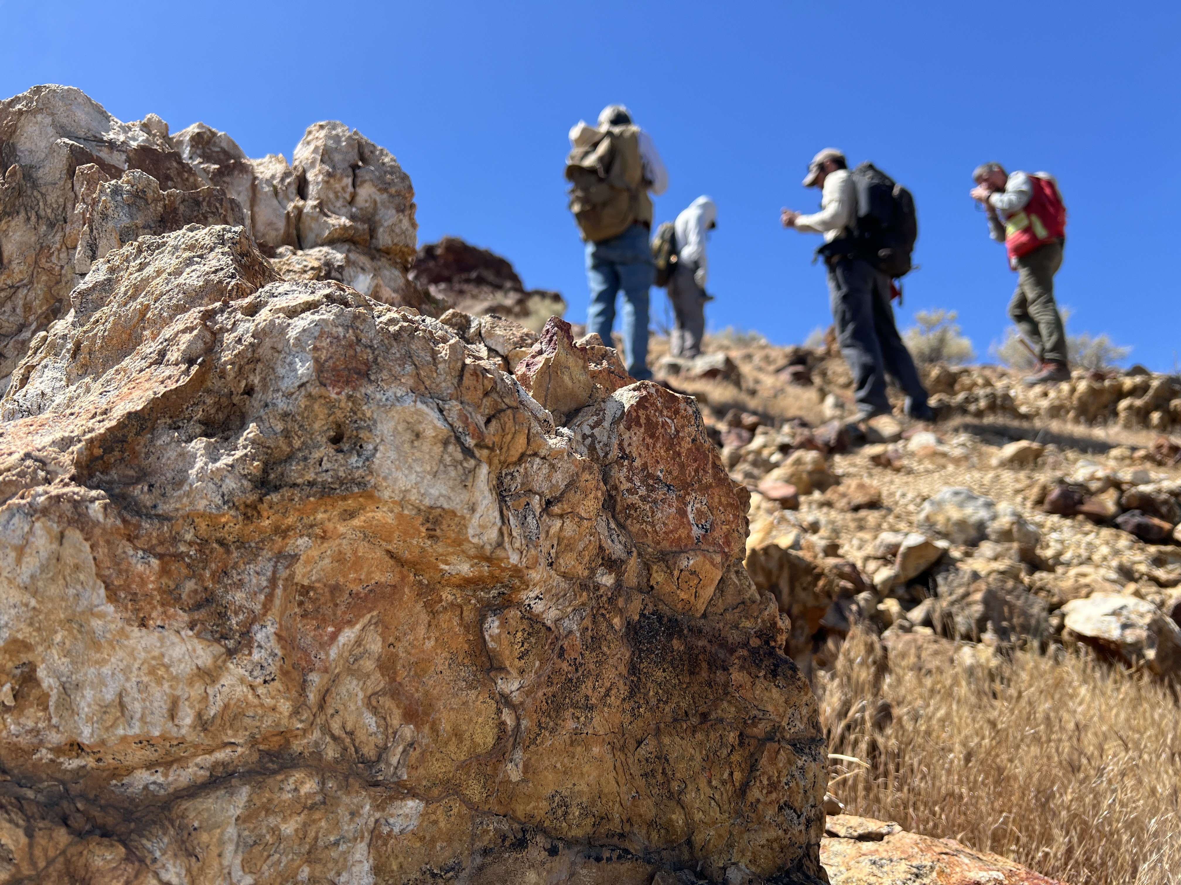
Four people with backpacks pause to examine rocks on a hillside under a clear blue sky, with a large orange-and-tan boulder in the foreground.
Geologists recently converged on a site near Barstow, California, to ground-truth a mineral discovery made on public land by a NASA JPL sensor flying aboard a plane overhead.
NASA/JPL-Caltech

Equipped with rock picks and hand lenses, a team of geoscientists deployed to the Mojave Desert recently to investigate a tantalizing “fingerprint” detected by a NASA sensor. Their target: a cache of topaz hiding in plain sight.

The geologists weren’t searching for gem-grade treasure. Rather, the presence of topaz could hint at a more valuable deposit below of something known as porphyry copper.

One of the world’s primary sources of copper, these deposits are left behind when magma and hot water from deep underground course through Earth’s crust, chemically transforming the surrounding rock. This tends to occur where one tectonic plate dives below another, known as a subduction zone, such as the North American Cordillera, which stretches from the Canadian Rockies to western Mexico.

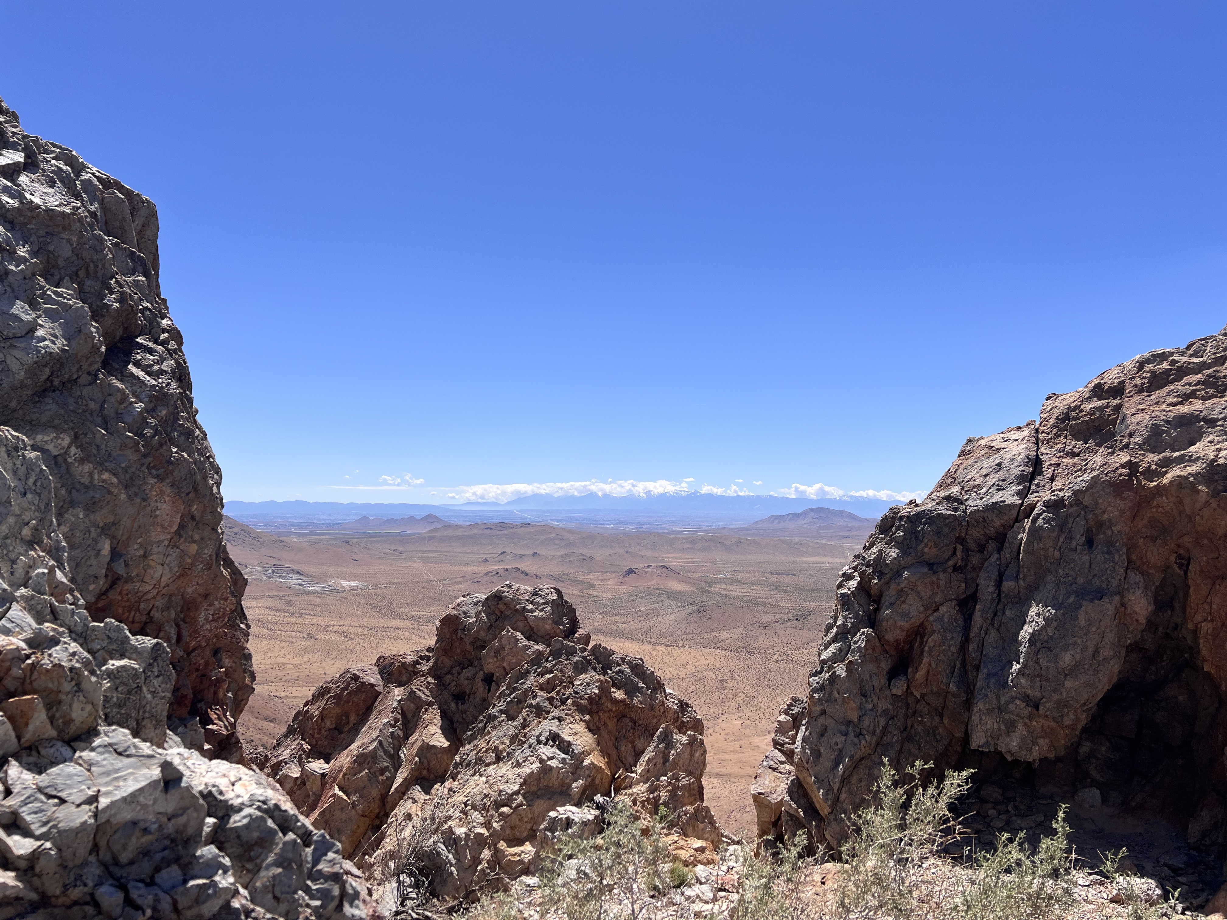
A wide-angle shot framing a vast desert plain viewed through a natural gap between jagged rock formations in the foreground. Distant snowcapped hills stretch across the far horizon beneath a thin line of cloud.
California’s high desert stretches below a bright spring sky in April 2026. NASA and USGS scientists are using airborne remote sensing to home in on potential sources of critical minerals here and across the Western U.S.
NASA/JPL-Caltech

In addition to copper — the third most used metal in the world after steel and aluminum — the deposits can hold other critical minerals like molybdenum and tellurium, which are used in everything from steelmaking to solar panels. Finding the deposits isn’t easy. Geologists look for topaz because it forms under the same volcanic conditions.

For the team in the Mojave, the goal was to collect more evidence. That would require boots on the ground and a heavy bag of samples. The scientists who converged on the site included three experts from the U.S. Geological Survey (USGS) and Robert Green of NASA’s Jet Propulsion Laboratory in Southern California.

“What we’re doing out here is geologic CSI,” said Green, referring to the investigative TV show, as he split open a weathered red rock to expose a sparkling core. “We’re looking for clues to reconstruct what happened here.”

A three-dimensional cube representing multispectral imaging data of an arid landscape. The front face shows an aerial image. The top and side panels display colored bands ranging from blue to red, illustrating spectral information for each pixel.
Three-dimensional image cubes illustrate the volume of data captured by NASA imaging spectrometers. The front face shows an aerial view of the Mojave Desert. The colorful side panels reveal what no eye or camera can detect: the spectral fingerprints of minerals present in every pixel.
NASA/JPL-Caltech

Next-generation mineral mapping

The sensor that detected the topaz deposit on public land near Barstow, California, was built at JPL. Called AVIRIS, short for Airborne Visible Infrared Imaging Spectrometer, it analyzes reflected sunlight and can be used to identify chemicals and minerals by their unique spectral fingerprint. The technology was pioneered in the early 1980s by a team that included Green, and space-hardened versions have explored the Moon, Mars, and other rocky bodies in the solar system in the decades since.

While its cousins study distant worlds aboard spacecraft, the AVIRIS line of sensors is advancing Earth science from aircraft. The latest model, AVIRIS-5, recently took to the skies for the first time as part of the NASA-USGS Geologic Earth Mapping Experiment (GEMx). The goal of GEMx is to identify sources of critical minerals across the American West, including in the waste rock of active and legacy mines. It is led by the USGS as part of its larger, nationwide initiative.

Carrying next-generation sensors, a high-altitude NASA ER-2 aircraft takes off from the agency’s Armstrong Flight Research Center in Edwards, California, on March 31, 2026, to support the GEMx mineral mapping campaign.
NASA/Carla Thomas

Since 2023, GEMx flights have covered more than 386,000 square miles (1 million square kilometers) of American soil, including most of California.

Ground-truthing the sensor data can entail hot field work, scrambling over steep crags to uncover samples for lab analysis. While testing has confirmed the topaz discovery, determining if the Mojave site overlies a porphyry copper deposit will require intensive investigation using ground-penetrating equipment. But the AVIRIS finding shows how advanced NASA airborne sensing can help lead geologists to the metaphorical needle in a haystack, even in heavily explored Southern California.

“People have been prospecting this area for generations,” said Erik Tharalson, a USGS geologist. “But there’s a lot more to discover.”

High flyer

From the beginning, the GEMx mineral mapping campaign has been enabled by one of the highest-flying aircraft in NASA’s fleet: the ER‑2. It deployed on March 31 from NASA’s Armstrong Flight Research Center in Edwards, California, to Colorado Springs Airport in Colorado.

“We deployed to Colorado Springs to maximize flight time for data collection needed in Colorado, Utah, New Mexico, Arizona, and Texas,” said John McGrath, ER‑2 project manager at NASA Armstrong.

By the conclusion of this deployment on June 5, the aircraft had completed 26 flights totaling more than 125 hours. Soaring at about 65,000 feet, the ER-2 can fly at high altitudes that allow it to collect broad‑area, high‑resolution spectral measurements in a single pass, supporting researchers studying mineral composition and surface processes.

In 2025, the aircraft flew 36 science missions, collecting more than 7 billion measurements over 200 flight hours. The data has contributed to the largest airborne surface mineralogy dataset gathered in a single NASA-USGS campaign.

The GEMx survey is led and funded by the USGS Earth Mapping Resources Initiative. Earth MRI is modernizing mapping the nation’s surface and subsurface to find new, critical, and other minerals. It is a partnership effort with 45 state geological surveys, federal agencies, private industry, tribes, universities, and others. The initiative will capitalize on both the technology developed by NASA for spectroscopic imaging, as well as the USGS expertise in analyzing the datasets, conducting field work, and deriving critical mineral information from them.

To learn more about GEMx visit:

https://science.nasa.gov/mission/gemx/

Media Contacts

Andrew Wang / Andrew Good
Jet Propulsion Laboratory, Pasadena, Calif.
626-379-6874 / 818-393-2433
andrew.wang@jpl.nasa.gov / andrew.c.good@jpl.nasa.gov

Written by Sally Younger

2026-037

The post NASA, USGS Scientists Go Rock Hounding in California’s High Desert appeared first on NASA Science.

NASA, USGS Scientists Go Rock Hounding in California’s High Desert

11 June 2026 at 16:38
Four people with backpacks pause to examine rocks on a hillside under a clear blue sky, with a large orange-and-tan boulder in the foreground.
Geologists recently converged on a site near Barstow, California, to ground-truth a mineral discovery made on public land by a NASA JPL sensor flying aboard a plane overhead.
NASA/JPL-Caltech

Equipped with rock picks and hand lenses, a team of geoscientists deployed to the Mojave Desert recently to investigate a tantalizing “fingerprint” detected by a NASA sensor. Their target: a cache of topaz hiding in plain sight.

The geologists weren’t searching for gem-grade treasure. Rather, the presence of topaz could hint at a more valuable deposit below of something known as porphyry copper.

One of the world’s primary sources of copper, these deposits are left behind when magma and hot water from deep underground course through Earth’s crust, chemically transforming the surrounding rock. This tends to occur where one tectonic plate dives below another, known as a subduction zone, such as the North American Cordillera, which stretches from the Canadian Rockies to western Mexico.

A wide-angle shot framing a vast desert plain viewed through a natural gap between jagged rock formations in the foreground. Distant snowcapped hills stretch across the far horizon beneath a thin line of cloud.
California’s high desert stretches below a bright spring sky in April 2026. NASA and USGS scientists are using airborne remote sensing to home in on potential sources of critical minerals here and across the Western U.S.
NASA/JPL-Caltech

In addition to copper — the third most used metal in the world after steel and aluminum — the deposits can hold other critical minerals like molybdenum and tellurium, which are used in everything from steelmaking to solar panels. Finding the deposits isn’t easy. Geologists look for topaz because it forms under the same volcanic conditions.

For the team in the Mojave, the goal was to collect more evidence. That would require boots on the ground and a heavy bag of samples. The scientists who converged on the site included three experts from the U.S. Geological Survey (USGS) and Robert Green of NASA’s Jet Propulsion Laboratory in Southern California.

“What we’re doing out here is geologic CSI,” said Green, referring to the investigative TV show, as he split open a weathered red rock to expose a sparkling core. “We’re looking for clues to reconstruct what happened here.”

A three-dimensional cube representing multispectral imaging data of an arid landscape. The front face shows an aerial image. The top and side panels display colored bands ranging from blue to red, illustrating spectral information for each pixel.
Three-dimensional image cubes illustrate the volume of data captured by NASA imaging spectrometers. The front face shows an aerial view of the Mojave Desert. The colorful side panels reveal what no eye or camera can detect: the spectral fingerprints of minerals present in every pixel.
NASA/JPL-Caltech

Next-generation mineral mapping

The sensor that detected the topaz deposit on public land near Barstow, California, was built at JPL. Called AVIRIS, short for Airborne Visible Infrared Imaging Spectrometer, it analyzes reflected sunlight and can be used to identify chemicals and minerals by their unique spectral fingerprint. The technology was pioneered in the early 1980s by a team that included Green, and space-hardened versions have explored the Moon, Mars, and other rocky bodies in the solar system in the decades since.

While its cousins study distant worlds aboard spacecraft, the AVIRIS line of sensors is advancing Earth science from aircraft. The latest model, AVIRIS-5, recently took to the skies for the first time as part of the NASA-USGS Geologic Earth Mapping Experiment (GEMx). The goal of GEMx is to identify sources of critical minerals across the American West, including in the waste rock of active and legacy mines. It is led by the USGS as part of its larger, nationwide initiative.

Carrying next-generation sensors, a high-altitude NASA ER-2 aircraft takes off from the agency’s Armstrong Flight Research Center in Edwards, California, on March 31, 2026, to support the GEMx mineral mapping campaign.
NASA/Carla Thomas

Since 2023, GEMx flights have covered more than 386,000 square miles (1 million square kilometers) of American soil, including most of California.

Ground-truthing the sensor data can entail hot field work, scrambling over steep crags to uncover samples for lab analysis. While testing has confirmed the topaz discovery, determining if the Mojave site overlies a porphyry copper deposit will require intensive investigation using ground-penetrating equipment. But the AVIRIS finding shows how advanced NASA airborne sensing can help lead geologists to the metaphorical needle in a haystack, even in heavily explored Southern California.

“People have been prospecting this area for generations,” said Erik Tharalson, a USGS geologist. “But there’s a lot more to discover.”

High flyer

From the beginning, the GEMx mineral mapping campaign has been enabled by one of the highest-flying aircraft in NASA’s fleet: the ER‑2. It deployed on March 31 from NASA’s Armstrong Flight Research Center in Edwards, California, to Colorado Springs Airport in Colorado.

“We deployed to Colorado Springs to maximize flight time for data collection needed in Colorado, Utah, New Mexico, Arizona, and Texas,” said John McGrath, ER‑2 project manager at NASA Armstrong.

By the conclusion of this deployment on June 5, the aircraft had completed 26 flights totaling more than 125 hours. Soaring at about 65,000 feet, the ER-2 can fly at high altitudes that allow it to collect broad‑area, high‑resolution spectral measurements in a single pass, supporting researchers studying mineral composition and surface processes.

In 2025, the aircraft flew 36 science missions, collecting more than 7 billion measurements over 200 flight hours. The data has contributed to the largest airborne surface mineralogy dataset gathered in a single NASA-USGS campaign.

The GEMx survey is led and funded by the USGS Earth Mapping Resources Initiative. Earth MRI is modernizing mapping the nation’s surface and subsurface to find new, critical, and other minerals. It is a partnership effort with 45 state geological surveys, federal agencies, private industry, tribes, universities, and others. The initiative will capitalize on both the technology developed by NASA for spectroscopic imaging, as well as the USGS expertise in analyzing the datasets, conducting field work, and deriving critical mineral information from them.

To learn more about GEMx visit:

https://science.nasa.gov/mission/gemx/

Media Contacts

Andrew Wang / Andrew Good
Jet Propulsion Laboratory, Pasadena, Calif.
626-379-6874 / 818-393-2433
andrew.wang@jpl.nasa.gov / andrew.c.good@jpl.nasa.gov

Written by Sally Younger

2026-037

The Surprising Way Asteroids May Have Helped Life Begin on Earth

11 June 2026 at 12:09
Impacts to Early EarthAncient asteroid impacts may have done more than reshape Earth’s surface. For decades, asteroid impacts have been viewed mainly as agents of destruction. But on the young Earth, they may have done something far more surprising: helped create some of the planet’s first habitable environments. A new study from Southwest Research Institute (SwRI) suggests that [...]

Private Sector Engagement

10 June 2026 at 20:41
A collage of the Earth with two rings filled with images related to multiple private sectors that use NASA data.

Private Sector Engagement


Transforming NASA’s trusted Earth science into powerful business intelligence

Earth Science Private Sector Engagement

NASA Earth science data, tools, and expertise drive economic innovation by providing industry with trusted insights to accurately forecast risk, optimize operations, and advance next-generation business solutions. By connecting, informing, and partnering with businesses, NASA’s Private Sector Engagement Office unlocks new opportunities to reinforce the use of Earth observations in existing markets and broaden adoption across emerging industry sectors, empowering organizations to build powerful and resilient solutions for the future.

Subscribe for Updates

Get the latest industry-relevant news and information direct to your inbox.

We will never share your email address.

Privacy Policy

Sign Up
A collage of the Earth with a newsletter signup icon overlaid with three rings around it including an ocean image, an engineering image, and a farmland image.

Propose for Innovation Funding

INNOVATE is NASA’s innovation funding program designed to accelerate the translation of Earth science into real-world applications. Selected teams receive access to NASA funding, data, and expertise to develop solutions that address commercial and societal challenges. This opportunity is open through August 31, 2026.

Real-Time Flood Inundation Forecasting & Impact Assessment

Investigators & Partners: NASA Goddard Space Flight Center; University of Wisconsin-Milwaukee; University of Colorado; University of Wisconsin-Madison; University of Connecticut; Swiss Re; Munich Re; Eversource

  • An AI-powered flood intelligence platform that combines NASA Earth observations with advanced modeling to deliver real-time flood forecasts and impact assessments, including Federal Emergency Management Agency and NOAA end users.
  • Designed with insurers and utilities to improve disaster response, risk management, and resilience.

Operational Risk Forecasting for AI Infrastructure

Investigators & Partners: NASA Goddard Space Flight Center; Universities Space Research Association; Meta; Uptime Institute; Open-IX

  • A first-of-its-kind system that uses NASA Earth observations to forecast operational risks to data centers, power systems, and water resources up to 14 days in advance.
  • Helps critical infrastructure operators anticipate disruptions before they occur.

Fire & Risk Modeling for Property Insurance

Investigators & Partners: National Science Foundation; National Center for Atmospheric Research; Mercury Insurance

  • A next-generation wildfire risk platform combining NASA Earth science, physics-based modeling, and AI to improve insurance underwriting and community resilience.
  • Developed with industry partners to better understand and manage growing wildfire risks.

Next-Generation Food Security Early Warning System

Investigators & Partners: Space Science Institute; Chapman University; World Food Program; Microinsurance Catastrophe Risk Organization

  • An advanced agricultural monitoring system that uses NASA Earth observations to detect food security risks months before traditional warning systems.
  • Supports insurers, humanitarian organizations, and agribusinesses with earlier, more actionable insights.

AI-Powered Wildfire Risk Intelligence for Utilities

Investigators & Partners: NASA Jet Propulsion Laboratory; OpalAI; Pacific Gas & Electric; Los Angeles Department of Water & Power

  • An AI-enabled wildfire intelligence platform that helps utilities identify asset-level wildfire risks and improve operational decision-making.
  • Designed to reduce outages, strengthen grid resilience, and protect communities.

Early Warning & Transparency for Forest Supply Chains

Investigators & Partners: NASA Goddard Space Flight Center; University of Maryland; Science Systems and Applications Inc.; Chainparency

  • A NASA-enabled monitoring and forecasting platform that helps forestry and wood-product industries track forest health, detect emerging risks, and improve supply chain transparency.
  • Supports more resilient and sustainable forest management at scale.

How NASA Helps Industry

How NASA supports agribusiness

Every day, farmers, food companies, and agricultural producers rely on timely, trusted information to manage their crops, land, water, and supply chains. NASA develops technology and missions to observe agricultural landscapes from space, informing optimal time and location for planting, monitoring of plant growth, best times for harvest, and market readiness assessments. U.S. and international partners use this information to support food security, stabilize markets, and strengthen productive farming.

From space, NASA tracks soil moisture, groundwater, crop condition, water use, heat stress, precipitation, and land change, while also supporting field-level tools and trusted partnerships with producers and agricultural organizations. By transforming satellite data into practical insights, NASA helps agribusiness to anticipate challenges, improve productivity, manage vital resources, and safeguard food systems.

On Aug. 23, 2025, NISAR imaged land adjacent to northeastern North Dakota's Forest River.
The NISAR (NASA-ISRO Synthetic Aperture Radar) satellite captured an image of northeastern North Dakota on Aug. 23, 2025. The darker agricultural plots are plowed and unplanted fields, while the lighter colors represent the presence of pasture or crops. Circular patterns indicate the use of center-pivot irrigation.
NASA JPL

FEbruary 2026

Industry Summit Report

The NASA Earth Science Industry Summit, hosted by the U.S. Chamber of Commerce on February 2, 2026, served as a strategic forum to explore how NASA’s Earth Science enterprise contributes to the engines of the American economy and how public and private sectors can work together to unlock greater opportunities in Earth observation.

Explore the summary report for key reflections and takeaways, representing the perspectives of more than 180 participants across finance, insurance, agriculture, energy, utilities, and more.

Image Credit: U.S. Chamber of Commerce

View the Report

FEbruary 2026

Industry Summit Report

data catalog & resources

NASA Earthdata

Earthdata is your gateway to find, access, visualize, and download NASA Earth science data. Browse the data catalog, search by topic, discover learning resources including tutorials and trainings, and more.

Explore
NASA Earthdata Icon

Featured Trainings

NASA's Applied Remote Sensing Training Program (ARSET) teaches users how to use remote sensing data for a range of applications. ARSET trainings are available for all levels of experience at no cost, both in person and online.

Fundamentals of Remote Sensing

Earth Observations for Insurance and Finance Sector Decision-Making

NASA Earth Observations for Energy Management

Satellite Remote Sensing for Agricultural Applications

Data Product Highlights

Screenshot of the FIRMS interface

Active Fire Tracking

The Fire Information for Resource Management System (FIRMS) tracks active fires and hotspots worldwide to support response, risk monitoring, and operational awareness.

The very green landscape shows the Ohio River, Mississippi River and Black River. They are all breeching their banks. The spave between the Black (left) and Mississippi (center) Rivers is more blue than green with water. The lower right corner of the image appears a powder blue with blanket cloud cover.

Flood Water Monitoring

NASA’s Land, Atmosphere Near real-time Capability for Earth observation (LANCE) provides near real-time flood products, showing flooding and surface water changes to support exposure, claims, and resilience planning.

Economic & Human Activity

Night-time lights, visible with NASA’s Black Marble products, are used to monitor economic indicators, human activity, outages, infrastructure disruptions, and disaster recovery.

Heat & Temperature Insights

The ECOsystem Spaceborne Thermal Radiometer Experiment on Space Station (ECOSTRESS) instrument detects surface heat, crop water stress, urban heat, and thermal conditions affecting assets and operations.

Land Surface Change & Risk

The OPERA Surface Displacement (DISP) product suite identifies land surface movement from processes such as sinkholes, earthquakes, and landslides, supporting risk assessment for infrastructure and critical assets.

Long-Term Risk Projection

NASA Earth eXchange Global Daily Downscaled Projections (NEX-GDDP) provides historical baselines and future climate scenarios for asset, portfolio, and resilience planning.

Partnerships & Collaboration

NASA offers 60 years of experience in advanced engineering and testing capabilities, cutting edge research and technology development, as well as unique assets such as land, facilities and laboratories for use by commercial industries, academic institutions, U.S. government agencies and international entities.

The NASA Partnerships icon- a handshake surrounded by two circles.

Partnerships Front Door

Discover how NASA works with industry, academic, and non-profit partners to advance mutual goals through through strategic, non-procurement partnerships.

Hall Thruster

Technology Transfer Program

The NASA Technology Transfer program ensures that innovations developed for exploration and discovery are broadly available to the public.

Research Opportunities

NASA Solicitation and Proposal Integrated Review and Evaluation System (NSPIRES) is the official system to submit and manage research proposals.

Data Insignia

Eligible organizations that incorporate NASA data into their products, services, or research can gain significant value by displaying the NASA Data Insignia.

Private Sector Engagement Office

Nima PahlevanProgram Manager
Janelle Heslop Project Manager
Rachel VershelOperations Officer

The post Private Sector Engagement appeared first on NASA Science.

NASA, NOAA to Hold Joint Session at 23rd Symposium on Operational Environmental Satellite Systems

10 June 2026 at 19:09
Credit: AMS

Submit your abstract for “Advancing Weather and Environmental Science Through NASA and NOAA Commercial Satellite Data Programs,” a joint session hosted by NASA’s Commercial Satellite Data Acquisition (CSDA) program, in partnership with the NOAA National Environmental Satellite, Data, and Information Service (NESDIS) Commercial Data Program (CDP).

The session is part of the 23rd Symposium on Operational Environmental Satellite Systems, which will take place at the 2027 American Meteorological Society (AMS) Annual Meeting January 10-14 in Denver, Colorado. It will examine the growing capabilities of commercial Earth observation providers that are creating new opportunities to advance weather research, operational forecasting, and environmental science applications.

NASA’s CSDA program and NESDIS’s CDP collaborate to expand federal access to commercial satellite data and accelerate its use in both research and operational applications.

The CSDA program supports the scientific community by evaluating and acquiring diverse commercial datasets, including optical, Synthetic Aperture Radar, Global Navigation Satellite System Radio Occultation and Reflectometry, methane, precipitation, and Digital Elevation/Terrain Models for modeling, hazard monitoring, climate studies, and applied research.

Similarly, the CDP operationalizes commercial space-based environmental data, with demonstrated impacts from assimilated observations in weather forecasting and space weather applications. It also conducts pilot projects and transitions the piloted data to operations.

Together, the CSDA and CDP strengthen the nation’s weather enterprise by enabling innovative research, closing observational gaps, and integrating commercial data into real-world forecasting and decision support applications.

To submit an abstract or for additional information about the abstract submission process, visit the symposium’s website.

The post NASA, NOAA to Hold Joint Session at 23rd Symposium on Operational Environmental Satellite Systems appeared first on NASA Science.

NASA, NOAA to Hold Joint Session at 23rd Symposium on Operational Environmental Satellite Systems

10 June 2026 at 19:09
Credit: AMS

Submit your abstract for “Advancing Weather and Environmental Science Through NASA and NOAA Commercial Satellite Data Programs,” a joint session hosted by NASA’s Commercial Satellite Data Acquisition (CSDA) program, in partnership with the NOAA National Environmental Satellite, Data, and Information Service (NESDIS) Commercial Data Program (CDP).

The session is part of the 23rd Symposium on Operational Environmental Satellite Systems, which will take place at the 2027 American Meteorological Society (AMS) Annual Meeting January 10-14 in Denver, Colorado. It will examine the growing capabilities of commercial Earth observation providers that are creating new opportunities to advance weather research, operational forecasting, and environmental science applications.

NASA’s CSDA program and NESDIS’s CDP collaborate to expand federal access to commercial satellite data and accelerate its use in both research and operational applications.

The CSDA program supports the scientific community by evaluating and acquiring diverse commercial datasets, including optical, Synthetic Aperture Radar, Global Navigation Satellite System Radio Occultation and Reflectometry, methane, precipitation, and Digital Elevation/Terrain Models for modeling, hazard monitoring, climate studies, and applied research.

Similarly, the CDP operationalizes commercial space-based environmental data, with demonstrated impacts from assimilated observations in weather forecasting and space weather applications. It also conducts pilot projects and transitions the piloted data to operations.

Together, the CSDA and CDP strengthen the nation’s weather enterprise by enabling innovative research, closing observational gaps, and integrating commercial data into real-world forecasting and decision support applications.

To submit an abstract or for additional information about the abstract submission process, visit the symposium’s website.

NASA’s INCUS Mission on Road to Launch, Study Storms From Space

5 June 2026 at 21:48
A complex spacecraft partially wrapped in gold-colored foil and featuring a large rectangular solar panel stands on a metallic support structure against a solid blue background.
Two of the three SmallSats for NASA’s INCUS mission, including the one shown here, have completed assembly and testing in preparation for shipment to NASA’s Wallops Flight Facility in Virginia for a 2027 launch. From low Earth orbit the satellites will observe the dynamics of tropical convective storms.
Blue Canyon Technologies

Teams working on NASA’s INCUS (Investigation of Convective Updrafts) mission, the first space-based survey of the dynamics of tropical convective storms, have completed assembly and tested two of the mission’s small satellites, or SmallSats. Testing continues on the third SmallSat and is scheduled for completion no earlier than September in advance of a 2027 launch.

The three satellites will fly in tight coordination in low Earth orbit, with the first and second satellites separated by 30 seconds and the second and third satellite by 90 seconds.

Characterized by the sudden and intense lifting of large amounts of air and water, tropical convective storms provide more than half of the world’s precipitation, a crucial source of life-supporting fresh water. But they also produce severe weather, which can increase risks to life and property. The INCUS mission will help improve understanding of where, when, and why convective storms form.

Led by principal investigator Sue van den Heever of Colorado State University in Fort Collins, INCUS will use spaceborne radar instruments developed at NASA’s Jet Propulsion Laboratory in Southern California to observe the vertical motion of air and water, known as convective mass flux, as storms develop and evolve. The mission will also explore how environmental factors such as air temperature, humidity, pressure, wind speed, and wind direction correlate with that movement.

These insights will improve storm forecasting, potentially mitigating loss of life and property damage in affected communities, by helping decision-makers plan for and respond to severe weather events and manage freshwater supplies. 

Teams at NASA JPL built each INCUS satellite’s radar, which were combined with a deployable mesh radar reflector made by Tendeg in Louisville, Colorado. The middle satellite also carries a microwave radiometer, also made at NASA JPL, that provides spatial context to the vertical precipitation profiles provided by the radars.

The three assemblies shipped in late 2025 and early 2026 to Blue Canyon Technologies in Lafayette, Colorado, where they were integrated with Blue Canyon’s spacecraft buses. The first two satellites, also called observatories, have successfully undergone vibration and thermal vacuum testing to ensure they will be able to withstand the jostling of launch and the extreme temperatures of space.

These two observatories also shipped to Tendeg, where teams successfully performed test deployments of the reflectors. Then they returned to Blue Canyon for additional testing. They’ll remain in storage before heading out next year to the launch site at NASA’s Wallops Flight Facility in Virginia.

Funded through the Earth Venture Mission-3 acquisition under NASA’s Earth System Science Pathfinder Program, INCUS is one of several missions fulfilling the clouds, convection, and precipitation requirements of NASA’s Earth System Observatory, a series of interconnected missions set to study our home planet’s dynamic natural systems and how they interact. The mission is also part of FALCON (Fleet for the Atmosphere Linking Commercial Observations with NASA), a fleet of atmosphere-observing satellites that will combine hardware contributions from NASA centers, universities, and commercial partners.

The post NASA’s INCUS Mission on Road to Launch, Study Storms From Space appeared first on NASA Science.

Testing their mettle: How bacteria in deep-sea vents deal with toxic metal environments

29 January 2023 at 10:46

Researchers from Okinawa Institute of Science and Technology and Japan Agency for Marine-Earth Science and Technology have identified how bacteria can adapt to toxic metals released from hydrothermal vents. The study focused on Nitratiruptor sp. SB155-2, a species of bacteria isolated from vents in the Okinawa Trough. The researchers found that bacteria use transporter proteins […]

The post Testing their mettle: How bacteria in deep-sea vents deal with toxic metal environments appeared first on Science Bulletin.

❌