Login

Iraq’s archaeological discoveries have shaped understanding of human civilisation – but its scientists have been sidelined
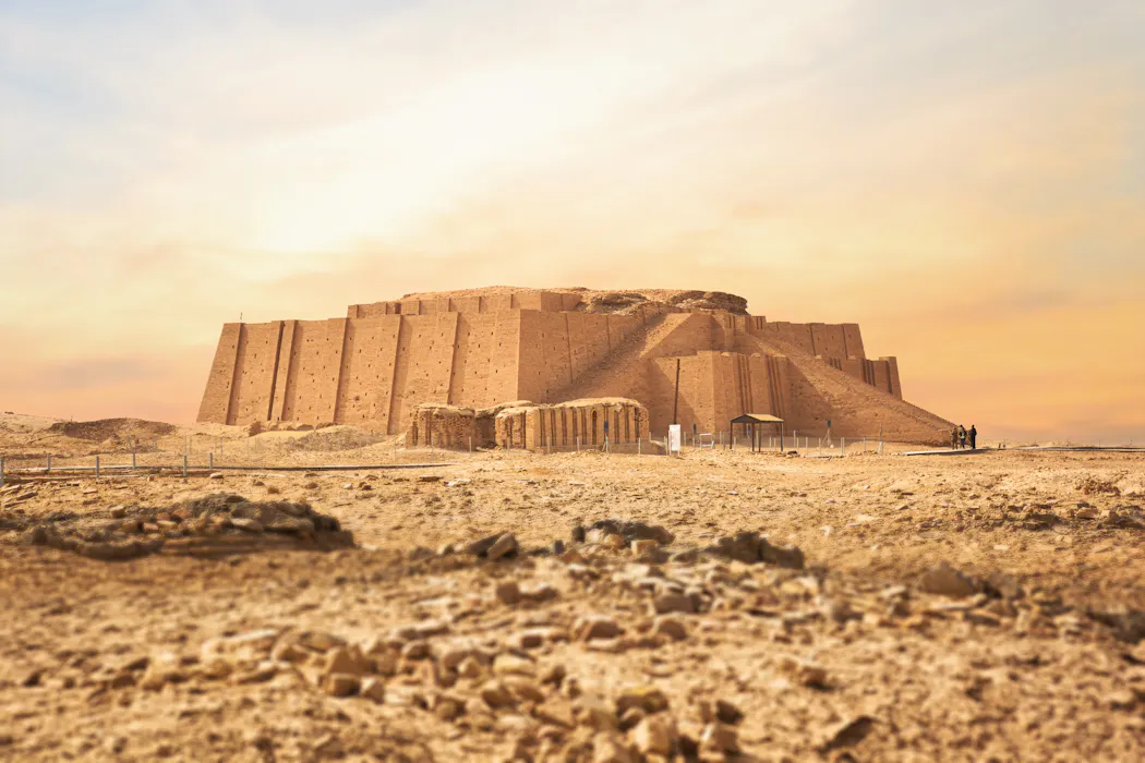
In recent years, archaeologists from around the world have marked the centenaries of some of Iraq’s most influential archaeological discoveries.
The excavation of the ancient city of Ur, for example, transformed understanding of early urban life, long-distance trade, royal tombs and burial customs. There has also been a century of research into the Jemdet Nasr period – pivotal in the development of some of the world’s earliest administrative systems and forms of writing.
These milestones are reminders of the profound influence of the archaeology of ancient Mesopotamia. It continues to inspire generations of researchers around the world, including recent work led by the University of Glasgow at the archaeological site of Shakhi Kora in the Kurdistan Region of Iraq.
This has brought new insights into the nature of the first public institutions, their development and demise. Other surveys in southern Iraq seek to understand long-term human relationships with Iraq’s rapidly disappearing marshlands.
But these milestone celebrations and fresh discoveries also invite reflection about the role of Iraq’s scientists and institutions in this developing story of human civilisation.
Changing the narrative of loss and rescue
International discussions of Iraqi heritage have long been dominated by stories of catastrophe. These range from looting after the 2003 US-led invasion and the destruction wrought by Islamic State, to endangered archaeological sites and emergency efforts to save what remains.
Many of these represent genuine crises. But they also frame Iraqi archaeology as a narrative of loss and rescue, with international institutions as providers of expertise. Local archaeologists are often portrayed as recipients of support, rather than equal partners in shaping future research.
Today, Iraqi archaeologists are still underrepresented in the bodies that decide research priorities and interpretations. Many institutions generating archaeological knowledge about Iraq are disproportionately directed from outside the country.
So, when 20 archaeologists and heritage professionals from Iraq and the Kurdistan Region of Iraq gathered in Glasgow alongside international colleagues in May 2025, they seized the opportunity to shift this narrative. Their discussions ranged from social media misinformation to women’s participation in archaeological fieldwork and the challenges that climate change poses, both to heritage and local communities.
Such conversations often came back to one key question: who gets to decide what archaeology in Iraq should focus on today?
Attempts to decolonise archaeology
Discussions about the future of archaeology often focus on participation: who receives funding, who directs projects, and who is included as a collaborator or author. These questions are important.
But meaningful attempts to decolonise this field of study also need to address how archaeological problems are defined, whose expertise is recognised, and who gets to shape research priorities.
At the Glasgow workshop, Iraqi and Kurdish archaeologists, heritage professionals, government officials and university leaders were asked to identify the issues they regarded as most urgent. Creating space for them to articulate priorities marked an important shift away from externally imposed agendas.
The discussion on gender highlighted a striking contradiction in Iraq. At the University of Al-Qadisiyah in the city of Al Diwaniyah, women account for around 70% of archaeology students – yet only around 2% of Iraqi excavation team members and approximately 15% of academic leaders are women.
This raised the question: is increasing women’s participation just a demographic goal – or will it influence the breadth of knowledge produced through archaeology? For example, a wider range of participants may encourage more archaeological attention to labour, care, social relationships and community life in the ancient past, complementing the traditional focus on kings, temples and powerful states.
Redefining what heritage means
Iraq is among the countries most vulnerable to environmental change. The workshop also highlighted rising temperatures, extreme dust storms, water scarcity, soil salination and environmental degradation, stressing their impact on archaeological sites and the communities who depend on wetlands, springs and marshlands.
It became clear that “heritage” meant more than just preservation. Traditional relationships between communities and landscapes offer valuable lessons for adapting to environmental uncertainty. Archaeology becomes less about recovering the past, more about helping to imagine sustainable futures.
According to Rozhen Mohammed-Amin, president of the Cultural Heritage Organisation in the Kurdistan Region of Iraq, one of the most significant achievements was bringing together people who are often “disconnected due to political and institutional divisions”.
Within months of the event, two women were promoted to senior positions at the University of Al-Qadisiyah. Participants also reported stronger engagement between Iraqi universities and the country’s State Board of Antiquities and Heritage.
These changes may seem modest – such developments rarely attract headlines in the way of a spectacular discovery or heritage emergency. But they may prove just as important to the future of archaeology – for Iraq and the wider world.

Claudia Glatz received funding from the British Institute for the Study of Iraq, which supported the workshop discussed in this article. Her research and heritage initiatives in the Kurdistan Region of Iraq have been supported by the British Academy, the British Institute for the Study of Iraq, the G.A. Wainwright Fund, the Cultural Protection Fund-British Council, the Royal Society of Edinburgh, the Alexander von Humboldt Foundation, the Gerda Henkel Foundation, and the National Science Foundation.
Daniel Calderbank works for the University of Glasgow. He has received funding from the Glasgow Centre for International Development and the British Institute for the Study of Iraq, which supported the workshop discussed in this article. He has also received research funding from the British Academy, UK Research and Innovation (UKRI), and the Royal Society of Edinburgh for research and heritage initiatives in Iraq.
Jaafar Jotheri does not work for, consult, own shares in or receive funding from any company or organisation that would benefit from this article, and has disclosed no relevant affiliations beyond their academic appointment.