❌

Reading view

Magnitude 6.8 earthquake traps shoppers as mall collapses in Japan —‬ here's why the seismic event was unusual

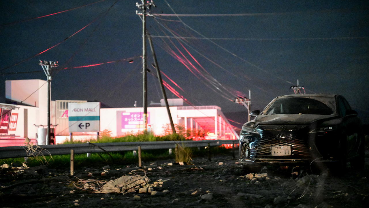
A powerful earthquake struck southwestern Japan Tuesday afternoon local time, collapsing part of a shopping mall, toppling a stone wall at the centuries-old Kumamoto Castle, and sending more than 150,000 people to evacuation shelters, the BBC reported.

The quake, which the U.S. Geological Survey (USGS) measured as a magnitude 6.8, hit at 4:27 p.m. local time near Kumamoto, a city of more than 700,000 people located on the island of Kyushu in southern Japan.

Thousands of homes lost power, and roads buckled across the region. The second floor of a shopping center collapsed, trapping shoppers inside, according to the BBC report; some of these people were evacuated and later hospitalized. A brief tsunami warning was issued and lifted within an hour.
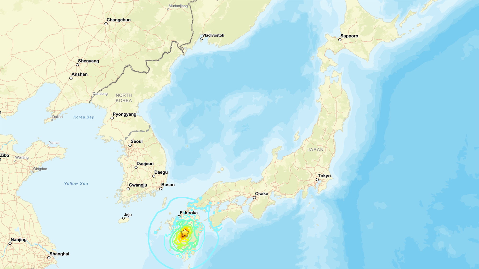
A map of Japan showing its various cities and provinces

A map showing the location of the July 2026 earthquake. (Image credit: National Tsunami Warning Center (ATWC), Pacific Tsunami Warning Center (PTWC), USGS National Earthquake Information Center, PDE)

The USGS measurement is different from the magnitude 7.1 reported by the Japan Meteorological Agency, "primarily because the agencies are reporting different magnitude types," the USGS reported. While Japan is looking at local magnitude, the USGS measured the moment magnitude, which is derived from the physical size of the fault rupture and gives the "most reliable estimate of earthquake size" for large earthquakes, since local-magnitude scales can lose accuracy once a rupture grows big enough, the USGS reported.

These measurements are helpful, as "different magnitude types capture different characteristics of earthquake source processes," the USGS noted. Local magnitude, for example, reflects how strongly the ground shook nearby, while moment magnitude reflects the total energy released across the fault.

Why this quake is scientifically interesting

Japan sits atop one of the most active plate boundaries on Earth, where the Philippine Sea Plate dives beneath the Eurasia Plate. That process, known as subduction, is responsible for the massive, tsunami-generating earthquakes that periodically strike offshore Japan, and it's been studied intensively for decades.

But Tuesday's earthquake didn't occur at the boundary itself. Instead, the rupture happened within the Eurasia Plate, more than 60 miles (100 kilometers) inland from where the plates meet, Jeffrey Park, a theoretical seismologist at Yale University, told Live Science. Roughly 90% of earthquakes happen at plate boundaries, where the constant grinding of two plates builds up stress until a fault gives way. Quakes that strike farther inside a plate β€” sometimes called intraplate earthquakes β€” are rarer and less understood, though scientists suspect that stress transmitted through the plate can reactivate old, dormant faults far from the boundary that produced it.

According to Park, the fault in Tuesday's earthquake moved in a way that suggests the plate tore horizontally as it was twisted by subduction occurring at an angle.

The USGS describes this event as shallow strike-slip faulting: the two sides of the fracture slid past each other horizontally, rather than one side thrusting up and over the other. This faulting style, combined with the shallow depth of just 6 miles (10 kilometers) down, points to the same type of rupture behind Kyushu’s deadly 2016 Kumamoto earthquake sequence.

That inland location is also why the quake didn't generate a damaging tsunami, despite the brief precautionary warning. Tsunamis are produced when a big event β€ͺ—‬ such as an earthquake, volcanic eruption or landslide β€ͺ—‬ displaces water; the force from that displacement then propagates as a wave.

Tuesday's rupture stayed entirely on land, so it never pushed the seafloor up the way offshore quakes do. That's why the tsunami risk stayed low, even with the brief precautionary warning. Still, an inland quake isn't automatically off the hook: if the shaking triggers a landslide that spills into the sea, that alone can generate a tsunami.

The depth mattered just as much as the location. The quake was shallow enough to concentrate its energy near the surface, which Park said explains the structural damage.

"Because it is shallow it will cause more structural damage than a similar-sized event that might occur deeper and offshore," he told Live Science in an email.

Earthquake country

Several earthquakes have already clustered in the area, and numerous aftershocks are expected over the coming days. Japan experiences roughly 1,500 earthquakes annually, making it one of the most seismically active countries on the planet β€” a byproduct of sitting at the junction of several tectonic plates.

To protect itself, Japan has spent decades β€” and learned from painful lessons from disasters like the 2011 Tohoku earthquake and tsunami β€” engineering a response system built for exactly this scenario.

Bullet trains are programmed to halt automatically the instant seismic sensors detect a major earthquake, a safeguard Park pointed to as a defining feature of the country's earthquake readiness. That automatic shutdown extends to other transit and utility systems, part of a broader early-warning network that alerts the public within seconds of a quake's detection, giving people crucial time to take cover before shaking arrives.

Japan's investment in its infrastructure may help to explain why, even after a magnitude 7 event near a city of 700,000, Japan's death toll and damage have historically been far lower than those from comparable quakes elsewhere in the world.

Search-and-rescue efforts are continuing in Kumamoto, with CNN reporting that between 20 and 30 employees remained unaccounted for at the Aeon Mall in Kashima Town, where the building’s second floor had collapsed. Firefighters were also working to reach the site and contain nearby fires.
  •  

Colossal scars of 60 million-year-long continental collision streak across warped mountains in Pakistan β€” Earth from space

QUICK FACTS

Where is it? Murgha Kibzai, Sulaiman Range, Pakistan [30.739354851, 69.50804296]

What's in the photo? Folded layers of rock left over from an ancient continental collision

Which satellite took the photo? NASA's Terra satellite

When was it taken? April 11, 2011

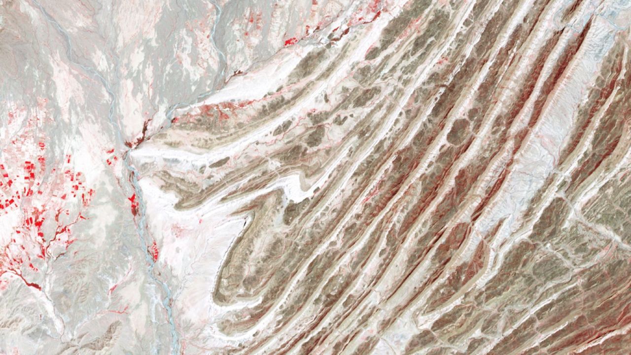
This striking satellite photo shows a multicolor "fan" of folded rocks sculpted by a longtime collision between two of Earth's tectonic plates.

The geological feature, known as an imbricate fan, is located around 3 miles (5 kilometers) east of the town of Murgha Kibzai in Pakistan's Balochistan province. The photographed section of folded rocks measures around 9 miles (15 km) across, but the fan stretches up to 55 miles (89 km) from end to end, well beyond the area in this image.

The dramatic structure sits at an altitude of around 5,000 feet (1,500 meters) in the Sulaiman Range, a series of mountains that covers around 2,500 square miles (6,500 square kilometers) of Pakistan and Afghanistan. ("Sulaiman" means "of Solomon," in reference to the biblical figure King Solomon, and the range's largest peak is Takht-e-Sulaiman, which translates to "Throne of Solomon.")

This is one of several unique features that emerged along the boundary between the Eurasian and Indian tectonic plates, which have been colliding for more than 60 million years. At one point during this tectonic tug-of-war, the two plates became somewhat intertwined, allowing the fan to take shape, according to NASA's Earth Observatory.

"As India moved northward, it began to rotate in a counter-clockwise direction, wrenching the northwestern part of the Indian plate backwards into part of the Eurasian plate," Earth Observatory representatives wrote. "The countervailing forces put the rocks of the Sulaiman Range in a unique compressional vice, causing many of its faults to curve and stretch in convoluted ways."

A wide-field image of the Sulaiman Range showing massive tectonic features spread out over a large area

The Sulaiman Range is full of unique geological features that were birthed by the collision between the Indian and Eurasian plates. (The imbricate fan is located on the far right of this wide-field image.) (Image credit: NASA/Terra)

The fan is made up of alternating layers of sandstone, which appear dark in the image, and limestone, which has a much lighter hue. These sedimentary rocks were formed by "thrust faults" that shot upward from the boundary between the Eurasian and Indian plates and became entangled as the boundary moved back and forth.

The satellite image is false-color, meaning it includes wavelengths of the electromagnetic spectrum that are not normally visible to humans. This helps to accentuate the differences between the two rock types, although they can also be easily distinguished with the naked eye. Pockets of vegetation appear in red throughout the image.

The photo is a small part of a larger, wide-field image (see above), which showcases several other intriguing geological features across the Sulaiman Range in false color.

Continental collision

The collision between the Eurasian and Indian plates became inevitable around 80 million years ago, when dinosaurs still ruled Earth, according to the Earth Observatory. At this point, the pair became locked on a collision course, with each plate moving more than 8 inches (20 centimeters) per year β€” around twice the speed of the fastest tectonic plates today.

Around 60 million years ago, the plates slowly slammed together. Normally, this would cause the smallest tectonic plate to sink below the other. However, the two plates' massive size meant neither receded. Instead, the continental crust along the boundary grew thicker, and the ground buckled, folded and pushed upward.

Satellite photo showing the warped shaped of the Sulaiman range

The Indian and Eurasian plates have been locked in a tectonic tug-of-war for more than 60 million years. Their collision birthed the Sulaiman Range, alongside the Karakoram and the Himalayas. (Image credit: Getty Images)

This process created not only the Sulaiman Range but also the Karakoram (a huge mountain range that spans the borders of China, India, Pakistan, Tajikistan and Afghanistan) and the Himalayas β€” the two tallest mountain ranges on Earth, according to the Earth Observatory.

This collision continued at full speed for around 30 million years, before eventually slowing down. However, the two plates are still technically colliding today, making the region a major earthquake hotspot.

See more Earth from space

A satellite photo showing a black blob of ancient lava surrounding a volcano in the middle of the Sahara desertShadowy tendrils of lava

A 2019 astronaut photo shows off ancient lava flows that once oozed down the jet-black slopes of the ToussidΓ© volcano in northwestern Chad. An intriguing volcanic "skull" also lurks in the aerial image.

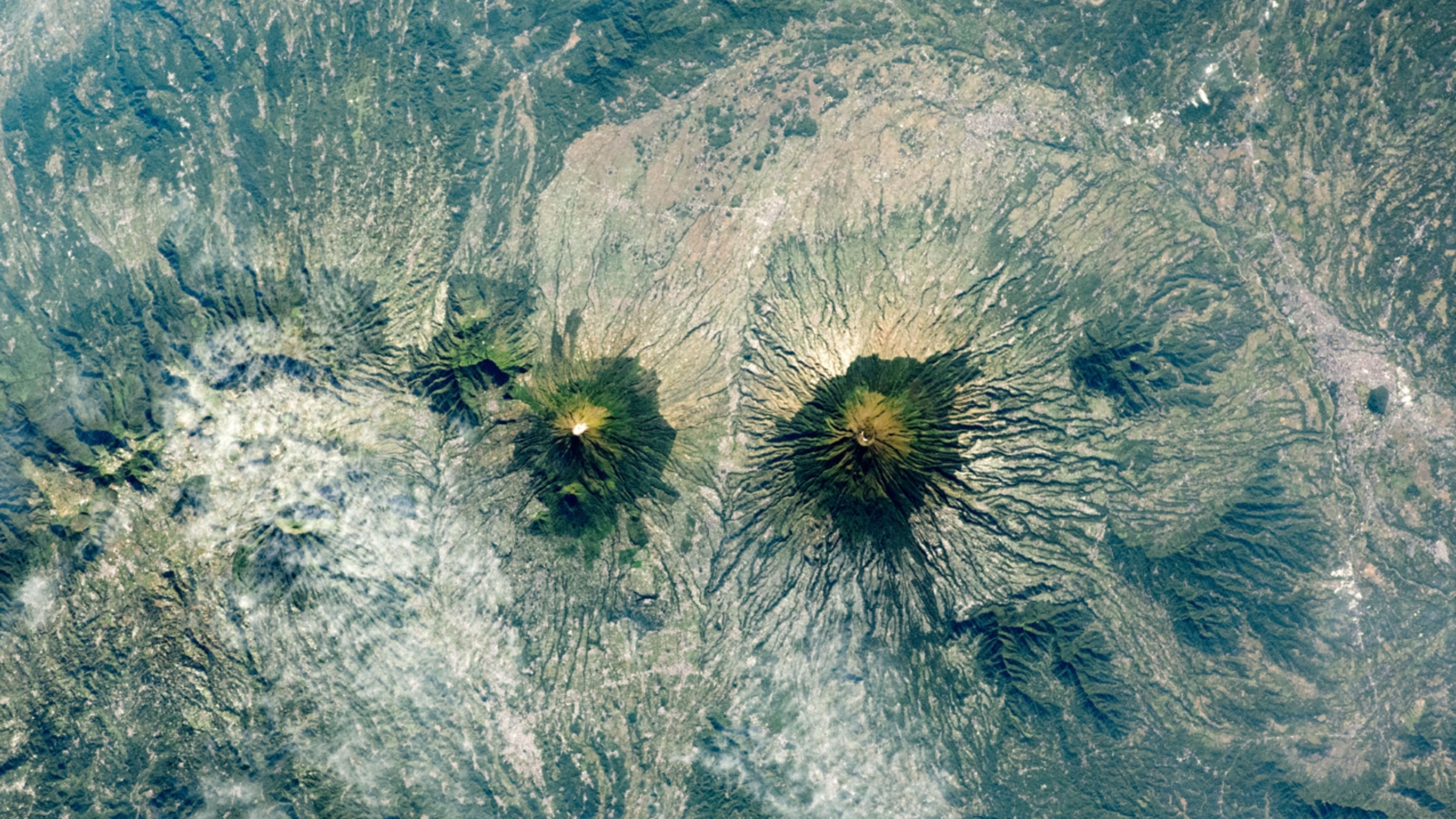
An astronaut photo of two near-identical volcanoes standing side-by-side on Indonesia's Java Island.Volcanic 'Twin peaks'

A 2021 astronaut photo shows the surprising similarities between Mount Sundoro and Mount Sumbing, which lie at the heart of Java, Indonesia.

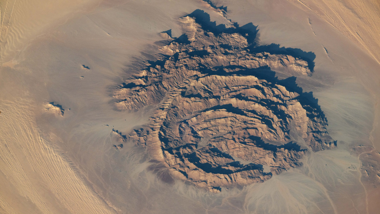
An astronaut photo of the massifConcentric rocky rings

A 2025 astronaut photo shows a massif made of concentric mountain ridges in the Libyan desert. The rocky walls contain ancient artworks and are occasionally used to contain herds of grazing cattle.

  •  

Science word of the day: Seamount

Science word of the day: Seamount

Pronunciation: SEE'-mount

What it means: A seamount is an undersea mountain that rises at least 3,300 feet (1,000 meters) above the seafloor but does not come close to breaking the surface. According to the National Oceanic and Atmospheric Administration, there are at least 100,000 seamounts in the oceans, and less than 0.1% of them have been explored. Seamounts typically form from volcanic activity, and many host dramatic communities of sea life β€ͺ—‬ from coral, to sharks, to an assortment of weird jellyfish-looking things.

How to use it in a sentence: Every time marine biologists explore a seamount with their remotely operated vehicles, they seem to discover a new universe of strange and blobby deep-sea creatures.

Can you crack our science word of the day puzzle, Chain Word?

  •  

Science word of the day: Pando

Science word of the day: Pando

Pronunciation: PAN'-doh

What it means: In Latin, "Pando" means "I spread." And boy, does it. Pando is a clonal stand of aspen trees in Utah that weighs about 13 million pounds (6 million kilograms), making it the world's heaviest living organism ever found. Its 40,000 trees cover 106 acres (43 hectares) in Fishlake National Forest, and they're all connected by a single, sprawling root system. Some DNA analysis suggests that this many-fingered megatree is tens of thousands of years old.

How to use it in a sentence: When you walk through Pando, what seems like a normal stroll through an aspen grove is actually a trip through a single, ancient living being.

Can you crack our science word of the day puzzle, Chain Word?

  •  

Science word of the day: Cenozoic

Science word of the day: Cenozoic

Pronunciation: See-noh-ZOH'-ihk

What it means: The ascendency of mammals, the birth of the Himalayas, the diversification of birds β€ͺ—‬ Earth's in its Cenozoic era, baby!

The Cenozoic is the geological era happening right now. It started 66 million years ago with the abrupt mass extinction known as the Cretaceous-Paleogene extinction event, when a massive asteroid hit Earth and wiped out the nonavian dinosaurs. It's been a busy few tens of millions of years, ushering in such hits as Earth's first cacti, whales and most (if not all) of the Grand Canyon.

How to use it in a sentence: The Cenozoic is called the Age of Mammals, but the University of California Museum of Paleontology in Berkeley would like you to know it could have been called the Age of Teleost Fish, if mammals weren't so dang self-centered.

Can you crack our science word of the day puzzle, Chain Word?

  •  
❌