What it means: Abiotic means "without living organisms." Scientists typically use the term when referring to nonliving aspects of an ecosystem that affect organisms' growth or reproduction. Some abiotic factors might be light, water, fertilizer, nutrients or chemical elements, such as oxygen or sulfur. Others include the tides or rain. Sometimes, "abiotic" is used to describe the origin of a particular chemical. Abiotic methane, for example, comes from chemical reactions between rocks and water in Earth's crust, unlike biotic methane, which comes from decaying organic matter as well as microbes living in your gut.
How to use it in a sentence: A new "gold rush" of exploration is on for abiotic hydrogen, which forms when rocks react with water deep underground and could be a renewable, carbon-free fuel of the future.
Can you crack our science word of the day puzzle, Chain Word?
What it means: Abiogenesis is the emergence of life from nonliving matter through chemical processes. Scientists still don't know exactly how abiogenesis happened on Earth. Theories range from lightning strikes that could have scrambled water, methane, ammonia and hydrogen into amino acids and sugars — the building blocks of life — to chemical reactions at deep-sea vents. Abiogenesis is not the same as spontaneous generation, which held that living organisms such as maggots formed directly from decaying matter. It was a compelling idea for anyone who had watched meat rot, but Louis Pasteur, inventor of pasteurization, disproved it in the 1860s by showing that microbes could only grow from preexisting microbes.
How to use it in a sentence: All life on Earth may owe itself to an incident of abiogenesis more than 3.7 billion years ago.
Can you crack our science word of the day puzzle, Chain Word?
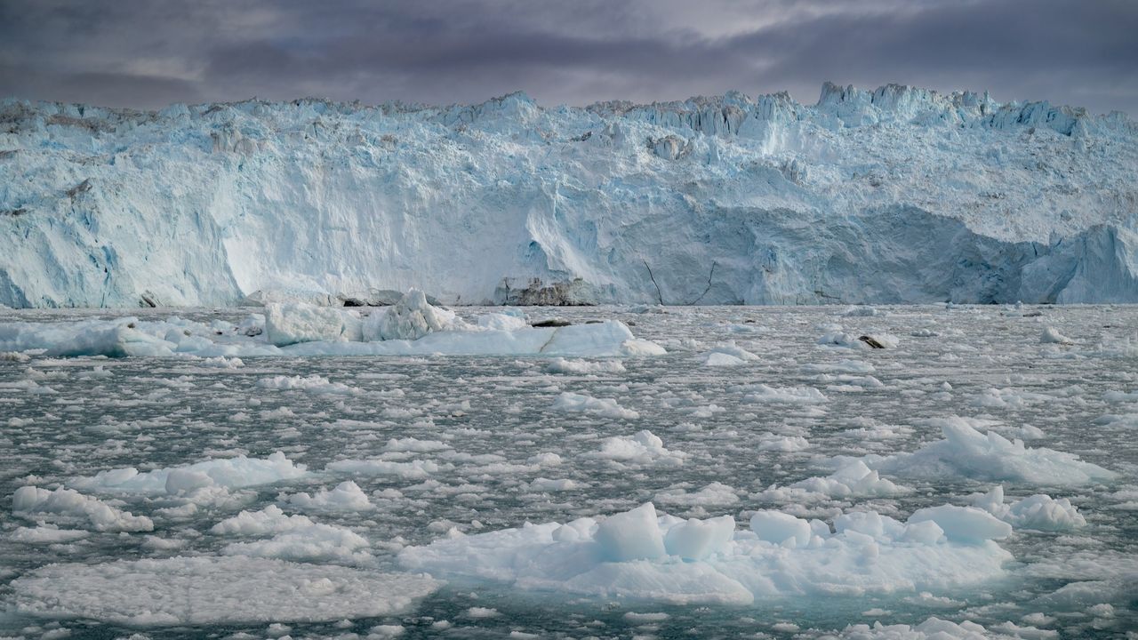
Runoff from Greenland's rapidly melting ice sheet could severely disrupt currents in the Atlantic Ocean that regulate the global climate, researchers say. But the fresh water won't trigger the complete and irreversible collapse of the circulation that some research predicts, a new study suggests.
By 2100, Greenland meltwater could cause a reduction in the strength of the Atlantic Meridional Overturning Circulation (AMOC) equivalent to an additional 10% to 20% on top of the weakening that many scientists already expect for this huge system of currents, researchers found.
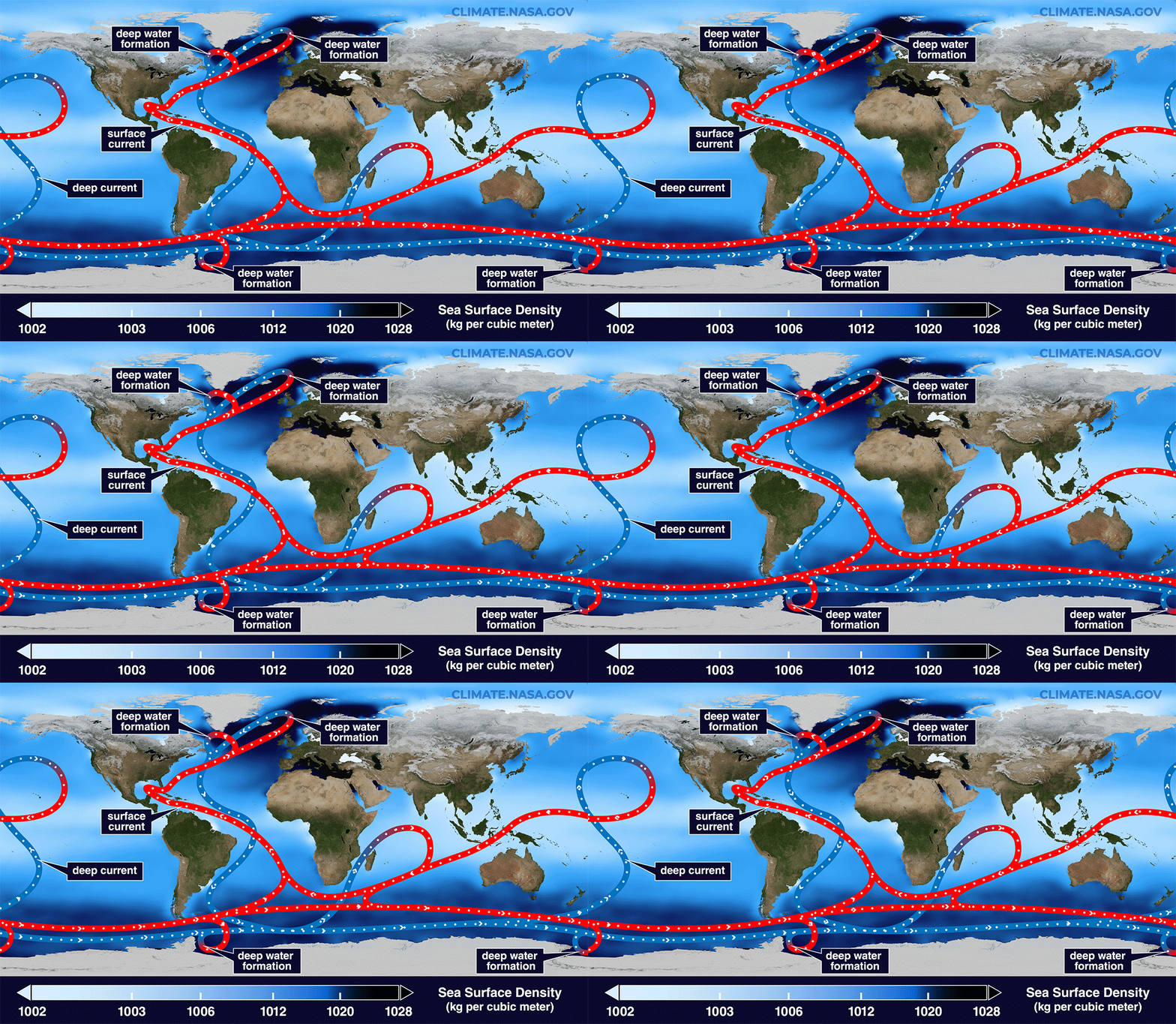
Previous research suggests the AMOC, which moves heat from the tropics to the Northern Hemisphere and cold water back south toward Antarctica, is at its weakest in more than 1,000 years due to Arctic ice melt and soaring ocean temperatures. Models indicate that the circulation will continue to weaken for decades to come, potentially unleashing freezing weather in Northwest Europe, additional sea-level rise along the U.S. East Coast and droughts around the equator.
The AMOC loops around the Atlantic Ocean, bringing warm waters north along the ocean's surface and cold waters south along the ocean floor. (Image credit: NASA/Goddard Space Flight Center Scientific Visualization Studio)
The new study revealed that by 2300, Greenland's ice sheet could cause a whopping 40% of AMOC weakening on top of the declines projected by some climate models if we continue to cook the planet. The results highlight the effects on the AMOC of a growing freshwater pulse from Greenland that most climate models currently don't take into account, the authors said.
"By the year 2100, yes, we have something, but the greatest fraction is what we add later," study co-author Jost von Hardenberg, a professor in the Department of Environment, Land and Infrastructure Engineering at the Polytechnic University of Turin in Italy, told Live Science.
Meltwater from the Arctic and Greenland slows the AMOC by preventing the formation of deep currents in the North Atlantic that drive the circulation south toward Antarctica. Deep currents form when masses of cold, salty water sink to the seabed, but inputs of fresh water and rising water temperatures are blocking this step by diluting and warming surface waters.
While Arctic meltwater is commonly integrated into climate simulations, researchers have been slower to include runoff from the Greenland ice sheet in models, partly because this runoff may not be as disruptive as Arctic meltwater on shorter timescales, von Hardenberg said.
"In order to represent correctly the Greenland melt, you need a specific, dynamic model for the Greenland ice sheet. It's nice to have, but it requires a lot of resources to develop," von Hardenberg said
The Community Ice Sheet Model version 2 (CESM2) is one of the few available simulations of the Greenland ice sheet. For the study, von Hardenberg and his colleagues used a global climate model called EC-Earth3, which does not include the Greenland ice sheet. The team added the ice sheet from CESM2 to explore how it might affect the AMOC over the next few centuries. Adding the ice sheet separately enabled them to compare AMOC weakening with and without Greenland, clearly revealing the impact of the ice sheet on the AMOC's strength.
The results, published June 19 in the journal Science Advances, suggest the Greenland ice sheet will have a big influence on Atlantic ocean currents, especially after 2100.
"Greenland starts really melting strongly only after that date," von Hardenberg said. "If you go farther in our simulation — we go up to the year 2300 — that is also when this meltwater really becomes extremely strong."
Yet unlike other studies that show the AMOC collapsing irreversibly under climate change, in this model, the circulation recovered once the team switched off the meltwater or dialed down greenhouse gas emissions. Both the simulations that didn't include the Greenland ice sheet and those that did had similar results, recovering partially when the meltwater was turned off and fully when greenhouse gas emissions were stopped.
The recovery in the model suggests that the AMOC is more stable than previously thought and doesn't suddenly flip from an active state into a collapsed one, von Hardenberg said. "It's consistent with a strong weakening, but not a shutdown," he said.
Overall, the findings show that it is important to include the Greenland ice sheet in climate models — something von Hardenberg and his colleagues are planning to do in the next version of the EC-Earth3 model.
"It's really something which is worthwhile doing to better constrain the uncertainty of these future simulations," von Hardenberg said. "If we have a larger set of models which include this component, we will be in a better position to try to answer the question, 'How much do we expect AMOC to decrease in different scenarios?'"
Other experts agreed that integrating the Greenland ice sheet in climate models will increase the accuracy of AMOC predictions.
"What makes the study particularly interesting is that it directly tests a process that has often been highlighted as an important source of uncertainty in future AMOC projections," said Jonathan Baker, a senior climate scientist at the Met Office in the U.K. who was not involved in the study.
The results are consistent with previous research showing that Greenland meltwater causes additional AMOC weakening, but whether the system could collapse is still uncertain, given that the team used only one model, Baker told Live Science in an email. "Repeating these experiments across a wider range of models will be important to assess how robust the findings are," he said.
Nicholas Foukal, an assistant professor at the University of Georgia's Skidaway Institute of Oceanography who was not involved in the study, said he doesn't think the use of a single model limits the analysis.
"I think this result is robust and I am glad to see the authors come to this conclusion in such a high-resolution and realistic coupled climate model," Foukal told Live Science in an email. "This finding also agrees with other modeling results that require immense amounts of fresh water, much more fresh water than is available on Greenland, to cause irreversible change in the AMOC."
However, a third expert said the model used in the study is unrealistic, because its parameters make the AMOC more resilient than those of other models. Therefore, the study should be replicated in other models to draw unbiased conclusions.
"While the experiment reported is interesting, its outcomes are neither surprising nor should be interpreted as exemplary for the whole model ensemble," Sybren Drijfhout, a professor of physical oceanography at the University of Southampton in the U.K., told Live Science in an email.
Researchers should investigate the impact of the Greenland ice sheet on the AMOC further, von Hardenberg said. "It would be interesting in the future to check it [the AMOC's recovery with Greenland meltwater] with other models, but of course it's encouraging to see it in one case," he added.
What's in the photo? A giant, milky-green swirl on the lake's surface
Who took the photo? An unnamed astronaut on board the International Space Station
When was it taken? Feb. 21, 2020
This eye-catching astronaut photo shows a cloud of sediment swirling into a giant, milky-green vortex in one of Europe's largest lakes.
Lake Skadar (also known as Shkodër, Shkodra or Scutari) is the largest lake in Southern Europe, with a surface area between 140 and 200 square miles (360 to 520 square kilometers), depending on the time of year. It is situated on the border between Montenegro, which surrounds the western half of the lake (left in the photo), and Albania, which encircles the lake's eastern shore. The body of water is split 65% to 35% in Montenegro's favor.
The lake's main water source is the Morača River, to the northwest, and its biggest outlets are the Bojana and Drin rivers, which start at the lake's easternmost point and eventually drain into the Adriatic Sea, which is partially visible in the bottom left of the photo. Skadar's southern shore is also hugged by a lofty mountain range, known as the Dinaric Alps.
During late winter and early spring, the lake's water level rises, and it usually fills with a milky-green substance that often gets whipped into a vortex by a combination of wind-driven surface currents and the natural flow of water between the lake's major inlets and outlets.
The swirling material looks very similar to blooming algae, but it is actually made of sediments — predominantly limestone and dolomite — that wash into the lake from the Dinaric Alps and other nearby mountains as the snow melts.
Lake Skadar formed millions of years ago and was once connected to the Adriatic Sea (visible in the background of this image). (Image credit: Wikimedia)
Skadar is a karst lake, meaning it was once a cave system that flooded and eventually collapsed, likely because the caves were made from the same easily erodible rocks that now swirl on the lake's surface, according to NASA's Earth Observatory. The lake is a "cryptodepression" because most of the lake's floor is below sea level.
The lake originally formed during the Cenozoic Era (66 million years ago to the present), according to the International Lake Environment Committee Foundation's World Lake Database. It is home to several small islands, some of which can be seen in the photo along the lake's southern shore. These include Beška, which is home to a pair of 600-year-old churches, and Grmožur, where the remains of a 19th-century fortification loom above the lake's surface.
The shipwreck of a paddle steamboat, named Skanderbeg, lies along the lake's western shore. Local partisans sank the vessel in 1942 after Italian soldiers commandeered it during the Axis occupation of Yugoslavia in World War II. When the lake's water levels are at their lowest, part of the shipwreck rises above the surface.
Skadar Lake is a biodiversity hotspot and has protected wildlife status on both sides of the Montenegro-Albania border. It is a particularly important site for birds; more than 280 avian species call it home, including the Dalmatian pelican (Pelecanus crispus) and several endemic species, according to BirdLife International.
The lake also hosts around 50 freshwater snail species — more than any other lake on Earth, according to a 2013 study.
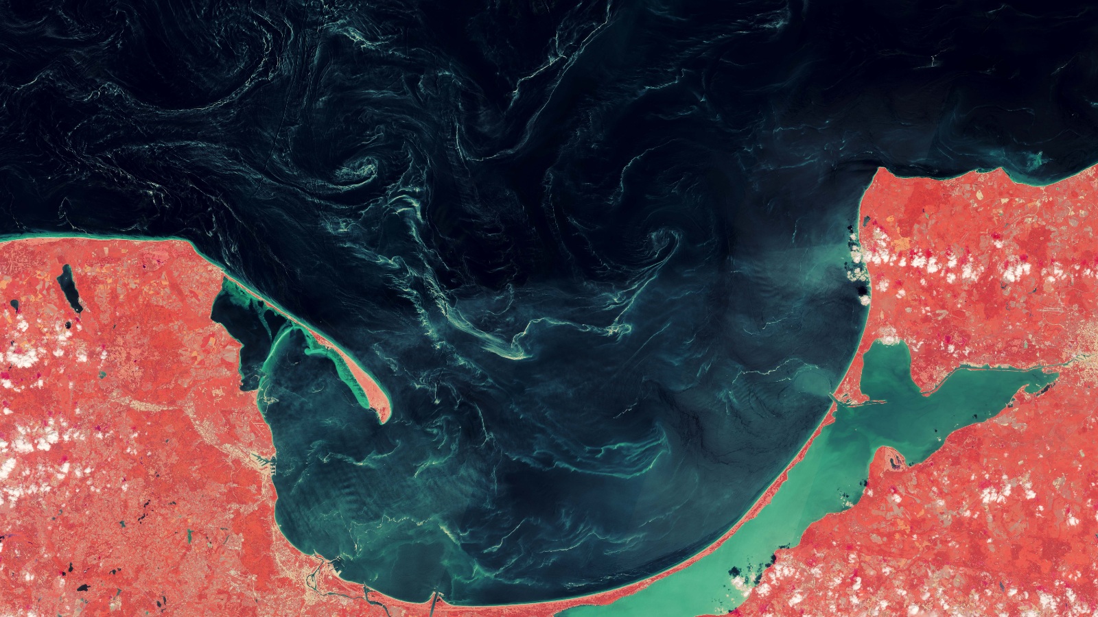
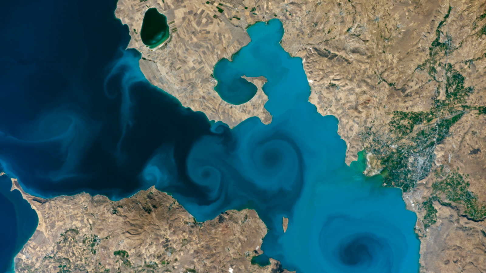
This 2018 satellite photo shows an unknown substance swirling across the Gulf of Gdańsk in Poland. Scientists were shocked to later discover what it really was.

 Login