❌

Reading view

These 'metallic' dunes on Mars look like sci-fi. What are they really?

If you still picture Mars as a monotonous red desert, it may be time for an update.

The European Space Agency's Mars Express orbiter has been capturing some of the Red Planet's most surreal landscapes, and its latest images reveal a sprawling field that looks like molten metal frozen across the floor of an ancient Mars crater.

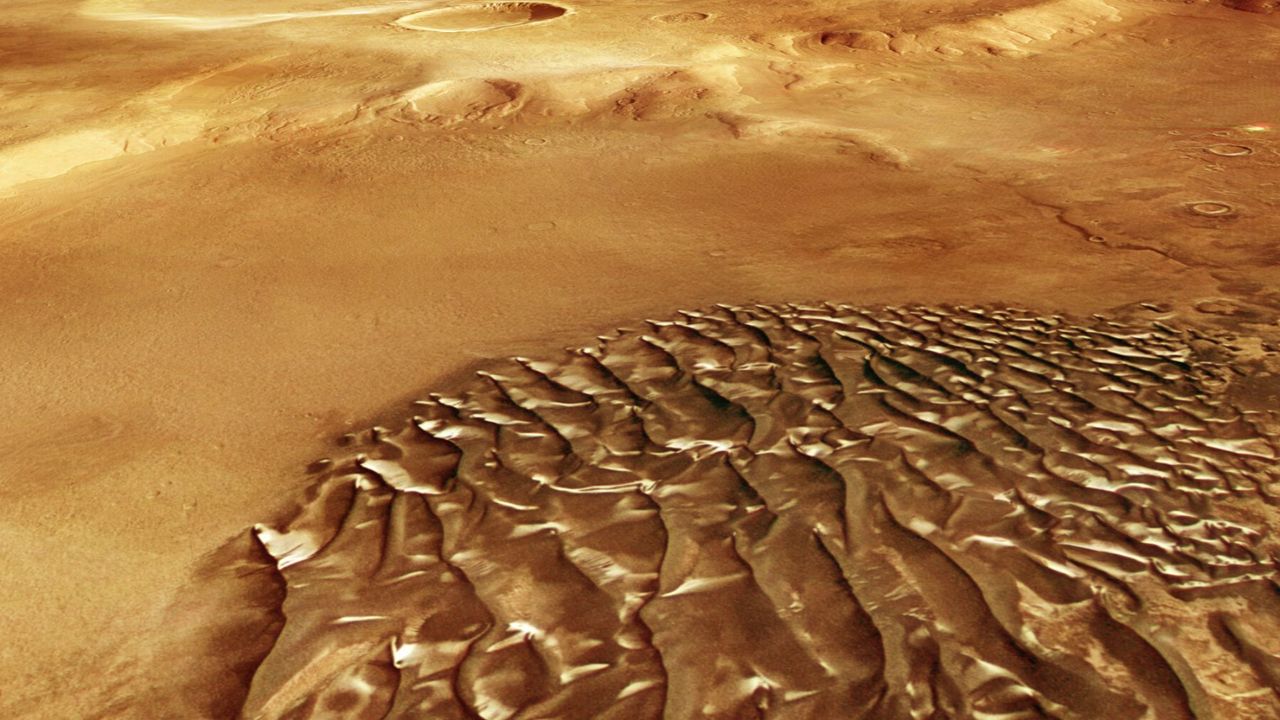
The shimmering "waves" aren't metal at all, however. They are dark sand dunes dusted with seasonal frost, much of it carbon dioxide, or "dry ice," that settles on the surface during Martian winters, giving the dunes their uncanny chrome-like sheen, according to ESA.

The rest is a trick of light and contrast. Because the dark sand absorbs light and the white frost reflects it, the interplay transforms the landscape into something that looks more like a scene from a sci-fi movie than a windswept Martian plain.
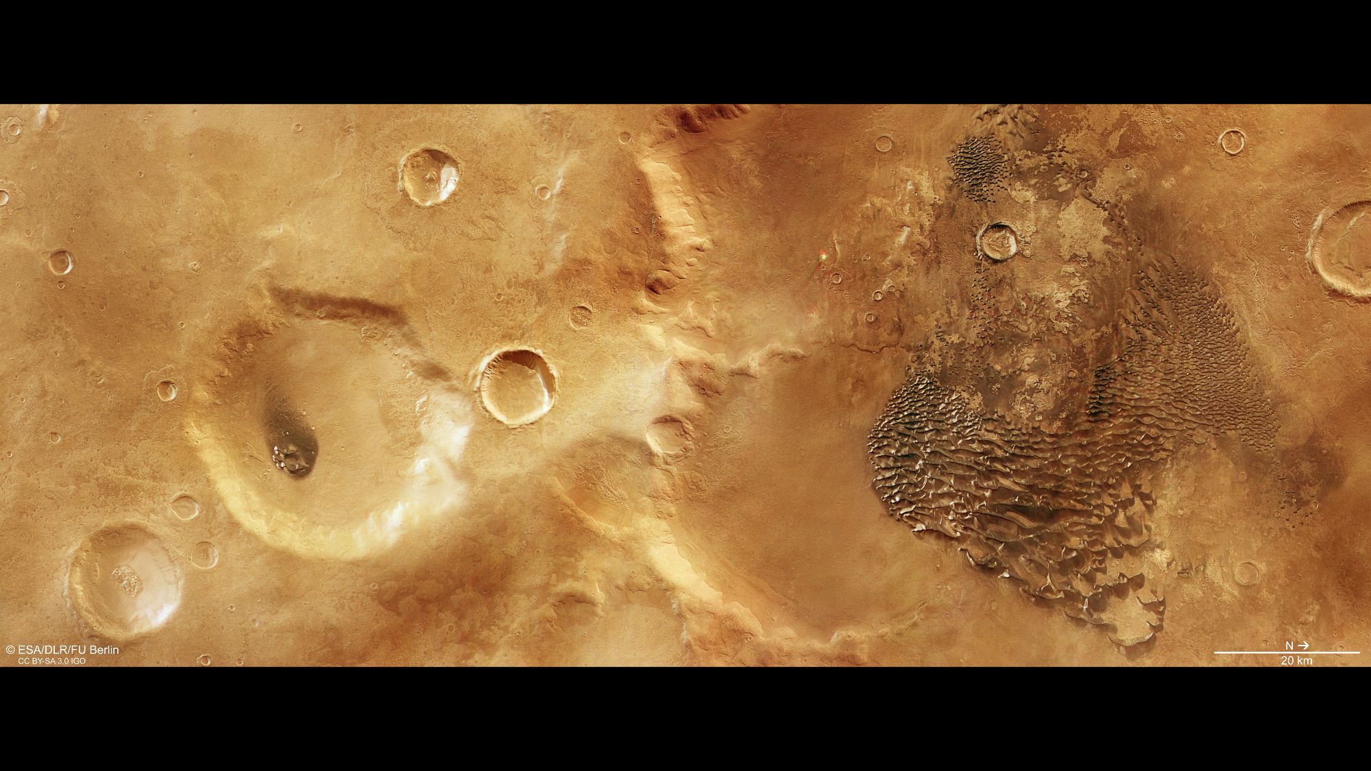
Metallic-looking waves on the right side of a reddish region with craters scattered.

A bird's-eye view of wind-blown dunes in Kaiser Crater. (Image credit: ESA/DLR/FU Berlin)

Over thousands of years, Martian winds have sculpted this volcanic sand into dunes that now ripple through the floor of Kaiser Crater, a 129-mile-wide (207-kilometer-wide) impact basin in the planet's southern highlands. The bowl-shaped crater acts as a giant sand trap that prevents the sand from escaping, according to NASA.

The dunes themselves are darker than much of Mars' surface because they are made of fine, basaltic sand rich in volcanic minerals such as pyroxene and olivine, rather than the iron-oxide dust that gives the planet its familiar rusty-red appearance and its famous moniker, the Red Planet.

Because the crater floor remains visible between the ridges, scientists think there is a relatively limited sand supply shaping the field. Still, these ripples of sand are massive, extending for several kilometers and towering more than 100 meters (320 feet) above the surrounding terrain.

The landscape isn't just visually dramatic, it also preserves clues to a time when Mars was a very different world.

Today, Mars is wrapped in an atmosphere little more than a thin veil that is 100 times thinner than Earth's and slowly leaking into space. That makes it harder for winds to lift and transport sand than it is on our own planet. Yet the soaring dunes inside Kaiser Crater show that Martian winds have nonetheless been powerful enough to sculpt vast landscapes over time, perhaps during a period when the Martian atmosphere was thicker a few billion years ago.

The new image adds to a growing collection of striking Martian scenes captured by Mars Express, which has been orbiting the Red Planet since 2003. Just last month, the probe tracked a frenetic cluster of 30 dust devils swirling through the canyons of Mamers Valles, also in the northern hemisphere.

Over the spring and summer, the orbiter similarly spotlighted the planet's vast and complex geological history, from Shalbatana Vallis β€” carved by groundwater floods about 3.5 billion years ago into winding valleys that span the length of Italy β€” to a massive blanket of dark volcanic ash elsewhere on the world that has spread across a large chunk of the terrain over just the last 50 years, having either been redistributed by Martian winds or exposed as the overlying dust was blown away.

However desolate Mars may appear from afar, there is certainly no shortage of activity on its surface β€” or discoveries still waiting to be made.
  •  

Smoke from devastating Canada wildfires visible from space | Space photo of the day for July 17, 2026

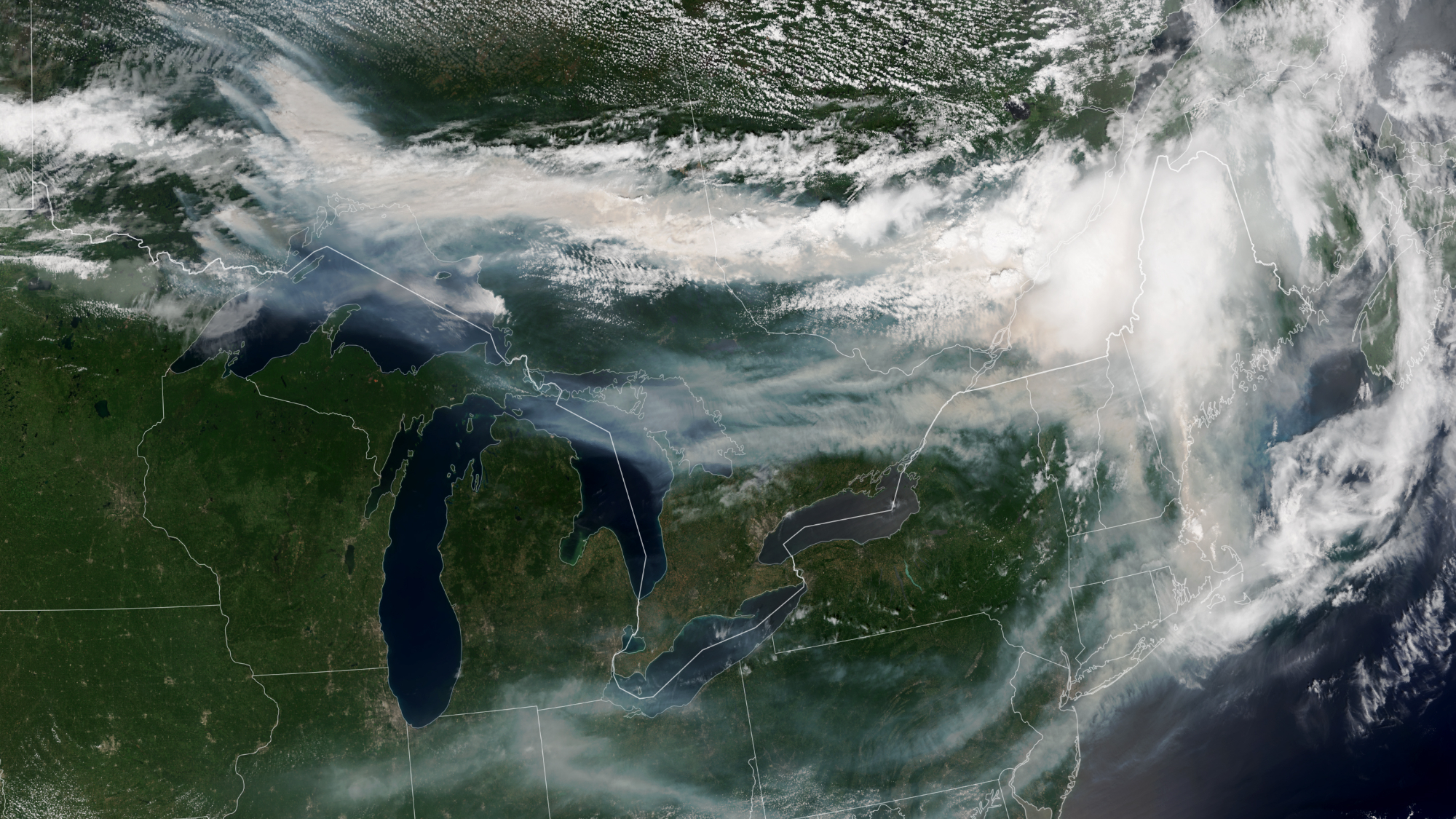
This image from space shows wildfires over Canada.

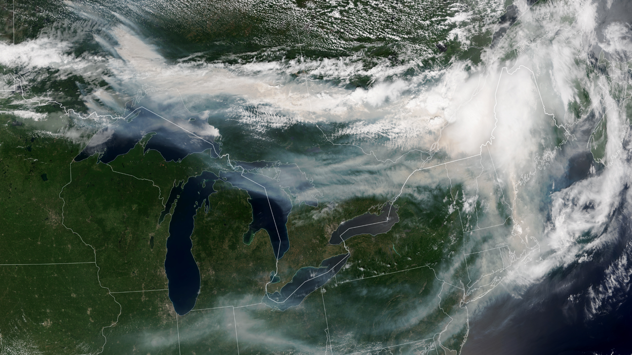
Smoke from wildfires across Canada travels across both Canada and the U.S. in this satellite image captured by NOAA-21 on July 14, 2026. (Image credit: NASA Earth Observatory/Lauren Dauphin)

The wildfires tearing across Canada are so extreme that the smoke billowing upward can be seen from space.

What is it?

Over 850 wildfires are currently devastating Canada, as reported by the Canadian Interagency Forest Fire Center. The fires are spreading across Manitoba, Saskatchewan and Ontario; most remain completely uncontrolled.

In addition to the immense destruction caused by the fires themselves, the smoke from these fires is causing serious concerns about dangerously poor air quality all across Canada and even in the northeastern United States. As far as New York, the air quality on Thursday (July 16) was labeled "very unhealthy" after the state activated emergency air quality protocols.

The smoke is so expansive it's clearly visible in this image captured on July 14 from Earth orbit.

Why is it noteworthy?

Studying wildfires and wildfire smoke from orbit can give us a bigger picture view of these catastrophic event. This data is important for disaster relief in the short term β€” but also in the long-term. With climate change continuing to progress due to human activities like burning coal for cheap power, we can expect natural disasters to worsen. Among the many effects of climate change, this includes longer and more intense wildfire seasons, especially in regions that are already susceptible to fire such as these regions across Canada.

The new image was captured by the NOAA-21 satellite with the instrument VIIRS (Visible Infrared Imagine Radiometer Suite). You can see massive plumes of smoke over southeastern Canada treading into the northeastern U.S. Thick smoke covers swaths of Canada's landscape and wisps of smoke trail all the way down through New York and across the U.S.

Most of this smoke, at least the smoke we can see in this satellite image, is coming from wildfires in northwestern Ontario. As the wildfires continue to burn, satellites like NOAA-21 will be keeping watch.

  •  

Are we underestimating the threat of solar storms? A 'once-in-a-thousand-year' disaster is worth considering, scientists say

The most powerful solar storms to strike Earth may pack a bigger punch than scientists realized, according to a new study that suggests the impacts of extreme space weather have been underestimated.

Researchers found evidence that the apparent upper limit on Earth's response to the strongest solar storms may be an artifact of how solar wind has been measured rather than a true physical ceiling. If confirmed, the findings suggest that rare "once-in-a-thousand-year" geomagnetic storms could have a greater impact on modern technology than current estimates indicate, according to a statement.

"Our planet's magnetic field does a really great job of protecting us against many space weather effects and so they often just show up as glitches or beautiful aurora," Maria Walach, co-author of the study from Lancaster University, said in the statement. "There are however extreme cases."

Solar storms occur when eruptions from the sun, such as coronal mass ejections and solar flares, send clouds of charged particles hurtling toward Earth. While they can produce spectacular auroras, they can also disrupt satellites, GPS, radio communications and power grids.

History has shown the damage even less extreme storms can cause. The 1859 Carrington Event, the strongest geomagnetic storm on record, disrupted telegraph systems around the world and pushed auroras from their usual high-latitude skies near the Arctic and Antarctic to locations as far south as the tropics. Another powerful storm in 1989 collapsed Quebec's power grid, leaving millions without electricity, while the 2003 "Halloween storms" disrupted satellites, GPS and radio communications.

While the study doesn't suggest that an unprecedented solar storm is imminent, it argues that scientists may need to rethink how they estimate the severity of the rarest events β€” an increasingly important challenge as modern society grows more dependent on satellites and other vulnerable technologies.

The researchers traced the apparent upper limit to where most solar wind measurements are collected. Many observations of extreme events come from spacecraft near the Sun-Earth Lagrange Point 1 (L1), about 1 million miles (1.5 million kilometers) upstream of Earth. Because the strongest solar wind tends to weaken somewhat before reaching Earth, comparing L1 measurements with conditions at our planet can make it appear that Earth's upper atmosphere stops responding to increasingly intense solar wind, even when it does not.

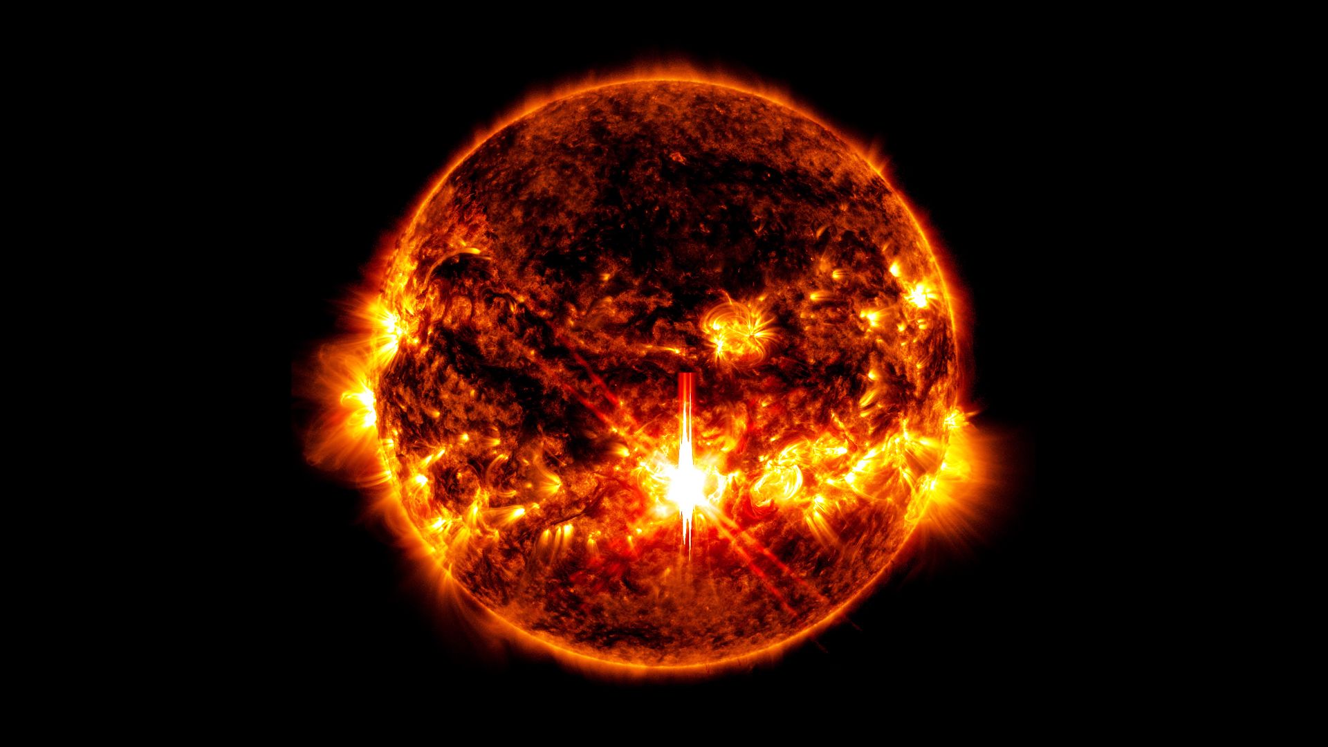
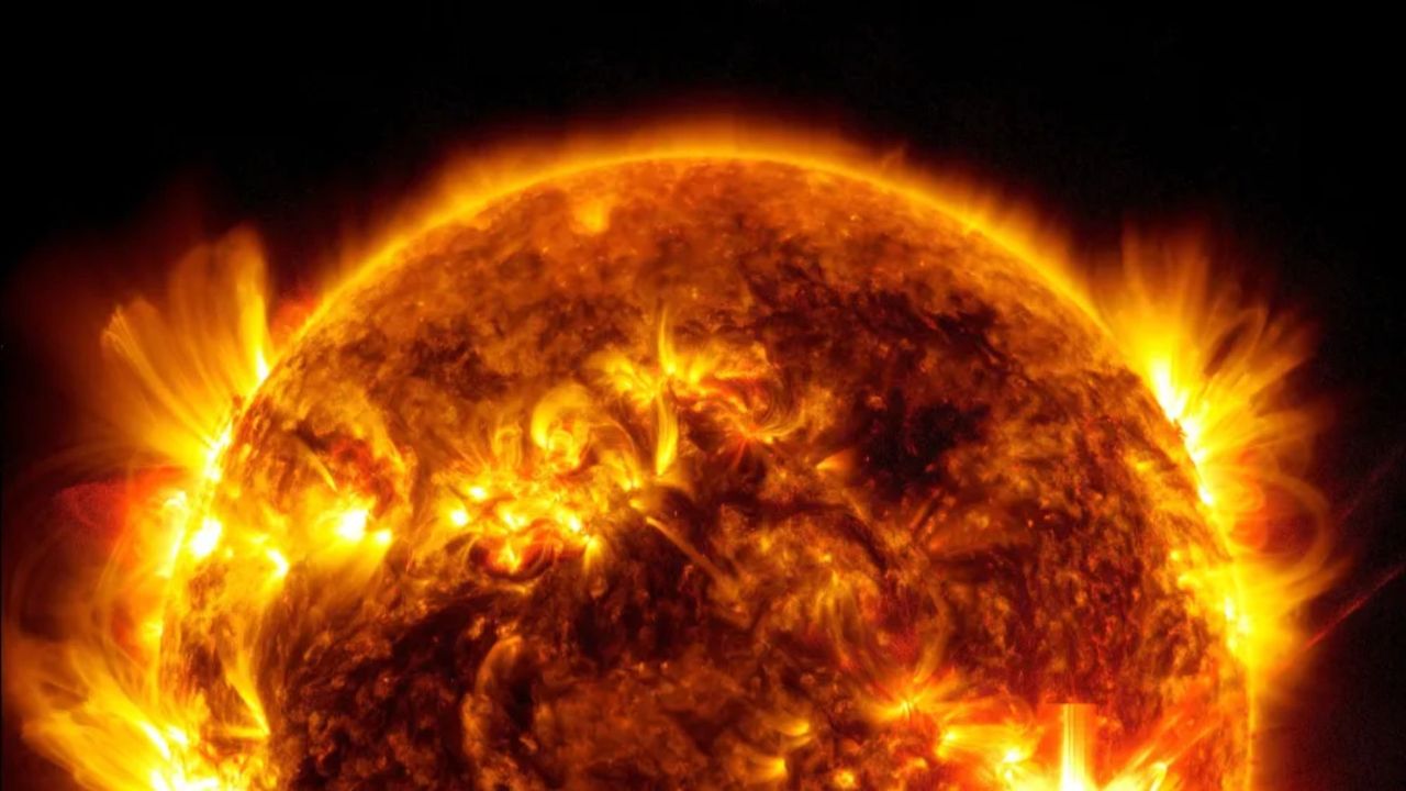
An image of a very violent looking sun against the darkness of space. In the center slightly toward the bottom there is a very bright spot.

A close-up of a solar flare on the sun. (Image credit: NASA/SDO)

To test that idea, the team analyzed more than one million solar wind measurements collected by NASA spacecraft orbiting much closer to Earth, where the solar wind directly interacts with our planet's magnetic field. Those observations showed that electrical currents flowing through Earth's upper atmosphere continued to increase alongside stronger solar wind, with no sign of the previously assumed upper limit. The results suggest that exceptionally powerful solar storms could generate stronger geomagnetic disturbances β€” and greater impacts on satellites, communications systems and power grids β€” than earlier estimates predicted.

"Fortunately, these very extreme cases are rare, but this also means we have limited data to work with and only time will tell what happens at the very extreme one-in-a-thousand-year kind of event," Walach said in the statement.

The study comes as the sun remains near the peak of its roughly 11-year solar cycle, known as solar maximum, when sunspots, solar flares and coronal mass ejections become more frequent. During the current cycle, strong geomagnetic storms have repeatedly sent auroras far beyond their usual polar skies.

In May 2024, the strongest geomagnetic storm in more than two decades illuminated skies across much of the United States and Europe while causing intermittent disruptions to high-frequency radio communications, GPS-guided equipment and some satellite operations. Although significant, that event was far less powerful than the Carrington Event β€” or the even rarer storms the new study suggests may be possible.

The findings were published July 15 in the journal Nature.

  •  

Astronomers discover landslides on Pluto large enough to bury entire cities on Earth

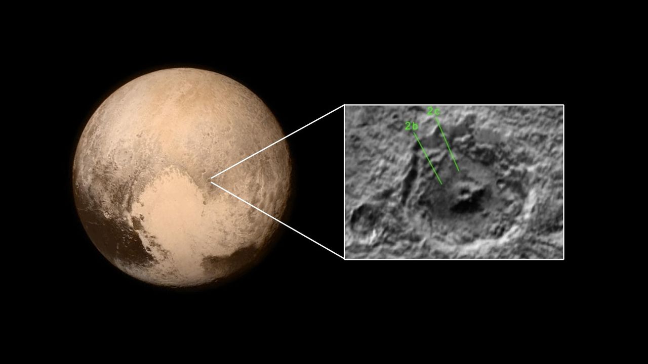
The aftermath of landslides have been found in images of Pluto's surface taken when the New Horizons mission flew past the dwarf planet in 2015. The landslides are evidence that the icy world is still active, albeit on geological timescales.

A team led by geologist Marco Emanuele Discenza pored over images taken by New Horizons' LORRI (Long-Range Reconnaissance Imager) instrument, which was capable of detecting surface features as small as 984 feet (300 meters). They found convincing evidence for six landslides in total that have taken place down the inner walls of three craters on the western edge of Sputnik Planitia, the heart-shaped feature that characterizes Pluto's appearance.

Previously, geological features left behind by landslides have been found on a host of bodies in the solar system, including Mars, Ceres in the asteroid belt, some of the icy moons of the gas giants, and even Pluto's companion, Charon. However, these are the first to be found on Pluto.

A landslide that fell 1.4 miles (2.2 kilometers) was identified in Pluto's Coughlin crater, close to a secondary crater on Coughlin's rim that may have triggered the landslide in the first place. Two further landslide features were seen in Giclas crater, and another three were spotted in a third, unnamed, crater.

The landslides were identifiable by their large debris aprons that spilled out onto the crater floors, the distance the landslide material travelled ranging being between 6.3 and 9 miles (10.1 and 14.5 km). Some of these debris aprons appeared bumpy, as if they contain large boulders of solid ice, while the areas around the source of the landslides feature well-defined, concave-shaped cliffs where material has broken away and tumbled down the craters' steep walls.

The great lengths that the debris rolled means that Pluto's landslides are among the most mobile in the solar system, a product of low gravity and low-friction icy rubble. The largest of the debris aprons covers 50 square miles (130 square kilometers), which would be large enough to bury a small city or a large town.

Landslides are important processes in shaping planetary surfaces, enabling the transport of material across great distances. The trigger for Pluto's landslides, however, is not yet clear. While the landslide in Coughlin appears to have been caused by a smaller impact nearby, the other five have less certain origins. One possibility is thermal stresses in the surface ice caused by the slight temperature changes that cause Pluto's volatile materials – among them molecular nitrogen, carbon monoxide and methane – to periodically sublimate and then condense again. These temperature changes are the result of Pluto subtly heating up and cooling down as its elliptical orbit brings it slightly closer to the sun, crossing inside Neptune's orbit, and then moving farther away again.

There is also evidence for more landslides in other craters, but New Horizons' coverage of Pluto's surface was limited as it hurriedly flew past on July 4, 2015, and the imagery required to confirm these other landslides is lacking.

The findings were published in the journal Icarus.

  •  
❌