❌

Reading view

Peculiar land bridge separates a pair of colorful lakes in Patagonia β€” Earth from space

QUICK FACTS

Where is it? Lake PueyrredΓ³n and Lake Posadas, Argentina [-47.41961002, -71.87622200]

What's in the photo? The point where two different-colored lakes meet

Who took the photo? An unnamed astronaut on board the International Space Station

When was it taken? Sept. 15, 2020

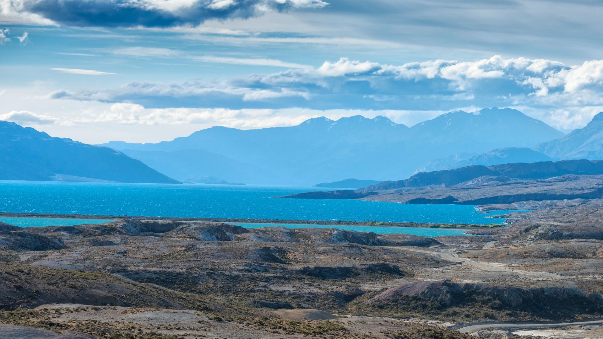
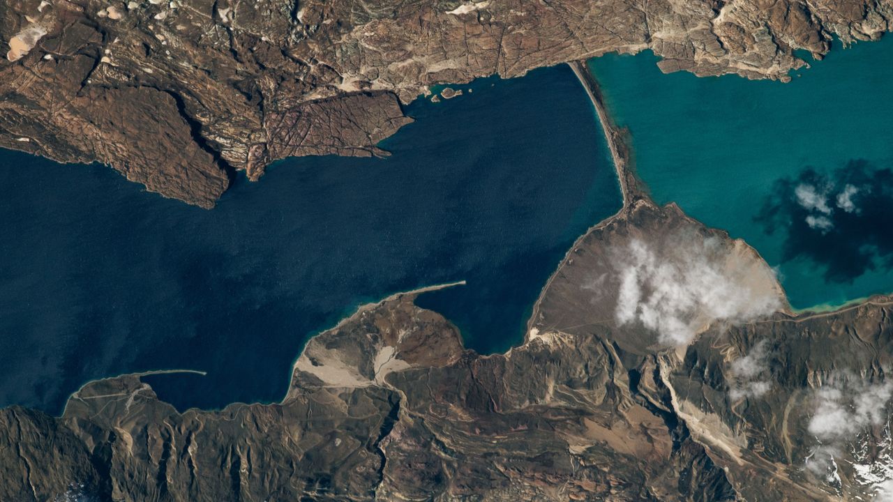
This eye-catching astronaut photo shows the point where an ancient Patagonian lake has been split by a peculiar land bridge, creating two contrastingly colored bodies of water.

Lake PueyrredΓ³n (on the left in the photo) is the Argentine half of a roughly 40-mile-long (65 kilometers) glacial lake, which stretches across the country's border with Chile in Patagonia β€” a region in South America that is well known for its diverse range of geographic features, including mountains, fjords, deserts and rainforests. The Chilean half of the lake is known as Lake Cochrane (not shown in this image). Both halves hold crystal-clear water that is up to 1,600 feet (500 meters) deep, giving PueyrredΓ³n a deep blue hue when viewed from above.

Thousands of years ago, a thick sediment barrier formed across the southern section of Lake PueyrredΓ³n, creating a new body of water known as Lake Posadas. This smaller body, which is roughly 5 miles (8 km) long, has a lighter, teal color due to its shallow water and a large influx of sediment from a nearby river, according to NASA's Earth Observatory.

Other rivers from nearby hills have previously dumped large quantities of sediment along the western shore of Lake PueyrredΓ³n (bottom of the photo), creating a trio of fan-shaped landforms, known as deltas, that increase in size from north to south (left to right in the photo).

Wind-driven currents and waves have pushed some of this sediment from the outer edges of the two smaller deltas, creating long, thin strips of land, known as sandspits, pointing down-current.
A photo of the lakes and the land bridge that separates them, taken from ground level

This image, snapped from the banks of Lake Posadas, shows a close-up view of the rocky barrier that formed across Lake PueyrredΓ³n thousands of years ago. (Image credit: Prisma Bildagentur/Universal Images Group via Getty Images)

The strip of land separating PueyrredΓ³n and Posadas looks similar to the sandspits. However, it is most likely a moraine β€” a barrier of sediment and larger rocks that formed along the edge of a hefty iceberg or long-lost glacier, according to the Earth Observatory.

Eagle-eyed viewers may be able to spot a narrow airstrip on the smallest delta (running almost parallel with its sandspit). While the area is largely uninhabited, it is popular with tourists, who travel to the lakes to camp, hike, fish and kayak, according to a local travel site.

Lake Posadas is also home to a unique island with a massive rocky arch (see below) that is also popular with tourists.
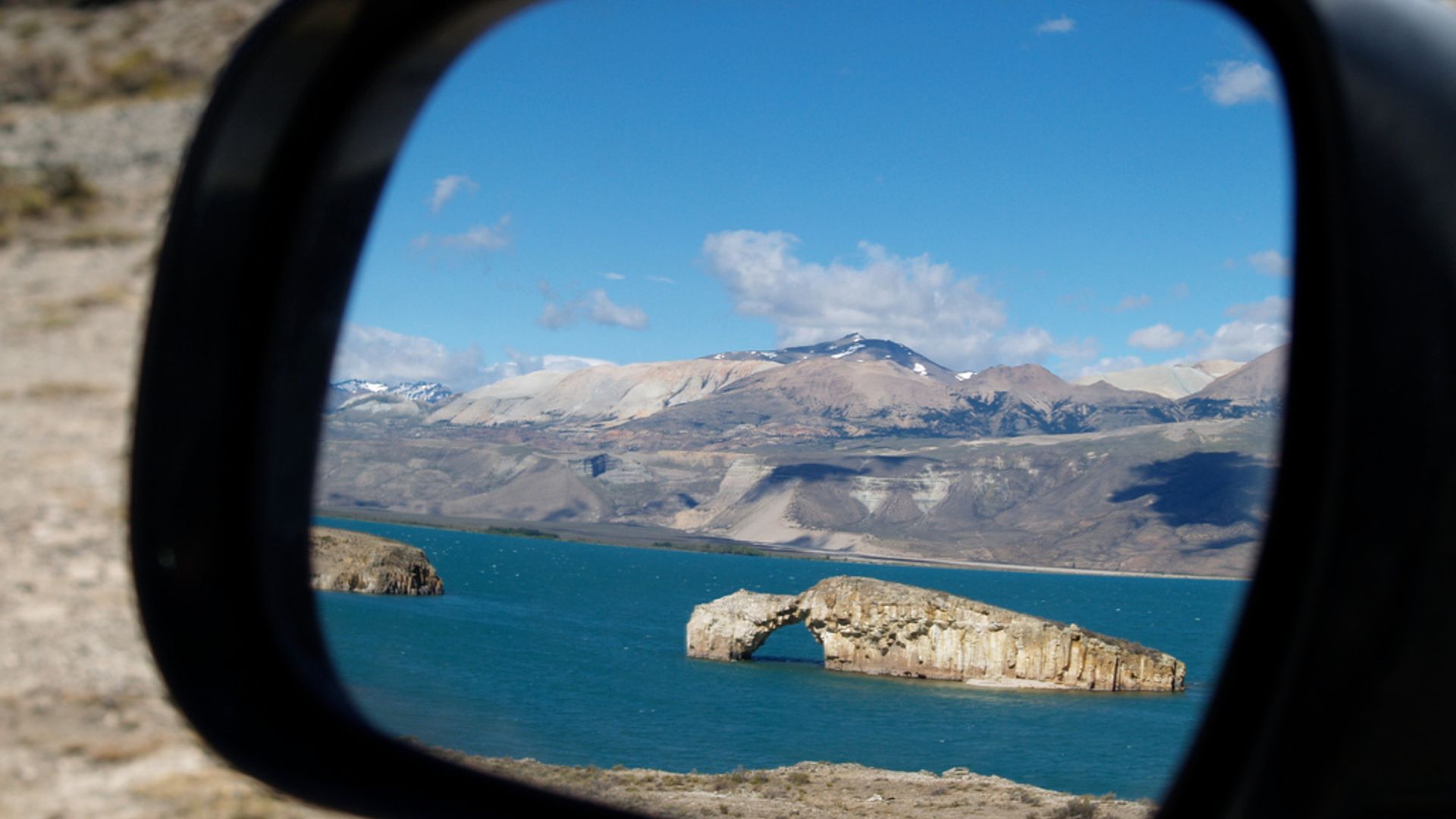
A photo of a car wingmirror showing Lake Posadas and its famous rocky arch reflected in the mirror

This photo, captured in the side-view mirror of a tourist's car, shows the famous rocky arch in Lake Posadas. (Image credit: alextorrenegra via Wikimedia)

The two lakes in the astronaut photo sit within a large valley, which was carved by a massive ice sheet that once covered the area. The last remnants of this ice sheet are located in northern Patagonia, around 20 miles (30 km) west of Lake Cochrane, and have also been snapped from space by astronauts.

Patagonia is home to dozens of similar valleys and fjords that were carved out by the same massive ice slab. Around 210 miles (340 km) southwest of PueyrredΓ³n and Posadas, a trio of ravines converge to create a rare configuration where a lake, river and glacier "touch" each other at a single point.

See more Earth from space
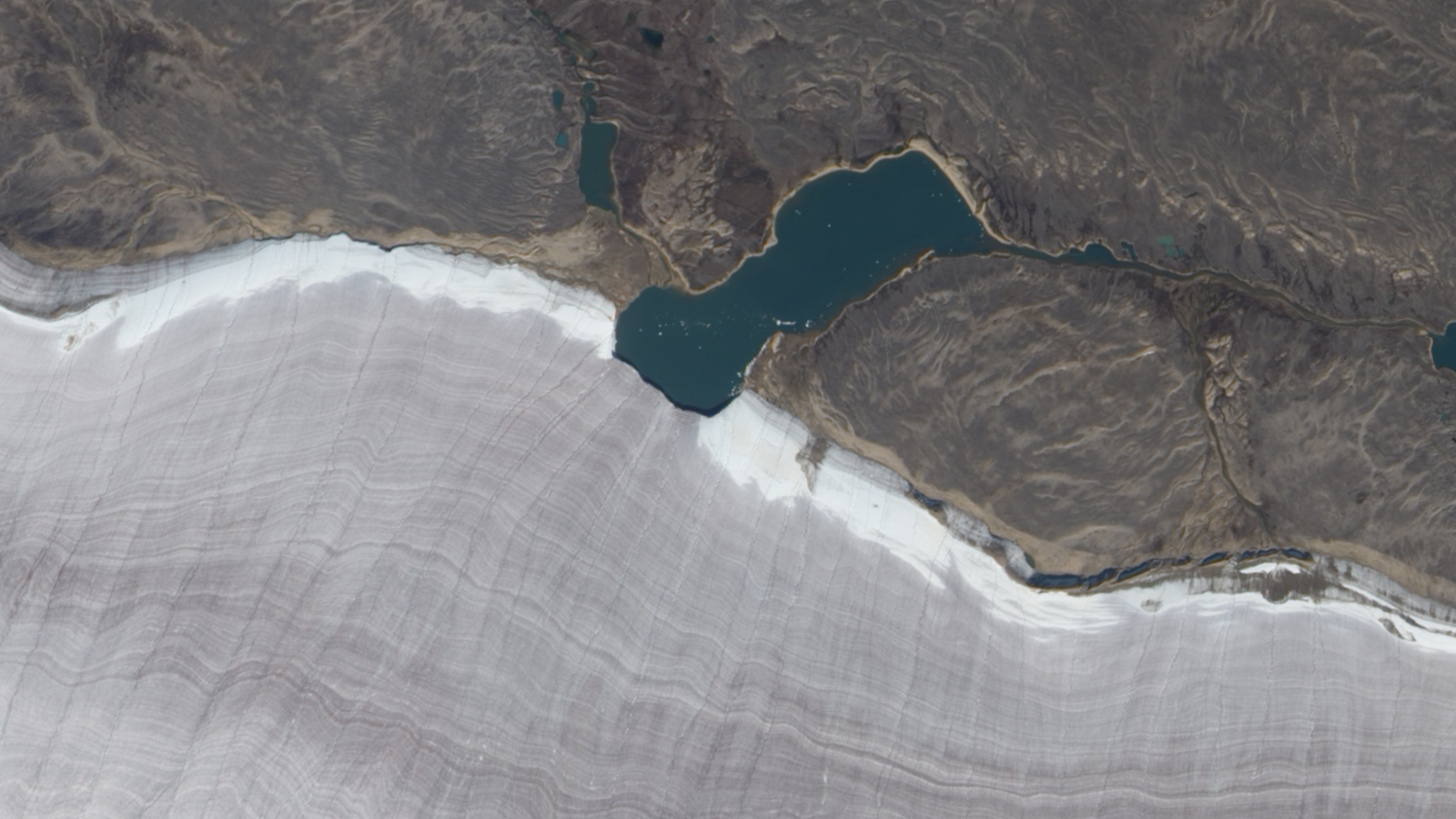
Satellite photo showing a lake bisecting the snowy edge of a gray ridged glacier

Mini lake meets massive glacier

A 2010 satellite photo shows the point where a small lake bisects the snowy rim of an ancient glacier on Canada's Baffin Island. The rippling, snow-rimmed structure is the last remaining fragment of a colossal ice sheet that once covered large parts of North America.
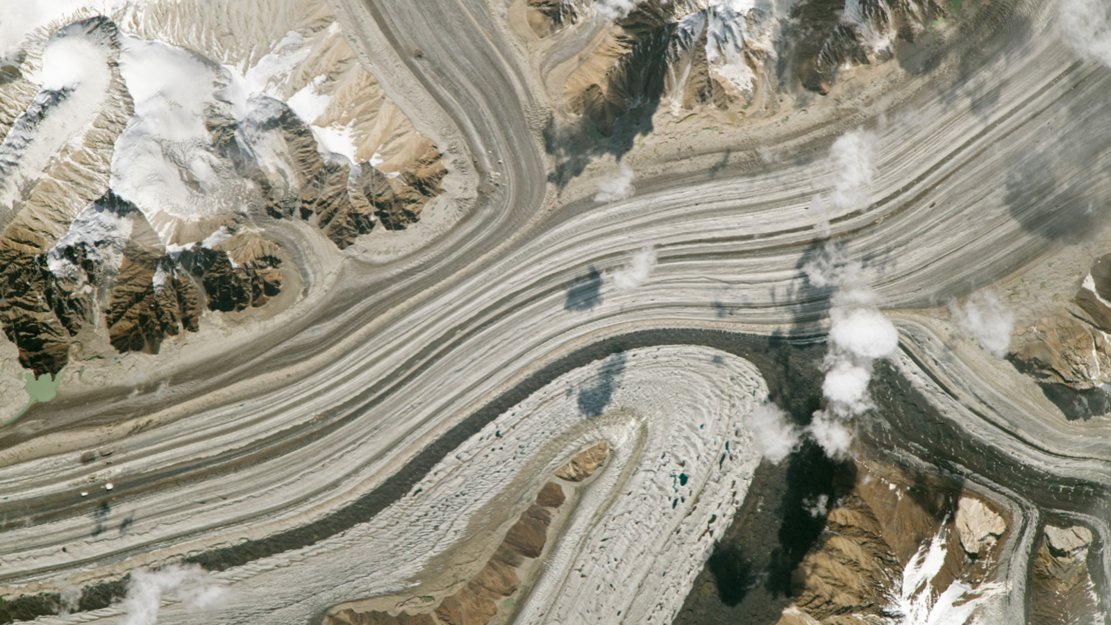
A satellite photo of multiple stripy glaciers merging into a single ice mass

Trio of 'battleground' glaciers merge

This 2023 astronaut photo shows three glaciers merging into a single massive ice mass in the Karakoram mountains. The stripy glaciers have gained ice in recent decades, despite the effects of human-caused climate change.
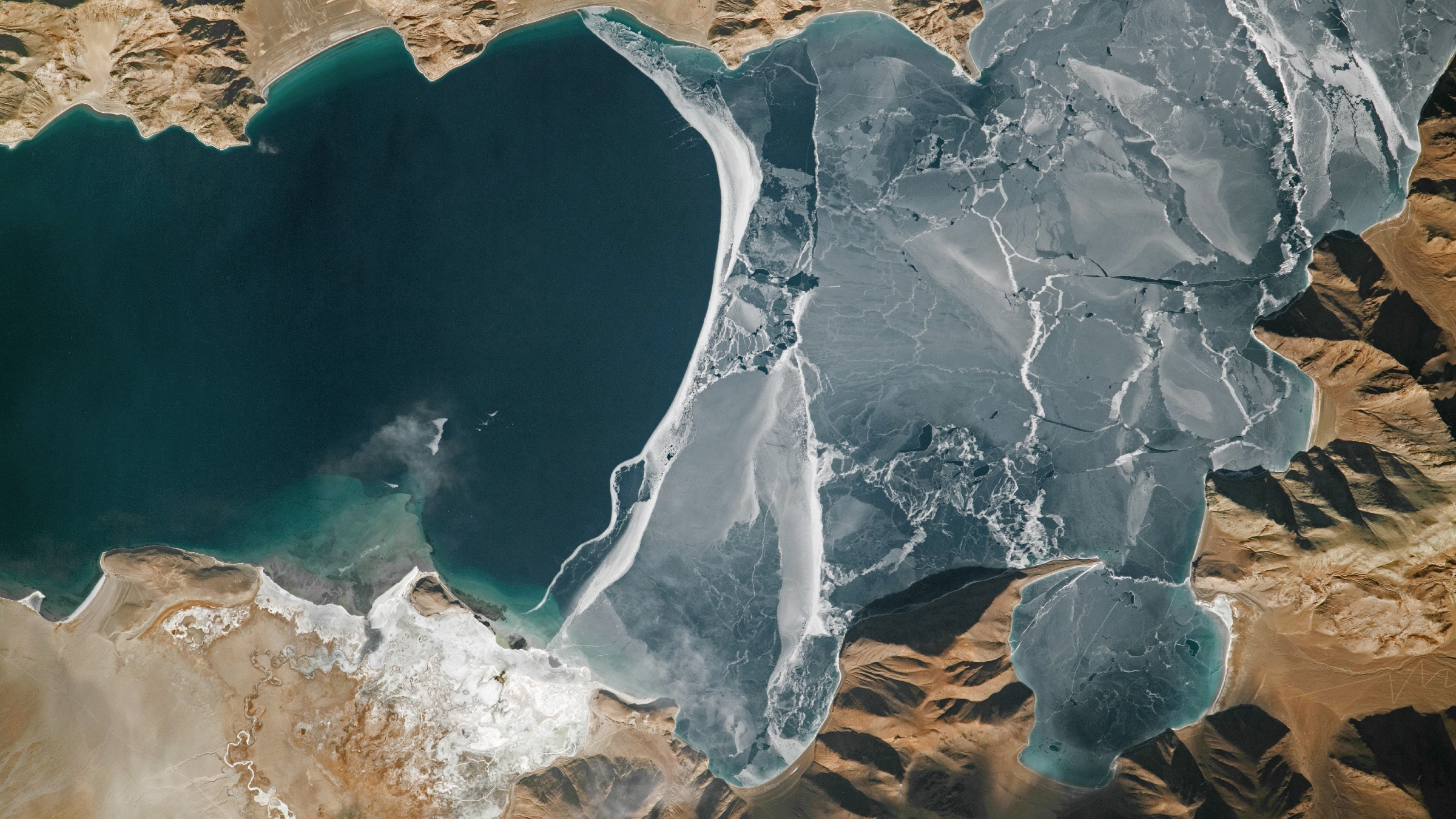
An astronaut photo of a section of a lake half covered in fracturing ice

World's highest frozen lake shatters

A 2024 astronaut photo shows the icy surface of Pangong Lake breaking apart in the lofty Tibetan Plateau. The point where the ice meets the water almost perfectly matches a disputed border between China and India.
  •  

Microscopic fragments of ancient alien tech may litter the moon β€” and scientists have a plan to find them

Tiny fragments of ancient alien tech may be strewn across the surface of the moon, and it may be relatively easy to find these microscopic relics, scientists propose in a new study.

The theoretical study does not claim to have found any evidence of advanced alien civilizations; rather, it offers a new way to search for clues of their existence.

Unlike Earth, the moon has no functional atmosphere or magnetic field, so it is completely exposed to the vacuum of space. As a result, it is constantly bombarded by meteorites, as well as hit by a steady stream of microscopic particles from the rest of the solar system and beyond. Because the moon has no water or tectonic movements, this microscopic matter accumulates and remains on the surface, completely undisturbed.

In the new paper, uploaded June 23 to the preprint server arXiv, the researchers argue that some of this dust originates from star systems beyond our own and, therefore, may contain evidence of long-lost alien civilizations. They also propose a new experiment that could potentially find these microscopic fragments within samples collected over the next decade or more. (The study has not been published yet, but it has been submitted to the International Journal of Astrobiology.)

"The moon has been quietly accumulating material from space for billions of years, much of it likely billions of years older than the moon itself," study first author Lewis Pinault, a planetary scientist at University College London and an affiliate of the SETI Institute, said in a statement. "We're asking whether that ancient collection might contain microscopic traces of technologies that existed long before humans ever looked up at the sky."

Photo of the moon with the crescent Earth in the background

Unlike Earth, the moon lacks a functional atmosphere or magnetic field, meaning that its surface is exposed to the vacuum of space. This allows cosmic dust and other tiny particles to embed themselves within the lunar regolith. (Image credit: NASA)

Tiny technosignatures

Until now, the search for evidence of advanced alien civilizations, known as technosignatures, has focused mainly on radio signals that could be emitted from inhabited exoplanets or hypothetical megastructures, such as Dyson spheres. However, these signals would originate only from active civilizations, not those that died out long before we could spot them.

The authors of the new study argue that when a civilization dies, traces of its technology could survive and end up in space, either via the deterioration of megastructures and other smaller spacecraft or via powerful asteroid strikes on once-inhabited exoplanets. Once in space, tiny specks of metal or other artificial materials could be ejected from star systems by powerful gusts of stellar wind and eventually drift toward us.

Using computer models, the team predicted that pieces of tech up to 3 micrometers across (three-millionths of a meter, or about 3% the width of a human hair) could escape their star systems and travel across interstellar space for up to 1 billion years. Then, they estimated how much of this material could be reaching the solar system and how likely it would be to end up on the moon. (We already know that interstellar dust can penetrate the inner solar system because scientists found some within samples collected from the surface of Bennu, an asteroid that orbits between Earth and Mars and was visited by NASA's OSIRIS-REx probe in 2020.)

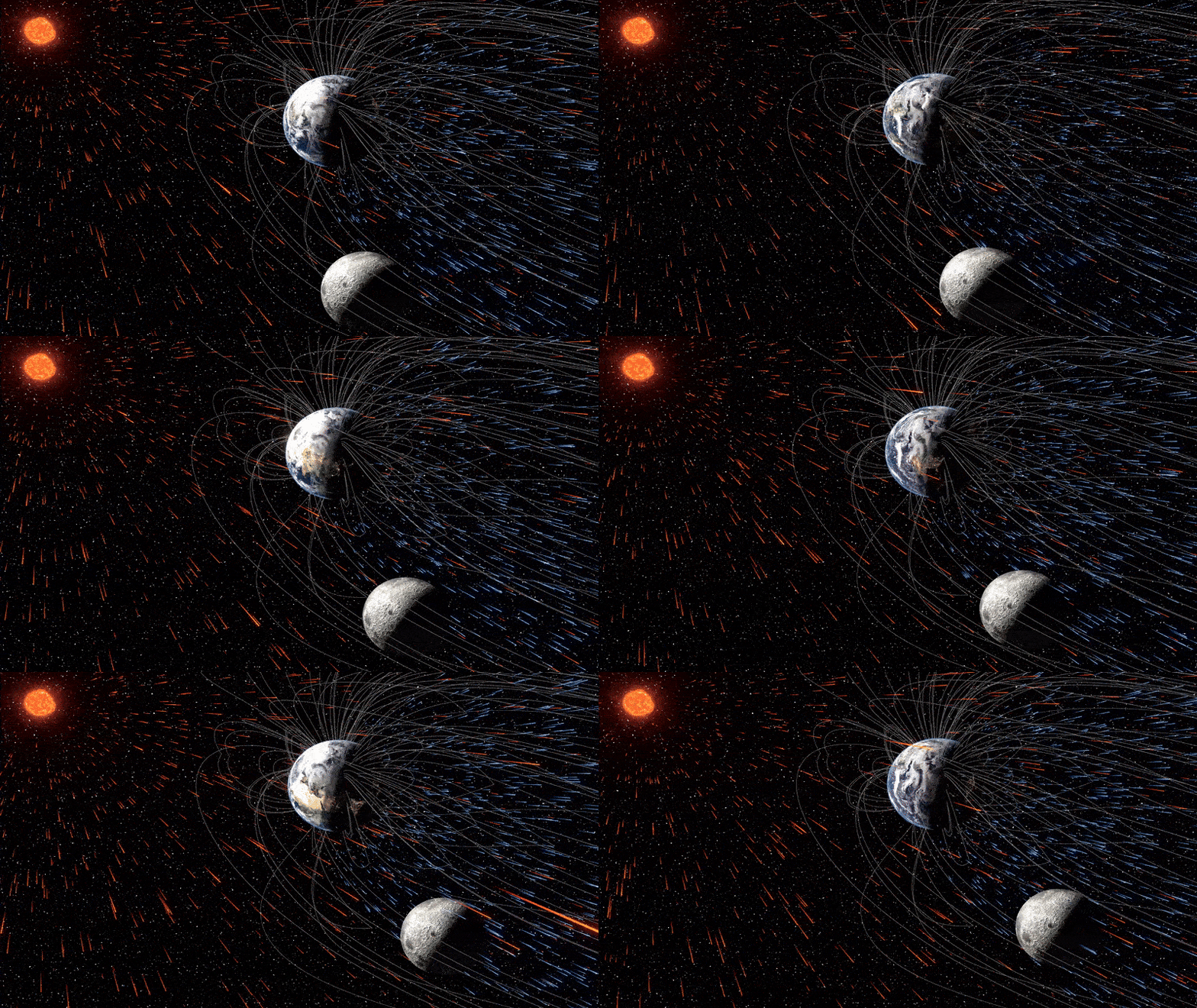
GIF showing simulation of moon passing through ions being blown of Earth by the solar wind

The moon is constantly being bombarded by tiny particles, some of which come from outside the solar system. (Image credit: University of Rochester illustration / Shubhonkar Paramanick)

To date, no lunar samples have contained any technosignatures. However, the scientists who studied them were likely not looking for such particulates, and the samples were probably too small to yield meaningful results, the study authors argue.

The researchers believe that a sample of lunar regolith with a volume of 35 cubic feet (1 cubic meter) could be enough to find at least one technological fragment. The team also proposed ways of combing through the material using microscopy, industrial materials analysis and AI-assisted imaging.

However, if such a sample does not yield any results, this would not necessarily disprove the researchers' hypothesis and may instead mean their models are off and a greater sample size would be required, the team wrote.

"Eminently reasonable"

A photo of the Artemis II rocket launching from Florida

Future missions in NASA's Artemis II program could bring back more samples of lunar regolith from the moon for future analysis. This photo shows the Artemis II mission lifting off April 1 from the Kennedy Space Center in Florida. (Image credit: Chip Somodevilla/Getty Images)

Several upcoming space missions will collect fresh samples from the lunar surface, including China's recently delayed Chang'e-7 mission and future missions in NASA's Artemis program. These samples could potentially hold technosignatures, although the volume of regolith collected will be far less than what the researchers are proposing.

Therefore, we may have to wait until humans establish a permanent moon base before astronauts can collect enough material to be analyzed properly. This may not be that far off, as both the U.S. and China are planning to construct lunar bases within the next decade. Researchers also think the samples could be analyzed on the moon rather than on Earth.

As a result, the SETI Institute, which leads the international hunt for technosignatures, views the new idea as very promising.

"The concept of searching the lunar regolith for microscopic technosignatures is at once extraordinarily original and eminently reasonable," Bill Diamond, president and CEO of the SETI Institute, who was not involved in the new study, said in the statement. "This is a novel addition to the search methodologies applied to seeking evidence of technology as a proxy for life and intelligence beyond our solar system and we are excited at the prospect of bringing this to fruition."

Extraterrestrials quiz: Are you an alien expert, or has your brain been abducted?

  •  

The moon may have formed in just 5 hours, new simulations suggest

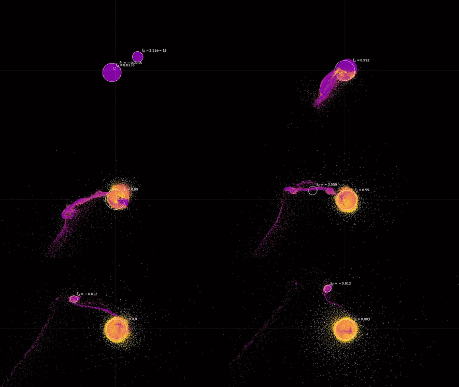
The moon may have formed in as few as five hours after the cataclysmic collision between Earth and a long-lost protoplanet, new simulations suggest. The surprising findings could help shed light on other historic impacts throughout our cosmic neighborhood and beyond.

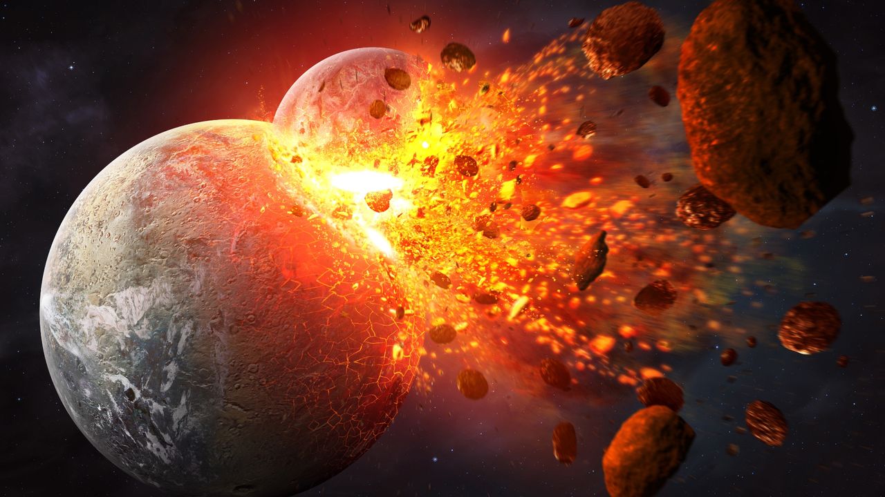
Experts strongly suspect that the moon was created when a Mars-size space rock called Theia smashed into an early version of our planet, back when the solar system was young and extremely unstable. This colossal impact likely would have turned the once-neighboring worlds into spinning clumps of molten rock that eventually coalesced and cooled into the versions of Earth and the moon we see today. Without this collision, which also may have left chunks of Theia buried deep within our planet, many scientists think that life may have never existed on Earth.

Lunar rocks collected during NASA's Apollo missions have provided evidence to support this theory, dubbed the giant impact hypothesis. These samples also tell us that the moon is around 4.5 billion years old, meaning the collision occurred roughly 100 million years after the sun was born. But although scientists have previously simulated the impact event, it has been tricky to ascertain exactly how the moon formed and how long it took to emerge after the Earth-Theia collision.

In the new study, published Sept. 1 in The Astrophysical Journal Letters, researchers conducted a series of simulations focusing on the varying potential geological properties of both Earth and Theia prior to their collision. This factor has been relatively understudied until now.

"When you simulate the Earth and the moon as colliding bodies with [different] geologic properties, it changes how the moon forms out of that impact β€” that's something we considered unnecessary before," study first author Adeene Denton, a geologist and planetary scientist at the Southwest Research Institute in Boulder, Colorado, said in a statement.

A GIF showing the simulation of the Earth-Theia collision and the resulting formation of the moon

Researchers simulated the ancient collision between Earth and Theia using a range of different geological properties and found that, with the right conditions, the moon could take shape in a matter of hours. (Image credit: Courtesy of SwRI)

Until now, simulations of the Earth-Theia impact have focused mainly on the masses of the colliding neighbors. But in the new study, the researchers were most interested in the material strength of the two bodies, particularly the hardness of their exteriors.

"Models have evolved to include material strength, something that's really important when you're studying collisions between smaller bodies like asteroids," Denton said. "We weren't sure if it would matter for the moon or not. When we did the simulations, we found it actually matters quite a bit."

The main factor in the strength of colliding bodies is temperature. Both Earth and Theia were very young when they smashed together, so they were still hot and had soft or molten surfaces. These properties would have cushioned the collision, allowing the debris to stay largely intact and enabling the moon to form more quickly. But when the giant impact hypothesis was first proposed (in 2001), researchers initially thought the collision occurred much later, meaning that the bodies would have cooled and become more brittle. In this case, their collision would have created a larger field of rocky debris that would have taken longer to coalesce.

Researchers simulated the collision using a range of potential temperatures and found that under the most extreme scenario β€” where the pair were at their hottest β€” the moon could have formed in just five hours. However, this is just one potential outcome, and there is no way of knowing exactly how hot β€” and, therefore, how strong β€” Earth and Theia really were when they smashed together.

When the moon took shape, it was initially covered with a magma ocean that took hundreds of millions of years to solidify. Even then, its increased proximity to Earth meant that it was likely a volcanic hellscape. However, over time, it moved away from our planet, cooling further, and it is now assumed to be geologically dead. (The moon is continuing to slowly move away from us and could eventually escape our planet's gravity entirely, if the dying sun doesn’t destroy it and us first in around 5 billion years.)

The new simulations highlight the importance of material strength in planetary impact modeling, which could change what we know about other ancient collisions, like the one that knocked Jupiter's moon Ganymede off its axis or the one that birthed Saturn's moon Titan.

Additionally, the findings could have implications in the search for exomoons β€” the hypothetical moons of distant exoplanets, which have so far remained elusive, according to Live Science's sister site Space.com. Until now, one of the main ways astronomers have been hunting for these alien satellites is by looking for debris fields around exoplanets. However, if the moon is anything to go by, these debris fields could be very short-lived and difficult to identify.

  •  

25 years ago, a NASA astronaut captured this haunting photo of the 9/11 attacks β€” Earth from space

QUICK FACTS

Where is it? New York City, NY [40.71113953, -74.01078602]

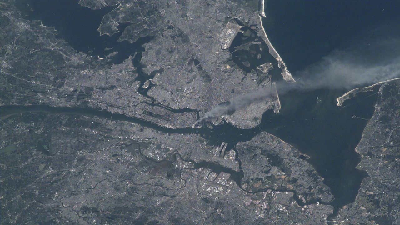
What's in the photo? A massive plume of smoke blowing from Manhattan in the wake of 9/11

Who took the photo? NASA astronaut Frank Culbertson, on board the ISS

When was it taken? Sept. 11, 2001

This iconic photo, captured by an American astronaut on board the International Space Station (ISS), shows a lengthy trail of thick smoke pouring across New York City in the immediate aftermath of the 9/11 attacks. A quarter of a century later, the image is as haunting as ever.

On the morning of Sept. 11, 2001, members of the terrorist group al-Qaeda hijacked four passenger airliners and crashed two of them into the twin towers β€” a pair of 110-story skyscrapers at the heart of the World Trade Center in lower Manhattan. The impact of these collisions, which occurred roughly 17 minutes apart, eventually caused both buildings to collapse.

Shortly after the second tower was hit, the third hijacked plane crashed into the Pentagon, the headquarters of the Department of Defense in Arlington, Virginia. Another attack β€” likely intended for Washington, D.C. β€” was thwarted when the passengers of a fourth plane fought back against their hijackers, causing the aircraft to crash near Shanksville, Pennsylvania. In total, 2,977 people were killed across the different attacks, according to the 9/11 Memorial and Museum.

NASA astronaut and ISS commander Frank Culbertson β€” the only American not on Earth at the time of the attacks β€” passed over New York City shortly after being told about what was happening back home. He photographed the thick plume of smoke blowing away from Manhattan, at an altitude of roughly 250 miles (400 kilometers) above Earth's surface.

If you look closely, you may be able to see what Culbertson described as an "odd bloom" around the base of the column of smoke rising from the towers. This is likely a sign that the image was captured "around the time of, or shortly after, the collapse of the second tower," Culbertson said.

Astronaut Frank Culbertson holding two cameras while floating in zero gravity on the International Space Station in 2001

NASA astronaut and ISS commander Frank Culbertson captured the aftermath of 9/11 from space. This photo, taken Sept. 17, 2001, shows him holding his cameras in zero gravity. (Image credit: NASA)

Culbertson wrote several letters in the days following the attacks, sharing his unique perspective of the events. "It's horrible to see smoke pouring from wounds in your own country from such a fantastic vantage point," Culbertson wrote on Sept. 13. "The dichotomy of being on a spacecraft dedicated to improving life on the earth and watching life being destroyed by such willful, terrible acts is jolting to the psyche."

While in space, Culbertson learned that the pilot of the plane that was later hijacked and crashed into the Pentagon was his former flight school classmate Charles "Chic" Burlingame. When the ISS later passed over the Pentagon, the astronauts could see the large gash in the side of the building where the third plane had crashed. "Tears don't flow the same in space," Culbertson wrote while discussing his friend.

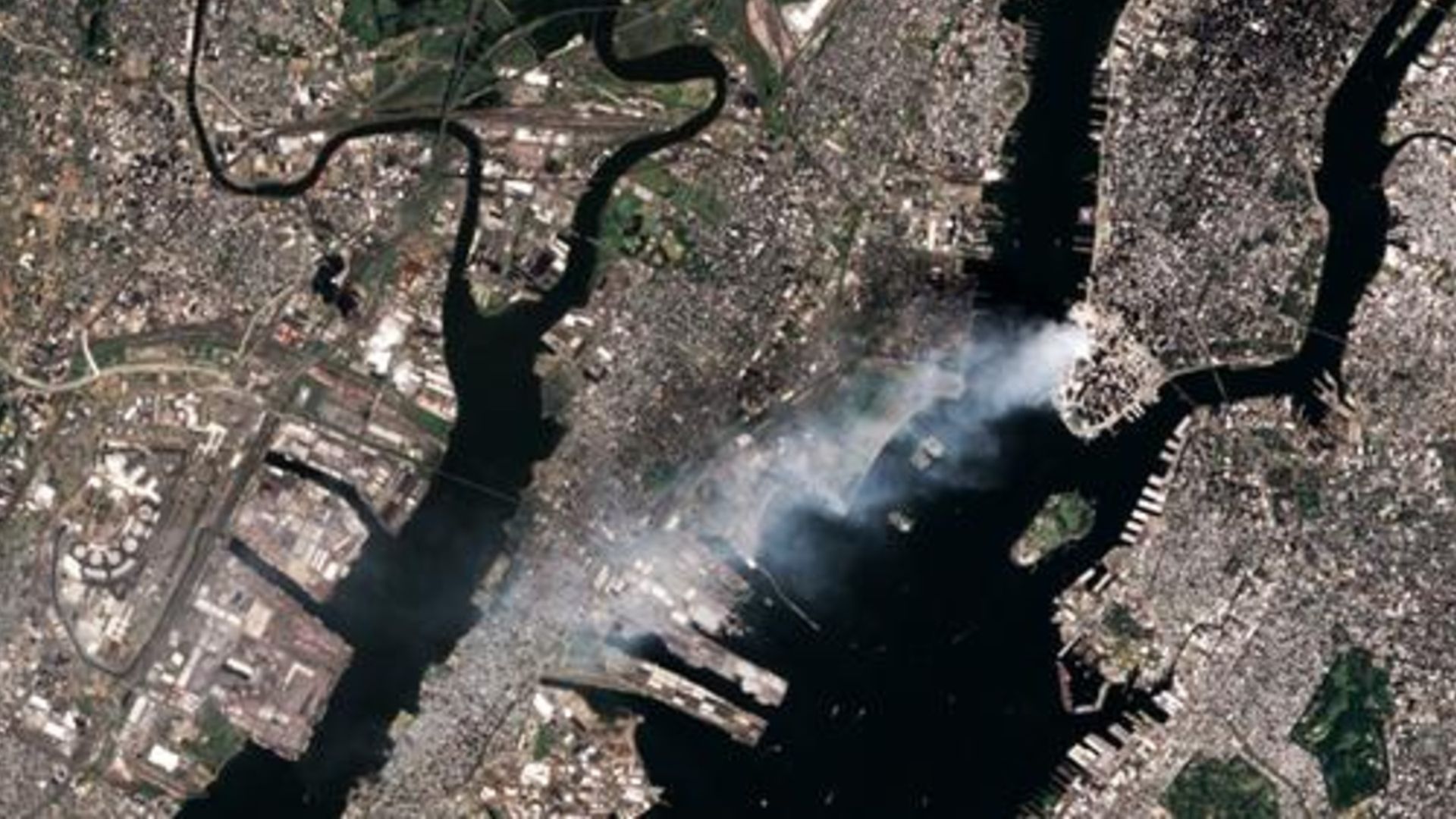
An additional satellite image showing smoke continuing to pour from Ground Zero on Sept. 12

Additional imagery β€” captured by the Landsat 7 satellite on Sept. 12, 2001 β€” shows that smoke continued to pour from Ground Zero for at least 24 hours. (Image credit: USGS/Landsat 7)

In 2017, Culbertson revealed that there was another striking thing he and the rest of his crew noticed in the wake of the attacks, according to Live Science's sister site Space.com. "One of the most startling effects was that within about two orbits, all of the contrails that are normally crisscrossing the United States had disappeared because they had grounded all the airplanes," he said.

However, there was one exception. The astronauts noticed a single contrail moving eastward across the Midwest. "That was Air Force One headed back to D.C. with President Bush," Culbertson said. It was a "very sobering" sight, he added.

See more Earth from space

Photo of a space shuttle with an open cargo bay over the Bahamas

Final Space Shuttle 'photobomb'

This 2011 astronaut photo captured one of NASA's iconic space shuttles passing between Earth and the International Space Station for the very last time.

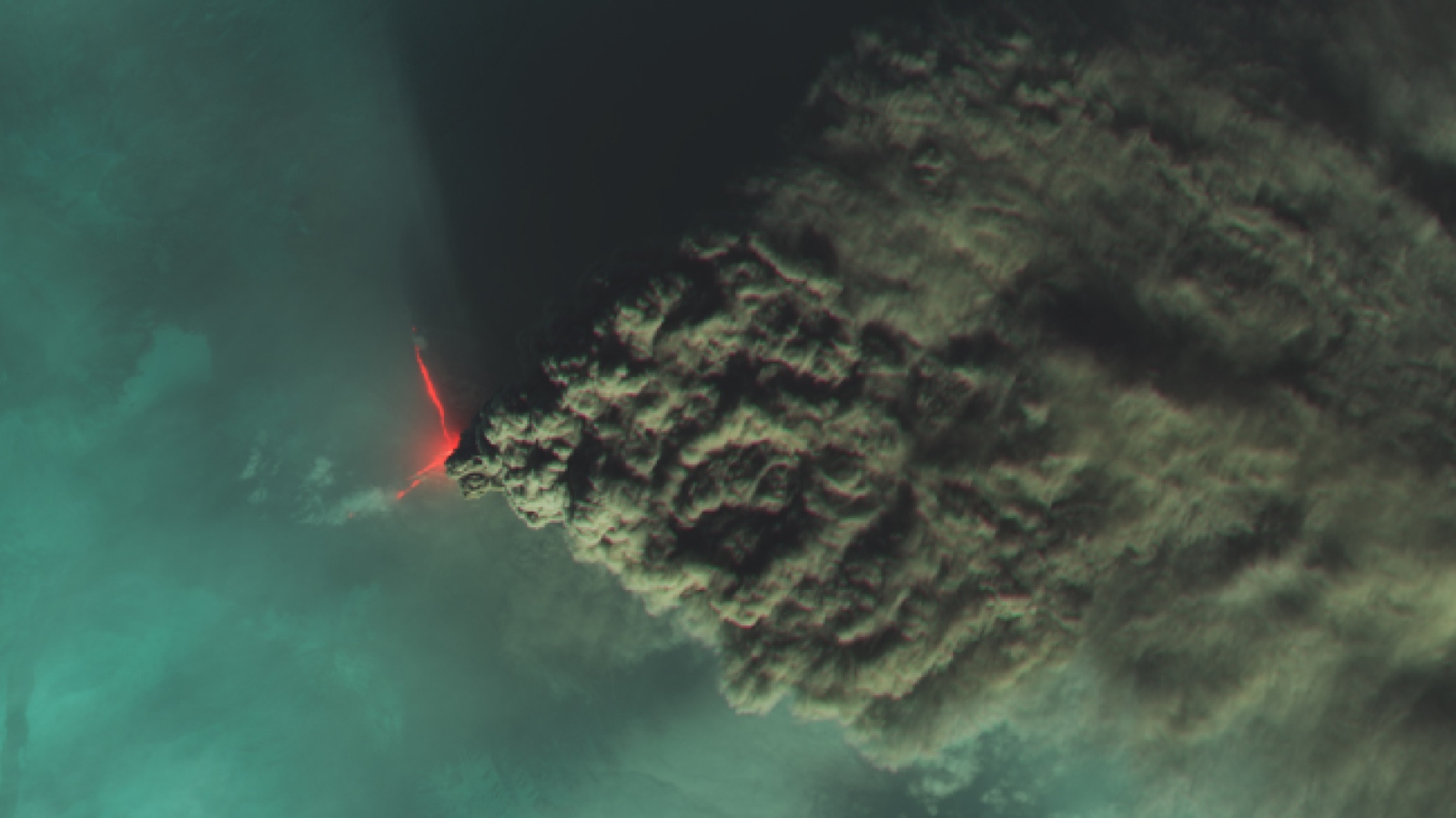
A dark cloud of smoke flows from a lava flow on a volcano

Russian 'river of smoke' eruption

A false-color satellite photo from 2023 shows a devilish pair of lava flows and an enormous plume of smoke spewing from Klyuchevskoy, the tallest volcano in Europe and Asia.

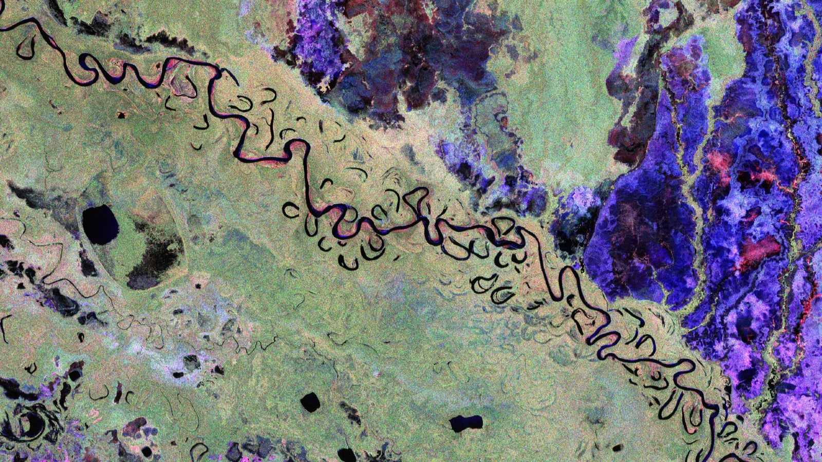
False-color satellite images of Earth taken by ESA's Biomass satellite

Trippy 'Biomass' satellite snap

The first false-color image from ESA's newly operational Biomass satellite shows off a unique perspective of the rainforests, grasslands and wetlands surrounding a winding river in Bolivia.

  •  

Blue Origin rocket explosion sent sound waves 1,000 miles across the US, report finds

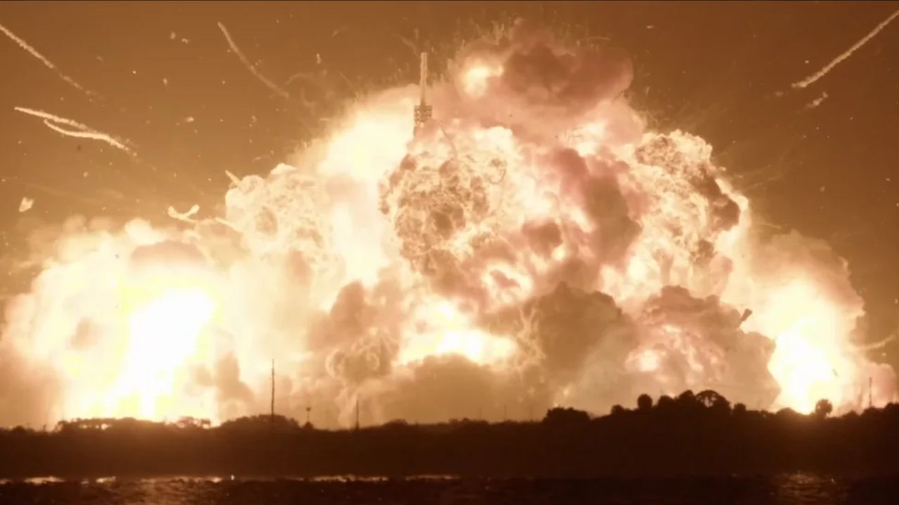
When Blue Origin's New Glenn rocket suddenly blew apart on a Florida launchpad earlier this year, it sent sound waves racing more than 1,000 miles (1,600 kilometers) across the U.S., new data reveals. While imperceptible to human ears, the subtle vibrations have helped researchers analyze the blast in surprising detail.

New Glenn is the largest and most powerful of Blue Origin's commercial rockets. It stands at 320 feet (98 meters) tall, roughly the same size as NASA's Space Launch System (most recently used during the Artemis II mission), and is designed to compete with SpaceX's supersized Starship rockets. New Glenn has launched into space three times: first in January 2025; then again in November 2025, when it launched a pair of NASA spacecraft to Mars; and finally in April this year, when it reached space but failed to deploy a giant communication satellite. During the second launch, Blue Origin successfully landed the rocket's reusable booster on Earth, making it the second company to achieve this feat, after SpaceX.

But on May 29, during a static "hotfire test" at Cape Canaveral Space Force Station, shortly before New Glenn's planned fourth launch, the rocket's booster violently exploded without warning. The blast shot bits of flaming debris into the air and unleashed a massive mushroom cloud that briefly lit up the night sky. On Aug. 5, Blue Origin revealed that a faulty oxygen valve likely caused the explosion, according to Live Science's sister site Space.com. (The company has not attempted to launch another New Glenn rocket since.)

The fiery failure is believed to be one of the most powerful prelaunch explosions ever seen. The damage caused to the launchpad alone could take at least a year to fix, according to Ars Technica. This not only affects Blue Origin's ability to launch rockets but could also delay NASA's proposed moon base, which will rely on New Glenn to launch some of its components.

Nobody was hurt by the explosion. But thousands of locals reported hearing a thunderous boom as they were hit with the resulting shockwave, which reached up to 135 miles (217 kilometers) from the launchpad, Florida Today previously reported. However, in terms of the sound produced by this event, this was just the tip of the iceberg.

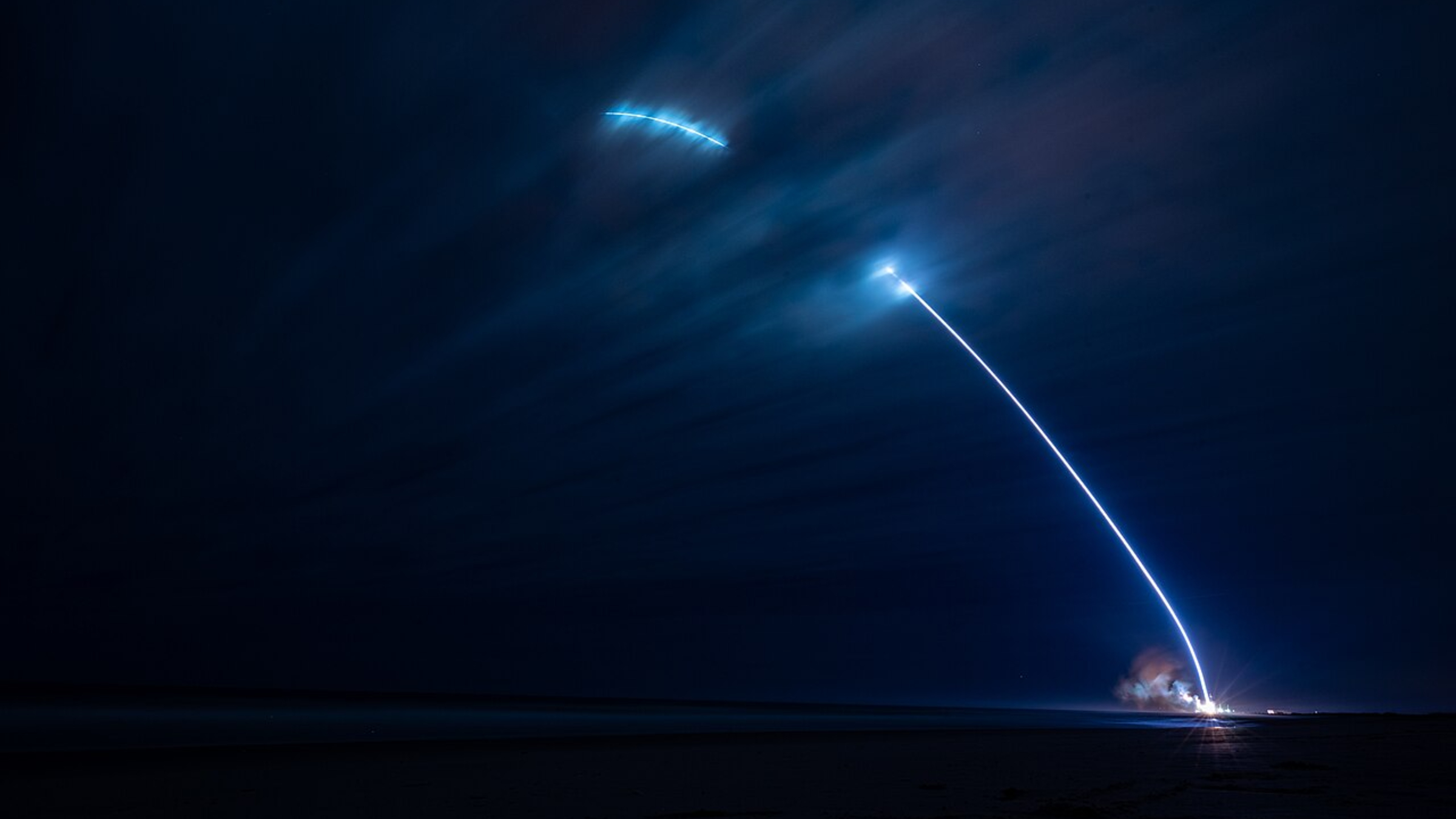
A timelapse photo of the first New Glenn launch showing a streak of light shooting into the night sky

New Glenn first launched from Cape Canaveral Space Force Station on Jan. 16, 2025, and successfully deployed one of Blue Origin's prototype spacecraft platforms in low Earth orbit. (Image credit: U.S. Space Force)

In a new study, published Aug. 12 in the journal The Seismic Record, researchers analyzed data from special listening stations across the U.S. for signs of infrasound β€” ultra-low-frequency sound below the range of human hearing β€” that coincided with the blast. At least 36 stations picked up infrasound signals from the explosion, the farthest of which was located in northeast Texas, about 1,046 miles (1,684 km) from Cape Canaveral Space Force Station.

Detecting such distant low-frequency sound waves not only highlights the scale of the blast but also provided researchers with "a very rare opportunity to study [the] large real-world energetic event" in more detail, study first author Elizabeth Silber, a physicist and planetary scientist at the Sandia National Laboratories in Albuquerque, New Mexico, wrote in a statement.

Based on the frequency and travel distance of the sound waves, the researchers estimated that the explosion had the equivalent power of 0.131 kilotons (144 U.S. tons) of TNT, which is slightly higher than the initial blast that destroyed the nuclear reactor at Chornobyl in 1986, according to a 2009 study.

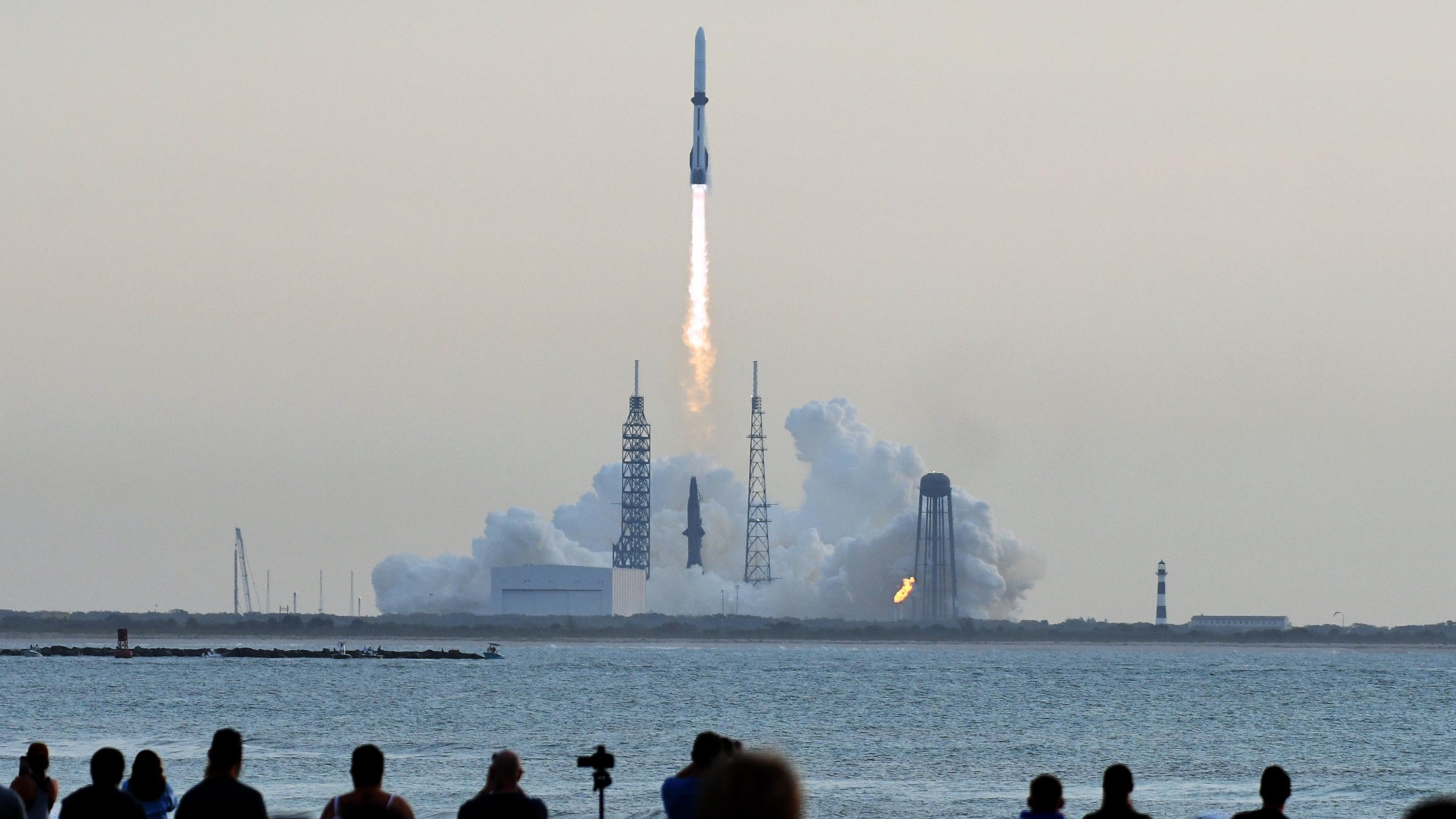
Photo of people watching New Glenn launch in April 2026

The most recent New Glenn launch occurred on April 19 this year, when the rocket made it to space but failed to properly deploy a communications satellite. (Image credit: Paul Hennesy/Anadolu via Getty Images)

The team also worked out how much of the rocket's fuel was consumed in the initial explosion. Although the exact amount of fuel in the booster is unknown, they estimate that between 3% and 6% of the rocket’s cryogenic propellant was used up in the initial blast. This may seem low, especially considering the size of the fireball, but it lies within the expected range, researchers said.

"In a large propellant accident, the fuel and oxidizer do not necessarily mix and react all at once," Silber said. "Some material can contribute to the initial blast, while other material can burn more gradually in the fireball and the plume."

The researchers believe that infrasound is an underutilized and potentially valuable tool for tracking spacecraft accidents or other large explosions across the globe.

The same team has also previously used the low-frequency sound waves to track meteors and spacecraft as they enter Earth's atmosphere, including the return capsule of NASA's OSIRIS-REx mission in 2023.

  •  

Ghostly green lakes merge in Australian outback after 2 years of heavy rain β€” Earth from space

QUICK FACTS

Where is it? Barkly Tableland, Australia's Northern Territory [-18.595019720, 135.2699610]

What's in the photo? A series of ephemeral lakes that have merged into a single body of water

Which satellite took the photo? Landsat 8

When was it taken? Oct. 30, 2024

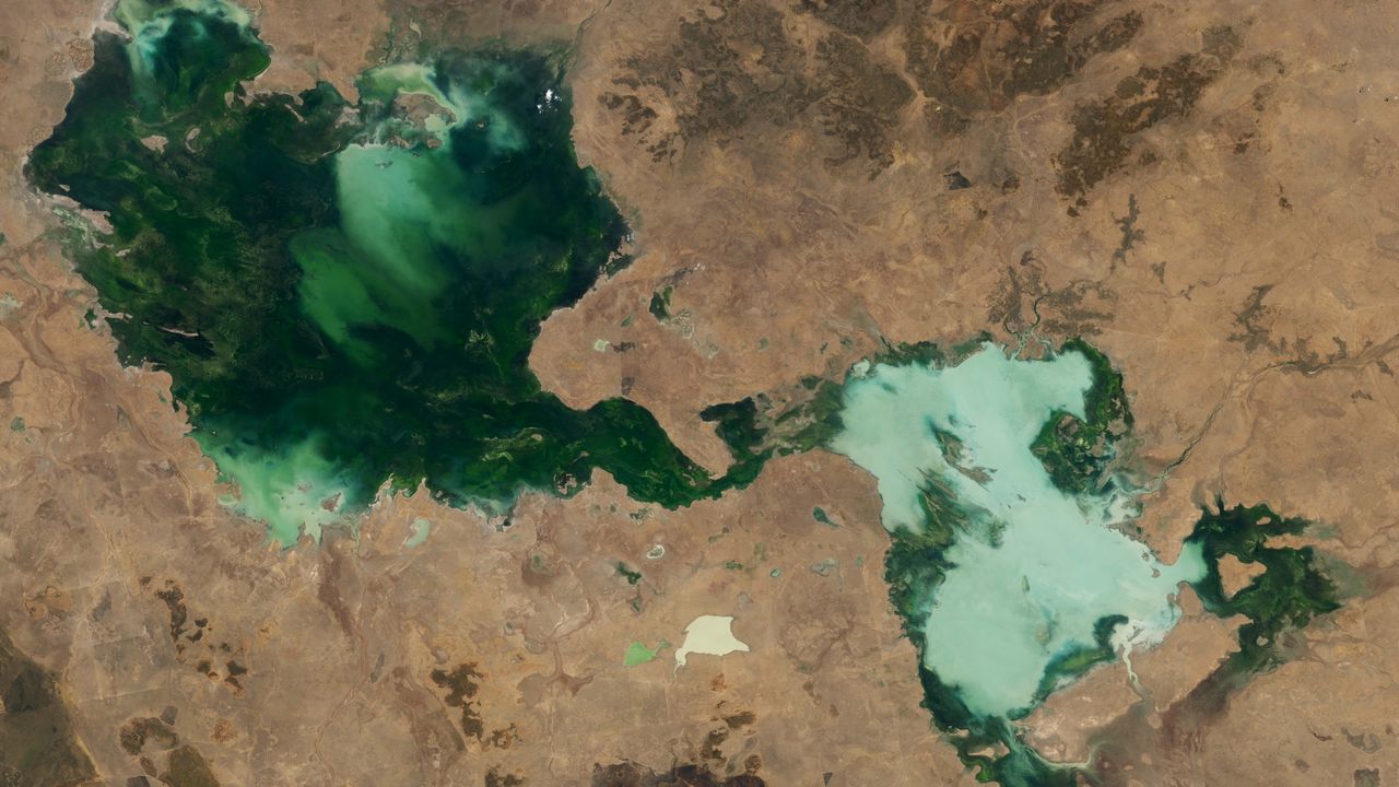
This striking satellite snap shows a series of ghostly green lakes that merged into a single murky entity after several years of unusual weather in the Australian outback.

The entwined lakes are located in Barkly Tableland, an area within Australia's Northern Territory, which lies between the states of Queensland, South Australia and Western Australia. The largest section of the conglomerate is Tarrabool Lake (on the left side of the photo), which stretches around 55 miles (90 kilometers) across at its widest point. It is dark green due to the dense vegetation and algae in the water.

The smaller half of the merged lakes (on the right side of the image) is made up of three lakes: Lake Sylvester, Lake Corella and Lake Deburgh. This section has a paler and chalkier hue due to high levels of suspended sediment. This is likely because the lakes have overflowed and mixed together, whipping up the dust and topsoil that once surrounded them. (Several other, smaller lakes of various sizes and shades of green can also be seen throughout the image.)

All of these lakes are ephemeral, meaning they have no constant inflow or outflow of water, much like most of Australia's other lakes. As a result, they almost completely dry out during prolonged periods of sunny weather, as high temperatures cause the water inside them to evaporate, and then reappear as heavy rainfall refills the basins.

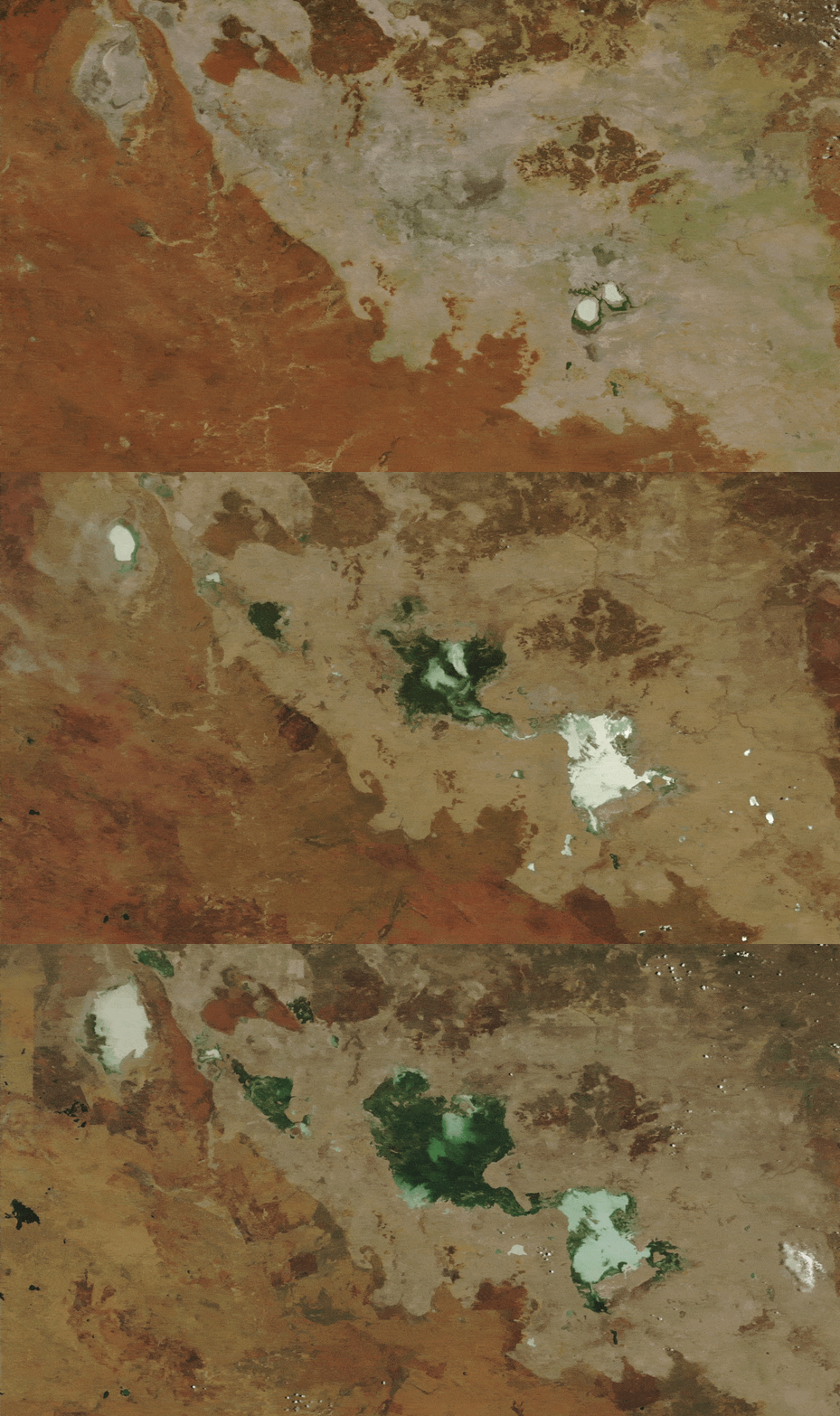
However, across the two years prior to this image, there was so much rain that the lakes never dried out. Instead, they continued to grow year over year, as you can see from additional satellite imagery (see below), which shows the same area between 2022 and 2024.

A GIF showing how the lakes grew in size between 2022 and 2024

Additional satellite imagery shows how the lakes grew significantly between 2022 and 2024. (These images were captured by the MODIS instruments on NASA's Aqua and Terra satellites.) (Image credit: NASA Earth Observatory/Landsat/Terra/Aqua/MODIS)

The Northern Territory's rainy season lasts between October and April. Both the 2022-2023 and 2023-2024 rainy seasons, which preceded the 2024 satellite photos, were ranked among the top 10 wettest since 1990, according to NASA's Earth Observatory, which released these images.

Although this is extreme, it is not that surprising, considering that annual rainfall in the Barkly Tableland rose by around 14% between 1989 and 2018, according to a report from the Australian Bureau of Meteorology. This is likely due to the effects of human-caused climate change.

On top of the general increase in rainfall, Tropical Cyclone Megan dumped a massive amount of rain on the region in March 2024. The resulting flash flooding was so great that fish were seen swimming across a nearby road, Australia's ABC News previously reported.

In the winter, Tarrabool Lake and Lake Sylvester are important breeding sites for birds, including the straw-necked ibis (Threskiornis spinicollis) and the Australian pelican (Pelecanus conspicillatus), and BirdLife International lists both lakes as important bird areas. At its fullest, Tarrabool Lake also floods the surrounding Eva Downs Swamp system, creating Australia's largest wooded swamp.

See more Earth from space

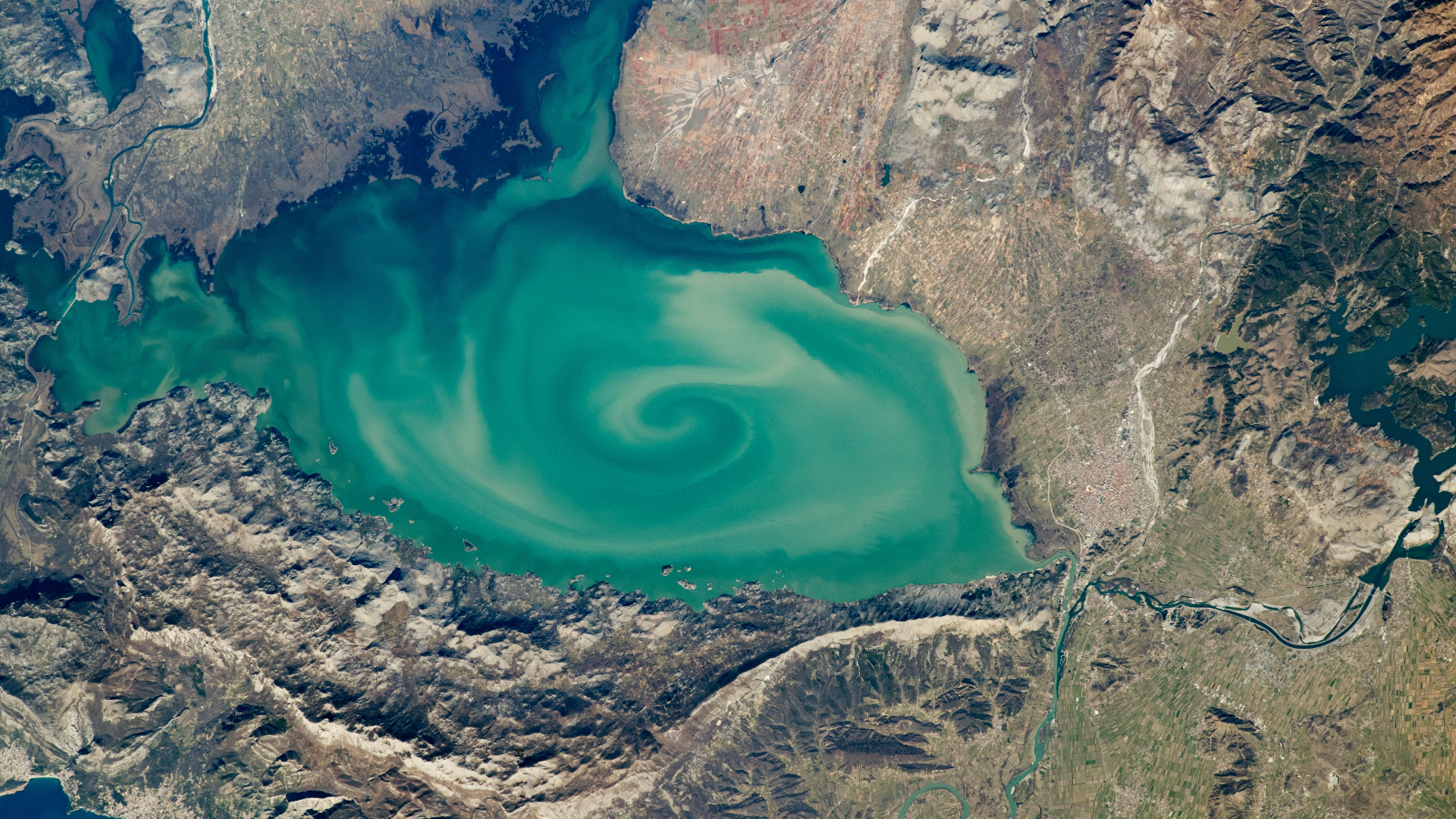
A satellite photo of a lake with a massive green swirl on its srufaceSwirling 'cryptodepression' lake

A 2020 astronaut photo shows a massive, milky-green vortex in Lake Skadar, which lies on the border between Montenegro and Albania.

An astronaut photo of a section of a lake half covered in fracturing iceWorld's highest frozen lake shatters

A 2024 astronaut photo shows the icy surface of Pangong Lake breaking apart in the lofty Tibetan Plateau, along a disputed border between China and India.
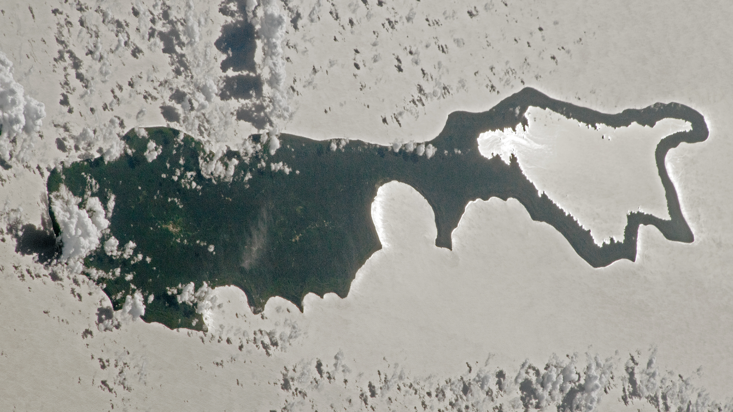
An astronaut photo of an island with sunlight reflecting off a lake making the landmass look like a magnifying glassSunglint 'magnifying glass' lake

A 2023 astronaut photo captured a "sunglint" illuminating one of the Solomon Islands. The rare phenomenon transformed the Pacific's largest lake into a shining silver "lens."

  •  
❌