❌

Reading view

'The violence leaves a mark': How satellites are helping the world monitor war and atrocities

For decades, researchers have been monitoring armed conflict around the world by analyzing news reports and collecting oral testimonies. This approach, while valuable, has its limitations. A new study suggests that a satellite's view from above might fill the gaps in our understanding of the grim realities of war.

In 2017, the Myanmar Army murdered several hundred Muslim Rohingya civilians in the village of Chut Pyin near the country's western coast. Reports of the massacre in the settlement of about 2,000 reached the world through the testimonies of survivors who fled to neighboring Bangladesh. The massacre was part of a years-long campaign of brutality against the Muslim minority conducted by the Buddhist-run state. Satellite data later showed that houses in the predominantly Rohingya neighborhood were burned down by the Myanmar military during the atrocity, providing undeniable proof that the ethnic minority was targeted.

The incident is one of many demonstrating the advantage of adding views from space into conflict research, study lead author Valerie Sticher, a political science researcher at the University of Zurich in Switzerland, told Space.com.

"We have huge data sets about wars around the world going back 40 years," Sticher said. "But those datasets are based mostly on media reports. And these reports are not always available and not always reliable. Media can have biases and often focus only on certain types of violence."

For example, human reporters are more likely to focus on the numbers of people killed rather than the number of houses destroyed, she said. Satellites, on the other hand, provide a broad sweep over vast areas of land and, crucially, revisit the same location repeatedly. They can reveal patterns in conflicts and trends that could otherwise go undetected, while providing an overview of areas controlled by authoritarian regimes.

The researchers are now developing a methodology to integrate satellite observations into conflict research and create automated image analysis pipelines that would generate early warnings and alert the world to what's happening on the ground.

"Automated satellite data analysis would allow us to respond faster," said Sticher. "For example, in Myanmar, the area affected by ethnic cleansing was closed to independent journalists and investigators. Satellite data was the earliest reliable information to reach the outside world."
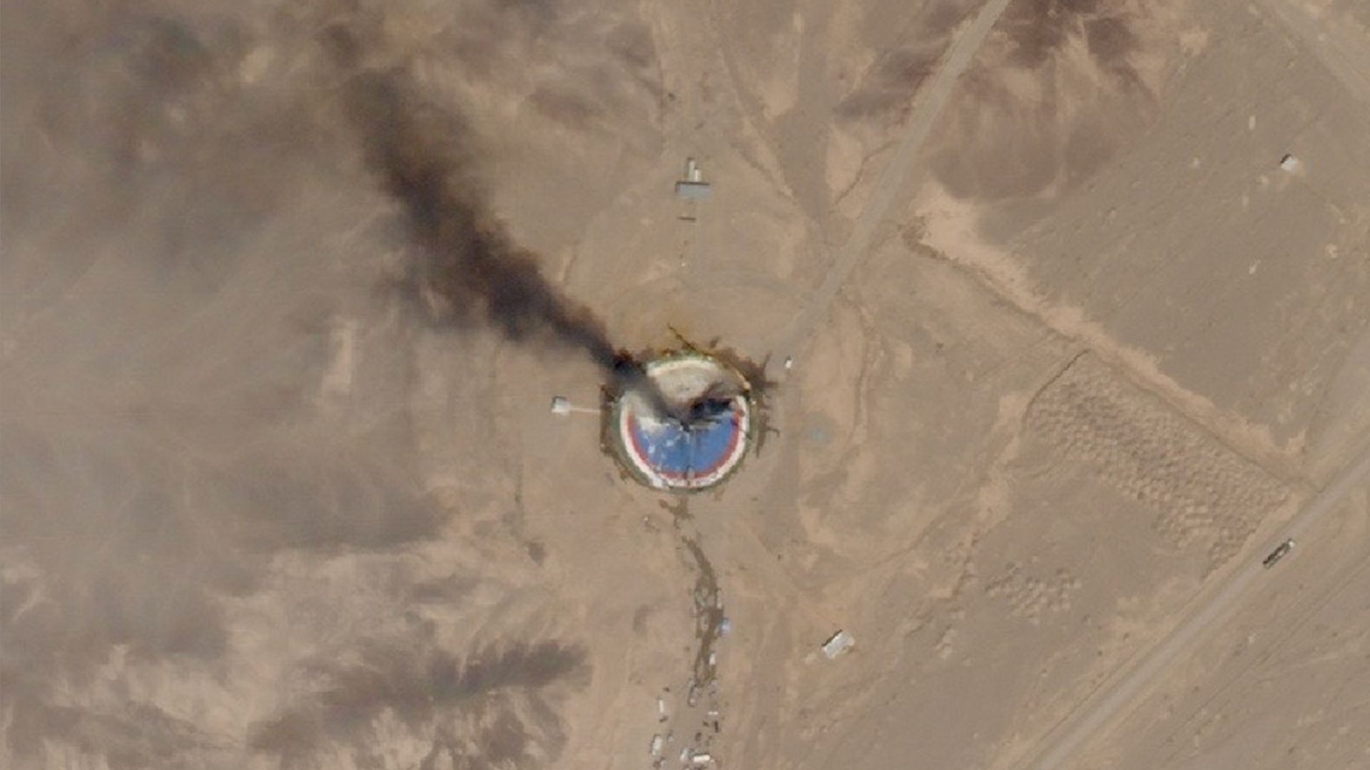
satellite photo of a circular, blue launch pad in the desert with black smoke rising from it

A SkySat Earth-observation satellite operated by the California company Planet spotted the wreckage of a failed launch out of Iran's Imam Khomeini Space Center on Aug. 29, 2019. (Image credit: Planet Labs, Inc.)

Hannes Mueller, a conflict researcher at the Spanish National Research Council, said that totalitarian governments can be very good at preventing information about atrocities from reaching the world. However, they can hardly fool satellites.

"In Myanmar, for example, when the military clears villages, they frequently kill everybody in those villages," he said. "Then you don't have any eyewitnesses for you to find out what's going on. But they usually also destroy the entire village, and so the violence leaves a mark from space."

Mueller was not involved in the new study but has used satellites in his work since the conflict in Syria in the early 2010s. He lauds the new paper for trying to "plot the road" for a more systematic integration of satellite data into conflict-monitoring data sets.

"Imagine we could generate a data stack of the entire world of all housing destruction since 2020 without any gaps in it," he said. "That would be a complete breakthrough!"

But satellites, too, have their limitations, he said. Currently, spacecraft must be tasked to take images and beam them to Earth. Because of the limited download availability, they can't image every spot they fly over, meaning they usually only reveal the aftermath of catastrophic incidents. For example, the Syrian city of Homs only became the focus of satellite imaging campaigns after the Syrian military attacked it with heavy artillery to suppress pro-democracy protests.

"There are no images of Homs before it got attacked," said Mueller. "There is no archival data of the city from before. Then, after the attack, you suddenly get lots."

In the future, onboard AI image processing β€” which some of the commercial satellite Earth-observation companies have already rolled out β€” might solve the problem. Machine learning algorithms running on computers on board the satellites will be able to detect incidents of potential interest and autonomously select significant images to send to the ground.

But there are other concerns. Just as authoritarian regimes can deny access to warzones to independent journalists, governments can order Earth-observation companies to restrict access to images of specific areas. In fact, the U.S. government did just that earlier this year when it ordered American commercial Earth-observation providers like Planet Labs to stop releasing high-resolution images of the Gulf of Oman and the Strait of Hormuz amid the escalating conflict in the region. The U.S also asked Europe to delay releasing images of that region captured by the European Sentinel satellites by 24 hours.

"With that, we are back to the same biases that we have with the news reporting," Mueller said. "We need to think about infrastructure that would provide us with transparency. That would really be a revolution in conflict research."

The new study was published in the journal Nature on Sept. 9.
  •  

2 satellites just burned up in Earth's atmosphere β€” and scientists were watching from a private jet. Here's why

A team of researchers just chased a pair of reentering satellites in a private jet to learn about the pollution caused by space debris burning up in Earth's atmosphere.

The satellites in question were the European Space Agency's (ESA) Tango and Samba spacecraft, which once formed the Cluster constellation, together with the already de-orbited Rumba and Salsa. The quartet used to study the interaction of Earth's magnetic field with the solar wind. After 25 years of service, ESA took advantage of the Tango and Samba's controlled demise to help scientists learn what happens when satellites break apart and burn up during their spiral back to Earth.

The international team of researchers chased the two reentries, which occurred one day apart β€” on Aug. 31 and Sept. 1 β€” above the southern Pacific Ocean a few hundred miles from the Polynesian archipelago of Tonga.

Their goal was to understand what happens when satellites disintegrate and what chemical compounds arise in the process. Although companies such as SpaceX, Amazon and Blue Origin want to launch huge numbers of satellites to space in the next decade β€” SpaceX alone plans to loft 100,000 of its Starlink V3 spacecraft β€” very little is known about the effects of satellite reentries on Earth's atmosphere. Researchers are also still unsure which spacecraft burn up completely and how many fragments may reach the ground, putting lives and property at risk.

"We want to understand what happens to these bodies as they fly through the atmosphere, which causes friction and very high temperatures," JiΕ™Γ­ Ε ilha, CEO of the Slovak company Astros Solutions, and one of the researchers aboard the plane, told Space.com. "We know that those satellites break up into fragments, which subsequently melt in the atmosphere."

The researchers chased the reentering spacecraft following exact calculations provided by ESA controllers, who were able to maintain connection with the spacecraft until the very last moment before they plunged into the atmosphere.

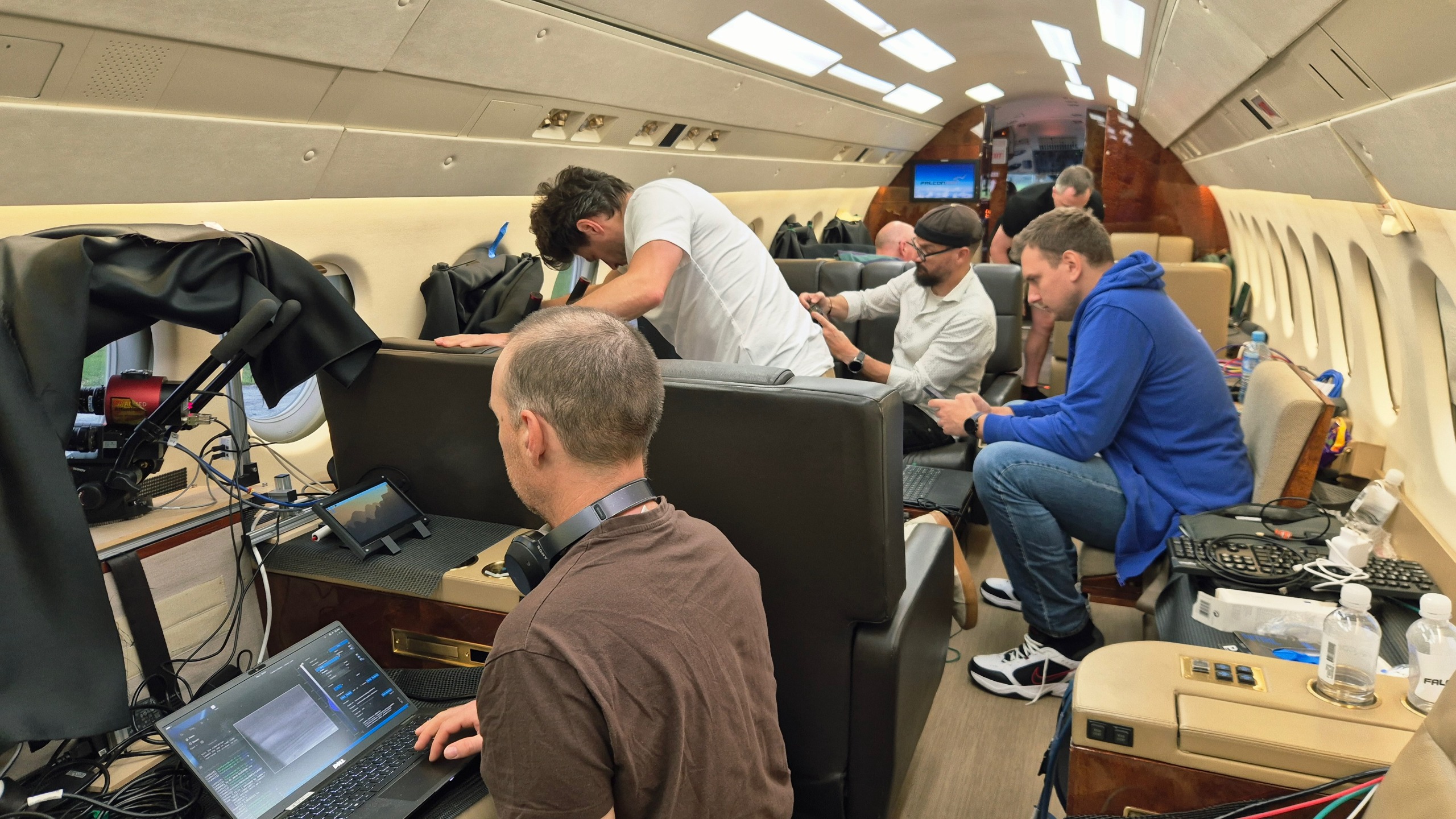
six people inside a private jet, with computer equipment strewn around the cabin

Researchers inside a private jet during a campaign observing the reentry of ESA's Cluster Tango satellite on Sept. 1, 2026. (Image credit: JiΕ™Γ­ Ε ilha)

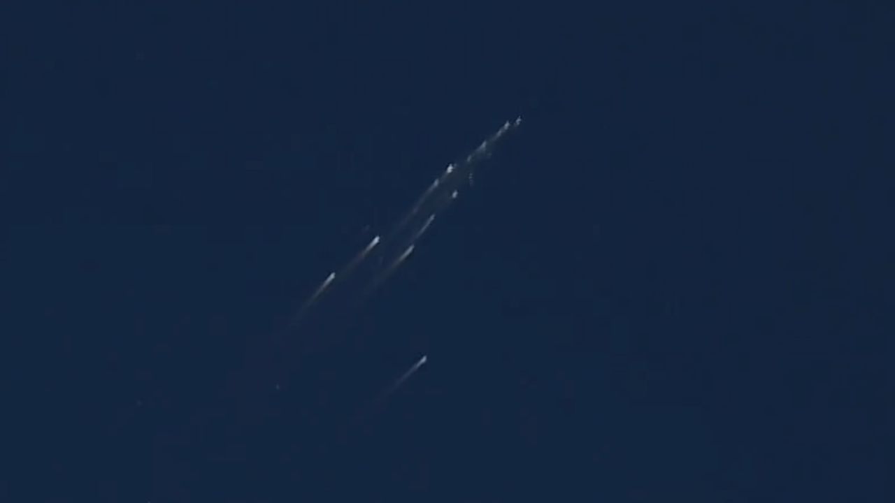
The satellite reentries, although they occurred during daylight, were visible from aboard the plane even to the naked eye, said Ε ilha, and created spectacular fireballs that lasted tens of seconds.

"Bolides and meteors only last a few seconds or less," said Ε ilha. "But satellites are slower. They enter the atmosphere at a shallower angle, and the atmosphere slows them down further."

But the researchers were there for science, not for a sky show. And it was a rare opportunity: The Cluster trajectories were so precisely known that the scientists could prepare for them and be at the exact spot at the exact time to witness those explosions from only a couple of hundred miles away.

The aircraft, a small commercial business jet, was packed with 30 cameras and spectrometers fitted with special filters to capture not only how the satellites disintegrated but also detect the spectral signatures of the chemical elements released as their bodies burned up.

Eight scientists were squashed on board the darkened jet operating the instruments through the aircraft's six windows as the pilots navigated to the vicinity of the spot where ESA analysts had predicted the breakup would occur.

"We were flying toward the object, and first it looked like a compact source of light as the material ablated," said Ε ilha. "At some point, there was a sudden explosion as the satellite disintegrated."

The plane allowed the researchers to overcome any clouds that could obscure the view from the ground, and also to bypass the thickest layer of the atmosphere, which would distort the measurements. As the satellites hurtled through the air, slowing down from the mind-boggling speed of 22,370 mph (36,000 kph) at which they hit the upper atmosphere, the jet approached them to within a distance of around 75 miles (120 kilometers).

"We begin observing it when it's at about 90 kilometers [56 miles] and it stops being visible at about 65 to 70 kilometers [40 to 44 miles]," Ε ilha said. "For about thirty to forty seconds after the explosion, you can observe an interesting structure as all those various fragments ablate in the atmosphere. Then they all either burn up or slow down."

Ε ilha said the cameras captured tens of fragments, in detail that had never been observed before.

The researchers also attempted to trace seven chemical compounds, including titanium, sodium and potassium, which get released as satellites burn up. The team was especially interested in aluminum, which makes up the majority of a satellite body. Aluminum is not naturally present in Earth's atmosphere and most likely forms aluminum oxide during the incineration. The potential presence of aluminum oxide in the atmosphere in higher concentrations worries scientists, as it could potentially trigger ozone depletion in the stratosphere.

"We tried to measure the aluminum at different altitudes, using specialized filters, which could tell us when this aluminum interacts with the atmosphere," said Ε ilha. "That's when the aluminum oxide likely forms, and that's something that has never been observed before. We don't know exactly how and in what quantities the aluminum oxide might be forming."

The researchers will now analyze the data to learn exactly what chemical reactions may be occurring during every second of the breakup and burn-up process. The data will help atmospheric physics and chemistry researchers improve their models to further our understanding of the potential damage the growing satellite industry might do to the planet and its climate in the future.

"The data will help us validate whether the models agree with reality," said Ε ilha.

The team previously chased the reentry of the first of the four Cluster satellites β€” Salsa β€” in September 2024. The lessons from that campaign helped the team get closer to the Tango and Samba spacecraft and obtain more and more accurate data.

  •  

SpaceX wants to put 1 million AI satellites in orbit. What would that do to Earth's climate?

Concentrations of dangerous pollutants from rocket launches and satellite reentries in Earth's upper atmosphere might reach treacherous tipping points if constellations of hundreds of thousands of orbiting data centers get deployed in the next decade, experts say.

There's no question that Earth has an AI data center problem. By 2030, AI data centers may be responsible for up to 17% of electricity consumption in the U.S., according to a forecast by the Electric Power Research Institute. New fossil fuel power plants are being built to feed the growing demand for electricity, and aging ones are kept online despite decarbonization plans. On top of that, huge amounts of water are taken from already strained reservoirs to cool the computers.

Companies such as SpaceX, Amazon and Blue Origin say they have a solution: moving the power-hungry data crunching infrastructure into space, where solar power is easy to produce, and heat can be radiated out into the frigid vacuum. Combined, those companies have filed applications to the U.S. Federal Communications Commission to launch more than a million orbiting data centers in the next 10 years. Most of those will belong to SpaceX, if all goes to plan; Elon Musk has said the company wants to operate a million-satellite AI constellation all by itself.

The plans are making atmospheric scientists tear their hair out. If all these projects come to fruition, the number of satellites being launched to space and reentering the atmosphere will increase 100 times compared to today's numbers.

Moreover, the data center satellites will be much larger than the spacecraft orbiting Earth today. This large mass will translate into higher quantities of polluting propellant needed to loft these systems off Earth and a much larger amount of metals vaporizing in Earth's atmosphere during reentry. Neither is good news for our planet's air.

Pristine upper atmosphere

"Launches and the reentries are really the only things that humans do that deposit material directly into the upper atmosphere," Aaron Boley, an astronomy professor and space sustainability researcher at the University of British Columbia, told Space.com. "And the way things mix in the upper atmosphere means that the launch and reentry emissions are by far more impactful."

Most rockets emit black carbon, which could worsen global warming. Satellite bodies are mostly made of aluminum, which likely turns into aluminum oxide when burned in the presence of oxygen. Aluminum oxide is known for its ability to trigger ozone depletion, a hazardous process that was successfully thwarted by the Montreal Protocol of 1987.

Currently, scientists don't have a precise understanding of the chemical reactions that occur between the pollutants and the atmospheric gases at high altitudes. They also don't understand the tipping points, which may mean the difference between minor and major impacts on the climate. What is worse, pollutants in the upper atmosphere remain much longer than those emitted by cars and factory chimneys close to the ground.

"Close to the ground, we have rain and wind that removes pollution from the atmosphere within weeks," Eloise Marais, a professor of atmospheric chemistry at University College London, told Space.com. "If we put it into the higher layers of the atmosphere, we rely on very slow atmospheric processes to bring this pollution back down."

Too many launches

Black carbon from rockets, for example, can stay in the atmosphere for three years, scientists think, meaning its concentrations could dangerously rise in the near future.

SpaceX's Starship megarocket is likely to play a key role in the deployment of data center constellations. Unlike SpaceX's current workhorse launcher Falcon 9, which burns a form of the aviation fuel kerosene, Starship combusts the much cleaner combination of methane and liquid oxygen. But Marais cautions that Starship's size and the much more frequent launches that will be needed to deploy the vast constellations would result in an overall increase in the pollution injected into the upper atmosphere.

"Starship is a bigger rocket burning more propellant," Marais said. "So, in terms of each rocket launch, the difference almost offsets. It has potential per launch to produce quite similar amounts of black carbon."

Andrew Wilson, a space sustainability researcher at Glasgow Caledonia University in the U.K., told Space.com that every single Starship launch produces around 76,000 metric tons of carbon dioxide equivalent. That's about as much as 17,727 gasoline-powered passenger cars emit in a year.

And up to 77,000 Starship launches β€” some 15,300 per year β€” might be needed, according to estimates by Ars Technica, to deploy SpaceX's planned million-data-center constellation. That's a lot of rocket pollution added into the atmosphere. For comparison, there were just 324 orbital rocket liftoffs globally in 2025, according to Space News.

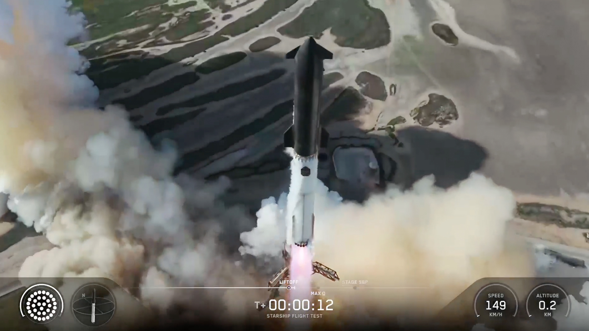
aerial view of a huge black and white rocket launching with wetlands beneath it

SpaceX's Starship megarocket launches on its 13th test flight, on July 24, 2026. (Image credit: SpaceX)

The space junk rain

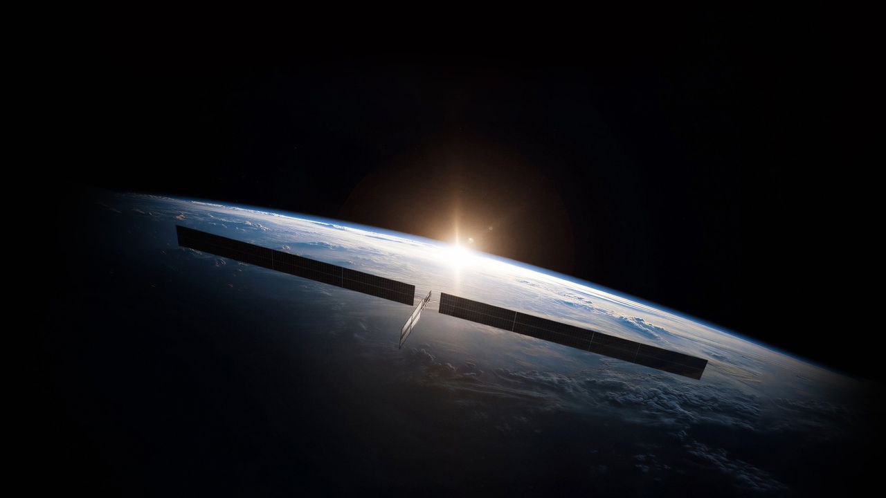
Then there is the toxic ash from reentering satellites. Today, nearly 19,000 operational and defunct satellites orbit Earth, according to the European Space Agency. Currently, the most numerous type of satellite in Earth orbit is SpaceX's Starlink V2 Mini, each of which weighs about 1,760 pounds (800 kilograms). But SpaceX's orbital data centers are likely to be much more massive. Featuring solar arrays 246 feet (75 m) wide, every data center satellite might weigh up to 7.5 metric tonnes, according to available estimates.

Industry insiders expect that SpaceX and other providers would want to replace their AI satellites every five years with newer technology, as they do with existing communications satellites. As a result, tens or even hundreds of tons of metal may be reentering the atmosphere every year in the future, exceeding the amount of natural space rock that hits the planet.

The materials that satellites are made of are not naturally present in Earth's atmosphere, which means the consequences of such reentries can be unpredictable.

"Only 10 years ago, the reentries were not really a concern, because there were much more natural meteorites entering the atmosphere per year," Wilson said. "But if you have hundreds of thousands or millions of satellites in space at any one time, you are essentially going to create a rain of man-made materials, electronic equipment and metals that otherwise wouldn't be coming into the atmosphere."

He added that the situation is akin to ongoing climate change, which shows no signs of slowing down as humanity has so far failed to reduce carbon emissions.

"This is the most objects we've ever had in space, and we're continuing to propose more and more and more and more and more," Wilson said. "And there seems, in my opinion, to be very little consideration for the environment."

Not enough funding is currently flowing into research to answer the unknowns, Marais added.

"We need way more observations and way more time to be able to look into that," she said.

Boley concurred: "We absolutely have to understand, and we have to understand that before we actually launch a million satellites. Not that we launch them and wait [to see] what happens."

The plans of the satellite companies are stirring protests also among astronomers, who fear that the light pollution the constellations create will impact astronomical observations. A recent study by the European Southern Observatory concluded that, if all currently planned satellite constellation projects were to be built, astronomical research from the surface of Earth would no longer be possible.

  •  

Every SpaceX Starlink satellite has to dodge a collision almost weekly, and experts fear the worst

SpaceX's Starlink satellites made over 355,000 collision avoidance maneuvers throughout the past year, with each satellite now dodging debris and other spacecraft on an almost weekly basis.

The numbers are based on disclosures made by SpaceX in its latest semiannual report to the Federal Communications Commission (FCC). According to the latest report, Starlink satellites performed an overall 207,152 avoidance maneuvers between December 2025 and May 2026, up nearly 60,000 from the 148,696 reported in the previous half year. That brings the yearly total to over 355,000, more than three times as many as the constellation performed in 2024. On average, each Starlink satellite performed more than 40 space dodging maneuvers per year between June 1, 2025 and May 31, 2026.

Experts fear the situation might soon get out of hand. "I think we're heading towards a situation where there will be a collision involving an operational satellite in the constellation," Hugh Lewis, a space sustainability expert and professor of astronautics at the University of Birmingham in the U.K., told Space.com. "And it will not be for the lack of trying to avoid those things. It will be in spite of all those maneuvers."

The increase coincides with the growth of the internet-beaming constellation and the overall number of satellites in space in the past five years. Starlink grew from about 6,000 satellites in 2024 to more than 10,000 as of June 2026. Over the same time period, the overall number of operational spacecraft in orbit rose from around 10,000 to about 16,000.

The SpaceX constellation orbits at altitudes between 298 miles (480 km) and 342 miles (550 kilometers) and uses an autonomous collision avoidance system that initiates a maneuver when the probability of a collision appears higher than 3 in 10 million. Lewis says that although SpaceX is "doing an excellent job" managing orbital traffic, the steep growth cannot continue without risks.

"The avoidance maneuvers reduce the probability of a collision to about one in a million, which is so small that it's negligible," Lewis said. "The problem is that if you make a million maneuvers and you have a residual probability of one in a million, you end up with an aggregate risk across your entire constellation that you can't get rid of."

Lewis points out that with the expected continued rise in avoidance maneuvers (SpaceX has applied to the FCC to increase the size of its constellation to 100,000 satellites), SpaceX will have made a million avoidance maneuvers over the lifetime of the Starlink constellation as early as June 2027. By 2030, the constellation may be making more than a million maneuvers every year. At that point, the one in a million risk of a collision may no longer be negligible at all.

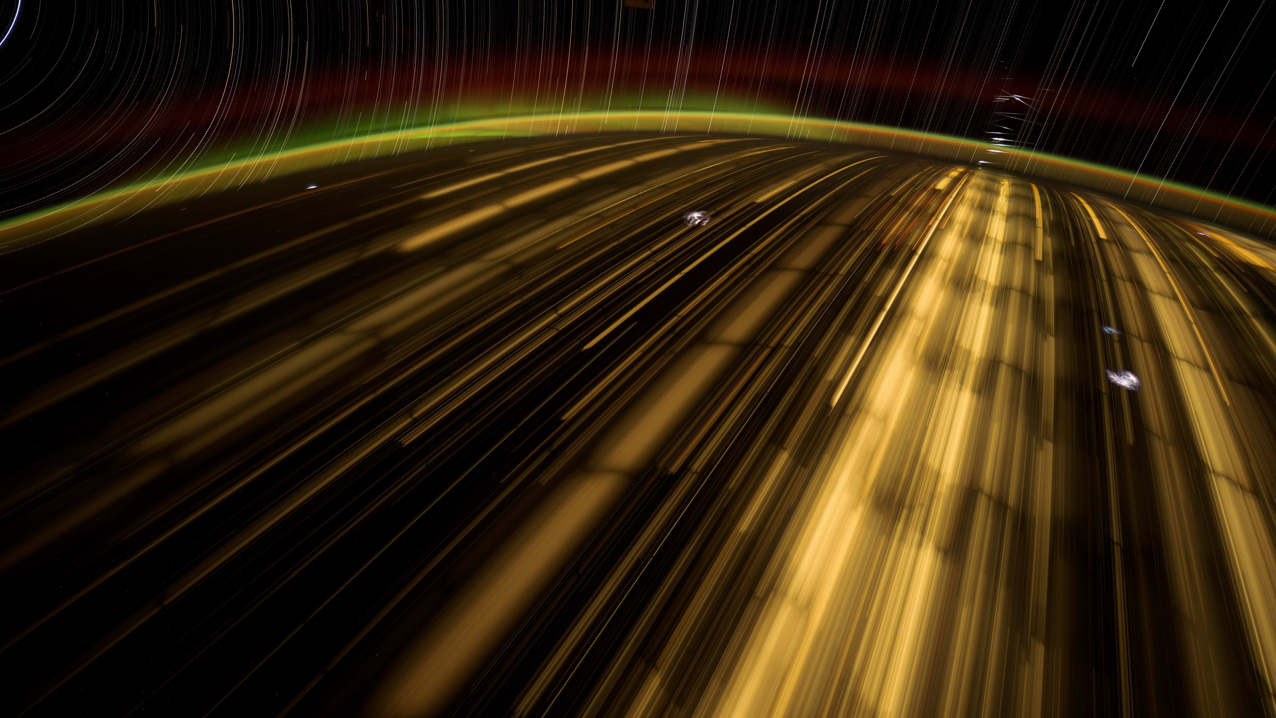
streaks of gold light on a black background

NASA astronaut Don Pettit captured SpaceX Starlink satellites below the International Space Station on November 2024. (Image credit: NASA/Don Pettit)

Tommaso Sgobba, the Director of the International Association for the Advancement of Space Safety, told Space.com that the increase in collision avoidance maneuvers is a predictable certainty.

"The more satellites you pack into [an orbital] shell, the more pairs of satellites exist that could potentially cross paths," Sgobba wrote in an email. "Adding satellites does not just add risk one unit at a time, it multiplies the number of possible pairings. Double the satellites in a shell and you roughly quadruple the number of pairs that need to be watched."

Sgobba also said that the collision probabilities predicted are highly inaccurate as the effects of air drag, which change frequently with space weather, are currently impossible to predict.

He said that due to the vast uncertainties in satellite trajectory predictions "operators lack tools to tell a real threat from statistical confusion," adding that "satellites are frequently dodging ghosts, burning fuel and shortening their operational lives in the process."

SpaceX, being the largest constellation currently in orbit, takes the bulk of responsibilities for orbital maneuvering. Instead of communicating with the other operator to decide who will make the dodge, Starlink satellites automatically avoid other objects β€” both space debris fragments or operational satellites β€” whenever there is a conjunction alert.

Other ambitious constellations, such as Amazon LEO or China's Thousand Sails, or Qianfan, are currently being deployed, actively adding to the high number of satellites operating in low Earth orbit.

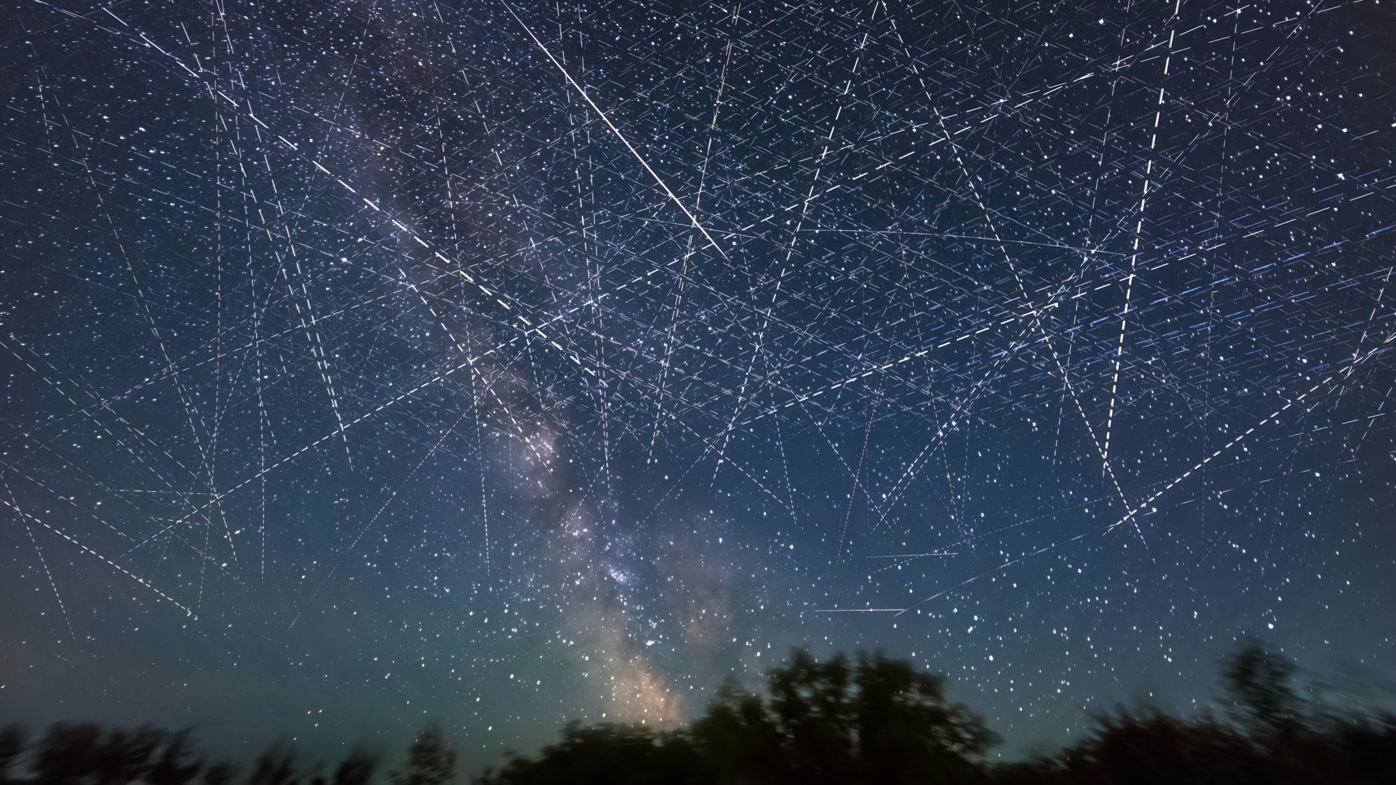
crisscrossed lines of light in the starry night sky

A 30-minute exposure of the night sky showing the high number of satellites in orbit as of June 2024. (Image credit: Alan Dyer/VWPics/Universal Images Group via Getty Images)

Lewis said that the only way to safely manage multiple constellations is to make sure their orbits do not intersect. That, however, is not the case based on available information. The Thousand Sails constellation, in particular, is expected to occupy similar regions as Starlink. Many of the recently announced orbital data center projects want to launch into particular orbital regions that are convenient for their operations and are therefore likely to overlap.

"The safe thing to do is to separate the constellations," Lewis said. "But then you are talking about orbital carrying capacity and the first mover benefit, because if I go into a particular altitude with my constellation, then nobody else can use it."

Sgobba calls for predicted numbers of collision avoidance maneuvers based on satellite numbers to be mandatorily disclosed to regulators before applications are granted.

"Right now, there is no clear requirement for a company to say, before launch, how many collision avoidance maneuvers a constellation of this size and density will need every year and whether the satellites carry enough fuel and automation to actually perform them all," Sgobba wrote.

"In short, the crowding of orbit is not an accident waiting to happen. It is a manageable, predictable engineering workload and the argument worth making publicly is that regulators should be treating it that way, by asking for these numbers up front rather than reacting to headlines about near misses after the fact."

  •  

Space junk debris cloud discovered in high-traffic orbit 'is a potential minefield' for the costliest satellites

Tiny pieces of space junk only 2 inches (5 centimeters) in size are cluttering a valuable orbital region where some of the costliest satellites reside, a new study has found.

Researchers from the University of Warwick in the U.K. found that the geostationary orbit β€” a region of space at the altitude of 22,000 miles (36,000 kilometers) β€” is full of dangerous, previously unseen bits of space junk that could destroy satellites.

The geostationary orbit is quite unique. Satellites at this altitude circle Earth in sync with the planet's rotation, appearing permanently suspended above a fixed spot on the equator. A single satellite in the geostationary ring has a constant view of a vast portion of the globe. This feature has been taken advantage of for decades for things like TV broadcasting, internet delivery, Earth observation and weather monitoring. But, as it appears, those satellites might not be safe up there at all.

"The debris in geosynchronous orbit is a potential minefield," Stuart Eves, the study’s co-author and space consultant at SJE Space, said in a statement. "No one in their right mind would enter a terrestrial minefield without a mine detector. Similarly, no one in their right mind should launch a satellite to GEO without an adequate debris survey."

The researchers uncovered the previously invisible debris by re-examining a dataset from an earlier space debris survey conducted by astronomers using the 8.3-foot (2.54-meter) Isaac Newton Telescope in La Palma, Canary Islands. They ran the data through new image processing algorithms to distinguish smaller and much fainter fragments than was previously possible in the distant geostationary orbit.

"The blind stacking technique is a very powerful method for improving the sensitivity limit of astronomical datasets," Ben Cooke, a research fellow at the University of Warwick's Center for Space Domain Awareness and co-author of the paper, said in the statement. "It involves testing many potential paths in an image sequence along which hidden targets might be moving and stacking the images to help bring those targets above the noise floor. This project shows a successful, real-world application of the method."

The researchers found 25 previously missed debris tracks in the images, 80% of which were caused by previously unknown objects.

The finding is concerning as space debris at such high altitudes behaves differently from that circling closer to Earth. The residual atmosphere at 22,000 miles is almost non-existent, meaning there is no air drag to force the orbital clutter spiral into the atmosphere and burn up.

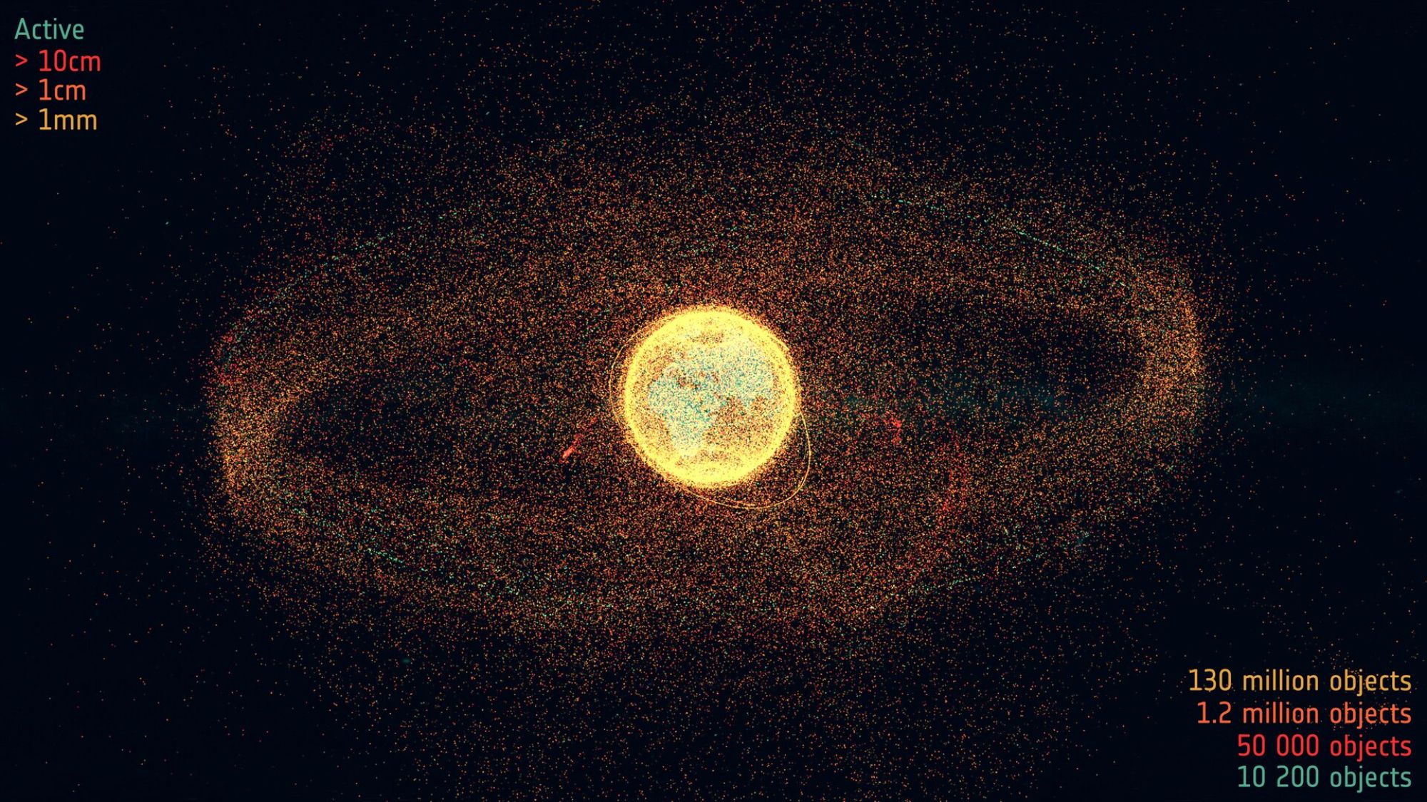
A diagram showing all the space debris orbiting our planet.

A still image from the short documentary film "Space Debris: Is it a Crisis?" on the state of space debris. (Image credit: ESA)

"Debris in the neighborhood of the geostationary belt is particularly concerning," James Blake, also a Warwick research fellow and the study’s co-author, said in the statement. "It's very far away, well above the Earth's atmosphere, so small objects tend to be incredibly faint and difficult to detect, and any debris that's generated will stick around indefinitely."

While orbits near Earth naturally clear up as the residual air at these altitudes slows the junk fragments down, at the higher altitude, the concentrations of such fragments will forever keep rising, making the region ever more tricky to operate in.

Moreover, the satellites that reside in this unique orbital region tend to be very large and expensive, designed for much longer missions than those making up megaconstellations in low Earth orbit. These satellites, frequently fitted with solar panels spanning 100 feet (30 meters) or more, can suffer substantial damage from a collision with the tiniest piece of junk.

"Pieces of space junk can be moving very quickly relative to one another, as much as several kilometers every second," Blake said. "The energies involved are really high, and even small debris can cause a lot of damage to very expensive satellites, so small things really matter."

The researchers are now looking to analyze additional images obtained by other telescopes around the world to get a fuller understanding of the scale of the debris contamination in the region.

The study was published in the Journal of Astronautical Sciences in June.

  •  

Your lost dog can now call home with the world's 1st satellite-connected dog collar

Imagine you're on a hike in a remote mountain range. Your hyperactive dog catches the scent of a deer and, powered by his hunter's instinct, disappears in the forest. He has a GPS tracker in his collar that can send his coordinates via the cellular network. But where you are, there is no mobile coverage. You keep whistling and calling but to no avail: your dog is nowhere to be seen.

That exact scenario prompted technologist Jonathan Bensamoun to develop what he describes as the world's first satellite-connected wearable device for dogs. Bensamoun is the founder and CEO of Fi, which has been manufacturing dog trackers since 2017. He first conceived the idea to make GPS devices for dogs when he adopted a young German shepherd named Thor and wanted to make sure that his hired dog walker wasn't cutting corners when taking him out for walks.

But even though the company had quickly grown into a market leader, Bensamoun kept hearing customers complain about the device's usefulness. That's where SpaceX's Starlink satellites came in.

"The number one complaint from customers is either 'I live in an area where the cellular network is not really good' or 'I get really worried about my dog when it's away from the typical suburban area. I am worried when it escapes the yard and runs into the woods," Bensamoun told Space.com.

When Starlink began delivering connectivity directly to smartphones in 2024, Bensamoun knew a solution to the problem was on its way. And on July 8, the world's first satellite dog tracking service came online.

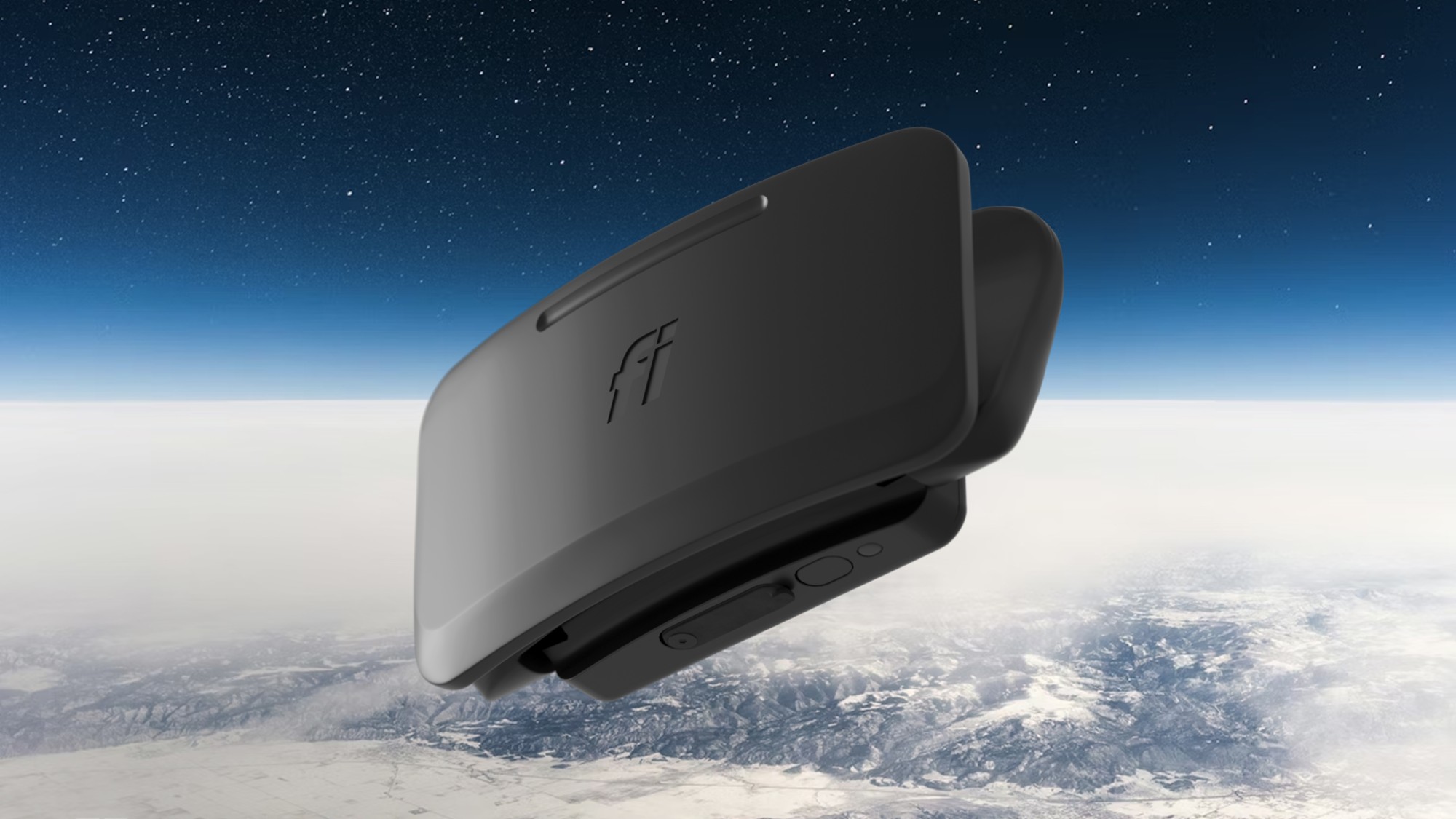
The device combines a GPS receiver, which determines the dog's position in real time, and a simple battery-powered modem that connects to T-Mobile's cellular network, which partners with Space's Starlink system. When the dog's position registers outside a pre-defined zone, the owner receives a message via a smartphone app.

When no cell tower is within reach, the device links with an overflying Starlink satellite to complete the task. The dog owner can also set a geo fence around the dog, an area within which the dog is allowed to move without triggering an alert. When the dog crosses that virtual boundary, for example, escapes from the backyard, the tracker sends a message to the owner.

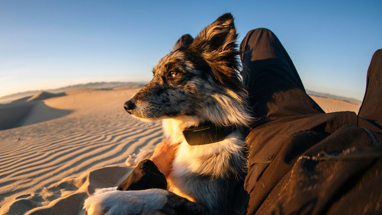
a dog wearing a collar with a black rectangular plastic device on it

The Fi Ultra GPS tracking collar, powered by SpaceX's Starlink direct-to-mobile network. (Image credit: Fi)

The device's battery lasts "multiple days", according to Fi, giving the desperate pet owner plenty of time to locate the refugee. To speed up the search, Fi enables the owner to send the dog signals β€” short bursts of vibrations or sounds β€” to entice it to come home voluntarily.

"You can train your dog with those vibrations and reward it with food every time they receive the vibration," said Bensamoun. "That way, they will start associating the vibration with their food being ready at home."

GPS tracking has been around for decades. In the animal realm, wild, endangered animals became the first to wear them in the 1990s. But those early devices were clunky and expensive, good for large mammals such as moose and caribou, but not fit for commercial use on pets. The technology finally shrunk to small enough dimensions in the early 2010s when first GPS dog trackers entered the market.

Today, some 11 million dogs worldwide are tracked or monitored by GPS in some form. Fi's new tracker β€” the Fi Ultra Direct-to-Cell tracker β€” takes the technology another step further by providing "nearly omnipresent connectivity," said Bensamoun.

  •  
❌