Earth has frozen over in the past — at least five times. Science fiction is full of takes about how it might happen again and the implications of a modern ice age. The problem: At a minimum, sci-fi gets the timetable for Earth turning into a “snowball” wrong — often laughably.
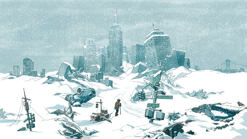
Here’s how some stories have portrayed it: Earth freezes. Humankind’s remnants huddle in ice caves, fending off giant alien monsters (Snowball Earth). Or people shelter in the New York Public Library as ice encases the Empire State Building (The Day After Tomorrow). Or a train hurtles in an endless loop, both protection and prison for Earth’s scant survivors (Snowpiercer).
These stories are all set in Earth’s near future, within a decade from now. And what makes their visions so chilling is that there’s at least a snowflake of truth in each. (Well, space monsters haven’t invaded Earth — yet.)
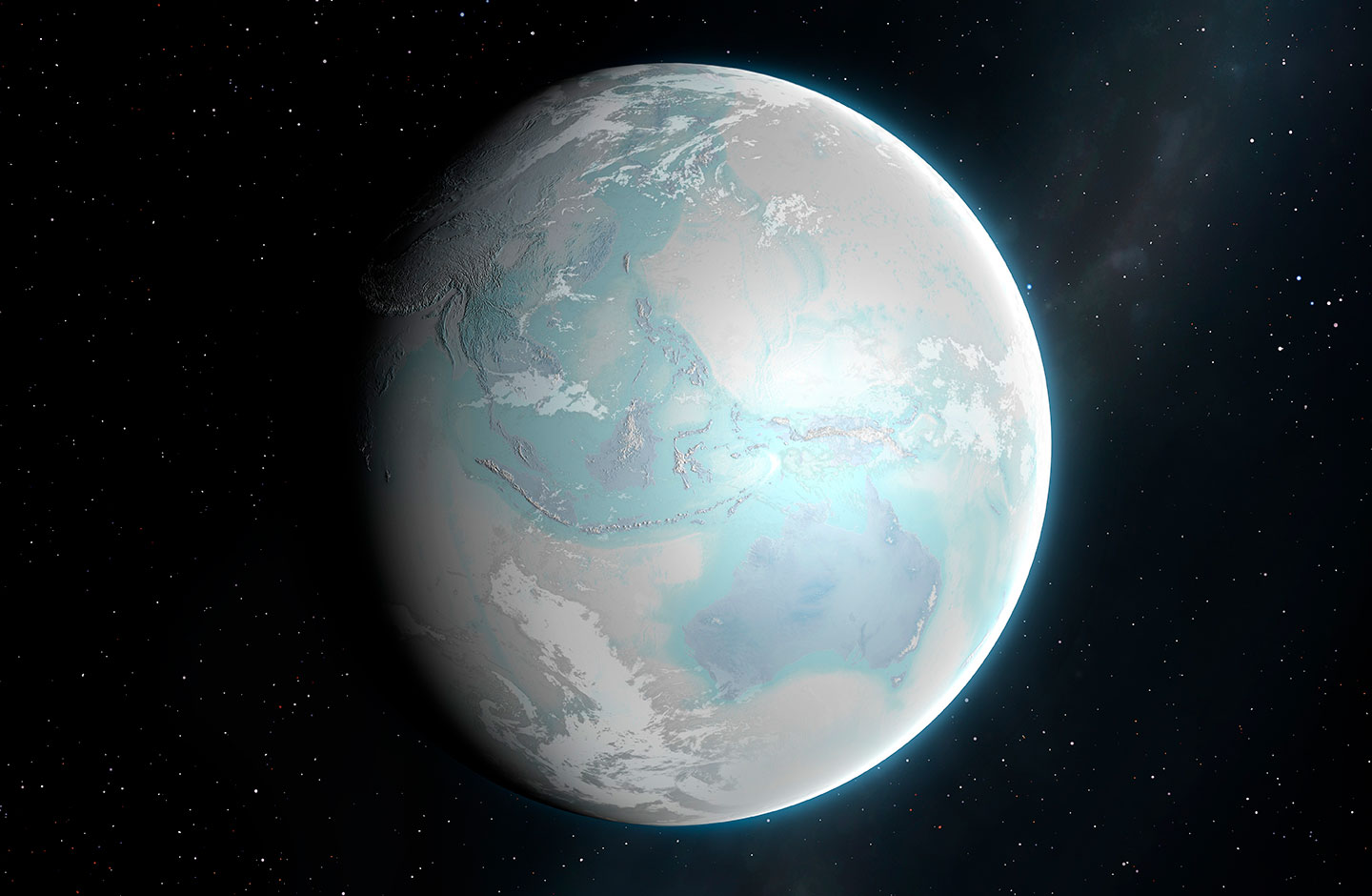
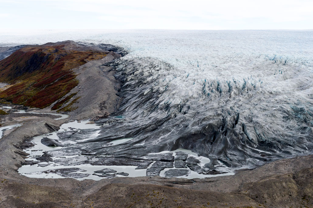
The most severe of Earth’s ice ages spanned from 720 million to 635 million years ago. It’s aptly been named the Cryogenian Period, from the Greek krýos (meaning cold) and génesis (meaning birth). At least twice during this period, glaciers extended from pole to pole. It could have amounted to a true Snowball Earth.
Although “maybe it was more of a Slushball Earth,” says Thomas Algeo. A geoscientist, he works at the University of Cincinnati in Ohio. Fossils, he says, suggest that even in the coldest times, seafloor-dwelling algae survived. They would have needed sunlight. So patches of open water must have persisted near the equator, he says.
The concept of a “Snowball Earth” includes glaciers and ice sheets spanning much of the globe, as imagined in this illustration.MARK GARLICK/SCIENCE PHOTO LIBRARY/Getty Images Plus
All such past deep freezes set in due to a series of geologic events. Take the Cryogenian. It developed after shifting tectonic plates caused a supercontinent to split apart. That increased rainfall and rock weathering. These dramatically reduced atmospheric carbon dioxide, which triggered a runaway cooling effect. Widespread ice, which reflects the sun’s warming rays back into space, would have exaggerated that cooling.
All of these processes are slow, which is not ideal for action flicks. Fortunately, sci-fi can play with time. It’s not unusual for fiction to take natural or human-caused climate interactions (and feedback effects) and accelerate or amp them up for drama.
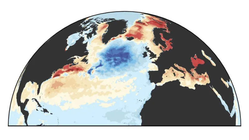
The Day After Tomorrow, for example, which hit theaters in 2004, is based on a real-world scenario: the potential shutdown of a part of a global system of ocean currents. These move heat around the planet. Known as AMOC, this system is short for the Atlantic Meridional Overturning Circulation. Today, AMOC brings relative warmth to regions that might otherwise be frigid.
Scientists today fear it could happen again — and soon.
But to geologists, “soon” doesn’t mean in days to weeks (as portrayed in The Day After Tomorrow). For them, it means perhaps decades to a century.
Here’s the movie trailer for 2004 disaster flick The Day After Tomorrow.
The Day After Tomorrow’s filmmakers were “quite up-front” about their process, says Stefan Rahmstorf. For ultimate drama, they just “took known weather extremes — tornadoes, storm surges, cyclones, hail storms and blizzards — and amplified those.” Rahmstorf is a physical oceanographer at the Potsdam Institute for Climate Impact Research in Germany. He fact-checked aspects of the film.
Despite its super-short timeline for turning the Northern Hemisphere into a deep freeze, this film did point to some very real science, he notes. For instance, the movie starts out with its science hero giving a talk at a United Nations science meeting. Its topic was “the possible risk of a shutdown of the North Atlantic Current. I gave a very similar talk at such a UN conference in Buenos Aires in 1998,” Rahmstorf notes. “I even showed the same diagram [as the movie’s scientist].”
Snowpiercer imagines a different deep-freeze scenario. Geoengineering goes haywire in this 2013 movie, 2014 graphic novel and TV series (which ran from 2020 to 2024). Here, scientists release aerosols into the sky to reflect sunlight back to space. Their goal was to slow global warming. This idea is, in fact, based on a real type of Earth engineering known as solar-radiation management.
But in this story line, the aerosols proved an overkill. They plunged Earth into a deep freeze within weeks (hours, actually, in the novel).
Geoengineering strategies could cool Earth — just not that quickly. They would more likely take at least a few years. And they wouldn’t be that potent, either. To bring on an ice age, aerosols would have to be deliberately and repeatedly injected over generations, says Douglas MacMartin. He’s a climate engineer at Cornell University in Ithaca, N.Y.
How Earth freezes in Snowball Earth is still something of a mystery, as the manga is still in progress (though a streaming anime version debuted in April). Here, the transition to an ice world takes about a decade. And — spoiler alert — giant alien monsters might have had something to do with it. (For that, scientists don’t really have an answer.)
But the premise behind these stories — that Earth could freeze over — is grounded in very real science. It’s happened before and could again. But it won’t happen quite the way these stories tell it.
One of Earth’s most vital ocean currents is rapidly weakening. The cause: global warming. A collapse of this current could send devastating ripples through the planet’s climate.
The current is known as the Atlantic Meridional Overturning Circulation. Most scientists just call it AMOC. If it were to shut down, the consequences could be catastrophic and far-ranging. In the worst case: Earth’s warming climate could flip to a deep-freeze. Scientists refer to this scenario as a “snowball Earth.”
Why might that happen?
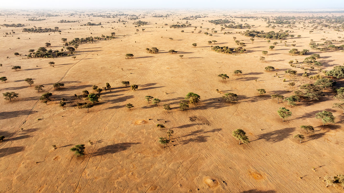
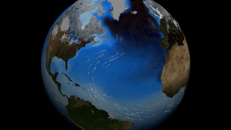
AMOC moves warm surface waters in the Atlantic Ocean from the tropics northward toward Europe. This water ferries with it a massive amount of heat. If that transport were to shut down, scientists say, the world might see a host of dramatic weather. Europe could experience more temperature extremes, of both chilling and heating. The Southern Hemisphere would warm even more than it is now. The North Atlantic would trigger stronger storms. The drought in Africa’s Sahel would worsen. And summer rains in Europe could sharply decrease, with devastating outcomes for farmers.
Africa’s Sahel region stretches across the continent just south of the Sahara Desert. A weaker AMOC could worsen drought conditions there, such as this arid region in Senegal.Martin Harvey/Photodisc/Getty Images
Researchers have rung warning bells about the AMOC for decades. Its possible shutdown even was the theme of The Day After Tomorrow, a 2004 snowball-Earth disaster movie.
This short January 2025 video notes that the scenario that played out in The Day After Tomorrow had actually been an extrapolation from research observations by Scottish geoscientists.
Their consensus: It’s not good — AMOC is weakening.
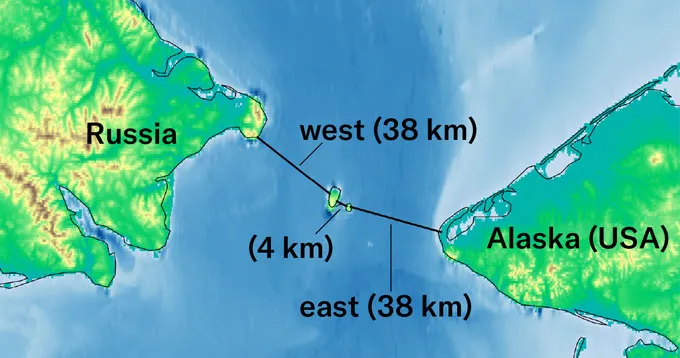
The stakes are so alarming that some scientists have proposed engineering changes to AMOC. One is building a series of dams to seal off the Bering Strait between Russia and Alaska. By cutting off the northward flow of water from the Strait into the AMOC, the current’s strength might stabilize. At least that’s what researchers claim in a report April 24 in Science Advances.
Such proposed changes are controversial. No one can be sure what unknown impacts they might trigger. And the Science Advances paper “is very much a conceptual study,” says Jelle Soons of Utrecht University in the Netherlands. By that he means it’s a clever idea — but no one yet knows how it might be achieved. And Soons should know. He’s not only a physical oceanographer but also a coauthor of that new report.
What such suggestions can do is focus attention on how serious a threat an AMOC shutdown is — and how little time remains to address it.
The role of sea salt
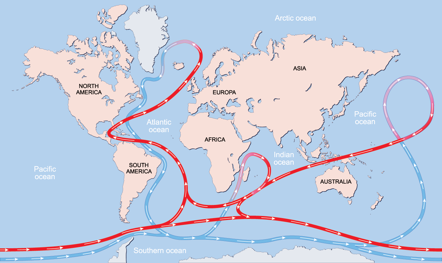
A system of currents — including the AMOC — moves ocean waters around the planet. The water’s density is what drives them.
Saltier masses of water sink below less-salty ones. Colder waters also sink relative to warmer ones. The constant shifting between these masses keeps those currents on the move, almost as if they were riding a conveyor belt.
As the AMOC releases heat to the atmosphere at its North Atlantic destination, the water chills and sinks. That colder, denser water then heads back southward along the seafloor. To replace it, warmer water gets pulled northward along the surface.
Surface ocean currents are shown in red and deep water currents are shown in blue. AMOC is the major current in the Atlantic Ocean, carrying warm water from the tropics toward Europe and cold water from the Arctic down the east coast of North America.ttsz/iStock/Getty Images Plus
For decades, researchers have worried that Earth’s changing climate could weaken AMOC’s strength.
Computer models have suggested the AMOC might weaken as the planet warms. But those models found it hard to know when and by how much — at least without data measured from the current. And such data had been lacking.
But scientists now have about two decades of direct observations to work with. These seem enough to start identifying a trend.
Predicting how the AMOC will change over time is “not as easy as predicting global temperature,” says Stefan Rahmstorf. He’s a physical oceanographer at the Potsdam Institute for Climate Impact Research in Germany. “It’s notoriously difficult to get [AMOC predictions] right,” he says.
The uncertainty is not strongly linked to future predictions of greenhouse-gas releases, says Valentin Portmann. He’s a climate-data scientist at the University of Bordeaux in France. He’s also lead author of the April 15 paper. Instead, he says, the issue comes down to differences between the many climate models.
The U.N. Intergovernmental Panel on Climate Change (IPCC) regularly updates its prediction of how Earth’s climate may change over the next few decades. To do this, it uses about 50 different computer models of climate. They’ve been developed by different scientists across the globe. Each model uses data on the current climate differently as it seeks to predict the future.
“The IPCC takes the mean of these to estimate what will be the future climate,” Portmann says. But the estimates can vary a bit above and below the mean, or average. This is known as standard deviation. For projections of Earth’s future heat, climate models show little disagreement. But for AMOC, the “spread is very high.”
The biggest problem, scientists say, is correctly projecting how salty different parts of the Atlantic Ocean’s future water will be. Where saltier and less-salty parts will be also matters, since saltier waters are more likely to sink, helping to drive currents.
To make an accurate prediction, Rahmstorf says, “you have to get the salinity all over the Atlantic Ocean right.”
To do that, scientists must also predict how precipitation will vary as the climate changes. Why? Rains can dilute the ocean’s saltiness. To predict rains, he says, “you’re talking about clouds — the biggest uncertainty in [climate] models.”
This video describes how water temperature and salinity affect ocean currents. Toward the end, researchers describe NASA’s Aquarius satellite, which launched in 2011 to collect better data on ocean salinity.
That’s one reason past models have varied widely when predicting how much AMOC will weaken over the next 75 years. The average drop hovers around 32 percent — give or take another 37 percent!
Portmann’s team used a branch of math known as statistics to get a less fuzzy estimate. One approach helped simplify complex problems with a lot of variables, like this one. This approach is “not often used in climate science,” Portmann notes, “but is very well known in statistical science.” Called ridge-regularized linear regression, it offered the best match to the problem.
It showed the likelier outcomes were those seen in models whose predictions were more dire. They now suggest AMOC will weaken by about 51 percent (plus or minus 8 percent) by the end of the century.
“What they have shown very convincingly is that, unfortunately, the simulations with the strongest decline are the most realistic ones,” says Rahmstorf. He did not take part in that analysis.
The biggest factor in this correction came from how one factor was weighted: how salty the surface of the future South Atlantic Ocean will be. Researchers had long suspected that the saltier those surface waters would be, the weaker the AMOC would become.
The new analysis now supports that link.
And measurements of these waters show they have been getting saltier. One reason is increased evaporation as the oceans have been warming. Another reason: More salty water has been leaking into the South Atlantic from the Indian Ocean as wind patterns shift.
The AMOC’s ins and outs are a lot to grasp
Scientists have identified many things that impact the AMOC besides the salinity of the South Atlantic. Those include circulation in the Nordic Seas and the release of freshwater into the oceans. This is especially likely in places such as the Arctic’s Bering Strait or where meltwater from Greenland’s ice sheet is flowing into the sea.
In fact, any big glut of freshwater entering the ocean is going to have a huge impact on its density. That in turn will drive changes in ocean currents.
Consider one 2025 study in the Earth ArXiv. Hundreds of thousands of years ago, it showed, meltwater from a decaying Greenland ice sheet triggered a weakening of the AMOC. That weakening lasted about 1,000 years!
Meltwater from the Greenland Ice Sheet that reaches the ocean dilutes the sea’s salinity. In the past, large amounts of freshwater flooding the North Atlantic weakened the AMOC. Jason Edwards/The Image Bank/Getty Images Plus
Still, AMOC is one complex beast. It has a northern branch known as the Nordic Seas Overturning Circulation, or the NOC. Even as AMOC has been weakening, NOC appears to be stable. Some computer models even project it could strengthen a bit in coming years.
That might seem like good news, says Sasha Roewer. She’s a physical oceanographer at the Max Planck Institute for Meteorology in Hamburg, Germany. However, she warns, NOC’s strengthening might actually be another warning sign.
She, Rahmstorf and other researchers modeled what would happen as the North Atlantic Ocean became less salty. On April 20 in Ocean Science, they reported this would — for a time — strengthen the NOC current.
But “eventually it reaches a tipping point where convection in the Nordic Seas breaks down,” Roewer says. And then, she says, “both currents collapse.”
The idea of damming the Bering Strait “really was a very spontaneous one,” says Soons at Utrecht. “It just started with a thought experiment.”
A study last year in Geophysical Research Letters analyzed what had played a role in a strong AMOC some 3 million years ago. And the Arctic’s Bering Strait was one factor.
Researchers propose that constructing three dams spanning a total of 80 kilometers across the Bering Strait could help stabilize the AMOC. J. SOONS AND H.A. DIJKSTRA/SCI. ADVANCES, 2026
It is narrow, just 82 kilometers (51 miles) wide. It’s also shallow, on average just 30 to 50 meters (100 to 160 feet) deep. So changing sea levels will alter how much water flows through this strait.
And that finding was like a light bulb going on, says Soons. “It made me think: Could we close the Bering Strait again?”
His simulations with Utrecht colleague Henk Dijkstra now suggest that damming the Bering Strait might work. But it’s also time sensitive. If the closure occurs during a very weak AMOC, they found, this stabilizing effect could backfire.
The damming idea has triggered mixed opinions. Notes Soons, “There are debates of whether we should even [study] geoengineering.” Why? “It would distract from the real problem,” says Soons — “give people a way out” of focusing on reducing the pollution behind climate change. (Soons admits that he and Dijkstra didn’t consider ecological and other impacts of damming the Strait.)
“I’m not a great fan [of the dam proposal], to put it mildly,” says Rahmstorf. “The most important thing we can do is stick to the Paris Agreement,” he says. This United Nations treaty aims to reduce emissions of greenhouse gases and slow global warming.
In fact, average temps this year are likely to blow through that treaty’s target: a warming of 1.5 degrees Celsius (2.7 degrees Fahrenheit) above what was typical in the 1700s. (That’s when heavy use of fossil fuels began.)
The world has likely not passed the point of triggering AMOC to stall, Rahmstorf says. When exactly that will be, he adds, is hard to know. But based on the most recent studies, that time might come as soon as the 2040s. That suggests, he says, “We have no time to lose.”
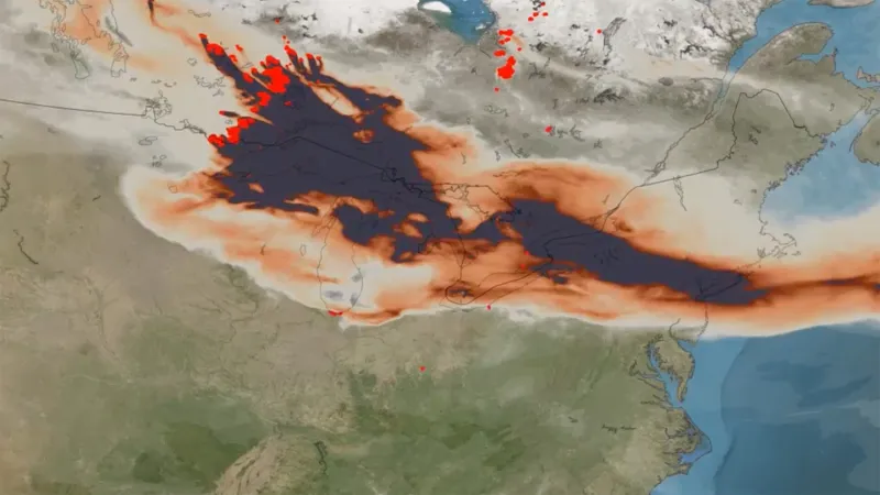
The inferno that sent toxic smoke billowing toward the United States won't be the last. Officials are now battling both the wildfires and misinformation.
Climate scientists are warning us to buckle up for a bumpy ride. An El Niño has begun. By year’s end, this periodic climate event might become the strongest El Niño on record.
An El Niño Southern Oscillation, or ENSO, is a recurring two- to seven-year ocean-climate pattern. On June 11, the U.S. National Oceanic and Atmospheric Administration confirmed Earth has officially entered the El Niño phase of this cycle.
El Niño events emerge in the Eastern Pacific. Eventually, the changes in climate they spawn will affect weather globally. And the stronger an El Niño, the more costly it can be to human health, farming, buildings and our wallets.
Forecasters currently predict a 63 percent chance that, by winter, the new El Niño will prove very strong — as in a “super El Niño.”
Here are four things to know as this climate pattern takes hold.
What’s an El Niño?
An ENSO’s several-years-long cycle has three phases.
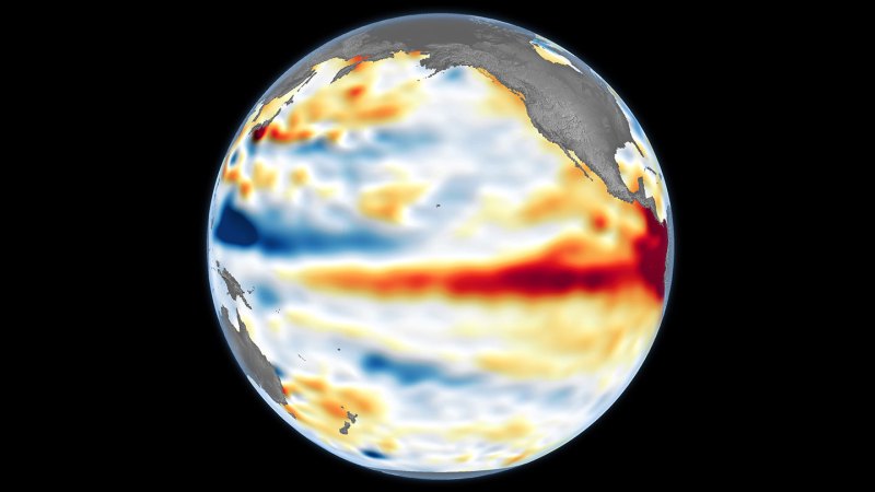
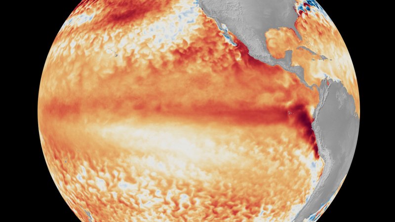
The first, known as El Niño, involves months of warmer than normal sea-surface temperatures in the eastern equatorial Pacific. Back in the 1600s, fishers in Peru noticed this warming tended to show up around Christmas. So they dubbed it “El Niño,” which is Spanish for “little boy.” It’s also the name given to “the Christ child.”
A second phase — La Niña (or little girl) — swings to cooler than normal temps in those eastern Pacific waters near the equator.
The last is a neutral, in-between phase. It brings average temperatures back to the Pacific’s equatorial sea surface.
The “Southern Oscillation” part of ENSO’s name refers to another seesawing pattern. Here the swings are between areas of high and low atmospheric pressure over the eastern versus western Pacific Ocean. That up-and-down pressure pattern triggers global-scale changes in winds, air temps and precipitation.
Scientists track ENSO air-pressure changes at two main stations. One is in the West Pacific at Darwin, Australia. The other is in the East Pacific at Tahiti (part of French Polynesia).
During neutral periods and La Niña phases, the high-pressure zone is in the east. That sends prevailing winds westward across the Pacific around the equator. These winds push the warming surface waters of the Pacific to the west. This keeps them away from the coast of the Americas.
In so doing, it allows cold, nutrient-rich water to well up from the deep ocean. That keeps the eastern equatorial Pacific waters cold.
But every few years, conditions flip. Now high pressure prevails over the western Pacific, and lower pressure over the eastern Pacific.
This weakens or even reverses the direction of the prevailing winds. It also allows warm surface waters to stay in place. This suppresses the upwelling of cold water. Now sea-surface temps warm rapidly in the eastern Pacific. This also serves as a telltale sign an El Niño is back.
No two El Niño events are exactly alike, says Tom Di Liberto. He’s a climate scientist and meteorologist now working for the nonprofit news group Climate Central. It’s based in Washington, D.C.
But each El Niño transfers huge amounts of heat from tropical Pacific waters into the air. That bonus heat can temporarily — and dramatically — boost air temperatures around the globe.
An El Niño officially starts when sea-surface temperatures in the eastern equatorial Pacific Ocean steadily remain at least 0.5 degree Celsius (0.9 degree Fahrenheit) above average for several months. The warmer the waters, the stronger an El Niño’s likely global impacts.
Waters warmer than 2 degrees C (3.6 degrees F) above average signal the emergence of a very strong — or “super” — El Niño.
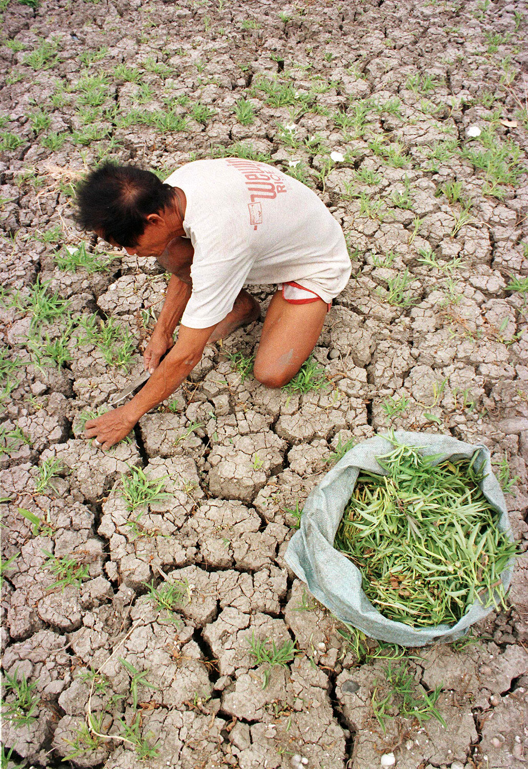
This Philippine farmer was trying to salvage any surviving water-pond plants during the super El Niño in April 1998. He hoped to feed local people and livestock. Seven Philippine corn and rice growing provinces were declared a state of calamity after their crops were totally destroyed by this El Niño’s long, severe drought.Romeo Gacad/AFP/Getty Images Plus
Since April, temps over the eastern equatorial Pacific Ocean have remained well above average. Dozens of forecasters around the world concluded an El Niño was on its way. By June, as the ocean warmed even more, their forecasts began to warn that this could prove a really powerful event.
Recently, climate change has made detecting an El Niño’s onset and strength more difficult. Why? Global temperatures have been warming steadily over the last decade, which can mask an emerging El Niño. So in May, NOAA’s Climate Prediction Center adopted a new tool for its El Niño forecasts. This now adjusts for that climate change–related warming.
Using this new tool, NOAA predicts that this winter, sea-surface temps in the eastern tropical Pacific are 63 percent likely to be more than 2 degrees Celsius higher than average. That’s what suggests a super El Niño is developing.
In fact, computer models are now forecasting “shockingly high” global temperatures for November and December, Di Liberto says.
Such heat can have deadly consequences. A rise in heat-related illnesses is one. Another is upticks in diseases (such as cholera, typhoid and malaria) carried by mosquitoes and other pests that like it hot.
El Niños also alter the track of the Pacific jet stream. The result: Some areas will become drier than normal. Others will get wetter.
For the United States, one of the most significant impacts will likely be more numerous and intense Pacific cyclones. At the same time, changing wind patterns can make it harder for Atlantic hurricanes to form.
Fortunately, the life of any one El Niño is relatively short: Events typically form in the summer, strengthen into the winter, then die out the next spring.
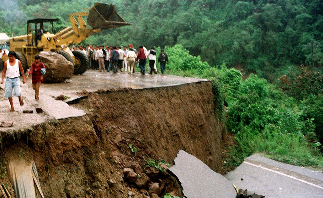
People in Locotal, Bolivia, check out a major road after torrential rains washed out a large section of it on January 9, 1998. Meteorologists attributed the flooding rains and mudslides here to a powerful El Niño, which had been triggering extreme weather events around the globe.STR/AFP/Getty Images Plus
How will this year compare to past major El Niños?
The most recent strong El Niños happened in 2015–16, 1997–98 and 1982–83.
The 1997–98 event was the strongest on record. It temporarily raised average global temps by 1.5 degrees Celsius (2.7 degrees Fahrenheit) and triggered devastating weather events.
These included torrential rains and floods in Peru and East Africa. Those, in turn, triggered an outbreak of Rift Valley Fever in Africa. Droughts in Southeast Asia kicked off deadly wildfires. California saw powerful storms that brought major flooding and landslides. Soaring ocean temperatures led to the bleaching of about one-sixth of the world’s coral reefs.
Such strong El Niños are costly, too. The 1982–83 one cost the world an estimated $4.1 billion. The 1997–98 event was estimated to cost about $5.7 trillion.
How bad this year’s event will be is still unclear. But it’s occurring on top of strong global warming from human activities. And even if this year’s turns out to be only moderately strong, Di Liberto says, its impacts could still be very big. “It would not take a very strong El Niño to see records broken this year.”
Here a BBC meteorologist offers a snapshot of why weather forecasters are worried about the developing El Niño and how its impacts could play out across the globe.
To work, these aerosols would have to be targeted over a particular patch of the Pacific Ocean. This should increase and brighten clouds there, a new computer model finds. And that would reflect more of the sun’s warming light back into space, cooling the climate.
The idea for this was sparked by the 2019–20 Australian wildfires, says Jessica Wan. She’s a climate scientist at the University of Chicago in Illinois. Those fires spewed huge billows of particles into the air. Plumes of them wafted over the southeastern subtropical Pacific Ocean. This brightened clouds there — and helped trigger a multiyear La Niña.
This natural “experiment” hinted at how altering clouds in the proper region can change large climate patterns, says Wan. Her team’s computer model has now calculated what would happen if people injected a huge quantity of aerosols into the atmosphere (as the wildfires had). This should weaken an El Niño. But how much weaker it got would depend on when the injection took place, the model finds. The strategy seemed to work best when done early in an El Niño.
This idea “is really interesting and very new,” says Daniele Visioni. He’s a climate scientist at Cornell University in Ithaca, N.Y. who did not take part in this new study. To him, “the fact that it looks like this could work is a really good indication that it is something worth thinking about.”
But it’s not a strategy that could work for this year’s El Niño. There are too many big questions to answer first, Wan says. For one thing, the technology to inject particles is years from being ready. Plus, there needs to be more study about the possible negative consequences of injecting aerosol particles.
For thousands of years, farmers have prepared their fields for planting by overturning the soil. It helps them the manage the moisture, nutrients and flow of air underfoot. But modern farming’s deep plowing and heavy machinery often do more harm than good, researchers report.
All that soil turnover disrupts the natural paths that water takes to percolate into the root zone. And this is not a problem just for growing crops. Breaking down the network of pores that water wants to move through also makes the soil less resilient to flooding and drought. So concludes a team of scientists in the April 16 Science.
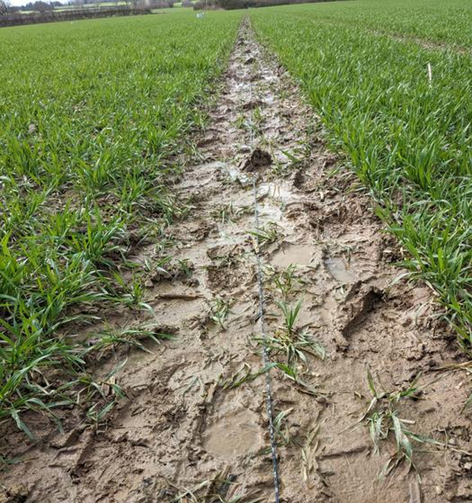
A fiber-optic cable, here laid along the relatively bare soil, was able to pick up tiny seismic signals. They’d been triggered by the movement of rainwater in the soil below.Marine Denolle
Qibin Shi is a geophysicist with the Chinese Academy of Sciences in Beijing. He was part of a team that fashioned a dense array of sensors out of fiber-optic cables. Such cables find use in more than just high-speed internet. They also can become powerful tools for seismology — and not just for earthquakes. They’re proving sensitive enough to detect even the tiny vibrations triggered as water moves through soil.
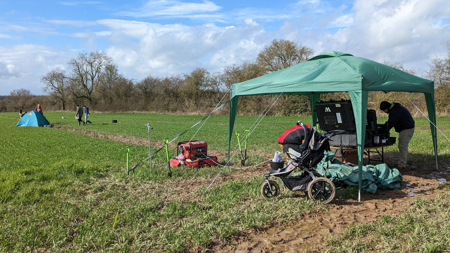
Shi’s group installed these cables along the edges of 27 plots of land at a university test farm in Newport, England. The plots were treated one of three ways. Nine went unplowed. Another nine were tilled to a depth of 10 centimeters (4 inches). The last nine were turned over to a depth of 25 centimeters (almost 10 inches). Within each group, plowing machinery of different weights were used. Why? The heavier they are, they more they can compact the soil.
For three days in March 2023, the team used its seismic-sensing system to track how the plots responded to rain. Rainwater didn’t seep down much on plots with the most compacted and deeply plowed soil. Instead, it tended to pool near the surface. Here, it could evaporate swiftly once the sun came out.
Water moved down and around more easily in the plots that were less compacted and less deeply plowed.
To understand what was happening, Shi’s team created a computer program that modeled the water’s movements. Rain, they found, moves through porous soil in a way that sort of mimics what happens to blood in capillaries — the body’s tiniest blood vessels. This process is known as capillary action.
Scientists used fiber-optic cables to study how turning over the soil in spring will affect rainwater’s ability to infiltrate the soil at this research site in Newport, England.Marine Denolle/University of Washington
Like our capillaries, the tiny, tunnel-like airways between specks of soil are very thin. Gravity does not drive water’s flow through these holes. Instead, as water tries to alternately adhere to soil particles and bind to other water molecules, it gets caught in a push-pull action. And that moves it. When those narrow pathways get disturbed or crushed, however, the suction forces strengthen, impairing the water’s flow.
Fiber-optic sensing could offer farmers a quick and inexpensive way to monitor soil moisture on a large scale, Shi’s team says. Such monitoring also could provide real-time warnings of natural hazards, such as flooding and soil liquefaction during an earthquake (when saturated ground can suddenly turn unstable due to shaking).

 Login